| The Ireland Story MAPSHOP |
||
| Main Menu \ Bookshop Front \ | ||
| The Ireland Story MAPSHOP |
||
| Main Menu \ Bookshop Front \ | ||
Maps of Ireland Back to Bookshop Front |
|||||||
See Also |
Looking for very detailed maps of Ireland? | ||||||
|
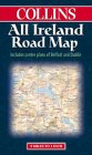
All Ireland Road Map Paperback (Map); 2000; Collins Cartographic; ISBN: 0004489675 A scale of 1:440,000 / 7 miles per inch. An essential map for anyone intending to tour around Ireland. This map features the whole island on a large sheet and shows all the Motorways and main roads and many of the minor roads. The map is marked with places of interest as well as tourist information. The background map is coloured with shaded relief giving a clear indication of the terrain. The map also gives the distances between the major settlements, city-centre plans of Dublin and Belfast and a full index of places. Ideal for the travelling tourist or anyone interested in exploring Ireland from home.
|
||||||
|
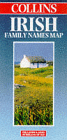
Irish Family Names Map Paperback (Map); 1995/1998; Collins Cartographic; ISBN: 0004486862 This map of Ireland gives the locations of origin of most of Ireland's medieval families. These are the Gaelic and Anglo-Irish families that were living in Ireland at the time of the Norman and English invasions. Of perhaps more interest is the fact that the map illustrates the coats of arms of over 200 of these families. A very interesting talking point and resource.
|
||||||
|
Holiday Maps of Ireland - North,
East, South and West Paperback (Map); 1992; Ordnance Survey of Ireland
|
||||||
|
Complete Road Atlas of Ireland Paperback / Spiral bound; 1997; Ordnance Survey of Ireland; ISBN: 1901496813; 121 pages. A scale of 1:210,000 / 3.3 miles per inch. This map of all Ireland takes the form of a book that is designed for the traveller. It concentrates on roads, showing all major and most minor roads in Ireland. Large numbers of towns, villages and hamlets are also marked, as are many places of interest such as camping sites, visitor attractions, historical monuments, beaches and golf courses. Shading is used to give an indication of relief. The maps are of good quality and, if they were all joined together, give a map of Ireland that is approximately 7 feet by 5 feet. This is easily enough to see all but the most local features. Railways, rivers and county boundaries are also marked. Included in the book is a set of 34 town plans, although these are not of spectacular quality - this is the atlas's only real failing. At the back is an index of golf courses and a 20 page placename index. This is an excellent resource, and it is the one that the webmaster has used when maintaining this web site. Definitely recommended for those travelling or wanting to explore Ireland in a little more detail.
|
||||||
|
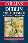
Streetfinder Atlas of Dublin Paperback; 1997 / 1999; Collins Cartographic; ISBN: 0004488717; 80 pages A scale of 1:16,000 / 440 yards per inch. This marvellous little book is ideal for anyone travelling to Dublin. The book is a colour map that covers all of central Dublin and most of its extensive suburbs. At 8x5 inches, it is perfect for the traveller. As well as the map, the book also features lists of information for tourists, such as hotels, places to see, galleries, museums, entertainment, shopping, sport and so on. There is also a brief history of Dublin city. Impeccably up to date, the book contains all the recent changes in the layout of the city's roads. A full index of street names is included. The map features practically every little street in central Dublin and is absolutely ideal for anyone intending to visit this beautiful city.
|
||
|
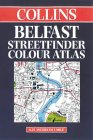
Streetfinder Atlas of Belfast Paperback; 1999; Collins Cartographic; ISBN: 0004488598; 40 pages A scale of 1:15,000 / 410 yards per inch. Another little pocket atlas that is ideal for the tourist in Belfast. This book is a colour map that covers all of the city centre as well as most of the suburbs. All prominent places and places of interest are marked, and there is a full index to help you find that elusive street. Every little road and street in Belfast is included. An indespensible book for anyone travelling to Belfast, or indeed anyone who wishes to follow events in Belfast on a map. With it, it is possible to follow the routes of parades, find places that feature in the news and see how the various areas of the city interrelate. Highly recommended.
|
||
|
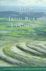
Atlas of the Irish Rural Landscape Hardback; Editors: FHA Aalen, K Whelan; Univ of Toronto Pr / Cork Univ Press; ISBN: 0802042945; 352 pages. This is not an atlas in the traditional sense: although filled with maps, it is also very textual and pictorial. A stunning and under-recognised book, it charts the dynamics of all parts of rural Ireland from the ravages of the Ice Age, through the Neolithic and Celtic periods, the Normans, the Plantation through to modern developments. At all stages, it is made abundantly clear how the Irish landscape is intertwined with human history and many chapters are devoted to the churches, castles and houses that characterise rural Ireland. As well as an invaluable reference book, this will give hours of enjoyment for the browser. In their balanced, but not detached, account the editors have put together an intimate portrayal of the Irish rural landscape that deserves to sit proudly on the shelf of anyone who loves Ireland.
|
||
|
|||
What do
you think
of this site?
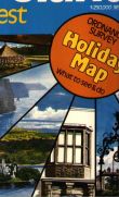
![Map coverage [1kB]](images/holiday_map_coverage.gif) A scale of 1:250,000 / 4 miles per inch.
This is a very popular series of four maps that cover all of Ireland, and are intended to
be as much a travel guide as a map. Each map is double-sided. One the one side is a colour
map of the region, including all major roads and most secondary roads. The map indicates
places of interest to tourists, and relief is well indicated by shading and contour lines.
Also shown are rivers, railways and county boundaries. On the other side of the sheet is a
guide to the region, including information on museums, stately homes, cathedrals,
historical sites, forests, parks and nature reserves. This part of the map provides a good
overview of the region and some of the maps include town plans. The four maps when taken
together cover all of Ireland. Recommended for the visitor.
A scale of 1:250,000 / 4 miles per inch.
This is a very popular series of four maps that cover all of Ireland, and are intended to
be as much a travel guide as a map. Each map is double-sided. One the one side is a colour
map of the region, including all major roads and most secondary roads. The map indicates
places of interest to tourists, and relief is well indicated by shading and contour lines.
Also shown are rivers, railways and county boundaries. On the other side of the sheet is a
guide to the region, including information on museums, stately homes, cathedrals,
historical sites, forests, parks and nature reserves. This part of the map provides a good
overview of the region and some of the maps include town plans. The four maps when taken
together cover all of Ireland. Recommended for the visitor.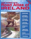