|
Status
|
Construction scheme
(completed)
Contractor: FP McCann
|
|
Where
|
Replacement
of two junctions at Millbrook and
Antivlle, Larne with roundabouts.
|
|
Total
Length
|
n/a |
|
Dates
|
A8 here dualled - 1965
Scheme proposed - December 1998
Public Consultations - June 1999
Environmental Statement - June 2000
Direction Orders Published - 26 Sep 2001
Millbrook constructed
first, then Antiville to minimise
disruption
Completed - December 2003
(changed from September 2003 at project
commencement)
Official opening - 13 January 2004
|
|
Cost
|
£2.2m |
|
Photos
|
See below. |
|
See
Also
|
Location
of Millbrook roundabout - Google
Maps
Location
of Antiville roundabout - Google
Maps
General area map - Google Maps
Roads
Service web site on scheme
|
This scheme was part of a package of schemes
constructed around the same time in a bid to
improve safety on the notoriously dangerous A8
between the M2 at Newtownabbey and Larne. The
other schemes were the dualling of a 2.2km stretch
of the A8 from Doagh Road
to Coleman's Corner; the construction of the
Ballynure
Southern Link Road; the imposition of a
40mph speed limit through Ballnure village and
climbing lanes north and south of Ballynure. This
scheme saw the replacement of two junctions at the
Larne end of the A8 which had poor accident
records and suffered from delays.
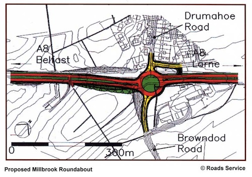
Millbrook Roundabout
The Millbrook roundabout replaced an existing
staggered crossroads on a section of road that was
upgraded to dual-carriageway in 1965. The side roads
are the B148 Drumahoe Road and the unclassified
Browndod Road. To provide the deflections (ie the
angle the road meets the roundabout) necessary on
the approach to the roundabout, the dual-carriageway
on the south-western side (on the left in the map
below) had to be realigned slightly to one side. You
can see the design superimposed on the old layout in
this Roads Service map:
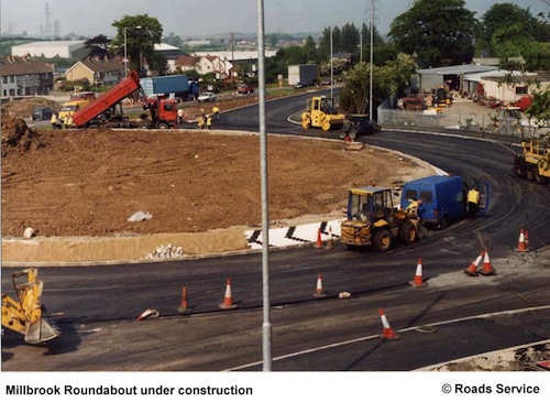
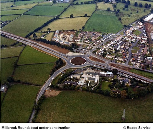
These two images show Millbrook
roundabout under construction (top) and just
completed (bottom). Both images are ©Roads
Service, and form part of a series that were
available here
at the time of writing (Nov 2012). The set also
includes two OSNI aerial views from before work
began that I can't include here for copyright
reasons.
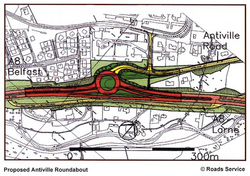
Antiville
The roundabout at Antiville was, at least to
observers, more technically challenging because it
was situated at a point where the A8 is on a steep
incline and because the land to the north also
slopes steeply away from the road. It was also on a
stretch of road that was dualled in 1965, but was
just a T-junction, with the side road being the
unclassified Antiville Road which is a main access
point to the residential areas of western Larne. The
Roads Service map below shows the planned roundabout
superimposed on a map of the area as it previously
existed:
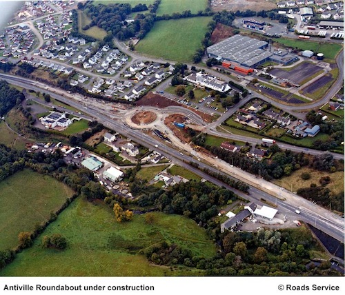
One of the key issues was that the steepness of
the A8 meant that HGVs heading towards Belfast
from Larne harbour had taken a long time to
build up speed going up the hill, and a
roundabout would force them to come to a
standstill again. Roads Service were able to
preserve part of the existing westbound
carriageway to provide a free-flow "jet lane"
bypassing the roundabout, meaning that HGVs do
not need to sacrifice momentum when going past
this junction. The steepness of the land beside
Antiville Road meant that the realigned
Antiville Road and new roundabout had to be cut
into the embankment, with a retaining wall
required. The photograph below shows the the
roundabout under construction, as seen from the
air. As already said, this image is ©Roads
Service, and form part of a series that were
available here
at the time of writing (Nov 2012).
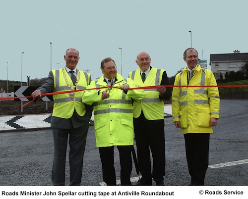
Other Photos
The official opening of
the roundabouts on 13 January 2004. [Roads
Service]
|