|
Status
|
Construction
scheme (completed) |
|
Where
|
Part of
the strategic route from Belfast to the
port of Larne |
|
Total
Length
|
2.2km / 1.4 miles |
|
Opened
|
27 July 2004 |
|
Cost
|
£6 million |
|
Photos
|
See below. |
|
See
Also
|
General
area map
Roads Service map of the
route (PDF)
|
The A8 route is vital
to Northern Ireland, since a large percentage of
our imports come in via the port of Larne and
travel along the A8 towards Belfast. The last
mile of the A8 is the A8(M)
motorway which then joins the M2 motorway for the last
leg of the journey to the city. Prior to this
project, only 1.5km of the route was dualled -
the section from the A8(M) to Doagh Road
(sometimes called Houston's Corner). This scheme
extended the dual-carriageway to Coleman's
Corner and made both junctions roundabouts. Work
began in March 2003 and lasted for 16 months.
Although the scheme seems unambitious, it gives
disproportionate benefits since Coleman's Corner
is where a large slice of the traffic heading to
the growing town of Ballyclare diverges from the
A8 and bo
th junctions were busy and dangerous before they
were converted to roundabouts. The scheme saw
the dangerous S-bend at Ballyearl straightened
out. This required environmental experts, as the
new route involved removing a badger sett. As
badgers are a protected species, the experts had
to build a new sett and used various methods to
persuade them to move over!
Photos
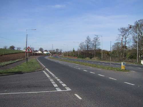
Looking north along the
A8 from the Doagh Road (left) prior to work
commencing. The existing dual-carriageway
terminates here. [Photo by Wesley Johnston]
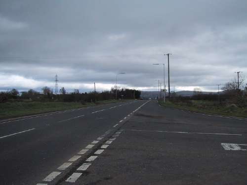
Looking south from
Coleman's Corner along the A8 prior to works.
This junction has now been replaced with a
roundabout, and the road ahead is a
dual-carriageway. [Photo by Wesley Johnston]
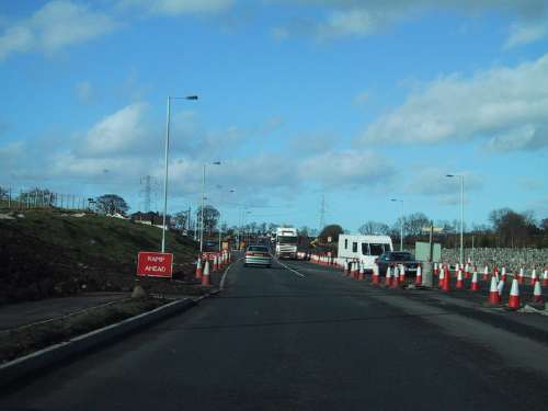
Roughly the same view as
the first photo above, showing work under way.
[Photo by Wesley Johnston]
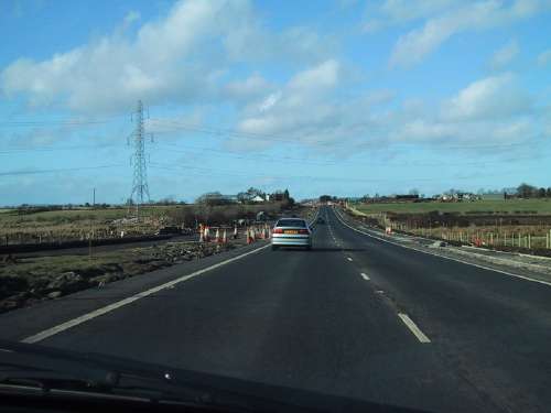
Work
well underway on the A8 in early 2004. The road
opened in July. [Photo by Wesley Johnston]
|
