Status |
Construction scheme (completed) |
Where |
Links the main A8 Larne Road to the Carrickfergus Road bypassing the village centre |
Total Length |
0.9 km / 0.6 miles |
Dates |
Work began 5 April 2004
Opened 15 March 2005 |
Cost |
£2.9m |
Photos / Map |
See below. |
See Also |
General area map |
Ballynure is a picturesque village that straddles the main A8 road from Belfast to Larne. This means that high volumes of traffic go through the area. A single-carriageway throughpass was completed many years ago, but traffic wishing to divert towards Carrickfergus still had to go through the village. Due to the local industrial landscape, a high volume of quarry lorries use this route. These lorries were heavy enough that the vibrations were damaging the buildings in the village.
This new road sees this traffic diverted out of the village centre. It joins the A8 at the dangerous junction with the A57 and Roads Service took the opportunity to build a roundabout here and reduce the speed limit on the throughpass section from 60 to 40mph. There is a plan to ultimately build a northern link road to mirror the southern one and act as an eastern bypass. This is unlikely to be built before 2015. The map below shows the chosen route.
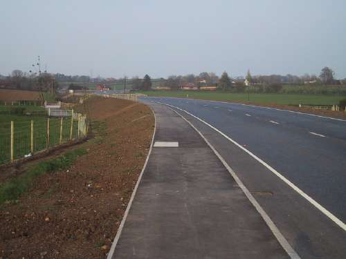
The road was built to a high-specification with an underpass for farmers, rather than direct gated access, and a footpath and cycle lane.
Photos / Map
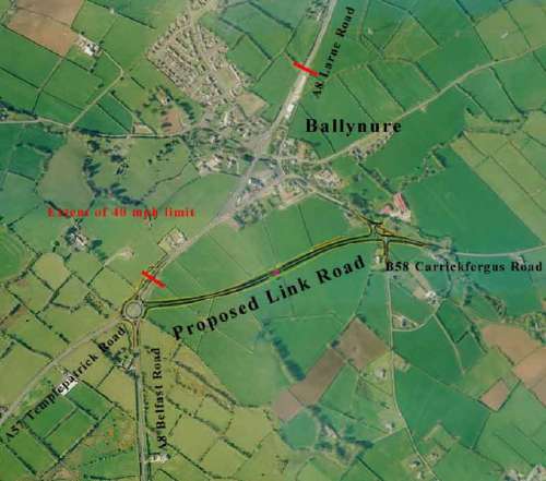
Map of the new road superimposed on an aerial photo of the village. [Roads Service Map]
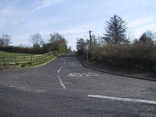
The junction of Straid Road with the Carrickfergus Road (left to right) prior to works.... [Photo by Wesley Johnston]
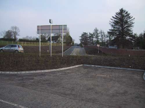
....and exactly the same view after the new road was built. [Photo by Wesley Johnston]
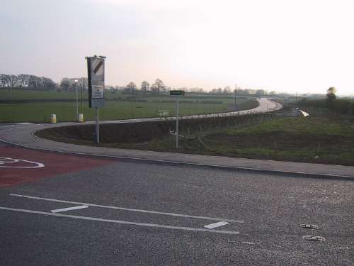
The new road seen from the north end. [Photo by Wesley Johnston]
The new road seen from the south western end. [Photo by Wesley Johnston]
|
