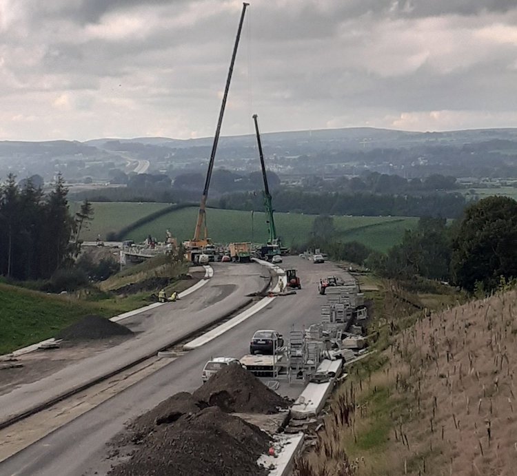
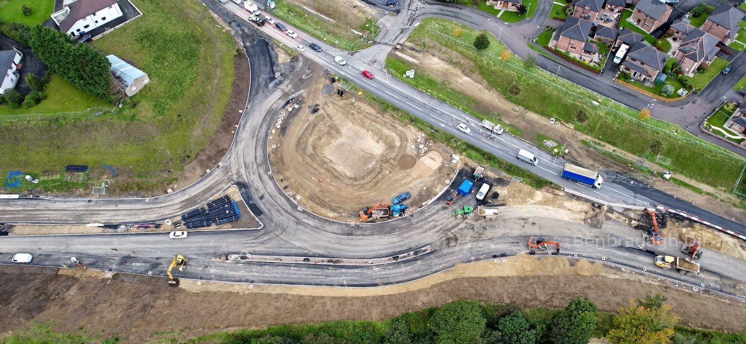
|
This page is an
archive of older updates from the main A6 Dualling
page.
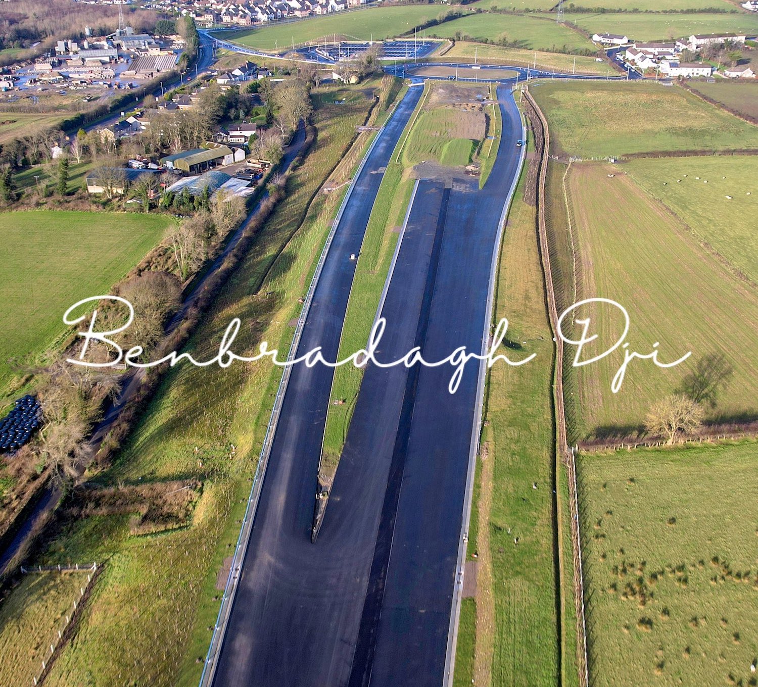
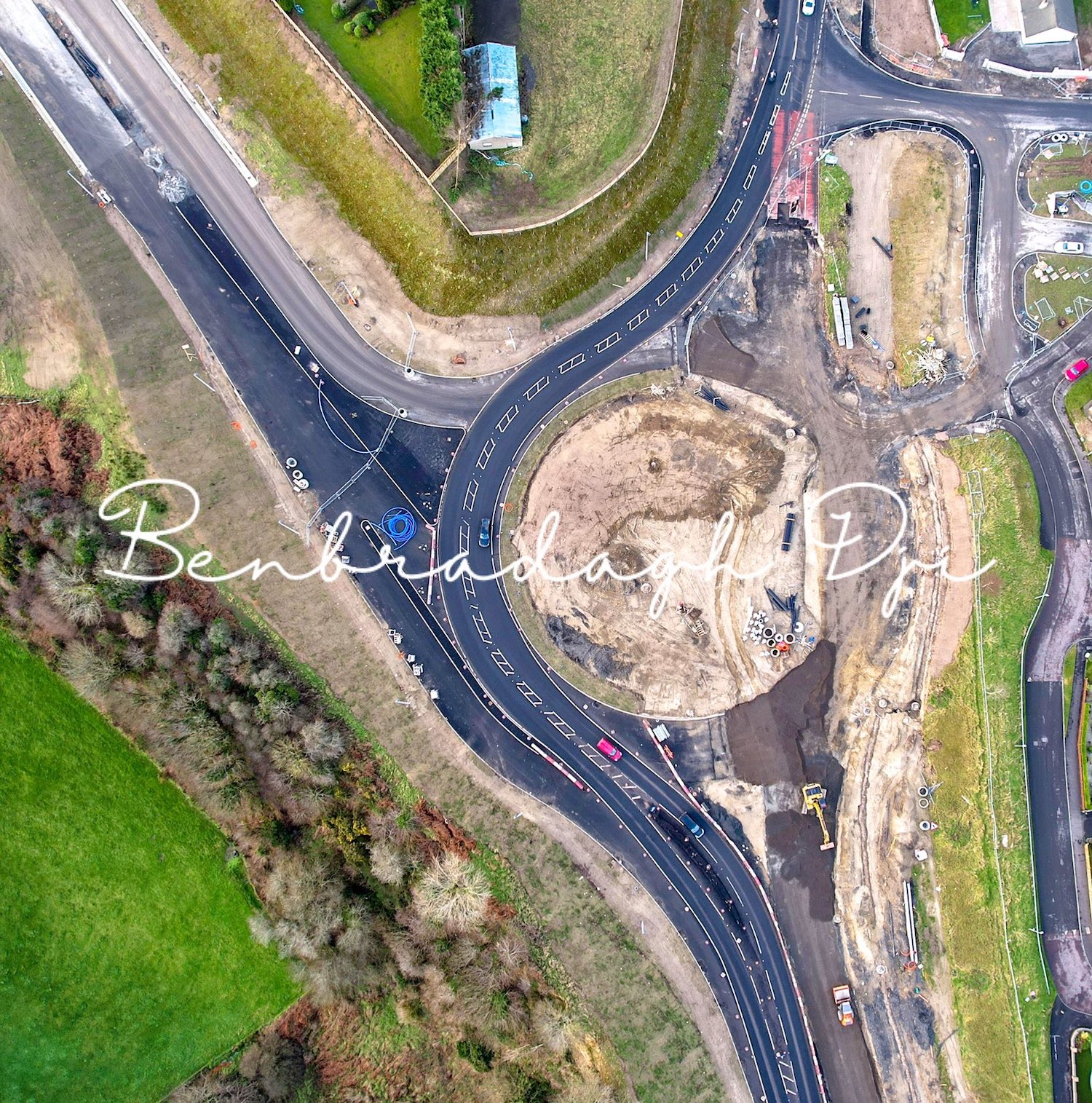
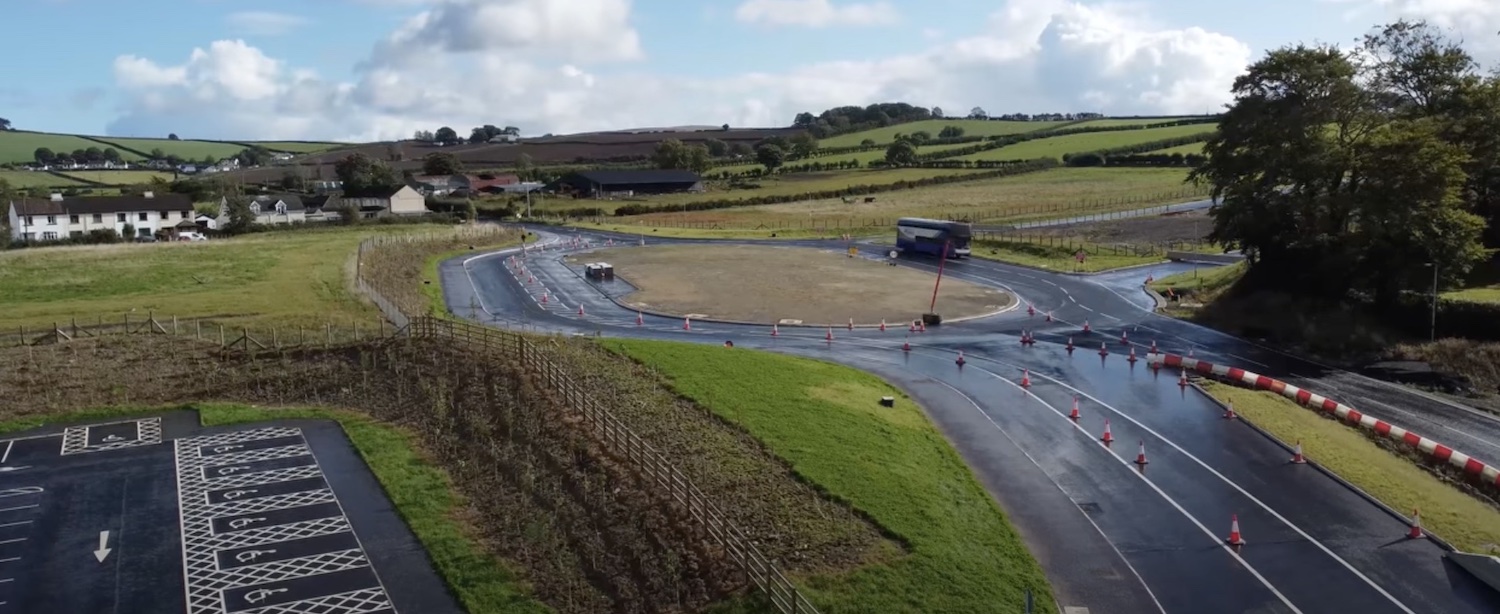
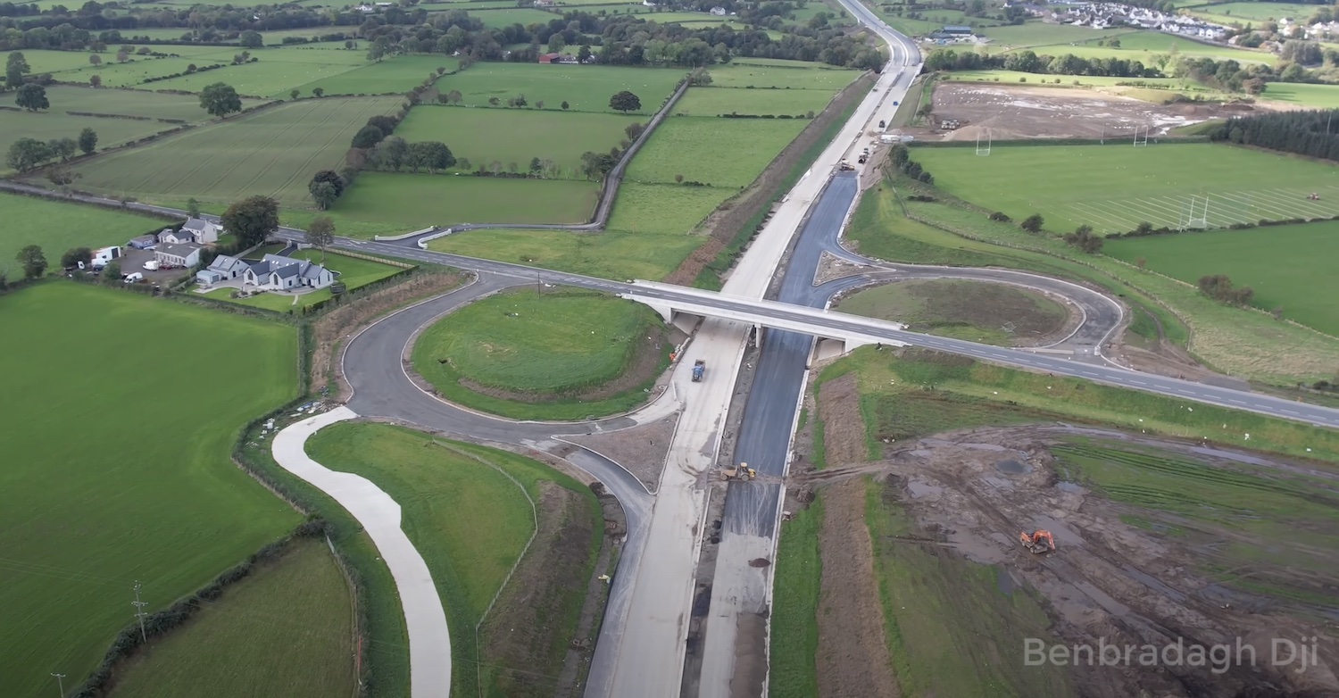
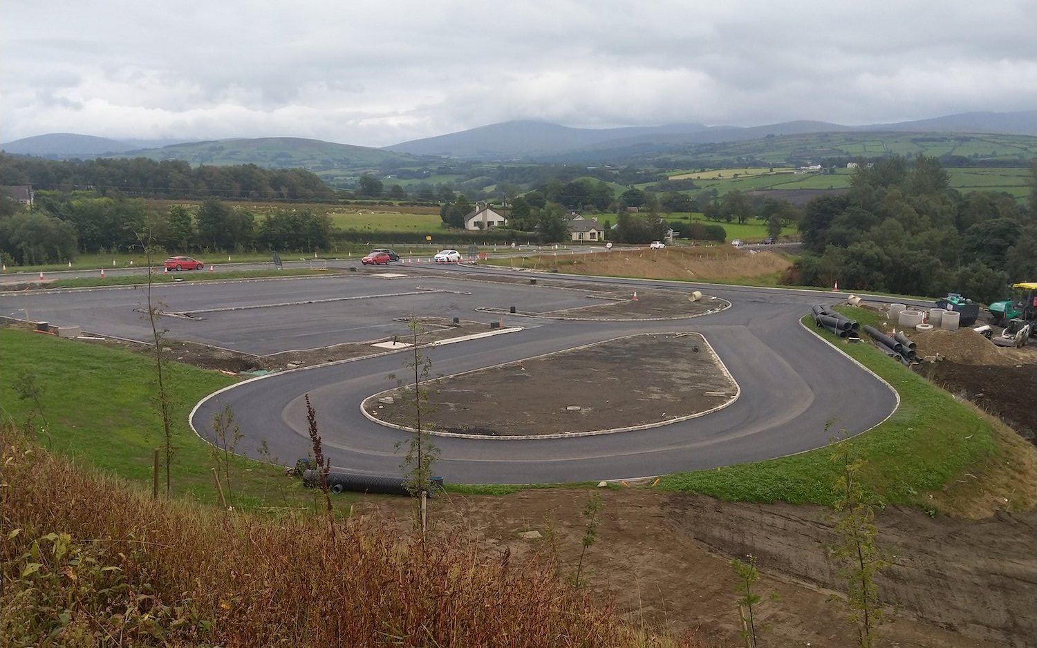
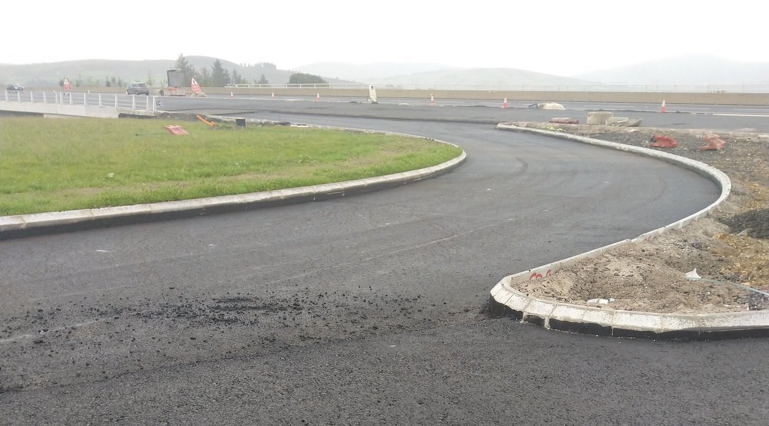
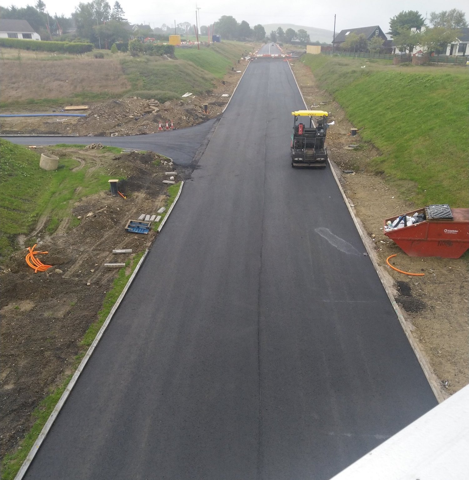
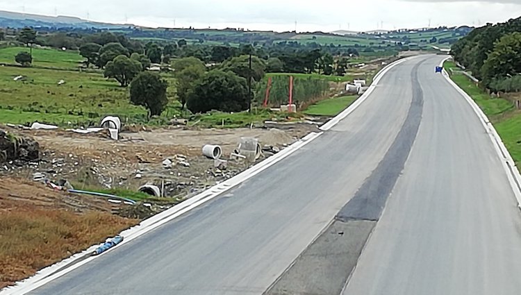
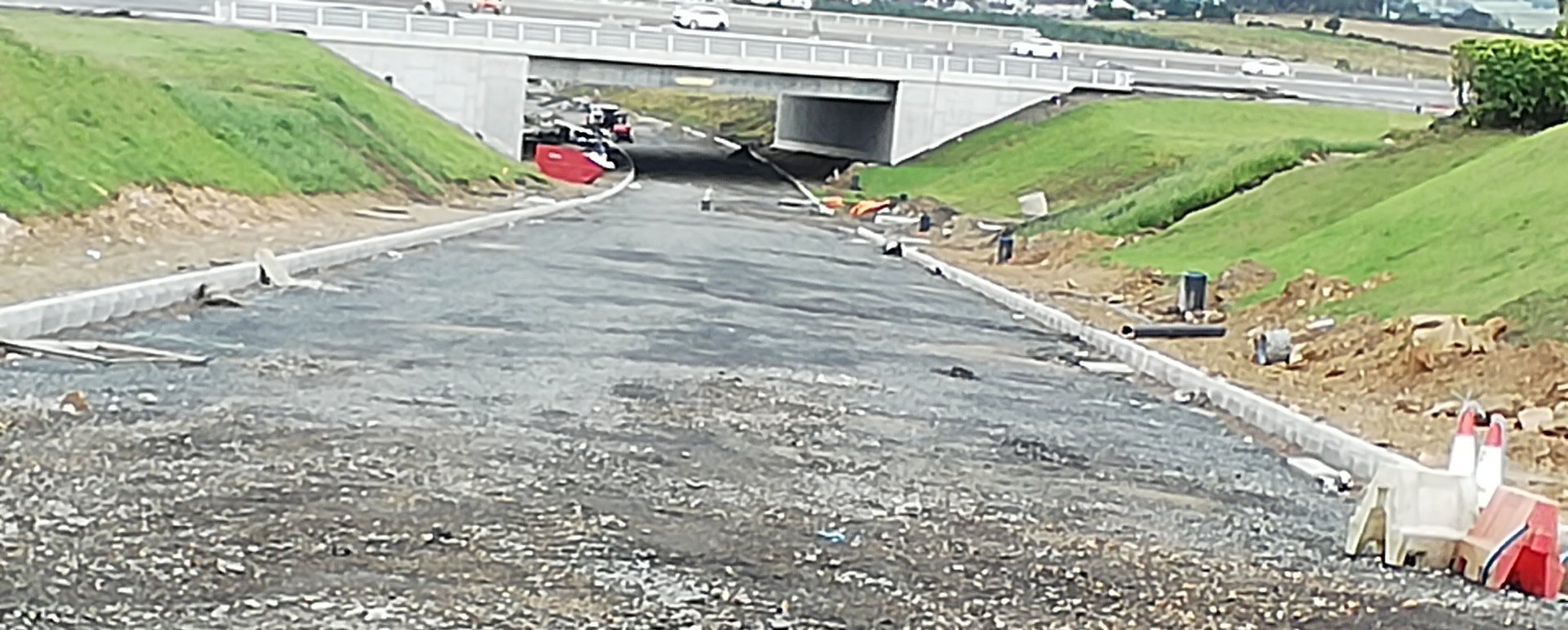
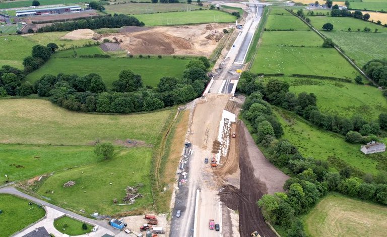
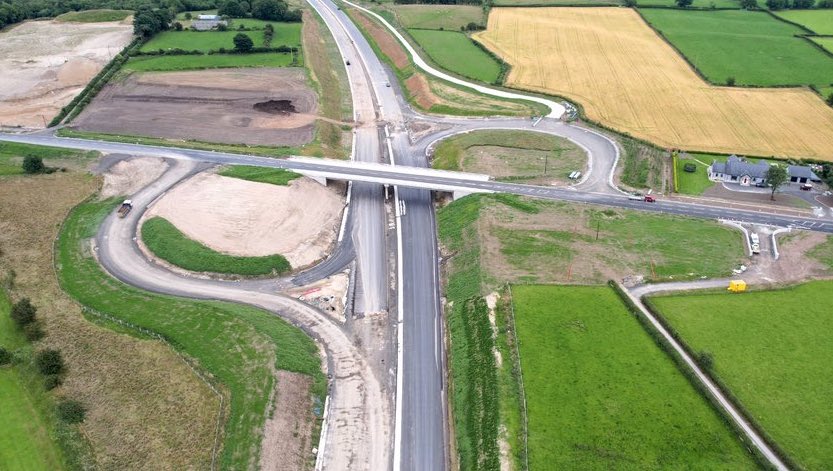
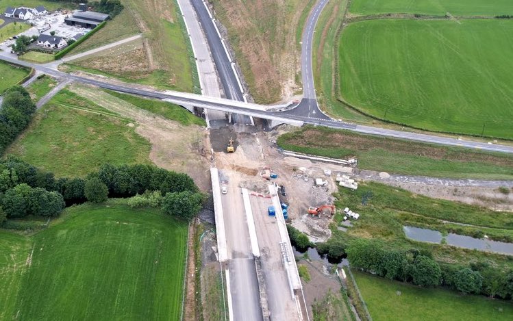
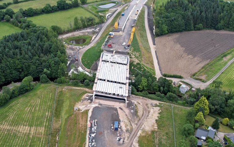
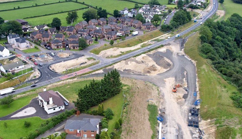
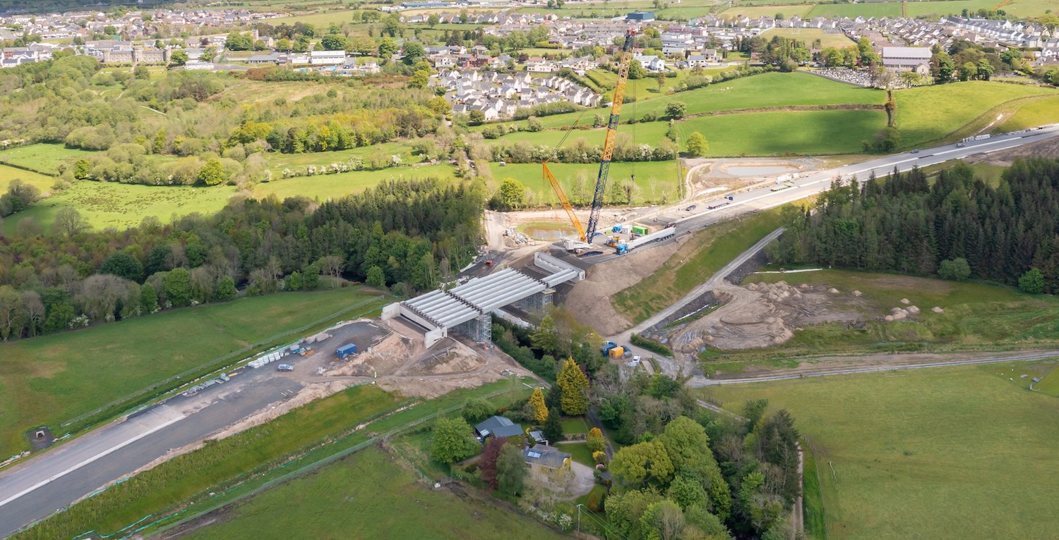
21 Feb 2022: Since the autumn several
more bridge structures have been completed.
Among those recently finished are Munreery Road
overbridge, Killunaught Road overbridge and the
Owenbeg river bridge. Only 6 of the 22 bridges
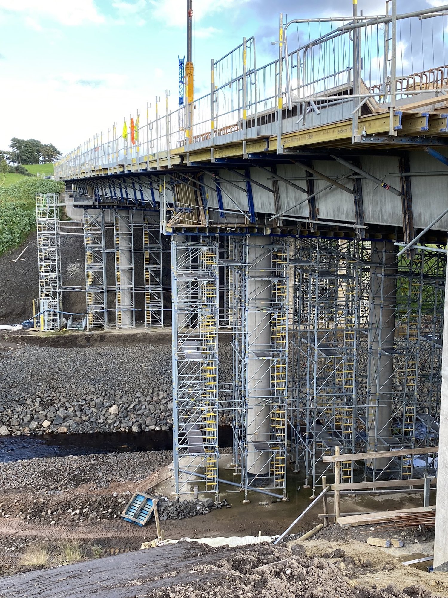
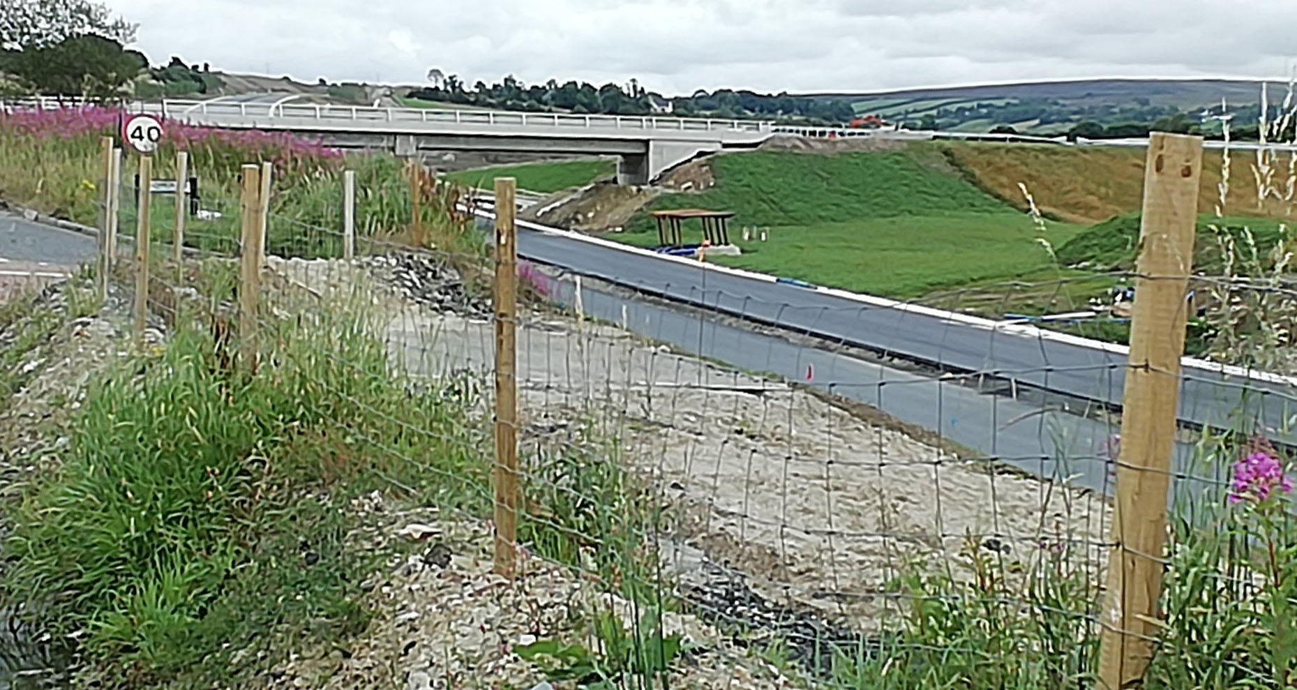
are still under construction. Liberty Glen
bridge, near Derry, is now getting its surfacing
(see pic 1 below). The nearby Tamnaherin Road
underbridge has had its wingwalls poured (the
triangles that hold back the embankment beside
the entrances to the bridge) and is due to get
parapet railings any time now. The southern half
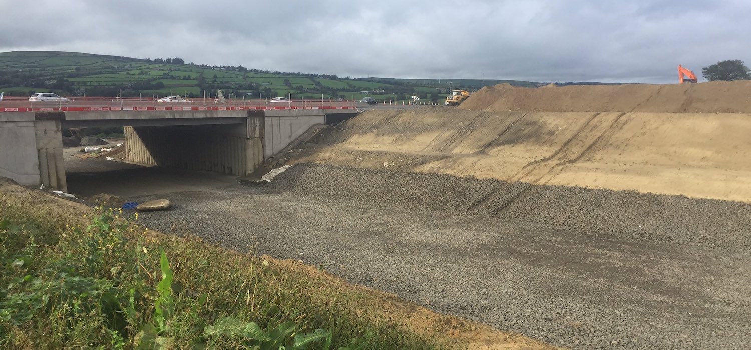
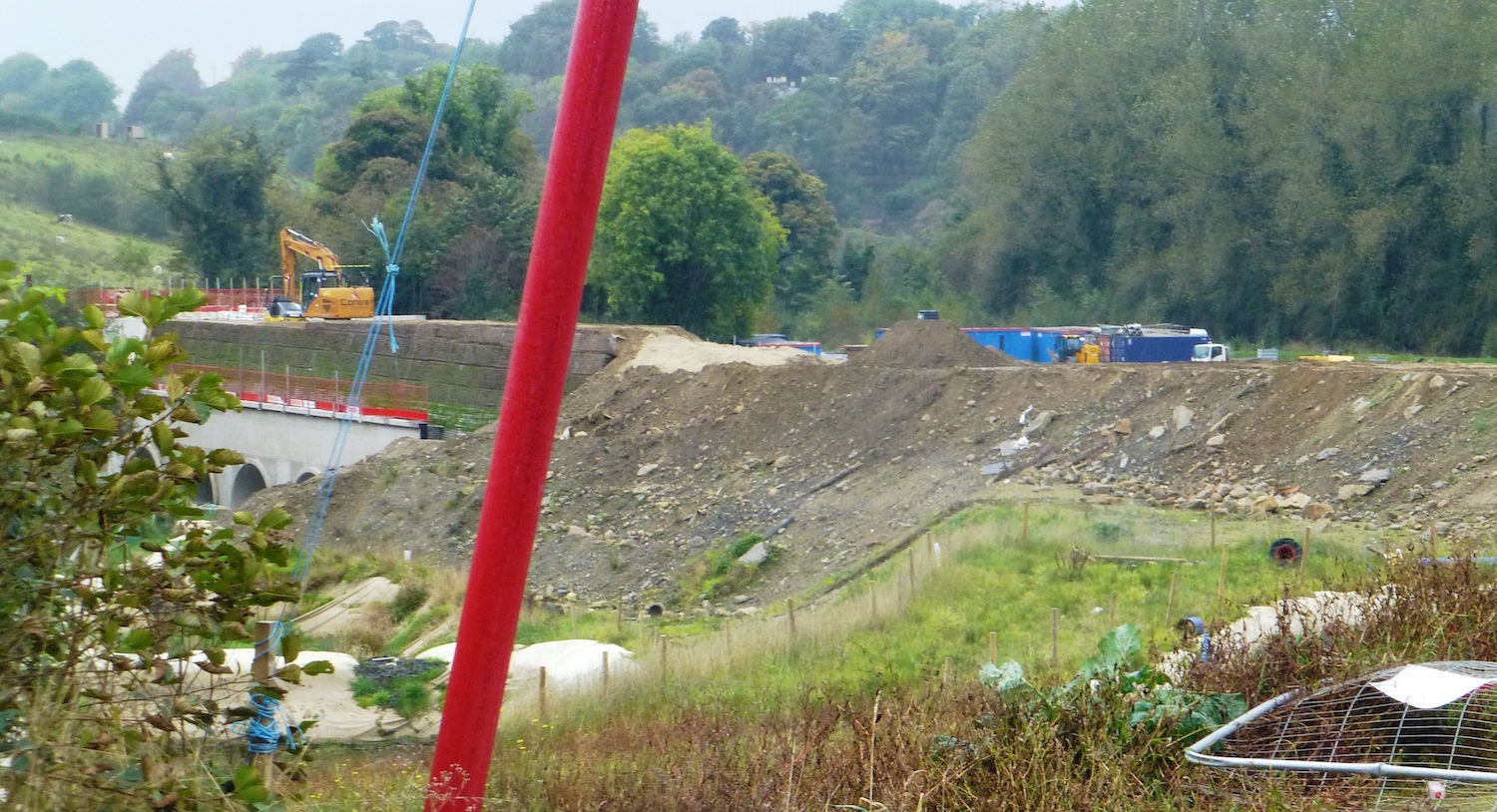
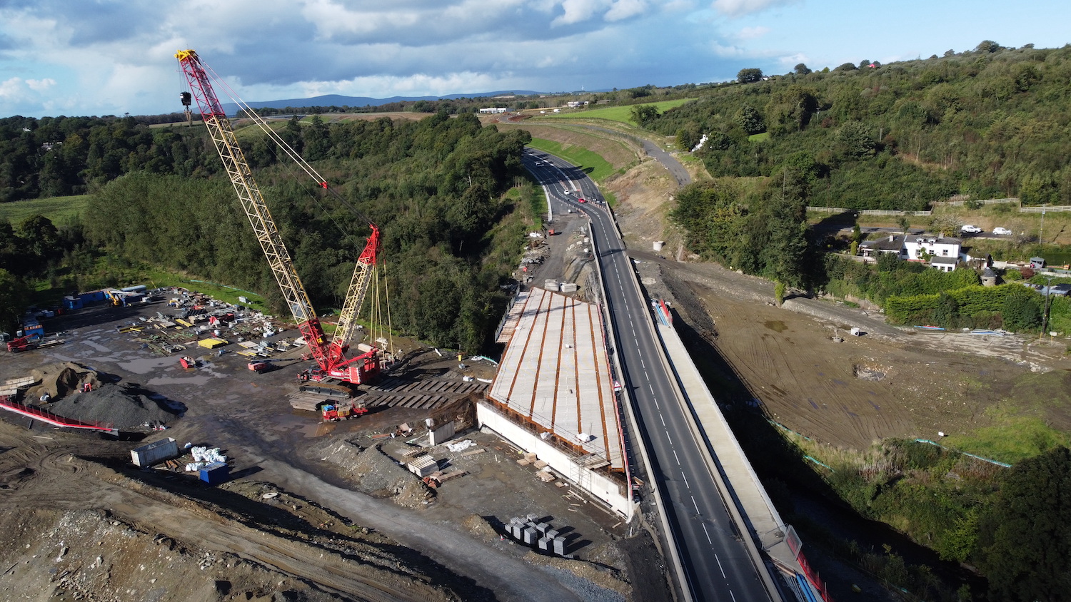
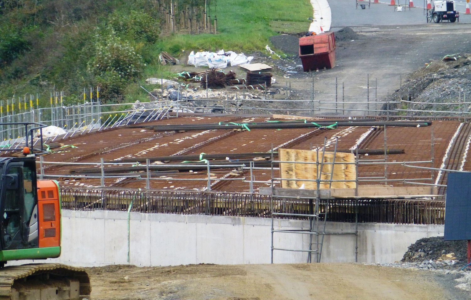
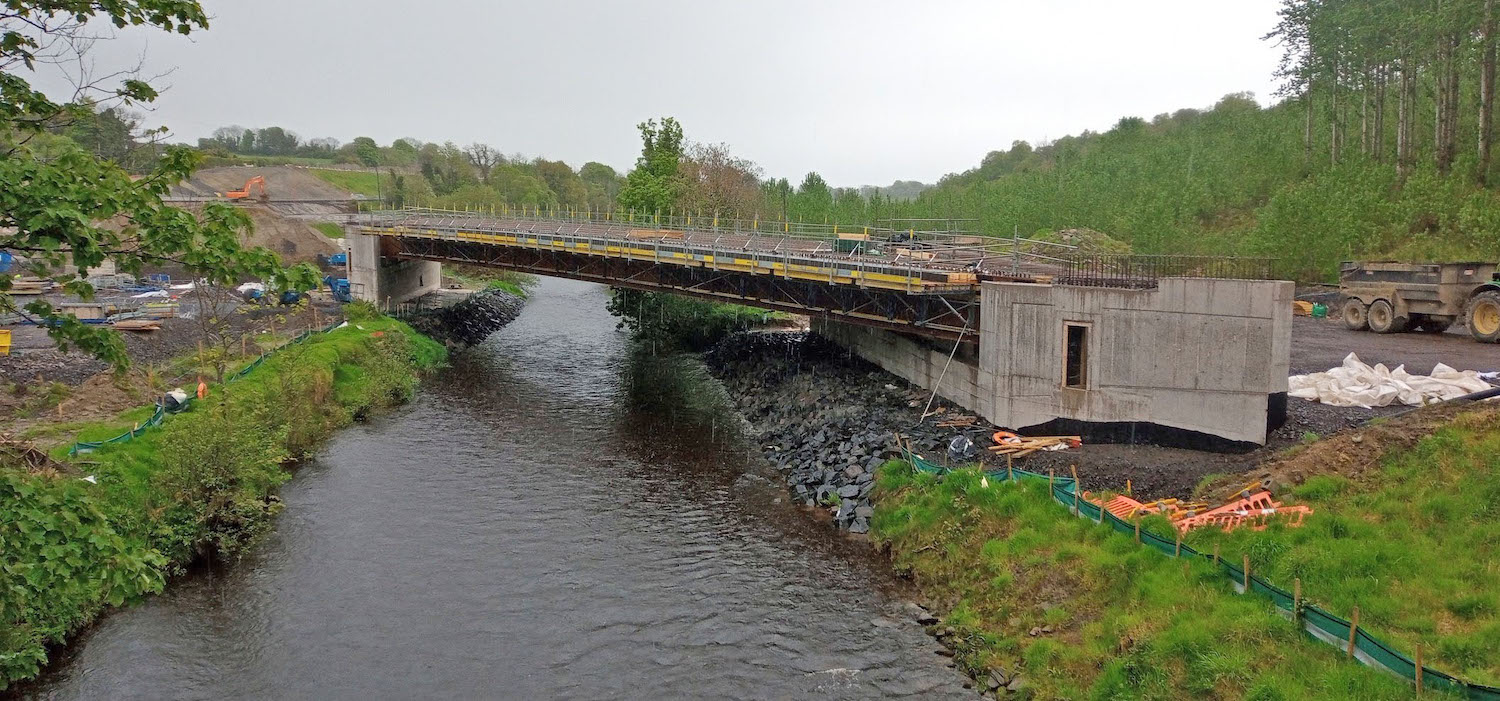
of Burntollet river bridge is now having its two
abutments filled up to road level, and the
bridge is due to be surfaced in the middle of
March. The adjacent Ardmore Road bridge has now
had its waterproofing layer complete, and work
is now underway on ducting (for utilities) and
kerbing (for footways), and is also due to get
surfaced in mid March. Killaloo Road overbridge,
one of the last bridges to get underway, is at
last due to get its first surfacing before the
end of this month. Finally, at Dungiven,
surfacing is now underway on the River Roe
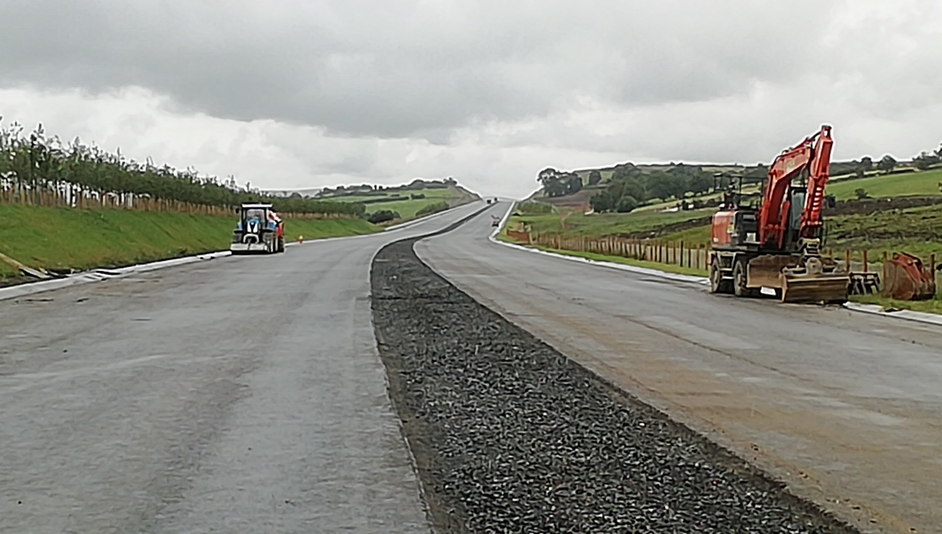
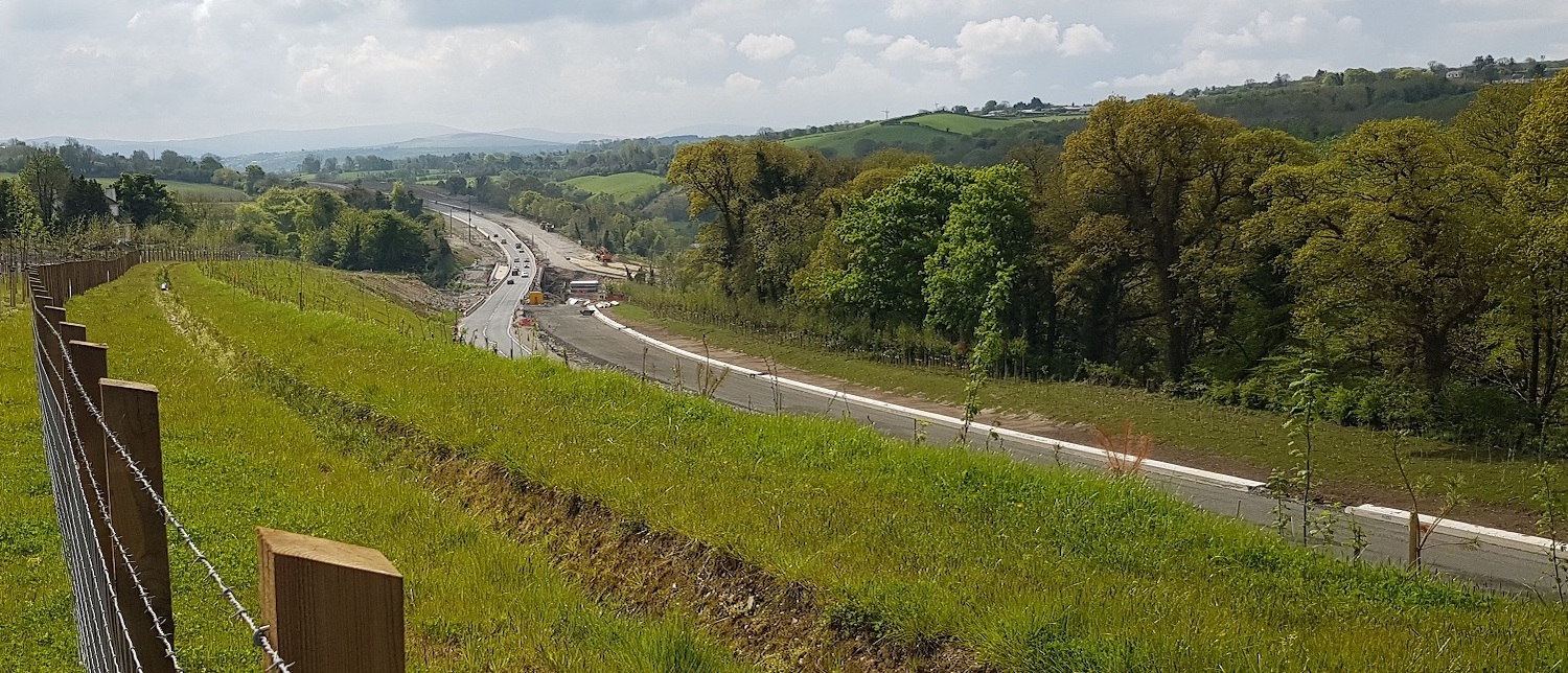
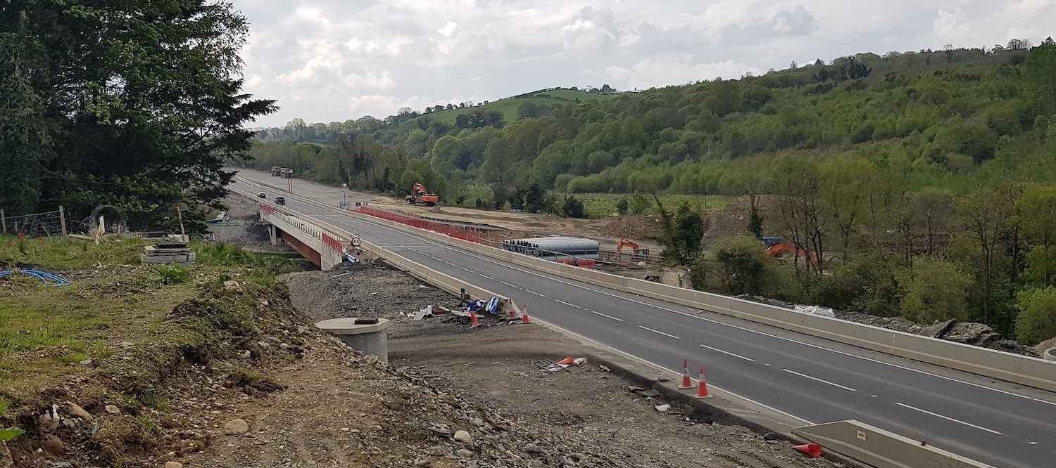
bridge. On the road itself, progress is very
impressive. Long stretches not only have their
final layer of tarmac, but white road markings
too. Work is also well underway on the laborious
task of installing central safety barriers along
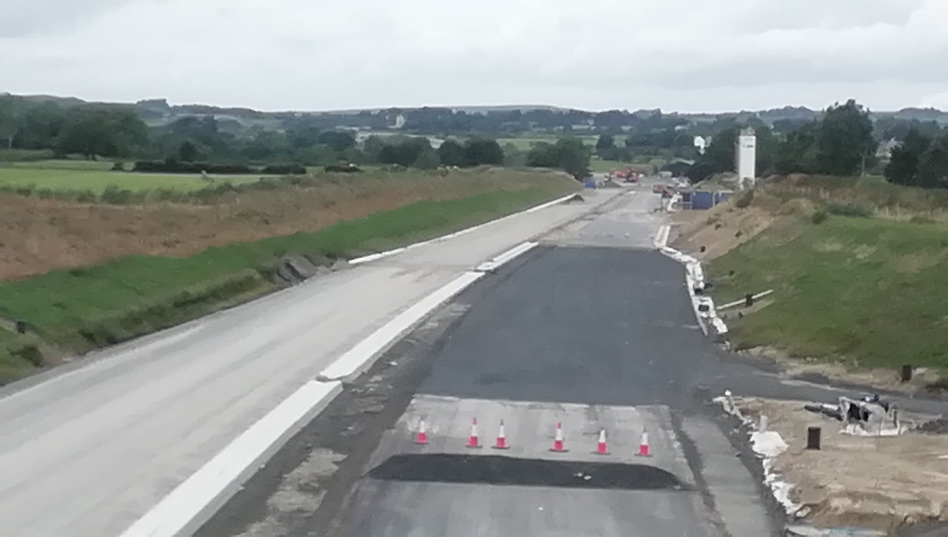
the entire 30 km of the scheme. At the Derry
end, the new roundabout at Tirbracken Road - the
scheme's "temporary" terminus - has been closed
for three weeks, until 6 March, apparently to
allow it to be reconfigured, probably as an
actual roundabout. Until now it has been
completed but not operating as a roundabout. The
progress suggests that we could see at least
part of the scheme open to traffic in some shape
or form during the spring. One option would be
to open the entire offline stretch from Dungiven
to Claudy in one go. Before we come to the
photos below, here
is a link to an aerial video by Dermot
O'Leary of the area around Ballyhanedin Road
(about half way along the scheme). The section
at the start of the video appears to have its
final wearing course of tarmac laid, and faint
white guidelines have been drawn to allow the
white lines to be added. Note also that the
central reservation - which still needs a crash
barrier - has been given red surfacing. The
photos below are arranged in order from west
(Derry) to east (Dungiven). With thanks to
everyone for taking, and letting me use, their
images.
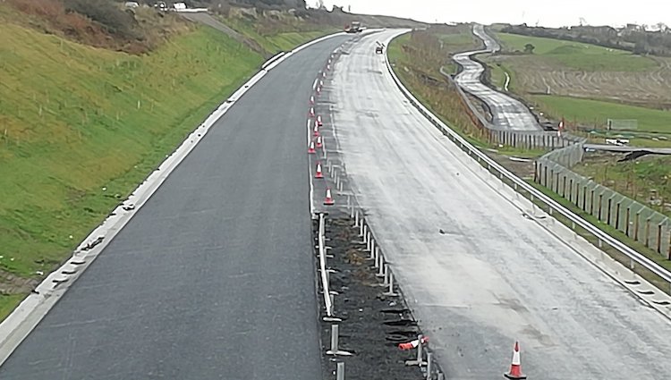
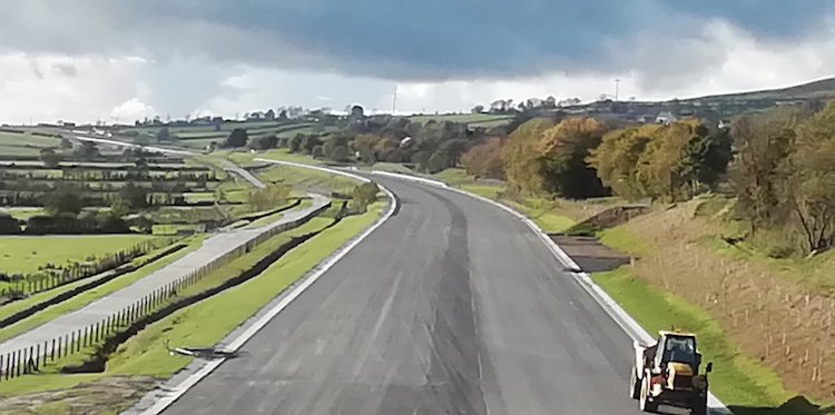
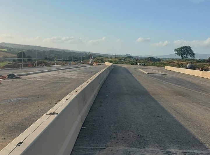
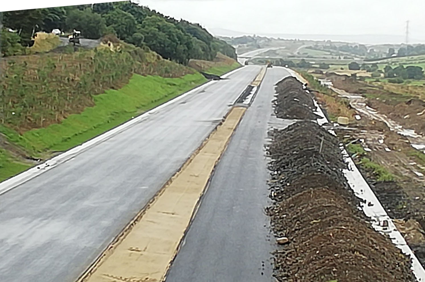
Pic 1: View west across Liberty Glen bridge on
28 January 2022 with the first course of tarmac
added, kerbing in place and the central crash
barrier being installed. [Arthur Ming]
Pic 2: View west from Liberty Glen bridge
towards Drumahoe on 28 January 2022. Ahead the
road has a base course of tarmac in place, while
the white markers show where the pillars for the
central cash barrier will be installed. [Arthur
Ming]
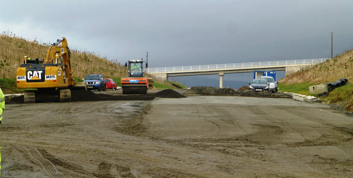
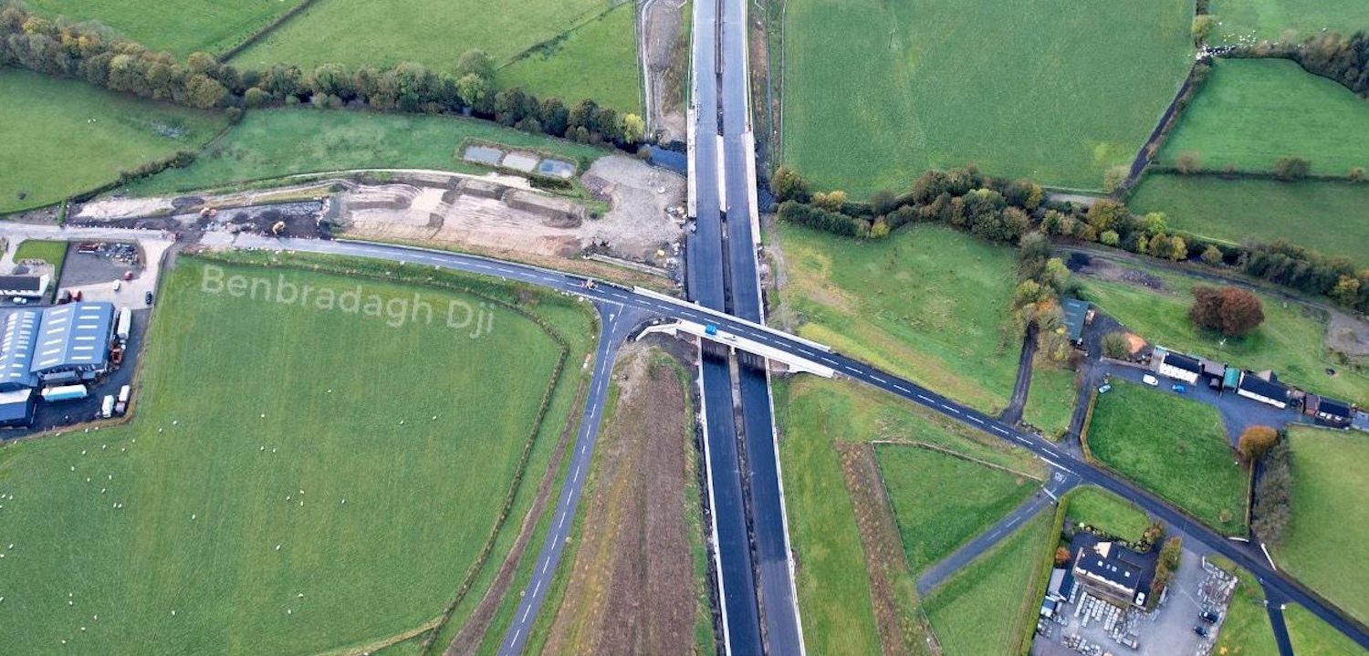
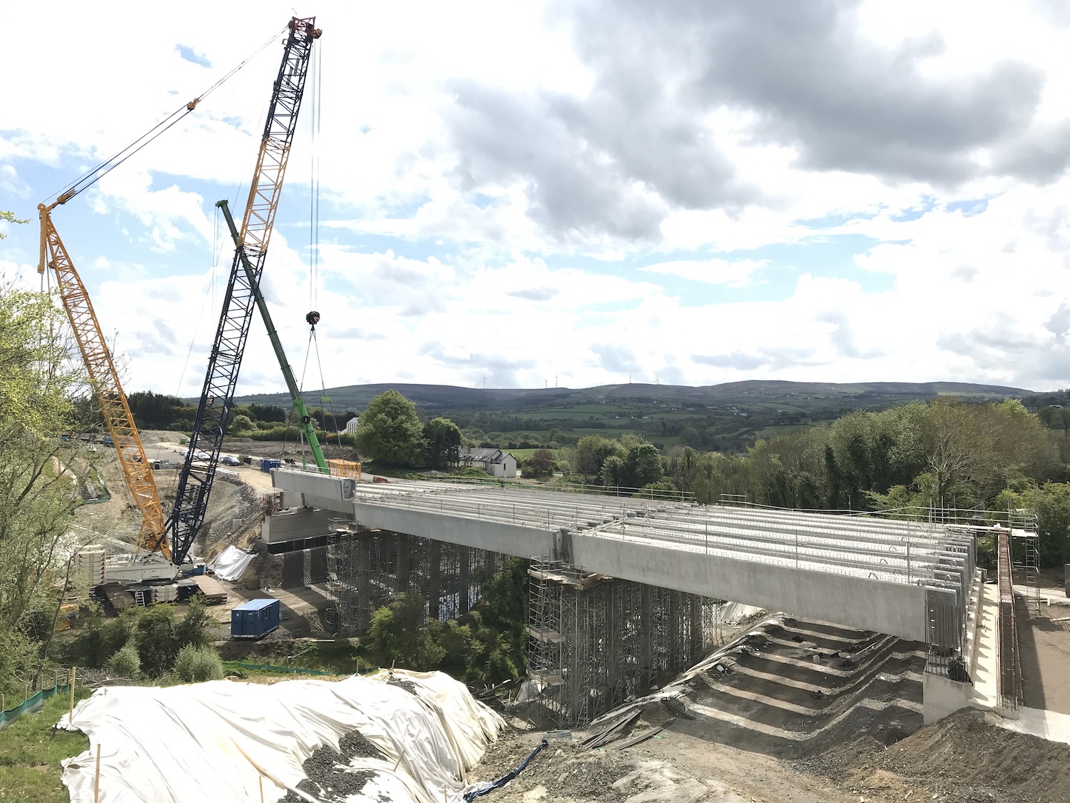
Pic 3: Burntollet Bridge on 1 February 2022,
with the approaches to the part of the bridge on
the left now built up to deck level. The road
will be surfaced next month. On the left the
wires strung across the road are to remind
workers that there are cables above. [Arthur
Ming]
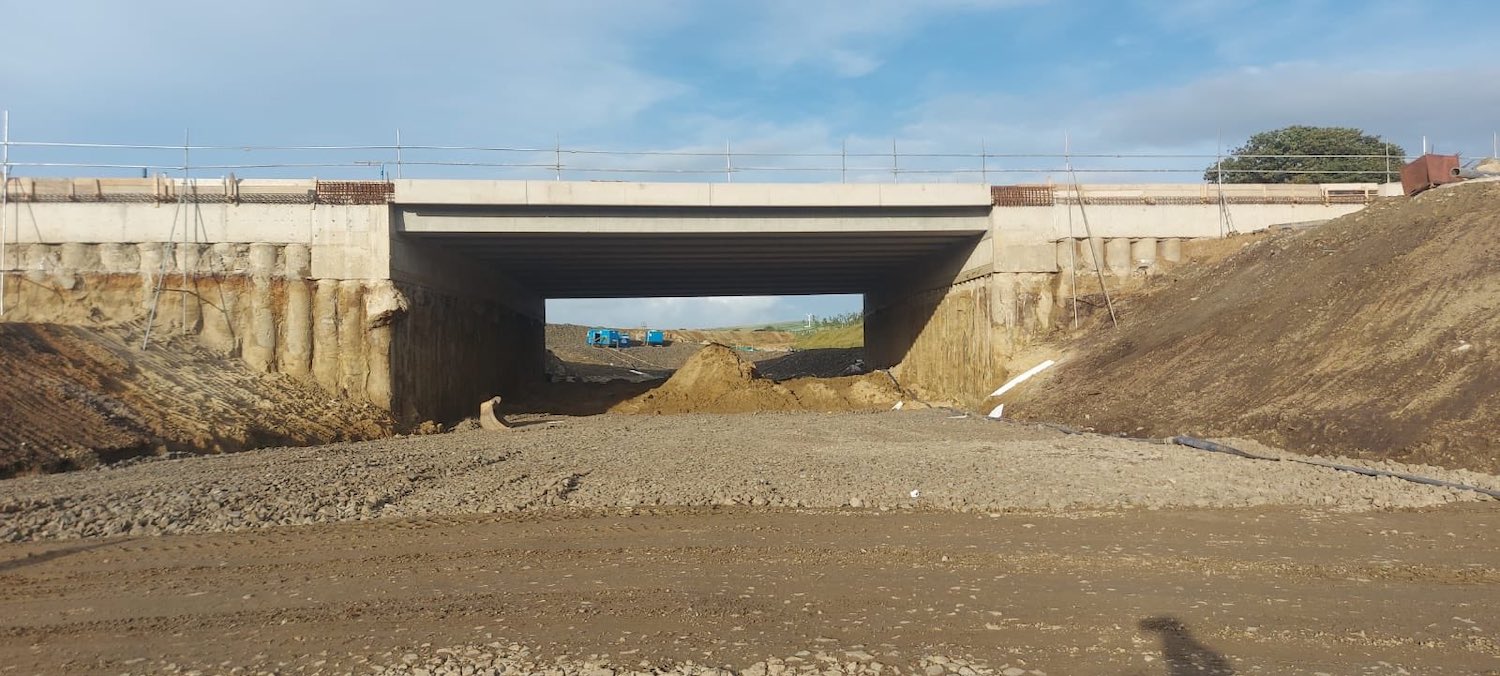
Pic 4: Moving to Claudy, this is the view
beneath the underpass on on 6 February 2022. The
road here is close to being completed - it looks
like a final wearing coruse of tarmac is needed
- but the contractor appears to be in no hurry
to open it. [Martin Lynch]
Pic 5:Baranailt Road between Claudy village and
the new road, seen on 6 February 2022, with work
advancing on the two footways and road itself. A
bit more work needed here. [Martin Lynch]
Pic 6: View from close to the new
dual-carriageway (behind camera) along the
future westbound offslip/onslip approach road at
Claudy. At the bottom fo the hill the road meets
Baranailt Road at a T-junction. The new
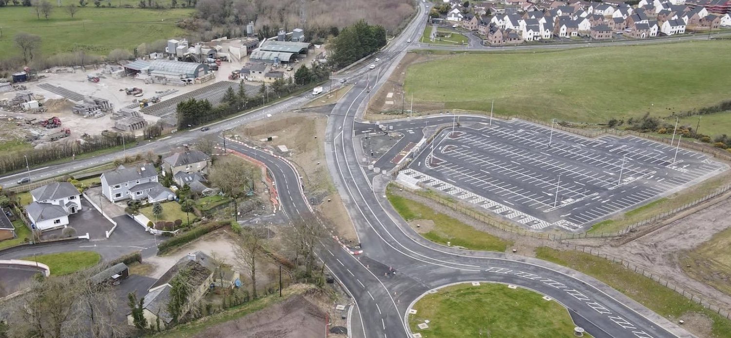
park-and-ride is on the right. 6 Feb 2022.
[Martin Lynch]
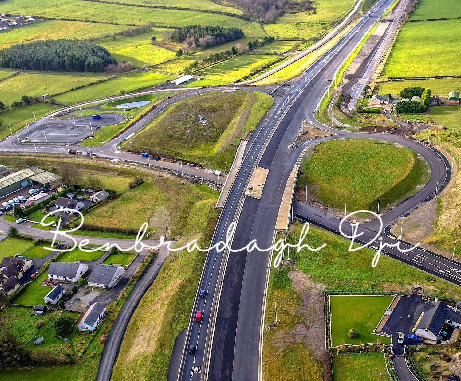
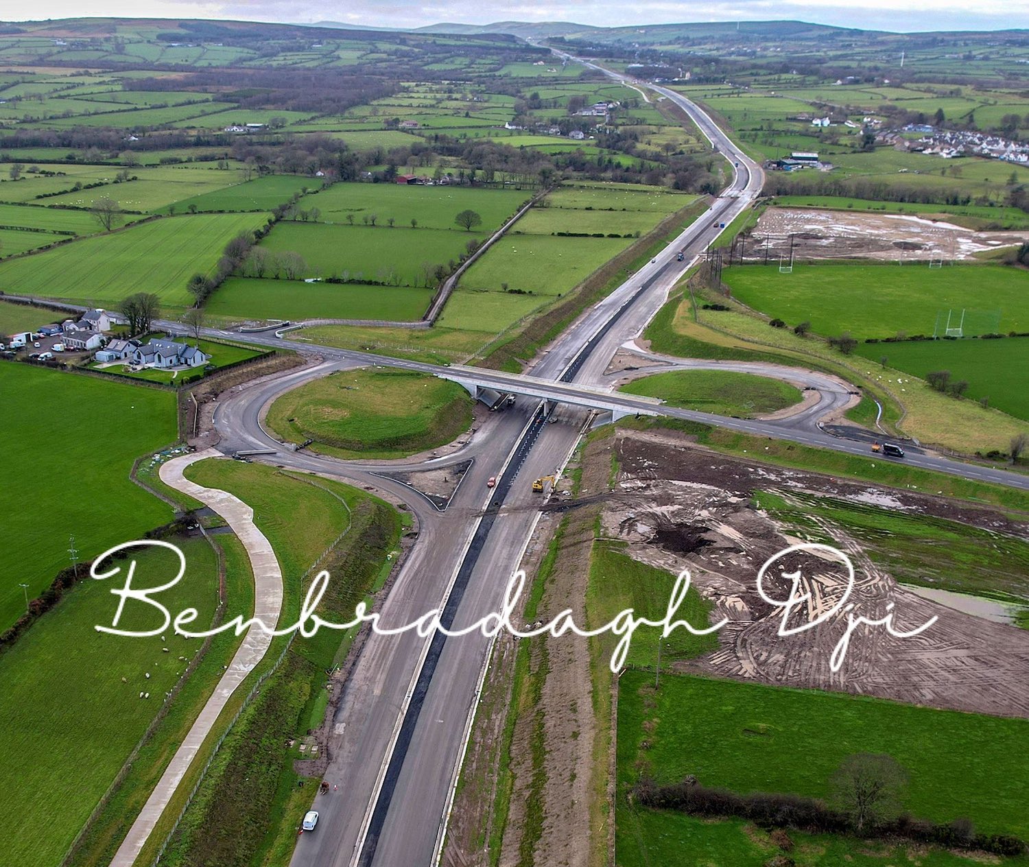
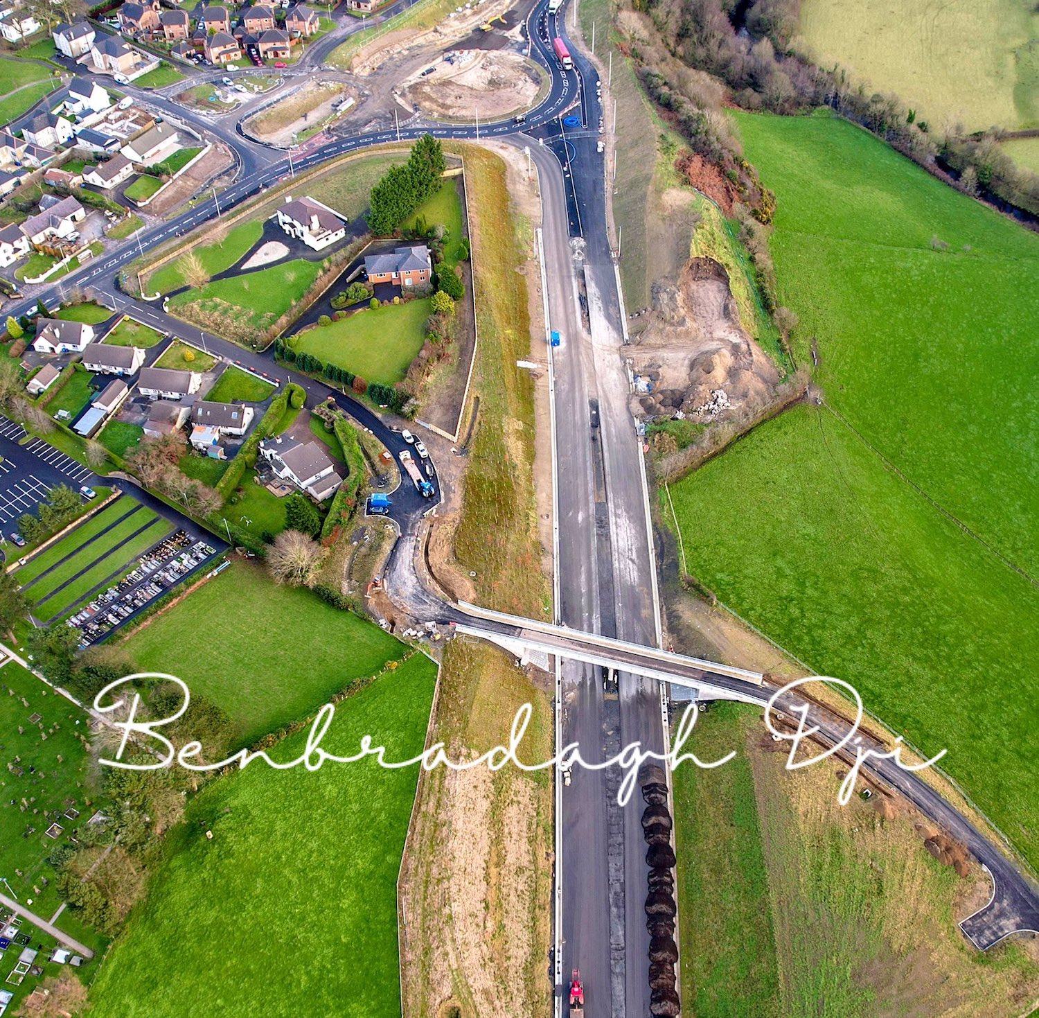
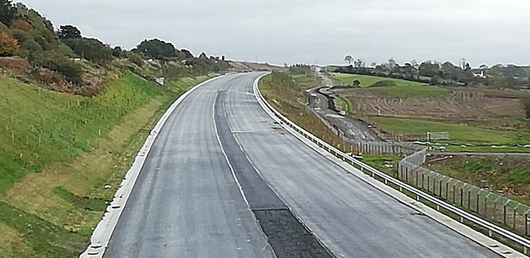
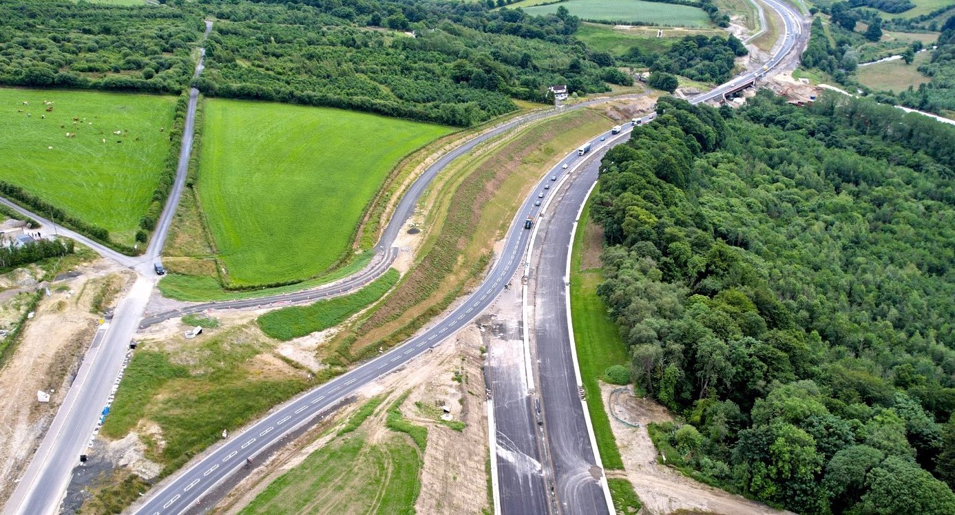
Pic 7: View east from Gortilea Road overbridge
on 14 February 2022. This section of road is
very advanced, with the surfacing complete and
the white lining done. Work on the central crash
barrier is underway. Just here the barrier
splits in two to pass either side of the central
bridge piers. [Paul McCloskey]
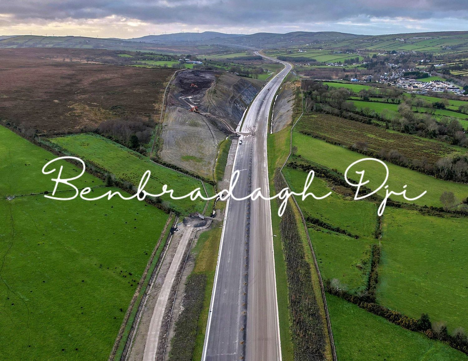
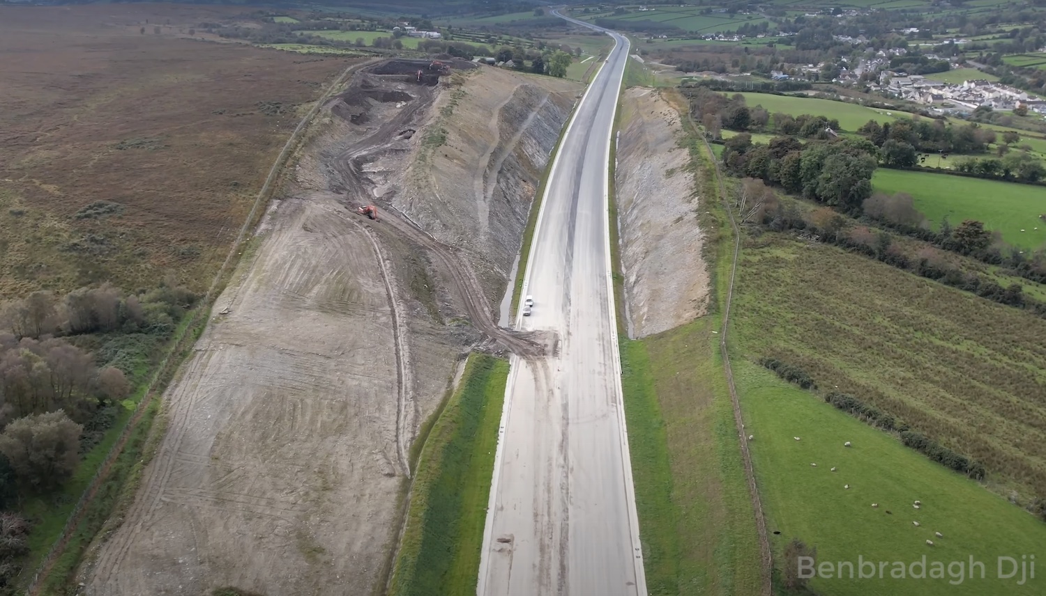
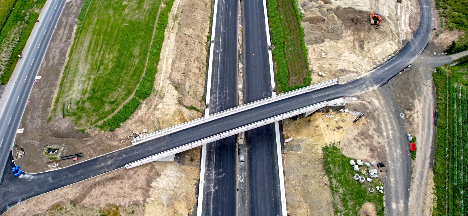
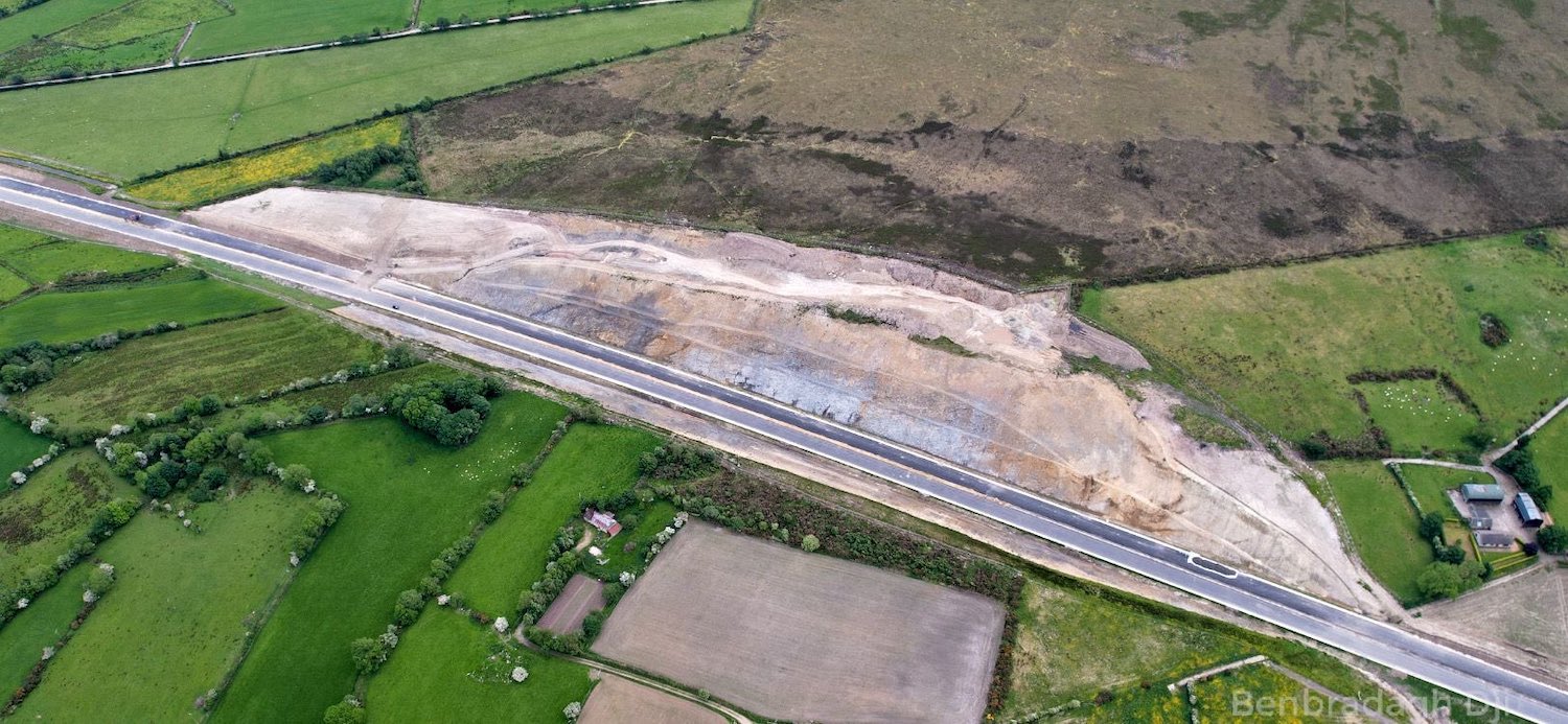
Pic 8: Aerial view looking west towards Ovil
Hill cutting, near Foreglen, the largest
excavation on the scheme. The future westbound
carriageway has been completed but work is still
underway eastbound and on the central barrier.
Fill works on the top of the cutting now seem to
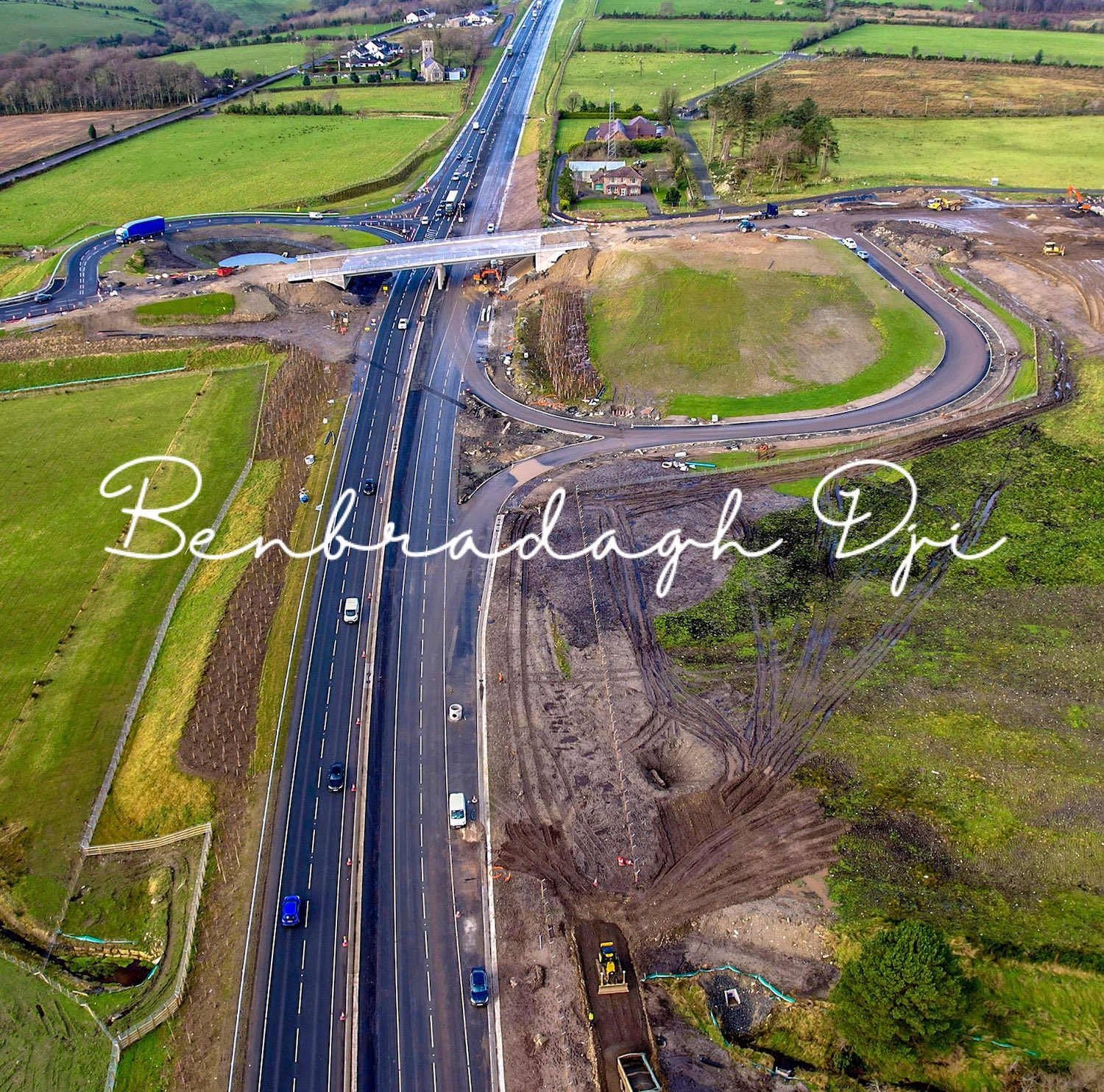
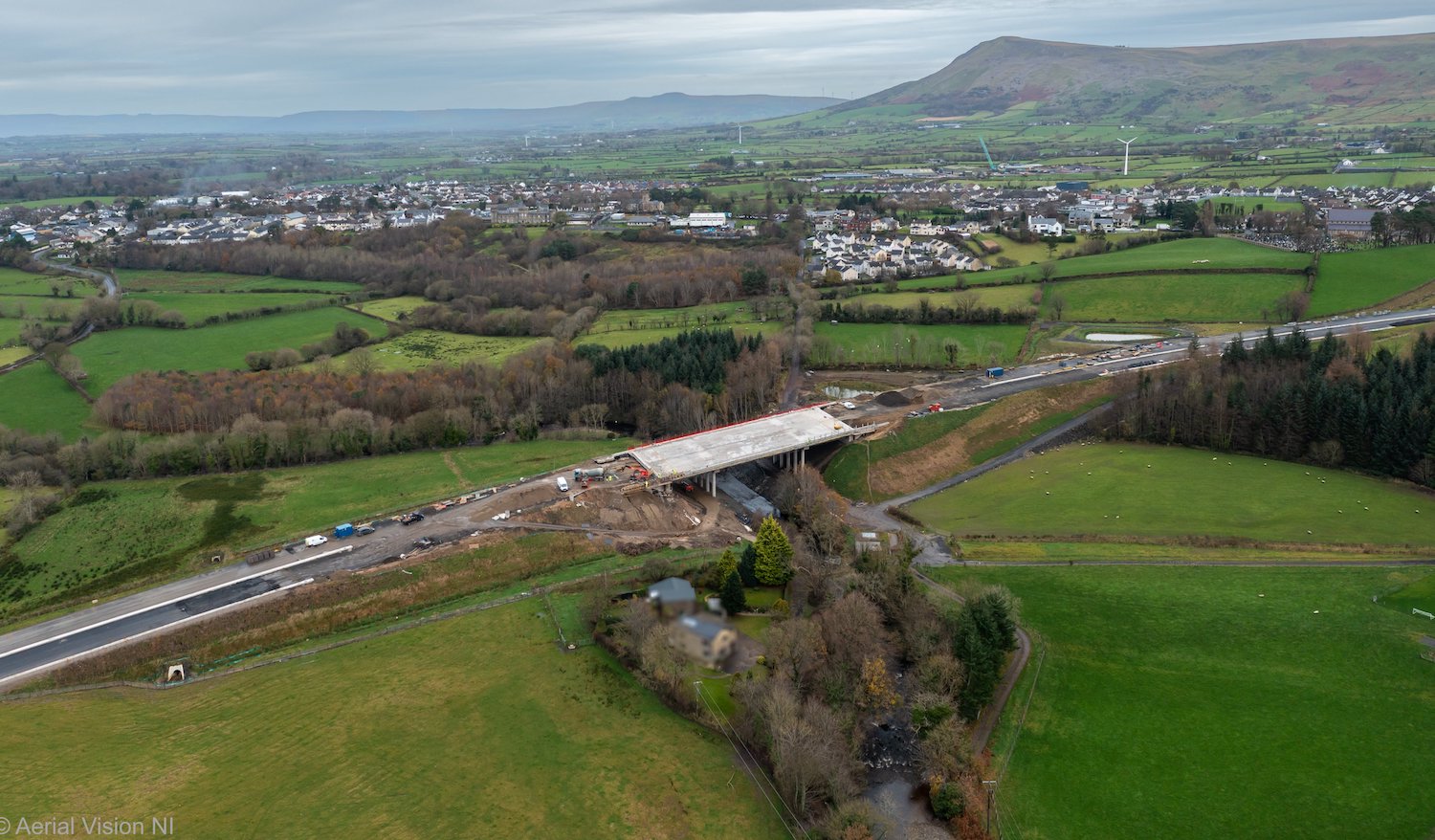
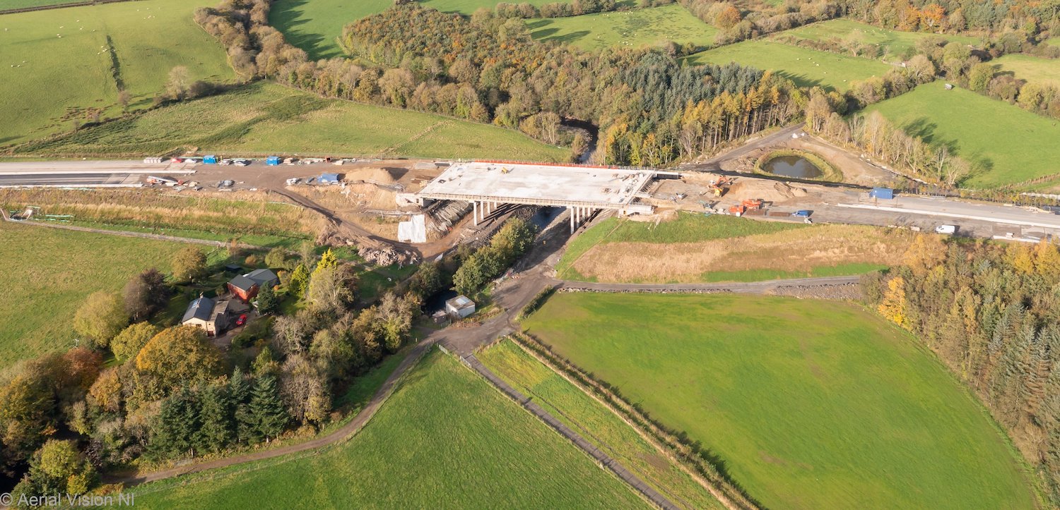
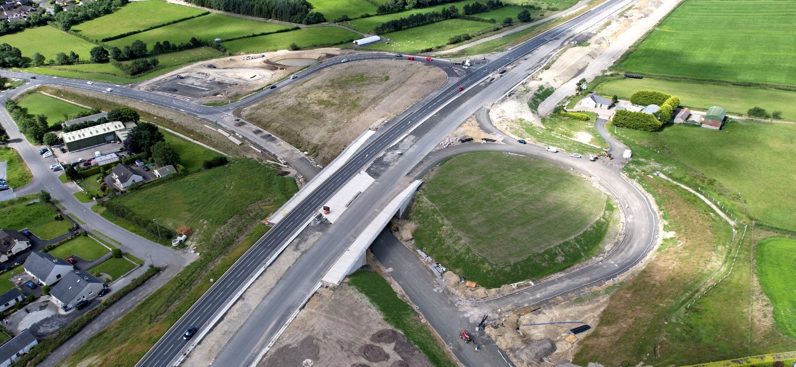
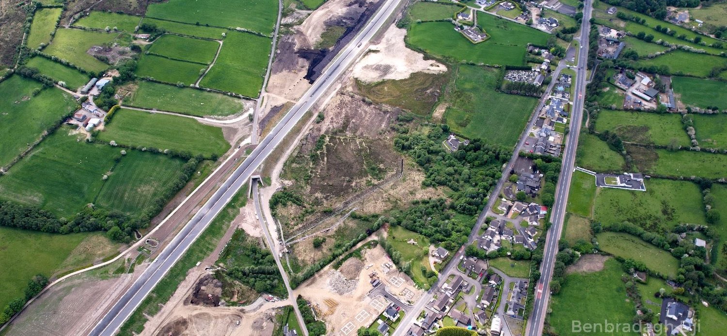
be finished too. 16 Feb 2022. [AerialVisionNI]
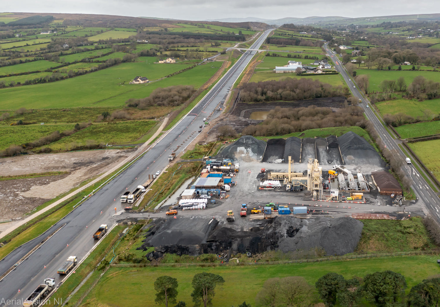
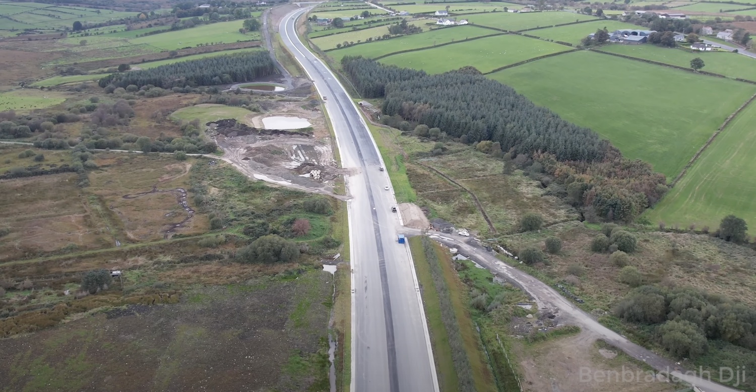
Pic 9: Aerial view of the tarmac batching plant
near Ovil on 16 Feb 2022. All the tarmac for the
scheme is being produced here. Killunaught Road
overbridge can be seen in the distance.
[AerialVisionNI]
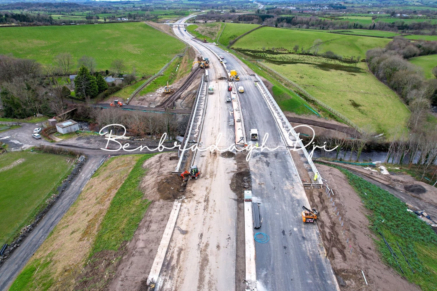
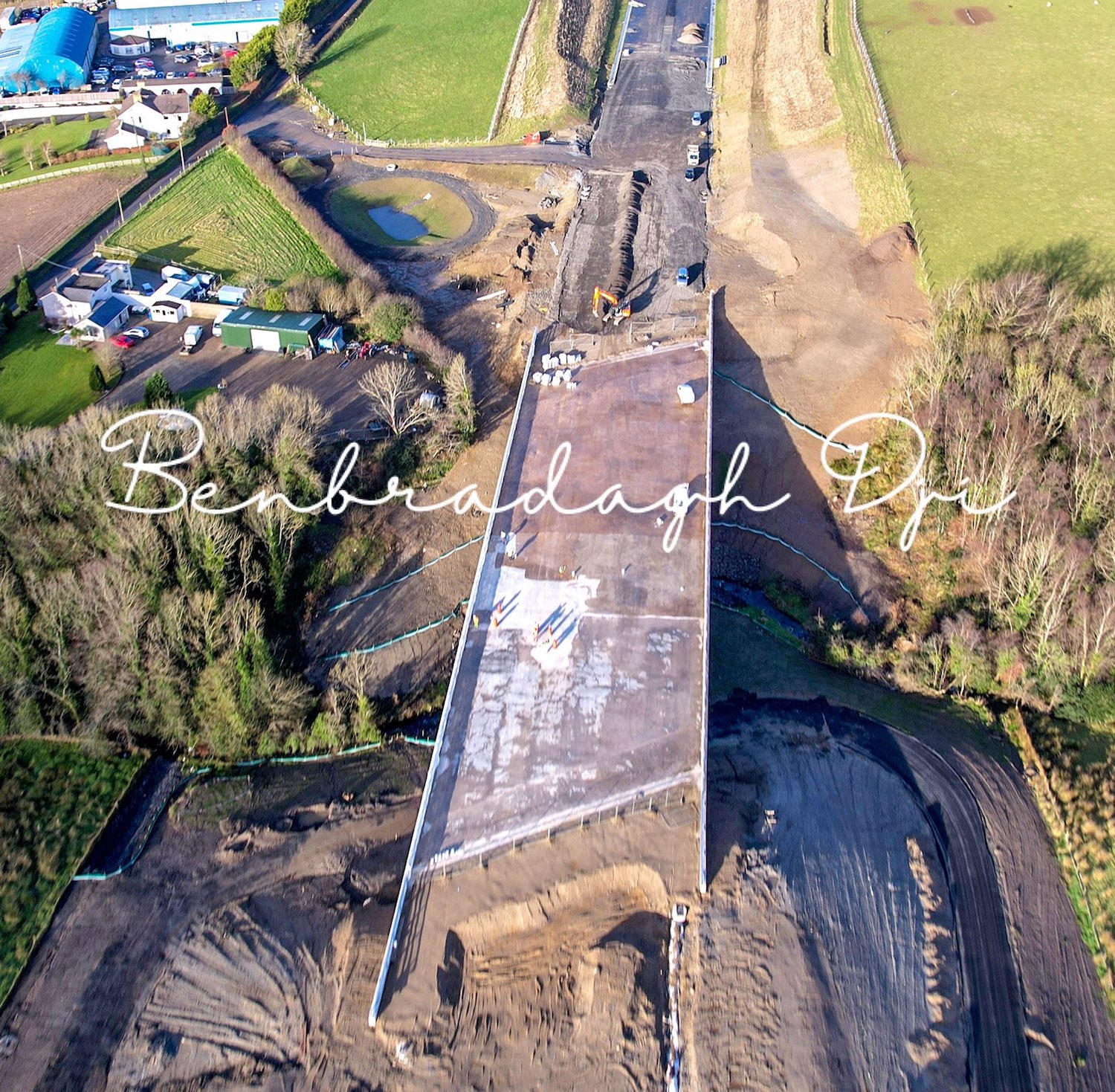
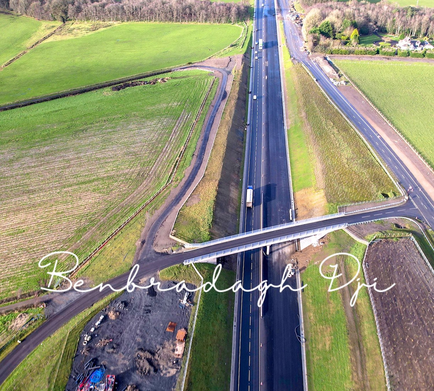
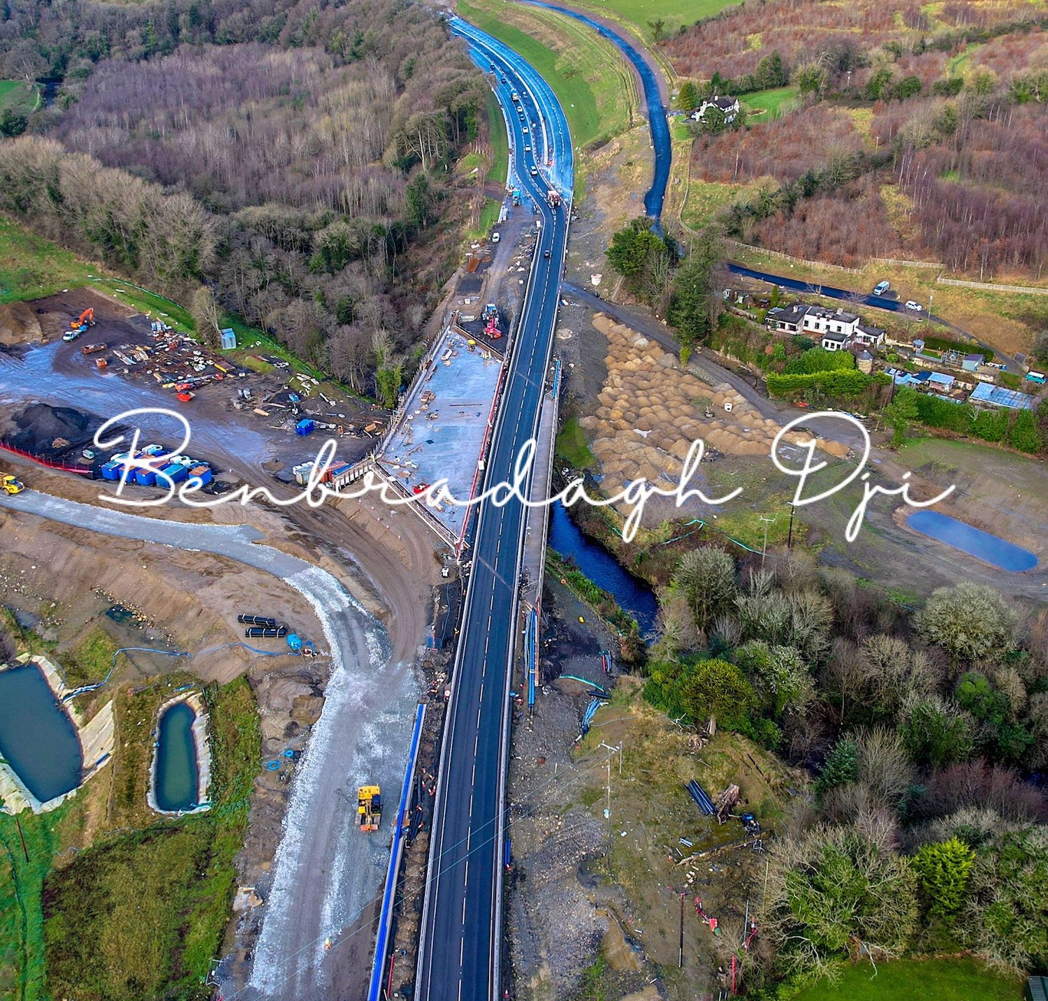
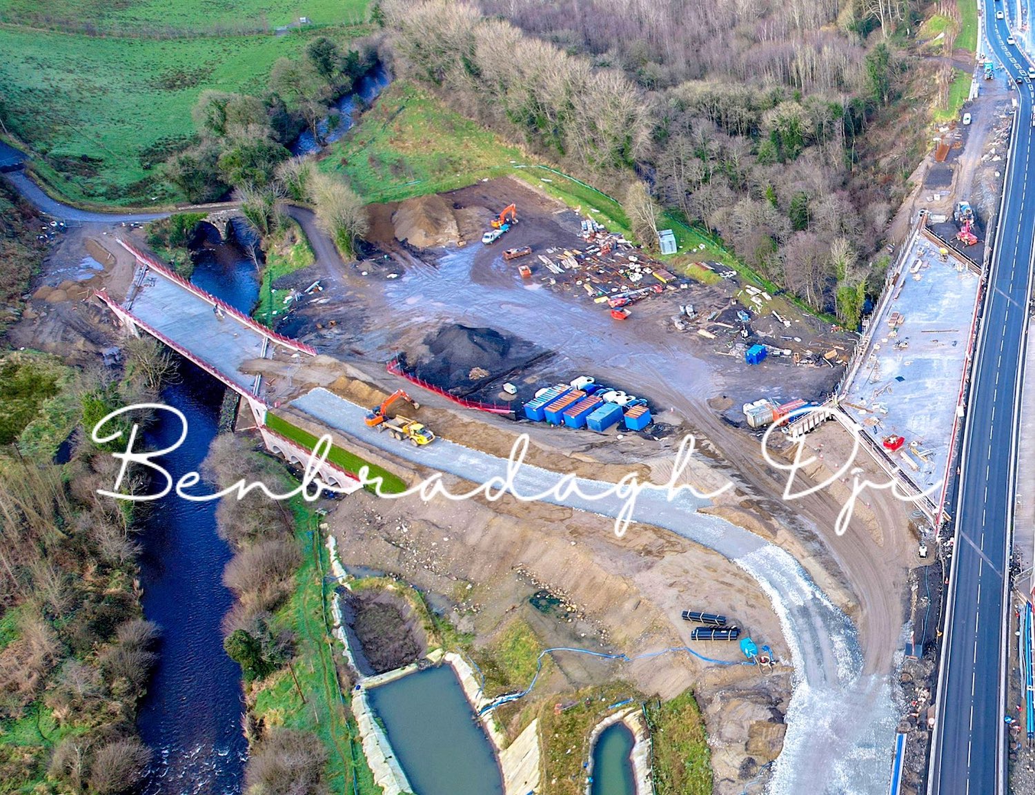
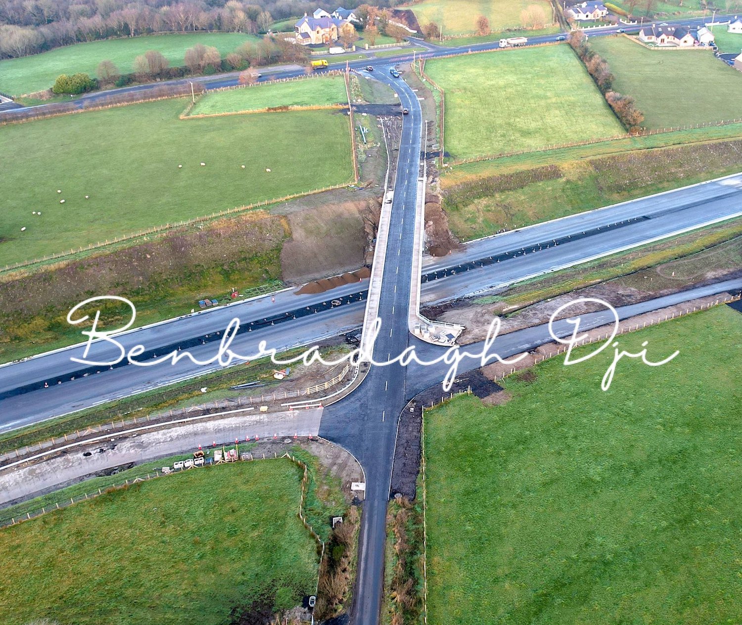
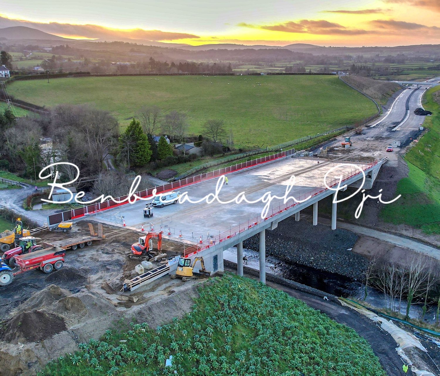
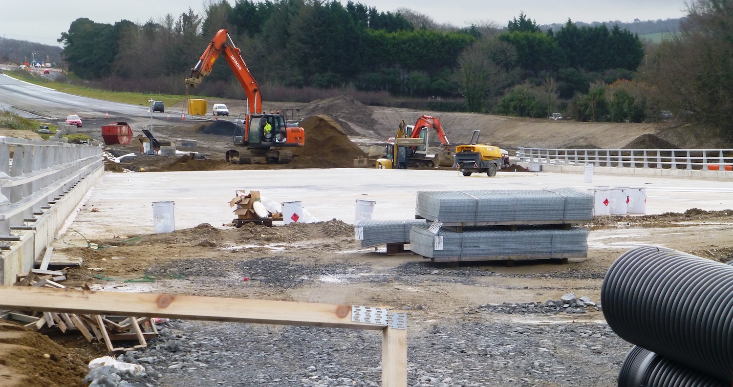
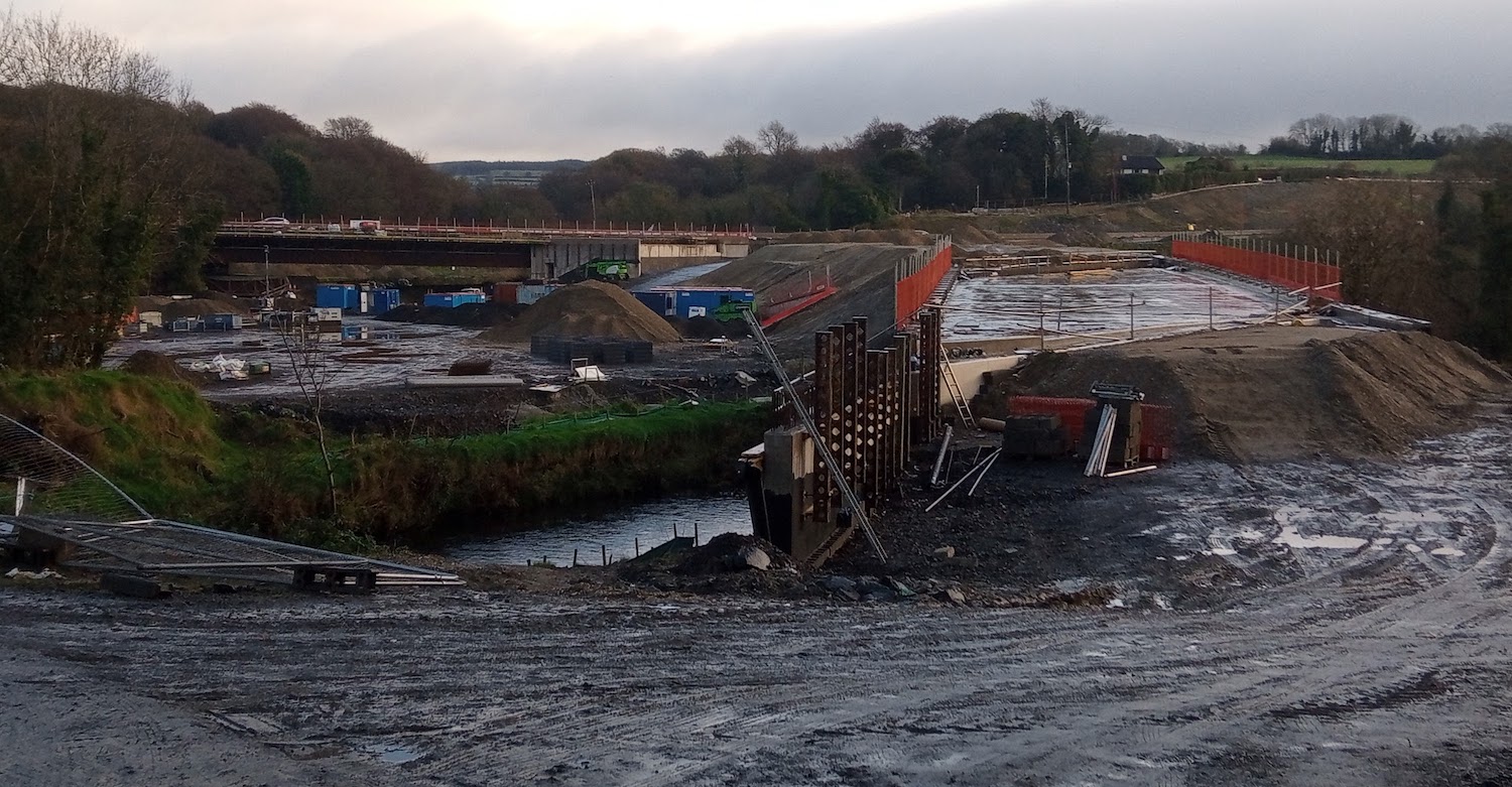
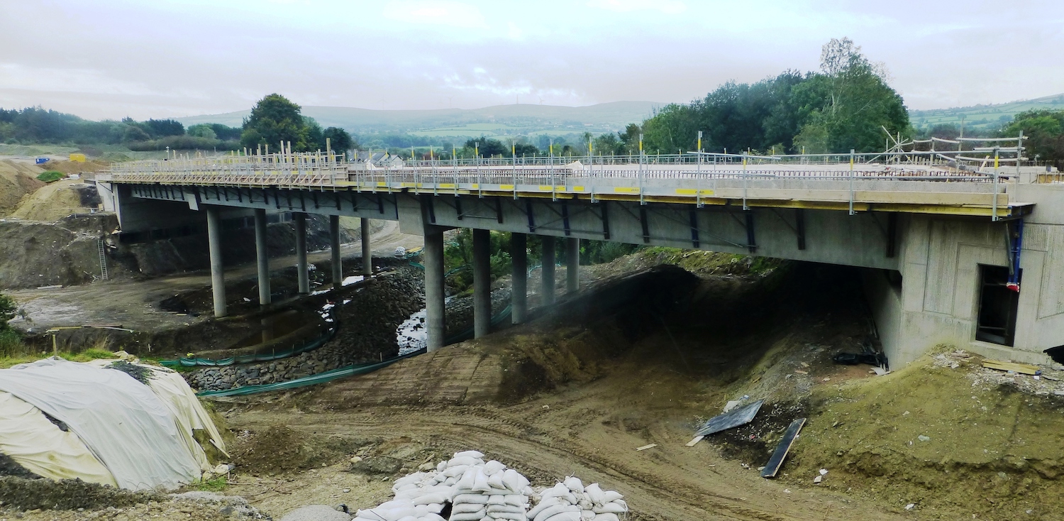
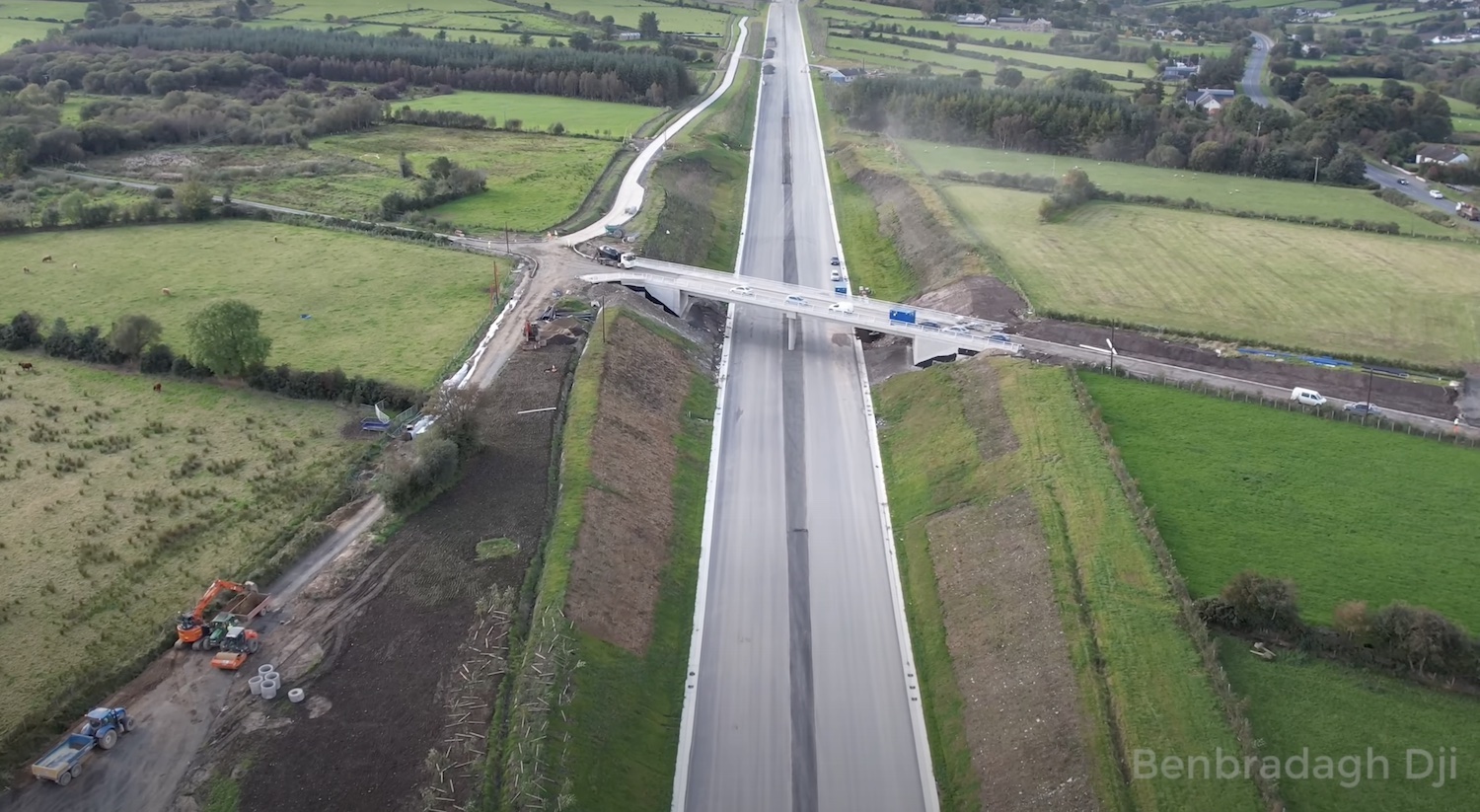
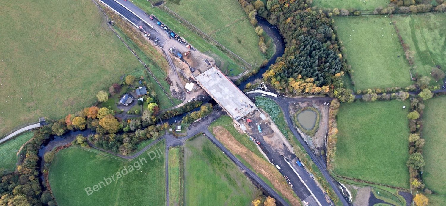
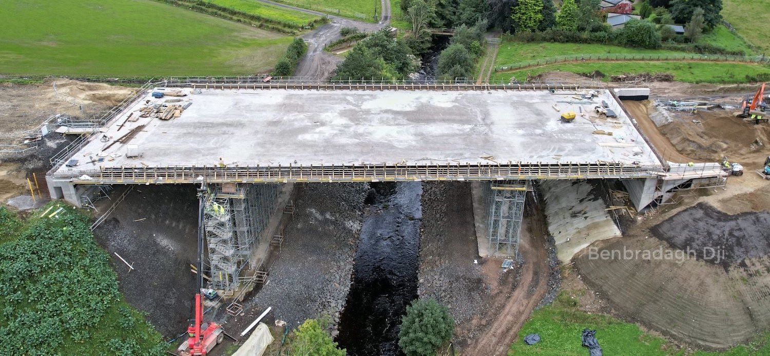
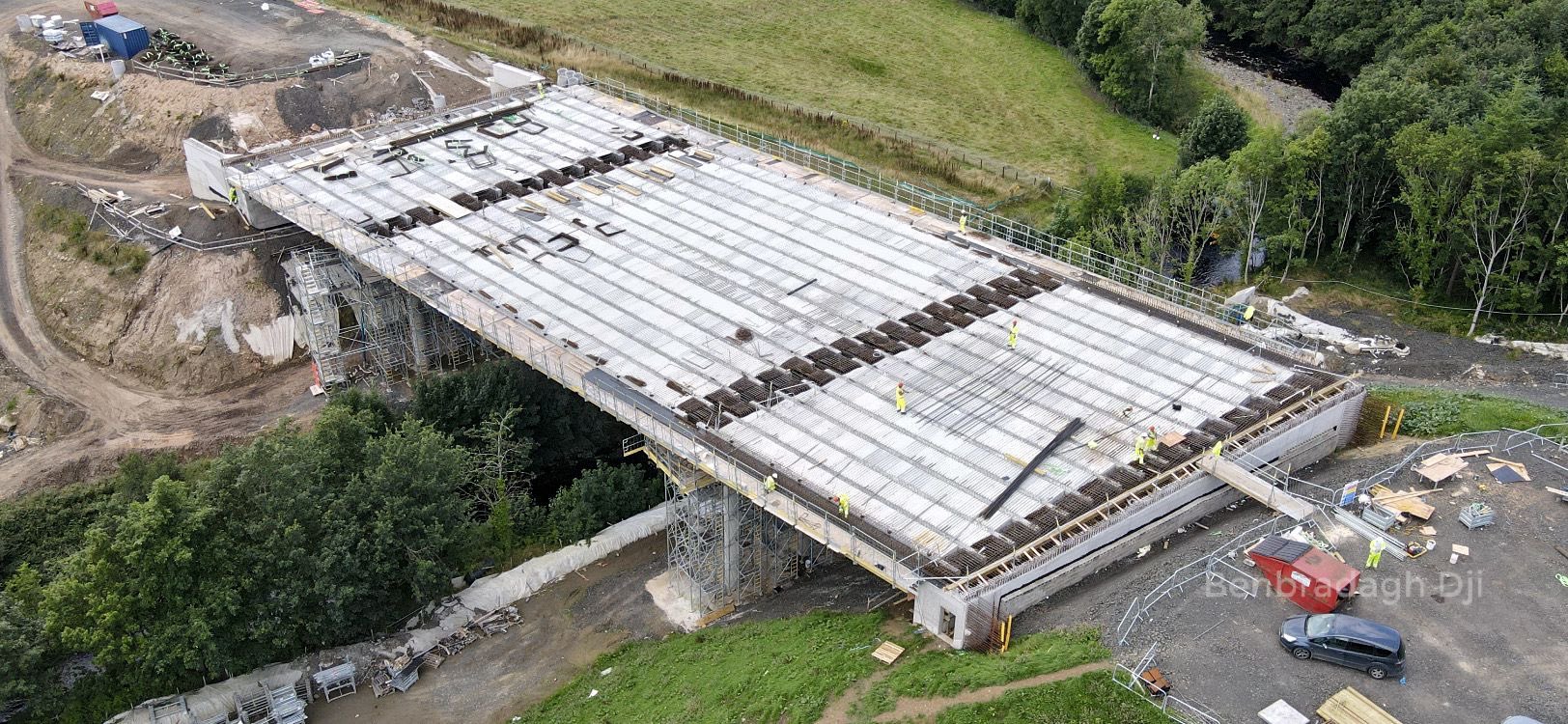
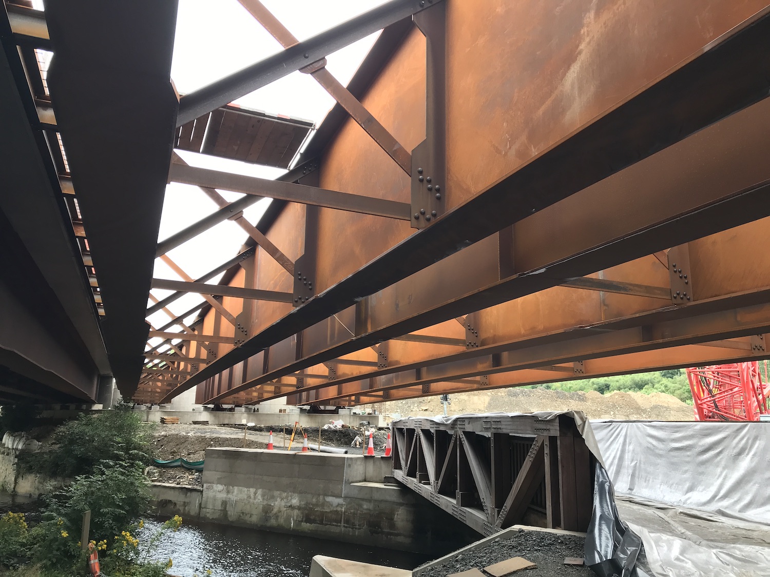
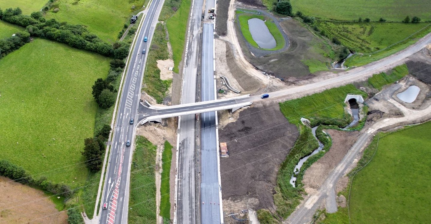
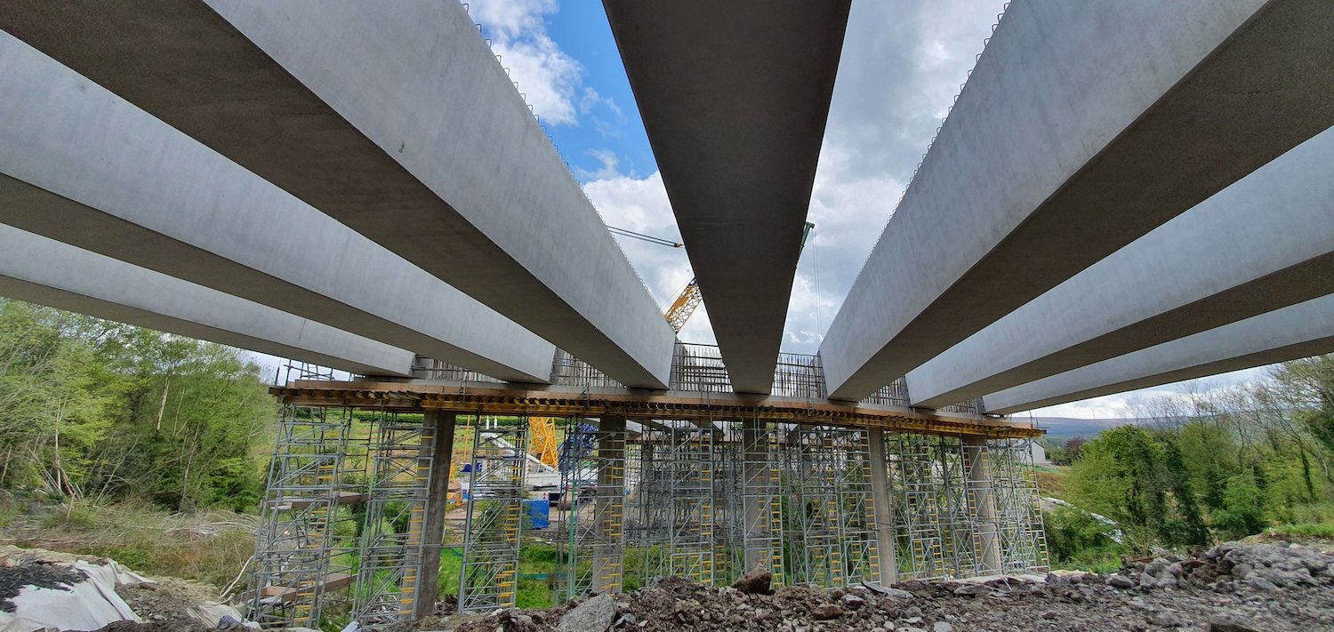
Pic 10: Aerial view of the River Roe bridge at
Dungiven on 17 February 2022. With work on the
approach embankments finally completed, work is
now underway to surface the bridge, add the
kerbs, the central barrier and the parapet
fences. An enormous amount of work has been
needed at this one spot to get us to this point.
[Benbradagh]
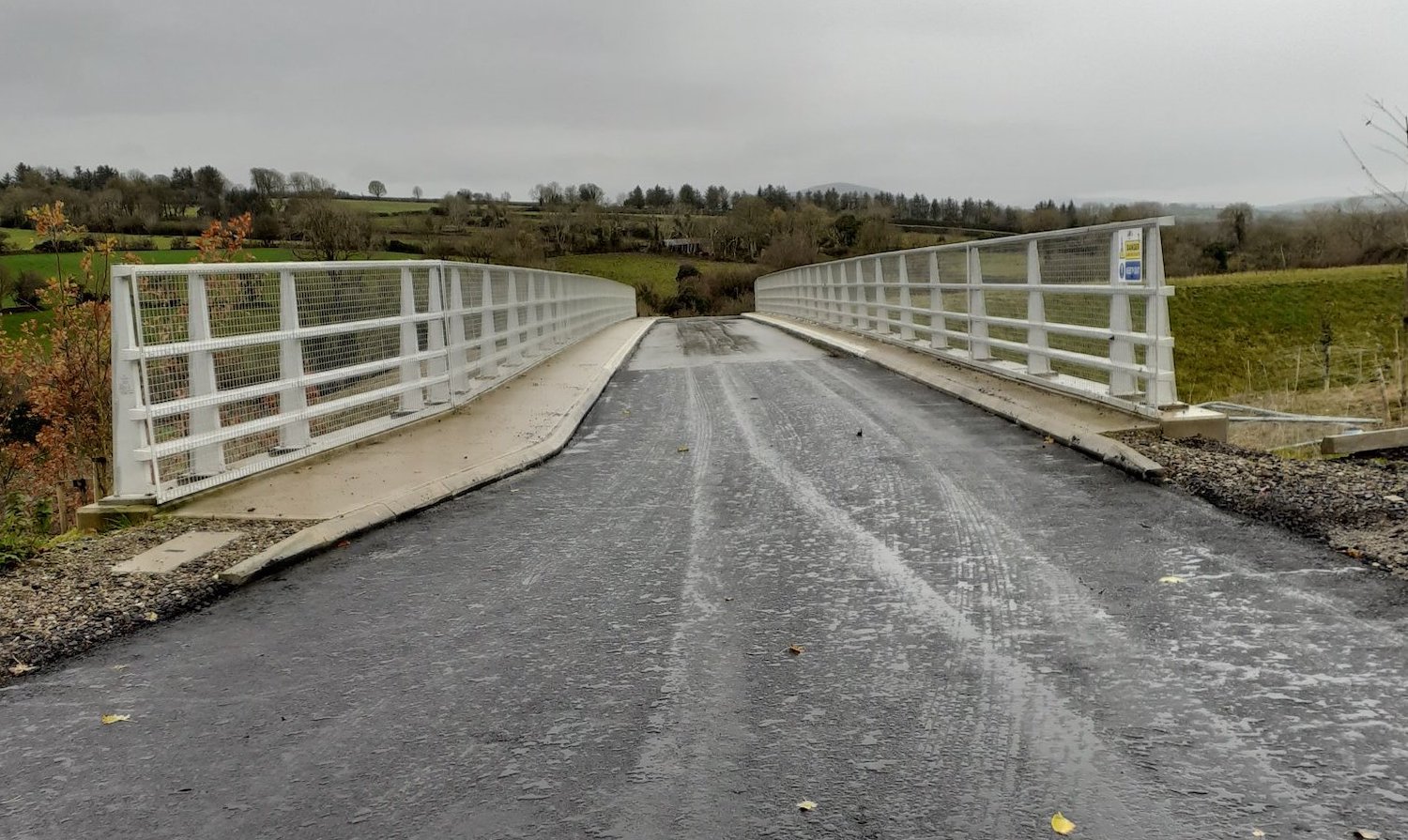
Pic 11: View across the River Roe bridge on 13
February 2022 showing the parapet fence (safety
barrier). On the left is the kerbing that will
mark the edge of the carriageway. It's hard tell
in this shot, but it looks like it might be the
hollow type that doubles as a drainage channel.
Behind the kerbs are ducts that will carry
cables etc. across the bridge. [Paul McCloskey]
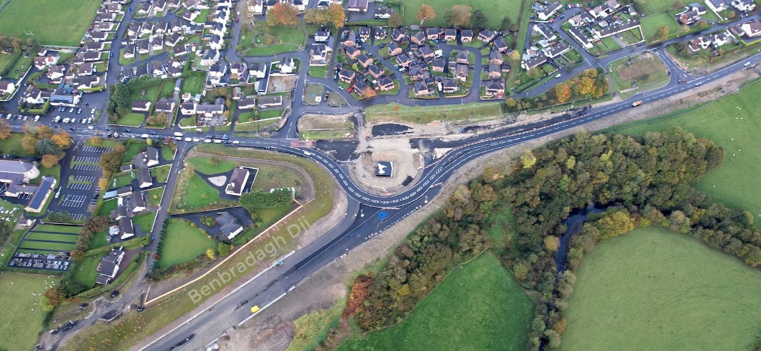
19 Jan 2022: The project has now
entered its final calendar year, with the
project likely to be finished by the summer.
Judging by progress on the ground, I would
speculate that sections of the "offline" section
from Claudy to Dungiven, and the Dungiven
Bypass, may well open to the public earlier than
this, perhaps around Easter, though I would
stress that the contractor has not said anything
to this effect. Progress on the road is very
advanced, with earthworks completed in many
areas, tarmac in place on 95% of the road and
work on the central crash barriers evident. The
three main areas where work on bridges is still
ongoing are Liberty Glen, Burntollet and the
River Roe bridge. Almost all the photos this
time are thanks to Benbradagh who completed a
mammoth drone video of the entire road in the
first week of January! He has made it available
on YouTube in four sections, travelling east
from Derry:
- From
Drumahoe to Burntollet: starting at the
future Lismacarol roundabout, passing Liberty
Glen Bridge at 1:44, Tamnaherin Road junction
at 3:15, The Oaks bridge at 4:20 and ending
just before Burntollet bridge.
- From
Burntollet to Claudy: crossing
Burntollet at 0:30, Brackfield Bawn at 2:00,
Killaloo/Gulf Road junction at 3:30, Baranalt
Road junction at Claudy at 6:00 and
terminating at the start of the "offline"
section east of Claudy.
- Claudy
to Altagarron Road: passing Gortilea
Road bridge at 2:25, Ballyhanedin Road bridge
at 4:10, Munreery accommodation bridge at
6:10, Crock-na-Brock Road (now permanently
severed) at 7:40 and ending at Altagarron Road
bridge outside Foreglen village at 8:30.
- Altagarron
Road to Dungiven: passing through Ovil
Hill cutting at 0:30, Killunaught Road bridge
at 2:15, Derrychrier Road at 3:40, the Owenbeg
river crossing at 4:50, Feeny Road junction at
5:35, the Owenrigh river crossing at 6:50
immediately followed by Magheramore Road
overbridge, the Roe river crossing at 7:40,
Priory Lane bridge at 8:15 and terminating at
the future Magherabuoy Roundabout east of
Dungiven.
Anyway, time for the photos:
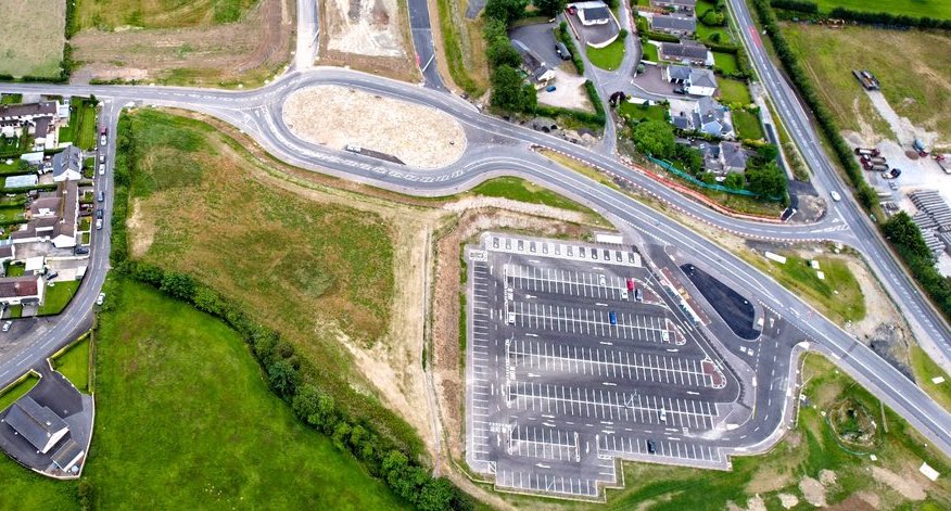
Pic 1: The start of the scheme at Drumahoe, this
is the future Lismacarol roundabout on 6 Jan
2022. As you can see it is still operating with
a rather convoluted parallel road/t-junction
setup. Once the new road opens, the existing A6
will be re-routed along the road that curves to
the upper left towards Derry city. The Park and
Ride site is also visible and appears to be in
use. [Benbradagh]
Pic 2: A more distant shot of Lismacarol
roundabout on 6 Jan 2022, showing the "splayed"
carriageways with the unused section of road
that will be needed only if phase 2 of the
project happens, i.e. the dual-carriageway is
extended over the roundabout and on towards
Gransha. In this case the splayed carriageways
would become off the offslip/onslip. Personally
I am not hopeful that this will ever happen so
this may well turn out to be yet another
permanent "temporary" terminus. [Benbradagh]
Pic 3: Aerial view of Liberty Glen bridge on 6
Jan 2022, where work on backfilling the bridge
abutments was underway and has since been
completed. This is one of the few sections of
road that has yet to get tarmac, but I don't
think it will be long now. [Benbradagh]
Pic 4: Ground-level view of Liberty Glen bridge
on 19 Jan 2022, two weeks after the previous
shot, here looking south-east away from Derry.
What appears to be a water-proofing coating has
been placed on the bridge deck and the aburments
are now filled, so I would expect to see the
road constructed over the bridge in the near
future. [Arthur Ming]
Pic 5: Moving east, this is the future
Tamnaherin Road junction on 6 Jan 2022. Great
progress has been made here, with the various
local roads now in place and being surfaced and
the layout of the junction now obvious. The old
loop of A6 seen at the upper left is now being
removed to be replaced by a realigned local
road, a bus stop and a water attenuation pond.
[Benbradagh]
Pic 6: Further east, this is The Oaks
accommodation bridge on 6 Jan 2022, with Derry
ahead and Burntollet behind the camera. This
bridge is now also in use. The road on the right
is the new Ervey Road link, an entirely new
local road that has been built to connect Ervey
Road (behind the camera on the right) to the
Tamnaherin Road junction (out of view ahead).
The original A6 occupied the same footprint as
the new dual-carriageway here. [Benbradagh]
Pic 7: Aerial view of Burntollet bridge on 6 Jan
2022. The southern half of the bridge deck now
appears to be completed, with work underway to
build up the bridge abutments at either side.
The light-coloured gravel at the lower left is
the foundations for the future Ardmore Road
junction, which will be a left-in/left-out only
T-junction. This area has required enormous
earthworks with still a bit of work to do.
[Benbradagh]
Pic 8: Same view as pic 7, but turning slightly
left to see Ardmore Road bridge on 6 Jan 2022.
Work to build an embankment for Ardmore Road has
recently been completed, including pipes under
the road to help it cope during flooding, and
work finally seems to be underway on the road
itself. Just above the new bridge you can see
the old stone Ardmore Road bridge which will
remain in situ, but no longer carrying traffic.
The area being used as a site yard here will
eventually be reduced in height to become a
flood compensation area, to replace the flood
storage space now occupied by the Ardmore Road
embankment. [Benbradagh]
Pic 9: The new road looking extremely
well-advanced on 6 Jan 2022, as it passes
Brackfield Bawn. This was another very confined
site due to the presence of the River Faughan on
the left and the historic bawn on the right.
[Benbradagh]
Pic 10: Killaloo junction (Gulf Road) west of
Claudy on 6 Jan 2022. This was one of the last
bridges to get its beams, but the bridge deck
here now also appears to be complete. Both pairs
of sliproads are in place and surfaced. As
elsewhere, all traffic is currently using one
carriageway. [Benbradagh]
Pic 11: A little further east, this is the
Claudy (Baranailt Road) junction on 6 Jan 2022
(looking west back towards Derry). The new
Baranailt Road under the bridge appears to be
almost complete, and has been for weeks, but the
contractor appears to be in no rush to open it.
I am not sure why. At the upper right you can
see the old A6, now marooned and disconnected.
This road will be reduced in width to become a
laneway for local landowners. [Benbradagh]
Pic 12: We are now on the "offline" section of
road, where the existing A6 will remain in use
as a local road. This is Gortilea Road bridge,
seen on 6 Jan 2022, with the current A6 on the
right. You can see here how the central crash
barrier on the new road will split in two to
pass on either side of the central bridge piers,
to protect both them and vehicle users.
[Benbradagh]
Pic 13: View west through the Ovil Hill cutting
on 6 Jan 2022, with Foreglen village and the
existing A6 at the upper right. Even here the
road seems well advanced with posts for the
central crash barrier apparently being fitted.
At the top of the left side of the cutting you
can see diggers adding waste material into what
was probably a borrow pit earlier in the scheme.
[Benbradagh]
Pic 14: Killunaught Road bridge over the new
road finally open to traffic on 6 Jan 2022. The
two roads heading off to the left and right in
the foreground are accommodation roads for local
landowners. [Benbradagh]
Pic 15: Arriving at Dungiven, this is the view
west of Feeny Road junction on 6 Jan 2022, which
is very well advanced with the sliproads built
and the first layers of tarmac laid. The two
parallel white lines running along the road are
drainage channels, one of which is in the
central reservation here due to the camber of
the road as it rounds this bend. [Benbradagh]
Pic 16: Lovely evening shot of the River Roe
bridge on 6 Jan 2022. Once again the bridge deck
here appears to have been completed, with the
work to infill the bridge abutments also looking
almost complete. The next stage will be to
construct the road over this quite challenging
structure. [Benbradagh]
Pic 17: Approaching the terminus of the scheme
at Dungiven, this is Priory Lane bridge on 6 Jan
2022 which got a layer of tarmac over the past
month, with more work still required.
[Benbradagh]
Pic 18: Vertical view of the terminal
Magherabuoy roundabout, east of Dungiven, on 6
Jan 2022 with the A6 towards Belfast at the
bottom, and the new dual-carriageway heading to
the upper left. The existing A6 into Dungiven is
at the upper right. You can see the new access
into Tracys Way at the top right, with the old
access being removed. The second half the
roundabout is slowly taking shape but there is
still plenty to do. [Benbradagh]
15 Dec 2021: As we close in on
Christmas, progress continues steadily. At least
one layer of tarmac has now been laid along all
of the scheme, with the exception of the areas
immediately around a few bridges that are still
under construction (e.g. River Roe, Burntollet,
Liberty Glen). Despite it being largely
finished, there is still apparently sufficient
work to be carried out at the Baranailt Road
junction near Claudy to justify a road closure
there in January. In terms of the mainline of
the road itself, the main ongoing works include
laying wearing courses of tarmac (the final
layer), installing the central crash barrier (a
big job in itself), signage and lighting where
appropriate. One of the final jobs will be the
white lining. The scheme was due to be completed
by the spring, but with the delays caused by the
pandemic it is more likely to stretch into the
summer. Nevertheless, I would expect to see some
significant stretches open before this -
possibly even the long offline stretch from
Dungiven to Claudy. However, neither DFI nor the
contractor have given any indication of this so
it remains speculation. Before I share some
photos (thanks to the amazing Arthur Ming, Sean
Wilson, Paul McCloskey, AerialVisionNI and
Benbradagh) here are some links to movies of
parts of the scheme:
- Dashcam
footage (speeded up) of a journey along
the existing A6 from Dungiven to Derry on 28
November (skipping the stretch from Dungiven
town centre to near Claudy where there is not
much to see). With thanks to Diarmaid
Macfheargail for sharing this.
- Aerial
footage taken by Benbradagh on 23
November from Killunaught Road to the terminus
of the scheme at Magherabuoy Road, Dungiven.
With thanks to Benbradagh for continuing to
take and share such great footage of the
scheme.
- Aerial
footage taken by the fine folks at Derry
City Paramotoring on 14 November showing the
scheme from Burntollet to the terminus of the
scheme at Magherabuoy Road, Dungiven. With
thanks to them for taking the time to share
such interesting footage.
And now onto some photos which, as usual, are
arranged in order from west (Derry) to east
(Dungiven). Once again I am indepted to those
from the area who continue to post pictures on
social media or send them to me, you are all
amazing!
Pic 1: View north from Liberty Glen Bridge, near
the Belfray Inn, on 14 Dec 2021. Up ahead is a
completed accommodation overbridge. Tarmac
has not been laid just here due to Liberty Glen
bridge still being under construction. [Arthur
Ming]
Pic 2: Same location as pic 1, but looking the
other way, this is the view south across Liberty
Glen Bridge on 14 Dec 2021. As you can see, the
bridge deck looks completed, the steel parapets
are in place and the abutments at either side
have been built up to the deck level. In the
foreground are what appear to be steel
reinforcement sheets, as well as some drainage
pipes. Still a bit of work to do here, but it's
well advanced now. [Arthur Ming]
Pic 3: Moving to Burntollet, this is the view
east across Ardmore Road bridge on 28 Nov 2021.
In the distance, on the left, is the new
Burntollet bridge itself which is currently
half-completed. This is very soft ground, and a
lot of work has been going on here to build
Ardmore Road back up to bridge level, and it
looks like this work will be going on for a
while yet. The land on the left, on the far bank
of the river, has been lowered to act as
additional water storage space during flood
events. [Sean Wilson]
Pic 4: View east along the future A6 from
Ballyhanedin Road bridge on 15 Dec 2021. The
most obvious change here is the installation of
columns for the central crash barrier. Note how,
in the foreground, the crash barrier will split
into two to go on either side of the central
bridge piers to protect both the bridge and
vehicle occupants. The existing A6 is on the
embankment on the left. [Paul McCloskey]
Pic 5: Aerial view west from near Dernaflaw
(visible on right) on 12 Dec 2021. In the
foreground is the completed Owenbeg river
bridge. The steam in the distance is coming from
the contractor's temporary tarmac batching
plant. [AerialVisionNI]
Pic 6: Aerial view, looking east, of Feeny Road
junction, near Dungiven on 12 Dec 2021 with all
four sliproad pairs surfaced with at least one
course of tarmac. [AerialVisionNI]
Pic 7: Similar view to pic 6, but this time
taken from Feeny Road bridge on 12 Dec 2021,
showing the central reservation covered with
fine gravel but no sign yet of the barrier. The
black slope on the left seems to be a temporary
access route for construction vehicles. [Paul
McCloskey]
Pic 8: Aerial view of the major River Roe bridge
on 12 Dec 2021, with Dungiven beyond. The deck
here seems to be largely completed though the
parapets don't seem to be in place yet. The
abutments on either side seem to now be filled
up to deck level so, once the bridge is
completed, the tarmac can be laid across the
whole structure. [AerialVisionNI]
Pic 9: View across the Priory Lane bridge over
the A6, close to the termin us of the scheme at
Dungiven on 28 Nov 2021. This does not look like
the final course of tarmac to me, so I suspect a
final wearing course still has to be laid here.
[Paul McCloskey]
Pic 10: This is a still from Benbradagh's aerial
movie of 23 Nov 2021 showing Magherabuoy
Roundabout in Dungiven, with the existing A6
into the town at the top, and future A6 to the
upper left. All traffic is currently using one
side of the roundabout but the other half of the
roundabout is clearly taking shape with the
foundation layer for the road in place. Priory
Lane bridge is also visible at the upper left
(see pic 9). There appears to be some kind of
underground structure in the centre of the
roundabout but I will admit to having no idea
what it is! [Benbradagh]
Pic 11: This final shot is a ground-level view
of Magherabuoy Roundabout on 12 Dec 2021, taken
from the road at the bottom right of pic 10
above. [Paul McCloskey] 4 Nov 2021: It has been over a
month since my last update, mostly due to the
busy-ness of life, but a lot of progress has
been made. Most obvious from the photos is that
most, though not quite all, of the road now has
tarmac in place. You can see this most clearly
in two aerial movies of the scheme. The first
movie, at the western end, takes in the
stretch from the start of the scheme at Drumahoe
to Burntollet and was taken about a month ago by
Sean Wilson. The
second movie, at the eastern end, takes in
the stretch from the terminus of the scheme at
Dungiven as far as Foreglen, and was taken on 11
October by Benbradagh. The photos below include
pictures/stills by both movie creators. However
they are augmented by additional photos taken by
Arthur Ming, Paul McCloskey, Pollyanne and
AerialVisionNI. Thank you once again to all
those who continue to share their photos with
the wider public and allow me to reproduce them
here. It is a fantastic way to make the scheme
accessible to the interested public! In general
news, at the Killaloo junction, access to Gulf
Road on the south side of the new A6 was
restored during October, though access to Gulf
Road on the north side won't be provided until
spring 2022. Ardmore Road will finally re-open
across the new bridge in December, as will
access to two local roads near Burntollet, Mavis
Road and Ervey Road. Also, a reminder that the
scheme that is currently underway is Phase 1 of
a larger scheme. Phase 2, which is still
in planning, would extend the road from
Drumahoe, around the Waterside, to the A2 near
Gransha. Phase 2 did not go ahead with phase 1
partly due to lack of funds, but also due to the
unresolved issue of an illegal dump at Mobuoy
Road, which lies exactly on the route of the
scheme. This issue shows no sign of being
resolved in the near future, with it looking
increasingly likely that the illegal waste will
remain in situ, leaving DFI with the choice of
either more delay, or re-designing the scheme
and risking having another public inquiry. The
DFI Minister recently confirmed
that the current estimated cost of Phase 2 is
£200m for 5.2 km of road. This is similar to the
cost for the Phase 1, which has a total length
of about 24 km. If Phase 2 is ever assessed as a
separate scheme (rather than Phase 2 of the
existing scheme), then it is highly unlikely
that it would pass a simple benefit/cost
assessment. For this reason, I continue to be of
the view that Phase 2 will not happen and that
Lismacarol roundabout in Drumahoe will remain
the permanent-temporary terminus of the
dual-carriageway for the foreseeable future.
Anyway, the photos below are arranged,
as always, in order from west (Derry) to east
(Dungiven).
Pic 1: The start of the scheme at Lismacarol
roundabout on 3 Oct 2021, viewed from above the
exiting A6 with the new Drumahoe park-and-ride
on the bottom left. The roundabout is completed,
but currently painted with an alternative lane
layout until it comes into use. If Phase 2 of
the scheme ever gets built, the dual-carriageway
will continue to the left over this roundabout
on a pair of bridges. [Sean Wilson]
Pic 2: Liberty Glen bridge, located about 1.5 km
from Lismacarol roundabout, near the Belfray,
seen on 16 Oct 2021, at which point work was
well underway on the deck. Since this view was
taken further work has taken place to build up
the fill in the abutments at either end up to
the level of the new road. The scale is hard to
judge here, but the bridge is larger than it
appears - it is the largest bridge on the
scheme, over 150 metres in length. [Arthur Ming]
Pic 3: View of Tamnaherin Road junction on 3 Oct
2021, with the bridge now fully excavated and in
use. Work on the local roads beneath and around
the bridge is very evident, including a new
roundabout at the bottom left. You can see how a
loop of the old A6 will eventually be bypassed
by the new road. This bit of road will be
completely removed, though a new local road will
be built across the site it occupied to preserve
access to the existing Glenshane Road which will
remain here for local access. Part of the
temporary loop of road on the right (that
traffic used for the past year) is now being
removed. The site will then be excavated to
build the eastbound offslip/onslip. [Sean
Wilson]
Pic 4: Roughly the same location as pic 3, at
Tamnaherin Road junction, but looking the other
way on 3 Oct 2021. On the left is the other end
of the temporary loop of road that traffic used
for the past year. However this part of the loop
will remain in use as the new "Ervey Road link"
which will run parallel to the dual-carriageway
from here to Burntollet, to provide local
access. You can see its future extension taking
shape in the gravel to the left of the new road.
A local road, Mavis Road, will join the new road
around here too, and it is due to re-open before
the end of the year. [Sean Wilson]
Pic 5: Closeup of the excavation on the north
side of Tamnaherin Road bridge on 17 Oct 2021.
This will eventially carry a local road under
the new A6 to the far side of the junction where
there will be a roundabout, visible in pic 4.
[Pollyanne]
Pic 6: Moving on to Burntollet, this is a
telephoto shot of the approach to Ardmore Road
bridge on 16 Oct 2021. This is interesting
because it shows a series of pipes under the new
road to provide additional flood relief in the
Faughan River, over and above the bridge itself.
The road itself seems to be build up higher
still, with what looks like gabions or some
other engineering structure to facilitate the
steep slope. The locality will also feature a
compensatory flood area (basically, an area for
floodwater to gather to replace the area lost by
the new road) and a flood attenuation pond. This
whole area has been very challenging for
engineers. [Arthur Ming]
Pic 7: Aerial view of Burntollet bridge itself
on 4 Oct 2021. In this shot Ardmore Road is off
screen to the lower left. All traffic is using
the completed northern side of the new bridge,
while the southern side is progressing well with
the deck now being constructed. Sean notes how
the new bridge is wider at this end than the far
end - this is because the future westbound
onslip to the A6 will terminate part way across
the bridge, requiring an extra triangle of space
on the bridge. The area occupied by the crane
will eventually be reconstructed to provide a
flood attenuation pond and compensatory flood
storage area, as well as a local access laneway.
[Sean Wilson]
Pic 8: Image of Burntollet bridge taken two
weeks after pic 7, on 16 Oct 2021. This shows
progress on deck construction with the brown
material being steel reinforcement bars that
have to be carefully laid out before the
concrete deck is cast on top. [Arthur Ming]
Pic 9: View west along the new A6 from Gortilea
Road bridge on 31 Oct 2021. This shows the base
course of tarmac in place, the central
reservation now surfaced too, ready for the
central crash barrier, as well as tree planting
and other landscaping. Other than the barrier,
and a final wearing course of tarmac, there is
not much more that needs to be done here. [Paul
McCloskey]
Pic 10: View east along the new A6 from
Ballyhanedin Road bridge on 26 Oct 2021.
Progress is similar to that at Gortilea Road,
with a crash barrier in place along the right
hand side here. I would expect to see central
barrier works before too much longer. [Paul
McCloskey]
Pic 11: The new A6 passing Crock-na-brock Road,
which is now permanently severed/closed, on 10
Oct 2021. In the distance you can see a flood
attenuation pond and, beyond that, another local
access laneway. [Benbradagh]
Pic 12: The new A6 well advanced as it passes
through Ovil Hill cutting on 10 Oct 2021. A lot
of work is evident at the top of the bank on the
left. I do not know for sure, but it looks as if
soft material, perhaps peat, is being deposited
here. This may be a way to store surplus
material from elsewhere on the scheme, or it may
be part of environmental mitigation.
[Benbradagh]
Pic 13: Aerial view of Killunaught Road bridge,
one of the last bridges yet to be opened, with
work underway on 10 Oct 2021. Note again the
completed base course of tarmac along this whole
stretch. [Benbradagh]
Pic 14: Aerial view of Feeny Road junction on
the new A6 near Dungiven on 10 Oct 2021. Both
sliproad pairs are now constructed and are
getting their tarmac. There is now no sign of
the temporary road that bypassed this site on
the far side as the bridge was being built.
[Benbradagh]
Pic 15: Aerial view of Magheramore Road bridge
over the new A6, near Dungiven, on 2 Nov 2021.
Magheramore Road is curently closed for two
weeks to allow the final tie-in works to be
completed on the left here. You can still see
where the temporary road went while the bridge
was being built. That road has now been largely
removed. I love that a little stub of Teevan
Road has survived in situ to the lower right in
this shot, despite being severed by the new
road! This is apparently to retain access to one
field. [Benbradagh]
Pic 16: Aerial shot of the River Roe bridge near
Dungiven on 02 Nov 2021, which continues to be a
hive of activity due to the size of the bridge
and the large approach embankments that are
required. A flood attenuation pond can also be
seen taking shape to the right of the bridge, as
well as a local access lane passing beneath it.
[Benbradagh]
Pic 17: Another view of the River Roe bridge on
29 Oct 2021. showing the height of the bridge
over the river and the progress on the approach
embankments. [AerialVisionNI]
Pic 18: This final shot shows the terminus of the
scheme at Magherabuoy roundabout on 02 Nov 2021.
All A6 traffic is now passing round the south side
of the roundabout while the old bit of the A6 is
torn up to be replaced by the other half of the
roundabout. The two new local access roads are now
both in use (Tracys Way to the left of the
roundabout and Abbeyfields, to the right of the
shot). [Benbradagh]
30 Sep 2021: The project has progressed
well over the past month, with several important
milestones happening at the various bridges as
well as along the mainline of the road itself.
At Liberty Glen, near the Belfray Inn at the
Derry end of the scheme, the deck of the new
bridge was poured during September. The same
thing has happened at the River Roe bridge near
Dungiven, which had its deck poured over the
past week or so. Concrete pours are also planned
on the decks of Killaloo bridge (around now) and
the second half of Burntollet bridge (late Oct).
Some other structures are even more advanced –
the bridge at Tamnaherin Road opened to A6
traffic on 21 September, with traffic no longer
using the temporary road that looped around the
site. The bridges at Munreery Road and
Killunaught Road are both almost ready, and just
need the road surface completed before they can
be opened. The Owenbeg river bridge, which will
carry the main A6, is similarly far advanced.
There is also progress at Ardmore Road bridge
(which carries a local road over the Faughan
River at an angle adjacent to the main
Burntollet Bridge) which has now had its deck
completed. At the Claudy junction, the "new"
Baranailt Road that will carry local traffic
under the new A6 looks very close to completion
with just a final wearing course of tarmac and
white lines needed. On the mainline itself, some
sections of side crash barrier have appeared
near Claudy, which is a substantial job that has
yet to take place along much of the scheme.
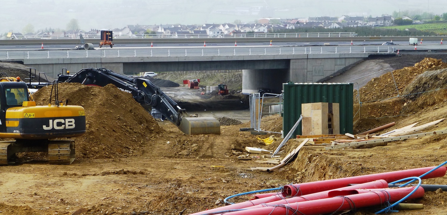
Traffic was also switched over to part of the
new road (one lane each way) from Burntollet to
Tamnaherin Road on 21 September. At the Dungiven
end of the scheme, a lot of work is taking place
at the future Magherabuoy Roundabout, the
southern half of which is being surfaced this
week. The temporary traffic management here has
been causing a lot of disruption lately, but it
looks to me as if traffic will be shifted onto
the southern half of the new roundabout in the
near future, which might help. Work can then
take place on the northern half of the
roundabout. My prediction is that the offline
section of the scheme from Dungiven to Claudy
will open to traffic sometime around the start
of 2022 – but we shall see! Anyway, below are 18
photos which I using with grateful thanks to
Martin Lynch, Benbradagh, Paul McCloskey, Arthur
Ming, Pollyanne, Esther Harper and Derrylad. As
always they're arranged in order from Derry to
Dungiven.
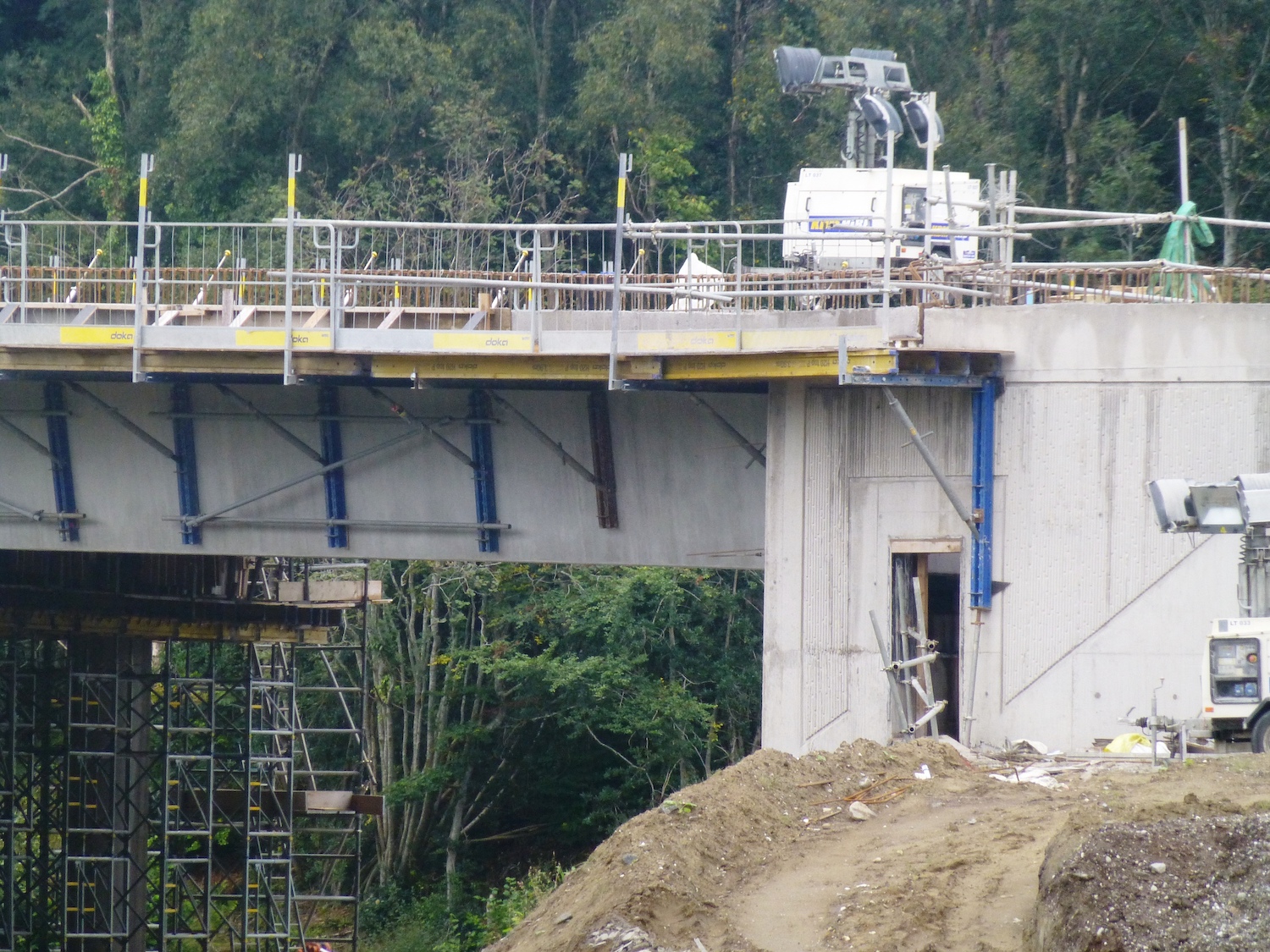
Pic 1: Closeup of an abutment and beam at
Liberty Glen bridge on 15 Sep 2021, prior to the
deck being poured. The blue fittings are
temporary falsework supporting a walkway for
workers. [Arthur Ming]
Pic 2: View beneath Tamnaherin Road bridge on 17
Sep 2021. This bridge was constructed close to
ground level and was then excavated. The
vertical circular concrete structures are where
a hole was bored into the ground and filled with
concrete. These will be covered over to give a
nicer appearance. [Pollyanne]
Pic 3: View over the top of Tamnaherin Road
bridge (same bridge as previous shot) on 17 Sep
2021. It has been surfaced here and temporary
armco barriers put down. Live traffic is now
using this bridge. [Pollyanne]
Pic 4: Contractor getting ready to switch
traffic onto a section of the new road between
Burntollet and Tamnaherin Road on 21 Sep 2021.
The switchover seems to have happened without
any issues. [Derrylad]
Pic 5: Section of the new A6 near Claudy seen on
27 Sep 2021 with a crash barrier now in place on
one side. [Paul McCloskey]
Pic 6: View south under Baranailt Road bridge,
Claudy on 6 Sep 2021. A6 traffic is currently
using the bridge, but the road below is not yet
open. However, it looks close to completion with
a final wearing course of tarmac needed, plus
lane markings. [Martin Lynch]
Pic 7: Claudt park-and-ride on 6 Sep 2021, with
surfacing work well advanced and just some
landscaping and probably lighting to do. [Martin
Lynch]
Pic 8: View of the eastbound onslip to the new
A6 at Baranailt Road junction, Claudy. Although
traffic is using the road ahead, the junction
itself is not yet open. The black waterproofing
on the kerbstones shows the level that the
tarmac will go up to. 12 Sep 2021 [Martin Lynch]
Pic 9: View north along the "new" Baranailt
Road, Claudy, from the bridge on 12 Sep 2021.
The road here is very well advanced. The
T-junction on the left will lead to the
eastbound off/onslip. [Martin Lynch]
Pic 10: View of the new A6 from Ballyhanedin
Road bridge on 26 Sep 2021, showing drainage
completed, road surface down and the site of the
future central crash barrier being surfaced.
[Paul McCloskey]
Pic 11: View south into Killunaught Road from
the main A6 on 26 Sep 2021. After a short
distance this road passes over the new A6 on a
bridge which has yet to open. This will probably
happen within the next month. [Paul McCloskey]
Pic 12: View west from Feeny Road bridge,
Dungiven on 26 Sep 2021. You can just see the
future eastbound offslip at the lower right. At
this point the camber of the road means that the
drainage channel for the westbound carriageway
is located adjacent to the central reservation
rather than at the side of the road. Hundreds of
trees have been planted on the left. [Paul
McCloskey]
Pic 13: View west from Magheramore Road bridge,
Dungiven, on 26 Sep 2021 showing more sections
of crash barrier in place on both sides of the
new road. The tarmac truck visible on the left
gives a clue as to what work is taking place.
[Paul McCloskey]
Pic 14: Beautiful photo of the River Roe bridge
on 30 Sep 2021 following the concrete pour for
the deck. At some point in the past month the
trees that were beneath the bridge appear to
have been felled and replaced with banks of
stones. The abutment on the right is being
in-filled in this shot too. [Benbradagh]
Pic 15: Another view of the River Roe bridge,
this time on 20 Sep 2021 prior to the concrete
pour. This photo shows how high this bridge is
compared to others on the scheme, with some
substantial sections of scaffolding required.
[Esther Harper]
Pic 16: This shot of the River Roe bridge was
taken on 14 Sep 2021, prior to the concrete
point, when two large cranes were in place to
aid the work on the deck. They appear to have
gone now. This shot is taken from the Priory
Lane bridge, which is completed. The future A6
here is currently being used as a site yard for
spoil. [Paul McCloskey]
Pic 17: Magherabuoy Roundabout, Dungiven, seen
on 30 Sep 2021. Tarmac has been laid here over
the past week. I would assume that at some point
soon A6 traffic will be diverted round the
bottom of the roundabout here to allow the other
side of the roundabout to be completed. You can
also see a long, thin traffic island at the
bottom - this is for a "jet lane" which will
allow westbound traffic to continue straight
onto the new A6 without having to stop at the
roundabout. [Benbradagh]
Pic 18: View east from the new A6, looking
towards the future Magherabuoy Roundabout. Ahead
you can see the long, thin traffic island for
the "jet lane". The larger island in the
foreground is the central reservation. 26 Sep
2021 [Paul McCloskey]
29 Aug 2021: In the previous update one
week ago (see below) I focused on the beam lift
at Burntollet. In this update I look at the
remainder of the scheme, with grateful thanks to
Paul McCloskey and Benbradagh. Progress
continues to be excellent with long stretches of
the road within a few months of completion.
Neither the contractor nor DFI has given any
dates, but I would not be at all surprised if at
least some of the road is open to traffic before
Christmas. The main obstacles preventing the
much-anticipated Dungiven Bypass stretch from
opening soon are the unfinished River Roe bridge
and the unfinished Magherabuoy roundabout.
However both are progressing apace. Work is
still continuing on several bridges: Liberty
Glen (near Drumahow), Burntollet, Ardmore Road,
Killaloo Road, Munreery Road, Killunaught Road,
Owenbeg river and River Roe. All the other
bridges are completed. From the point of view of
the travelling public, the main point of note is
the severe congestion that is being regularly
caused by the construction of Magherabuoy
roundabout on the eastern side of Dungiven.
Pic 1: View of the "new" Baranailt Road being
constructed beneath the Claudy underpass on 23
Aug 2021. This view is looking south. All A6
traffic is currently driving across the new
bridge. [Paul McCloskey]
Pic 2: View east from Gortilea Road bridge (i.e.
with Claudy behind the camera and Foreglen
ahead) on 22 Aug 2021. The drainage channels are
completed and the first layer of tarmac down,
though the road has yet to get a central barrier
and a second (wearing) course of tarmac. Note
the new trees planted on the left. The future
westbound carriageway is currently in use to
store spoil. [Paul McCloskey]
Pic 3: Same location as pic 2, but moving about
50 metres to the right, this is a new flood
attenuation pond near Gortilea Road on 22 Aug
2021. These ponds store runoff from the road
during heavy rain and release it slowly, so as
to avoid overwhelming local watercourses. They
allow time for particles (such as tiny bits of
rubber) to settle out and not enter the
watercourses. [Paul McCloskey]
Pic 4: View east from the recently-completed
Ballyhanedin Road overbridge on 22 Aug 2021. At
this point the future central reservation has
been surfaced with either concrete or some kind
of gravel (it is hard to tell which from here).
Again, this stretch just needs a final course of
tarmac and a crash barrier, plus signage, and
could then be opened. [Paul McCloskey]
Pic 5: View of the completed Ballyhanedin Road
bridge, seen looking east on 19 Aug 2021. The
bridge is now open to traffic. [Paul McCloskey]
Pic 6: Looking east from around Crock na Brock
Road (about 1 km from Foreglen) with the Ovil
Hill cutting in the distance on 21 Aug 2021.
Progress here is similar to pic 4, with a layer
of gravel occupying the future central
reservation. More trees have been planted on the
left here and fencing seems to be in place too.
[Paul McCloskey]
Pic 7: View west from Feeny Road bridge on 15
Aug 2021, showing work underway on the future
eastbound offslip to this junction (the kink in
the drainage channel is the deceleation lane,
and then the offslip is heading off to the
bottom right). Work here is a bit less advanced
than elsewhere because the section in the
foreground could not be built until the Feeny
Road flyover was opened. [Paul McCloskey]
Pic 8: View west from the Magheramore Road
bridge showing another stretch of the Dungiven
Bypass as it crosses the Owenrigh river. Like
Feeny Road, the section in the foreground could
not be built until the Magheramore Road flyover
was opened. [Paul McCloskey]
Pic 9: Aerial shot of the River Roe bridge near
Dungiven on 23 Aug 2021. Since the beams were
installed work has been underway to add
shuttering between and over the beams, and steel
reinforcement is being added across the entire
deck. Once this is completed a "diaphragm" will
be built above each set of pillars/abutments to
tie the beams together. After this there will be
a concrete pour to form a bridge deck on top of
which the road will be built. [Benbradagh]
Pic 10: Unusual vertical perspective on the
western abutment of the River Roe bridge, seen
on 23 Aug 2021. You can see the eight beams
resting on the abutments. The hollow with the
two yellow-clad workers will be filled with
concrete to form the diaphragm, which will serve
to hold the beams together. The abutment itself
will be in-filled with earth/gravel (or, if
weight is an issue, polystyrene blocks) and the
road built on top. You an also clearly see the
shuttering between each beam and covering the
hollow top of each beam. The shuttering will
eventually be buried under the road deck,
forming its base. [Benbradagh]
Pic 11: Side view of the River Roe bridge on 23
Aug 2021. Construction rules mean that
contractors are no longer permitted to put
machinery into watercourses, so the vegetation
along the river is so far unaffected by the
bridge works. You can see that the western
abutment (on the left) has already been filled
in, whereas this has yet to be done on the
eastern side. [Benbradagh]
22 Aug 2021: This is a brief update to
draw attention to two recent events - firstly,
the installation of the beams on the second half
of the new bridge at Burntollet, and secondly
the opening of Ballyhanedin Road overbridge.
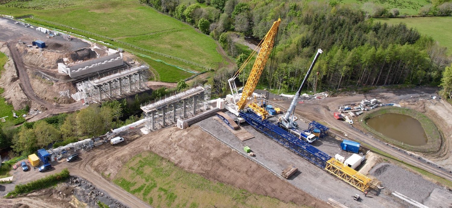
First, at Burntollet, six steel bridge
beams were brought to the site in stages in
early 2021 from Victor Buyck's construction site
in Belgium. Once they arrived here they were
then connected together to form three pairs of
beams. Each pair is 80 metres long, 6 metres
wide, 3.4 metres high and weighs around 270
tonnes. The lift coincided with poor weather,
and two were craned into position by a mobile
crane in the week of 2 August while the last was
put in place on 9 August. The lift is shown in
the images below. Also shown is the Burntollet
Woodland Trust accommodation bridge. This is a
wooden structure that sits beneath the main
Burntollet bridge and will allow pedestrian
access along woodland paths on both sides of the
river. I had thought that this smaller bridge
would not be put in place until the Burntollet
bridge was completed, but the contractor seems
to have chosen to put it in place ahead of the
beam lift, presumably for ease of access. This
is another milestone - it means that all bridge
beams for the scheme are now in place, so well
done to the contractor. At Ballyhanedin Road
overbridge (a side road that passes
over the new dual-carriageway between Claudy and
Foreglen) the bridge was opened to traffic on or
around 19 August. With thanks to Paul McCloskey
for spotting this. Paul has also shared a number
of pictures along the scheme today, which I
don't have time to share here, but you can see
them on his Twitter
feed. There are rumours that part of the
scheme (particularly the stretch including the
Dungiven Bypass and possibly as far as Claudy)
may open to traffic before the end of 2021. This
has NOT been stated by the contractor or DFI, so
remains a rumour. However the degree of progress
being made means that it is quite plausible.
Pic 1: The final pair of beams being craned into
position at Burntollet Bridge on 9 August 2021. It
is hard to get a sense of scale here, but the
height of each beam is about the same as two
adults standing on top of each other! [DFI]
Pic 2: Underneath view of the three pairs of beams
on 9 August 2021. You can see here the bracing
that was welded between each pair to hold them
together. On the left you can see the beam pairs
that were put in place last year for the first
half of this bridge. Also visible under the main
beams is the Burntollet Woodland Trust
accommodation bridge, which was also craned into
place in the last few weeks. Although it looks
like a steel bridge, it's actually made of timber.
The abutments for this pedestrian bridge partly
re-use the abutments for the original 1950s bridge
that used to stand at this spot. [DFI]
25 Jul 2021: This update is entirely
with grateful thanks to the amazing Benbradagh
Dji who continues to tweet fantastic
aerial images and to share movies of the scheme.
Thanks are also owed to Paul
McCloskey, probably the most prolific
photographer and commentator on the scheme, who
is well worth a follow for regular updates and
photos from the ground. Anyway, the 16 photos
that follow are all arranged in order from west
(Derry) to east (Dungiven). The scheme now only
has about nine months to run so we are
definitely in the final straight. I’d expect to
see traffic switching into more stretches of the
new road in the coming months though as yet we
have no dates for this.
Benbradagh has also shared an extended aerial
movie of the entire scheme starting at Dungiven
end and working west. It is available in four
sections, at these links:
https://www.youtube.com/watch?v=gaAtBm6ITW4
https://www.youtube.com/watch?v=YAsvTZQbxNM
https://www.youtube.com/watch?v=zYIU0cZJZhc
https://www.youtube.com/watch?v=GcKZ3I9ebw0
Pic 1: The “temporary” terminus of the scheme at
Lismacarol Road, Drumahoe on 16 July 2021. The
new roundabout is completed, but at the minute
is set up as a rather odd T-junction which will
probably remain in place until the new link road
(going off at an angle to the bottom right) is
opened. Also visible is the new park-and-ride
site, also completed. [Benbradagh]
Pic 2: Liberty Glen bridge (near the Belfray
Inn) seen looking south-east on 16 July 2021.
Since its beams were installed, shuttering has
been placed between them and work is now
underway to cast the deck itself. Just beyond
the bridge you can see two laybys taking shape.
[Benbradagh]
Pic 3: View, looking east, of the future
Tamnaherin Road junction on 16 July 2021. The
flyover – which is at ground level – has been
completed, and work now seems to be underway to
excavate the cutting beneath it. The roundabout
on the right will connect the cutting to the
westbound sliproads (top), a local access lane
(right) and the existing A6 Glenshane Road
(bottom arm of the roundabout). Traffic is using
a temporary road on the left which will be
removed, though the upper portion of it in this
shot will later be re-used as part of the Ervey
Road link, which will preserve local access from
here to Burntollet. [Benbradagh]
Pic 4: The Oaks accommodation bridge looking
close to completion on 16 July 2021, with tarmac
now laid over it. Traffic apparently started to
use it on 2 July, though I have not had this
confirmed. The future A6 beneath the bridge is
also very advanced – typical of much of the
scheme now – with tarmac and drainage in place
though no central crash barrier as yet. The new
road follows the path of the existing A6. The
road on the left in this shot, being used by all
A6 traffic for now, is the new Ervey Link Road
whose role is to preserve local access on the
stretch from Tamnaherin Road to Burntollet.
[Benbradagh]
Pic 5: This shot, looking east towards
Burntollet on 16 July 2021, illustrates why this
is the most confined point on the whole scheme,
with protected woodland on both sides of the
road and a river valley on the right. It shows
quite a collection of roads. The future
dual-carriageway is obvious, as is the new Ervey
Road Link Road on the bottom left. The road
running diagonally from the bottom left is a
temporary road that allows A6 traffic to get
back onto the A6. It will eventually be closed
and removed and the embankment rebuilt. Finally,
the narrower road above the temporary link is a
local access laneway. [Benbradagh]
Pic 6: Fantastic aerial shot of Burntollet
bridge on 16 July 2021. At this point the
northern half of the bridge (on the left) is
open and in use. The old 1950s bridge was
demolished in recent weeks, although in this
shot it looks as if part of the bridge deck is
still in place over the river. It’s not clear
what we’re seeing here, so I could be wrong!
However, what is clear is that the two abutments
for the southern half of the new bridge are now
in place, and the huge set of still bridge beam
pairs on the right shows that we are ready for
another beam lift, which is currently scheduled
to take place on Monday, 2 August (thanks to
Fred Fisher for this). Once completed, a small
pedestrian bridge will be built beneath the main
bridge, for a woodland path. On the right you
can also see Ardmore Road bridge with the deck
completed. To its left a series of culverts is
being built below the future Ardmore Road. This
may be to provide an additional route for water
during flood events. [Benbradagh]
Pic 7: Killaloo Road junction (Gulf Road) west
of Claudy seen looking east on 16 July 2021 with
its abutments and central piers in place. A few
days after this picture was taken beams were
lifted into place first on the southern half of
the bridge (on the right here) and then on the
northern half, with ten beams in total. This was
the last bridge on the scheme to get beams (not
counting the second half of Burntollet bridge).
Esther Harper tweeted
some images of the beams on 21 July.
[Benbradagh]
Pic 8: Claudy junction (Baranailt Road) seen
looking west on 16 July 2021, with Claudy off to
the left. The excavation of the cutting is now
complete and the new road being built under the
bridge. Work on the westbound sliproads (on the
right here) is also well advanced. We should see
Baranailt Road re-opened here before too long,
hopefully before the end of the summer. You can
still see part of the old A6 on the right. It
will eventually be “narrowed” to become an
agricultural access lane. The future Claudy
park-and-ride site can also be seen at the upper
left. [Benbradagh]
Pic 9: Ballyhanedin Road bridge open and in use
on 16 July 2021. The new dual-carriageway along
this stretch was less advanced than in other
places on the scheme, but as you can see here a
lot of progress has been made with tarmac is
place here too. You can see the original line of
Ballyhanedin Road at the bottom of the image, as
well as two new flood attenuation ponds. These
are designed to hold water during heavy rain and
release it slowly so as not to overwhelm local
watercourses. You can also see two sets of
culverts. [Benbradagh]
Pic 10: Munreery bridge seen looking east on 16
July 2021, with the bridge deck under
construction. This bridge will preserve access
for local landowners, and involves the
construction of a 2.5 km access lane parallel to
the new road, visible on the right here. The
S-shaped road on the left is probably a
temporary road for construction traffic as it
does not appear on the designs for the new road.
[Benbradagh]
Pic 11: Moving east now past Foreglen village
and past Ovil cutting, this is Killunaught Road
overbridge seen looking east on 16 July 2021.
Like Munreery, this bridge too is still at the
stage of having its bridge deck constructed.
This road has been closed for some time, and DFI
advise that the contractor is aiming to open the
road over the new bridge on 1 October, so still
two months to go. [Benbradagh]
Pic 12: Looking east towards the Owenbeg river
bridge west of Dungiven on 16 July 2021. The
bridge appears to be completed now, with the
deck in place and construction of the new road
itself apparently underway on either side.
[Benbradagh]
Pic 13: View east of Feeny Road grade-separated
junction at Dungiven on 16 July 2021. The
junction appears close to completion with the
bridge open and in use and the two sliproad
pairs well advanced. On the right you can see a
new entranceway for a local laneway. This
doesn’t appear on the plans for the scheme so
must be a late change. At the top of the
photograph you can see a new concrete
agricultural access lane. [Benbradagh]
Pic 14: Magheramore Road bridge, Dungiven, seen
on 16 July 2021. The temporary road bypassing
the bridge has now been partially removed
(evident in the grass on the left) and the new
dual-carriageway is being completed at the point
where it crossed. In the foreground is the
Owenrigh river bridge, which has been completed
for some time. [Benbradagh]
Pic 15: The River Roe bridge at Dungiven seen on
16 July 2021. This was the scene of a major beam
lift last month and since then work has been
continuing on the deck. Concrete shuttering has
been placed in the gaps between the beams. The
next stage will be to fit a network of concrete
reinforcement bars and then to cast the concrete
deck. The eastern abutment (at the top) has been
filled in but the western abutment (at the
bottom) has yet to be done. [Benbradagh]
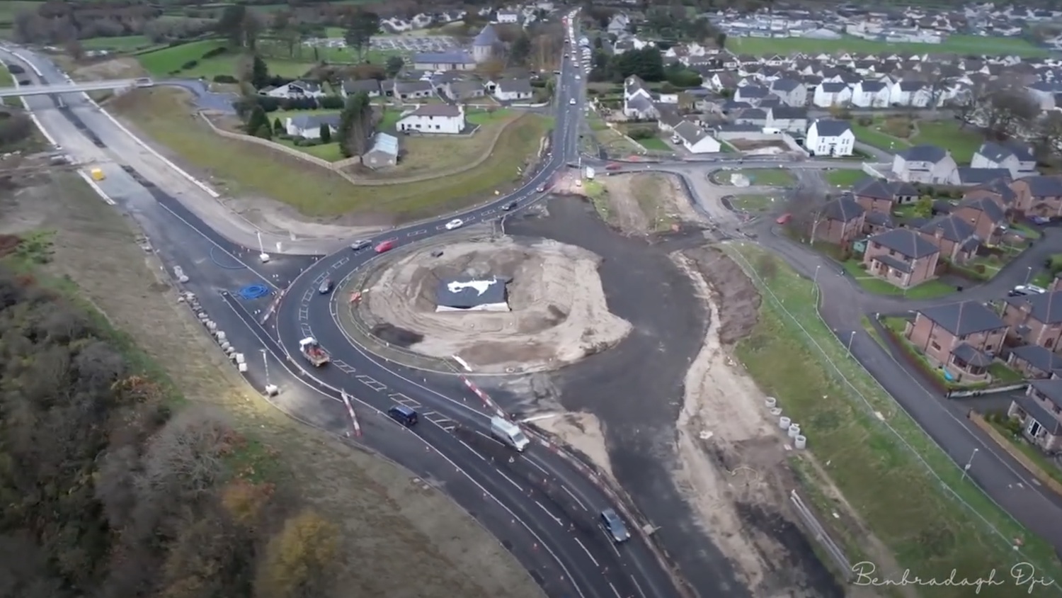
Pic 16: Magherabuoy roundabout, the terminus of
the scheme east of Dungiven, seen on 16 July
2021. The shape of the new roundabout is now
clear. The new access road for Tracys Way and
Abbeyfields is seen under construction. A
similar new access for Magherabuoy Terrace, seen
at the top right, opened to traffic on 21 June
(thanks to Paul McCloskey for spotting this).
[Benbradagh] 27 Jun 2021: The past month has seen
fewer 'major' events on the scheme - such as
beam lifts - but work has still been continuing
at good speed. The only particular point of note
is that the old 1950s bridge at Burntollet,
which carried the main A6 until last year, was
demolished between 12 and 13 June. This was the
first pre-stressed concrete bridge in Northern
Ireland, and would have lasted many years longer
had it not been made redundant by this scheme.
The contractor has recently published a short
newsletter outlining some of the recent work and
some other articles of interest, which you can
see by clicking
here. The newsletter enumerates progress
in a good way:
- 90% of drainage on the dual-carriageway has
been completed.
- 90% of excavations completed and 14 of the
22 structures (bridges) completed.
- 70% of the base courses of the road surface
(Cement Bound Granular Mixture or CBGM).
- 50% of the pavement on the main
dual-carriageway (what road users would think
of as 'the tarmac').
The photos below are arranged in order from
west (Derry end) to east (Dungiven end) and are
with grateful thanks to Benbradagh and Paul
McCloskey.
Pic 1: View east from Gortilea Road overbridge,
which is now open, showing substantial progress
on the mainline here with drainage channels on
either side, surfacing down on the eastbound
carriageway and tree planting on the embankment.
[Paul McCloskey]
Pic 2: View east from the existing A6 towards
Ballyhanedin overbridge, which is substantially
complete but not yet open, on 21 June 2021.
Beneath it, progress is well underway on the new
road itself with more surfacing down. [Paul
McCloskey]
Pic 3: View west from above Foreglen village on
10 June 2021, showing a very well-advanced
dual-carriageway on the left, with the existing
A6 on the right. The road running left-right in
the foreground is Crock-na-brock Road which will
be permanently severed. In the distance you can
just see Munreery overbridge, which serves a
handful of local properties and is not yet
completed. Ballyhanedin Road bridge is just out
of shot at the top of the frame. [Benbradagh]
Pic 4: Aerial view of Altagarron Road, as it
passes under the new dual-carriageway, on 10
June 2021. This road has been open for some time
now, and links to Foreglen village, visible
here. Again you can see that the surfacing on
this stretch of the new road is very advanced.
This shot also shows three centuries of roads -
the 19th century road serving all the houses,
its 20th century replacement to the right, and
its 21st century replacement still under
construction! Altagarron Road itself is probably
19th century. [Benbradagh]
Pic 5: Aerial view of Ovil Hill cutting, east of
Foreglen, on 10 June 2021, once again with the
road very well advanced through it. This
enormous cutting was the source of much of the
stone used elsewhere on the scheme. At the
minute it is rather a conspicuous scar on the
landscape, but in time it will be grassed over
and perhaps even grow trees. [Benbradagh]
Pic 6: Aerial view of Killunaught Road
overbridge under construction on 10 June 2021,
with the current A6 on the right. [Benbradagh]
Pic 7: Aerial view of the temporary 'tarmac'
batching plant at Dernaflaw, a few hundred
metres east of the previous shot. This plant
manufactures all the 'tarmac' needed for the
scheme. You can see a new layby taking shape on
the new dual-carriageway too. 10 June 2021
[Benbradagh]
Pic 8: View east from Feeny Road bridge,
Dungiven, on 21 June 2021. This bridge is now
open to traffic, affording a grandstand view of
the works, in this case the future eastbound
offslip/onslip loop, with an accommodation
laneway visible beyond. [Paul McCloskey]
Pic 9: Magheramore Road bridge, Dungiven,
complete and in use on 13 June 2021. [Paul
McCloskey]
Pic 10: The River Roe bridge, near Dungiven,
which gots its beams during May, seen here on 10
June 2021. Work is underway to place the
shuttering between the beams in order to
construct the deck above. The large crane was
still sitting at the site this week, though it's
not clear why. [Benbradagh]
Pic 11: This final shot shows
the site of the terminal roundabout at
Magherabuoy, Dungiven on 25 June 2021. The new
road heads off to the bottom of the image. The
dark road left of centre is the new entrance
road to Tracys Way and Abbeyfields. This link
must be completed before the original entrance
is removed to make way for the roundabout. The
circle of the roundabout is starting to appear
in this shot. [Benbradagh]
26 May 2021: A huge amount has happened
on the scheme over the past month. This includes
structures, with beams lifted on the two largest
bridge on the scheme (Liberty Glen, commencing
12 May, and the River Roe, commencing 24 May).
Much more of the road itself has also been
progressed, to the extent that the large
'tarmac' making plant near Ovil hasn't been
needed as much over the past few weeks. On long
stretches of the scheme you can see completed
blacktop and drainage in place on both
carriageways. The photos below focus on the
structures and junctions, because they are the
things most noticeable to the public, but we
must not lose sight of the fact that laying the
road base itself is the biggest job of all and
that it is progressing very well. This past
month traffic has been (or is about to be)
diverted over two of the new bridges (Feeny Road
bridge, which opened on 30 April, and
Magheramore Road, which will open on 31 May). In
both cases, traffic was using a temporary road
around the site, which will now be removed to
allow the dual-carriageway to be completed. A
third bridge, Gortilea Road, also opened to
traffic, on 21 May. This road had been closed
for over a year. In other news, the B74
Glenshane Road (which takes you into Claudy from
the Derry side) was closed at the end of April
for four months to allow more work to take place
on the future Killaloo junction. At this point,
only two road bridges still need their beams -
Killaloo, and the second half of Burntollet
bridge - and one bridge has yet to begin - the
footbridge which will eventually cross the
Faughan river beneath the finished Burntollet
bridge. Before moving into the photos, there are
three videos which I must link to:
There are 19 photos below, arranged as always
from west (Derry) to east (Dungiven). In truth,
you the public are amazing at taking photos of
this scheme and there are literally hundreds on
Twitter and which I could share. Thank you all.
These are just a small sample. With thanks to
Aerial Vision NI, Benbradagh, Esther Harper,
Alan Lynas, Martin Lynch, Paul McCloskey, Arthur
Ming, Les Ross and Sean Wilson.
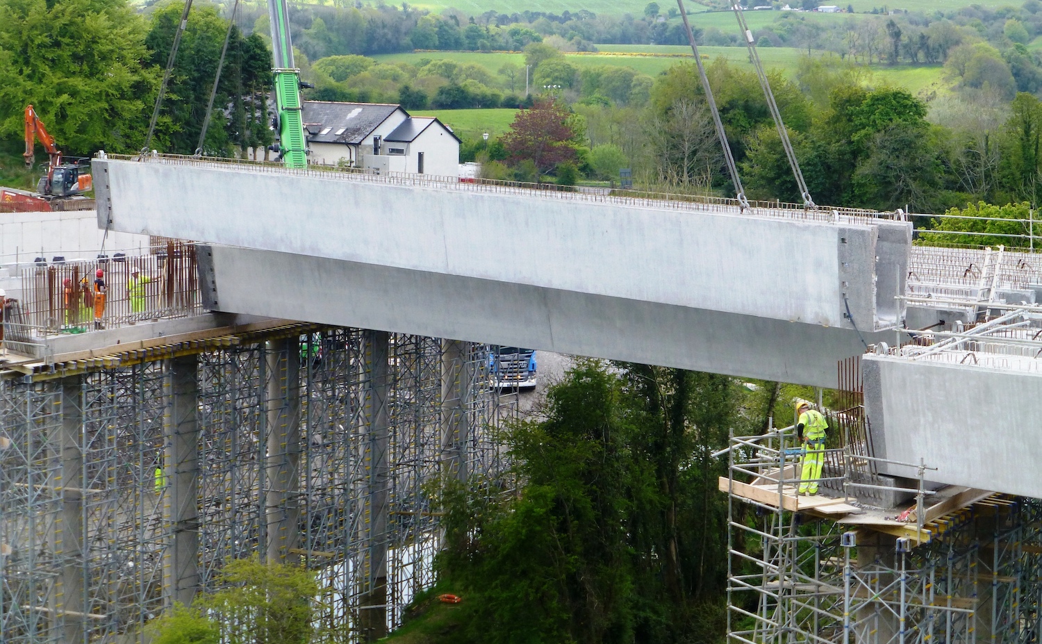
Pic 1: One of the seven central beams being
lifted into place at Liberty Glen on 15 May
2021. This is the longest bridge on the scheme,
and requires 21 beams in total, in three spans.
[Arthur Ming]
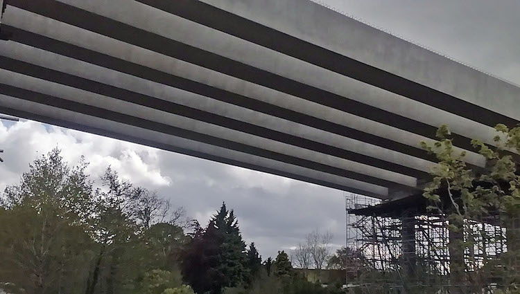
Pic 2: The completed beams in place at Liberty
Glen, as seen from underneath on 14 May 2021.
That these enormous beams can be supported on
the five slender pillars ahead is a testament to
how far civil engineering has progressed since
the 1960s. [DFI Roads]
Pic 3: The final beam being lifted into place at
Liberty Glen on 14 May 2021. Work here will now
focus on placing shutters between the beams and
then constructing the road deck on top. [DFI
Roads]
Pic 4: Aerial view looking west across the
future Tamnaherin Road junction on 16 May 2021.
All traffic is using a temporary road which can
be seen crossing left-right mid shot. Beyond
that can be seen the future dual-carriageway. In
the foreground is the bridge deck of the
Tamnaherin Road flyover, which is actually at
ground level. Once completed, a cutting will be
excavated beneath it to allow local traffic to
cross under the road. Still a lot of earthworks
to be done here. [Sean Wilson]
Pic 5: View of new dual-carriageway looking east
approaching The Oaks accommodation bridge on 16
May 2021. The road on the left is being used by
all A6 traffic, but is actually the Ervey Link
Road, a new local road that will remain in place
once the dual-carriageway has been completed.
[Sean Wilson]
Pic 6: The new Ardmore Bridge (a local road at
Burntollet) taking shape on 23 May 2021. Work
here is focused on constructing the deck of the
bridge. Picture taken from the old stone Ardmore
bridge, which will remain in place but no longer
used by traffic. [Sean Wilson]
Pic 7: View east along the new road towards
Burntollet Bridge on 16 May 2021. All traffic is
using the future eastbound carriageway. There is
still little evidence of progress on the second
half of the new Burntollet Bridge. The 1950s
bridge, in fact, has not yet been demolished and
appears to be being used to store materials.
[Alan Lynas]
Pic 8: Closeup of Burntollet Bridge on 16 May
2021, looking east. All traffic is using the
northern half of the new bridge, with the
southern half still to be built. The grey pipes
are sitting on the older 1950s Burntollet Bridge
which has yet to be demolished. Ardmore Road
bridge is off frame to the right in this view.
[Alan Lynas]
Pic 9: Moving to Claudy, this is the view south
along the future route of Baranailt Road,
towards the new A6 bridge on 9 May 2021. With
the bridge now open, work is well underway to
complete Baranailt Road underneath. [Arthur
Ming]
Pic 10: Same location as Pic 9, but this is
looking north along Baranailt Road, Claudy FROM
the new A6 bridge on 16 May 2021. The original
A6 ran left-to-right across this view, in what
is now mid-air, since excavation works have
since taken place. You can see Baranailt Road
beyond the barrier, drumming its fingers as it
awaits its chance to be connected under this
bridge. [Martin Lynch]
Pic 11: Gortilea Road finally reopened, over its
new bridge over the A6, on 21 May 2021. This
view shows the final surfacing works underway on
the approach embankment on the southern (far)
side of the new bridge. Gortilea Road is
perfectly straight, giving away its origin as a
'direct alignment' road, typical of Irish road
engineering in the 18th century. [Esther Harper]
Pic 12: View beneath Killunaught Road bridge,
near Foreglen, taken from the new
dual-carriageway, on 16 May 2021. Work on bridge
deck is well advanced, but in this shot we can
see the reinforcement bars being erected for the
concrete wingwalls on either side of the bridge
abutment. These will be in-filled to allow the
road to be constructed on top. [Esther Harper]
Pic 13: Aerial view of Feeny Road junction, near
Dungiven, on 29 April 2021. At this point, the
'temporary' road (which ran on the bottom side
of the bridge in this view) had already been
removed. The bridge itself was being surfaced,
and it opened to trafic on 30 April. With the
temporary road out of the way, work is now
underway to complete the two sets of sliproads
and the dual-carriageway beneath this bridge.
[Benbradagh]
Pic 14: Aerial view of Magheramore Road bridge,
near Dungiven on 26 May 2021. The road under the
bridge is well advanced and Magheramore Road
itself is due to reopen to traffic on 31 May. In
the photo you can see work underway to lay
tarmac over the bridge in preparation for this.
Once completed, the temporary road that traffic
used while the bridge was being built - just
beyond the bridge and partly hidden in this view
- will be removed and the new road completed.
[Aerial Vision NI]
Pic 15: The huge crane being assembled - by
another crane! - at the River Roe bridge, near
Dungiven, on 19 May 2021. The crane itself is on
a specially-constructed pad to spread its weight
as this is very soft ground. The beam lift
itself began on 24 May and should be completed
today, 26 May. [Benbradagh]
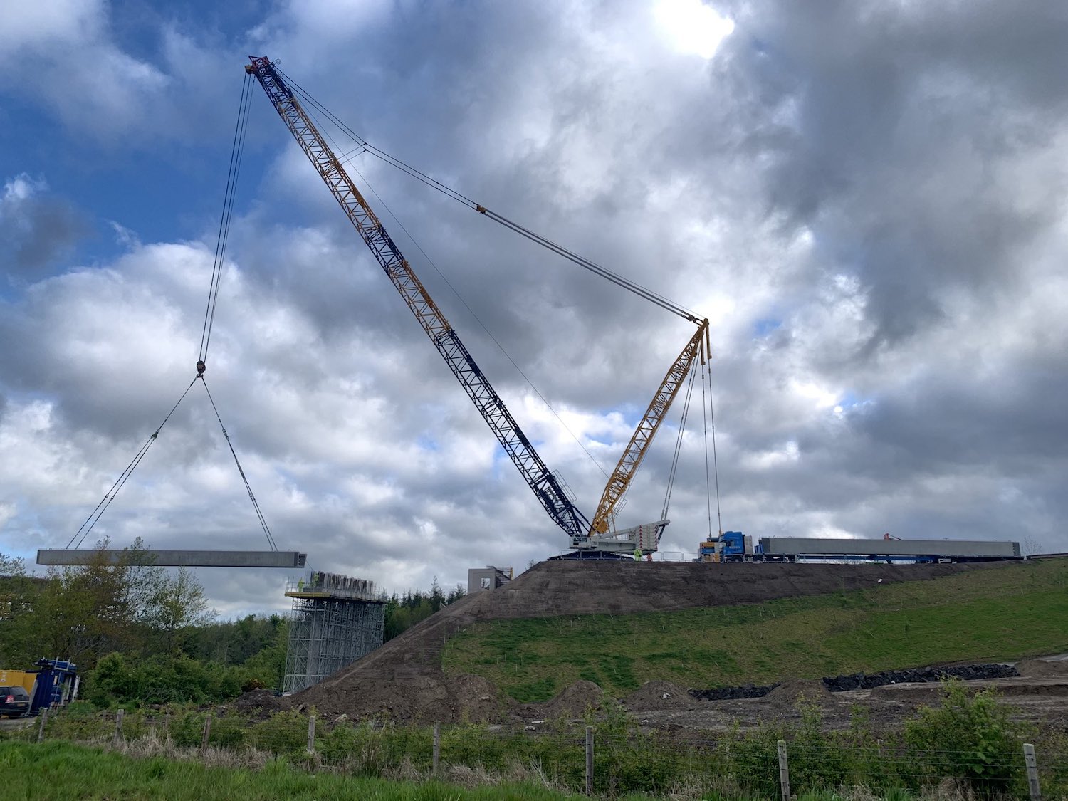
Pic 16: The crane in action lifting first of the
central beams into place at the River Roe bridge
on 25 May 2021, while a lorry carrying the next
beam waits beside it. This crane had been used
at Liberty Glen two weeks earlier. [Les Ross]
Pic 17: Underneath view of the central span of
the River Roe bridge with six of its eight beams
in place on 25 May 2021. Each beam weighs 80
tonnes, so this span alone has 640 tonnes of
beams. [Paul McCloskey]
Pic 18: 17 of the 24 bridge beams in place at
the River Roe bridge as seen on 26 May 2021.
This bridge consists of 24 beams, in three
spans. The central beams are the longest, and
weigh 80 tonnes apiece. Some large trees had to
be felled for this bridge, but the remainder of
the vegetation under the bridge is undisturbed
by all this work. [Aerial Vision NI]
Pic 19: The terminus of the
scheme at Magherabuoy roundabout, seen on 26 May
2021. The existing A6 into Dungiven is on the
right. Works to realign the entrance to the
Tracys Way and Abbeyfields housing developments
is evident on the right. The 'circle' of the
future roundabout is starting to become visible.
The crane at the River Roe can be seen in the
upper left corner. [Aerial Vision NI]
21 Apr 2021: This update shows how
advanced the scheme now is, with work on all
structures underway or completed. The next six
weeks are going to see beam lifts on the largest
bridges on the whole scheme - Liberty Glen
within the next fortnight, and at the River Roe
bridge near Dungiven in late May. Once those are
in place, and with beams at Ardmore Road likely
to be in place soon too, only the Killaloo Road
bridge will remain without its beams (plus a
small accommodation bridge at Burntollet which
will be built towards the end of the scheme).
There are 19 photographs below with thanks to
the usual suspects - Benbradagh, Alan Lynas,
Paul McCloskey, Martin Lynch, Esther Harper and
Arthur Ming. Our grateful thanks as always. I
will include more commentary in the captions.
Not shown in the pictures are Feeny Road and
Magheramore Road bridges, both at Dungiven. Both
of these bridges will come into use in the near
future - Magheramore Road bridge should be open
any day now, while Feeny Road bridge should be
open next week.
But before we come to those, I must share this
great aerial movie, taken by Aidey Heaney
on 14 April. I recommend you switch it to HD
playback for the best experience. It does not
show every inch of the scheme, but focuses on
certain areas. Some indications of what you are
looking at are given below (numbers are
minutes:seconds into the video):
- 0:00 Starting at Drumahoe, this is McCay's
accommodation bridge.
- 0:30 Construction of Liberty Glen bridge,
the longest bridge on the whole scheme.
- 0:45 Jumping to The Oaks accommodation
bridge, near Burntollet.
- 1:08 Construction of Burntollet bridge, with
part of the new bridge in use and the 1950s
bridge still in place.
- 1:30 Approaching Baranailt Road junction,
Claudy with the "old" A6, now disused, visible
to the left of the new road.
- 1:45 Baranailt Road junction, Claudy.
- 2:05 Gortilea Road bridge.
- 2:30 Very advanced stretch of the new A6
approaching Foreglen with Munreery
accommodation bridge ahead.
- 3:15 Killunaught Road bridge.
- 3:35 Derrychrier Road underpass.
- 4:10 Owenrigh river bridge, immediately
followed by Magheramore Road bridge.
- 4:50 Construction of River Roe bridge, near
Dungiven.
There is a second video here,
for those who would love to drive the works, but
have not been able to do so. This video was
taken about a month ago by Diarmaid Macfheargail
from a car and takes in a good run along a new
stretch of the road westbound from near Claudy,
past Burntollet to Tamnaherin Road (where
Peter's house is apparently located!!). The
video then turns round and goes back the same
way.
The photos are, as always, arranged in order
from west (Drumahoe) to east (Dungiven).
Pic 1: The "temporary" terminus of the scheme is
here at Lismacarol roundabout, in Drumahoe, seen
on 6 Apr 2021. The park-and-ride is completed
but not yet in use, with large concrete pipes
blocking access. The roundabout is not yet
operating as a roundabout. You can see how the
current A6 (where the cars are) will be diverted
to meet the roundabout once the new road is
open. [Benbradagh]
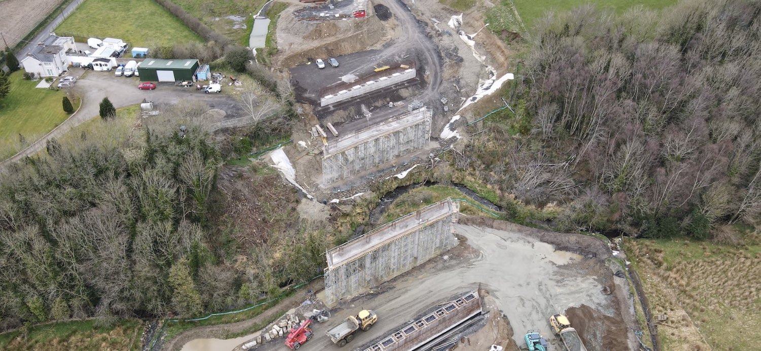
Pic 2: Aerial view of Liberty Glen bridge on 6
Apr 2021. This bridge, the longest on the whole
scheme, is almost ready for its three spans of
beams, which are due to be craned into position
around the end of April. [Benbradagh]
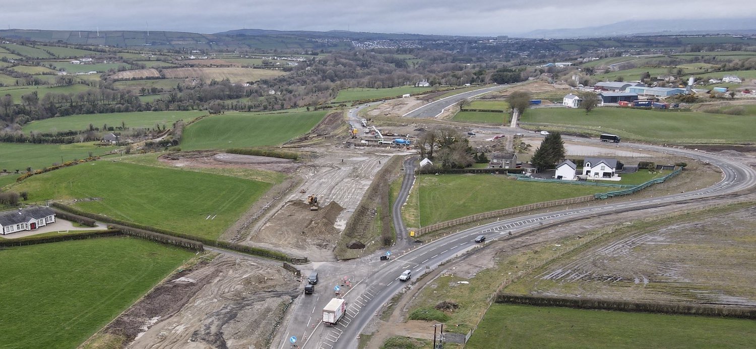
Pic 3: Traffic is still being diverted around
the site of Tamnaherin Road bridge, whose deck
will be at ground level. When this was taken, on
6 Apr 2021, the bridge aburtments were ready but
had not yet received their beams (see next pic).
Once the bridge is completed traffic will be
diverted over it, and then Tamhaherin Road will
be excavated down to pass beneath the new
bridge. You can see how the structure of the new
dual-carriageway beyond the site is largely
completed. [Benbradagh]
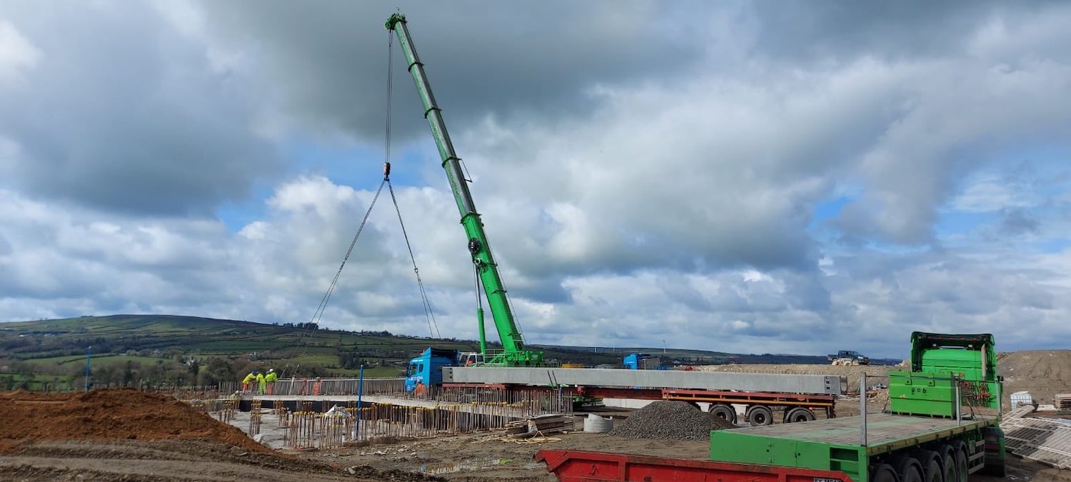
Pic 4: Much excitement on 12 Apr 2021 as the
beams for Tamnaherin Road bridge were craned
into position. [Polyanne]
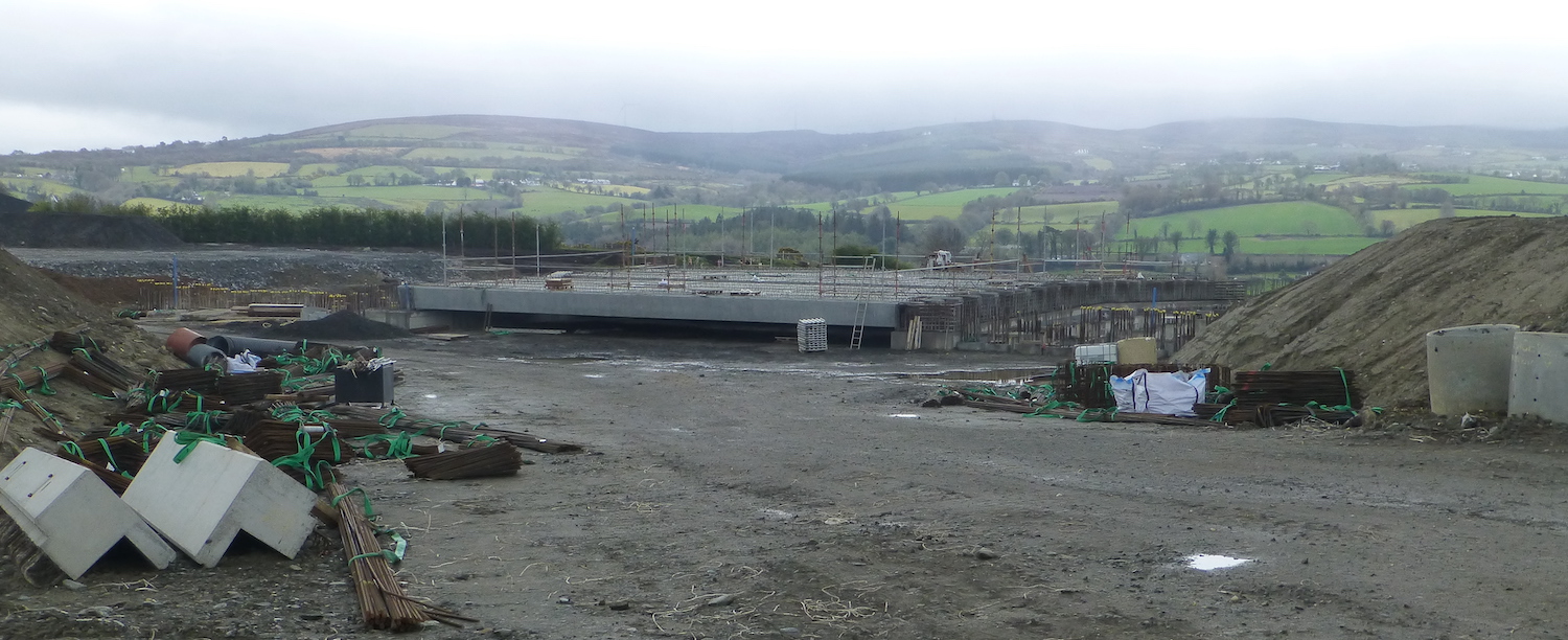
Pic 5: Tamnaherin Road bridge seen five days
after the beam lift, on 17 Apr 2021. The new
road will pass over this bridge from left to
right. Eventually the ground under it will be
excavated to create a new underpass for
Tamnaherin Road. [Arthur Ming]
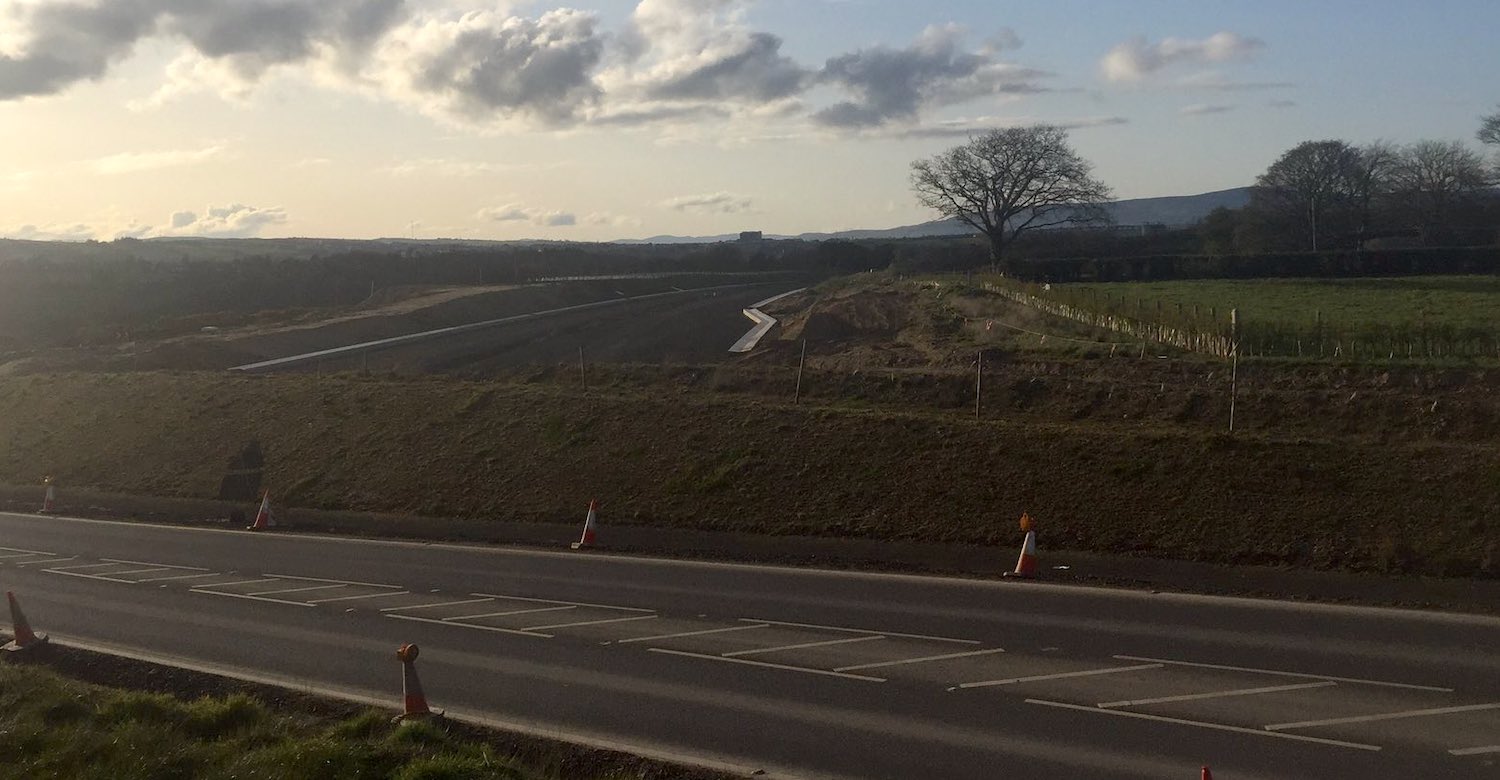
Pic 6: Dusk view looking over the "temporary"
road at Tamnaherin Road on 13 Apr 2021, showing
the new dual-carriageway beyond completed right
up to this point. The "kink" in the drainage
channel is the start of the eastbound offslip to
the future Tamnaherin Road junction, which will
be located behind the camera. [Polyanne]
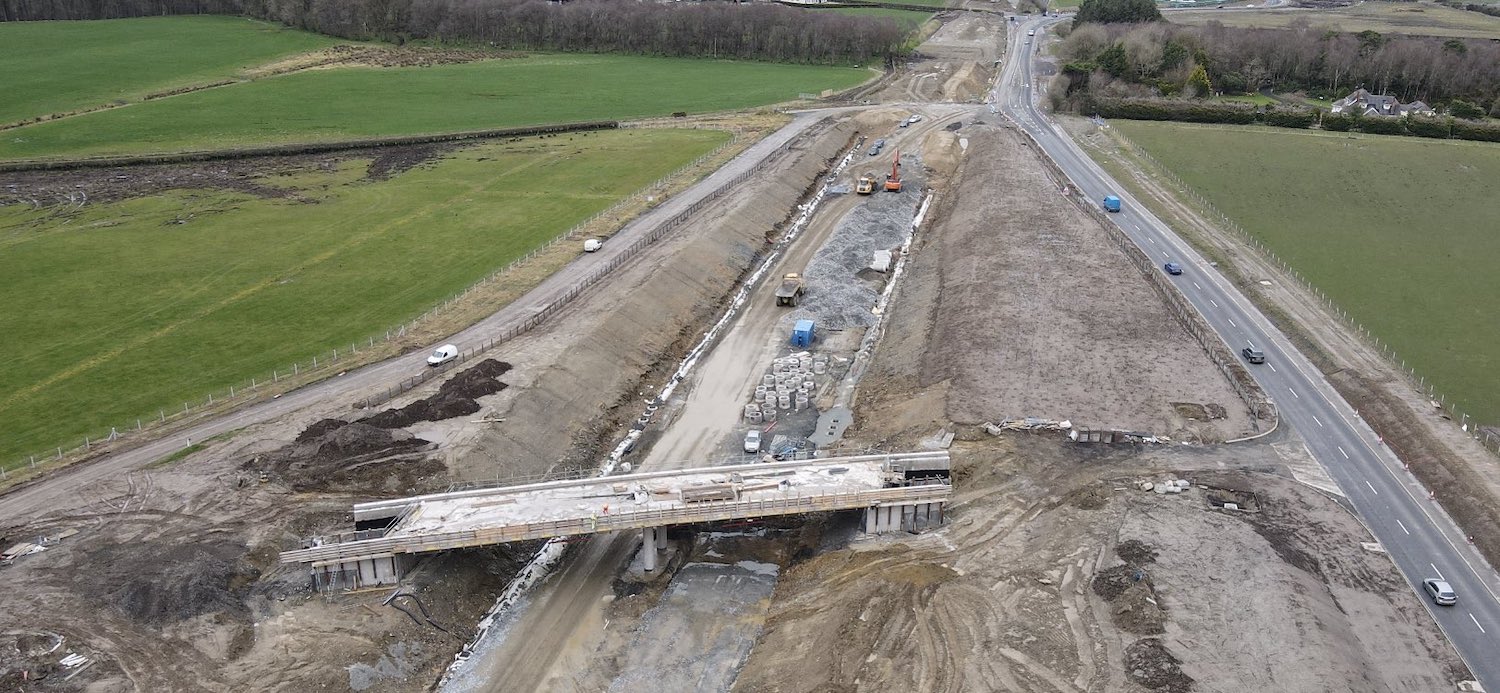
Pic 7: Moving towards Burntollet, this is The
Oaks accommodation bridge seen on 6 Apr 2021,
with work on the deck underway. All A6 traffic
is currently using the future Ervey Road Link on
the right, giving the engineers free reign at
the bridge site. The Ervey Road Link will run
alongside the A6 to join the Tamnaherin Road
junction. [Benbradagh]
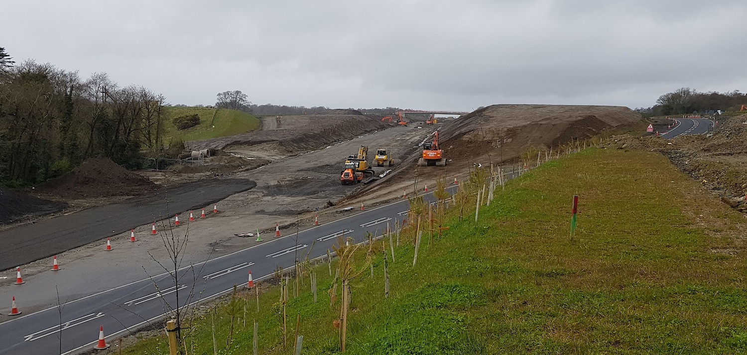
Pic 8: View west from Burntollet on 18 Apr 2021
showing the route of the future dual-carriageway
with the Oaks accommodation bridge on the right.
The road in the foreground is a temporary
stretch joining the existing A6 (bottom left) to
the Ervey Road Link (top right). It will
eventually be removed. [Alan Lynas]
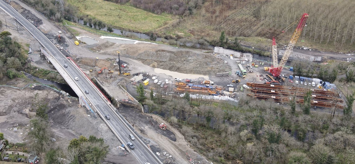
Pic 9: Fascinating view of the Burntollet area
on 6 Apr 2021. On the left is half of the new
bridge, which is currently carrying all A6
traffic. To the right of that is the old 1950s
Burntollet bridge, which carried all traffic
until a few months ago. It has yet to be
demolished, though work is already underway on
the foundations for the second half of the new
bridge which will replace it. On the right is
the future Ardmore Road bridge, over the Faughan
river. A crane was present for a few days this
month, possible to assist with the assembly of
the three huge sets of steel beams that can be
seen beside it. As if all this was not enough,
another bridge has still to be built here - the
Burntollet Woodland Trust accommodation bridge,
a pedestrian bridge which will run over
the Burntollet river beneath the new A6
bridge! [Benbradagh]
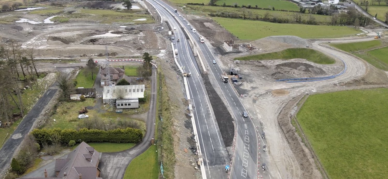
Pic 10: Aerial view of Killaloo junction on 6
Apr 2021. This is now the least-advanced bridge
on the scheme, primarily because traffic had to
be diverted onto the new westbound carriageway
(on the right here) before work could begin on
the northern abutment (on the left). The
switchover of traffic happened at Easter. The
B74 Glenshane Road (which takes you into Claudy
from here) will be closed from 30 April. Gulf
Road (which heads off to the left here) is
currently closed but is due to reopen in autumn
2021. This may coincide with the opening of the
new bridge. [Benbradagh]
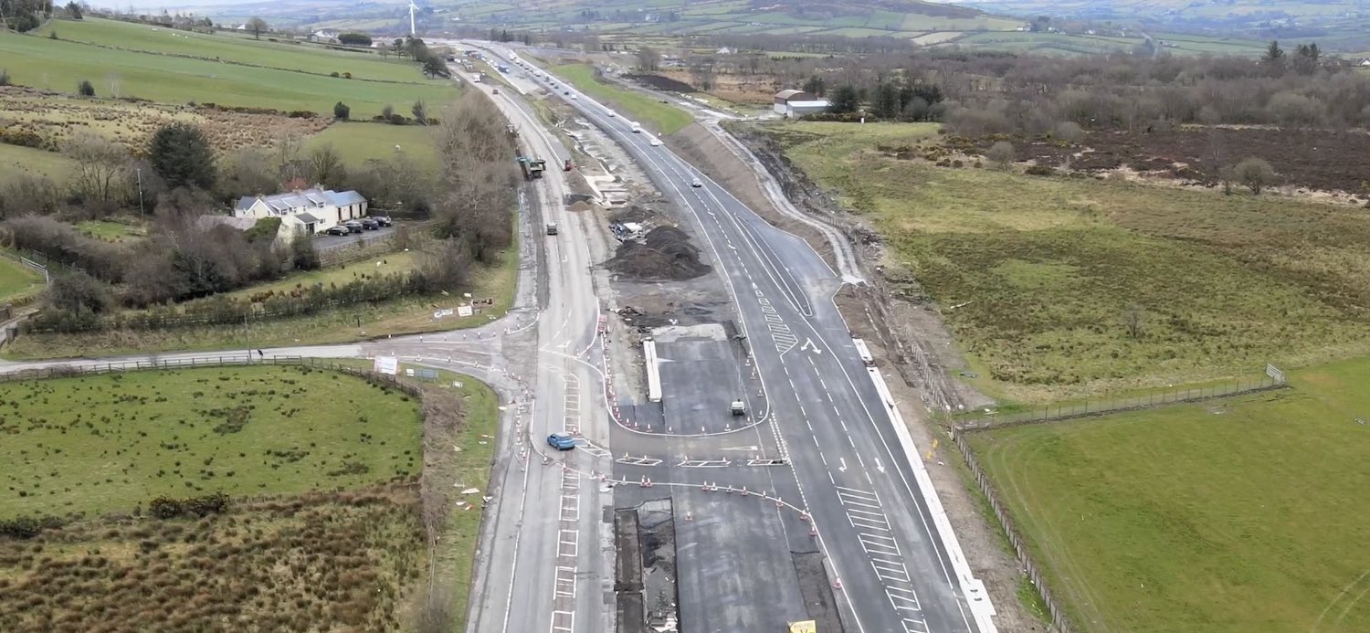
Pic 11: View east along the new road from about
1 mile west of the Claudy junction on 6 Apr
2021. At this point the new dual-carriageway
runs slightly to one side of the old road, which
will remain in situ, albeit with a reduced
width, to maintain access to properties along
here. Note the completed westbound layby. All
traffic is using the future westbound
carriageway here, which sports temporary road
markings including hatching for this side road
(which also leads to the contractor's main
compound). [Benbradagh]
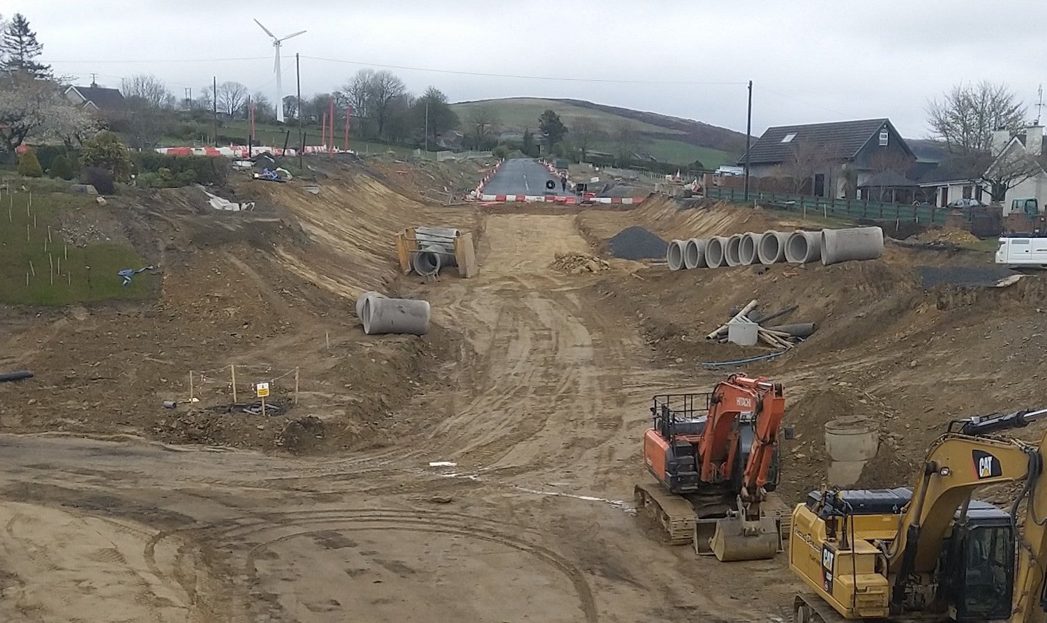
Pic 12: Moving to Claudy, this is the view
north-east towards Baranailt Road from the new
A6 bridge on 18 Apr 2021. Until just a few weeks
ago the old A6 ran from left to right where the
diggers are, but it has now been excavated down
to make the future underpass. The gap to the
left in the foreground will lead to the
eastbound pair of sliproads on/off the A6. There
will eventually be a bus stop to the right of
the diggers. [Martin Lynch]
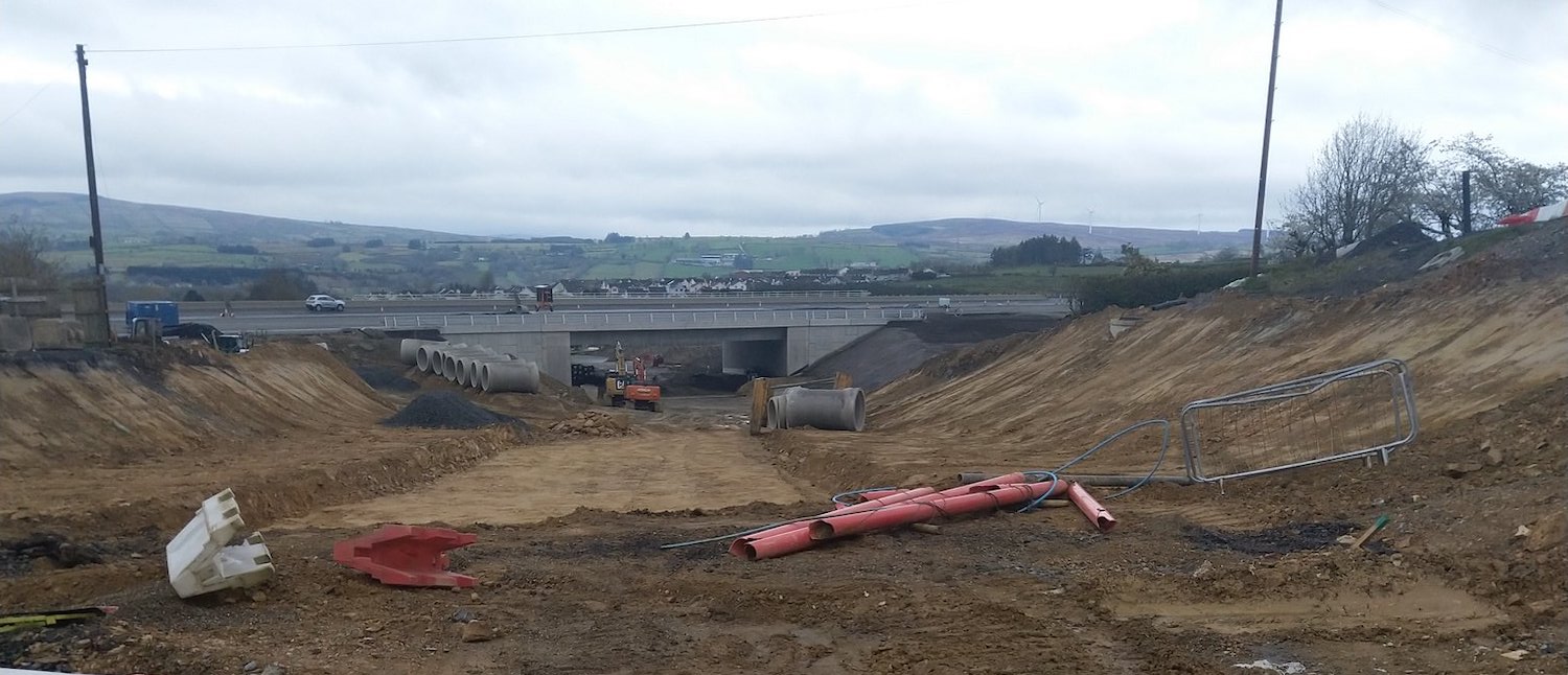
Pic 13: This is the same locality as pic 12,
except this view is taken from the
red-and-white barrier seen in pic 12 and looking
towards the A6 bridge and the
newly-excavated underpass. 18 Apr 2021 [Martin
Lynch]
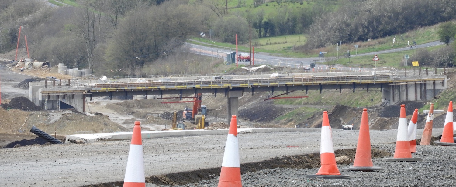
Pic 14: Telephoto shot of Ballyhanedin Road
overbridge on 18 Apr 2021, looking west with the
existing A6 on the right. The existing A6 will
be maintained as a local road with the new road
running beside it at a lower elevation. Beyond
this bridge (not visible here) is Gortilea Road
bridge which is due to open to traffic in May.
[Esther Harper]
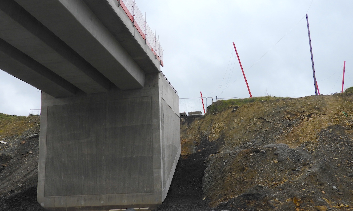
Pic 15: View of the underside of Munreary
accommodation bridge, west of Foreglen village,
on 18 Apr 2021, with beams in place and bridge
deck well underway. This will preserve access to
various areas of farmland and some residential
properties. [Esther Harper]
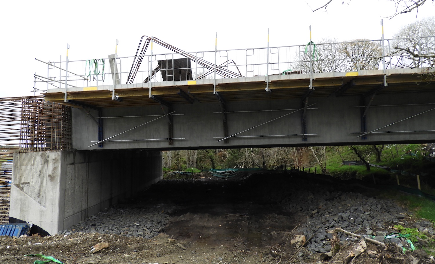
Pic 16: View of Owenbeg river bridge on 18 Apr
2021. Construction of the bridge deck is well
underway. The gap beneath the bridge is low, but
not quite as low as it looks - the beams are
very large. [Esther Harper]
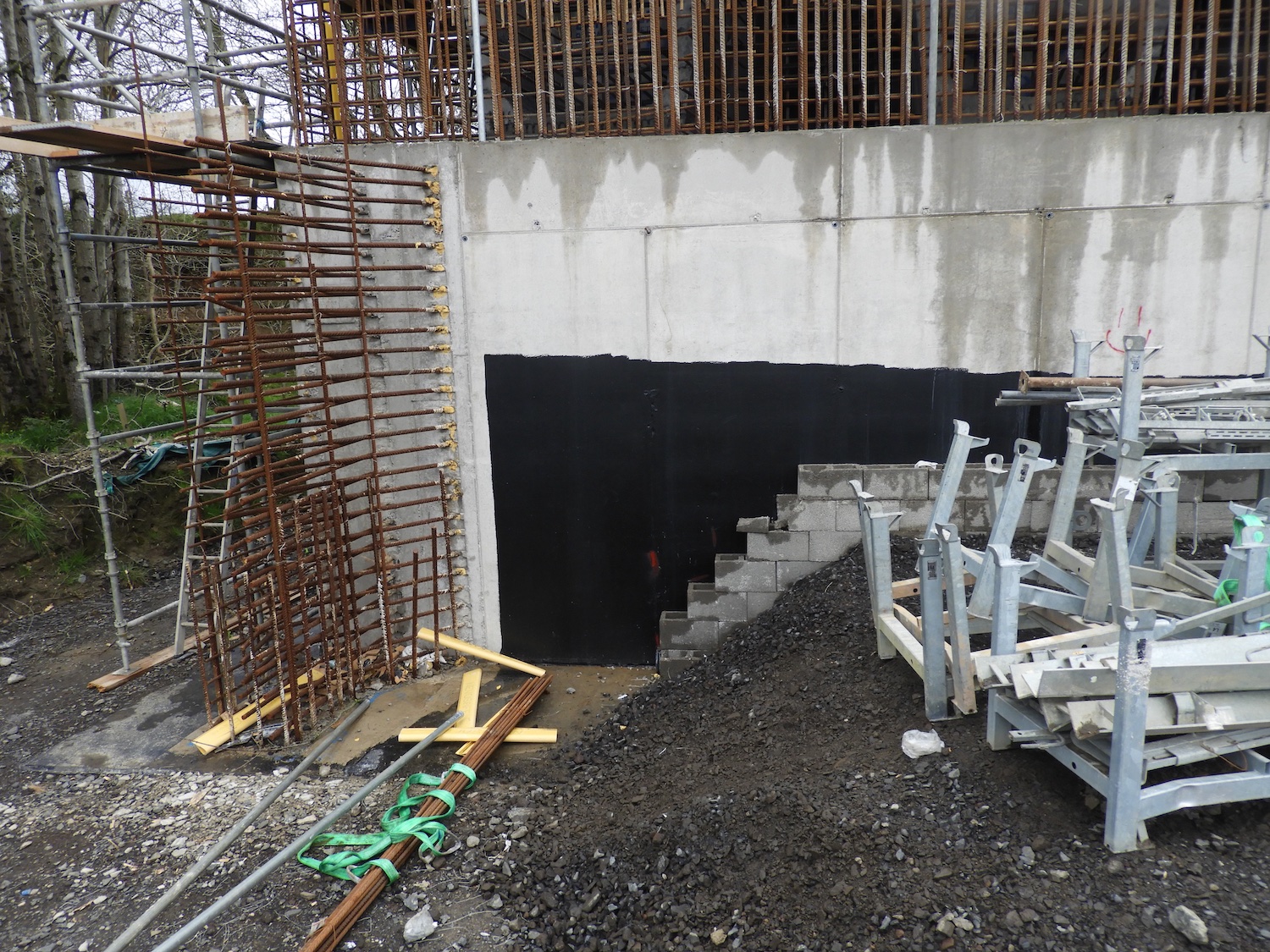
Pic 17: Closeup of works for the wingwalls for
the Owenbeg riber bridge on 18 Apr 2021. On the
left and on top of the abutment are large
quantites of steel reinforcement which will be
encased in concrete. The black material on the
concrete is a waterproofing layer, which is now
being encased behind protective blockwork. The
new road will run from behind the camera to in
front of the camera above head height, once the
approach embankments have been constructed.
[Esther Harper]
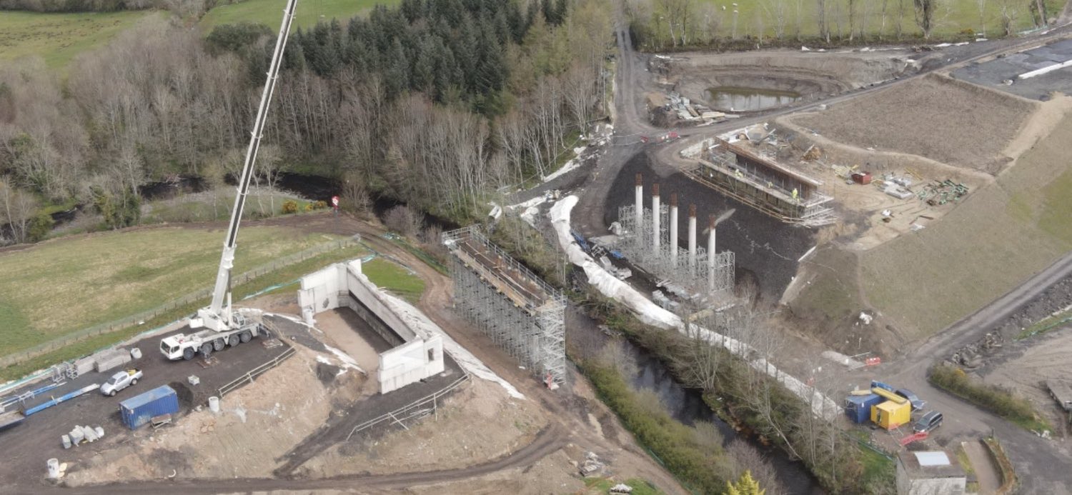
Pic 18: Aerial shot of the River Roe bridge on 6
Apr 2021. At this point the two sets of
intermediate piers were in place, with work
underway to tie them together at the top to form
a base for the beams. Three spans of beams will
be required here, and these are currently
scheduled to be craned into place at the end of
May 2021. This bridge has very large approach
embankments on either side. [Benbradagh]
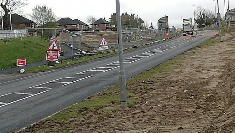
Pic 19: At the terminus of the scheme at
Magherabuoy, on the east side of Dungiven, work is
underway on 18 Apr 2021. As shown in this photo,
which is looking east, work is focused on
constructing a new access road into the Tracys Way
housing development, as the original access has to
be closed to facilitate the new roundabout.
Similar work also has to take place at Magherabuoy
Terrace, whose entrance also has to be relocated
further from the new roundabout. [Paul McCloskey]
24 Mar 2021: The scheme is now into its
final year and we are starting to see the road
take on its final shape in an ever-increasing
number of locations. Some of the least-advanced
bridges are also progressing, with beam lifts
imminent at both Liberty Glen and Ardmore Road,
while the Owenbeg river crossing finally got its
beams in the past month too. Another milestone
was the transfer of traffic onto one carriageway
of the new road at Claudy, on 10 March, and the
commencement of works for the terminal
roundabout at Magherabuoy, on the eastern side
of Dungiven, on 22 March. The pictures below
detail the progress at various places and as
usual are arranged in order from west to east
(Derry to Dungiven) and are with grateful thanks
to Benbradagh, Alan Lynas, Paul McCloskey,
Esther Harper, Arthur Ming and Les Ross as
always to them for keeping us so well-informed.
The only places I haven't seen photos from
recently are Tamnaherin Road and Killaloo
grade-separated junctions, so sorry that they
are not represented.
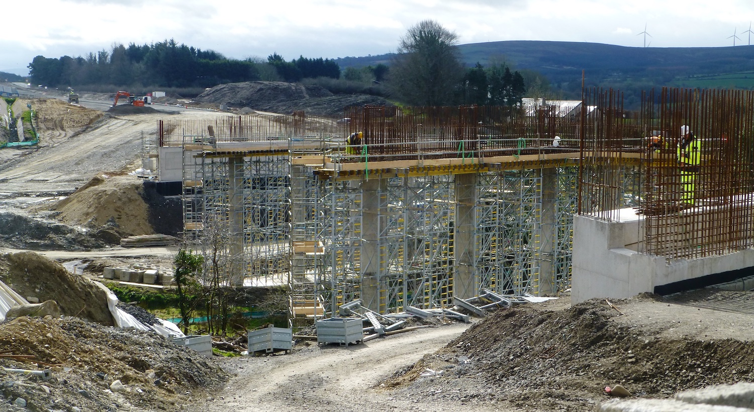
Pic 1: Liberty Glen bridge seen looking east on
23 March, showing a lot of progress since
Febraury. The central piers are now being
connected together to form the base for the
installation of three spans of bridge beams.
[Arthur Ming]
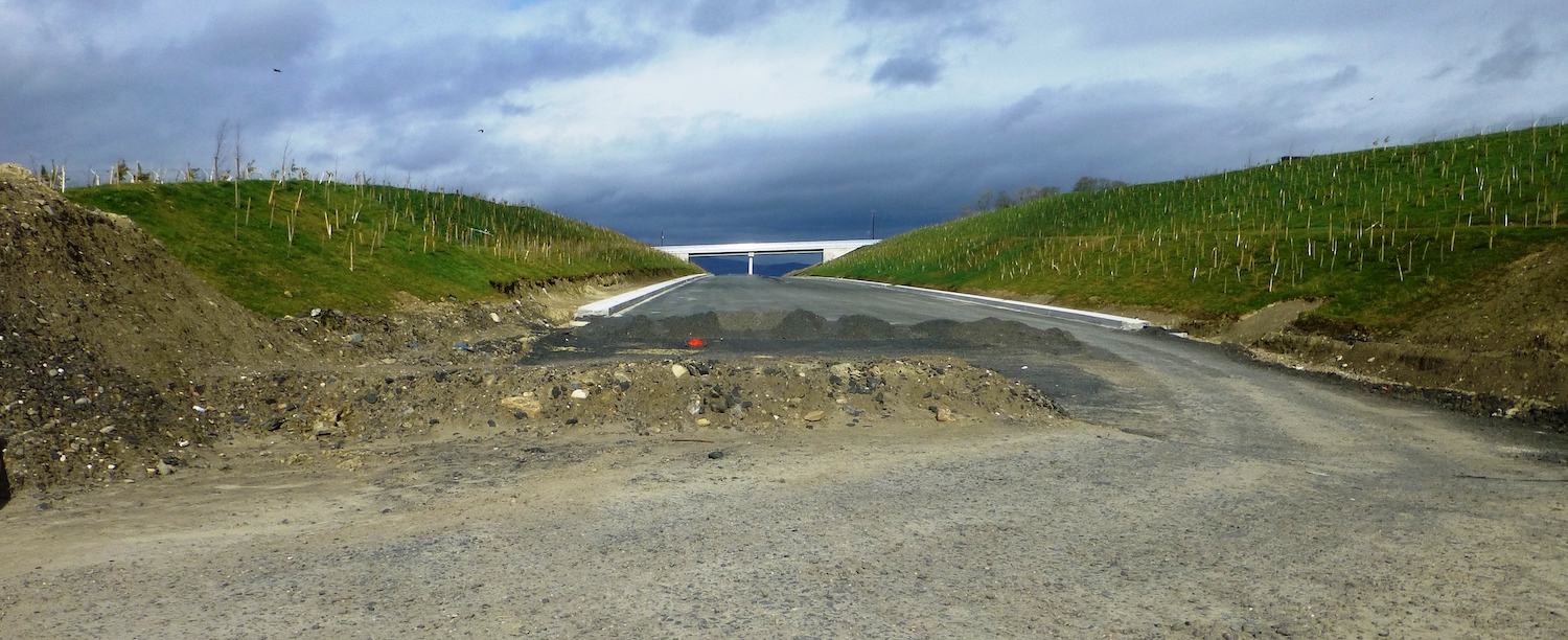
Pic 2: View looking west (towards Derry) from
Liberty Glen bridge, showing that the section of
dual-carriageway ahead is very advanced indeed,
with drainage installed, a base course of
asphalt laid and planting completed. 23 Mar 2021
[Arthur Ming]
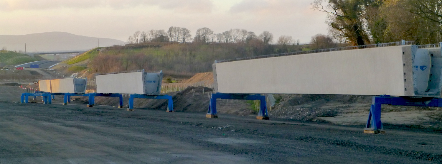
Pic 3: Several bridge beams have recently
arrived near to Liberty Glen bridge. These are
probably some of the beams that will be
installed at Liberty Glen in the coming weeks.
23 Mar 2021 [Arthur Ming]
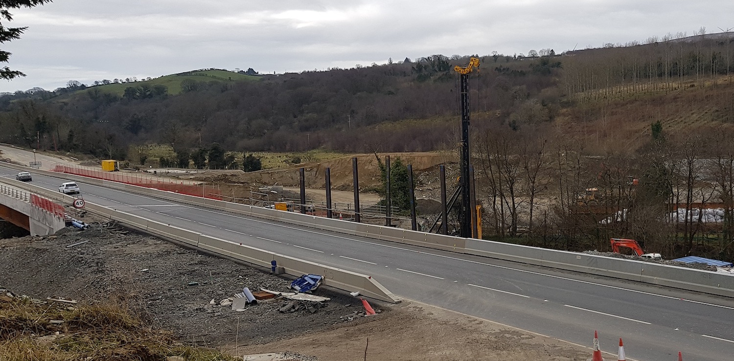
Pic 4: View of Burntollet bridge on 7 March
2021, showing piling works taking place for the
abutments of the second half of the bridge here.
It's impossible to tell from this angle whether
the "old" 1950s Burntollet Bridge has been
demolished yet - does anyone know? [Alan Lynas]
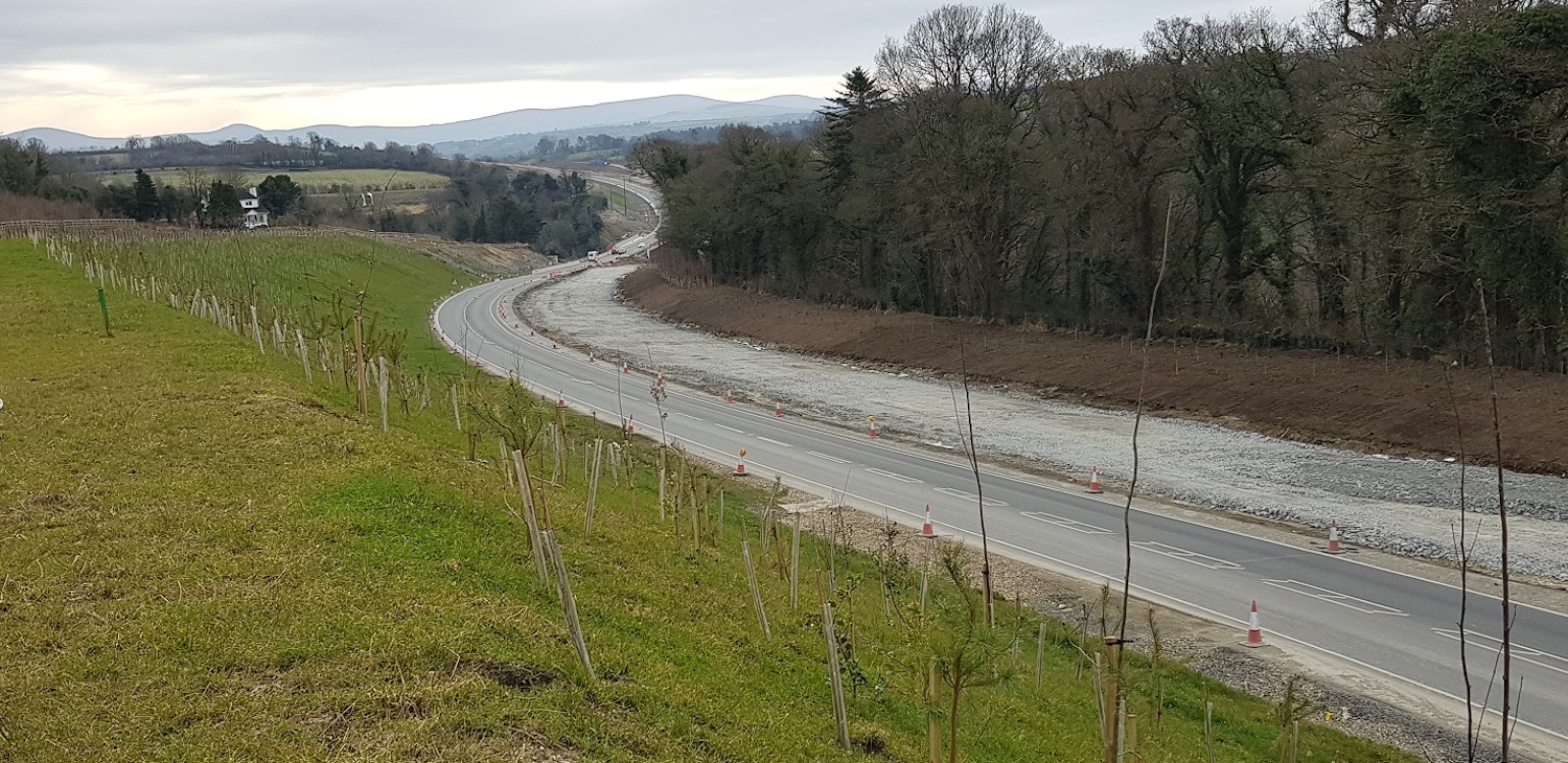
Pic 5: View looking east towards Burntollet
Bridge from The Oaks side on 7 March 2021. The
old road (which ran roughly where the gravel is)
has now been completely removed, excavated
deeper down, and is now being rebuilt to form
the future eastbound carriageway. [Alan Lynas]
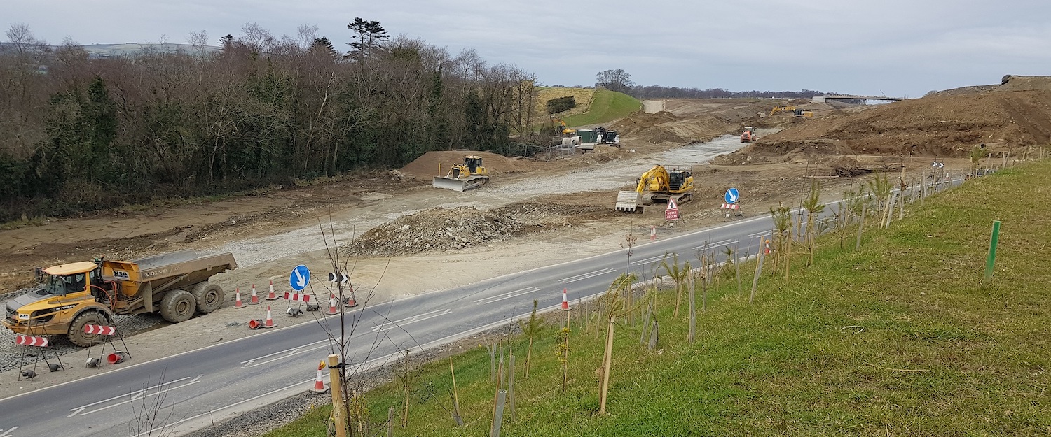
Pic 6: View west from the same location as
picutre 5, towards The Oaks accommodation
bridge, visible in the distance, on 7 Mar 2021.
The old A6 ran where the gravel is, and has been
completely removed. The new dual-carriageway is
being built where it was. All traffic is
currently using the temporry road that heads off
to the right. This bit will eventually be
removed, while the remainder (off frame to the
right) will become part of the new Ervey Road
link, which will run parallel to the A6 for a
distance. [Alan Lynas]
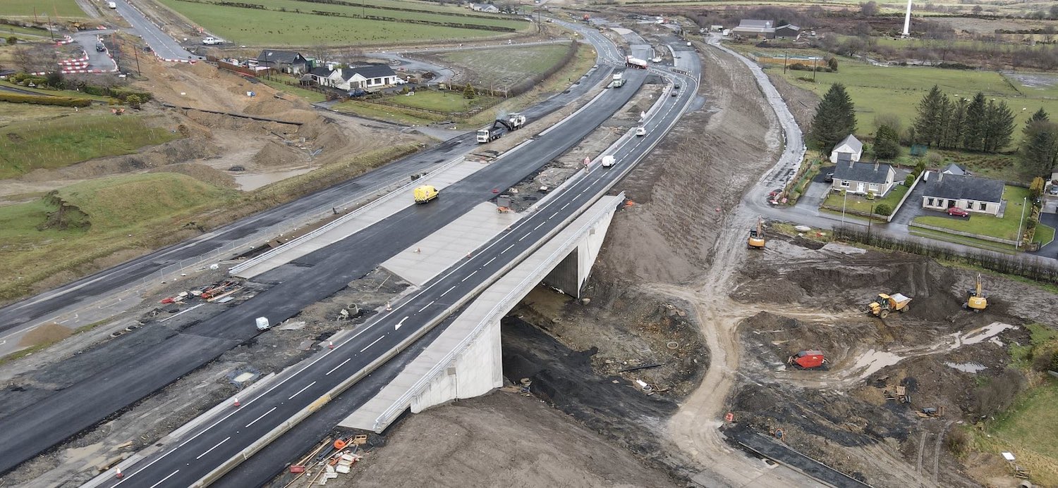
Pic 7: Aerial view of Claudy overbridge on 12
Mar 2021, a couple of days after traffic was
diverted onto it, using the future westbound
carriageway. The old A6, which is to the left of
the yellow van, had just been closed at this
point and is now being excavated to create the
cutting for the local Baranailt Road, which will
run beneath it to join the road visible at the
upper left. The yellow van is on the future
eastbound carriageway, which is not yet open.
The wide gap between the carriageways over this
bridge is to provide sufficient forward
sightlines for traffic heading west.
[Benbradagh]
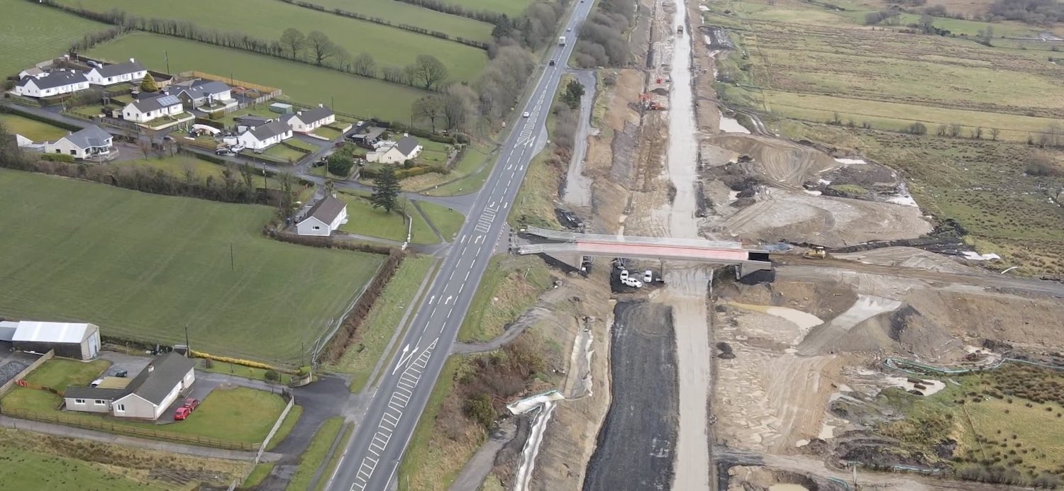
Pic 8: Gortilea Road bridge seen from the air on
12 Mar 2021. This local road, which simply
passes over the new road, has been closed for
over a year. The overburden (basically, a large
pile of rock and earth) which sat to the right
of the bridge for several months (purpose being
to compress the soft ground more speedily) has
now been removed and the embankment for the road
itself at last seems to be underway. Work also
seems to be taking place on the road itself,
with a lot of earthwork evident over the past
month. [Benbradagh]
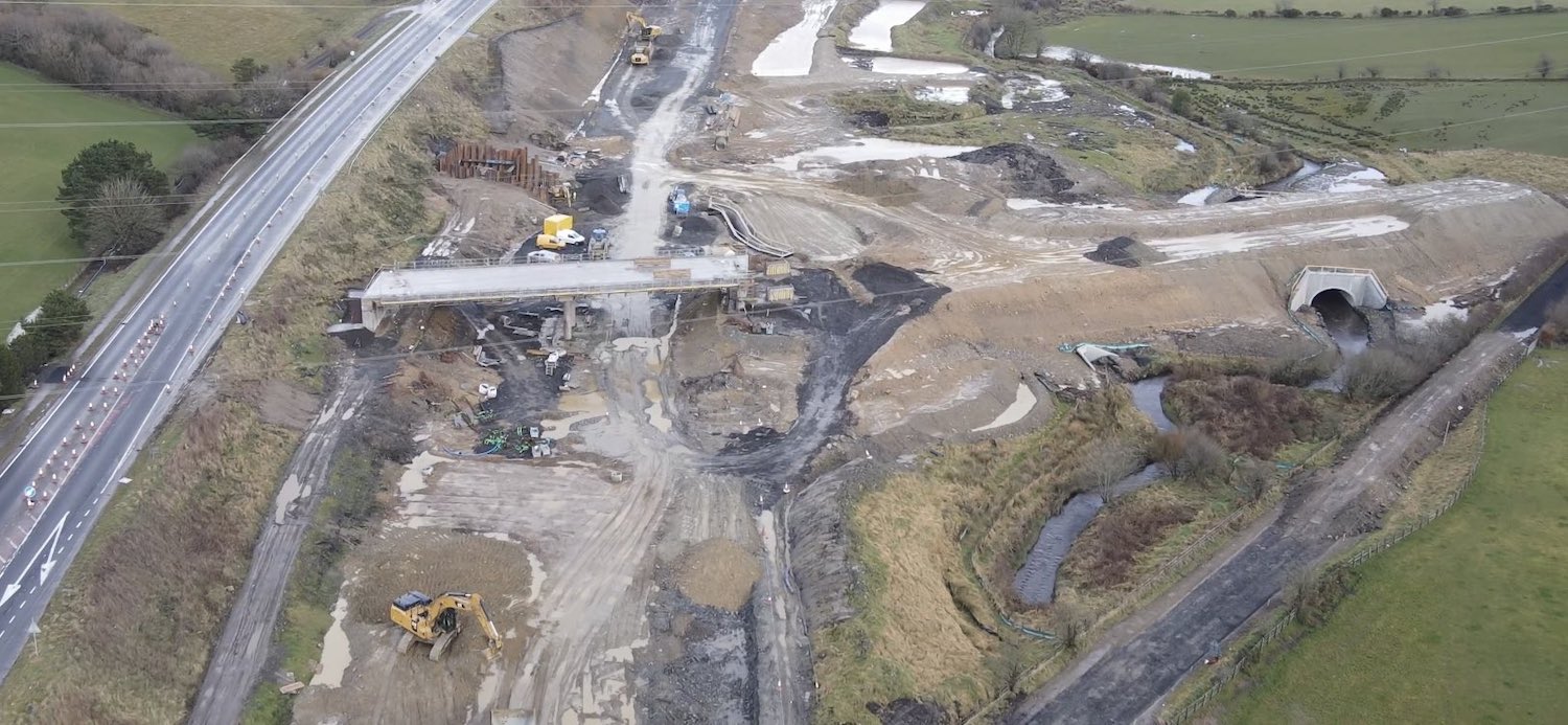
Pic 9: Ballyhanedin Road bridge, which is about
1 km east of Gortilea Road, is also an active
site, with the bridge deck partly in place and
the embankment on the right being built up too,
as seen on 12 Mar 2021. [Benbradagh]
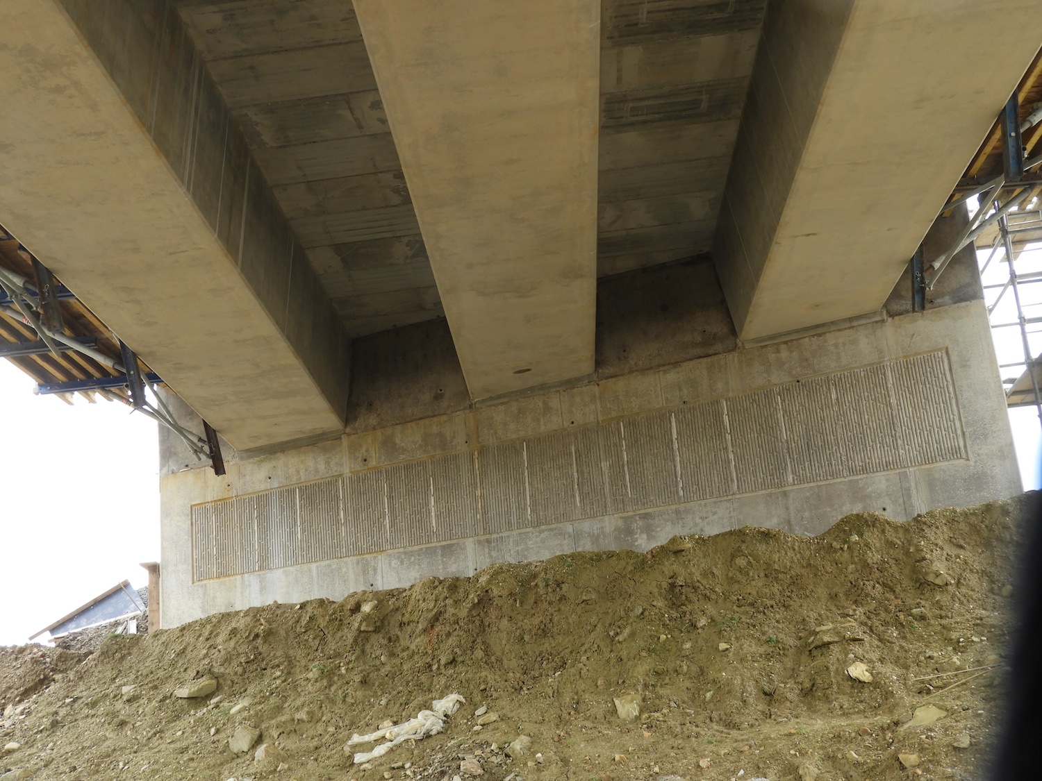
Pic 10: View beneath Ballyhanedin Road bridge on
21 March 2021, showing three bridge beams and
completed shuttering between them to facilitate
construction of the deck above. The temporary
working platforms (falsework) on either side are
also visible. [Esther Harper]
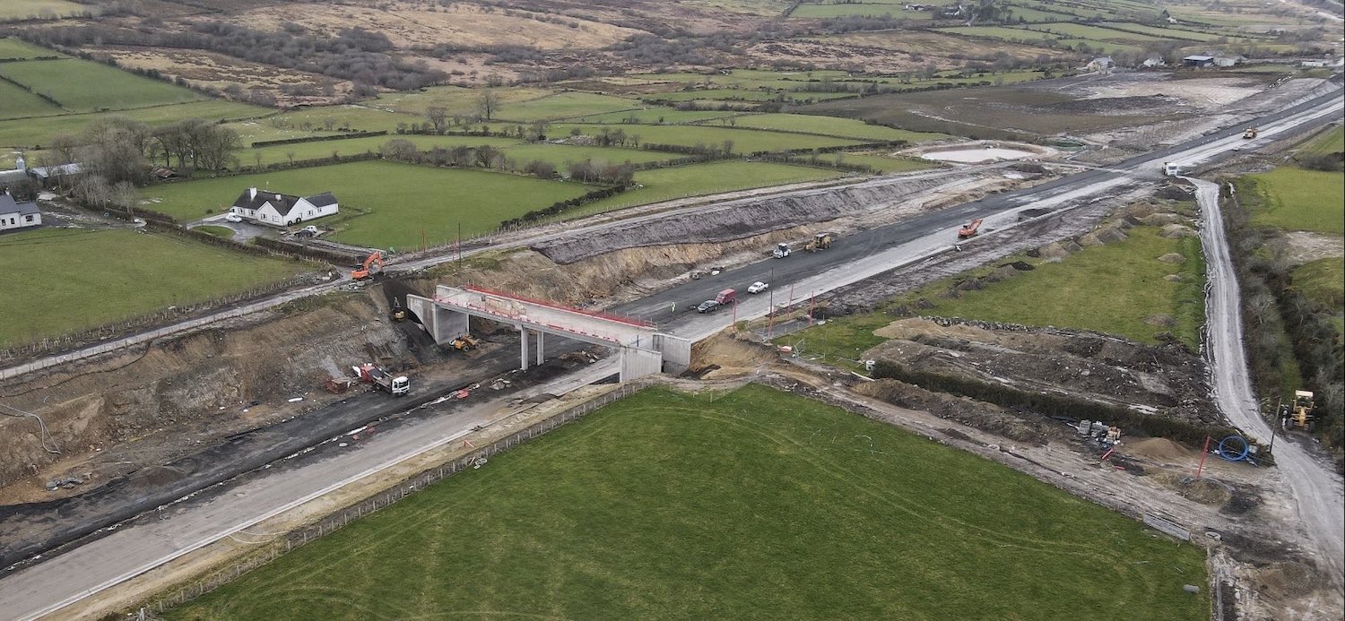
Pic 11: An accommodation bridge (which exist to
preserve access to private property) just east
of Ballyhanedin Road with its bridge deck under
construction on 12 Mar 2021. Note the hollow
abutments, which will be filled in in due
course. The road itself here is more advanced,
with base courses of gravel in place.
[Benbradagh]
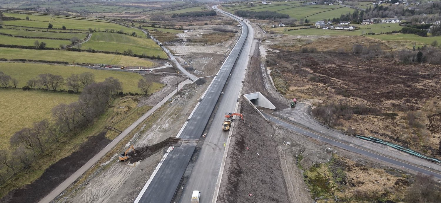
Pic 12: The new dual-carriageway is very
advanced here, at Altagarron Road on 12 Mar
2021. Both carriageways have (at least) base
courses of asphalt laid and drainage in place.
Still needed are the crash barriers, final
wearing courses of asphalt and signage.
[Benbradagh]
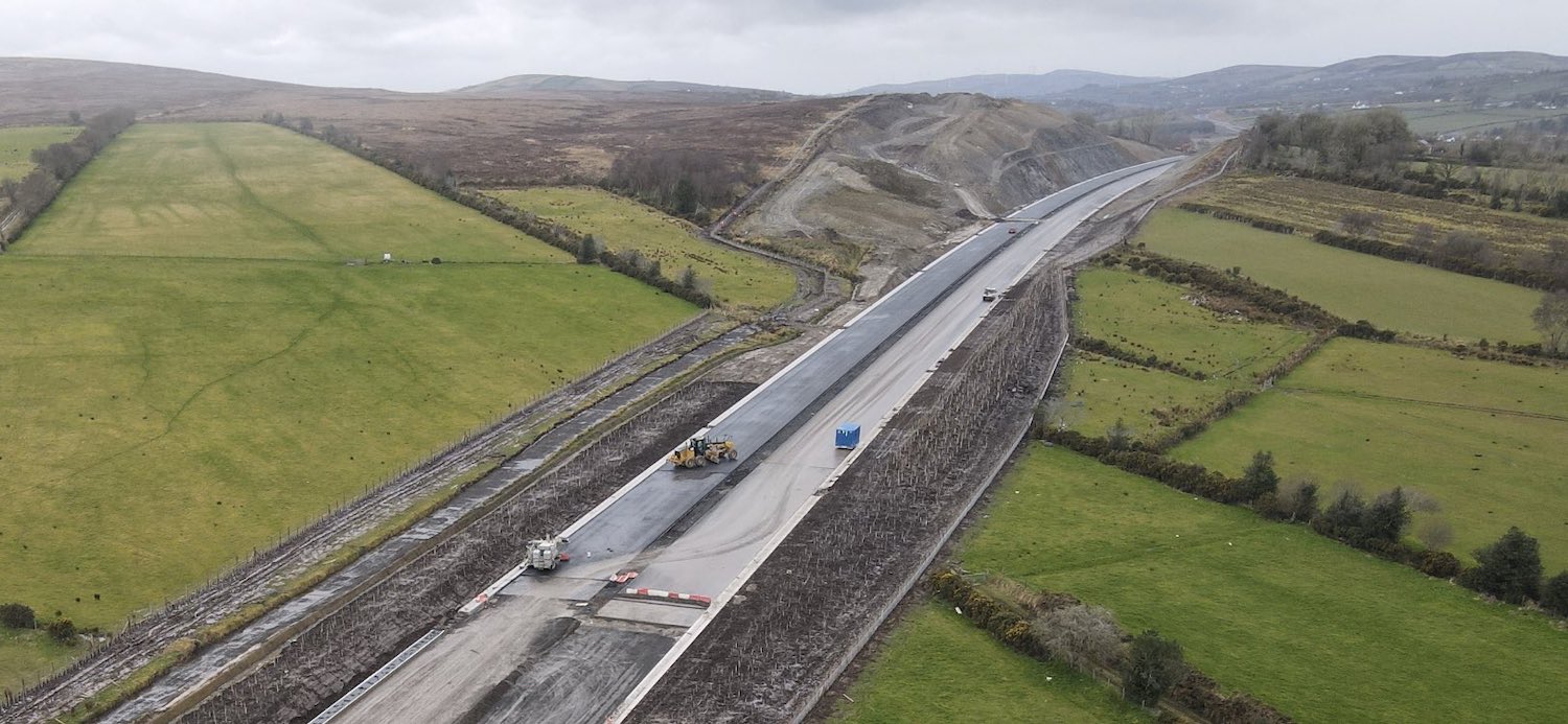
Pic 13: View west through the huge Ovil Hill
cutting on 12 Mar 2021. Again, surfacing has
recently been installed here. The number of
stretches of road that are close to completion
is increasing all the time. Huge numbers of
trees have been planted in the foreground.
[Benbradagh]
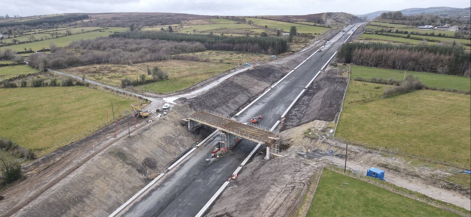
Pic 14: Killunaught Road bridge, not far from
Dernaflaw, got its bridge beams about six weeks
ago and work is now underway on the deck, though
the concrete for the deck has yet to be poured.
New accommodation lanes are being built along
the left side of the new road here, on top of
the banks. Once again, a lot of progress is
evident on the surface of the new road itself.
12 Mar 2021 [Benbradagh]
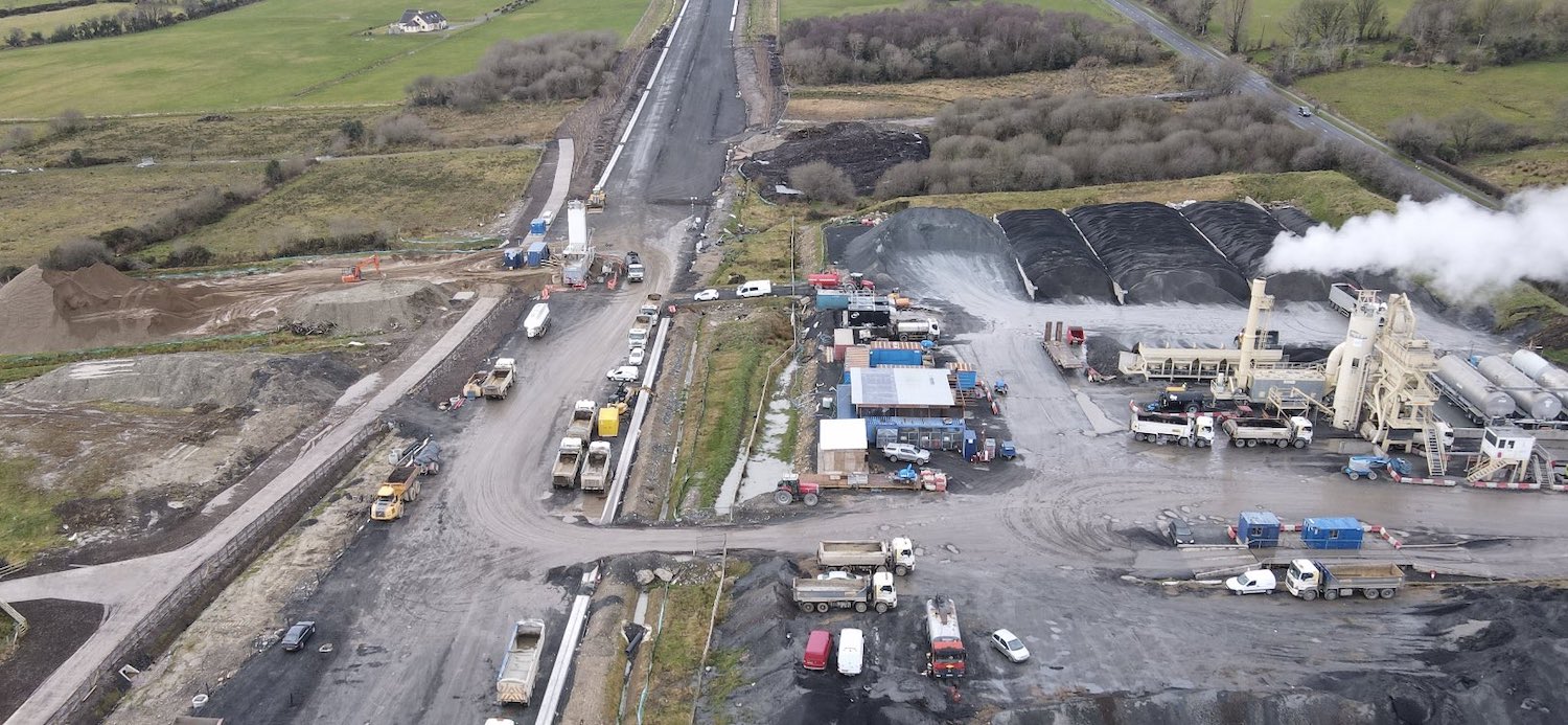
Pic 15: Closeup of the asphalt batching plant -
basically, a tarmac factory - near Derrychrier
Road on 12 Mar 2021. Though this noisy and
smelly facility will definitely not be missed by
local residents when it is gone, it is currently
doing a huge amount of work manufacturing
asphalt surfacing for the new road. Various
grades of stone can be seen stored beside it.
[Benbradagh]
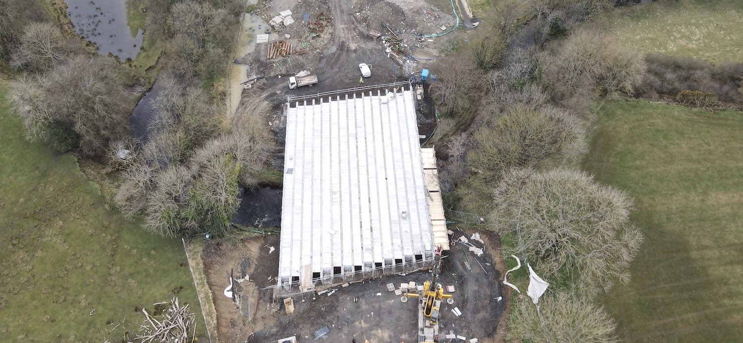
Pic 16: The Owenbeg river bridge near Dernaflaw
finally got its bridge beams (all eight of them)
earlier in March. In this shot, the shuttering
between the beams is in place but work on the
deck itself has yet to take place. 12 Mar 2021
[Benbradagh]
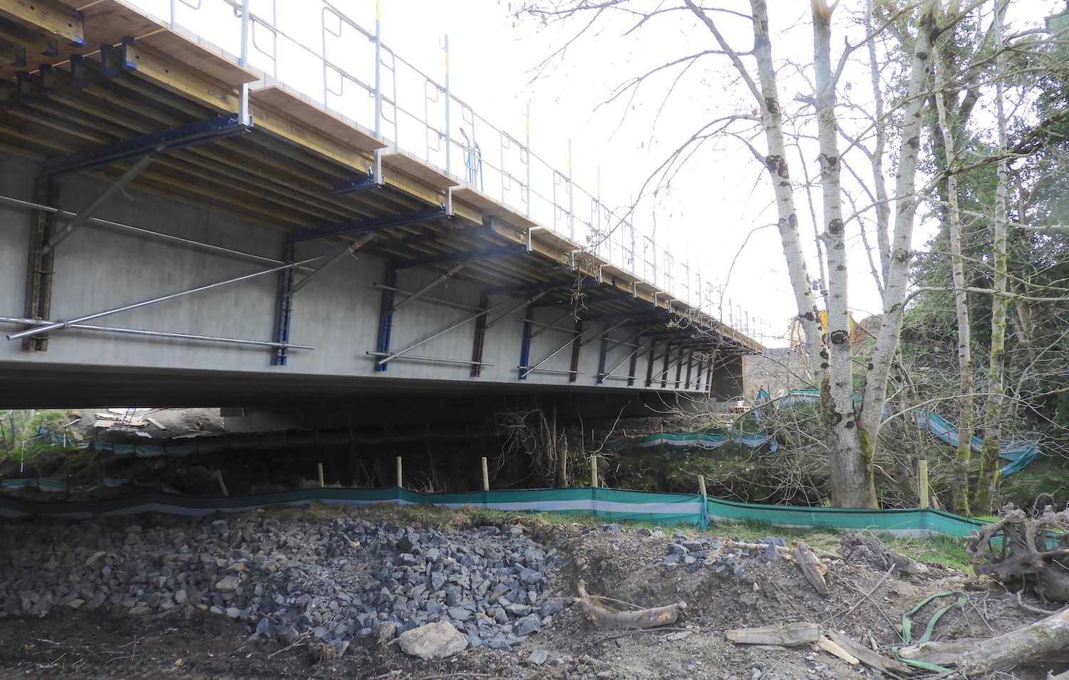
Pic 17: Ground-level view of Owenbeg River
bridge on 21 March 2021, about ten days after
the previous shot, showing the falsework bolted
onto the sides of one beam to allow workers to
access it. This shot shows how little space
there is below this bridge compared to, say, the
River Roe bridge at Dungiven. [Esther Harper]
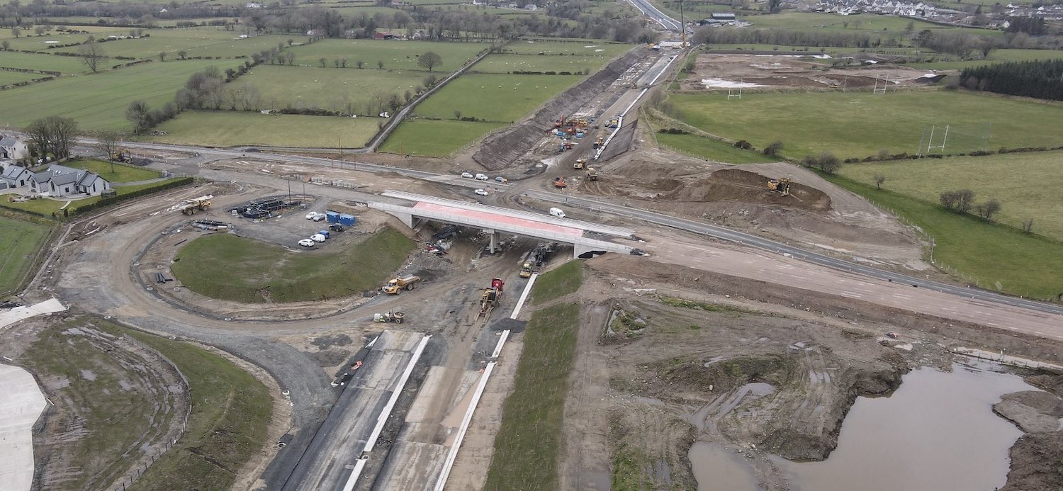
Pic 18: The site of Feeny Road junction looking
west on 12 Mar 2021. The bridge is completed but
the road has not yet been rebuilt over it. The
pink material is a waterproofing layer on the
bridge deck. The west-facing sliproad loop is
really taking shape at the bottom left.
Earthworks on the new road itself are also very
evident. At some point Feeny Road will be
realigned over the new bridge, and then the
temporary road will be removed to complete the
cutting. It was recently announced that a
park-and-ride facility is to be built at this
junction, though not as part of the current
contract. [Benbradagh]
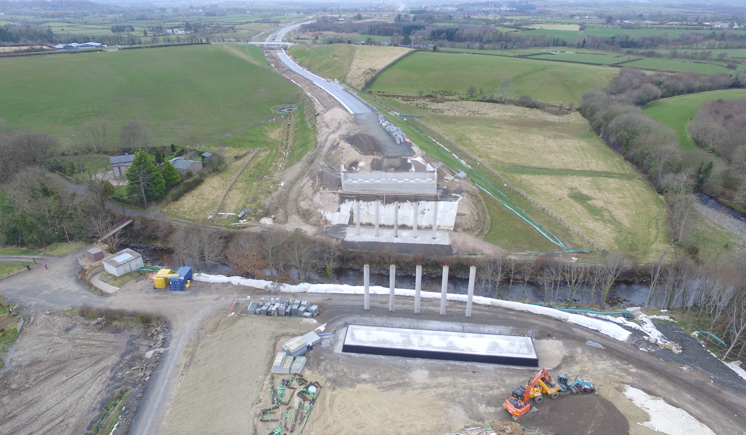
Pic 19: The River Roe bridge, south of Dungiven,
as seen on 9 Mar 2021. This bridge still looks
to be some weeks away from a beam lift, which
will be quite a sight when it is underway given
the height of the bridge deck. One carriageway
of the future dual-carriagway is well advanced
ahead. Benbradagh recently shared an aerial
movie of this bridge, taken a few days
later than this picture. [Les Ross]
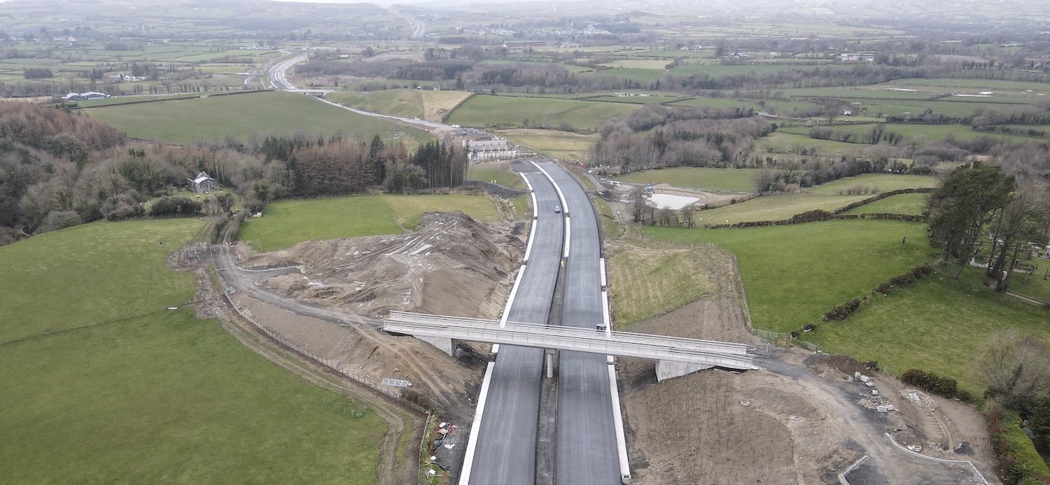
Pic 20: View looking west of Priory Lane bridge,
Dungiven, which is completed though not yet open
to the public. Earthworks still seem to be
outstanding on the left here. The new
dual-carriageway here is very advanced with
asphalt in place. It is likely that the crane
will need to come down this stretch to reach the
River Roe bridge (in the middle distance) when
the time comes for the beam lift. 12 Mar 2021.
[Benbradagh]
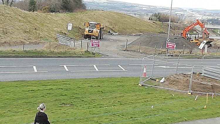
Pic 21: Work began here, on the current A6
Chapel Road at the eastern side of Dungiven, on
Monday this week, 22 March 2021. This is the
view the day before. This is the site of a
future roundabout which will be known as
Magherabuoy Roundabout, and marks the terminus
of the new dual-carriageway. The works are
schedueld to last about eight months, so we
should see work completed around the end of
November. [Paul McCloskey] 26 Feb 2021: There is now only a little
more than a year to go on this three-and-a-half
year scheme and progress continues well, and the
better weather of the approaching spring will
help this. The contractor posted an update on
their web site here
two weeks ago (though as I write this the site
is down for maintenance) which I won't reproduce
here, but I will note some significant points
before moving on to some photos:
- Work at Liberty Glen bridge, near the
Belfray Inn, is ongoing. The base for the
southern/eastern abutment is complete, with
work now focused on the northern/western
abutment.
- The Oaks accommodation bridge, which got its
bridge beams in December, has now had its
diaphragms completed (the structure that holds
the beams together) and work on the deck
itself is due to happen next.
- At Burntollet, it is now quite hard to see
the old 1950s bridge, but it appears to still
be in place. It will need demolished before
long. Meanwhile, work is underway on the
piling platforms that will eventually form the
abutments for the second half of the new
bridge.
- At the nearby Ardmore Road bridge, the
abutments are almost complete and the beams
will be lifted into place in March. Some of
these are already sitting on the site.
- At the Claudy junction, work on the new
bridge is almost complete. A6 traffic had been
due to be diverted onto the new bridge today,
but this has been deferred by at least a week
so that the contractor can complete some
outstanding work on the bridge. After this,
the existing A6 will be removed in order to
excavate the cutting needed to get the
northern part of Baranailt Road down under the
new bridge. There are a number of photos of
this junction below.
- At Gortilea Road, the contractor has
indicated that the embankment to carry
Gortilea Road on the south side will be
constructed soon. The bridge has sat completed
for some months now with nothing much
happening.
- Ballyhanedin Road overbridge also got its
bridge beams, in early January, a fact which I
missed at the time.
- At Killunaught Road overbridge, the beams
were placed about ten days ago and work is now
underway on the deck.
- At the Owenbeg River bridge, west of
Dungiven, the west abutment is being completed
and the beams will be placed in March. There
was an incident
this week when a beam on its way to the
A6 scheme, possibly for this bridge, was
struck by a motorist who appears to have tried
to drive under it as it negotiated Sprucefield
roundabout!
- Although both the Feeny Road and Magheramore
Road bridges near Dungiven are structurally
complete, a lot of work still has to be done
before they can be opened to traffic, namely
the construction of the footpaths over the
bridges and then the reconstruction of the
approach roads on either side and over the
bridges themselves. So we may not see this
happen for a few weeks yet. It was also
announced this week that a park-and-ride
facility is to be built for Dungiven at Feeny
Road, as a separate project from this one.
- At the River Roe bridge, south of Dungiven
(the least-advanced river bridge) the piling
work for the abutments has been completed, and
work on the eastern abutment is now to get
underway.
- At the terminus of the scheme in Dungiven,
work on Magherabuoy roundabout seems to have
gotten underway over the past month, though as
yet this has had no impact on traffic on the
existing A6.
- A new
aerial movie of the Dungiven Bypass
section was uploaded last week by Benbradagh.
It begins near Derrychrier Road (visible at
1:00) and thereafter moves east towards
Dungiven.
And now some images. As usual these are
arranged west to east.
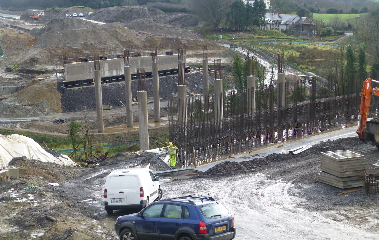 Liberty Glen
bridge near the Belfray Inn looking east on 4
Feb 2021 with work focused on the northern
abutment. Workers can be seen constructing the
steel reinforcement in the foreground, which
will eventually be encased in concrete like the
one on the other side. [Arthur Ming] Liberty Glen
bridge near the Belfray Inn looking east on 4
Feb 2021 with work focused on the northern
abutment. Workers can be seen constructing the
steel reinforcement in the foreground, which
will eventually be encased in concrete like the
one on the other side. [Arthur Ming]
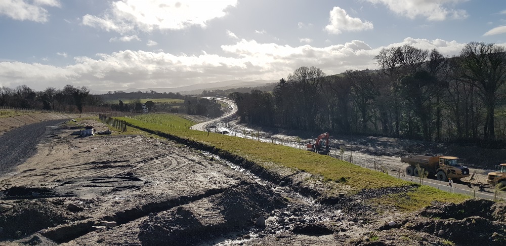
The view west towards Burntollet Bridge (in the
distance) on 21 Feb 2021. Work is underway to
widen the existing A6 on the right, creating an
embankment below the trees. On the left work is
underway on a new accommodation laneway. [Alan
Lynas]
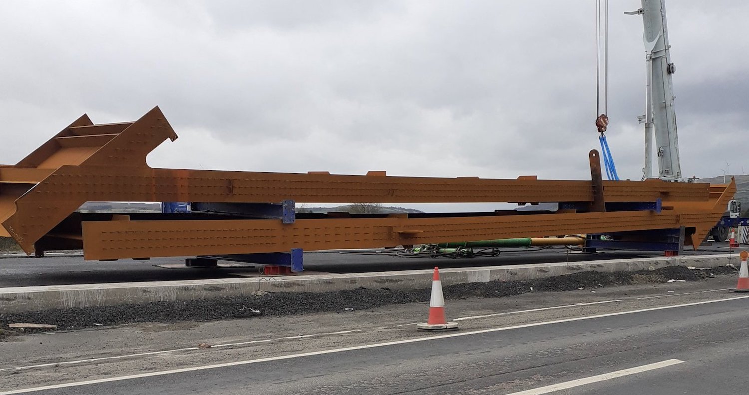
Large steel bridge beams that have appeared near
Gulf Road at the contractor's compound. These
are probably for the the second half of the new
Burntollet bridge, though I haven't confirmed
that. They're being stored here as there is
currently nowhere closer to store them. 21 Feb
2021 [Paul McCloskey]
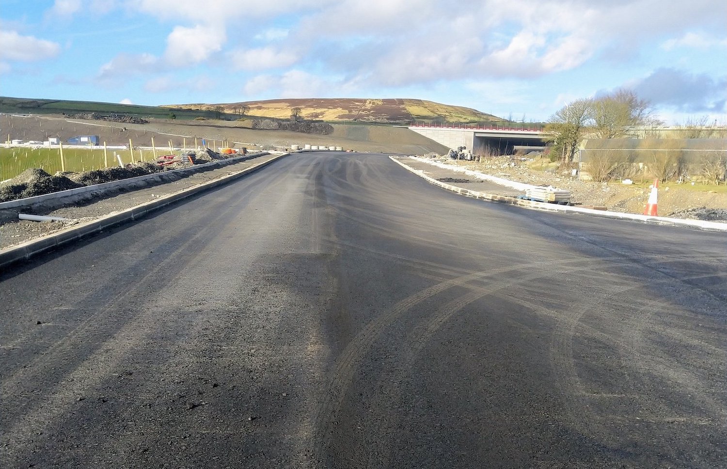
At Claudy junction, this is the "new" Baranailt
Road looking north with Claudy behind the camera
and the new bridge ahead. This road is not yet
open to traffic, but the road to the right in
the foreground leads to the current Baranailt
Road. This road may come into use when the A6 is
diverted over the new bridge in early March. In
the distance you can see the west-facing
sliproads heading up the hill to the left from
the circular pipe segments. To the left of
camera, not really visible, work is underway on
a new park-and-ride facility. 21 Feb 2021.
[Martin Lynch]
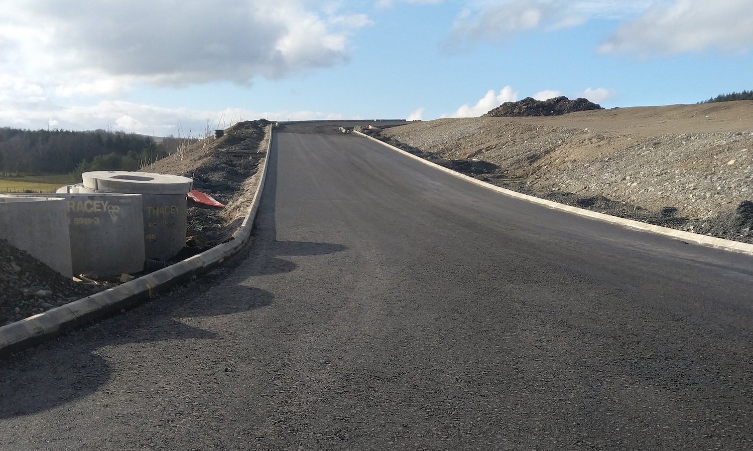
Looking up what will be the westbound sliproads
to/from the A6 at Claudy on 21 Feb 2021. [Martin
Lynch]
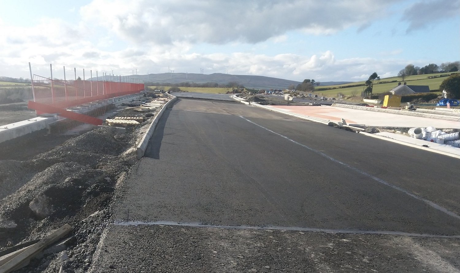
View west across the Claudy bridge on 21 Feb
2021. This will eventually carry the entire
dual-carriageway, but from early March the
section visible here will come into use to carry
all A6 traffic on the future westbound
carriageway. [Martin Lynch]
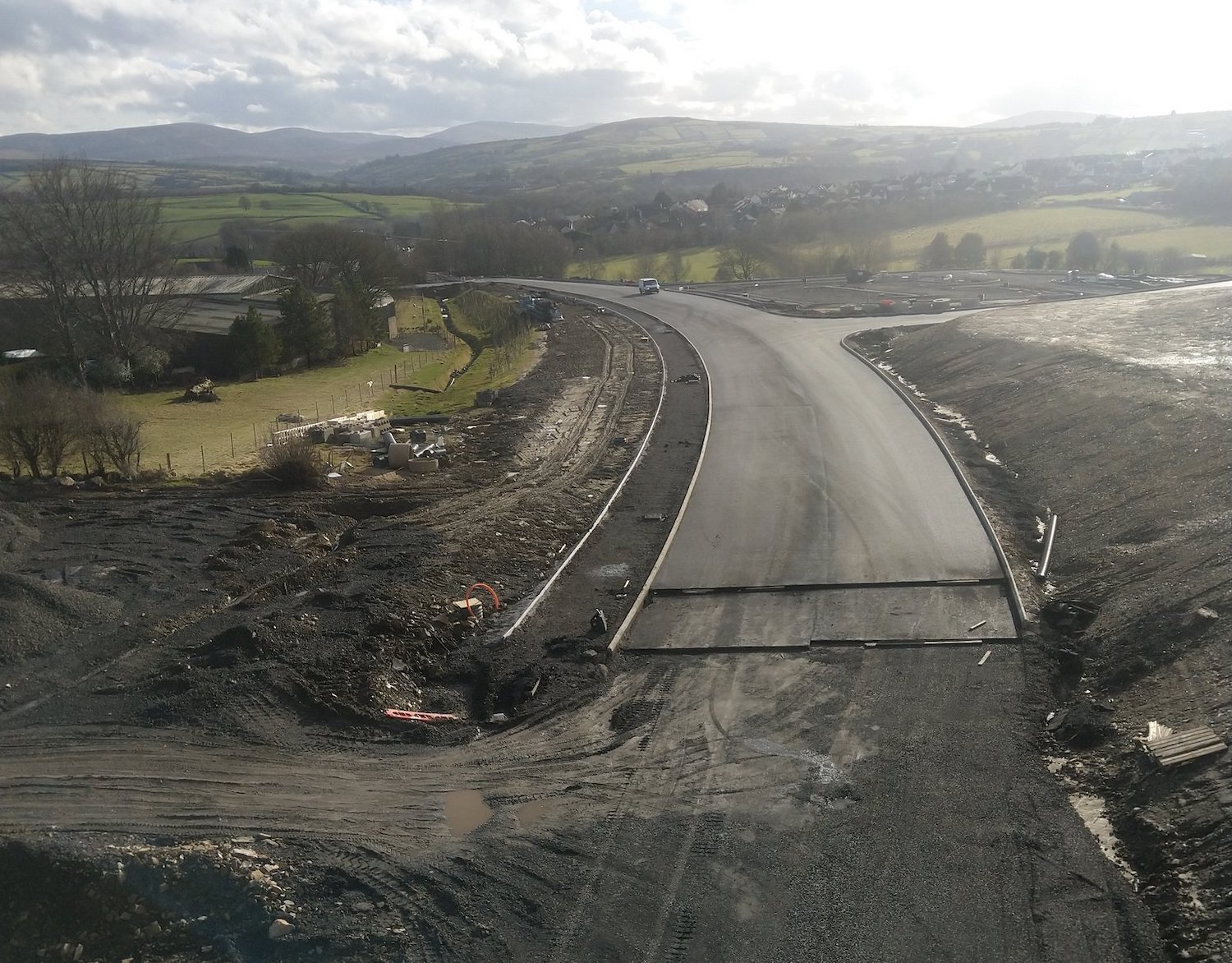
View south from the Claudy bridge on 21 Feb
2021. This is the "new" Baranailt Road looking
towards Claudy, with the new park-and-ride
visible on the right middle distance. The road
hasn't been completed closer than shown here
because the underpass currently ends at an
earthen cliff – the existing A6 must be closed
before this can be excavated. In this shot you
can clearly see the layers of road construction
- gravel base course, asphalt binder course and
the asphalt wearing course on top. [Martin
Lynch]
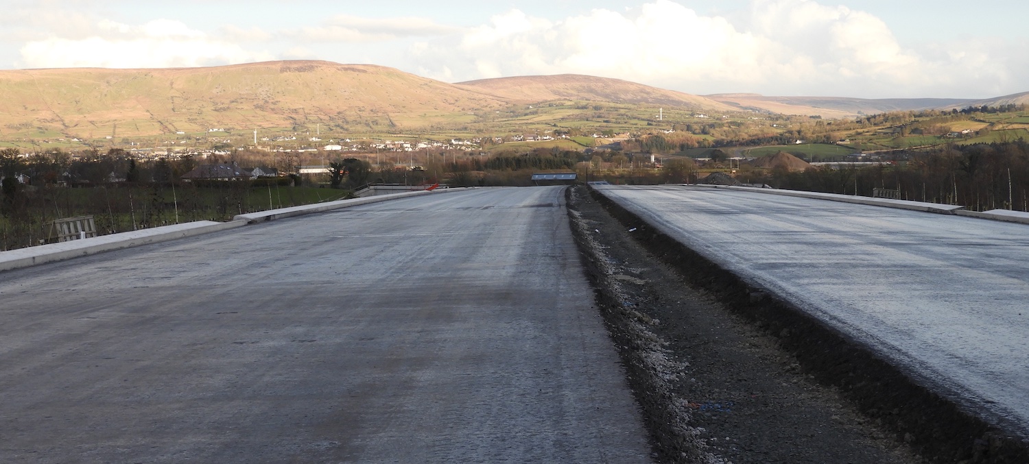
Section of the new dual-carriageway near
Derrychrier Road on 21 Feb 2021 with the binder
course of asphalt laid, but otherwise not much
happening. The gap in the foreground is for the
future central barrier, while drainage channels
can be seen on either side. This shot shows how
wide the new road is. [Esther Harper]
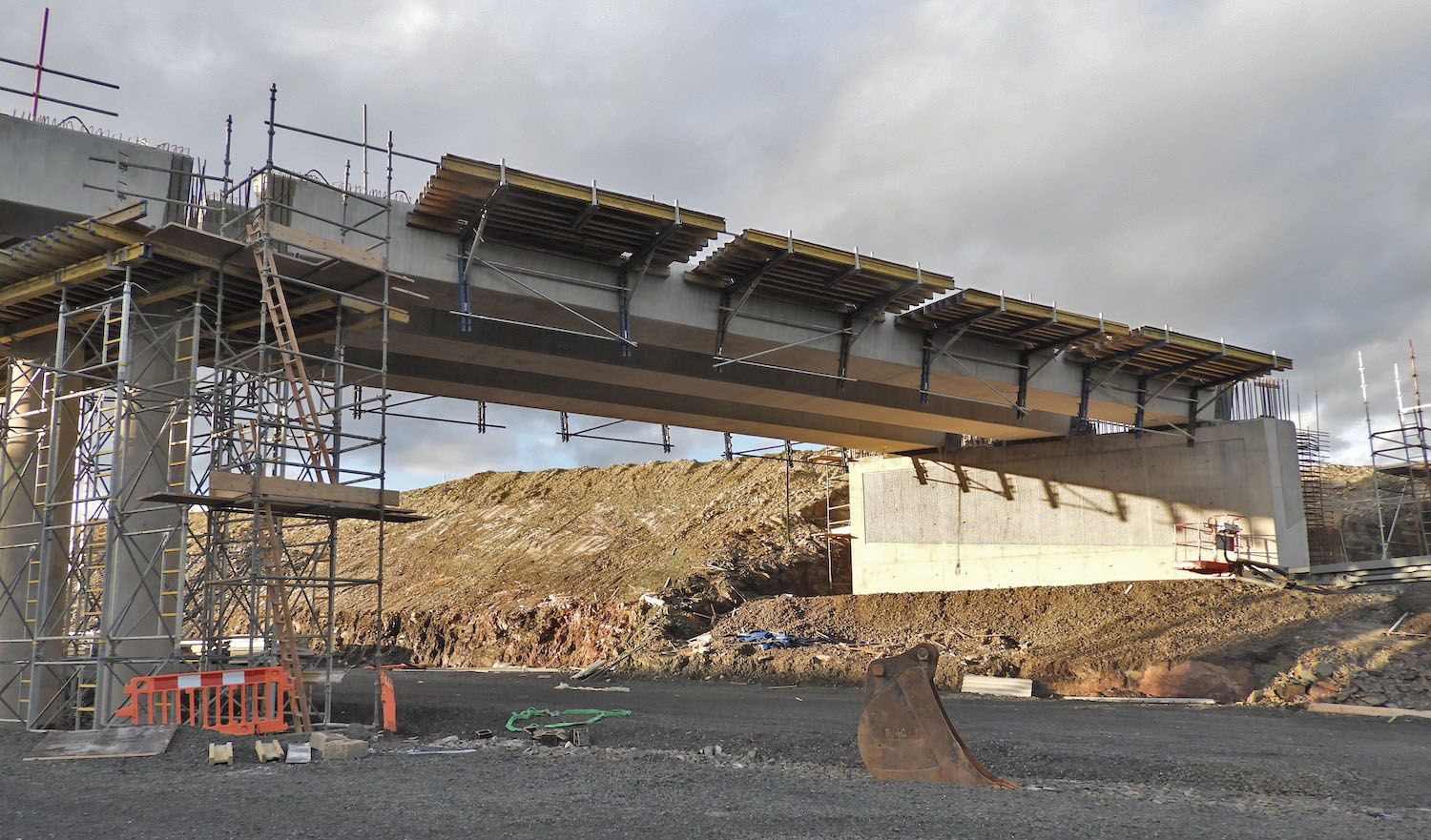
Killunaught Road bridge with its six concrete
beams in place on 21 Feb 2021. [Esther Harper]
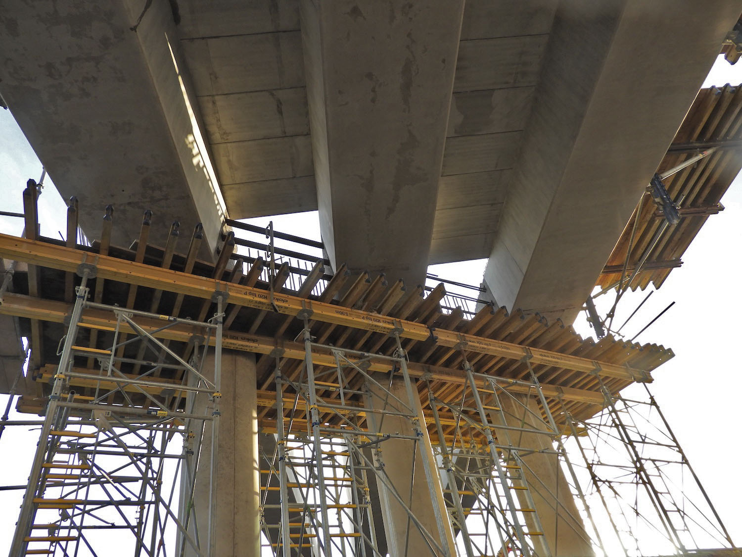
View of the central pillars of the Killunaught
Road bridge on 21 Feb 2021. Work is underway
here to build the diaphragm above the central
pillars, while formwork has been placed between
the beams to allow construction of the deck
above. [Esther Harper]
Work underway on the terminal roundabout of the
scheme at Magherabuoy, Dungiven on 21 Feb 2021
[Paul McCloskey] 1 Feb 2021: There are quite a few photos
in this update, and one aerial movie, with
thanks to Arthur Ming, Sean Wilson, Esther
Harper and Benbragagh. Firstly, I'll link to a great
movie of the Dungiven Bypass portion of
the scheme by Benbradagh, dating to 16 January.
I've written a brief commentary below. The times
refer to minutes and seconds in the video. After
that, there are a series of photos.
- 0:00 Starting at the site of the future
Magherabuoy roundabout, on the east side of
Dungiven and then heading west.
- 0:19 Priory Lane bridge, with the approach
roads on either side now under construction.
- 0:30 Completed flood attenuation pond
visible on the right.
- 0:40 River Roe bridge still under
construction - with the abutments and pillars
for the three spans well advanced.
- 1:20 Magheramore Road bridge, still not
open, with the Owenrigh river bridge
immediately beyond. From here there is a long
stretch with blacktop laid and drainage
channels (visible in light grey) in place.
- 2:22 Feeny Road grade-separated junction
taking shape, with the bridge completed and
the loop for the westbound on/offslip visible
on the left. No work has yet taken place on
the eastbound on/offslip (upper right corner)
as the temporary route of Feeny Road currently
blocks the site, which seems to be in use
right now as a spoil heap.
- 2:36 Kink in kerb line on right reveals the
site of the future eastbound offslip.
- 3:05 Site of the Owenbeg river bridge, the
least-advanced structure on the Dungiven
Bypass. Some initial work has taken place on
the abutments, but the temporary bailey bridge
is still in place and little else evident.
- 3:25 Further area of subsurface now in place
with another permanent flood attenuation pond
on the left.
- 4:15 Crossing Derrychrier Road, with the
underpass completed and in use. Long
agricultural accommodation laneway to the left
of the new road.
- 4:35 Site of future westbound layby, just
apparent in the shape of the road base. The
large batching plant on the right is a
temporary structure that is making tarmac,
though the noise and smell is apparently
causing quite a nuisance to local residents.
- 5:15 On this stretch significant earthworks
still seem to be underway. Also evident are
hundreds of newly-planted trees on either side
of the new road.
- 5:35 Killunaught Road bridge under
construction, with the central pillars in
place and work on the abutments underway.
- 5:48 Camera stops, and returns to Dungiven
along the same route.
The following photos are, as
usual, arranged in order from west to east
starting at the Derry end. There is a particular
focus this time on the complex works taking
place around Burntollet.
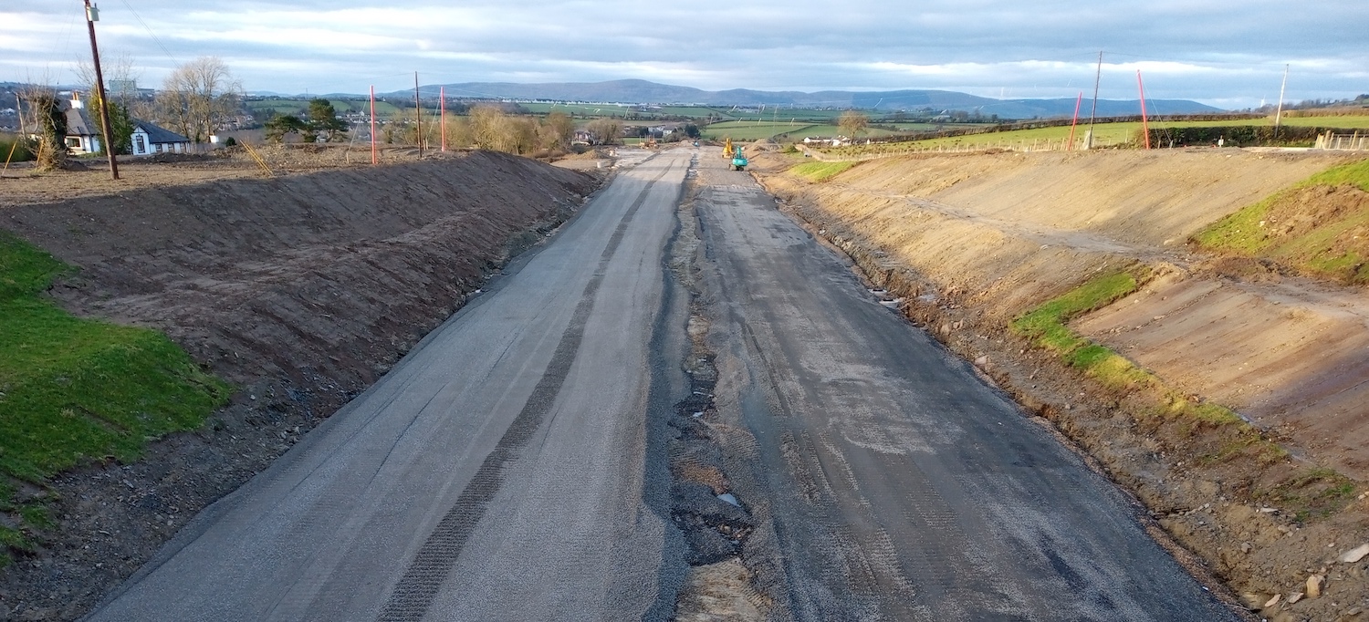
Pic 1: View west from McCay's accommodation
bridge at Drumahoe, about 1km east of the
scheme's starting point at the new Lismacarol
Roundabout, Drumahoe. The gravel foundations of
the two carriageways are in place here, while
the cutting ahead has just been excavated
following the closure of a laneway that has now
been re-routed across this accommodation bridge.
30 Jan 2021 [Sean Wilson]
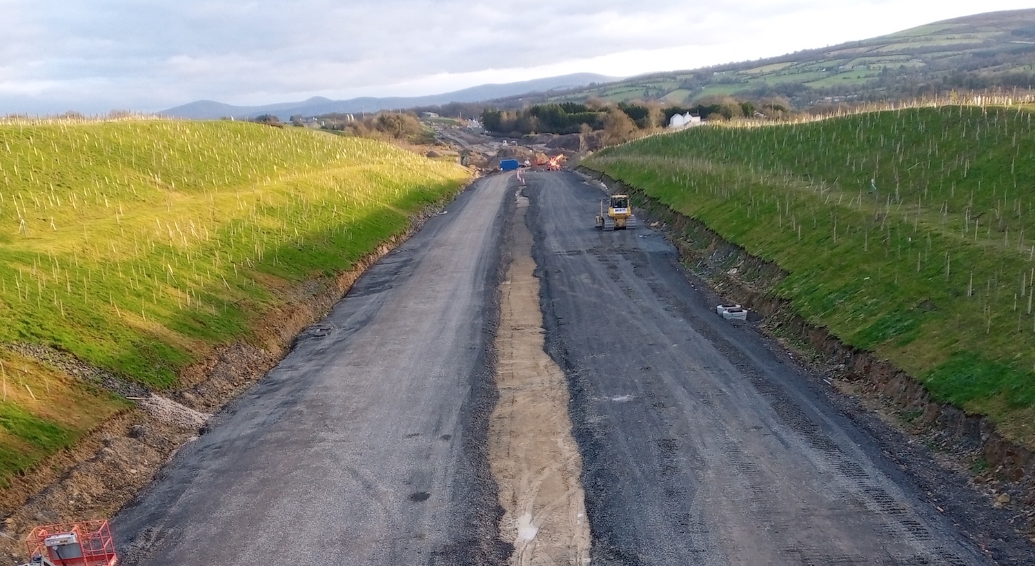
Pic 2: View east from McCay's accommodation
bridge on 30 Jan 2021, with the site of Liberty
Glen bridge - the longest bridge on the scheme -
visible as the dip beyond the orange machinery
in the distance. Again, both carriageways here
are having their gravel foundations laid and
graded. There has also been a lot of work
planting hundreds of trees on the banks. In ten
years' time passing through this cutting will be
like driving through woodland. [Sean Wilson]
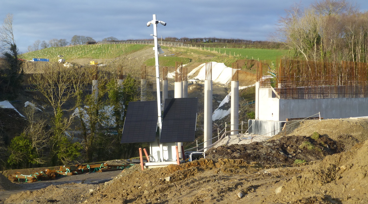
Pic 3: View of the work underway on Liberty Glen
bridge, near the Belfray Inn, on 30 Jan 2021.
The eastern abutment appears close to
completion, as are the two sets of intermediate
piers. The western abutment is less advanced.
We're still a bit away from being ready for a
beam lift here I think. In the upper left is the
same cutting seen in pic 2. [Arthur Ming]
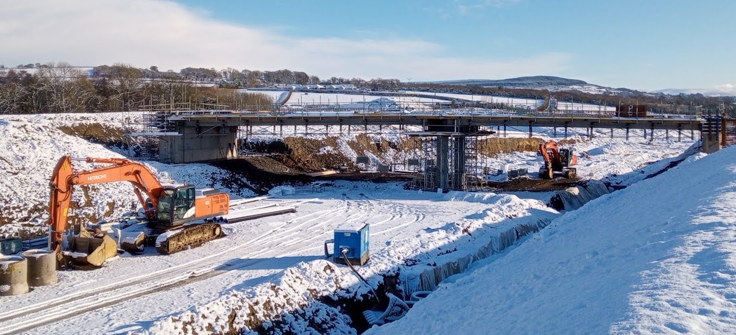
Pic 4: View of The Oaks accommodation bridge,
near Burntollet, in the snow on 23 Jan 2021. In
my update on 8 December I said that the beams
had been lifted on Ardmore Road bridge. This was
incorrect, it was actually this bridge that had
its beams added, apologies. Believe it or not,
the site in the foreground was the existing A6
until traffic was diverted onto a temporary road
just a matter of weeks ago. [Sean Wilson]
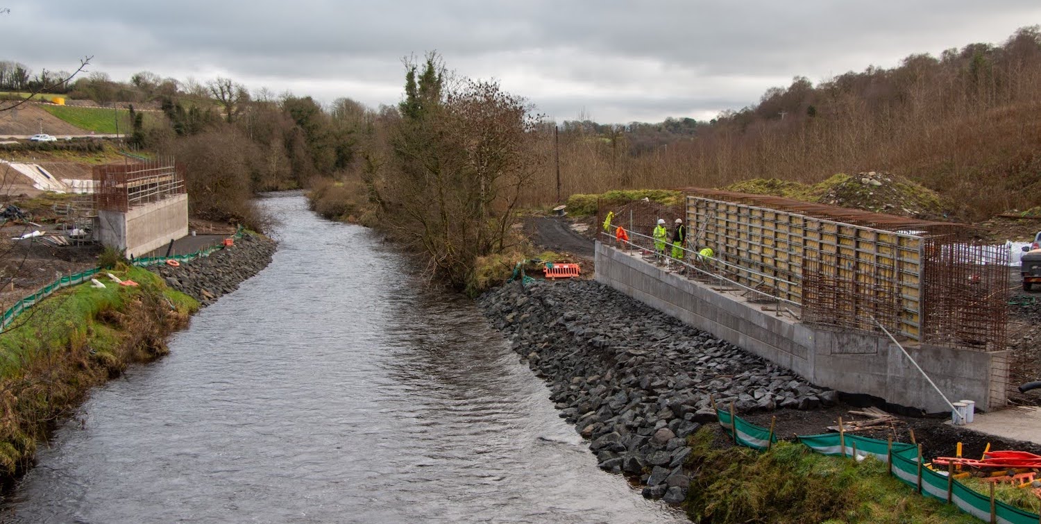
Pic 5: View of the site of Ardmore Road bridge,
taken from the existing stone Oaks Bridge (which
will remain in situ) on 29 Jan 2021. Work on
both abutments is progressing well and should be
ready for a beam lift before too long. This
bridge is at a high skew (around 60°) over the
River Faughan and is required due to the need to
reconstruct both the vertical and horizontal
alignment of Ardmore Road. [Sean Wilson]
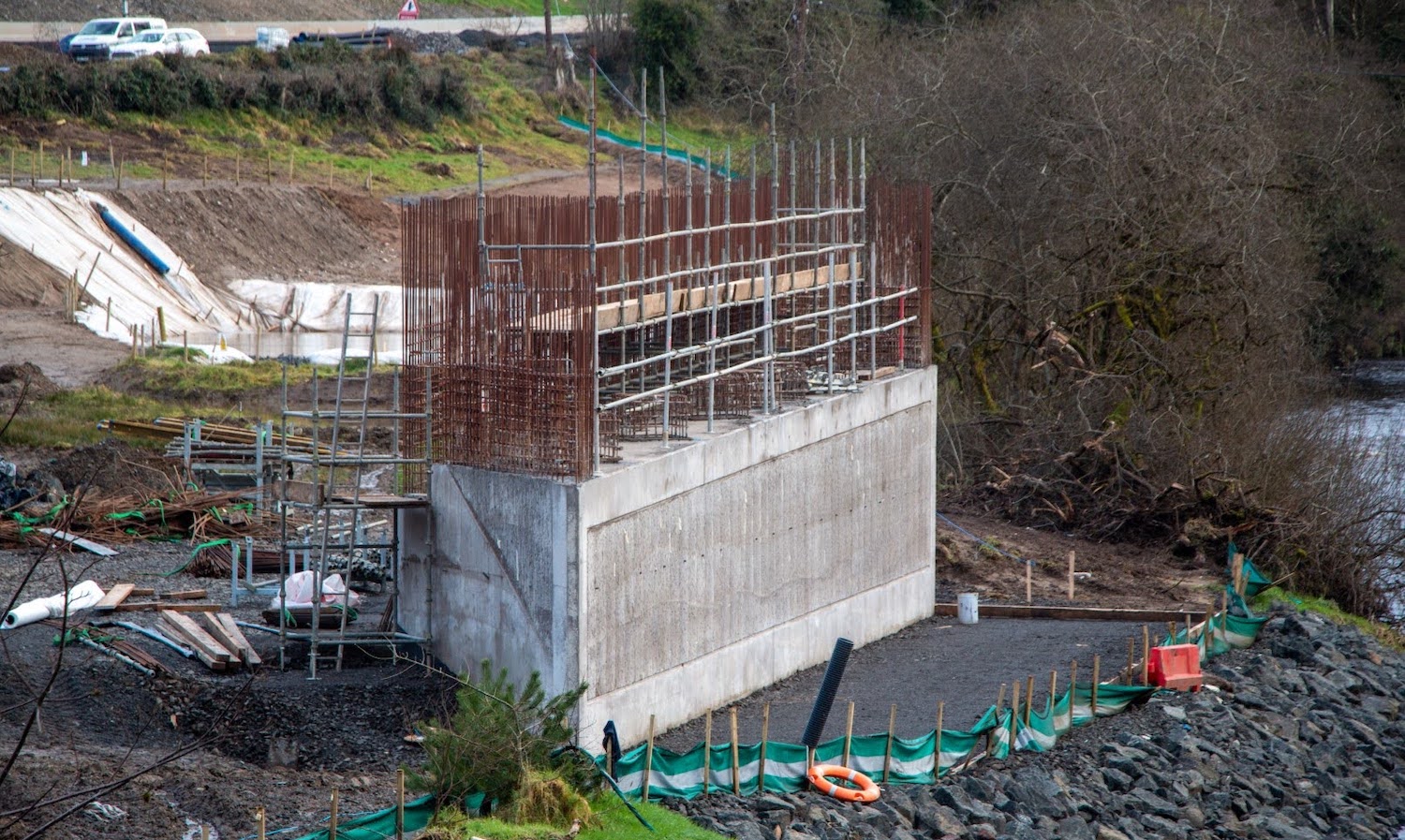
Pic 6: Close-up of the northern abutment of the
Ardmore Road bridge on 29 Jan 2021. The existing
A6 can be seen beyond. [Sean Wilson]
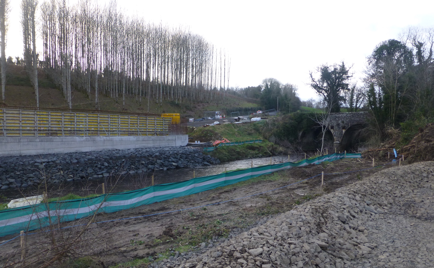
Pic 7: View of the southern abutment of Ardmore
Road bridge (left) and the existing stone Oaks
bridge, as seen from near the northern abutment
on 30 Jan 2021. The green fabric protects the
River Faughan from runoff from the site. [Arthur
Ming]
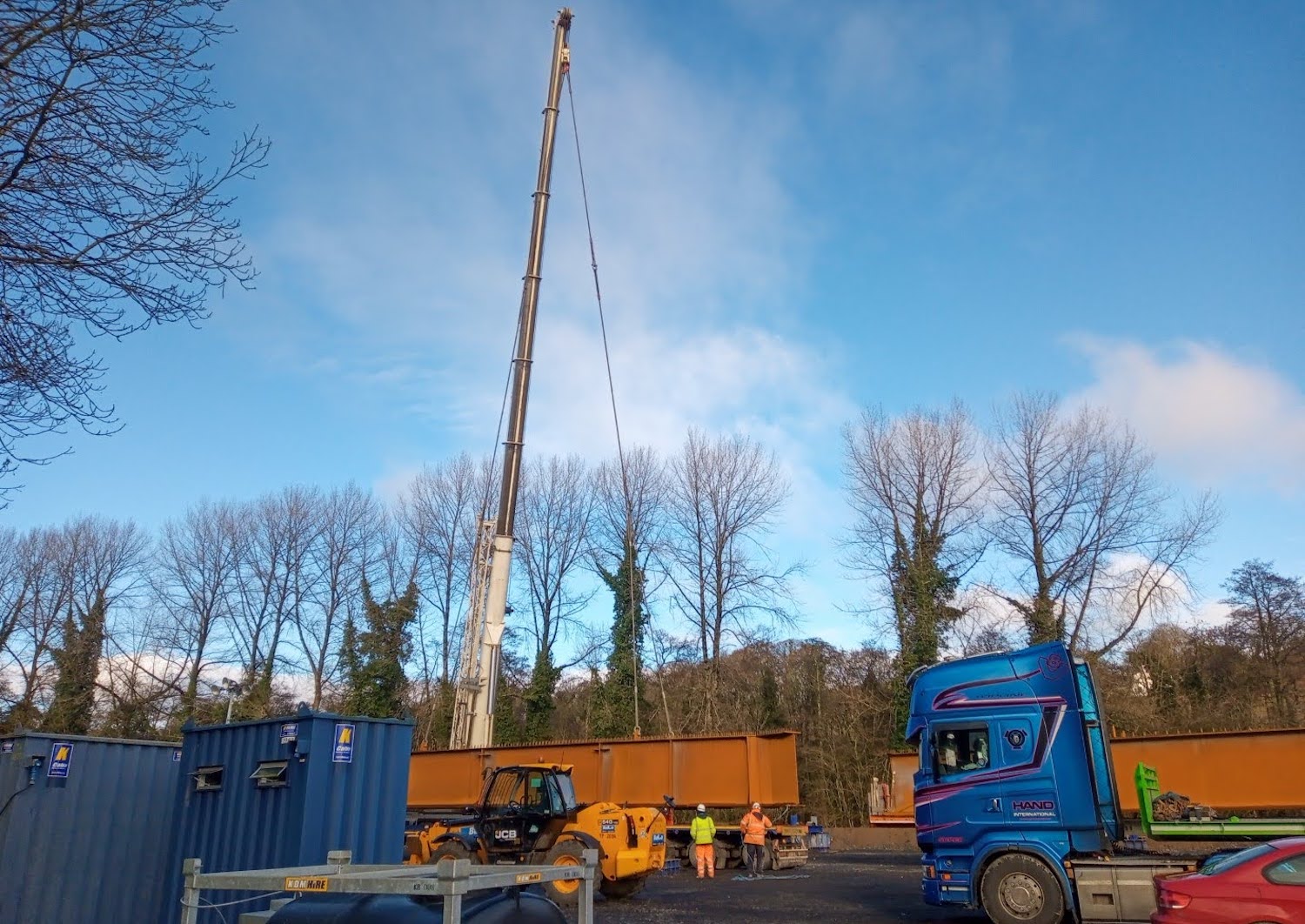
Pic 8: The first beams for the Ardmore Road
bridge arriving on site on 20 Jan 2021. They are
located close to the existing stone bridge.
[Sean Wilson]
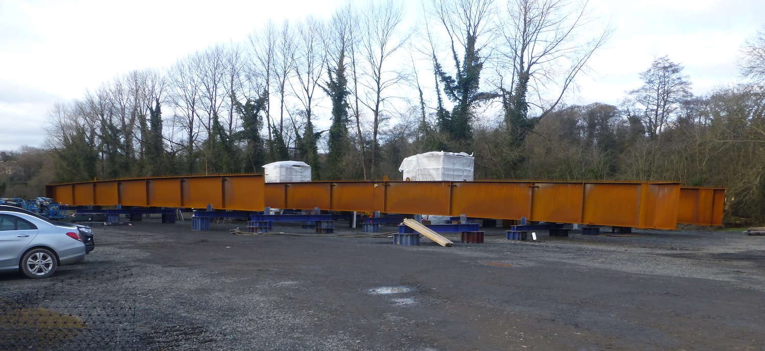
Pic 9: Three steel bridge beams for the Ardmore
Road bridge being stored at the site on 30 Jan
2021. They appear to have a slight curvature to
them. [Arthur Ming]
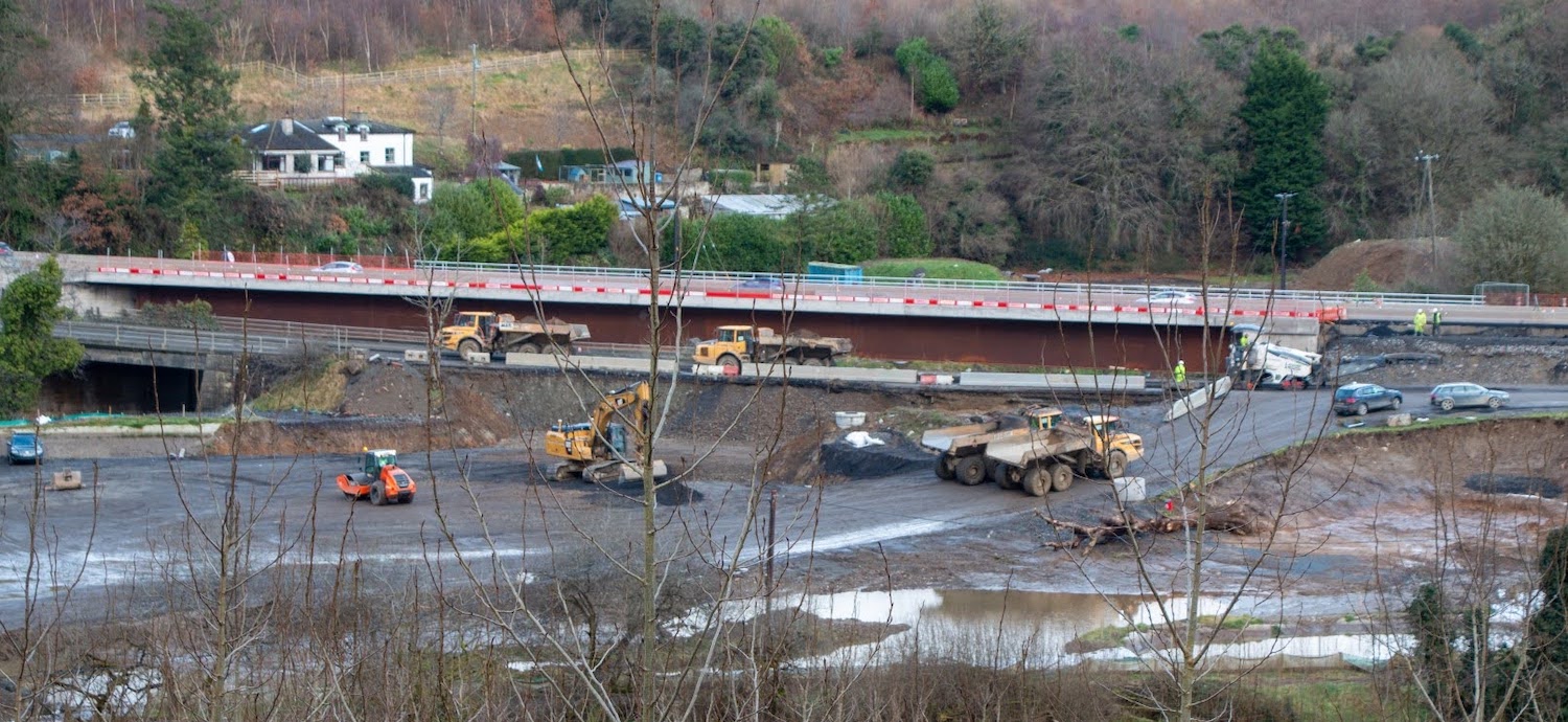
Pic 10: Telephoto shot of Burntollet Bridge as
seen from near Ardmore Road on 29 Jan 2021. The
higher structure, with the red-and-white
barriers, is the northern half of the "new" A6
bridge, now carrying all traffic. The smaller
bridge to the left is the 1950s A6 bridge, now
closed to traffic, and soon to be demolished.
The two cars on the right are parked at the
former junction of the A6 and Ardmore Road. The
entire area visible on the left between Ardmore
Road bridge and Burntollet bridge has been
cleared as a large construction site. When it
comes time to install the beams for the southern
half of the new bridge, probably in mid 2021,
the massive crane will likely be sited roughly
where the orange roller is parked. Eventually
the area will be built up onto an embankment to
allow Ardmore Road to be reconstructed to meet
the new A6 at the same level as the new bridge.
A lot still to happen here. [Sean Wilson]
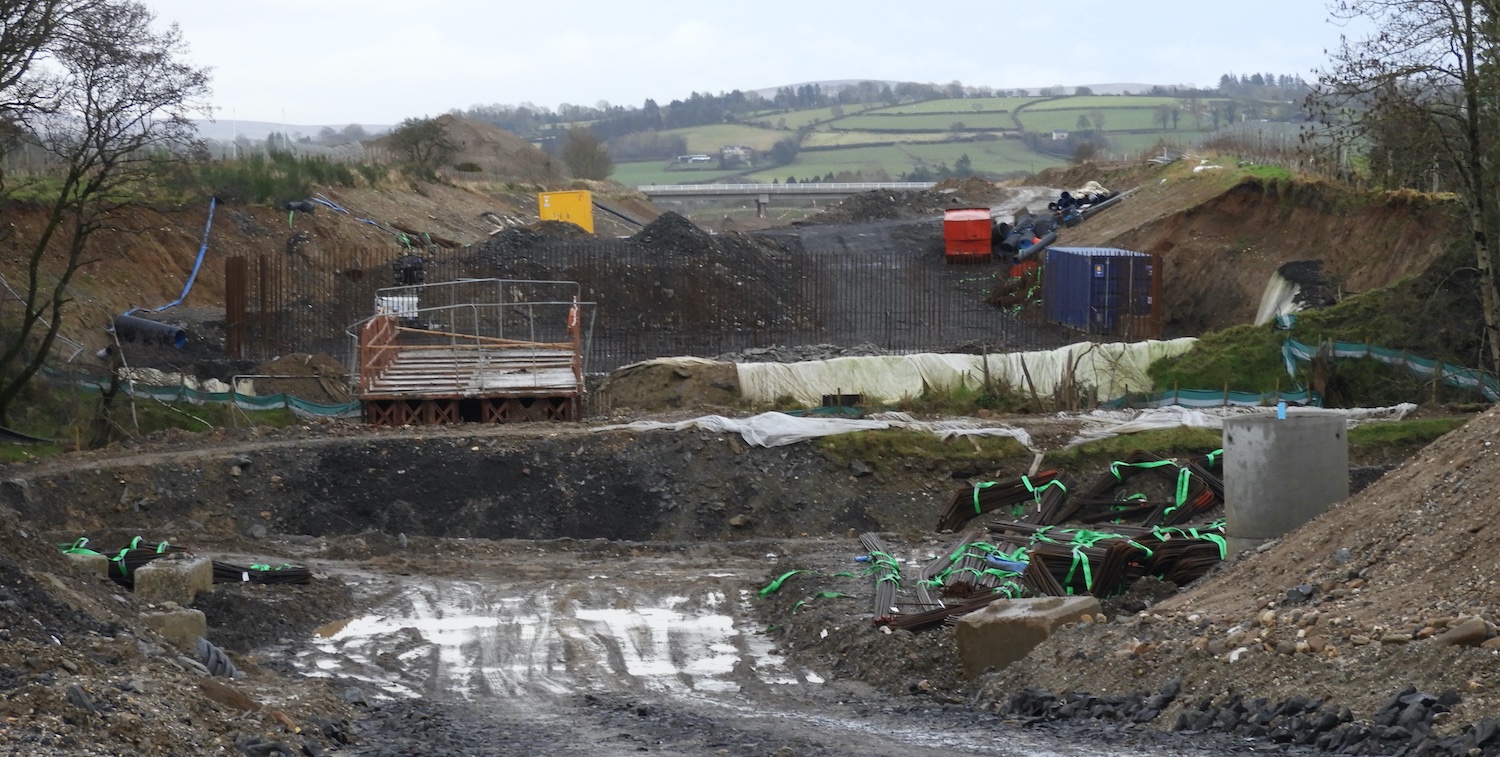
Pic 11: Moving close to Dungiven now, this is
the site of the future Owenbeg river bridge seen
looking east on 17 Jan 2021, with Feeny Road
overbridge visible in the distance. A lot of the
work here is still at the earthwork stage, but
you can now see vertical steel reinforcement
bars on the eastern bank of the river, showing
that work on the abutments has now commenced. A
brown bailey bridge, giving access over the
river for site works, can be seen here too.
[Esther Harper]
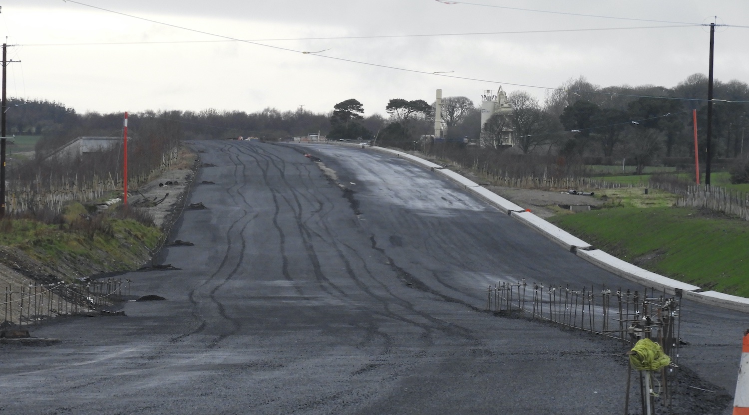
Pic 12: Same location as previous, but looking
west, this shows the base course of tarmac in
place here on 17 Jan 2021. The telephoto makes
the road appear more undulating than it really
is. The white towers in the distance are part of
the batching plant that makes the tarmac.
[Esther Harper]
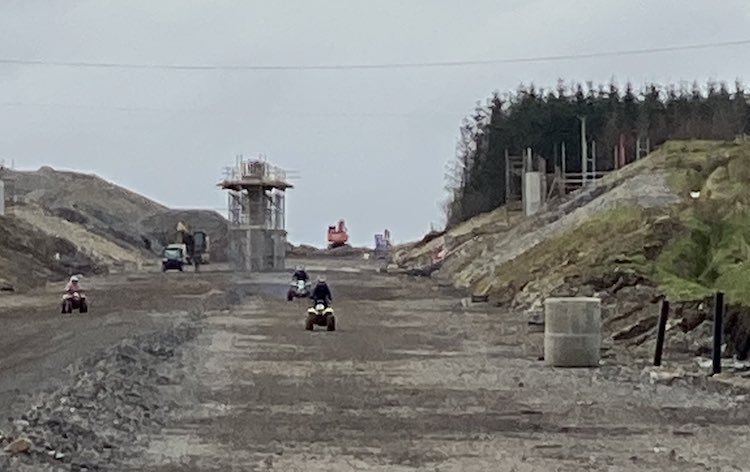
Pic 13: Finally, this shot taken on Sunday 31
Jan shows some people taking advantage of the
quiet weekend site to race quad bikes on the
future dual-carriageway. I would not recommend
using a construction site in this way, as there
can be many hidden dangers. The bridge pier and
abutment visible here are for Killunaught Road
overbridge, between Foreglen and Dernaflaw.
[Esther Harper]
22 Dec 2020: This is a brief update to
report on the significant change at Burntollet,
where traffic was switched onto the northern
half of the new bridge overnight on 18/19
December. Traffic was also switched onto the
future eastbound carriageway from Burntollet all
the way to the future Killaloo junction, a
distance of about 2.5 km. This marks a
significant milestone in this confined part of
the scheme. The next step, as summarised in Pic
1 below, will be to demolish the existing 20th
century (1950s) bridge and then build the
southern half of the new bridge. There are two
photos below showing the new layout, taken by
Alan Lynas. But before we come to the photos, I
need to share links to some superb third party
material:
- Superb
drone footage taken by Sky Photography,
showing the route from Liberty Glen (near the
Belfray) to Burntollet, a few days before the
switch-over happened.
- A series of lovely
aerial photos by Aerial Vision NI of the
stretch of the A6 from Dungiven to Foreglen.
- Footage
taken from a car by Diarmaid
Macfheargail showing Burntollet. The first
part of the video is taken travelling towards
Derry before the switch-over. The second part
of the video is taken travelling towards
Belfast after the switch-over and crossing the
new bridge, and then travelling about 5 km
further east past Killaloo to near Claudy! The
smooth vertical alignment of the new
Burntollet Bridge means it's easy to miss it
in the movie! With thanks to Paul McCloskey
for flagging this video.
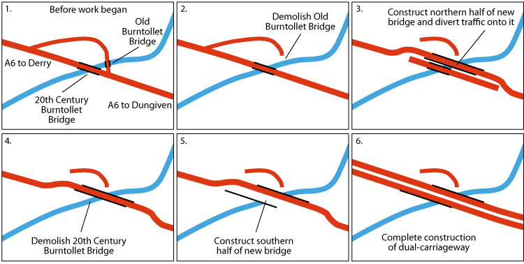
Pic 1: The stages of work at Burntollet Bridge. We
have just completed stage (3). The next phase,
which I would expect to see in January 2021, will
be stage (4), the demolition of the 1950s bridge.
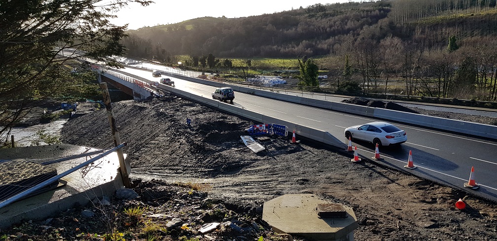
Pic 2: View of the first half of Burntollet Bridge
open and in use on 20 December 2020. This was very
fast work, given that the approach embankments
were barely started six weeks ago. Well done to
the contractor. [Alan Lynas]
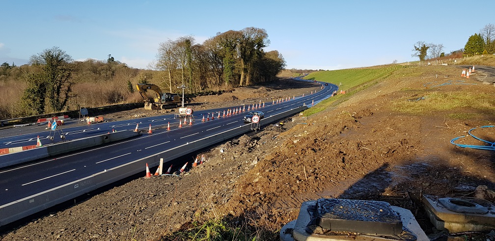
Pic 3: Same location as pic 2, but looking towards
Derry. All traffic is using the future eastbound
carriageway. The old A6 ran where the digger is,
and hugging the trees beyond. This line has now
been excavated and dropped down in height by a
couple of metres in order to give a better
vertical alignment for the future westbound
carriageway. [Alan Lynas]
8 Dec 2020: In this update there is more
material than you can shake a stick at. We have
several aerial videos, so many in fact that I am
not able to provide a commentary on them this
time. After the video links I then include a
series of photographs with captions that detail
a bit more about what is happening. Thank you to
everyone who sends photos; this scheme really
has attracted a huge amount of interest. So
first, the videos:
Four taken on 22 Nov 2020, by the amazing
Benbradagh:
- Movie
1 – from the east side of Dungiven to
Derrychrier Road, west of the town.
- Movie
2 - from the batching plant at
Derrychrier Road, through Ovil Hill cutting,
to near Ballyhanedin Road.
- Movie
3 - from Ballyhanedin Road to just after
Baranailt Road, Claudy.
- Movie
4 - from just west of Baranailt Road,
Claudy, past Burntollet, to the terminus of
the scheme at Drumahoe.
And a more recent movie taken on 6 Dec 2020,
also by Benbradagh:
- Movie
5 - travelling east from Killunaught
Road (near Foreglen, just east of Ovil Hill
cutting) to Chapel Road, Dungiven.
Some particular news that is worth
highlighting:
At Ardmore Road bridge, a side road
near Burntollet, beams have been lifted into
place over the past week. 2 Feb
2021: Actually the beams were lifted into
place at The Oaks accommodation bridge, not
Ardmore Road, apologies.
- Tamnaherin Road, a side road about 2km west
of Burntollet, will be closed to traffic at
the current A6 from 4 January for 4 months, to
allow work to take place on the new bridge for
the future junction there.
- Ballyhanedin Road, on the rural stretch
between Foreglen and Claudy, will also be
closed to traffic at the current A6 from 4
January, for 6-and-a-half months, to allow
work on the new bridge that will carry it over
the new road.
And now on to the photographs. As usual, these
are arranged in order from the Derry end and
moving towards Dungiven.
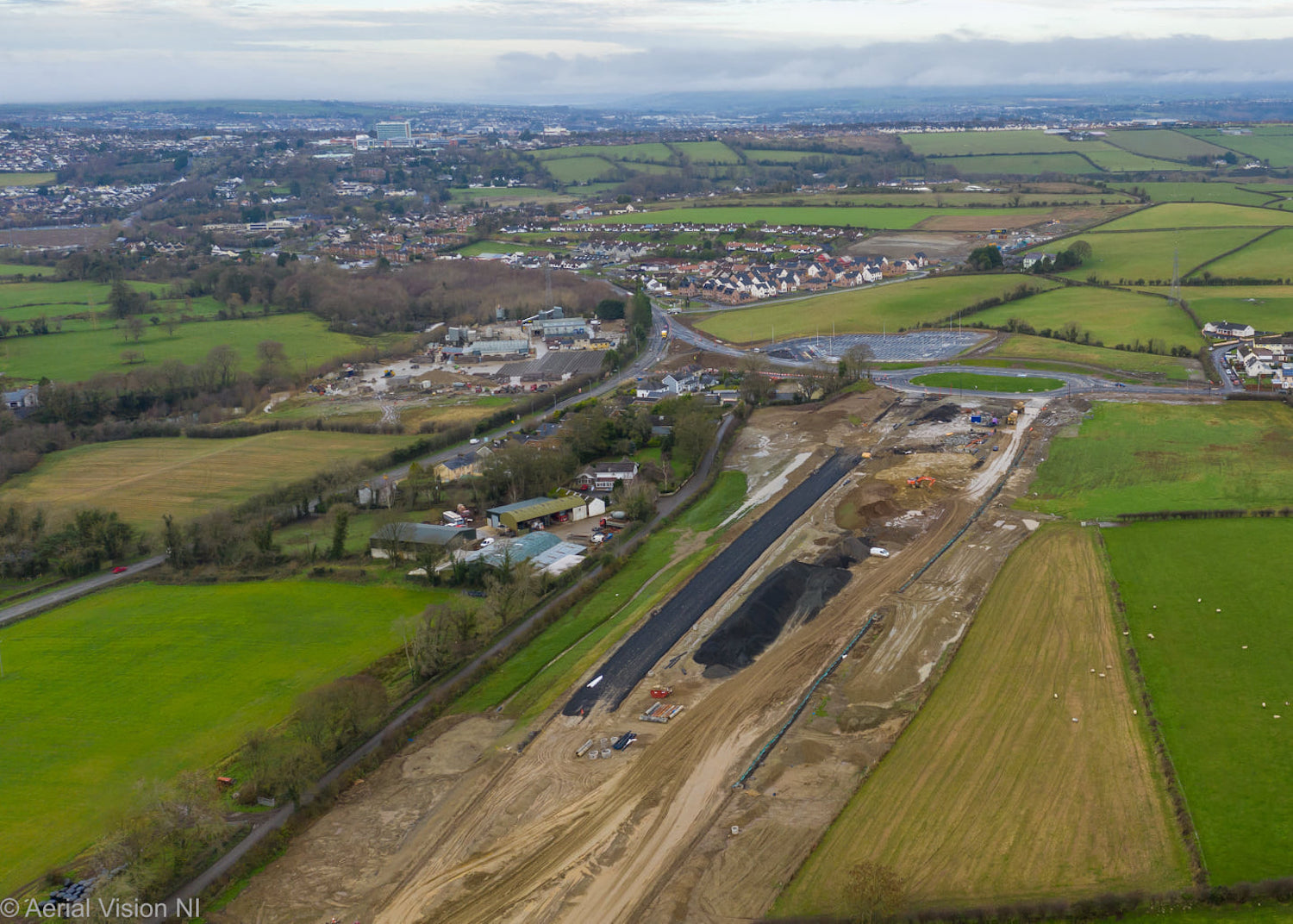
Pic 1: The "temporary" terminus of the scheme at
Drumahoe on 1 Dec 2020. The new Lismacarol
roundabout is complete, but not operating as a
roundabout yet, with traffic being diverted
round one side of it for the time being. The
Park-and-Ride is also completed but not yet in
use. Some blacktop is also being laid on the
future westbound offslip. [AerialVisionNI]
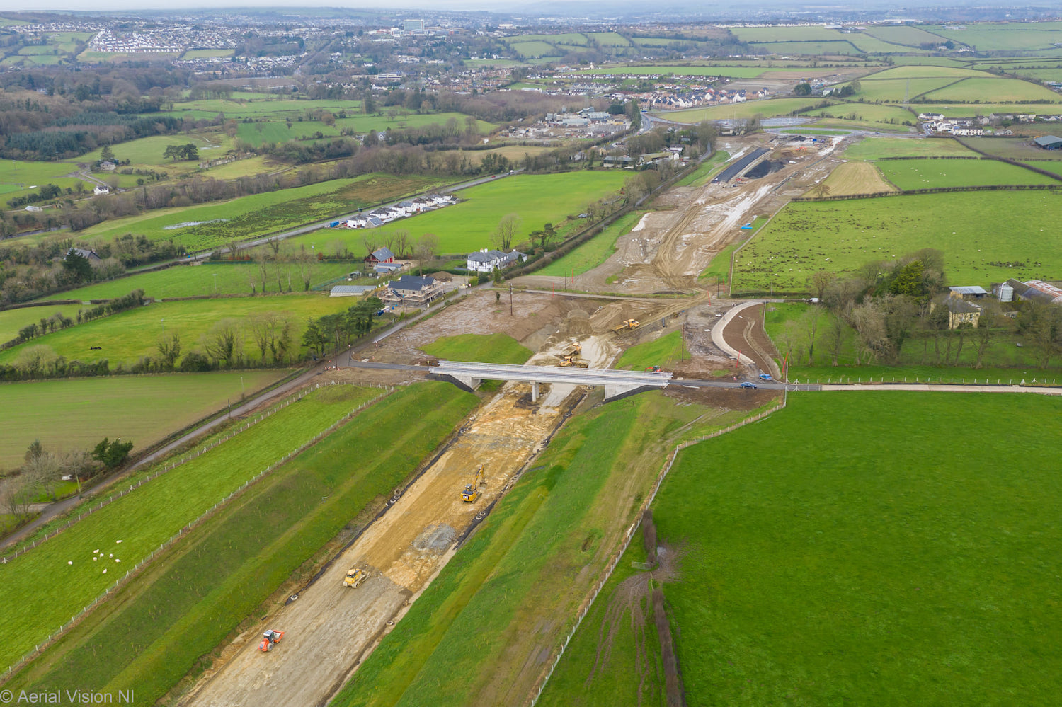
Pic 2: Similar view to the previous shot, but
moving slightly east to show McCay's
accommodation overbridge on 1 Dec 2020, which
appears to be completed. The original access
laneway is still in place beyond it. The cutting
here appears to have been planted with grass and
native trees. [AerialVisionNI]
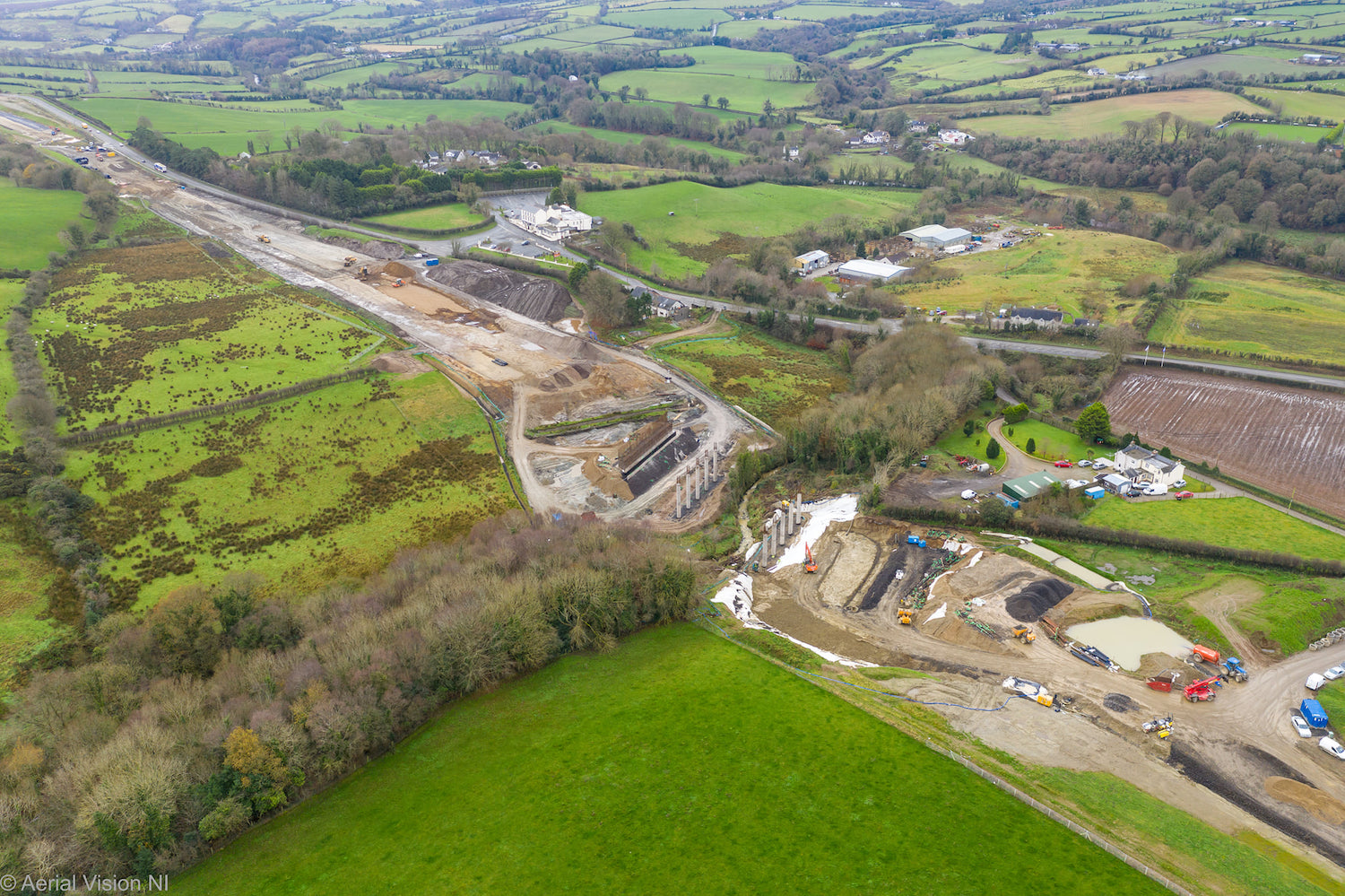
Pic 3: It is hard to see progress at Liberty
Glen (at the Belfray) from the main road, but
this photo on 1 Dec 2020 confirms that work is
well underway on what will be the longest bridge
on the whole scheme. It will consist of three
separate spans with two sets of five
intermediate pillars well advanced, and work
also underway on the abutments. [AerialVisionNI]
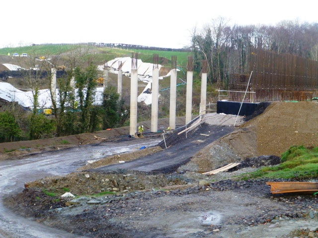
Pic 4: This ground-level shot of Liberty Glen
bridge was taken on 1 Dec 2020. The person in
yellow high-vis shows how tall these pillars
are. [Arthur Ming]
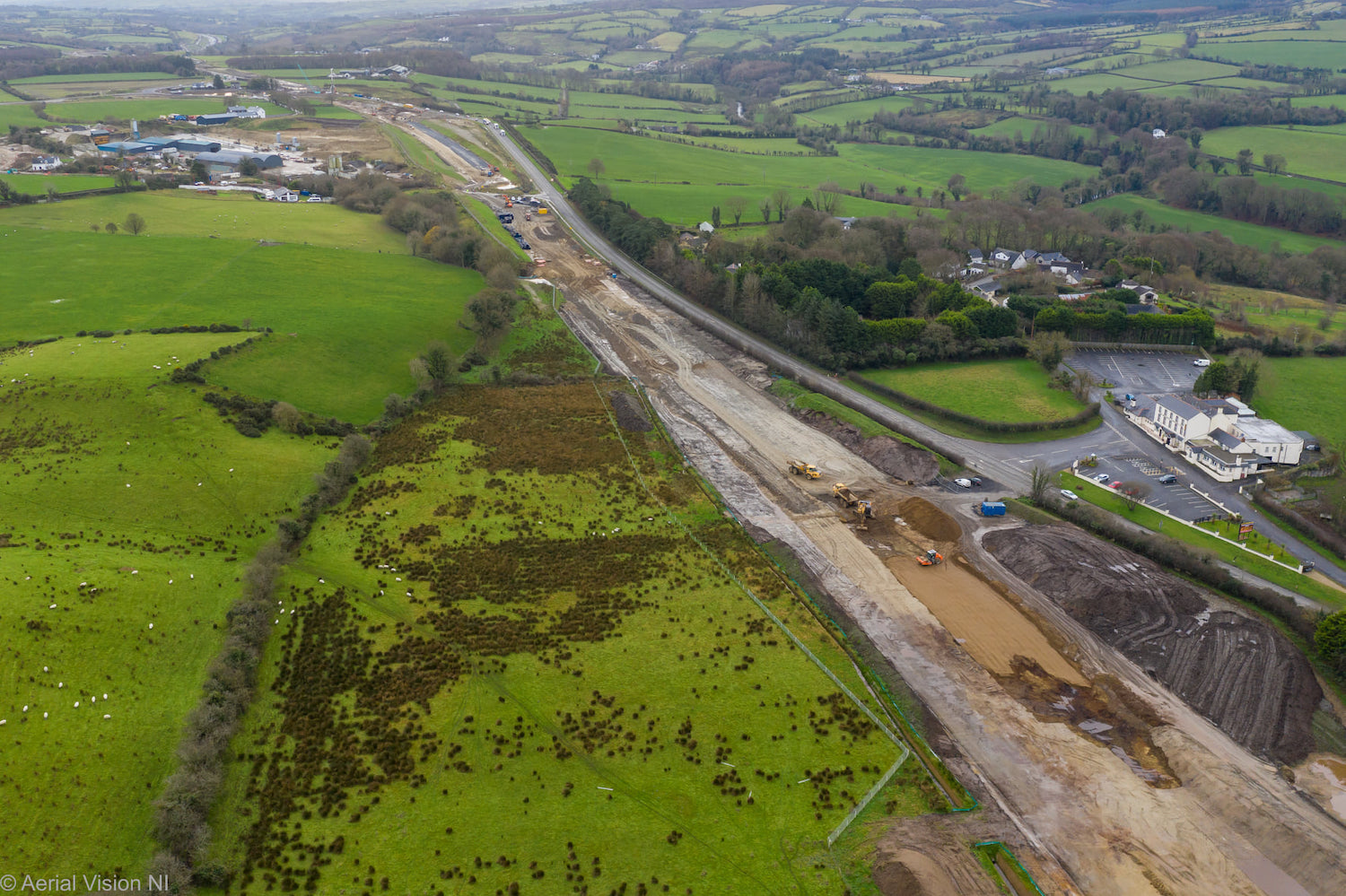
Pic 5: This view looking south-east from above
Liberty Glen shows earthworks underway on the
future dual-carriageway towards the future
Tamnaherin Road junction on 1 Dec 2020. The
existing A6 here will remain in situ for local
access. [AerialVisionNI]
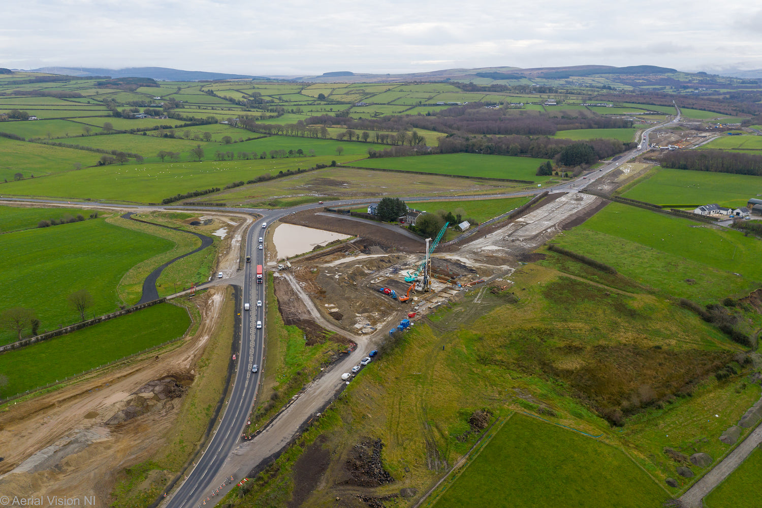
Pic 6: The site of the future Tamnaherin Road
junction on 1 Dec 2020. All traffic is being
diverted round the site while piling takes place
for the new underbridge that will carry
Tamnaherin Road beneath the new road. In January
Tamnaherin Road (going off to the left) will be
closed to allow work on the approach cutting.
[AerialVisionNI]
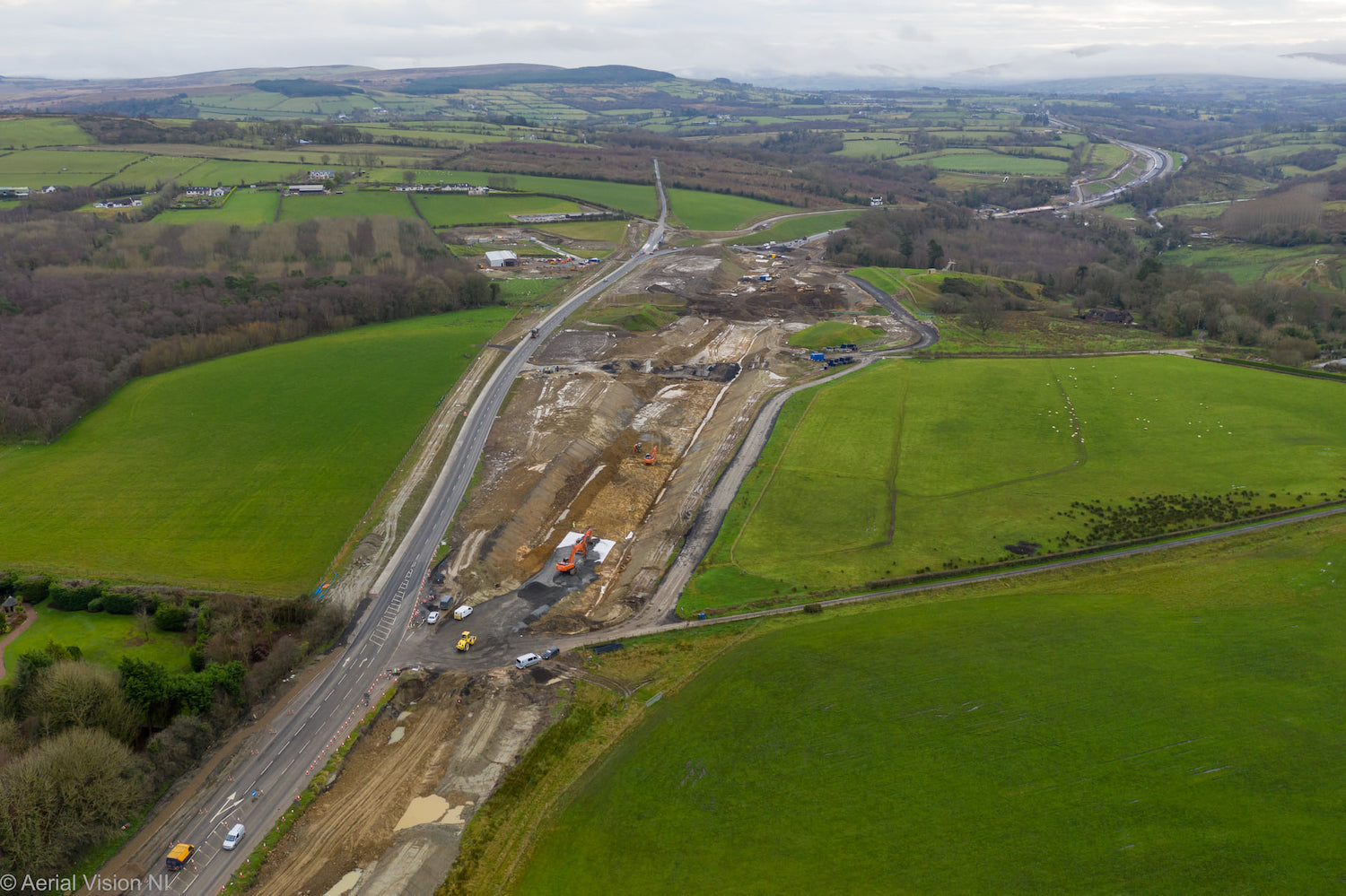
Pic 7: View east towards Burntollet from
Tamnaherin Road on 1 Dec 2020. The earthworks
are on the route of the original A6, but all
traffic is currently being diverted onto the new
Ervery link road, visible on the left here, to
allow construction of The Oaks accommodation
bridge (the black patch beyond the diggers).
[AerialVisionNI]
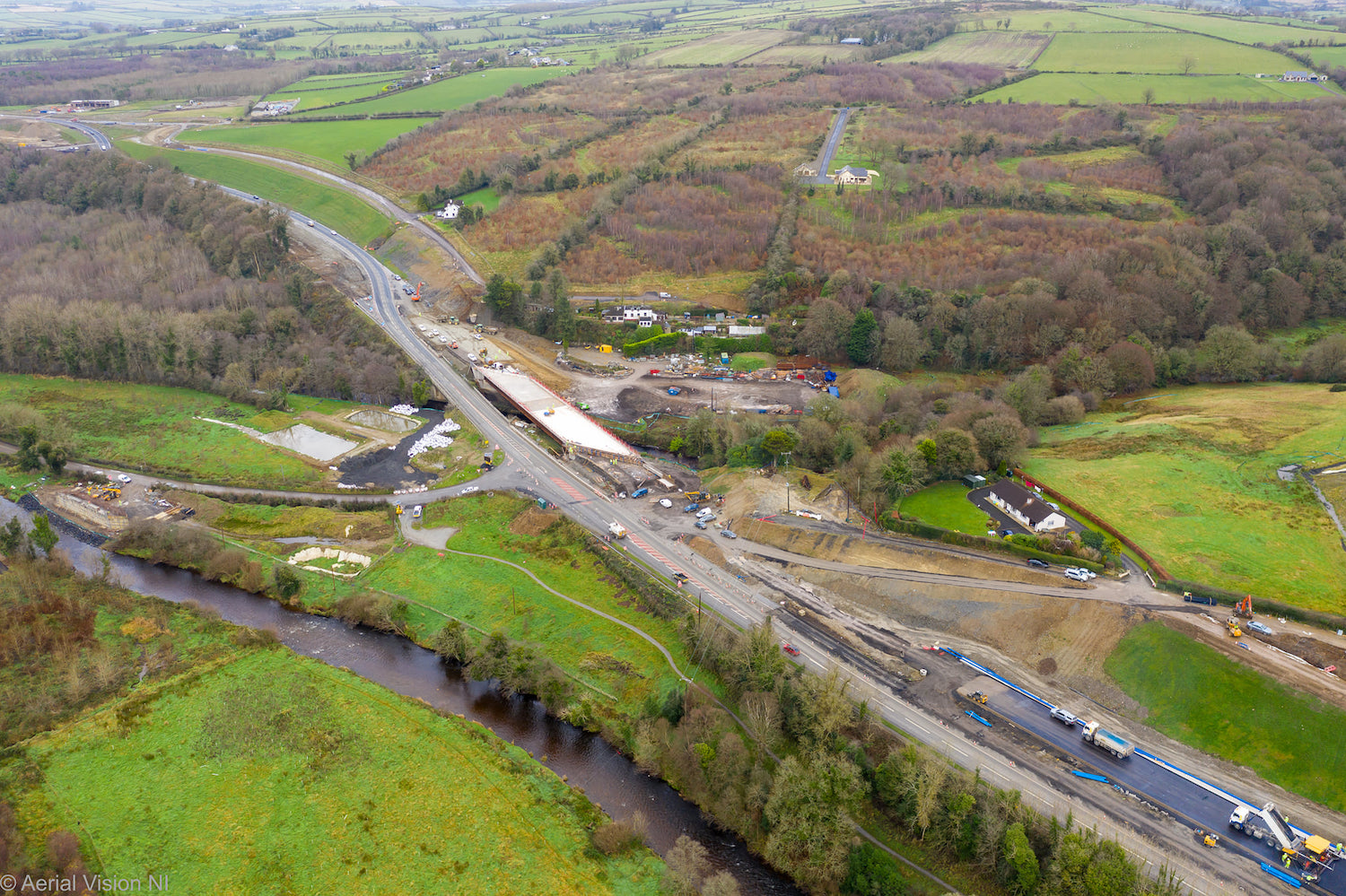
Pic 8: Burntollet Bridge as seen on 1 Dec 2020,
with the deck of the northern half of the new
bridge well underway. The word on the street is
that this half of the bridge is due to be
completed by the end of the year. At this point,
traffic will likely to be switched onto it to
allow the 1950s bridge to be demolished. On the
extreme left you can see one of the abutments
for the Ardmore Road bridge over the Faughan
River. Since this photo was taken the beams have
been placed on this bridge. [AerialVisionNI]
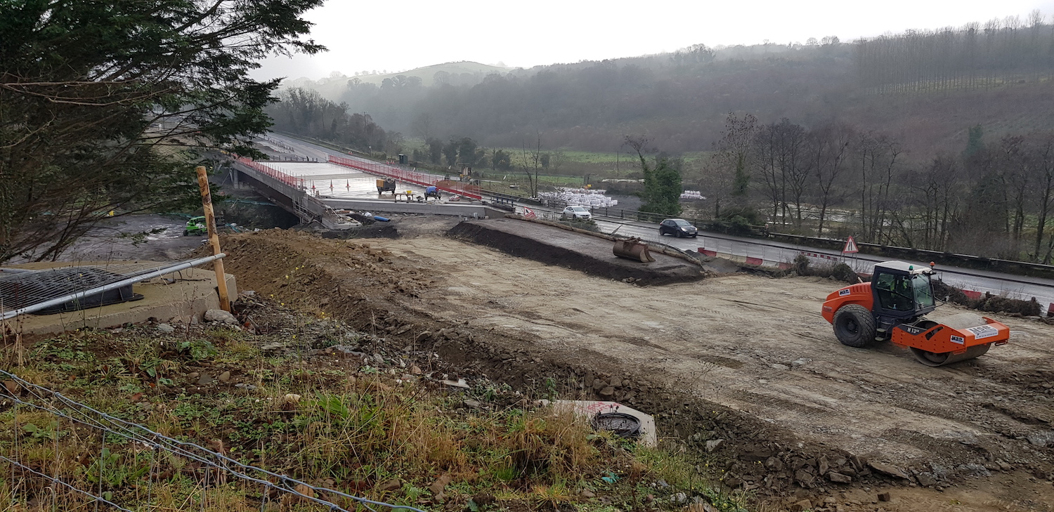
Pic 9: View of Burntollet Bridge on 29 Nov 2020,
showing that the embankments on either side have
been significantly built up over the course of
November, to the height needed to construct the
road over. [Alan Lynas]
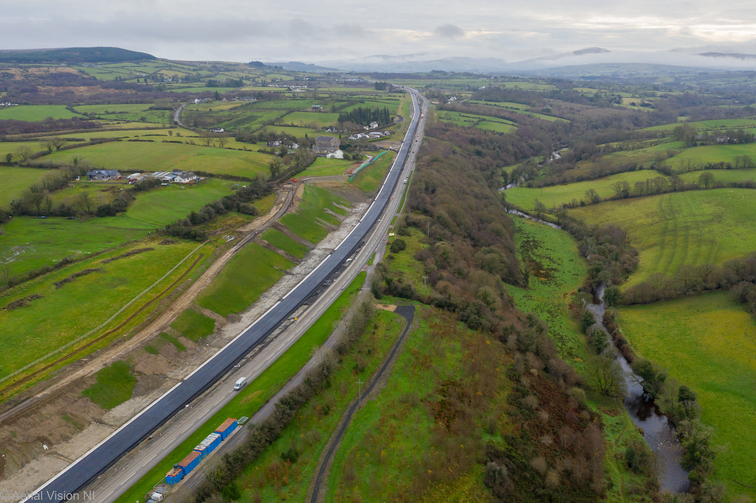
Pic 10: View east from Burntollet on 1 Dec 2020,
showing the large cutting that has been needed
to widen the road here. The steep drop into the
River Faughan on the right shows why the cutting
was needed. The future eastbound carriageway has
been surfaced for a long distance – traffic
could be transferred onto this section of road
and over the Burntollet Bridge soon, perhaps by
January. [AerialVisionNI]
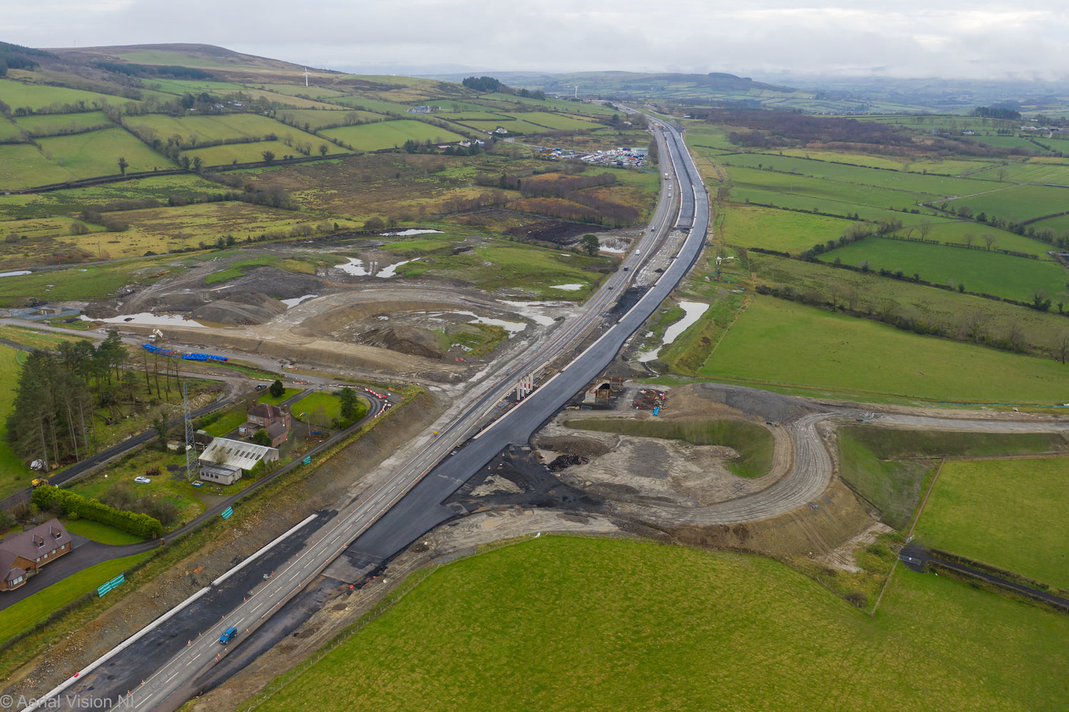
Pic 11: Gulf Road (Killaloo) junction as seen
looking east on 1 Dec 2020, with blacktop laid
on long stretches into the distance. The pattern
of sliproads is clearly evident here, but work
on the bridge is not very advanced due to the
awkward position of the current A6 here. I
suspect the plan here is to divert traffic onto
a stretch of the new carriageway here, to allow
the other bridge abutment to be built. The
existing A6 will remain in situ here, but it
will be reduced in width to serve as a minor
access road. [AerialVisionNI]
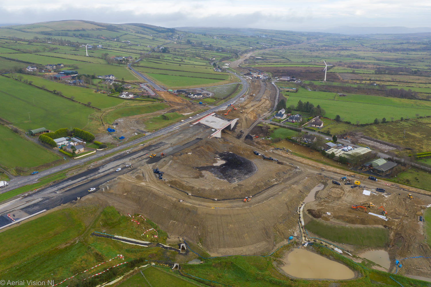
Pic 12: Superb aerial shot of the Baranailt Road
(Claudy) junction on 1 Dec 2020 showing the
largely-completed underbridge, as well as the
earthworks for the westbound sliproads in the
foreground. From here to Dungiven the existing
A6 will remain as a B-classified local road
running parallel to the new road.
[AerialVisionNI]
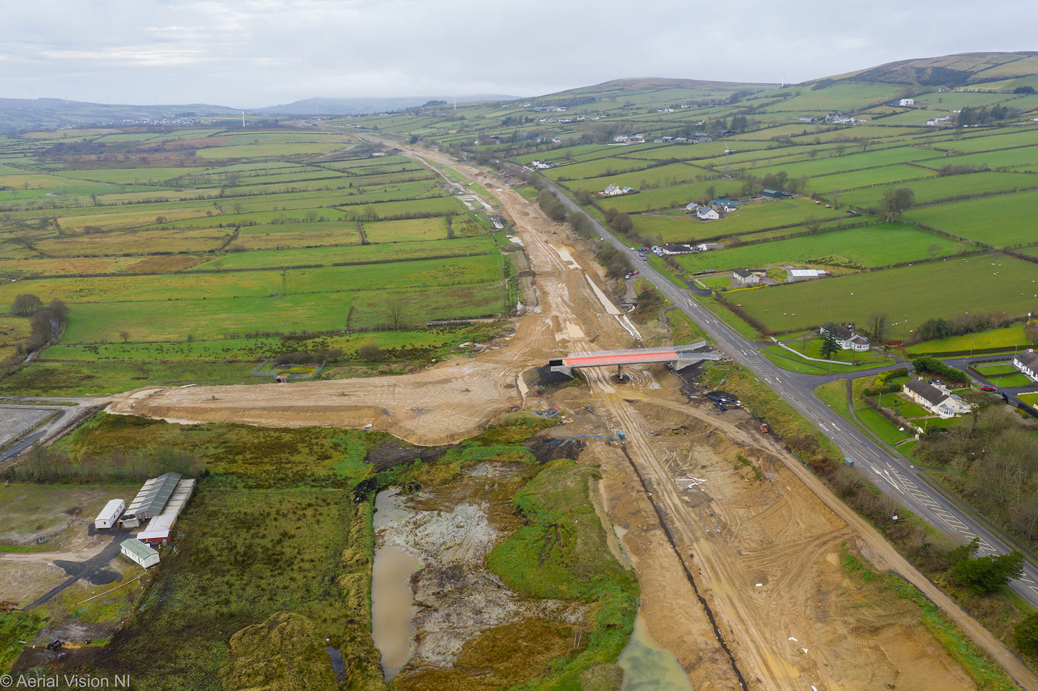
Pic 13: Gortilea Bridge sitting in splendid
isolation on 1 Dec 2020. This photo reveals why
nothing much seems to be happening - the area of
brown earth to the left of the bridge seems to
have vertical drains sticking out of it. That
suggests that the ground here has been
surcharged with extra material to encourage the
soft ground to settle. It will have to remain
like this for a period of months until movement
stops before the approach embankment can be
completed. [AerialVisionNI]
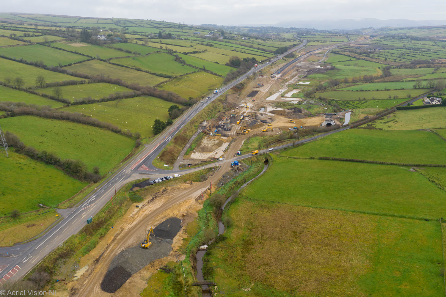
Pic 14: The site of the future Ballyhanedin Road
overbridge on 1 Dec 2020 (where all the yellow
vehicles are). The new A6 runs beside, and at a
lower elevation than, the old A6. Ballynahedin
Road, which runs at 45° here, will be closed in
January until the summer to allow the new bridge
and its approach embankment to be completed. Two
culverts for a local watercourse are also
evident here. [AerialVisionNI]
Not shown in this sequence of
photos is Killunaught Road, near Foreglen, where
work on the new overbridge also seems to now be
underway. It can be seen in Movie 5, linked at
the top of this update.
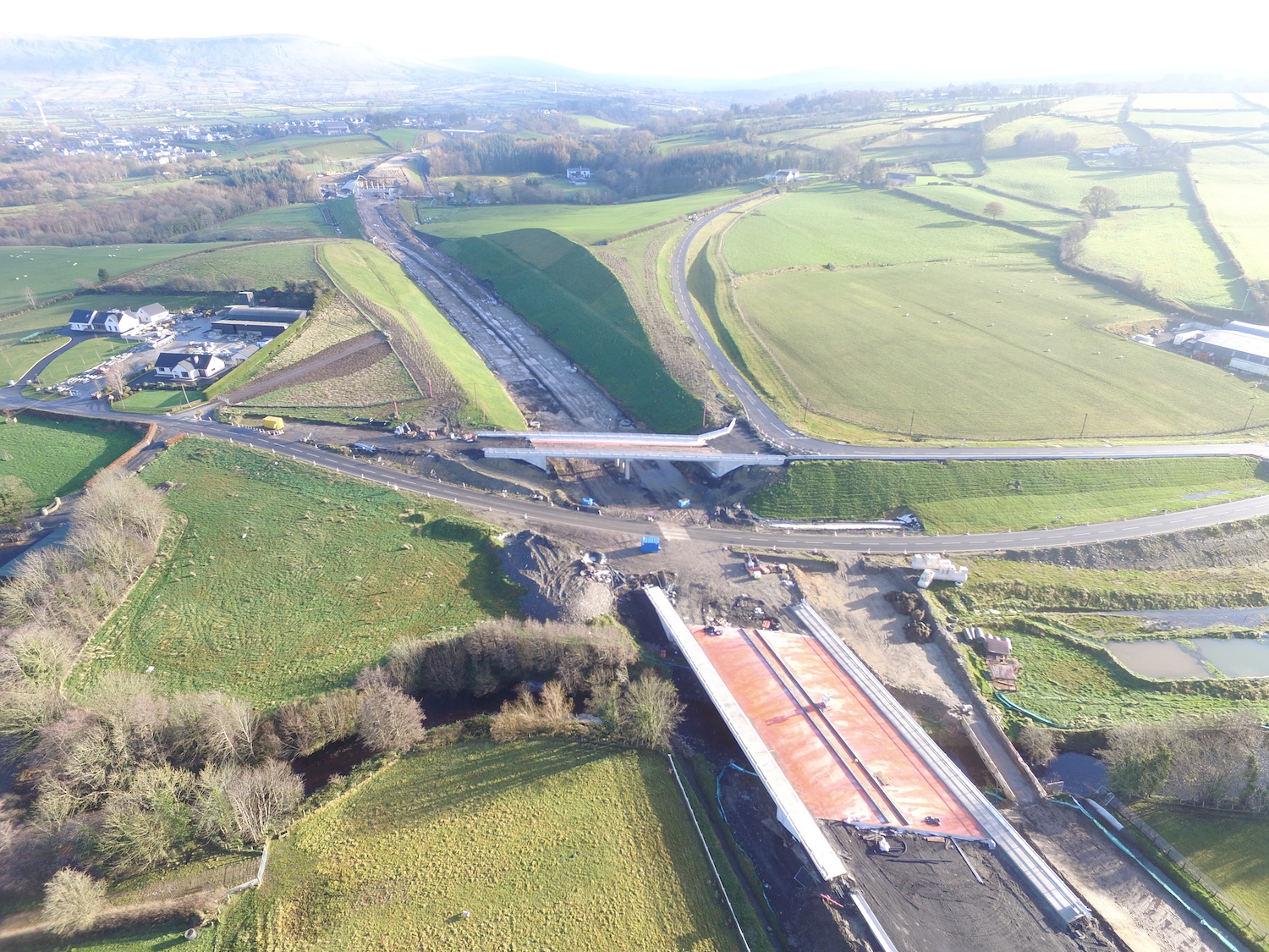
Pic 15: View of the completed Owenrigh River
Bridge and the Magheramore Road overbridge on 28
Nov 2020. It looks as if Magheramore Road
overbridge is largely completed, so the next
step will be to reinstate the road over it and
remove the temporary road beside it. The cutting
here has been landscaped with grass and trees.
Beyond the cutting is the site of the River Roe
bridge, seen below. [Les Ross]
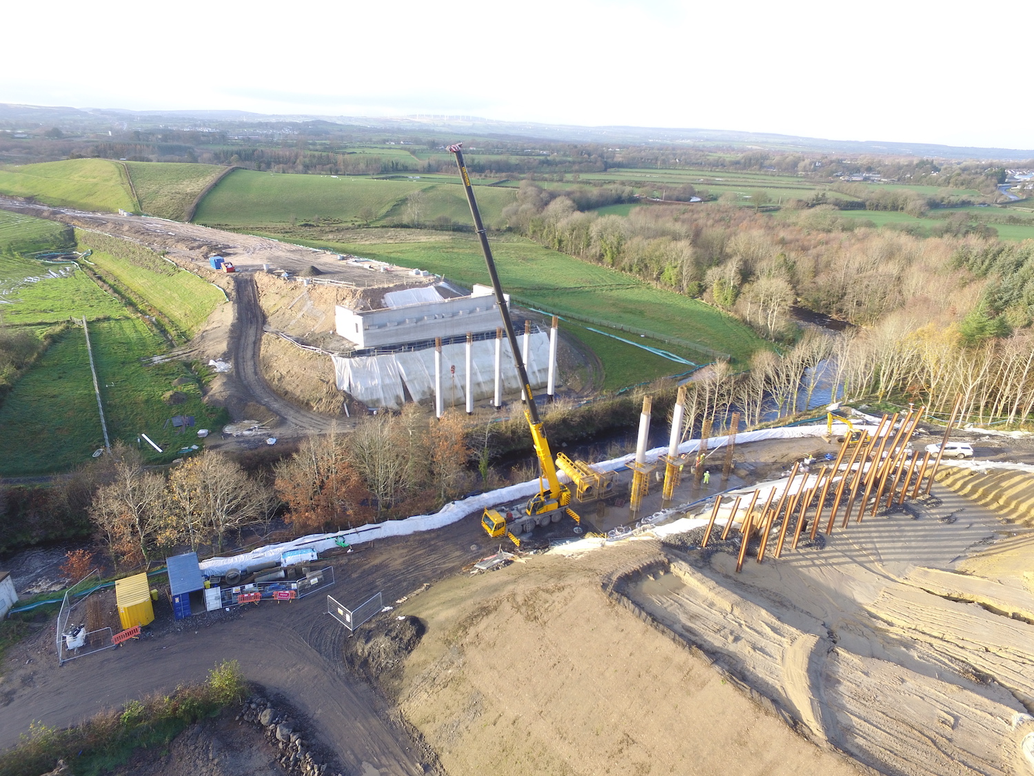
Pic 16: A lovely shot of the work underway on
the River Roe bridge, near Dungiven, on 28 Nov
2020. This bridge, like the one at Liberty Glen,
consists of three spans and is at quite a height
above the river on soft ground, hence the huge
amount of work needed. The embankment on the far
side looks like a ski jump, but this is an
illusion! [Les Ross]
15 Nov 2020: Work has progressed very
well over the past two months, and continues to
attract a lot of interest from the travelling
public. There is now only about a
year-and-a-half until the scheme is completed,
so we are well past the half-way point. Below I
present 16 photos with thanks to the prolific
Paul McCloskey, as well as the Burntollet
reporter-in-situ Alan Lynas - thank you both! -
and the DFI. In addition, there are a couple of
aerial movies that I link to at appropriate
points. The photos are are arranged in order
from east (Dungiven end) to west (Derry end).
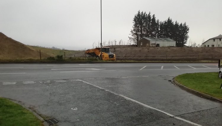
Pic 1: Work now appears to have begun on
Magherabuoy roundabout, which is where the
scheme will begin, at the east side of Dungiven.
This is the view actross the existing A6 on 8
Nov 2020 towards the site works now underway.
You can see an aerial view of the site here
– Magherabuoy roundabout being on the right hand
side. [Paul McCloskey]
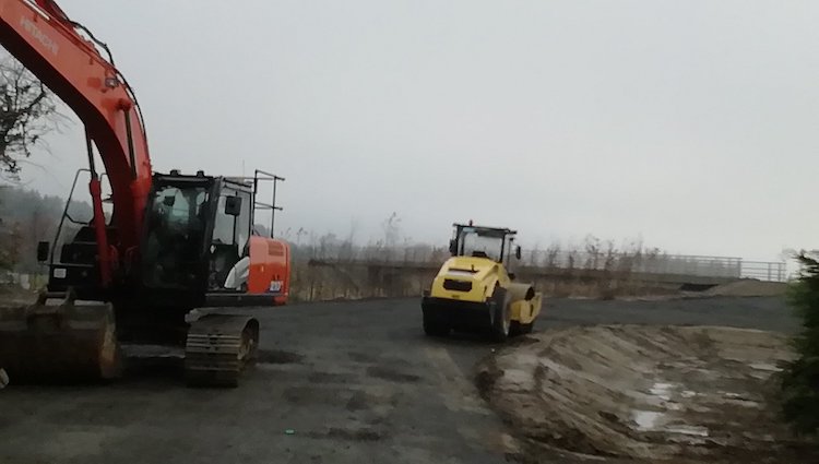
Pic 2: Priory Lane, which gives access to
Dungiven Priory, is currently closed but will be
re-routed over the new bridge. This is the new
road under construction on 8 Nov 2020. You can
see the bridge in this
aerial view, visible by the pink waterproof
course on the bridge deck. [Paul McCloskey]
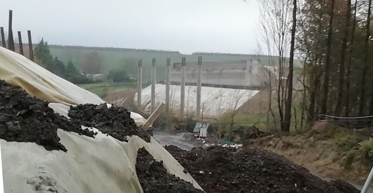
Pic 3: Work on the future River Roe bridge,
which is a complex structure on challenging
ground, underway on 8 Nov 2020 with the western
bridge piers and abutments looking close to
completion. Work on the eastern piers and
abutment is less advanced. We could see a beam
lift here before the end of the winter. You can
see an aerial view of the bridge here.
[Paul McCloskey]
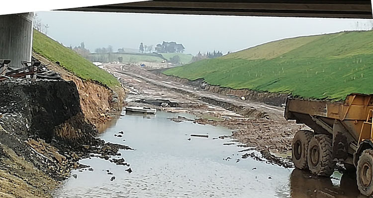
Pic 4: Moving west to Magheramore Road, this is
the view north-east across a rather waterlogged
site beneath Magheramore Road bridge on 8 Nov
2020. The huge cutting here is complete, with
some tree planting apparent too, but less work
on the new road itself. [Paul McCloskey]
This
is a link to an aerial movie of the whole
Dungiven Bypass, starting near the (as yet
unbuilt) River Owenbeg bridge at 2:50, passing
the site of Feeny Road junction at 3:30, the
completed Owenrigh river bridge and adjacent
Magheramore Road bridge at 4:10, the (under
construction) River Roe bridge at 4:40 and
reaching the site of the future Magherabuoy
roundabout at 5:15. Note how well-advanced the
stretch of dual-carriageway between Feeny Road
and Magheramore Road is.
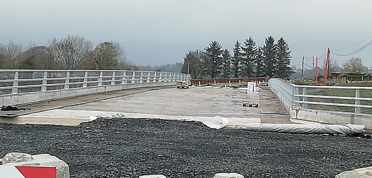
Pic 5: View across the top of the Magheramore
Road bridge on 8 Nov 2020, with the bridge deck
complete, fencing in place and just awaiting the
tarmac! [Paul McCloskey]
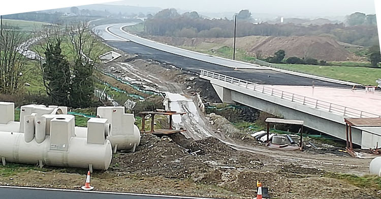
Pic 6: View west from Magheramore Road on 8 Nov
2020 showing the new road now being constructed
over the completed Owenrigh River bridge, and a
very well-developed road snaking off into the
distance towards Feeny Road. [Paul McCloskey]
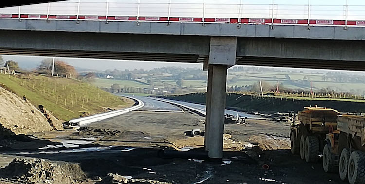
Pic 7: Moving further west to Feeny Road, this
is the view east (back towards Magheramore Road)
beneath the new bridge on 8 Nov 2020. This will
eventually be a grade-separated junction. Note
more tree planting along the banks here. [Paul
McCloskey]
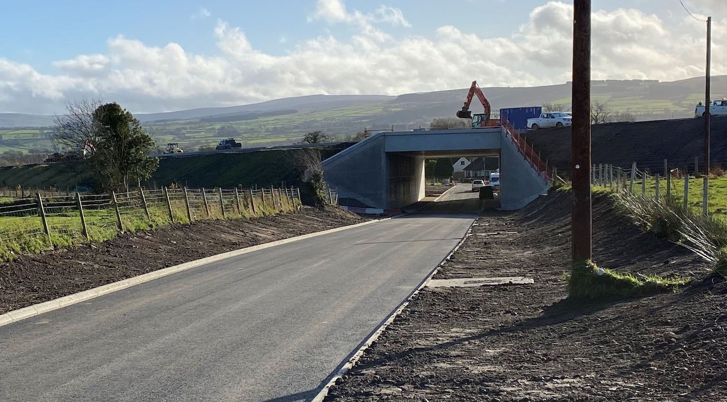
Pic 8: Derrychrier Road (Lower Ovil Road)
finally re-opened to traffic on 12 Nov 2020.
This is it on 13 Nov 2020, with work on the new
road evident above. Local resident Esther Harper
took
a movie of her first drive through it. The
length of the underpass (which runs at a skew)
bears witness to the width of the new
dual-carriageway above. [DFI]
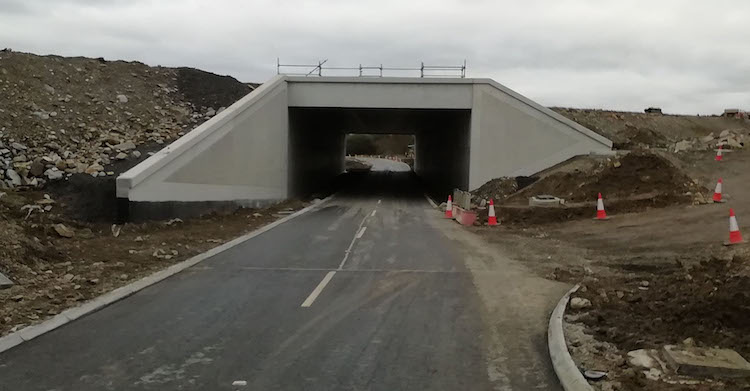
Pic 9: Altagarron Road underpass, near Foreglen,
opened to traffic during October. This view was
taken on 17 Oct 2020. The bridge at Killunaught
Road (half way between Derrychrier Road and
Altagarron Road) is not due to open until summer
2021. [Paul McCloskey]
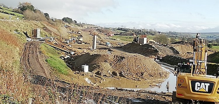
Pic 10: Work on Ballyhanedin Road bridge
continues at a slow pace, with a bit more work
evident on the northern abutment (on the left)
since September. This is the view on 8 Nov 2020.
A kilometres west of here is Gortilea Road
bridge which is completed but not open. The
contractor has said that they plan to open the
road and bridge in the spring of 2021. [Paul
McCloskey]
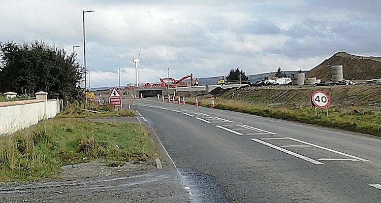
Pic 11: View east along the existing A6 towards
the new bridge at Baranailt Road, Claudy, on 8
Nov 2020. The new dual-carriageway will run on
the right, a couple of metres higher than the
current road, which will be retained only as far
as the house on the left, for local access. To
get a better idea of the progress on this
junction see this
aerial movie, with thanks to Sky
Photography. Baranailt Road into Claudy is
currently closed for reconstruction (at around
1:00 in the video) but is scheduled to reopen at
the end of April 2021. [Paul McCloskey]
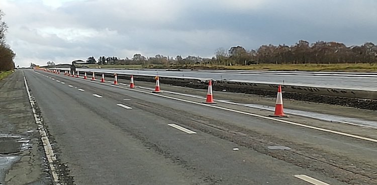
Pic 12: Between Baranailt Road and Killaloo
junction motorists have a grandstand view of
work on the future dual-carriageway adjacent to
the current road, which will be retained for
local access. This view is looking east on 8 Nov
2020 showing work well advanced with blacktop in
place on long stretches. This is also evident
from 2:15 in this
movie. Very impressive work here. [Paul
McCloskey]
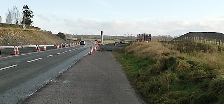
Pic 13: Not much has changed at the future
Killaloo junction (Gulf Road at Claudy west) on
8 Nov 2020. The southern abutment and central
piers are in place, but further work will
require traffic to be moved away from the
existing road. Gulf Road is due to re-open in
autumn 2021, a year from now. [Paul McCloskey]
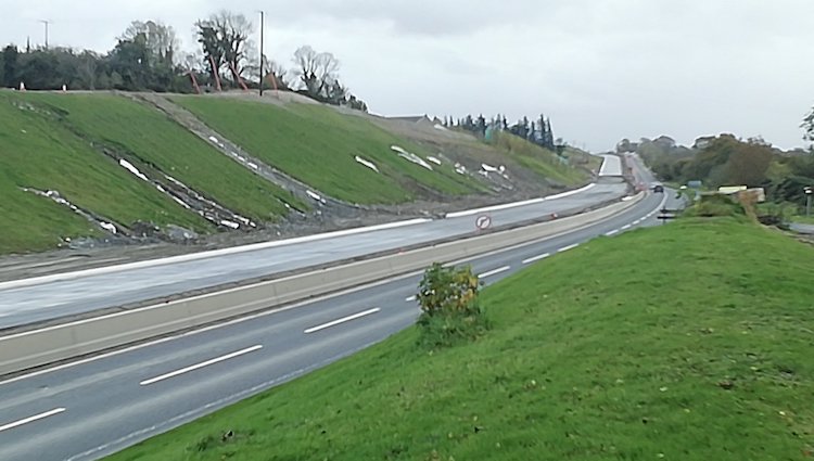
Pic 14: View looking east along the new road not
far from Brackfield Bawn, just east of
Burntollet on 26 Oct 2020. This shows the new
cutting straight ahead, with multiple gullies
evident, probably caused by recent heavy rain.
It will take time for vegetation to stabilise
the soil here. At its base is the future
eastbound carriageway with blacktop in place,
while all traffic is currently on the old road,
in the foreground. Presumably traffic will be
moved onto the new stretch of road soon to allow
the old road to be reconstructed to become the
westbound carriageway. [Paul McCloskey]
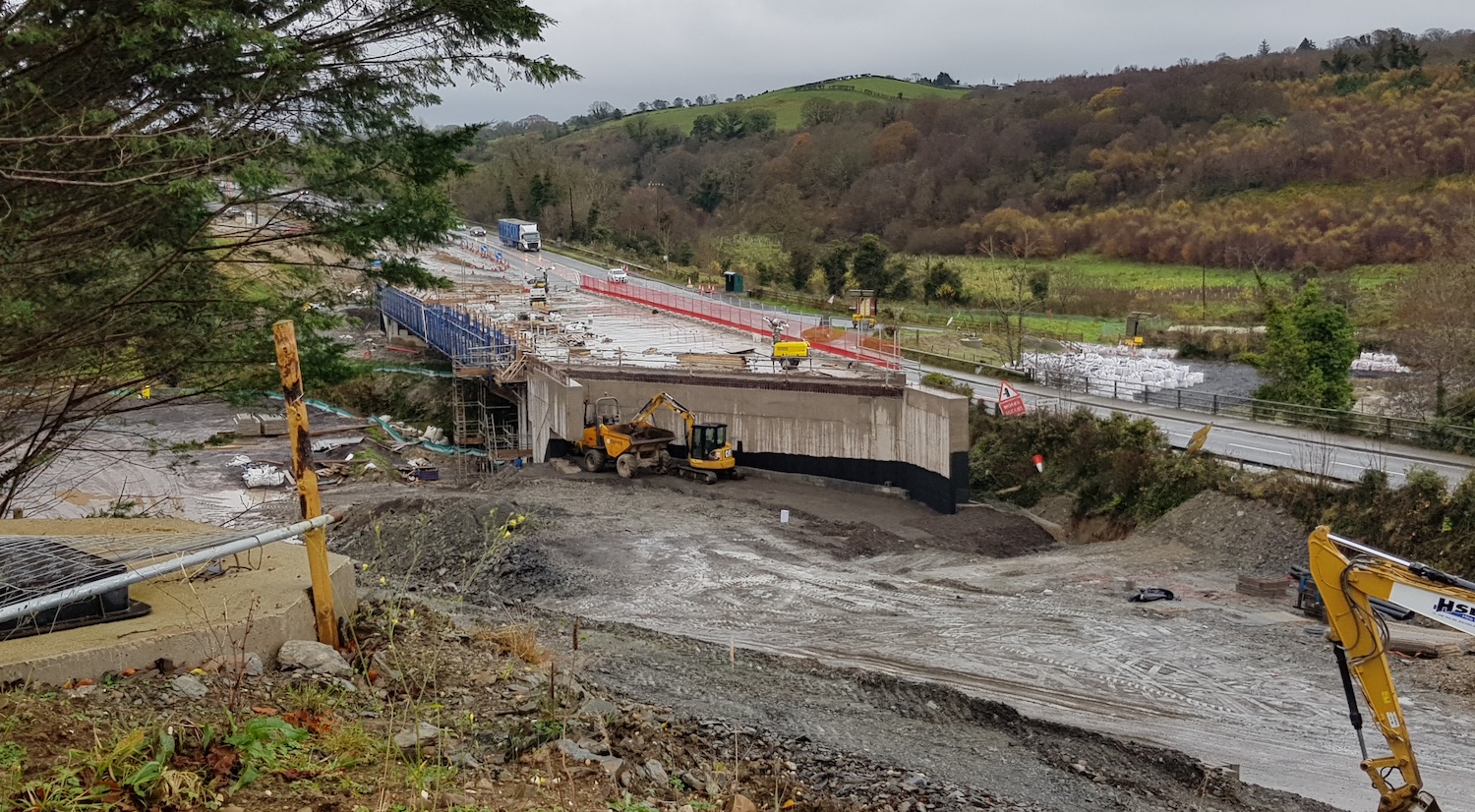
Pic 15: Three months on from the beam-lift at
Burntollet bridge, work has progressed on the
deck with concrete being poured during October.
This view was taken on 15 Nov 2020. Once the
deck is completed, the embankments will need
built up at either side to allow the road to be
built over the top. Once traffic is using this
part of the new bridge, the old bridge (on the
right) will be demolished and work will begin on
the second half of the bridge. [Alan Lynas]
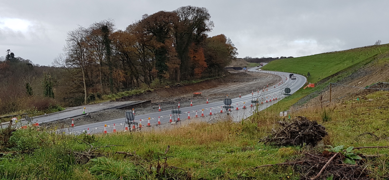
Pic 16: View west from Burntollet on 15 Nov 2020
– all traffic continues to use the temporary
road visible here. Meanwhile the old A6 has now
been completely removed as part of work to form
the base of the new road. Ardmore Road, which is
off-camera to the left here, will be closed at
this point on 25 November for twelve months, to
allow cosntruction of the new Ardmore Road
bridge (at The Oaks). [Alan Lynas]
I have no photos of the
Tamnaherin Road or Derry end of the scheme, but
the park-and-ride at Drumahoe is now complete
and just awaiting a bus service. Work will
presumably also begin soon at Liberty Glen, if
it has not already done so, as it is the largest
bridge structure on the whole scheme.
25 Sep 2020: Tomorrow marks the second
anniversary of the sod-cutting ceremony that
started the scheme in 2018. With only 18 months
left to go, we are now well past the half-way
mark and much progress continues to be made.
Unfortunately the YouTube aerial videos that I
linked to in the previous update (below, 18 Aug)
are no longer available, which is a shame.
Nevertheless, we have a whole series of photos
once again, thanks to Andrew Bratton, Dee Logue,
Alan Lynas, Paul McCloskey and Polyanne. Thank
you once again. The photos are, as always,
arranged in order from Derry towards Dungiven.
In other news, the project received another
£14.8m of funding (from the COVID emergency
fund!) this week. As the project crosses
multiple financial years, a budget allocation is
needed every year to keep the project funding,
though once the contract has been signed such
funding is really a given. The contractor has
indicated that traffic may be moved onto
sections of the new road before Christmas, which
would be an exciting moment.
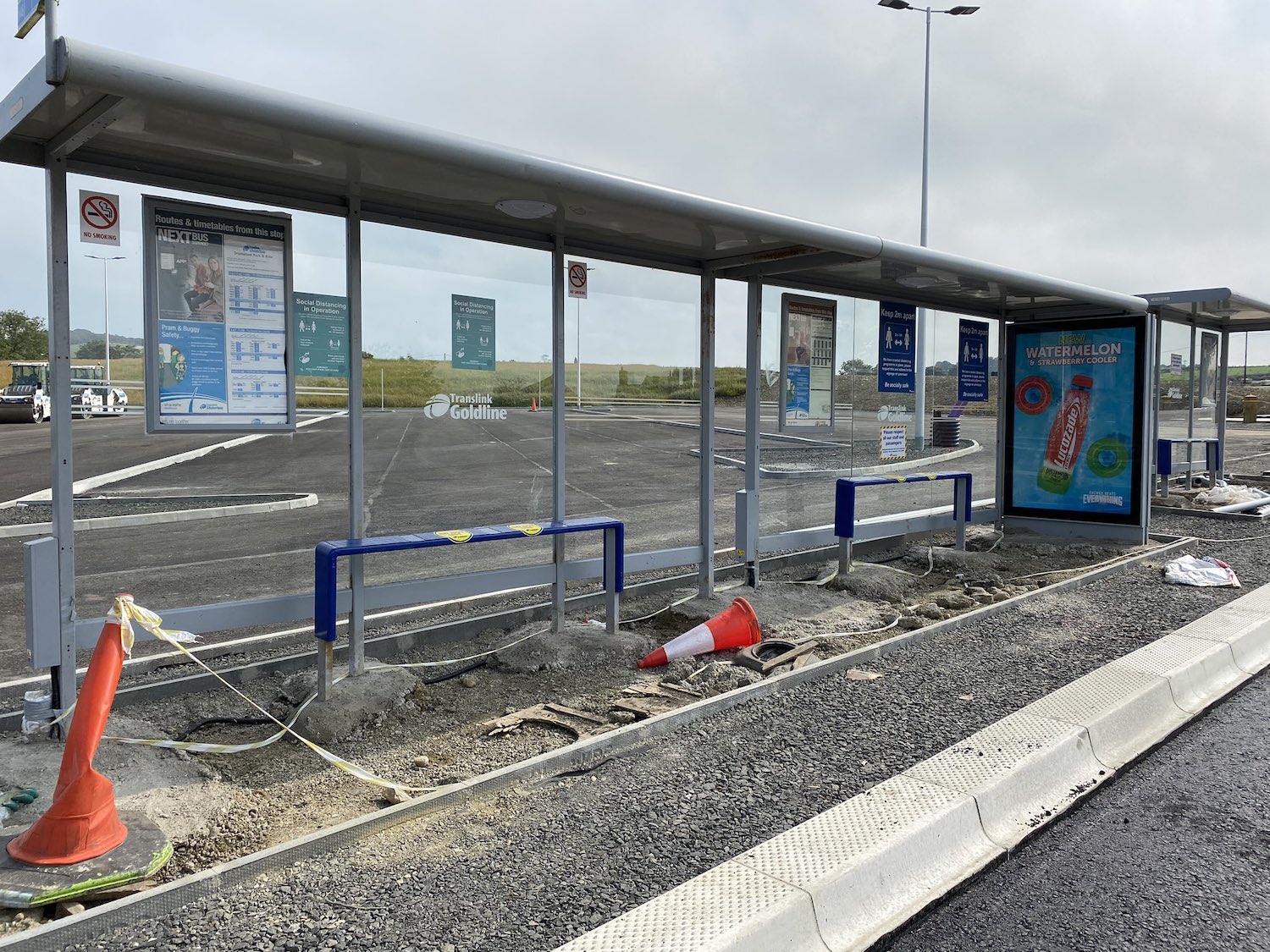
Pic 1: The new park-and-ride facility at
Drumahoe very close to completion, as seen on 15
September 2020. The facility will probably open
soon, along with the new Lismacarol roundabout
on Tirbracken Road. The branding suggests
Ulsterbus Goldliners will stop there. [Andrew
Bratton]
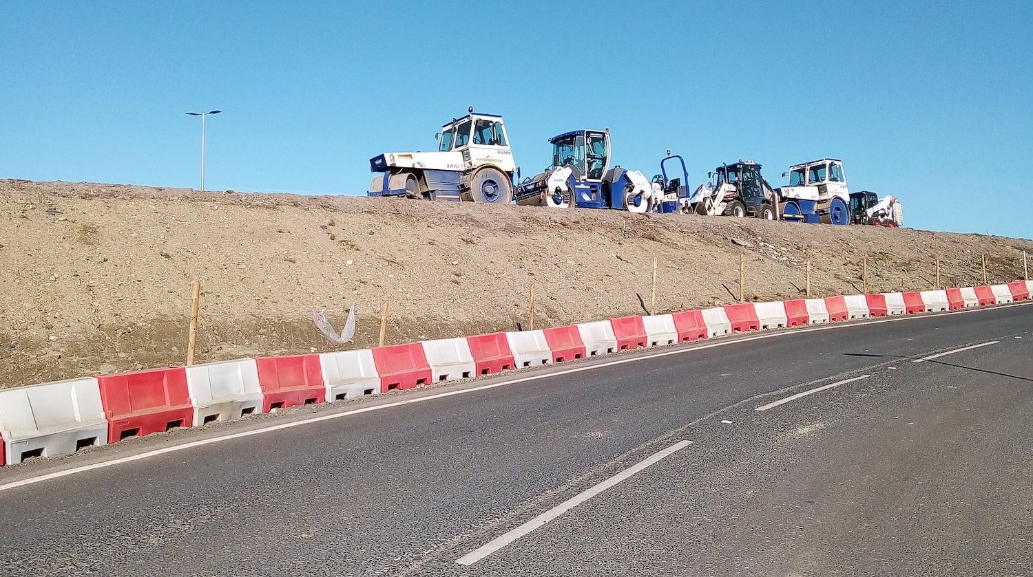
Pic 2: During the weekend of 18 to 21 September
2020 work was carried out to construct the
future alignment of Tirbracken Road, which will
lead traffic leaving Derry directly to the new
Lismacarol roundabout. This is a line of road
surfacing plant machinery waiting to be used on
the Saturday of the works, beside the existing
Tirbracken Road. [Dee Logue]
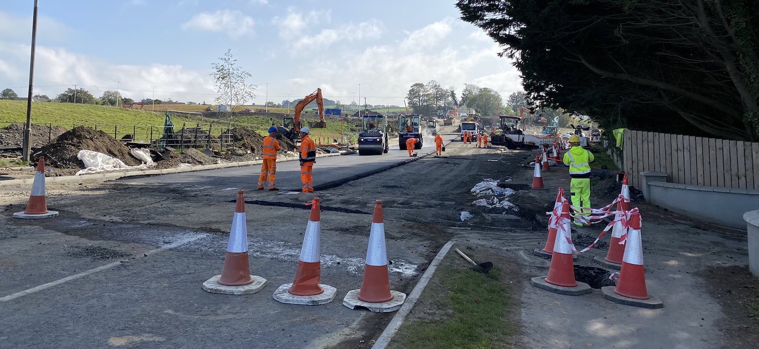
Pic 3: Another view of the realignment works
taking place on the A6 at Drumahoe on Sunday, 20
September 2020 with surfacing works well
underway. The original A6 curves to the right,
whereas in the future it will run along the new
line straight ahead. Traffic will still use the
old alignment for the time being, but will be
diverted along here once the new road opens. This
is the same view before work began.
[Andrew Bratton]
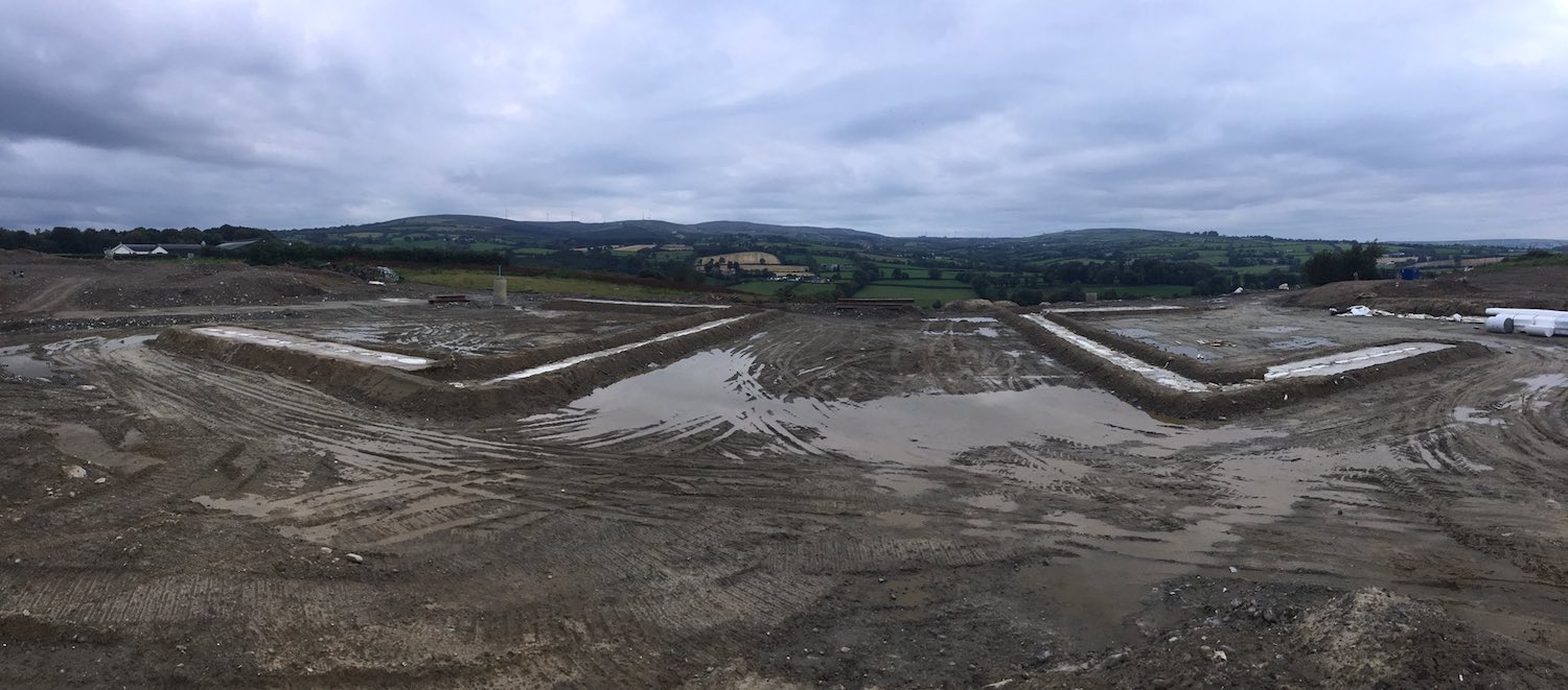
Pic 4: Panorama of the site of the future
flyover at Tamnaherin Road on 15 September 2020.
The previous landscape here has been completely
obliterated, but basically the original A6 ran
left-right across the site, with Tamnaherin Road
running from roughly where the photographer is
standing to join the A6 at a T-junction.
Currently all traffic is being diverted around
the site on a temporary loop of road behind the
camera. The two white sites mark the locations
of the two abutments. Piling for these has since
begun, as captured in a video
by Polyanne on 23 September. [Polyanne]
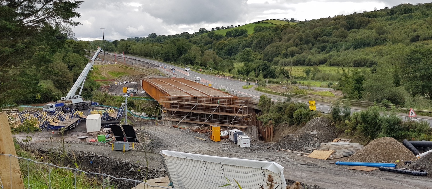
Pic 5: Since the beam lift at Burntollet six
weeks ago, much work has taken place to join the
six steel beams together to form the base for
the bridge deck. Taken on 9 September 2020. The
plan is to complete this half of the bridge,
build the approach embankments and divert all
traffic onto it, probably in the first half of
2021. [Alan Lynas]
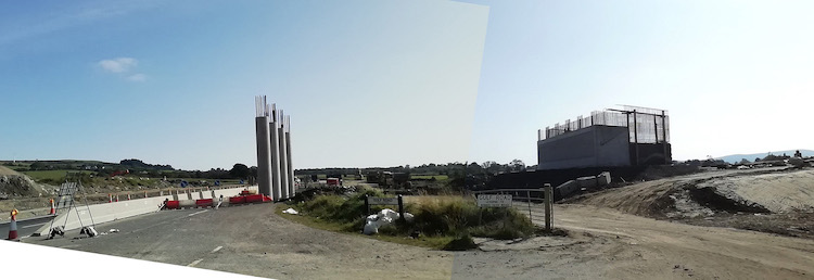
Pic 6: View east towards Killaloo junction (Gulf
Road, for Claudy west) on 20 September 2020. The
south abutment and central piers have been
built, but no work has yet started on the north
abutment as the existing A6 is currently
occupying the site. [Paul McCloskey]
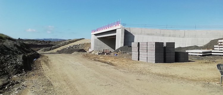
Pic 7: View looking west towards the completed
bridge that will carry the new dual-carriageway
over Baranailt Road, Claudy on 20 September
2020. The embankment being formed ahead is for
both the new road and the westbound sliproad
loop which will curve round to join Baranailt
Road just to the left here. The patio chair on
the right is a nice touch. [Paul McCloskey]
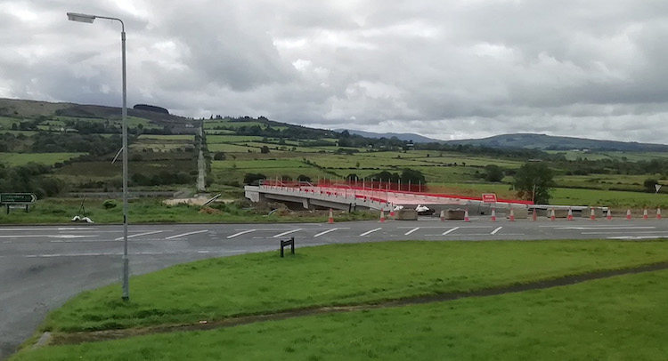
Pic 8: Gortilea Road bridge, seen looking across
the existing A6 on 6 September 2020. Nothing
much has happened here since the bridge was
completed in July. At some point a large
embankment needs to be built at the far side to
allow Gortilea Road (visible going up the hill
in a straight line, a feature typical of 18th
century roads) to be connected and reopened. The
future road will run under the new bridge at a
lower elevation. [Paul McCloskey]
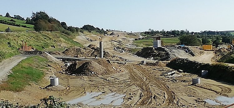
Pic 9: About 2 km east of Gortilea Road bridge
is Ballyhanedin Road Bridge, seen here looking
east on 20 September 2020. Not a lot has
happened here either, with the central piers
built, and both abutments underway. A lot of
earthworks are, however, evident in the
distance. [Paul McCloskey]
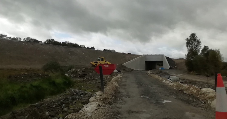
Pic 10: This is Altagarran Road underpass as it
was on 13 September 2020, now completed but with
Altagarran Road still not reopened to traffic.
The embankment for the future A6 has now been
constructed here, showing how high it rises
above the existing landscape at this point. This
is the same view before work began. [Paul
McCloskey]
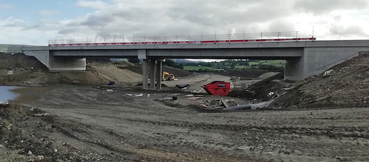
Pic 11: View east towards Feeny Road overbridge
on 13 September 2020. The bridge appears to be
largely completed, with the foundations of the
dual-carriageway itself now taking shape below
it. Traffic may be diverted onto this bridge
during the autumn. [Paul McCloskey]
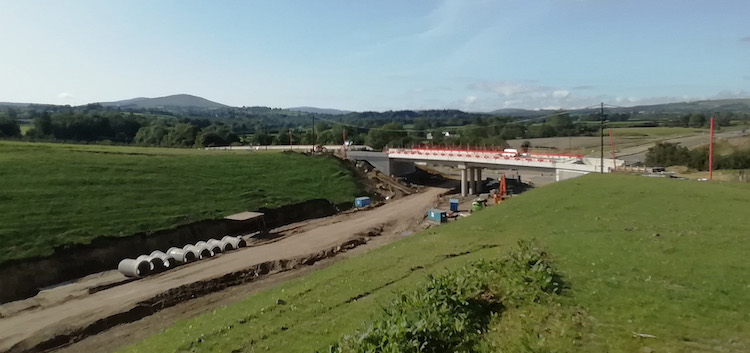
Pic 12: View west towards Magheramore Road
overbridge, near Dungiven, on 20 September 2020.
Taken from the "old" Teeavan Road, which has now
been diverted to make way for the enormous
cutting that can be seen here. This
is the same view before work began. [Paul
McCloskey]
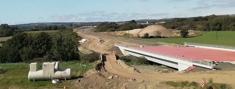
Pic 13: View from Magheramore Road near Dungiven
on 20 September 2020 showing the completed
Owenrigh river bridge, sporting its shiny new
red waterproofing layer. The alignment of the
future road is taking shape beyond. [Paul
McCloskey]
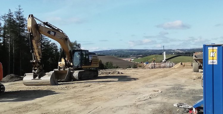
Pic 14: View looking west from near Beech Green
Lane, Dungiven, on 20 September 2020. The white
crane visible right of centre is working on the
abutments of the future River Roe bridge. It has
yet to receive its bridge beams. Magheramore
Road bridge can just be seen in the distance.
[Paul McCloskey]
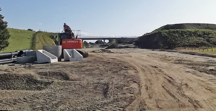
Pic 15: Looking east from near Beech Green Lane,
Dungiven, on 20 September 2020, showing the
largely-completed Priory Lane overbridge beyond
the cutting. Traffic has yet to be diverted onto
this bridge too. [Paul McCloskey]
18 Aug 2020: This update is in two
parts. In the first we focus on the spectacular
beam lift that took place at Burntollet last
weekend (15-16 August). In the second we look at
a set of five aerial drone movies of the ENTIRE
scheme that were recently put up by Benbradagh.
I've written a commentary to go with them.
So firstly, the beam lift at Burntollet
required two pairs of steel beams, each 84
metres long and weighing 280 tonnes, to be
craned into place over the Burntollet river. It
required one of the largest mobile cranes in
Ireland, the Liebherr LR 1600/2, to be assembled
on the site during the week before. Each lift
took about five hours, so the first one was done
on Saturday 15th August, and the second one the
following day. Hundreds of motorists got to see
it first hand as it required a closure of one
lane of the A6, and the ensuing queues allowed
people the opportunity to see 280 tonnes of
steel suspended in mid air. Several people sent
me photographs - thank you all so much - and I
can't include them all here but I've included a
few below which illustrate particular points.
However, I would specifically encourage you to
watch two YouTube videos. The first
was taken by a drone by the manufacturer of the
steel beams, Victor Buyck. The second
is a time-lapse movie of the Sunday lift taken
by Sean Wilson. A similar beam lift will take
place early in 2021 for the second half of the
new bridge.
Be sure to scroll down below the photos as they
are followed by a commentary on the aerial
movies of the rest of the scheme.
Pic 1: Maps showing the overall plan at Burntollet
Bridge. Due to the need to keep A6 traffic moving
the bridge is being built in two halves. The beam
lift that took place last weekend is part of phase
(3) on this plan.
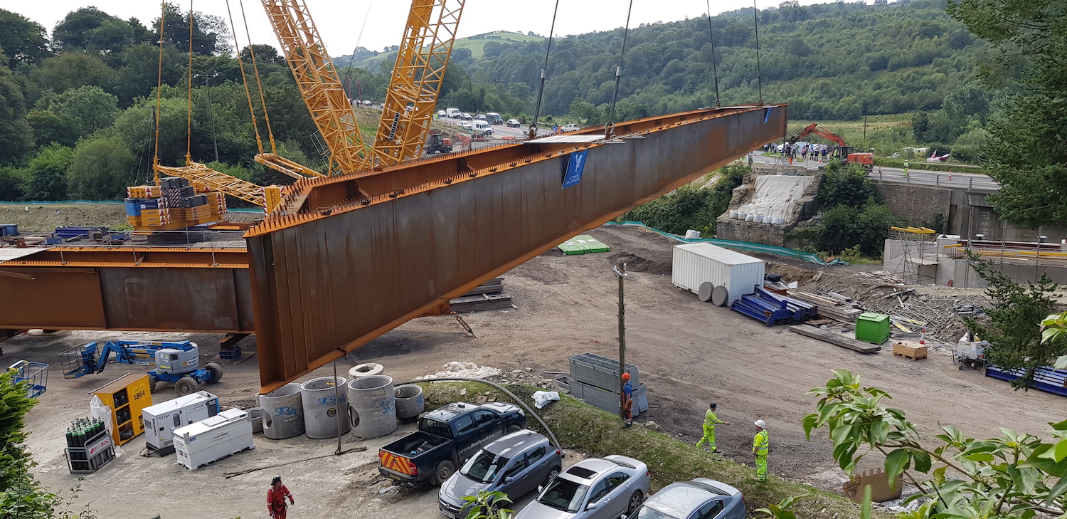
Pic 2: The lift of the first pair of beams
underway on Saturday 15 August. Both the workers
and car owners are showing great confidence in the
crane! The pair of beams weighs 280 tonnes. [Alan
Lynas]
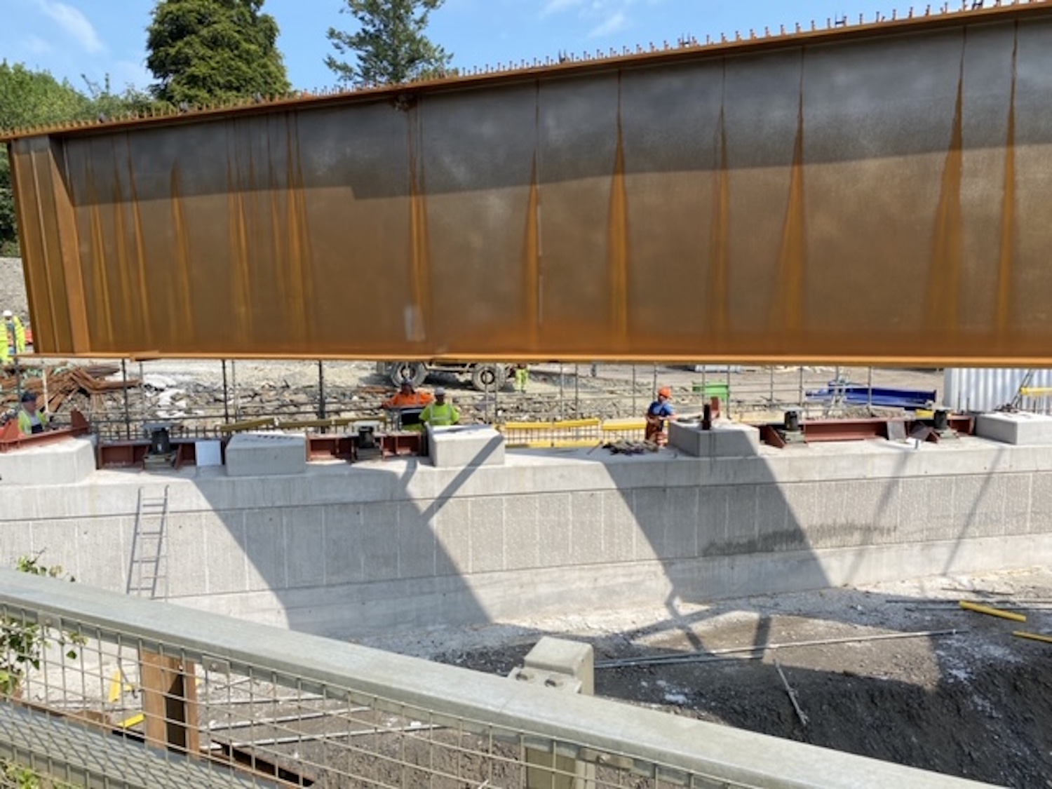
Pic 3: First beam pair being gently lowered onto
the bridge abutment on Saturday 15 August. [Anon]
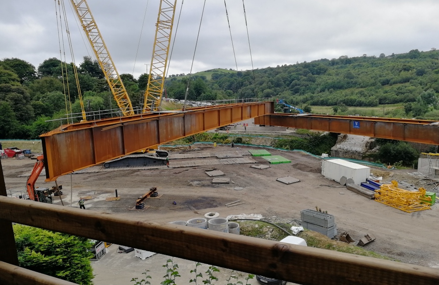
Pic 4: Next day, Sunday 16 August, this is the
second pair of beams being swung into place. [Alan
Lynas]
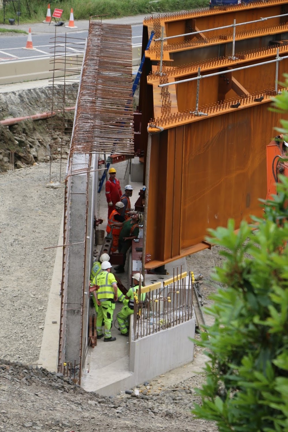
Pic 5: Workers dwarfed by the two pairs of beams
resting on their mountings in the afternoon of
Sunday 16 August. Each beam is 5 metres deep. The
existing A6 can be seen beyond. [Sean Wilson]
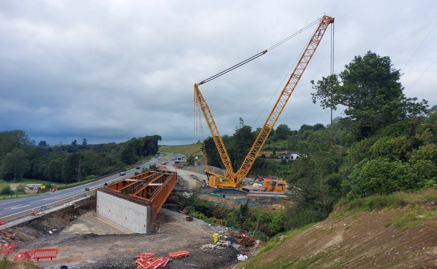
Pic 6: Job done! The two pairs of beams in place
on the evening of 16 August. This view also
illustrates how much higher the new bridge will be
than the existing (20th century) bridge. The next
step is to build the bridge deck, divert traffic
onto it, demolish the old bridge and then
construct the second half of the new bridge to the
left here - at which point the crane will return!
[Alan Lynas]
Stuff has been going on at the rest of the
scheme too. I don't have time tonight to
prep any more photos, but have a look in
particular at recent tweets by Paul
McCloskey, Polly
Lynch and Esther
Harper who often share images. However, the
following is a commentary on five wonderful aerial
drone movies put up by Benbradagh
(thank you!). They were taken at the start of
August. I've included a link to each video at the
start of each section of commentary.
Part
1
00:00 Starting at Glenshane Road, just east of
Dungiven, the site of the future Magherabuoy
roundabout. A strip of tarmac has been laid on the
new road here, possibly to give access to the
sites of the Roe river and Priory Lane bridges up
ahead.
0:16 Priory Lane overbridge very advanced, but
with the road over the top yet to be built.
0:47 River Roe overbridge with abutments well
advanced, but no beams in place. This bridge is
high enough to allow some trees to remain below
it, albeit reduced in height.
1:20 Teeavan Road cutting now completed!
1:35 Magheramore Road overbridge immediately
followed by the Owenrigh river bridge. Both very
advanced, but neither with roads being built over
them as yet.
3:02 Feeny Road overbridge, also with its deck
well advanced.
3:40 Site of Owenbeg river bridge, with abutments
being built but no beams. Temporary bailey bridge
still in place for site access.
5:00 Passing Dernaflaw (on right). Derrychrier
Road underpass completed but not yet in use.
Embankment for dual-carriageway being built up
here.
5:40 Site of temporary batching plant, which is
manufacturing the large amount of asphalt needed
for the scheme.
6:40 Site of future Killunaught Road bridge, yet
to be started. Work here is still focused on
excavating the cutting required for the
dual-carriageway.
7:20 Start of the enormous Ovil Hill cutting,
which is has now had its first strip of blacktop
laid.
8:35 Passing Foreglen (GAA pitch visible on right)
9:35 Altagarron Road underpass completed, but not
yet open to traffic.
10:30 More blacktop all the way to here (Crock na
Brock Road). This local road will be closed once
the new road is completed to become two dead-ends.
11:00 Bridge over local watercourse.
Part
2
1:00 Road in shallow cutting as it executes a
gentle curve.
1:30 Works underway on foundations for Munreery
Road overbridge, which will provide access for
local landowners.
2:30 Road approaches existing A6, which it will
run adjacent to from here to Claudy. The existing
A6 will remain in situ for local access.
4:05 Foundations in place for Ballyhanedin Road
overbridge. Existing Ballyhanedin Road running at
45° beyond.
5:40 Long stretch of new road where large
quantities of base material are being put in
place.
7:15 Gortilea Road overbridge close to completion,
but still no sign of the earthen ramp that will
carry the road up to it.
8:20 Farm agricultural underpass. A new
accommodation lane is being built on the left,
parallel to the new road.
10:00 New drainage channels clearly visible in
white.
Part
3
0:00 This is the point where the new road rejoins
the existing road and subsumes it for several
miles. The curved section of the road to the right
is new, and will preserve access to the section of
the current A6 that we have just flown over.
0:25 Approaching Claudy grade-separated junction
(Baranailt Road). Long embankment that will bring
the new road above ground level taking shape here.
Ahead is the completed new bridge that will carry
it over a new local road.
0:35 Curved cutting on the right is for the
eastbound on/offslip pair.
0:50 Curved cutting on the left is for the
westbound on/offslip pair.
1:25 New road briefly swings to the left of the
old road to achieve a gentle curve here. The
section of the old road on the right will be
removed and replaced by an agricultural access
lane.
2:50 Site of future westbound layby visible on the
left. The local road on the right will be stopped
up.
4:00 Contractor's HQ. Hello everyone, great job
you're doing!
5:45 Approaching site of Killaloo grade-separated
junction (Claudy West). Southern abutment of new
flyover and central pier are in place, but not
much else. Approach embankment on the left for
realigned Gulf Road.
6:00 Cutting for westbound on/offslip pair visible
just beyond the new bridge.
8:25 Beautiful part of Co Derry, with the
protected River Faughan to the left and historic
Brackfield Bawn on the right. New road squeezes
between them on the only route possible.
9:10 Large cutting into the hillside to allow the
new road to negotiate the corner.
10:30 Foundations of Ardmore Road bridge on the
left, at The Oaks. In middle of frame is the site
of the new Burntollet Bridge, with the two
enormous pairs of steel beams that were craned
into position on 15/16 August 2020.
Part
4
0:00 Traffic diverted onto a temporary road here
(following the route of the future eastbound
carriageway). New local access laneway being built
at the top of the slope.
0:30 The S-bend is a temporary link taking
existing traffic onto the Ervey Road Link, which
will be a permanent local road. Traffic is no
longer using the old A6 to allow construction of
The Oaks accommodation overbridge ahead.
1:15 Site of the future Oaks accommodation bridge.
The existing road will be excavated down into a
cutting here so that the dual-carriageway runs
slightly lower down.
2:00 Large amount of surcharge material sitting on
the route of the future dual-carriageway in order
to speed up the settlement process of the soft
ground. All traffic diverted along the new Ervey
Road Link ahead to bypass the site of the future
Tamnaherin Road grade-separated junction.
2:30 Excavations underway on a partial cutting
that will take the local road under the future
dual-carriageway here. The new road will be built
up on an embankment. A lot of work to be done
here. From here to Drumahoe the road goes back to
an offline route, leaving the existing A6 intact
once again.
4:30 Site of the future Liberty Glen bridge, the
longest bridge on the while scheme. Work has yet
to begin in earnest on this structure.
5:30 McCay's accommodation overbridge close to
completion.
6:15 Approaching the terminus of the scheme at the
"temporary" terminus at Lismacarol, Drumahoe.
Part
5
0:35 Lismacarol roundabout on Tirbracken Road
taking shape. To the left is the new park-and-ride
which is very advanced and should open during the
autumn, ahead of the rest of the scheme. From here
the drone follows the route of the proposed "phase
2" as far as 2:45, after which it leaves the route
of the future road (due to issues flying the drone
in proximity to the airport) and flies over
Crescent Link to the Foyle.
27 Jul 2020: This update is to bring
another 20 photographs, again thanks to Alan
Lynas, Esther Harper, Paul McCloskey and Aerial
Vision NI. Work seems to be progressing well
along all parts of the scheme. The commentary is
in the captions to the photos below which are
arranged in order from west to east. Some areas
do not have photographs - this does not mean
that nothing is happening there merely that i
don't have photos of them. For example, work
seems to be finally getting started at Liberty
Glen (just east of Drumahoe), which will be the
longest bridge on the entire scheme at just
under 200 metres in length and passing about 13
metres above lowest ground level.
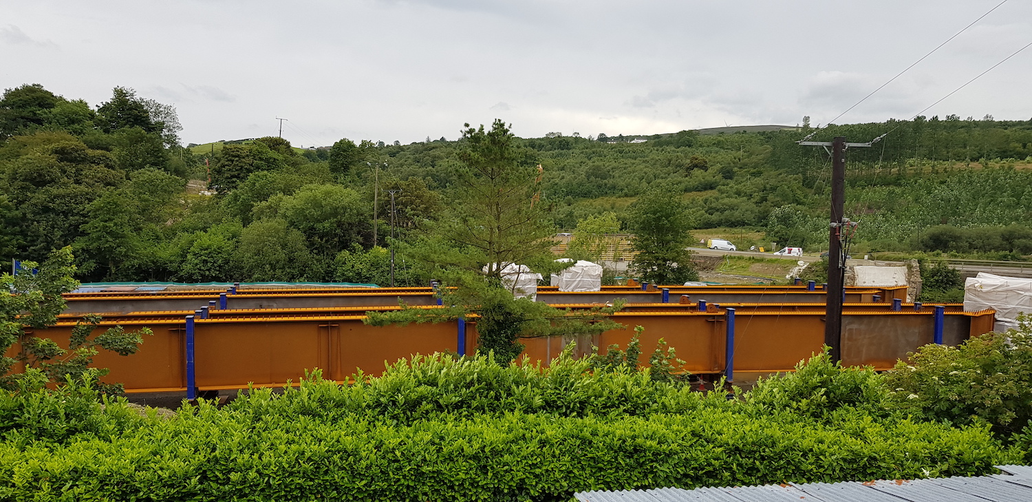
Pic 1 - A set of enormous steel beams waiting
patiently at Burntollet on 24 July 2020 ready to
be craned into place onto the new bridge once
the abutments are ready. This bridge is too long
for the more usual concrete beam construction.
[Alan Lynas]
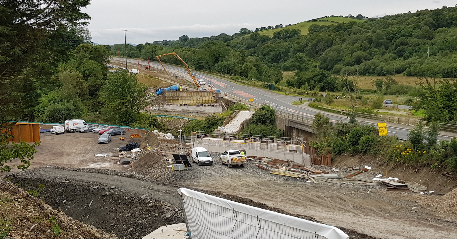
Pic 2 - Burntollet bridge on 24 July 2020,
showing the abutments for the northern half of
the new bridge taking shape adjacent to the
existing 1950s bridge. This is where the beams
in pic 1 will be placed eventually. Over the
past few months there have been concerns
about pollution incidents in watercourses along
the scheme, especially the Faughan which runs
particularly close to the site at Burntollet.
The matter
was raised in Stormont in late June when
the DFI Minister said that NIEA was being
proactive in investigating. Let's hope incidents
of this nature do not occur going forward. [Alan
Lynas]
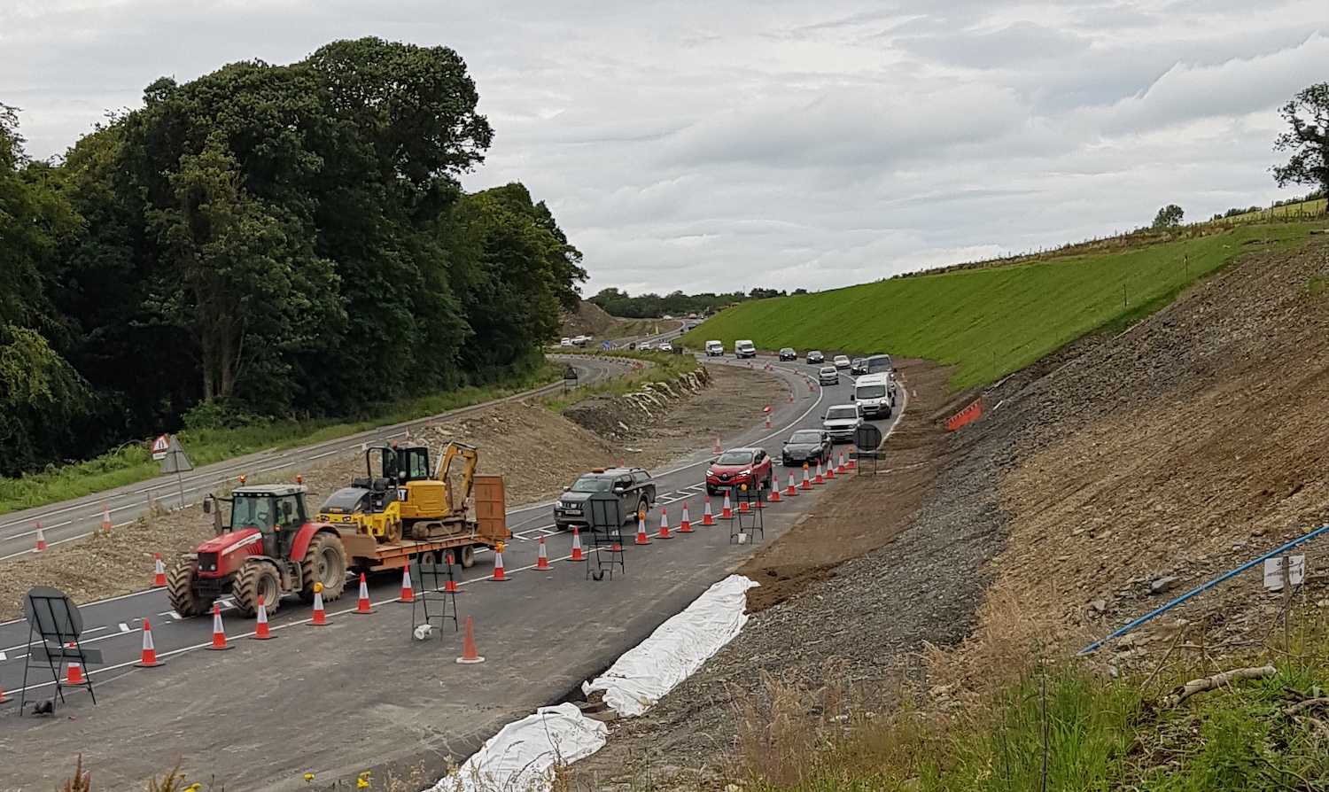
Pic 3 - View looking west from Burntollet on 24
July 2020 showing all traffic on a temporary
road that has been built adjacent to the A6.
This is to allow the construction of The Oaks
accommodation bridge which will pass over the
new road on the site of the old road. Ahead, the
temporary road curves to the right and then to
the left where it continues as the Ervey Road
Link, a permanent access road that has just been
built and is temporarily carrying all A6
traffic. The diversion came into use on 23 July
and will be in place for several months. [Alan
Lynas]
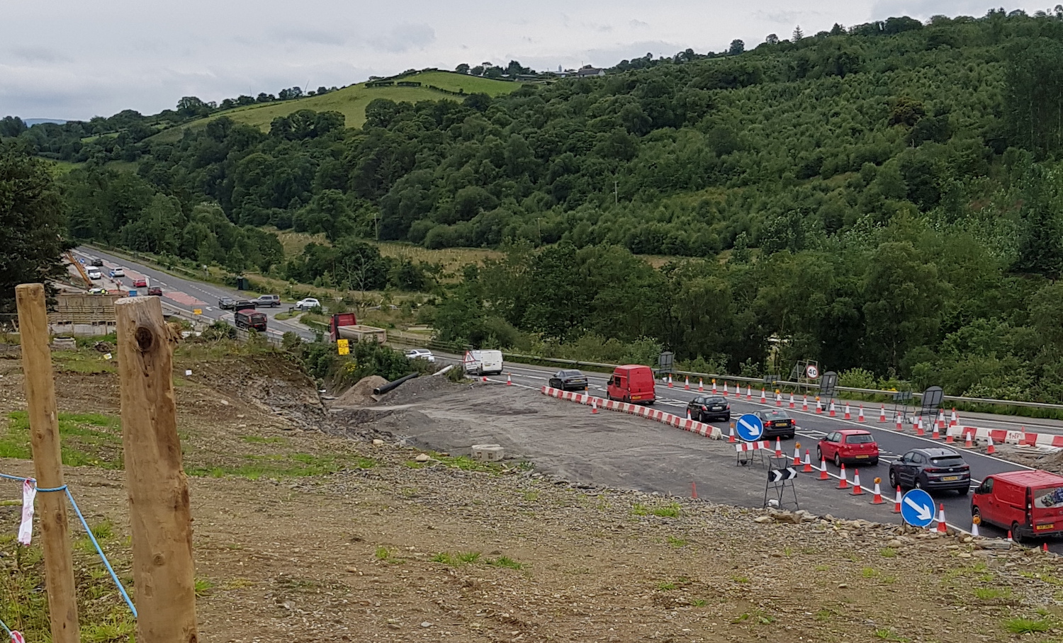
Pic 4 - View in the other direction (towards
Burntollet) on 24 July 2020 showing the
temporary diversion rejoining the existing road.
[Alan Lynas]
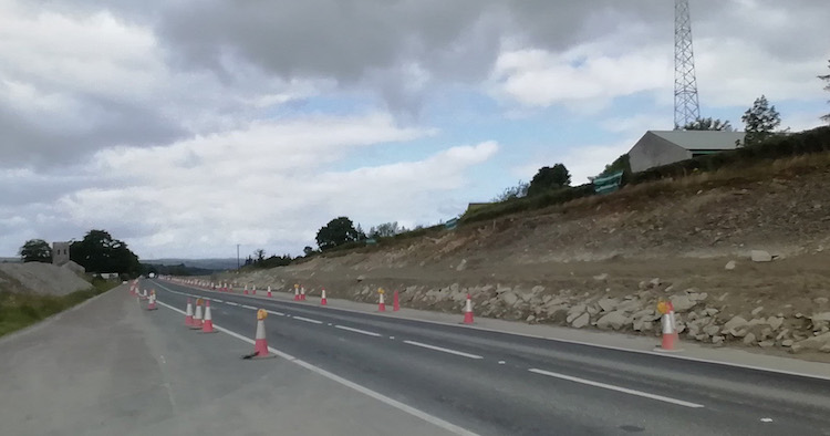
Pic 5 - View west at the site of the future
Killaloo (Gulf Road) grade separated junction
west of Claudy on 19 July 2020. The new road
will subsume the existing road here, so the
embankment beside the road has been cut back to
accommodate the wider road, though most of the
widening will be on the left. [Paul McCloskey]
Pic 6 - Work on the future Killaloo flyover is
so far limited to the southern abutment (shown
here on 19 July 2020) plus the central pillars
(not shown) as well as some of the approach
embankments beyond. It will be some time yet
before the beams are placed. [Paul McCloskey]
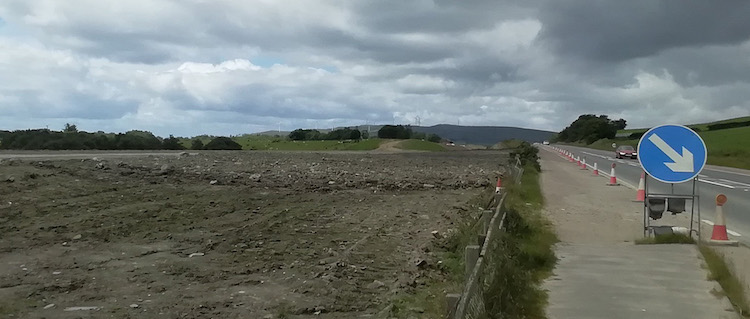
Pic 7 - View west along the existing A6 from
just west of Claudy crossroads (Baranailt Road)
on 19 July 2020. Although the road here is an
online upgrade, it actually swings to the left
here to achieve the correct geometry for the
Claudy junction. The whole area on the left here
will be the future dual-carriageway, while the
existing A6 shown here will be largely removed
and replaced with a much narrower agricultural
access road. [Paul McCloskey]
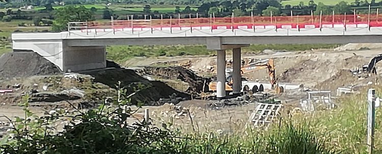
Pic 8 - Gortilea Road bridge looking rather
gorgeous (in the engineering sense!) in the sun
on 19 July 2020 with its fresh concrete and
completed bridge deck. [Paul McCloskey]
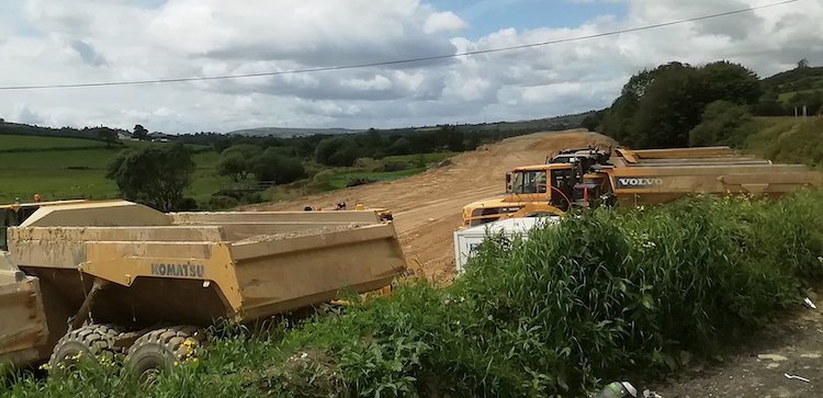
Pic 9 - View west along the route of the future
road from near Ballyhanedin Road on 19 July
2020. From here to Dungiven the road runs
offline, meaning that the existing road (visible
on the extreme right) will remain in place. This
was one part of the scheme that was
least-advanced, but these photos show major
earthworks now underway. [Paul McCloskey]
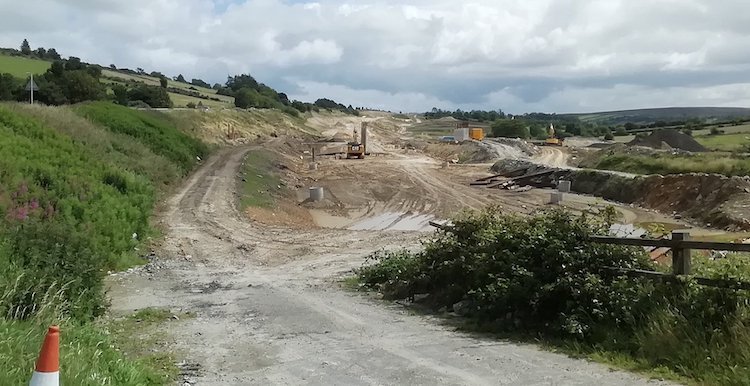
Pic 10 - Same location as pic 9 but looking east
towards the site of the future Ballyhanedin Road
bridge on 19 July 2020 - the central bridge
pillars are beside the excavator, while the
southern abutment is visible to the right. Much
still to be done here. [Paul McCloskey]
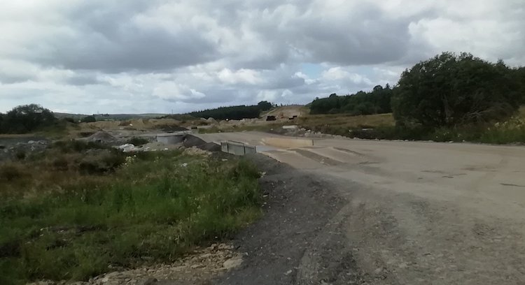
Pic 11 - View west along the future
dual-carriageway from Crock-na-brock Road (now
permanently closed here) near Foreglen on 19
July 2020. Works here have included a major
culvert over a local watercourse, now completed.
Paul McCloskey]
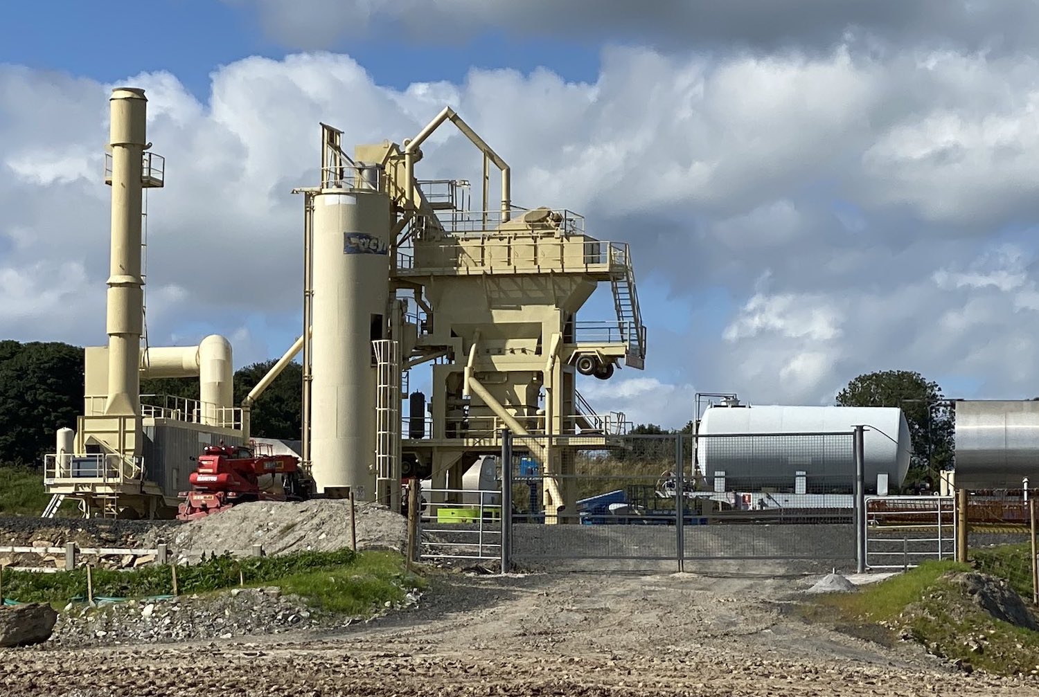
Pic 12 - The batching plant at Ovil (near
Foreglen) is now up and running, as seen here on
20 July 2020. It will be capable of producing
large quantities of blacktop for surfacing the
road. [Esther Harper]
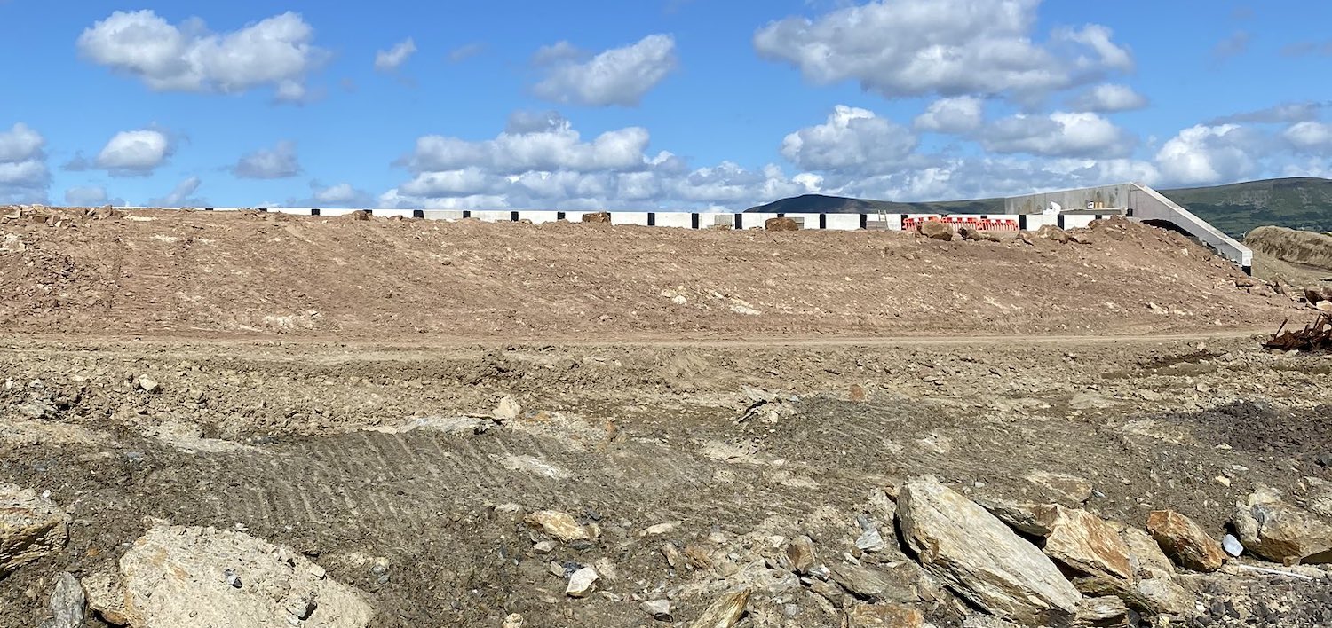
Pic 13 - Derrychrier Road underpass has now been
buried with rock and earth fill, as seen here on
20 July 2020. At a later date the embankments
for the road itself will be built on either
side. Much of the rock used on the scheme comes
from the huge cutting at Ovil Hill. [Esther
Harper]
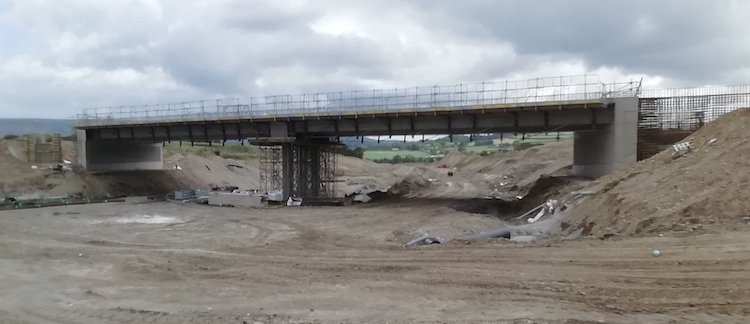
Pic 14 - Moving now to Dungiven, this is Feeny
Road overbridge looking well advanced on 19 July
2020. On the right you can see steel
reinforcement being placed for casting one of
the wingwalls. [Paul McCloskey]
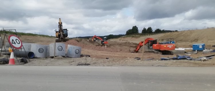
Pic 15 - Same location as pic 14, this is the
view west from the "temporary" Feeny Road on 19
July 2020 along what will be the future
dual-carriageway. A lot of earthworks are
evident here too. [Paul McCloskey]
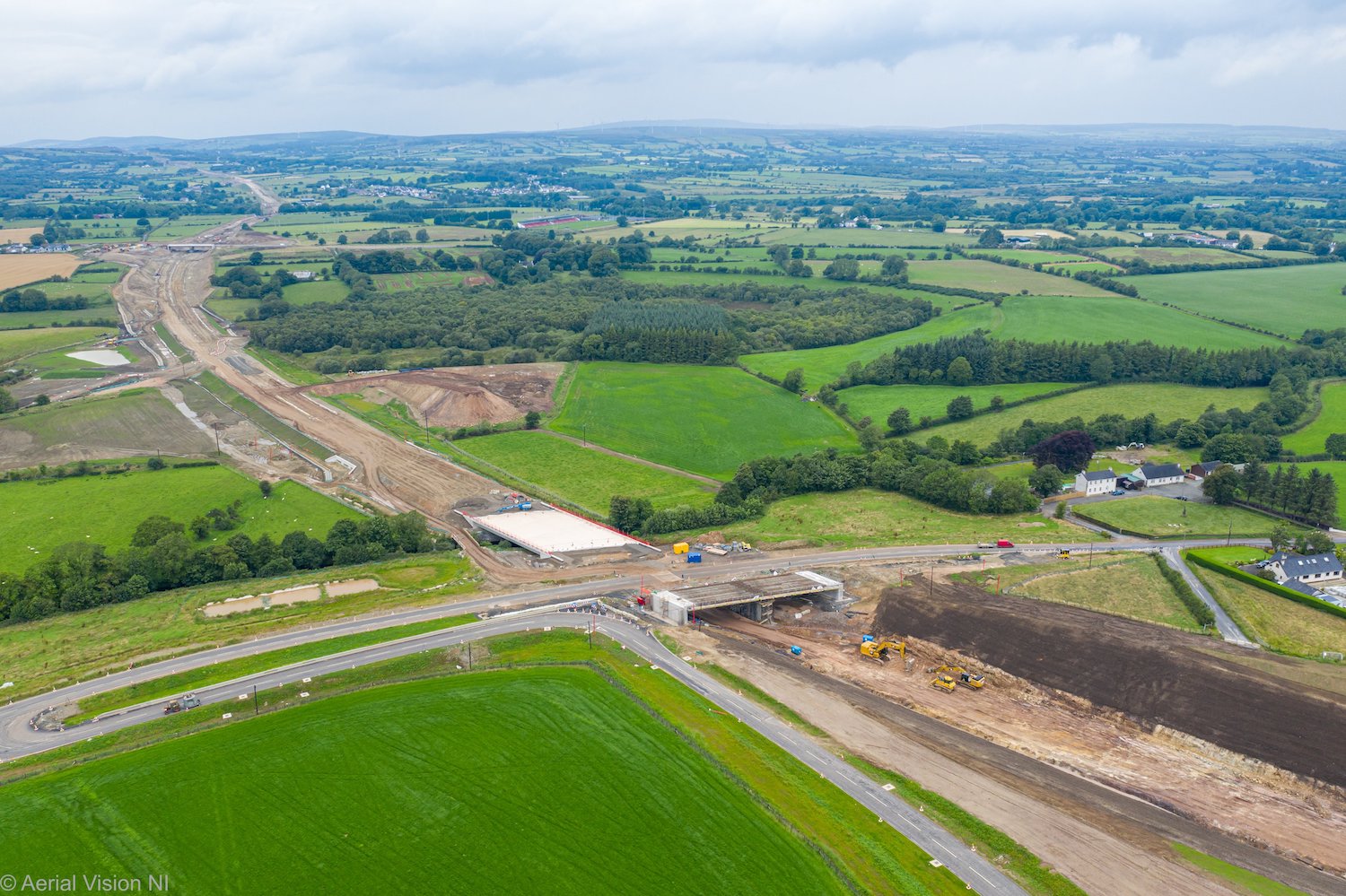
Pic 16 - Lovely aerial shot looking west on 24
July 2020 towards the Magheramore Road
overbridge (foreground), the completed deck of
the Owenrigh River bridge just beyond it and, in
the far distance, the Feeny Road overbridge.
Since Teeavan Road was closed in May (see its
little surviving stretch clinging on on the
right) the remainder of the cutting has now been
fully excavated. [Aerial Vision NI]
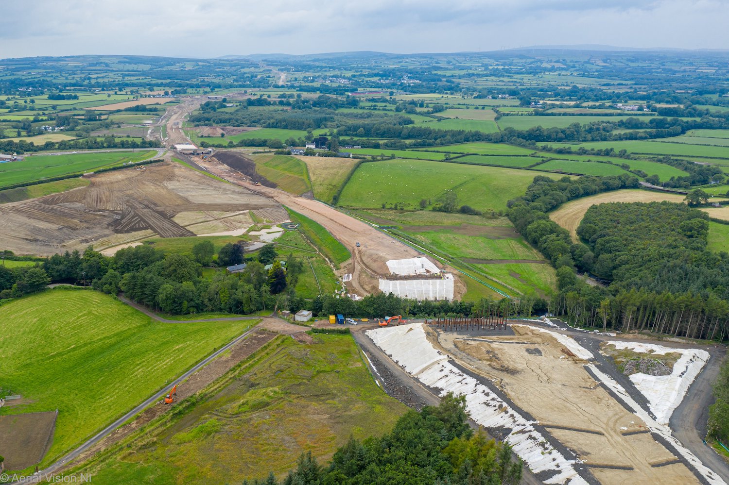
Pic 17 - Moving a little further east than pic
16, this is the view looking west from above the
site of the River Roe bridge. This bridge will
pass over the river above tree height, and both
abutments are taking shape. The white membrane
is designed to reduce run off into rivers. 24
July 2020 [Aerial Vision NI]
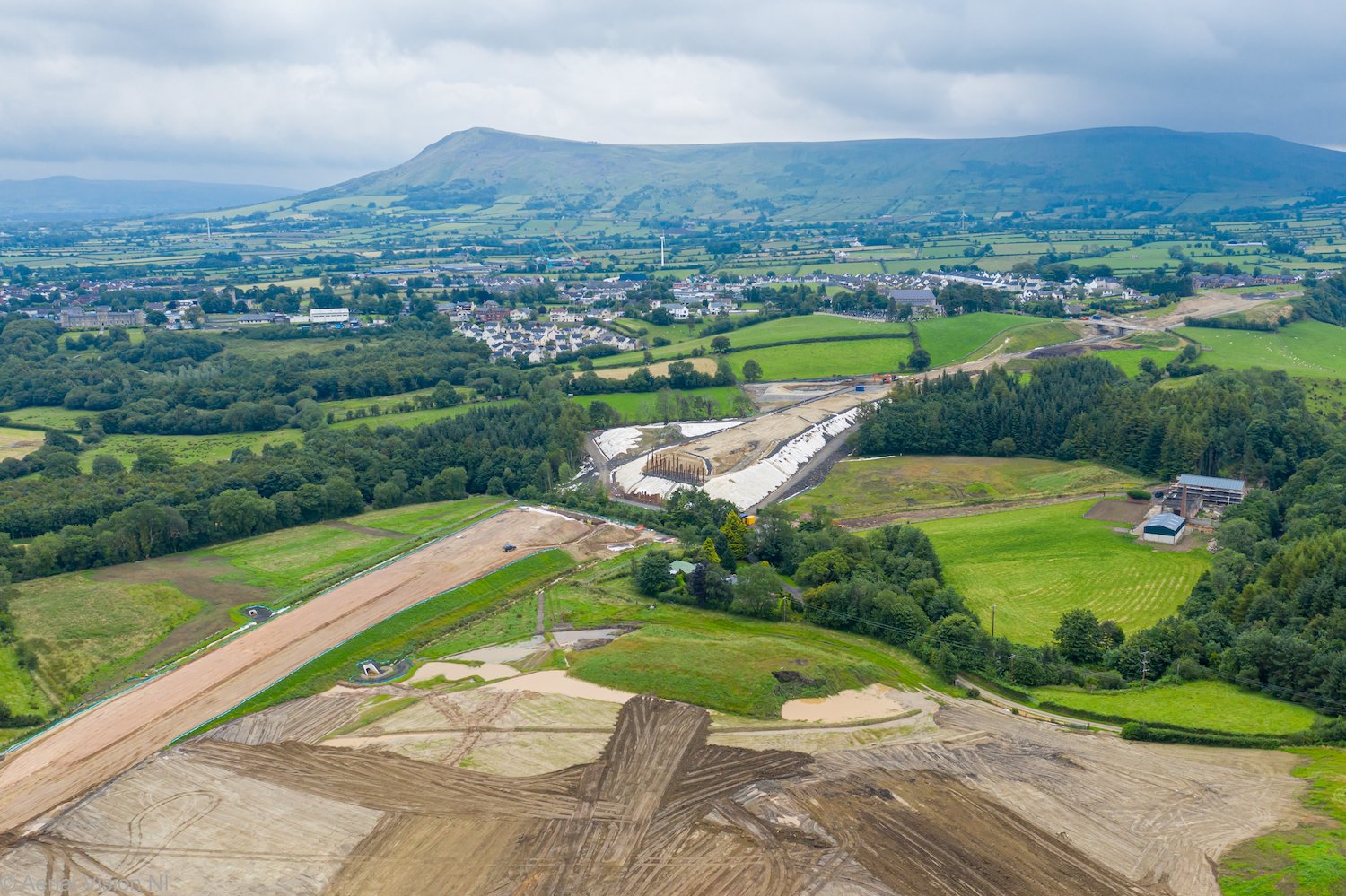
Pic 18 - Another view of the River Roe bridge
site, this time looking east, on 24 July 2020.
The terminus of the scheme is on the upper
right. Priory Lane overbridge, the last
structure on the scheme, can be seen just before
it. [Aerial Vision NI]
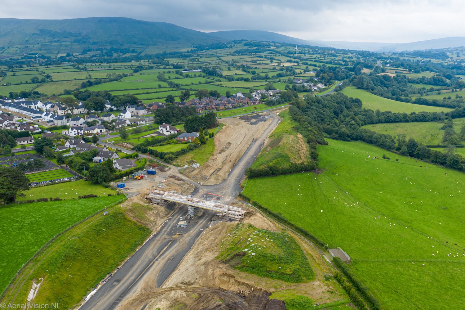
Pic 19 - View of the terminus of the scheme at
the future Magherabuoy roundabout (large site
beore the red houses ahead) and the deck of
Priory Lane overbridge under construction. The
first layers of blacktop are evident here (this
might have been placed to provide access for the
crane that will be used to install the bridge
beams at the River Roe). No work appears to have
happened yet on the new stretch of Priory Lane
that will be needed to pass over this bridge.
[Aerial Vision NI]
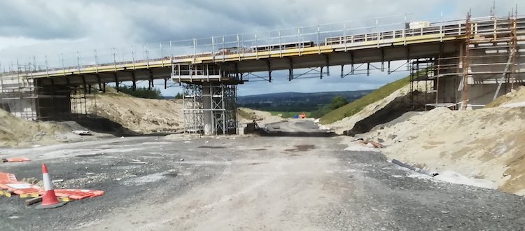
Pic 20 - Our final shot is of Priory Lane
overbridge, Dungiven, seen here on 19 July 2020
with work well underway on the bridge deck.
[Aerial Vision NI]
22 Jun 2020: Another feast of photos in
this update, thanks to our amazing spies and
photographers on the ground - Alan Lynas, Polly
Lynch, Esther Harper, Turmeel, Paul McCloskey
and Aerial Vision NI - as well as the
contractor, who updated their web site a week
or so ago. As always the commentary is in the
photo captions and are arranged in order from
west to east. The aerial photos were taken by
Aerial Vision NI. Although they date from the
end of May they're still very relevant. Remember
you can see their great pictures on Facebook
or Twitter.
It's also worth following Esther
Harper who often tweets photos from the
area around Ovil. Note also that Google Earth
recently updated their imagery of the stretch of
the A6 from Drumahoe to Ovil, so that's worth
checking out too - you can see the whole stretch
as it was on 24 April 2020. We are approaching
the half way point of the project, in time
terms, with completion due in spring 2022.
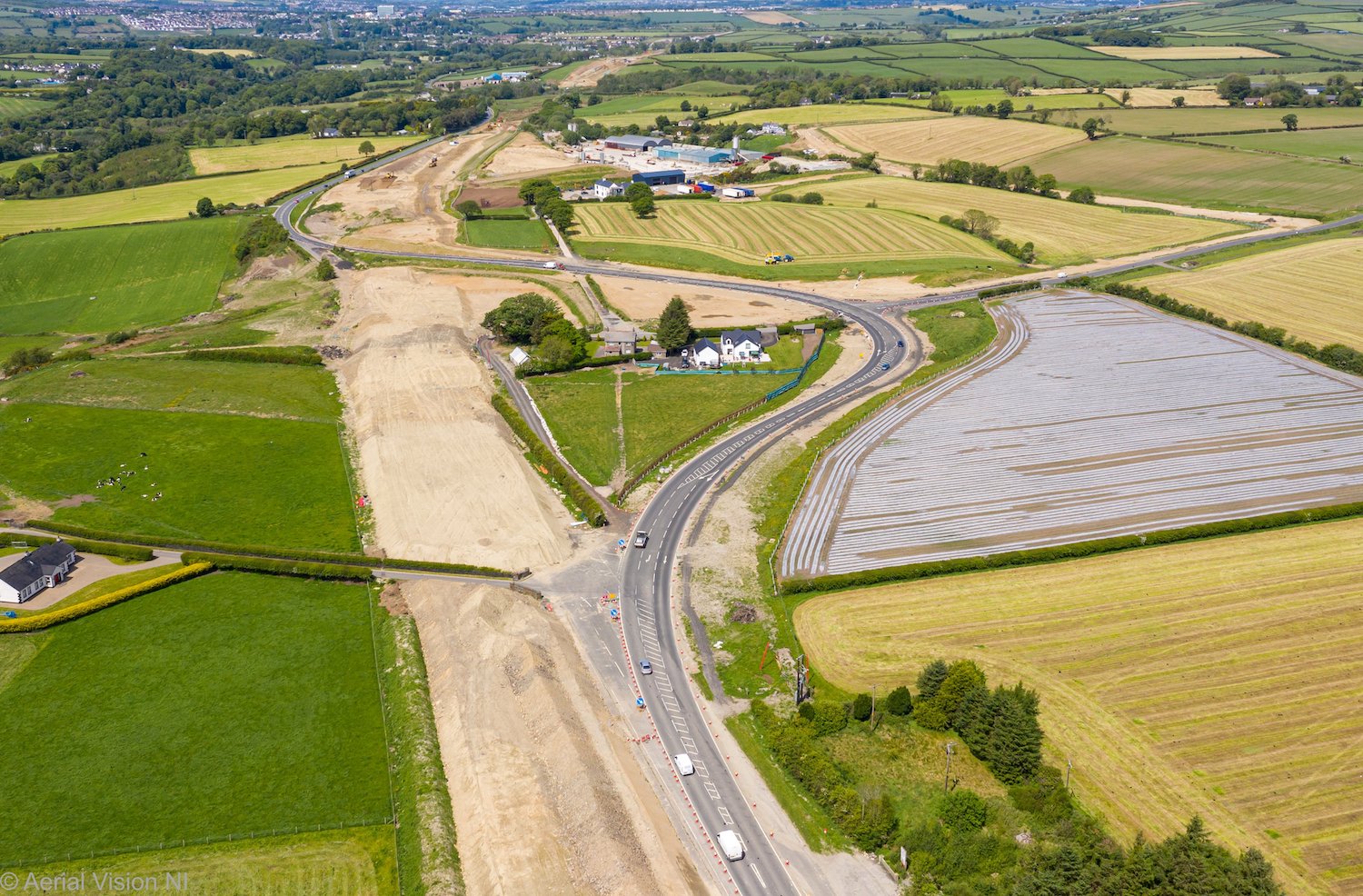
Aerial photo of the future Tamnaherin Road
junction, between Drumahoe and Burntollet, on 30
May 2020. The route of the new dual-carriageway
here is obvious, but the material visible is
actually overburden, placed to encourage the
soft ground to settle. Piling work is due to
begin this month on the bridge that will carry
the dual-carriageway over Tamnaherin Road. It
will be situated close to where the current road
passes through the line of the future road.
[Aerial Vision NI]
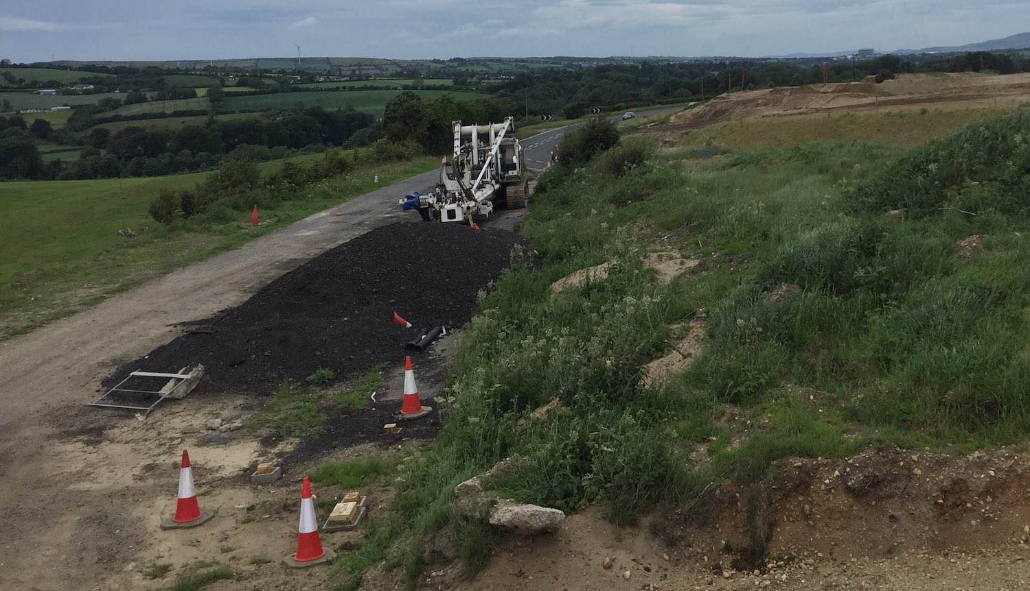
A piling rig sitting at the site of the future
bridge at Tamnaherin Road on 21 June 2020,
presumably ready to start work shortly. The
tarmac in the left foreground is the former A6,
which will eventually be buried under the
embankment of the new road. [Polly Lynch]
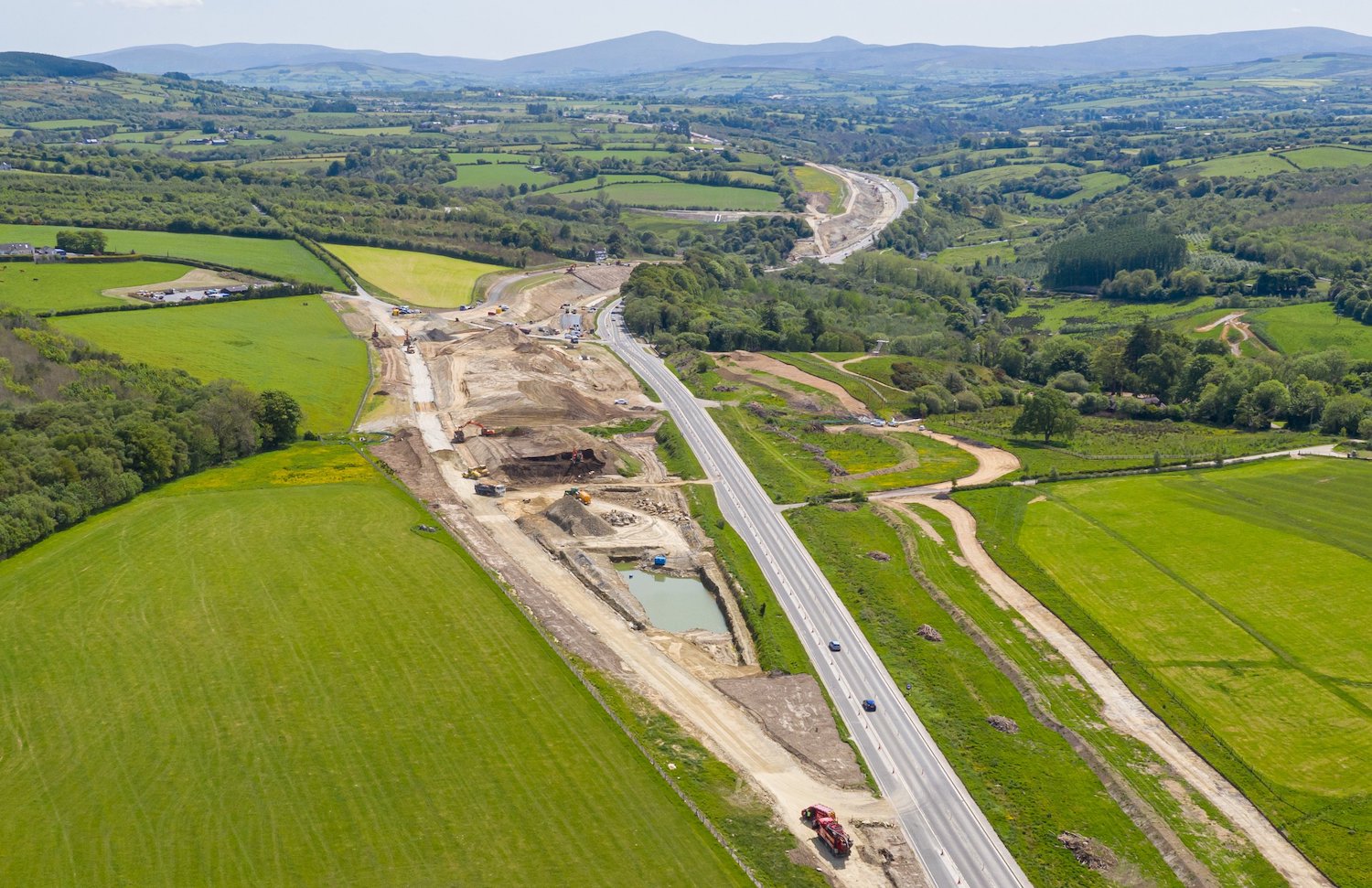
Same location as the previous aerial shot, but
looking east, this was the view towards
Burntollet (hidden behind the trees) on 30 May
2020. In the left foreground work is well
underway on the Ervey Road link, which will
connect Ervey Road to the Tamnaherin Road
junction. Drivers are going to get a better view
of this in July when all A6 traffic is diverted
onto it to allow the construction of The Oaks
accommodation bridge, which will pass over the
A6 just beyond the pool of water visible in the
foreground. [Aerial Vision NI]
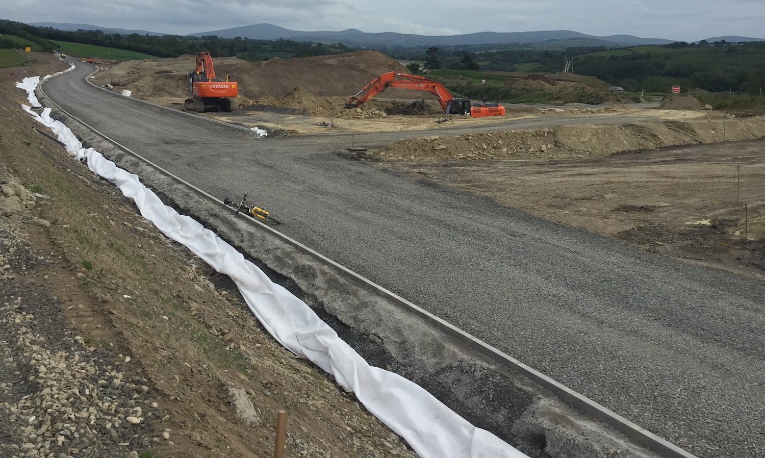
This photo of the Ervey Road link was taken on
21 June, three weeks after the aerial shot
above, showing how much it has progressed even
in that time. This view is also looking east,
with the current A6 just visible at the top
right. The stretch of gravel going to the right
just before the two excavators will lead to the
future Oaks accommodation bridge. [Polly Lynch]
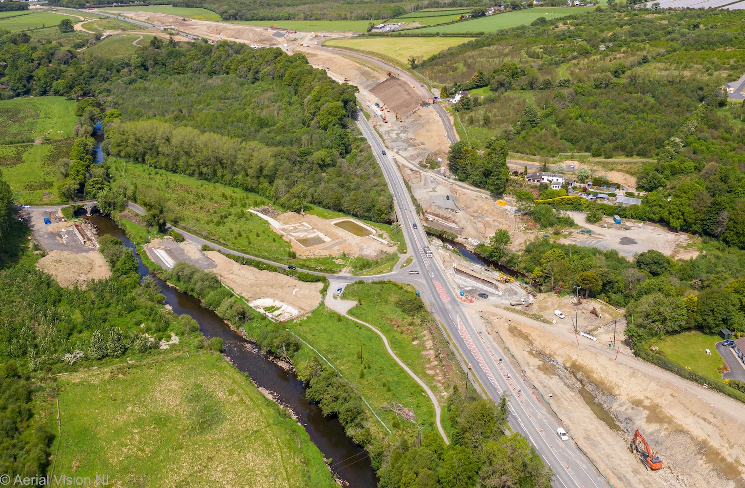
Moving now to Burntollet Bridge, this is the
view looking back the way we came (north,
towards Derry) with the Ervey Road link just
visible at the very top of the frame. The
abutments for the eastern half of Burntollet
bridge were in place when this picture was taken
on 30 May 2020. On the left of the shot you can
also see the two abutments for the future
Ardmore Road bridge also in place. As you can
see it will cross the river diagonally, rather
than at right angles as the older bridge does.
[Aerial Vision NI]
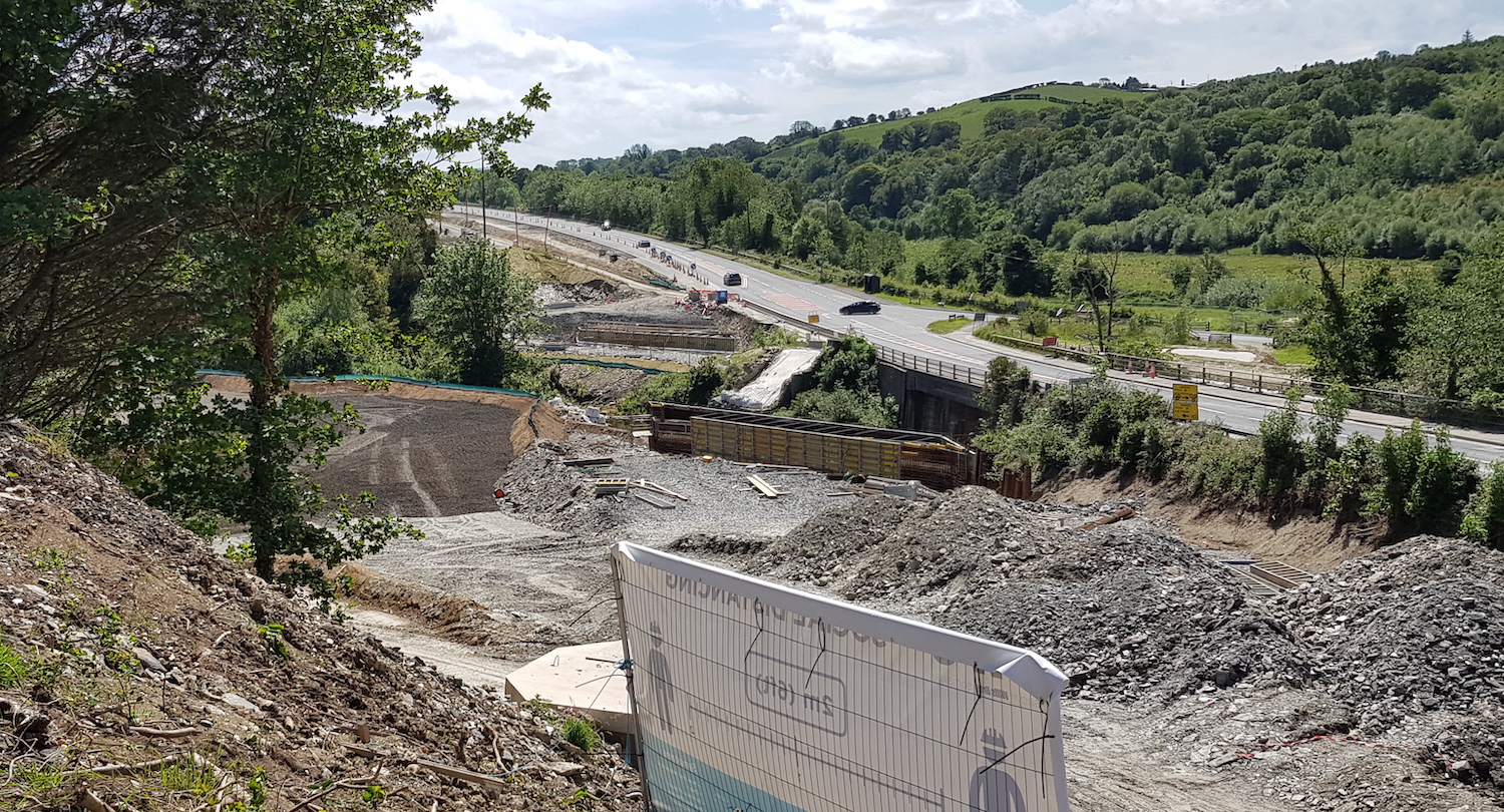
This is a ground-level view of Burntollet Bridge
seen looking south (towards Dungiven) on 22 June
2020. The original 1950s bridge is on the right,
still carrying the A6, while the two abutments
for the eastern half of the new bridge are
visible to its left. The sloping white sheets in
the centre of the shot are all that remains of
the 18th century bridge that was demolished to
make way for the new bridge. [Alan Lynas]
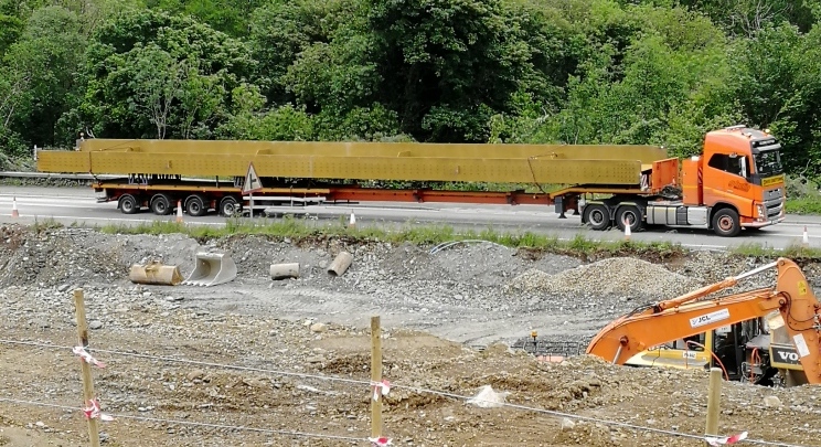
On 22 June 2020 a set of four steel beams
arrived at Burntollet bridge on lorries like
this one. This tells us that the new Burntollet
bridge is going to have steel beams, rather than
concrete ones, probably due to its length and
high skew angle. [Alan Lynas]
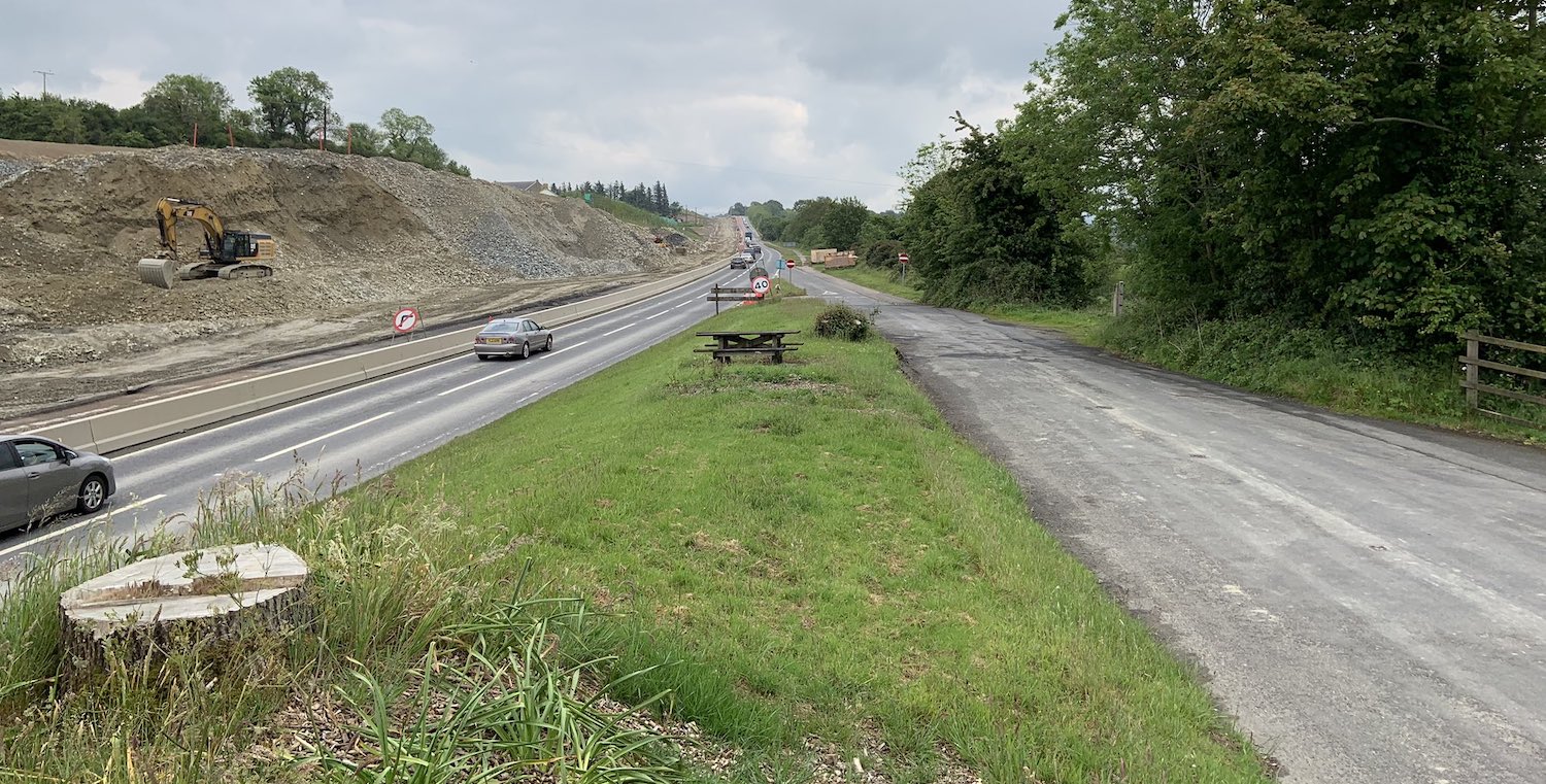
This photo was taken looking towards Dungiven at
Brackfield Bawn, just east of Burntollet on 14
June 2020. It beautifully illustrates three
centuries of development - on the right is the
early 19th century road (which itself replaced
the 17th/18th century road located nearby), the
20th century (1950s) road with the cars on it,
and the works taking place to construct the 21st
century dual-carriageway on the left. [@Turmeel]
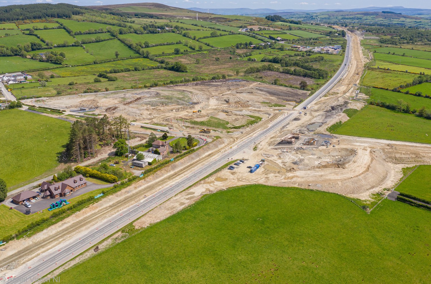
Moving about 2km further east, this aerial shot
of the Killaloo (Gulf Road) junction was taken
looking east on 30 May 2020. Work here is not as
advanced as the other junctions, with only the
south abutment of the future overbridge in
place. The approach embankment on the right, and
the curve of the future westbound on/off-slip,
are also visible. [Aerial Vision NI]
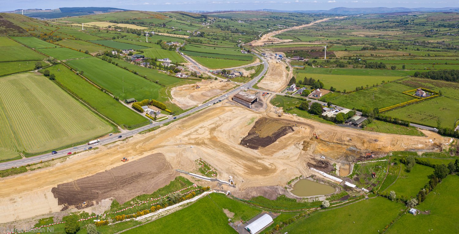
Moving another 2km east, this was the site of
the future Baranailt Road junction on 30 May
2020. In the centre of the shot is the future
bridge with beams in place and the diaphragm
(which joins the beams together to form the
deck) being constructed during June. The line of
the future road and its sliproads is obvious in
the earthworks. From here to Dungiven the new
road will run offline, leaving the existing A6
in situ, rather than subsuming it. [Aerial
Vision NI]
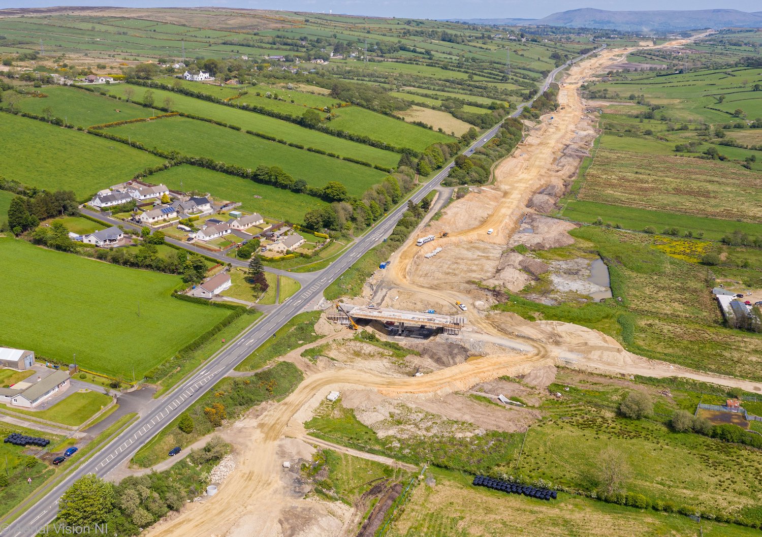
Gortilea Road overbridge as seen on 30 May 2020.
With the bridge deck itself now essentially
completed, work is now taking place on
backfilling the abutments. It will carry
Gortilea Road over the new road, though this
will require an approach embankment on the right
that has yet to be started. [Aerial Vision NI]
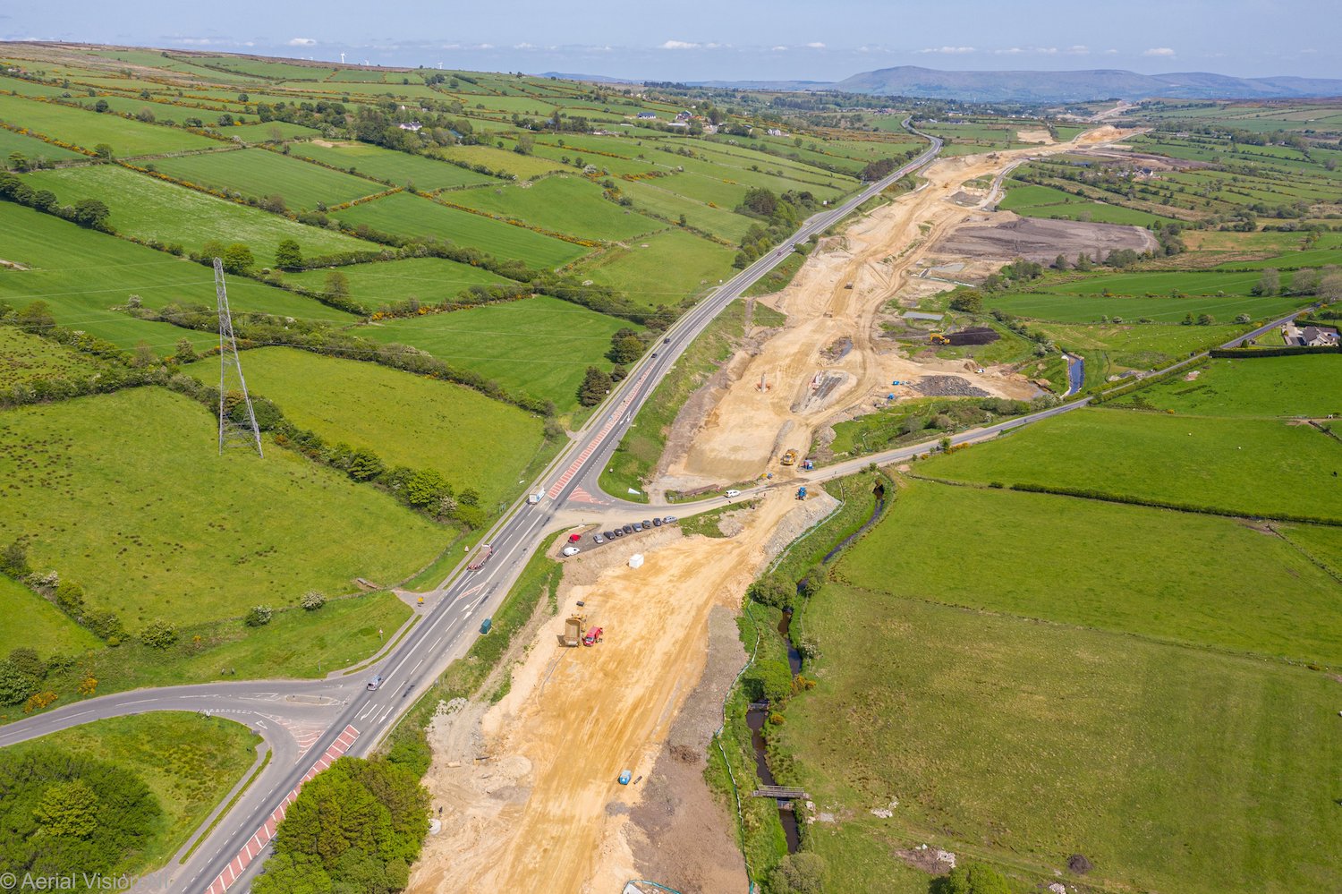
About 1km east of Gortilea Road is Ballyhanedin
Road which will also be bridged over the new
road. The central pillar is in place (just
visible in splendid isolation a couple of
hundred metres beyond Ballyhanedin Road), but
work has finally started on the abutments, with
piling works for the southern abutment due to
commence soon. More work seems to be taking
place on the future road itself at this point
too. There is another bridge, an accommodation
bridge, at Munreery about 1km east of this one.
We don't have a photo of it, but excavations for
the bases of this bridge are apparently now
taking place. [Aerial Vision NI]
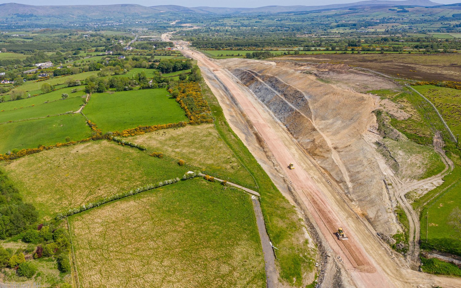
Close to Foreglen village, this is a view
looking east (to Dungiven) of the huge Ovil Hill
cutting, the largest cutting on the whole
scheme, on 30 May 2020, now completed and with
the base layers of the road being formed. In
time the bare slopes will return to nature and
this will look less scar-like on the landscape.
It also provided a huge amount of rock for
elsewhere on the scheme, greatly reducing the
amount of rock that had to be imported from
quarries elsewhere. [Aerial Vision NI]
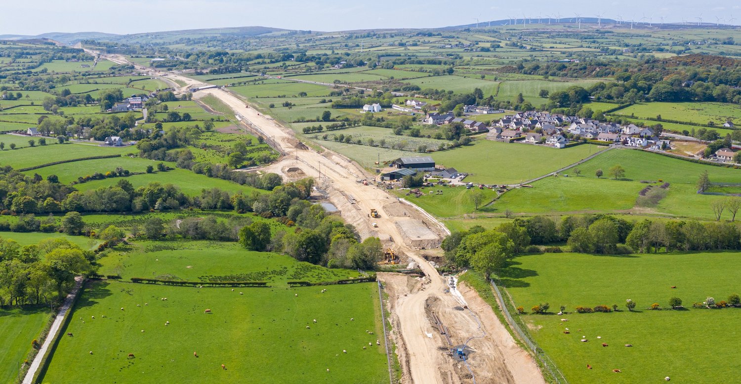 Reaching
Dungiven and looking back west (towards Derry)
this is the point where the new road will cross
the Owenbeg River. This is the only one of the
three river bridge at Dungiven that has not yet
started, but piling works are due to commence
during June on the east and west abutments.
Right now there is a temporary 'bailey' bridge
over the river for site traffic. In the distance
you can just make out a white line crossing over
the future road - this is the Derrychrier Road
underpass, now completed. This week Esther
Harper went for a drive through it, and uploaded
a video
here! [Aerial Vision NI] Reaching
Dungiven and looking back west (towards Derry)
this is the point where the new road will cross
the Owenbeg River. This is the only one of the
three river bridge at Dungiven that has not yet
started, but piling works are due to commence
during June on the east and west abutments.
Right now there is a temporary 'bailey' bridge
over the river for site traffic. In the distance
you can just make out a white line crossing over
the future road - this is the Derrychrier Road
underpass, now completed. This week Esther
Harper went for a drive through it, and uploaded
a video
here! [Aerial Vision NI]
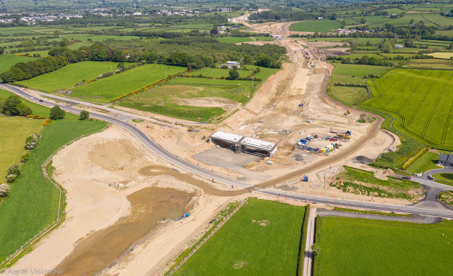
Same location as the previous photo but turning
round 180° and looking east, this is the future
Feeny Road junction on 30 May 2020 with works
now underway on the diaphragm to hold the bridge
beams together. Feeny Road will be diverted over
the new bridge in due course. [Aerial Vision NI]
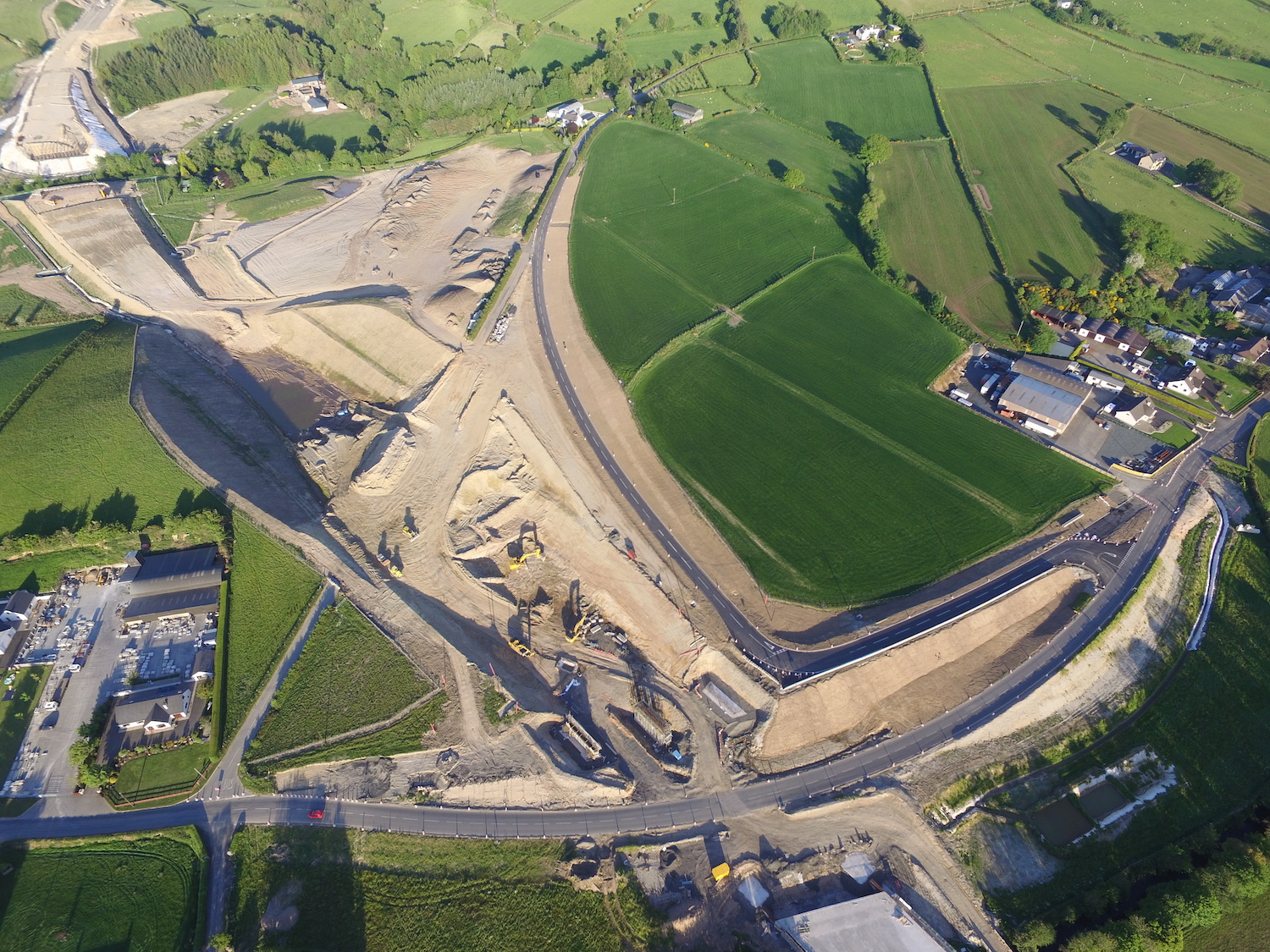
This magnificent aerial shot of Teeavan Road
(which until recently ran from top middle to
bottom left) and Magheramore Road (middle right
to lower left) was taken on 31 May 2020. The
diverted Teeavan Road had just been opened, and
the contractor lost no time at all in excavating
the original Teeavan Road to complete the
cutting through this hill. At the very bottom of
the shot you can see the Owenrigh River bridge,
with its deck completed and backfilling now
underway. At the top left you can also see the
future River Roe bridge, where work is still
ongoing on the two abutments. Close to the
bottom of the shot you can see the two abutments
and the central pillars of the Magheramore Road
overbridge. The 8 beams for this bridge were
craned into place overnight on 18/19 June 2020.
[Les Ross]
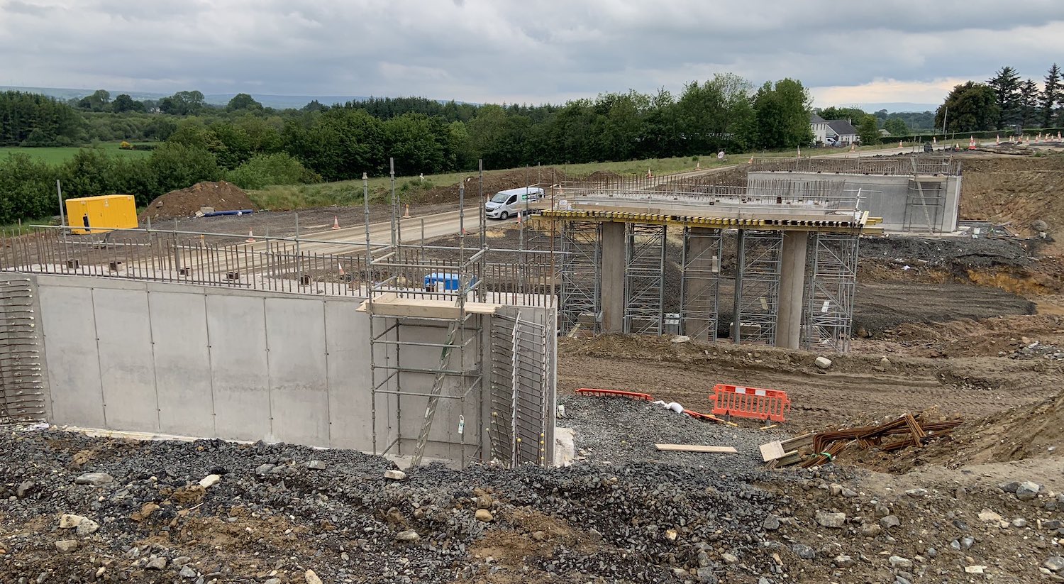
This shot of Magheramore Road junction was taken
on 14 June 2020, four days before the beams were
placed. You can see the southern abutment in the
foreground, with the central pier beyond and the
northern abutment beyond that. All traffic is
temporarily diverted around the site, visible on
the left. [Turmeel]
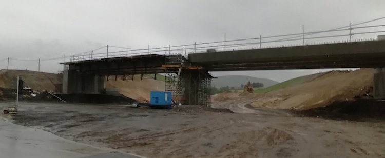
This picture was taken on 21 June 2020 and shows
the eight beams in place at Magheramore Road,
having been craned into place two days
previously. Work will now start on the diaphragm
and the bridge deck. [Paul McCloskey] 17 May 2020: We are spoiled for
photographs and aerial footage in this update,
thanks to various people who are taking photos
and allowing me to share them here. You'll also
find these folks on Twitter. This month we must
thank Alan Lynas, Dee Logue, Polly Lynch, Esther
Harper, Paul McCloskey and Sky Photography. I'm
going to share 17 photos this time (must be some
kind of record), and to make sense of them I'm
starting at Derry and working east. I'll include
the commentary in the captions.
Pic 1: This shot of the new Park-and-ride
facility at Drumahoe on 17 May 2020 shows that
kerbing in place and almost ready for tarmac to
be laid. This element of the scheme is likely to
open in advance of the main dual-carriageway,
perhaps sometime this summer. [Dee Logue]
Pic 2: Surcharging in place at Tamnaherin Road
junction, between Drumahoe and Burntollet, on 26
April 2020. The future road will run straight
ahead here, while all traffic is being diverted
to the right. Surcharging is the addition of
extra material to speed up the settlement of
soft ground. [Polly Lynch]
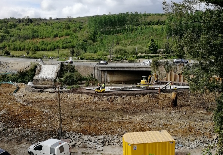
Pic 3: The 1957 Burntollet Bridge as seen on 16
May 2020. On the left the white sheet covers the
remains of the late 18th century "old" bridge
which was demolished last summer. The
foundations for one of the new abutments for the
future bridge is in the centre of shot, with the
other abutment being off shot to the left. Due
to the fact that the new bridge shares a
footprint with the 1957 bridge, the plan is to
build the eastbound half of the bridge first,
then demolish the 1957 bridge and build the
westbound half in its place. [Alan Lynas]
The whole Burntollet area
is covered in this
amazing aerial movie, released on 7 May
2020. The footage also shows the approaches from
either direction. At 3:40 the movie then turns
to the nearby Ardmore Road bridge, which will
functionally replace the older Oaks Bridge
that's also visible, though the older bridge
will be retained in this case. There's a good
overhead view at 4:30. [Sky Photography]
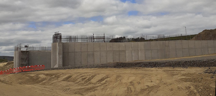
Pic 4: At the future Claudy junction (Baranailt
Road), the beams on the new bridge that will
carry the dual-carriageway over the local road
were craned into place during the first week of
May. The shot above was taken by Paul McCloskey
before this happened, on 26 April 2020. There's
a great shot of the bridge a week later with the
beams in place here.
There's also a great aerial movie of this entire
junction here,
taken by Sky Photography before the beams were
put in place, that gives an excellent overview
of the site.
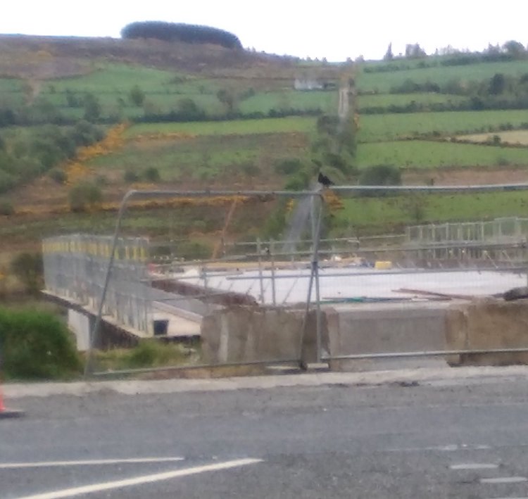
Pic 5: This view of Gortilea Road bridge was
taken from the existing A6 on 11 May 2020, with
Gortilea Road visible in the distance. This
bridge will carry this local road over the new
dual-carriageway. The beams were put in place
last month and the contractor is currently
starting the wingwall construction (triangular
retaining walls beside the abutments) and
backfilling to build the road height up. [Paul
McCloskey]
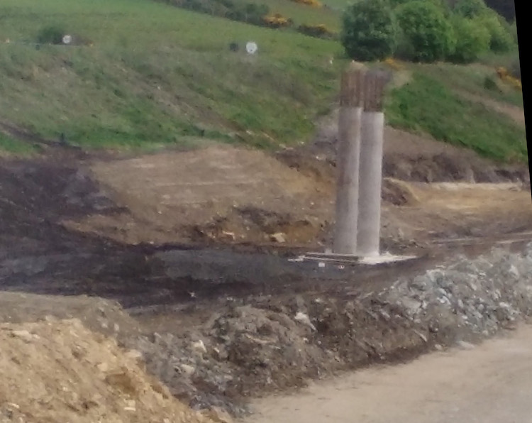
Pic 6: The next bridge to the east of Gortilea
Road is Ballyhanedin Road bridge, which will
carry this local road over the new
dual-carriageway. Work here is less advanced -
the photograph above shows what looks like the
central pillars of the future bridge with the
existing A6 on the embankment behind. [Paul
McCloskey]
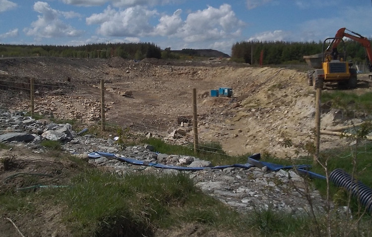
Pic 7: Moving now to east of Foreglen village,
this picture was taken at the site of the future
Killunaught Road bridge, near Ovil Hill on 3 May
2020. At this point the new road will run in a
cutting below ground level. This is the view
west from Killunaught Road towards Ovil Hill,
showing the cutting being excavated. [Paul
McCloskey]
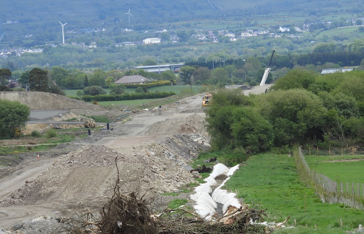
Pic 8: Same location as above, this is the view
east from Killunaught Road looking towards
Dungiven on 17 May 2020, showing the foundations
of the new dual-carriageway well underway. In
the distance is a very large crane. It's hard to
see where this is from this view, but it might
be at Feeny Road junction which is due to get
its beams lifted into place during May. [Esther
Harper]
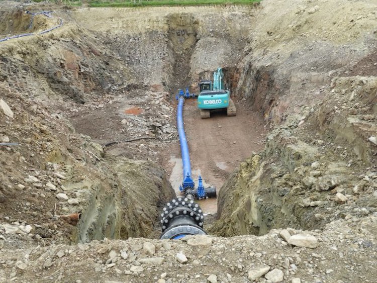
Pic 9: The cutting works at Killunaught Road
seem to involve the relocation of a water main
as shown in this view taken on 17 May 2020.
[Esther Harper]
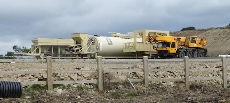
Pic 10: Also near Ovil, the contractor seems to
have been building an on-site batching plant for
making asphalt, adjacent to the existing A6, as
seen in this shot taken on 10 May 2020.
Presumably it's cheaper to build this on site
than ship in huge quantities of ready-made
asphalt from elsewhere. This implies that we're
going to be seeing blacktop being laid in large
quantities before too long. [Esther Harper]
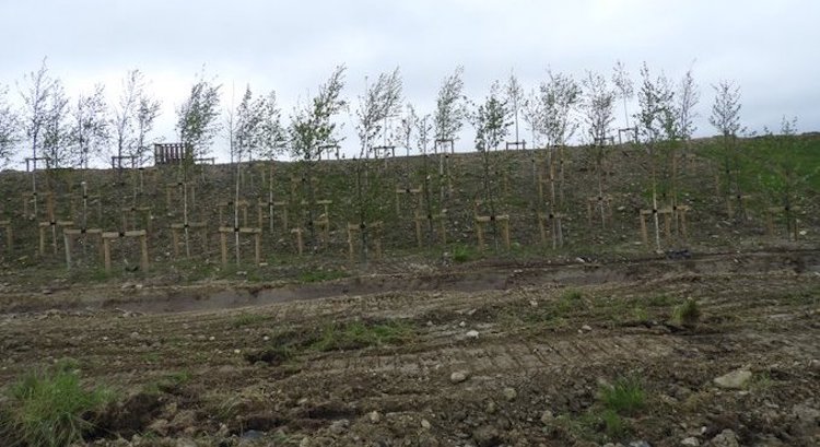
Pic 11: This view was taken near Ovil on 17 May
2020 and shows that the planned planting of
trees along the new road is already underway
[Esther Harper].
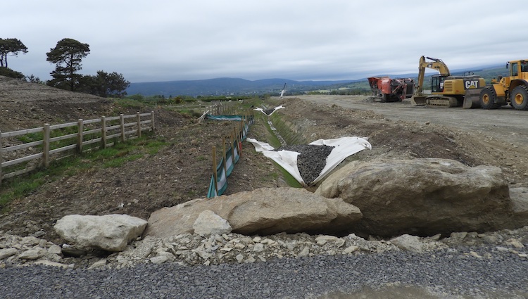
Pic 12: This view was also taken near Ovil on 17
May 2020, and shows the foundations of a stretch
of the new dual-carriageway well underway, with
a drainage ditch to one side. [Esther Harper]
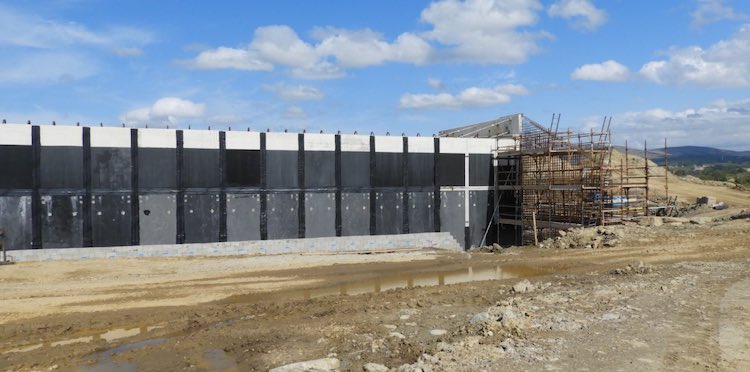
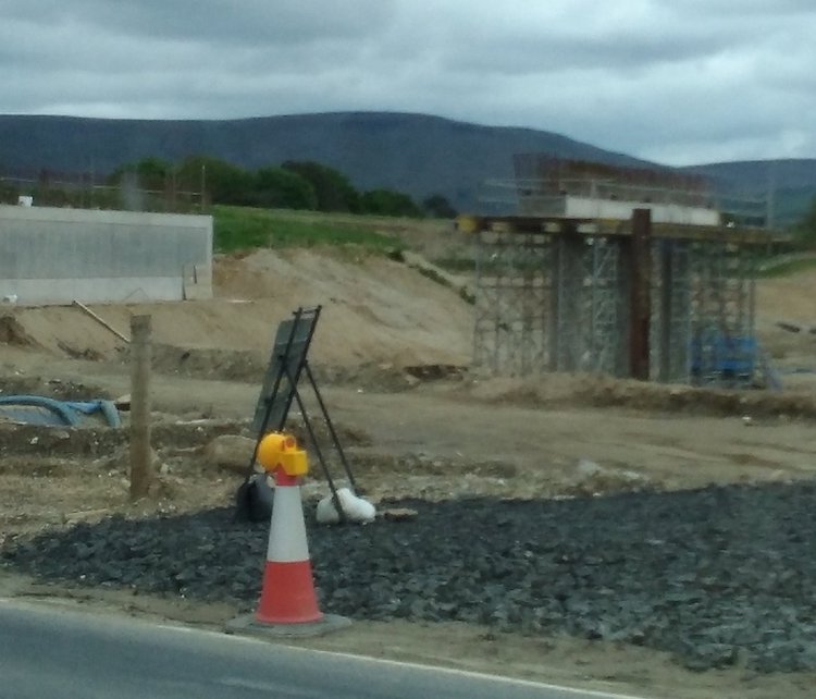
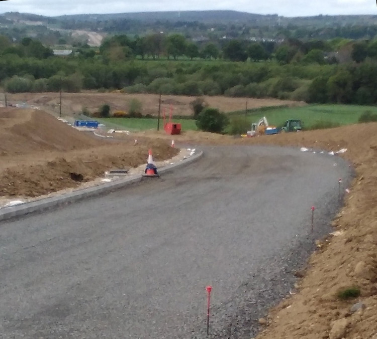
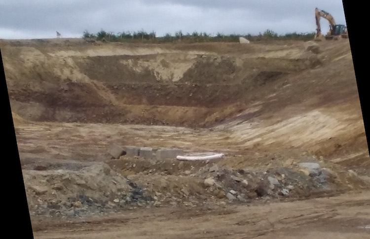
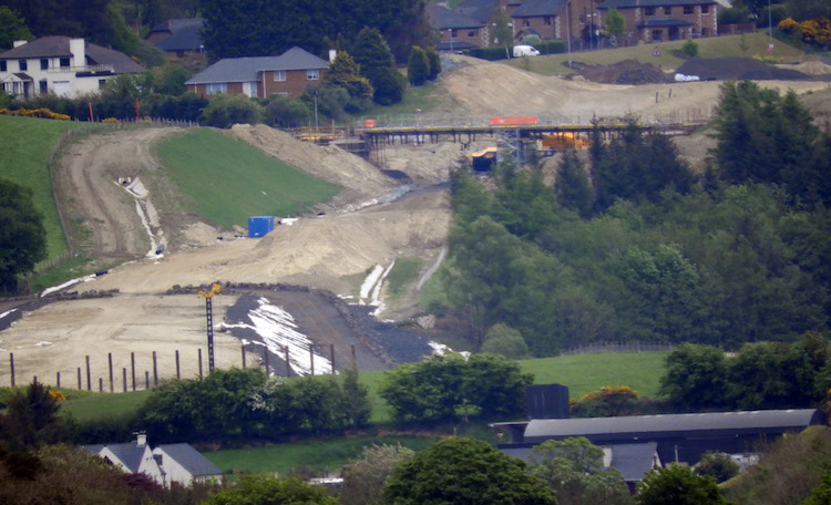
21 Apr 2020: The purpose of this update
is to let you know about two new movies that are
available on YouTube. The first is a
series of aerial shots (available
here) taken from a drone on the eastern
part of the scheme, between Foreglen village and
Dungiven. Thank you to Sky Photography for
making this available. I have provided a
commentary on the video below, where the numbers
refer to the times in the video that the items
appear. The second movie is this
one, by Ciaran, who has overlaid the plans
for each section of the dual-carriageway onto
Google Earth imagery, for the entire scheme from
Maydown to Dungiven (though note that the first
bit from Maydown to Drumahoe is not being built
in the current construction phase). A lot of
work has gone into this, thank you Ciaran. Two
photos are also given at the bottom of this
update, with thanks to our man on the ground,
Paul McCloskey. The commentary below gives some
detail of progress on major structures in the
Foreglen-Dungiven area. The following is the
latest news from the contractor on the other
major structures currently underway on the
scheme:
- McCay’s Accommodation bridge (near
Drumahoe) – has its beams in place and work
has started on the bridge deck.
- Burntollet bridge – on a very
difficult site, slope stabilisation is
complete and work has started on the abutments
of the new bridge, which will replace the
current one.
- Ardmore Road bridge (carrying a local
road near Burntollet over the river) – the
piles for the abutments are in place, and work
on the abutments themselves has begun.
- Killaloo overbridge (for the new
junction west of Claudy) – work is still
underway on the south abutment, with the north
abutment yet to begin.
- Claudy underbridge (which will carry
the dual-carriageway over Baranailt Road) –
beams are to be installed within the next
month.
- Gortilea Road overbridge – had its
beams put in place last month. Work is now
underway on the deck and wingwalls (retaining
walls on either side of the abutments).
- River Roe bridge, Dungiven – piling
work for the eastern abutment is complete and
work is underway on the western abutment. See
pic 1 below.
- Priory Lane overbridge, Dungiven –
had its beams put in place last month. Work is
now underway on the deck. See pic 2 below.
- Several other structures are discussed in
the commentary below.
Commentary on the aerial video:
- 0:10 Starting near the village of Foreglen,
this is the view west at the Altagarran Road
underpass which is completed but not yet open
to traffic. The hardcore foundation of the
dual-carriageway is being laid over it.
- 0:34 Culvert for a small watercourse visible
going beneath the embankment. Beyond is a new
residential/agricultural access laneway
preserving access to a property.
- 0:50 Now heading west towards the Ovil Hill
cutting, the largest cutting on the whole
scheme.
- 1:30 Entering Ovil Hill cutting, which is
now completed and the hardcore foundation for
the road now laid. The sides of the cutting
have been cut into terraces for stability. In
due course the embankments will be covered
with vegetation. The rock from this cutting
was used as fill elsewhere on the scheme.
- 2:08 Turning back west and heading back
towards Altagarran Road. The road will be on
an embankment from where it exits Ovil Hill
cutting.
- 3:08 Looking north east towards Foreglen
village along Altagarran Road. The road here
is currently closed but will likely be
reopened this year.
- 3:33 Now jumping about 4 km east towards
Dungiven, this is the Derrychrier Road
underbridge which, like Altagarran Road, is a
box structure over which the embankment for
the new dual-carriageway will be constructed.
On the right is the foundation for a new
agricultural access road.
- 3:57 With the box structure completed works
here are focused on the north wingwall (bottom
left) and south wingwall (upper right).
Wingwalls are often triangular in shape and
hold back the edges of embankments beside the
entrance to a bridge or tunnel.
- 4:27 Contractor’s van proving that it’s
possible to drive through the underpass! We
seem to love this underpass, so the next
two-and-a-half minutes are an aerial tour
around the structure looking at it from all
angles.
- 7:10 On the top surface you can see the
metal brackets that were used to attach the
box sections to the crane when they were being
laid.
- 7:30 Jumping a further 1.5 km east this is
Feeny Road near Dungiven. There will be a
grade-separated junction here with sliproad
pairs to the bottom left and top right. Feeny
Road has been temporarily diverted around the
site in order to keep it open during the
works.
- 7:45 Feeny Road flyover – you can see the
two abutments and the central piers of the
future flyover here. The beams are due to be
placed during May.
- 8:00 The large gap in the embankment on the
right is where the westbound sliproad pair
will leave/join the future dual-carriageway.
- 8:30 Continuing to head east along the
future dual-carriageway towards the Owenrigh
River bridge. Dungiven town is off to the
left.
- 8:43 Turning back to fly back west to Feeny
Road junction. Part of the site beyond the
junction is currently flooded. As it is
currently very dry, this is presumably a
deliberate result of drainage management
during the works.
- 9:15 Jumping another 1.5 km east this is the
Owenrigh River bridge with its bridge beams in
place and the diaphragm under construction.
The diaphragm is the structure that holds the
bridge beams together. The deck itself will be
built on top of that. This is a very wide
bridge, as it has to carry four traffic lanes
plus a central reservation. There’s an
incredible amount of steel rebar visible here
– this structure is being built to last! The
temporary ‘bailey’ bridge on the left will
probably be removed once the bridge is
completed.
- 10:00 This angle illustrates the significant
skew that this bridge has. Beyond the bridge
is the temporary route of Magheramore Road
which has been diverted around the site of a
new flyover that will eventually carry it over
the dual-carriageway. Work on this bridge has
yet to begin.
- 11:40 Turning east along the route of the
future dual-carriageway. Currently Teeavan
Road crosses the site (where the tractor is
driving) but it is to be diverted to the right
along the road visible in the centre of the
shot. Once it’s been diverted, the ‘old’
Teeavan Road will be closed and the remaining
section of cutting excavated. The camera then
flies along the ‘new’ Teeavan Road, which
looks close to getting blacktop laid.
- 12:22 And turning round to fly west again
for the final seconds. Thank you Sky
Photography!
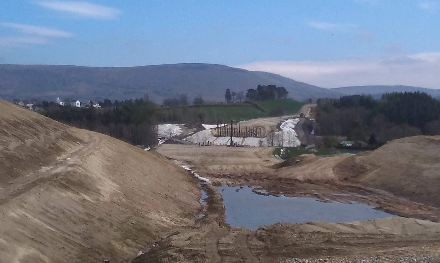
Pic 1: View east from Teeavan Road on 19 April
2020, towards the piling works for the River Roe
bridge. The new road will run towards the camera
here in a cutting. Teeavan Road is being
re-routed and, once that’s done, the embankment
on which the photographer is standing will be
cut away to extend the cutting. The white sheets
are material designed to reduce mud runoff into
the river. [Paul McCloskey]
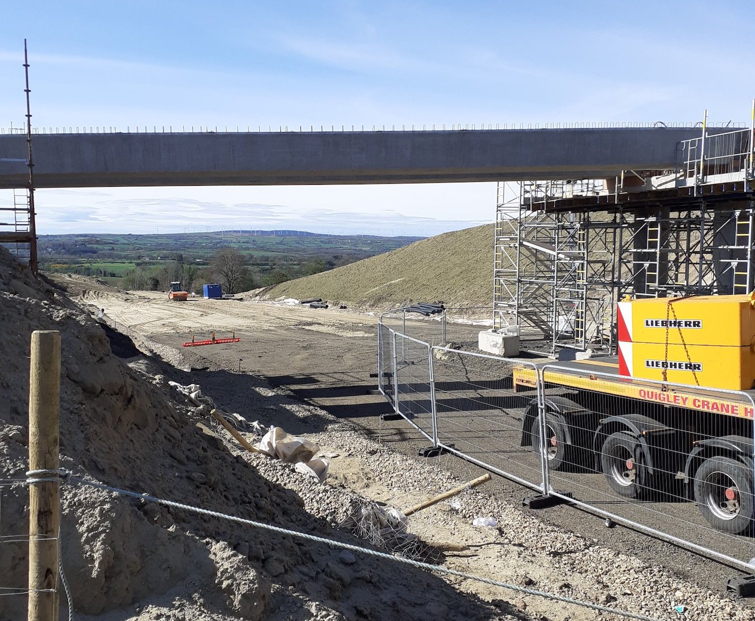
Pic 2: Priory Lane bridge as seen on 11 April
2020, with its beams in place. You can see that
the hardcore base for the dual-carriageway is
also being put in place. [Paul McCloskey]
10 Apr 2020: Despite the Covid-19
pandemic, some work appears to be ongoing on the
scheme and there is some progress to report.
Near Dungiven, the realignment of Teeavan
Road has progressed well in the past two
weeks. Picture 1 below shows this seen from the
air. The piling work for the abutments of the
River Roe bridge (one of three river crossings
near Dungiven) is now completed on the eastern
side, and has now begun in the western side. In
the month since the beams were lifted into place
on the nearby Owenrigh River bridge, the work on
the deck of the bridge appears to have advanced
well, as can be seen at the bottom right of
picture 2 below. Another beam lift took place
during the week - this time at the Priory
Lane overbridge near the terminus of the
scheme in Dungiven. This bridge will allow
continued access to Dungiven Priory. After the
lift there appears to have been some kind of accident
involving a crane toppling over, resulting in
the Air Ambulance visiting the scene. Hopefully
everybody is OK. At the western end of the
scheme, work on realigning the existing A6
Glenshane Road at Drumahoe to meet the
new Lismacarol roundabout is continuing. This
can be seen in pictures 3 and 4 below. With
thanks to Paul McCloskey, Dee Logue and Les Ross
in particular for keeping us updated. Mark Lusby
recently shared a shot of the works underway
near Brackfield Bawn (near Burntollet) here,
while Paul McCloskey shared a shot of the
Derrychrier Road underpass box structure
apparently completed here.
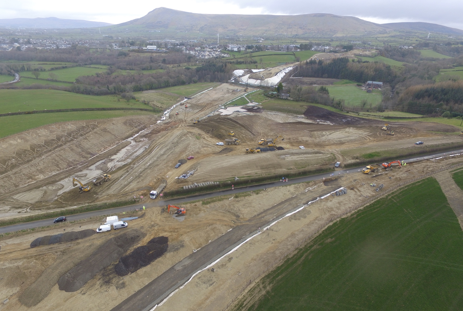
Pic 1: Shot looking north-east from above
Teeavan Road (left-right in centre of shot) on 2
April. Dungiven is on the upper left. The white
sheeting (designed to prevent mud washing into
the river) marks the site of the River Roe
overbridge. You can see the piles now in place
on the eastern abutment, with a pile driver
working on the western abutment. The cutting for
the A6 on the left is currently blocked by
Teeavan Road, but you can see the route of the
realigned route of Teeavan Road taking shape at
the bottom. Once diverted, the cutting will be
completed. [Les Ross]
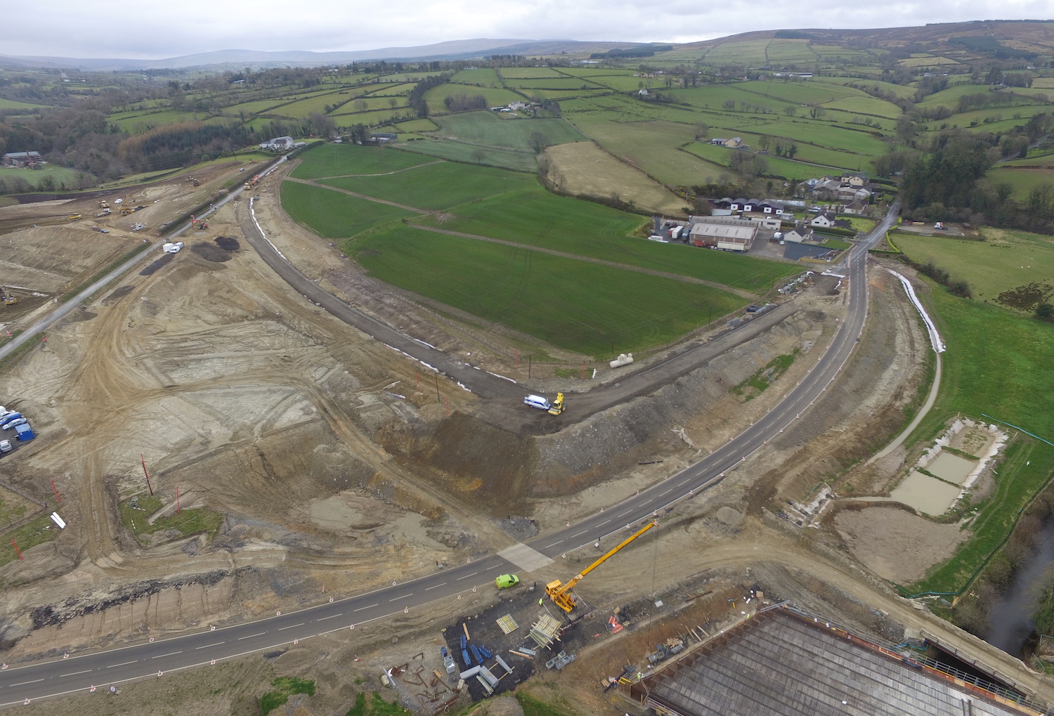 Pic 2: Same shot as above, but
moving further west to above Magheramore Road
(bottom left to middle right). Magheramore Road
is currently on a temporary alignment so that a
bridge can be built (to the left of where the
white van is in centre of shot). Once the bridge
is completed the road will be put across it and
the current realignment will be removed. You can
also see the realigned Teeavan Road taking
shape. On the bottom right you can see the deck
of the Owenrigh River overbridge taking shape,
with a temporary "works" bailey bridge beside
it. 2 Apr 2020. [Les Ross]
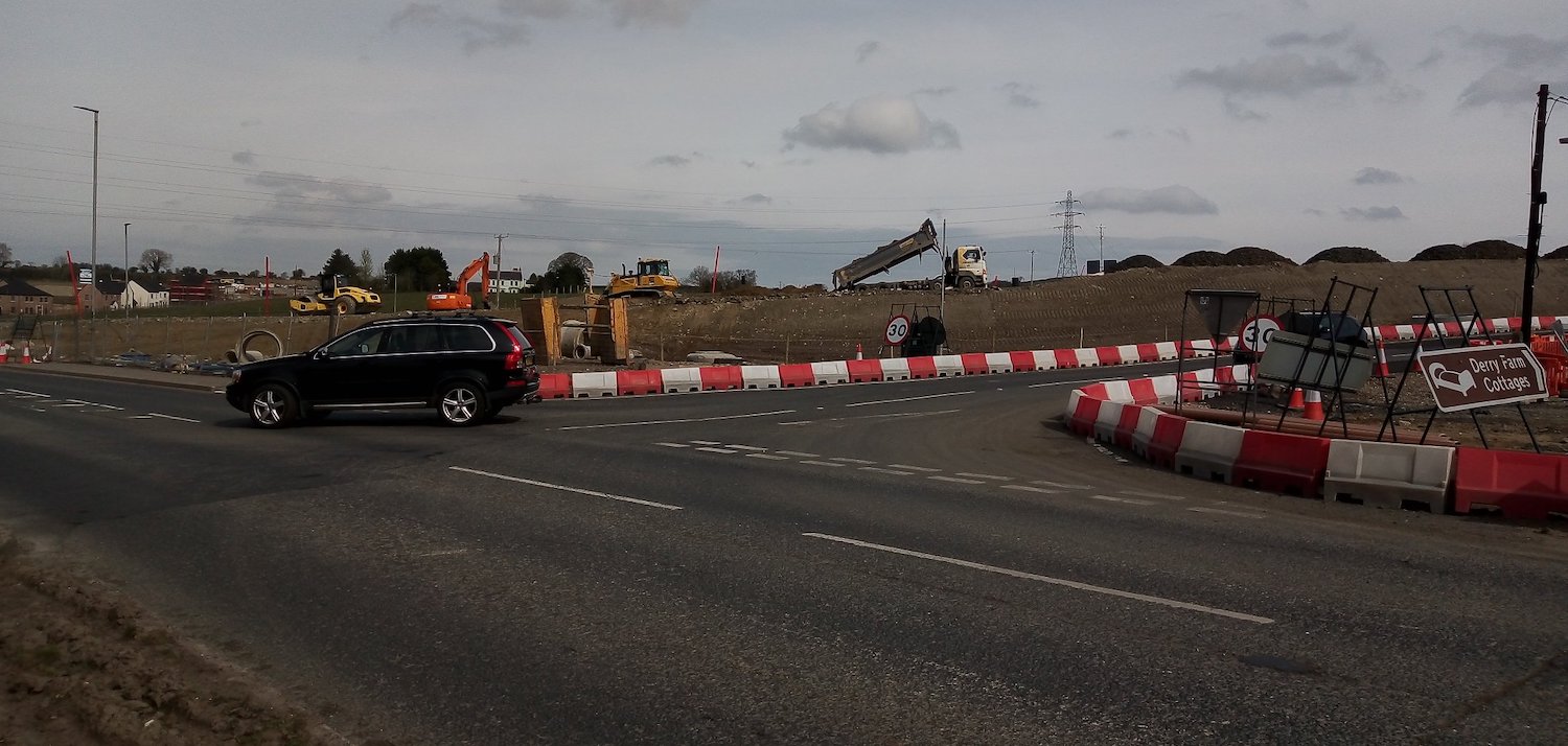
Pic 3: View of the Tirbracken Road junction with
the A6 at Drumahoe on 9 Apr 2020, with Derry
city to the left. The A6 is being realigned onto
the embankment that can be seen in the distance
to meet the new Lismacarol roundabout, the
"temporary" terminus of the scheme, that is
being built to the right of this shot. [Dee
Logue] 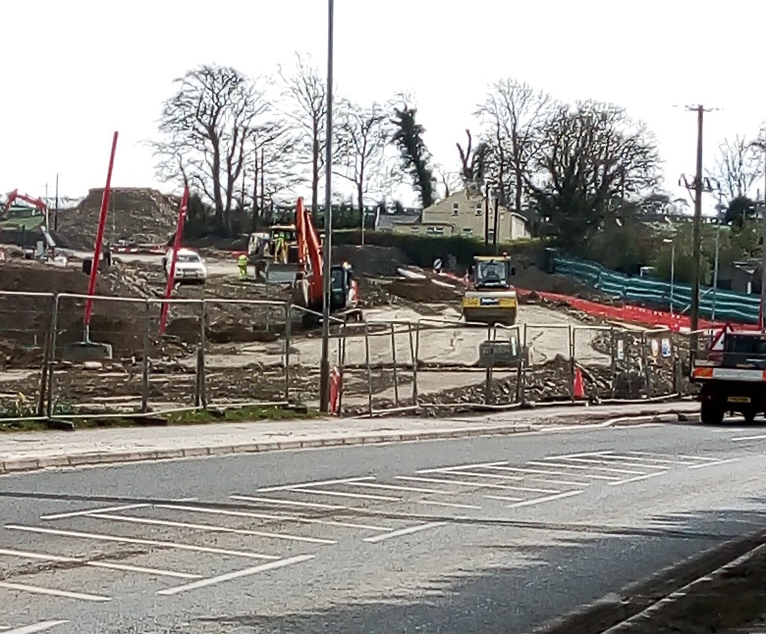
Pic 4: Moving a bit further west along the A6 in
the Derry direction, and then looking back east
this is the view up the embankment visible in
pic 3. The A6 will be realigned onto this
embankment. Interestingly, this will restore the
road to the older alignment that it had in the
18th century, when the main route to Dungiven
from Derry continued along what is now
Lismacarol Road, before it was replaced by the
current Glenshane Road in the 19th century. [Dee
Logue]
26 Mar 2020: This update follows on from
the one two weeks ago, where the focus was on
Dungiven. This time we have photographs
that focus on the Derry end of the scheme,
with grateful thanks to Dee Logue and
'Pollyanne'. The contractor, DFI and the
scheme's designers issued a joint statement
a week ago saying that work on the project would
continue despite the Covid-19 pandemic, but that
all personnel would be observing social
distancing. I don't know if that position has
changed in the 7 days since then, but people
passing the site have reported less activity in
the past few days. Nevertheless, we have six
photographs to share below which begin at
Tamnaherin Road (The Cross) and then move on to
Drumahoe. Enjoy!
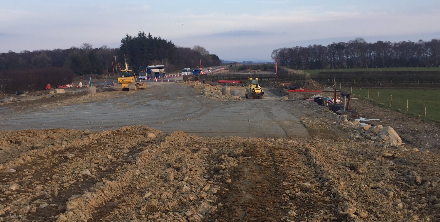
Pic 1: View east along the future westbound
carriageway near Tamnaherin Road junction (which
is just behind the camera) on 26 March 2020. The
bus is on the existing A6, which temporarily
veers off to the left just here to bypass the
site. The fence crossing the site just ahead is
a private access lane. In due course it will be
replaced by a new laneway to the future
roundabout, but remains open for now. This
is a similar viewpoint before work began.
[Pollyanne]
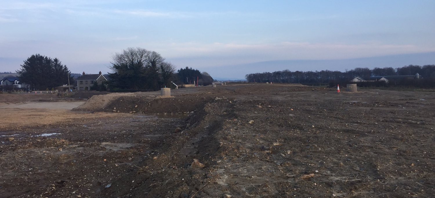
Pic 2: View east along the future (and also
past) A6 from just west of the original
Tamnaherin Road junction. Traffic is currently
being diverted round this site to the left of
the shot. The road here has been built up on a
shallow embankment. The plans show an embankment
here, so it's not certain whether this is the
final height of the new road, or whether it has
also been 'surcharged' with extra material to
make it settle more rapidly. This
is the same view before work began. [Pollyanne]
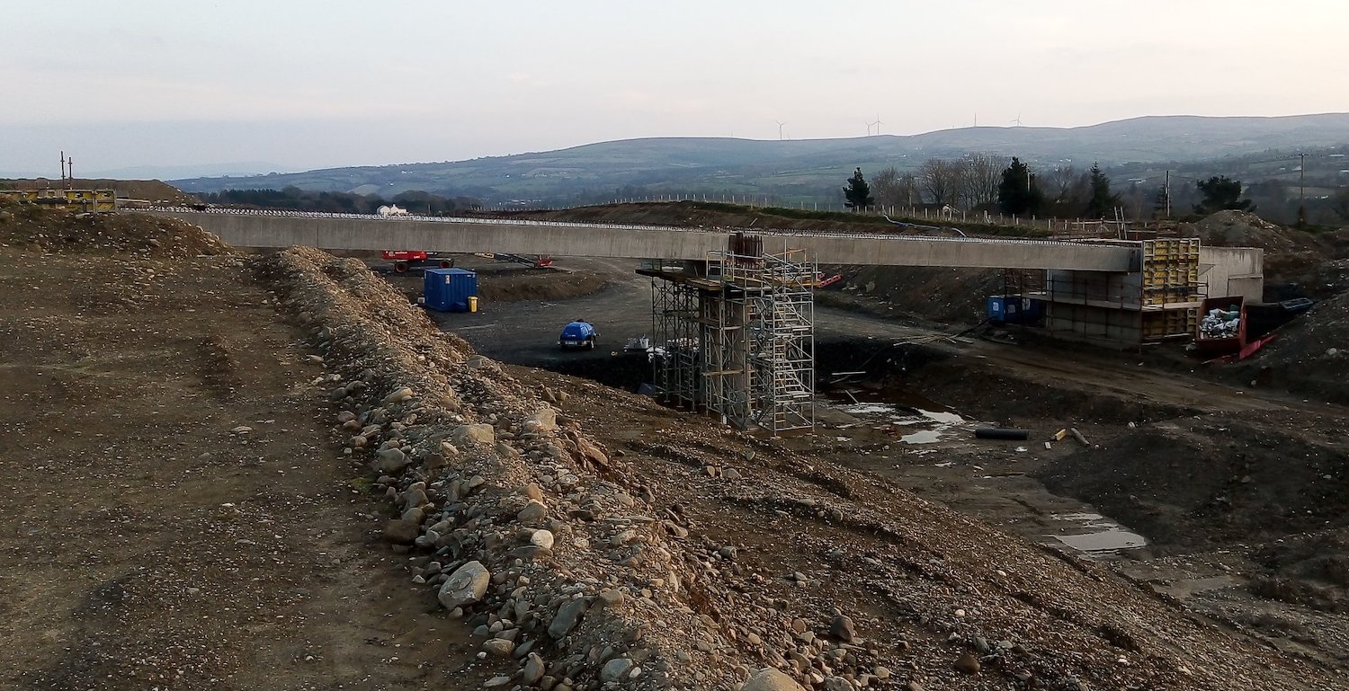
Pic 3: Moving to Lismacarol Road, this is the
McCay's accommodation overbridge about half a
mile east of the scheme's terminus at Drumahoe,
on 26 Mar 2020 with its beams recently lifted
into place. It will preserve access to private
property. [Dee Logue]
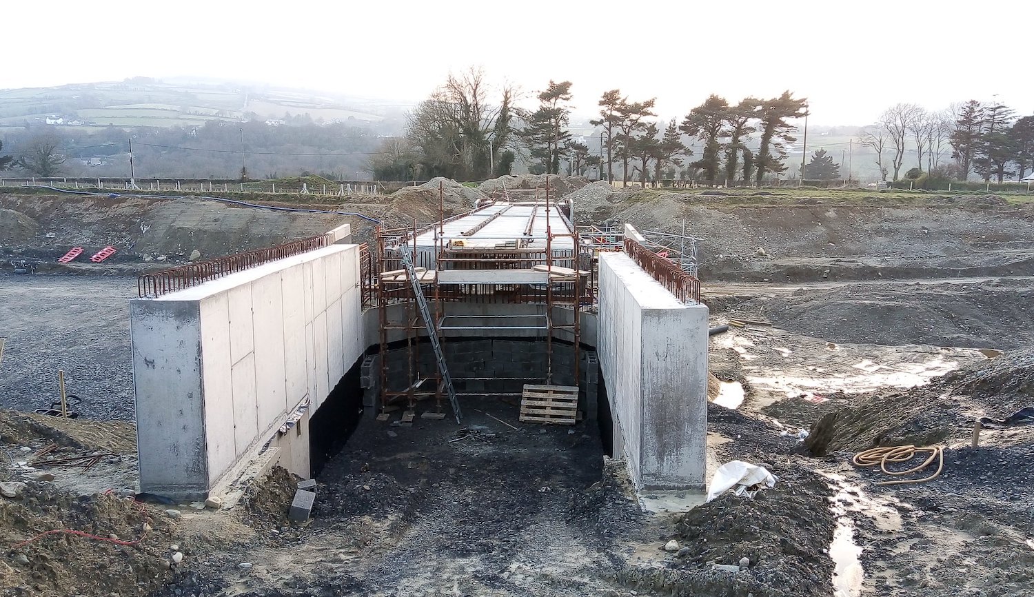
Pic 4: View north across McCay's accommodation
overbridge on 26 Mar 2020. The concrete
structure in the foreground is the bridge
abutment, which will be backfilled, while ahead
you can see the six beams (two sets of three)
that make up the bridge structure. It is narrow
as it will only carry a laneway. [Dee Logue]
Pic 5: Slightly blurry, but nevertheless a very
informative shot looking along the future route
of the A6 Glenshane Road where it will curve
round to meet the terminus of the
dual-carriageway at a new roundabout behind the
camera. This
is roughly the same viewpoint before work began.
26 Mar 2020. [Dee Logue]
Pic 6: This is the same area as pic 5, but
viewed from the Glenshane Road. The road will be
diverted up the hill straight ahead to the
future Lismacarol roundabout. The building site
on the left of the shot is the future
park-and-ride facility. This
is the same view before work began. [Dee Logue]
12 Mar 2020: Quite a bit has happened
since the last update in February. The update
here will focus mostly on the structures
(bridges and underpasses) along the scheme since
that's what we have the most information on.
There are also some additional photos taken
around Dungiven. The most significant event was
the biggest beam lift on the scheme to date,
which took place in mid February and involved
lifting 8 beams, each of 135 tonnes, into place
across the Owenrigh River beside
Magheramore Road, Dungiven (here).
The number of beams required is so high because
this bridge will carry the dual-carriageway
itself over the river. Below are some pictures
of the area showing it before, during and after
the beam lift. The contractor has made a great
time-lapse movie of the beam lift that can be
seen on YouTube
here (though mis-identifying the river as
the Roe). This is one of three river bridges
that need to be built on the Dungiven Bypass
section, the other two being the Owenbeg and Roe
bridges. Neither of those is as advanced as the
Owenrigh River bridge. The other notable beam
lift of the past month was at Gortilea Road,
which is a local road east of Claudy that will
be bridged over the new dual-carriageway here.
These beams were lifted into place around 25
February. There is one photo of this below. A
third structure which advanced this month was
the Derrychrier Road underpass, west of
Dungiven. This is a local road that will pass
beneath the new dual-carriageway, and so is made
from box sections placed side by side. There is
a photo of this below, too. The contractor has
put a site update
on their web site for March, though because they
refer to the structures by number rather than by
name I've translated the bulk of it below (going
from west to east).
- Structure 1 - McCays accommodation
overbridge, which is located a few
hundred metres from the terminus of the scheme
at Drumahoe. Abutments are in place and the
beams will be lifted in early March (if not
already).
- 5 - Burntollet Bridge - Piling has
been installed for this very complex bridge
and pouring of the concrete base is taking
place in early March 2020. I suspect only the
eastern half of this bridge is being built
initially, though that's not confirmed.
- 8 - Killaloo Road overbridge, at the
new grade-separated junction west of Claudy.
The concrete base and abutment on the south
side is well advanced, and excavation for
centre pier is underway. Work on the north
pier can't start yet as the current A6 is in
the way.
- 9 - Baranailt Road underbridge, at
the new grade-separated junction at Claudy.
This bridge will carry the new road over a
local road. The pit for the local road has
been dug and work on laying the the concrete
base is underway. The abutments on either side
also seem to be advancing.
- 11 - Gortilea Road bridge - now that
the beams have been installed, work on the
diaphragm (which ties the beams together) is
underway after which the deck itself can be
built.
- 18 - Feeny Road overbridge, Dungiven
- Concrete making up the two abutments and
centre pier will be poured this month. Once
that's done the next stage will be a beam
lift.
- 21 - River Roe overbridge - Work is
continuing on piling for the east abutment.
- 22 - Priory Lane overbridge, which
will carry the lane used to access Dungiven
Priory over the new road, is located near the
eastern terminus of the scheme. The abutments
and central pier of this bridge are well
advanced and the beams will be lifted at the
end of March. See photos below.
Finally, time for the photos. All but two of
these are by Paul McCloskey. I recommend
following his Twitter
feed for more updates.
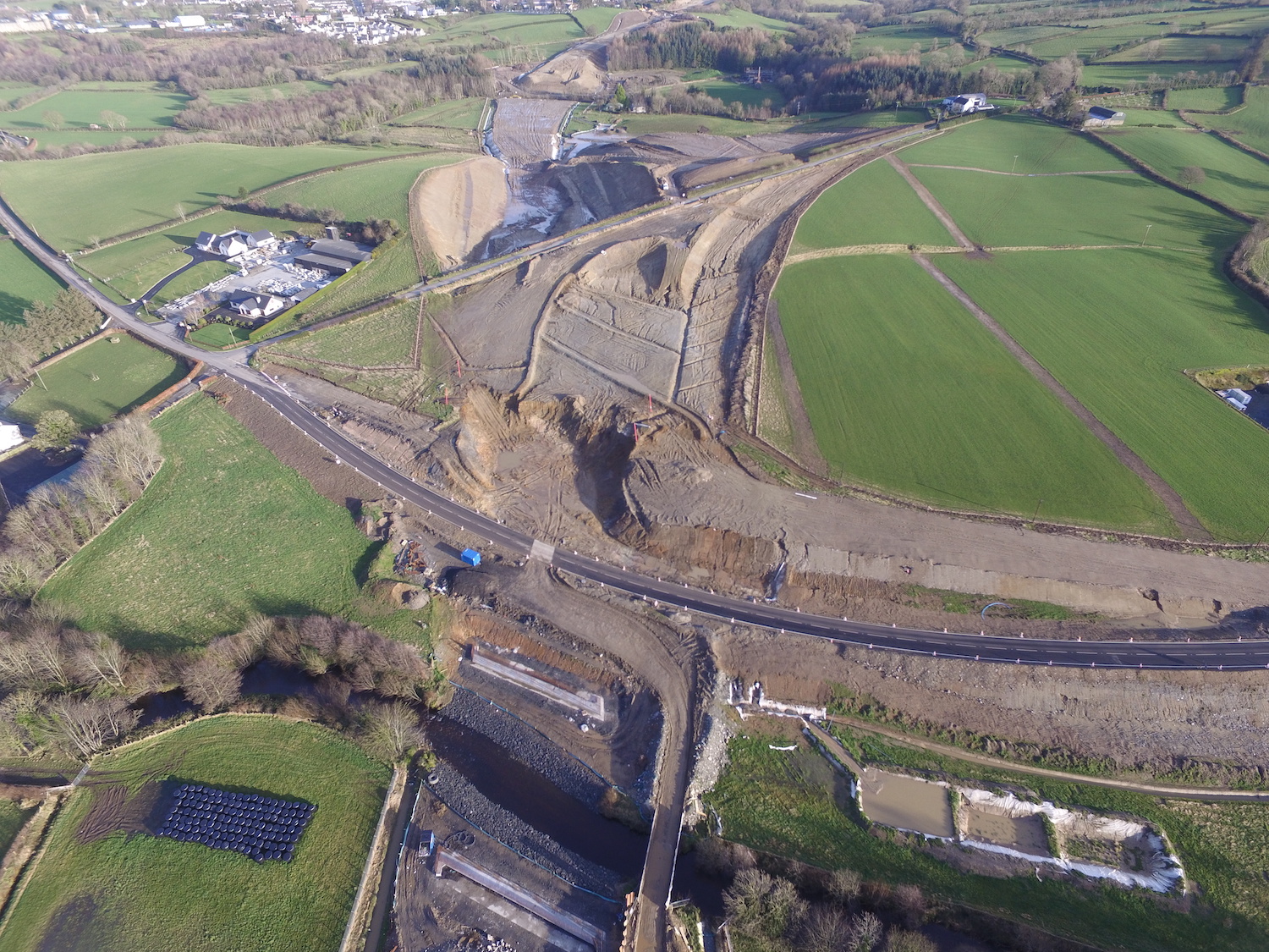
Pic 1: We start with this amazing aerial
photo of the Owenrigh River bridge before the
beam lift, with the Magheramore Road parallel to
it and Teeavan Road heading up to the top right.
You can see how Magheramore Road is temporarily
diverted round the site of what will be a bridge
to carry it over the new road. Teeavan Road, at
the top, will be diverted to the right of the
new road, so won't require a bridge. Photo taken
early Feb 2020. [Les Ross]
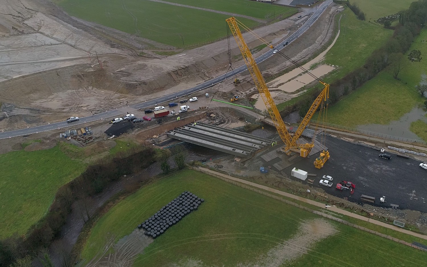
Pic 2: Photo shared by DFI showing the beam lift
taking place c14 Feb 2020. A large base has been
constructed to spread the load of the crane to
ensure that it doesn't collapse the river bank,
with each beam weighing 135 tonnes. [DFI]
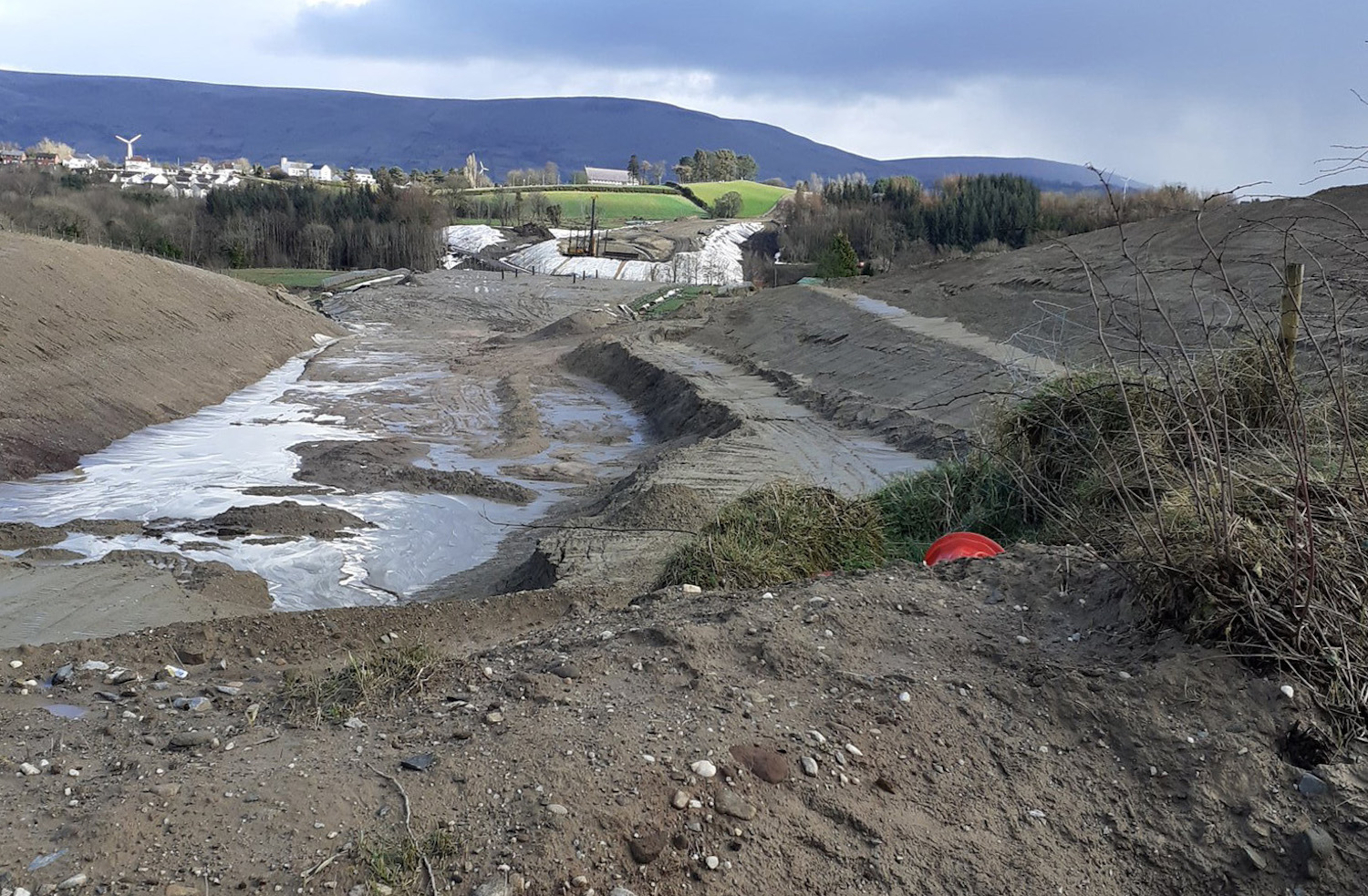
Pic 3. Photo taken from Teeavan Road (near the
top edge of pic 1) on 8 March 2020 looking east
along the route of the future dual-carriageway
towards Dungiven Priory. The large cutting
visible here will eventually be extended by
removing Teeavan Road itself, once an
alternative route has been built. The white
sheeting ahead is to prevent silt entering the
River Roe which is up ahead. [Paul McCloskey]
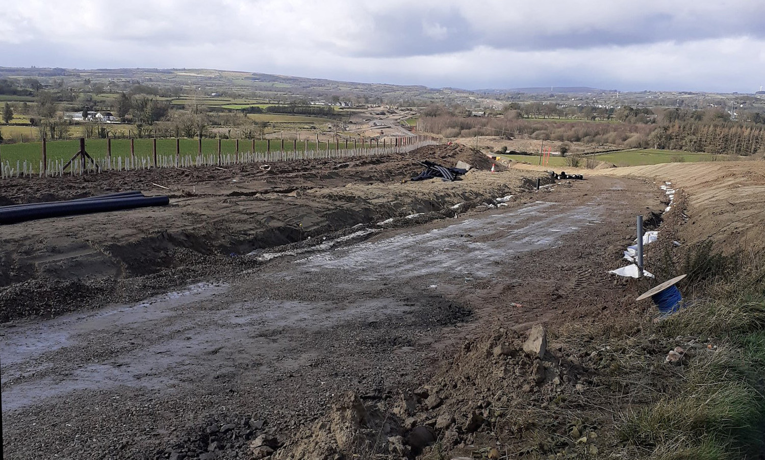
Pic 4. Same location on Teeavan Road as pic 3,
but turning round the other way and looking
west, 8 March 2020. The flat area ahead is the
future route of Teeavan Road which will be
diverted to run alongside the new
dual-carriageway.[Paul McCloskey]
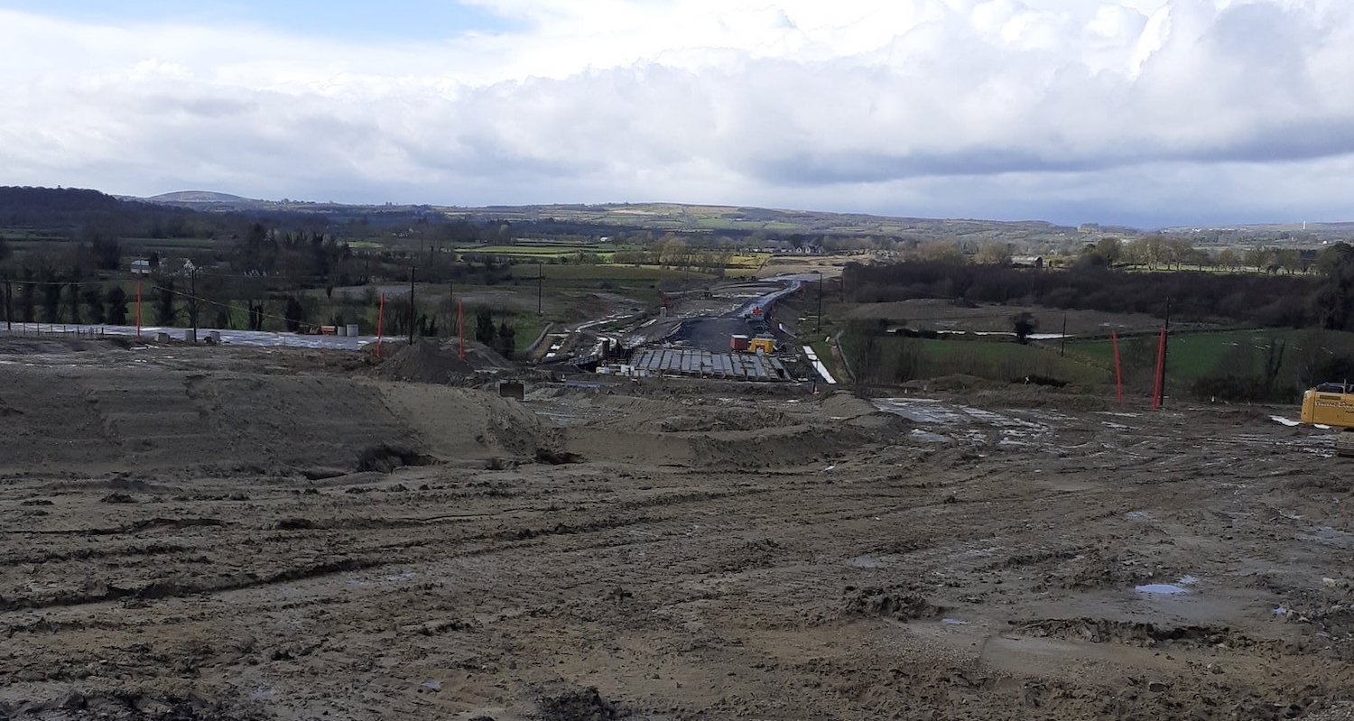
Pic 5. Moving further along Teeavan Road, this
is the view west on 8 March 2020 showing the
beams now in place on the Owenrigh River bridge.
Once the diversion for Teeavan Road has been
built, the whole area on which the photographer
is standing will be excavated to form a cutting
for the new road. [Paul McCloskey]
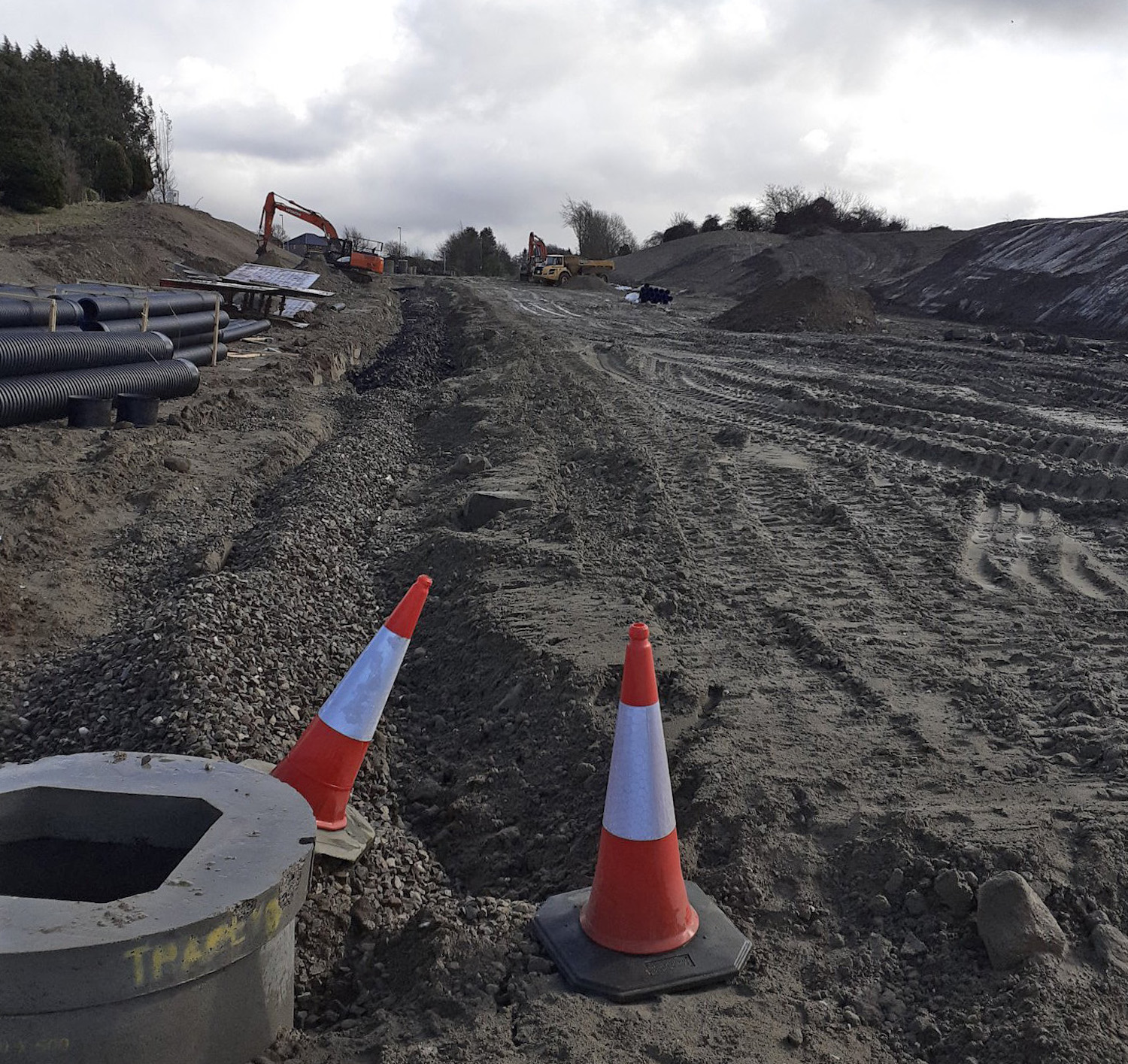
Pic 6. Moving briefly east to Priory Lane, near
the eastern terminus of the scheme, this is the
view east (from here)
towards what will be the Magherabuoy Road
roundabout on 8 March 2020. You can just see the
street lights of the existing A6. [Paul
McCloskey]
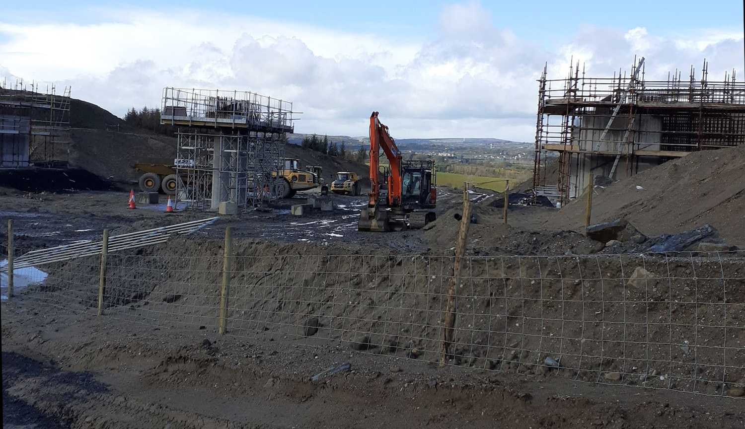
Pic 7. Same location as pic 6 (here),
but looking the other way (west), this is the
two abutments and central pier for Priory Lane
overbridge on 8 March 2020. The beams for this
bridge will be lifted into place at the end of
March. [Paul McCloskey]
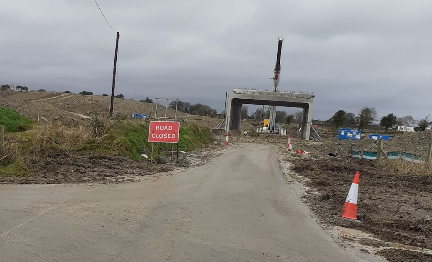
Pic 8. The pre-cast box sections in place for
Derrychrier Road underbridge (here)
on 8 March 2020, not long after being installed.
The new road will eventually pass over this
structure on an embankment. [Paul McCloskey]
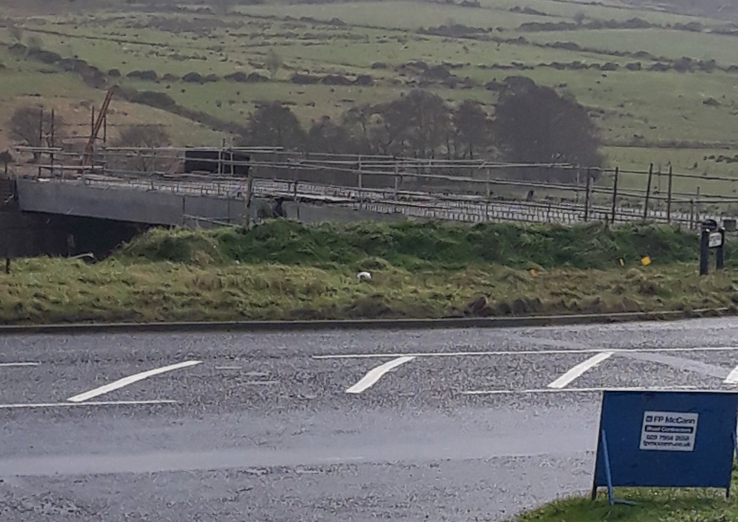
Pic 9. A view of Gortilea Road overbridge (here)
with its beams in place on 28 February 2020. The
new dual-carriageway runs parallel to the
existing road here, but at a lower elevation, so
this bridge is at "ground" level from the
perspective of the existing road. [Paul
McCloskey]
10 Feb 2020: From a famine to a feast!
Since the last update we have been treated to a
set of wonderful photos taken by AerialVisionNI
which I reproduce below with a detailed
commentary. If you want to see the full-res
versions of the images you can get them on his Twitter
feed, dated 5 Feb 2020. We are also
treated to a wonderful aerial video of the
Dungiven Bypass end of the scheme, which has
been posted on Twitter
by Sean Owens on 7 Feb 2020. The video starts on
the existing A6 at Magherabuoy where the hill
has now been fully excavated to reach the main
road. Construction of the roundabout could begin
before too long, though they may decide to wait
until the new road is closer to completion. The
video then turns west and follows the route of
the Dungiven Bypass for 1.6 miles to Feeny Road.
On the way it passes over the River Roe and the
River Owenreagh. The latter is easily identified
because it has a massive yellow crane adjacent
to it, ready to lift the bridge beams into
place. This lift was to have taken place last
weekend but appears to have been thwarted by
Storm Ciara. Hopefully the beam lift will be
able to take place this week, as it is not cheap
to hire a crane of this size, and you certainly
don't want it sitting idle. A second
video by Sean Owens focuses on the crane
itself. Anyway, here are the photos. Thanks
again to the AerialVisionNI!
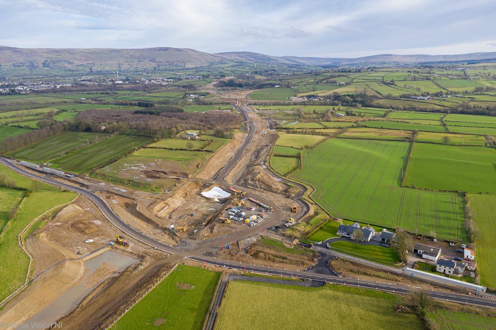 Pic 1:
View east along the future dual-carriageway from
Feeny Road, Dungiven on 5 Feb 2020. Feeny Road is
currently diverted around the work site on a
temporary road to allow construction of the future
flyover. The picture shows that the foundations of
the bridge are now in place, with work on the
abutments and central piers getting underway. On
either side you can see two bridge beams being
stored. These are not for Feeny Road, but rather
for the bridge that will carry the new
dual-carriageway over Owenrigh River. This is
located where the yellow crane can be seen in the
distance. They were due to be lifted into place
during the weekend of 7-9 February, but this seems
to have been delayed due to Storm Ciara.
[AerialVisionNI] Pic 1:
View east along the future dual-carriageway from
Feeny Road, Dungiven on 5 Feb 2020. Feeny Road is
currently diverted around the work site on a
temporary road to allow construction of the future
flyover. The picture shows that the foundations of
the bridge are now in place, with work on the
abutments and central piers getting underway. On
either side you can see two bridge beams being
stored. These are not for Feeny Road, but rather
for the bridge that will carry the new
dual-carriageway over Owenrigh River. This is
located where the yellow crane can be seen in the
distance. They were due to be lifted into place
during the weekend of 7-9 February, but this seems
to have been delayed due to Storm Ciara.
[AerialVisionNI]
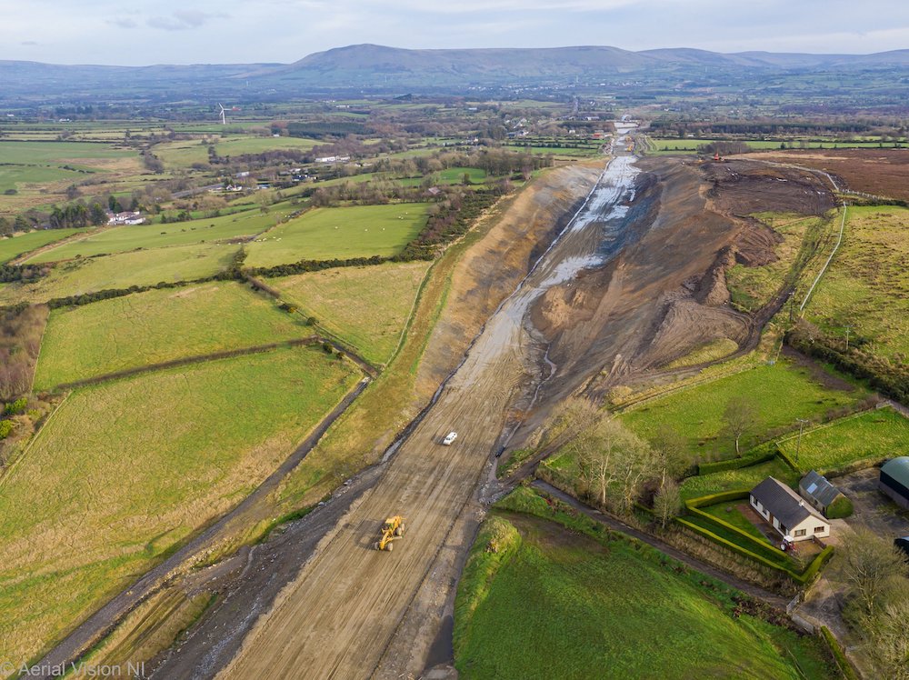
Pic 2: Moving west to Foreglen, this is the
view east through Ovil Hill cutting, the largest
cutting on the whole scheme, on 5 Feb 2020. This
was one of the first excavations to commence and
it now appears to be completed, with the exposed
rock on either side now landscaped with topsoil.
The foundations of the road itself now seem to be
under construction here. [AerialVisionNI]

Pic 3: View west from roughly the same
location as picture 2, this is the view east along
the future dual-carriageway on 5 Feb 2020.
Foreglen village is on the right with the GAA
pitch in the foreground. The underpass that will
carry Altagarron beneath the new road appears to
be largely completed, but not yet open to traffic,
while the embankments for the new road are in
place on either side. [AerialVisionNI]
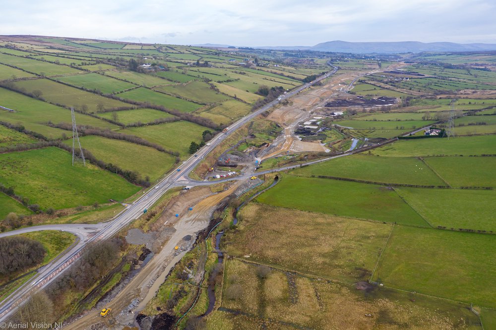
Pic 4: Moving further west again, this is
the view east along the future dual-carriageway at
Ballyhanedin Road on 5 Feb 2020. At this point the
new road will run adjacent to the current road,
but at a lower elevation. Early works are underway
on the bridge that will carry Ballyhanedin Road
over the new road, but works on the foundations of
the new road are not as advanced here as they are
near Foreglen. [AerialVisionNI]
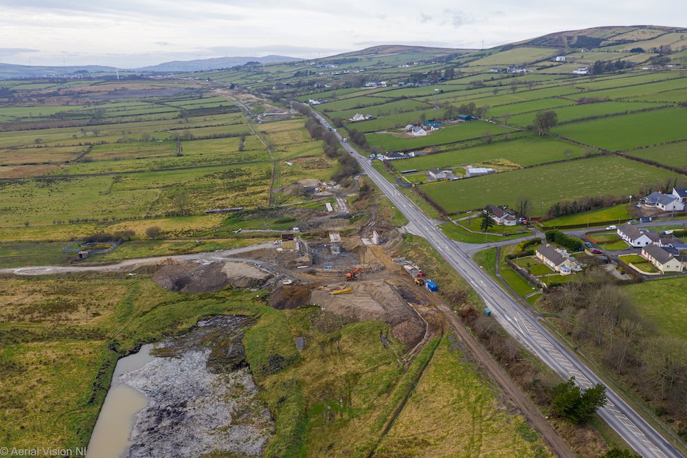
Pic 5: View west from roughly the same
location as picture 4, this is the view west on 5
Feb 2020 with Gortilea Road in the foreground.
Works on the bridge visible here are more advanced
than they are at Ballyhanedin Road. Beyond this
point little work has taken place on the future
dual-carriageway, but its route is apparent in the
fencing in the fields in the distance.
[AerialVisionNI]
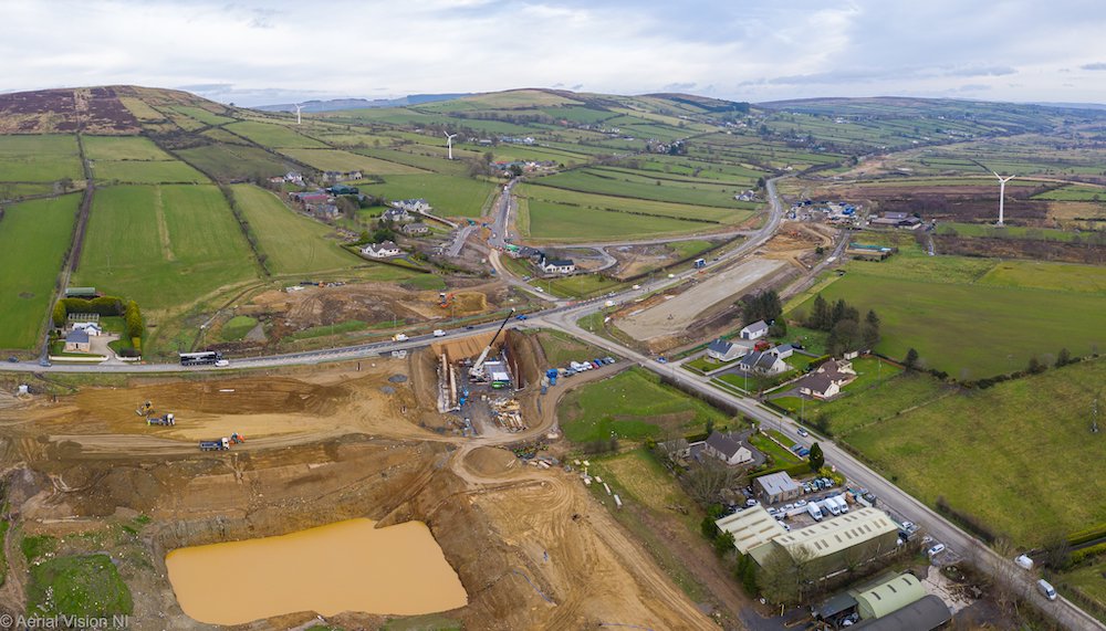
Pic 6: Fantastic view looking north of the
future Baranailt Road grade-separated junction
near Claudy on 5 Feb 2020. Baranailt Road is to be
diverted to pass to the left of the buildings
visible at the bottom of this image, and you can
see a major excavation underway. This is to carry
the realigned Baranailt Road beneath the new
dual-carriageway, which will be built up on an
embankment here. To the right of the excavation
the foundations of the new road are underway,
after the last of the vested properties here was
recently demolished. From here to near Drumahoe
the new road will run along the route of the
existing A6, rather than to one side of it.
[AerialVisionNI]
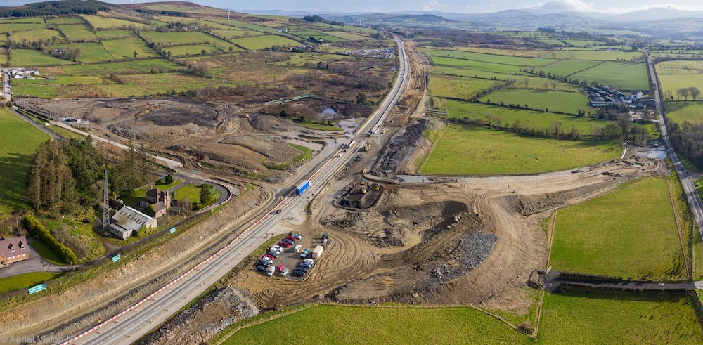
Pic 7: View looking east of the future
Killaloo grade-separated junction (just west of
Claudy) on 5 Feb 2020. This will feature two
looped sliproads – one on the bottom right, shown
partially constructed here, and one on the upper
left. Connecting them will be a new bridge over
the A6, the foundations of which can just be seen
to the right of the blue lorry. On the left a new
local access lane to provide access to the homes
visible on the left appears to be completed and in
use. [AerialVisionNI]
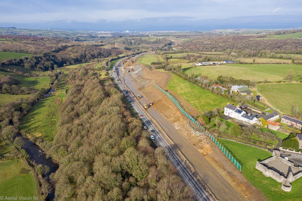
Pic 8: View north-west along the A6 on 5
Feb 2020 from beside Cumber Presbyterian Church
and Brackfield Bawn, the latter of which is
visible on the right. Here the new road curves to
the right as it approaches Burntollet. This
requires a major cutting into the hillside on the
right as the much wider road needs to be
accommodated on this site, as it can’t encroach on
the River Faughan on the left. The layby visible
on the left distance preserves the line of the
original 19th century road, prior to the previous
A6 upgrade in the 1960s and 70s. A new layby, of a
more modern design, will be constructed
here. [AerialVisionNI]
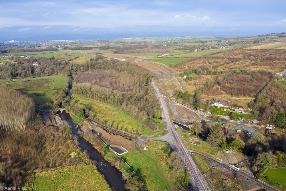
Pic 9: View north over Burntollet Bridge on
5 Feb 2020. This is the most confined point on the
entire scheme due to the protected woodland on the
right and the protected River Faughan on the left.
On the left you can see the historic Oaks Bridge
which carries Ardmore Road. That bridge will be
retained, but will be functionally replaced by a
new, and considerably longer, bridge –
construction of which can be seen to be underway
adjacent to it. The 1960s Burntollet Bridge itself
will be replaced by a new, wider structure, the
foundations of which are taking shape here. It
looks possible that the eastbound half of the
bridge will be built first, and brought into use,
after which the existing bridge will be
demolished, allowing the westbound half of the new
bridge to be completed. Finally, another cutting
is visible ahead, as the new wider road has to be
accommodated on the sloping terrain here.
[AerialVisionNI]
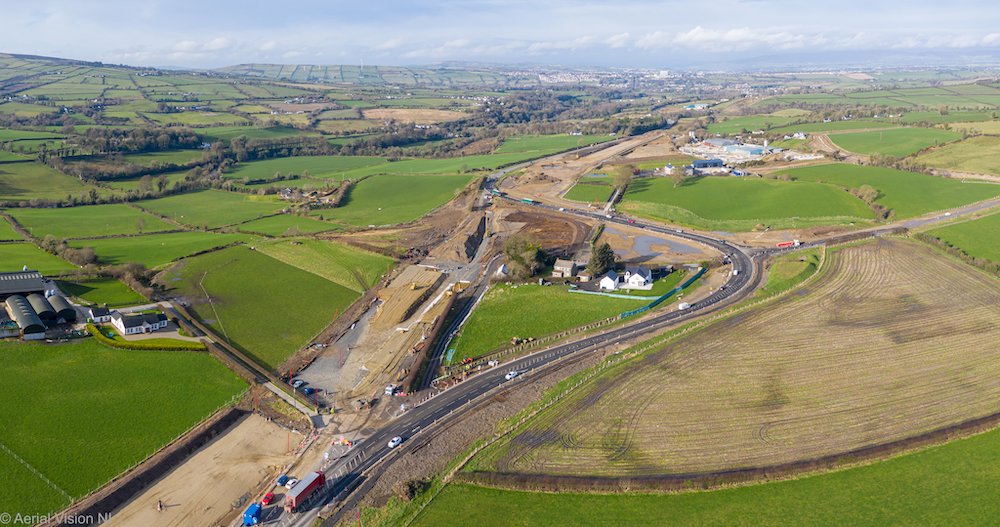
Pic 10: View west towards the future
Tamnaherin Road grade-separated junction on 5 Feb
2020, a couple of miles east of Drumahoe. Here all
traffic is being diverted around the junction to
allow construction of the bridge that will carry
the new A6 over the junction. Although the
diversion is temporary, the section of road in the
foreground is actually permanent, as it will form
part of a new local road link to Ervey Road once
the new dual-carriageway is completed. From here
to Drumahoe the new road once again leaves the
route of the existing A6 and runs cross-country to
its terminus. A short length of new road will be
built to the left of the junction as seen here to
connect the junction to the existing A6 into the
city. [AerialVisionNI]
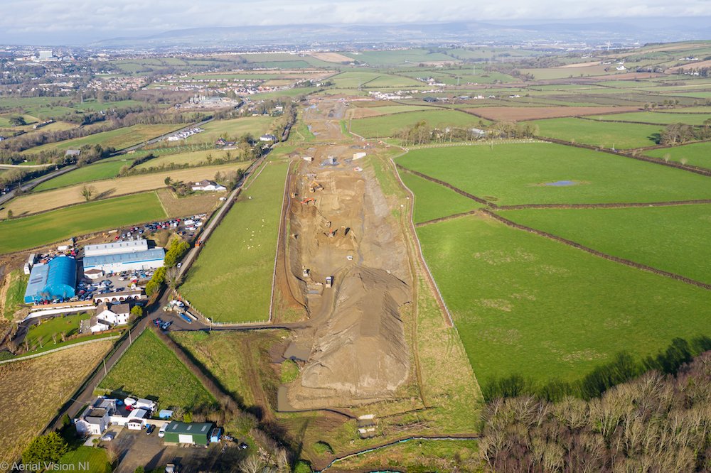
Pic 11: View west along the future
dual-carriageway from above Liberty Glen (which
will be the longest bridge on the scheme, though
work has not yet begun on it) on 5 Feb 2020. Here
the road runs in a shallow cutting, which
currently seems to be being used to store spoil
temporarily. Work on an accommodation bridge is
visible half way along the cutting, to preserve
access to the farm on the right. The existing road
on the left here is Lismacarol Road. It is today a
minor road but in the 1700s it was the principal
route from Drumahoe towards Glenshane.
[AerialVisionNI]
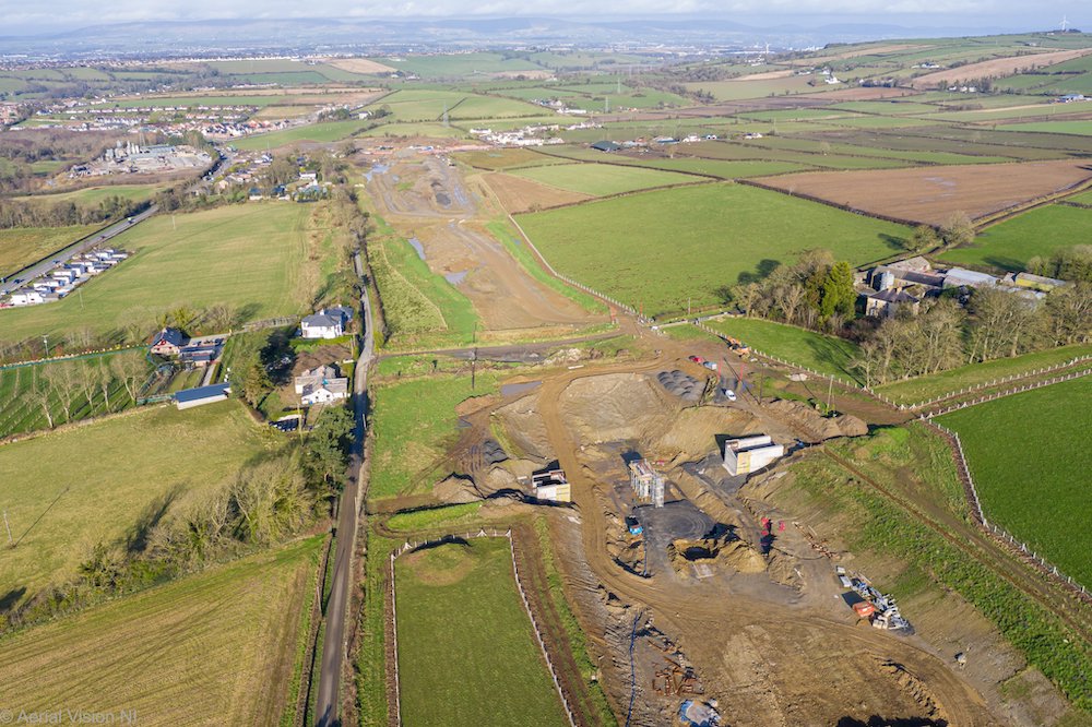
Pic 12: Same view as pic 11, but moving a
few hundred metres west to the accommodation
bridge under construction. It does not look as if
it will be too much longer before the beams for
this bridge can be put in place. The laneway
visible just beyond the bridge will be closed and
excavated once the bridge is completed. Feb 2020.
[AerialVisionNI]
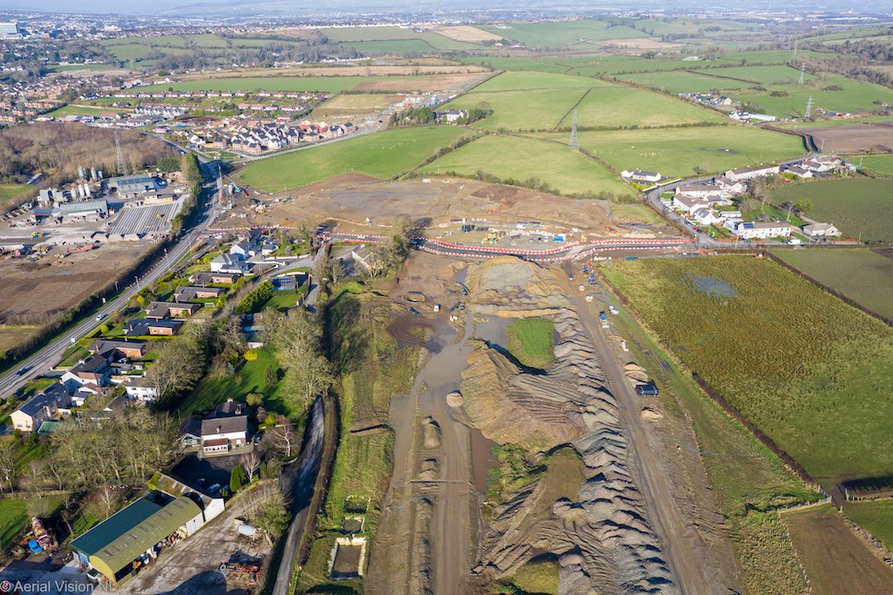
Pic 13: View of the temporary terminus of
the scheme at Tirbracken Road on 5 Feb 2020. The
new roundabout is taking shape here, with traffic
on Tirbracken Road currently being diverted round
the eastern side of it. The two carriageways will
separate as they approach this junction (“splay”)
to allow for its future continuation to Caw. For
now this will mean that the area of land between
the on and offslips will remain undeveloped. Right
now it appears to be being used as a storage area
for spoil. The flat area of land to the upper left
of the roundabout is being developed as a
park-and-ride facility. The eventual plan is that,
under a separate contract, the dual-carriageway
will be continued beyond this point and curve to
the right into the distance to meet the A2 near
Caw. For now, this is where all traffic will have
to come off the new road. [AerialVisionNI]
27 Jan 2020: It is difficult to find out
exactly what is happening on the scheme, so what
follows is really just snippets I have gathered
from here and there. Hopefully the contractor
will put up another update soon, and perhaps
even a new drone video! At the start of the
scheme in Drumahoe work still seems to
be ongoing at Tirbracken Road. This will not
only be the site of the new Lismacarol
roundabout, but it will also be the site of a
new park-and-ride facility. Dee Logue posted a
couple of pictures
of the site last week, which show earthworks
underway to allow the existing A6 to be
realigned to meet the new roundabout, plus other
adjacent works. Piling work also seems to be
well underway for the abutments of the new
bridge at Burntollet, with the climbing
lanes on the approach also closed. It will be
interesting to see how the temporary traffic
management will work here since the new bridge
is to occupy the site of the current bridge, but
about one metre higher. Clearly the old bridge
can't be taken out of use until there is an
alternative for traffic. Perhaps the new bridge
will be built in two halves, with traffic
switched to one half and the old bridge then
demolished. We shall have to wait and see. A
number of large bridge beams were seen being
transported towards Drumahoe during January, but
it's not clear which bridge they were intended
for. Closer to Claudy, at the site of the Baranailt
Road grade-separated junction the two
remaining houses that lay on the route of the
future dual-carriageway have finally been
demolished (these are visible in pic 4 in the
update for 20 Nov 2019 below). Finally, there is
more evidence of work east of Claudy around Gortilea
Road and Ballyhanedin Road. Both
roads are to be bridged over the future
dual-carriageway, and construction work is well
underway on both, with Gortilea Road looking
like it will be ready for beams before long.
According to Paul McCloskey earthworks on the
future dual-carriageway itself have intensified
along this stretch since the New Year. As I
said, hopefully we'll get an update soon from
the contractor, but in the meantime your best
bet is to follow the man-on-the-ground, Paul
McCloskey, who is keeping us all updated!
20 Dec 2019: As the winter sets in,
work on the scheme now seems to be very focused
around construction of structures (bridges and
underpasses) of which there are 22 on the
scheme. The contractor recently put up an update
on
their web site here, which lists all the
structures that work is taking place on, plus a
number of interesting photos at the bottom of
their page. The unstoppable Paul McCloskey,
meanwhile, has also been putting up pictures.
You can see his images taken recently at the
Dungiven end of the scheme here,
here
and here.
Finally, Edward Durey of
www.derrycityparamotoring.co.uk has put up a
wonderful aerial video that he took of the
western half of the scheme at the start of
December. What follows is a brief commentary on
this video, which begins at Drumahoe and works
east almost as far as Claudy. The first minute
is just Eddy taking off, so we begin at 1:09.
1:09 - The terminus of the scheme at Drumahoe.
This is the site of the future Lismacarol
roundabout on Tirbraken Road, which finally
re-opened to traffic this week after a four week
closure. The foundations of the eastern arm of
the roundabout can just be seen to the left of
the red fencing.
1:53 - With the road in a cutting, this is
McCay's accommodation overbridge. The bridge
piers appear completed, and the beams will be
lifted into place during January.
2:25 - Trees cleared for the bridge over Liberty
Glen, the largest structure on the whole scheme.
Work on this bridge has not yet begun.
2:48 - Footprint of the new road very evident to
the left of the existing road, which will remain
in place here for local access.
3:05 - Approaching the site of the future
Tamnaherin Road overbridge. The existing A6 has
been diverted onto a temporary loop around the
site to allow construction of the bridge and
approach embankments. From here to Claudy the
new road will subsume the existing A6.
3:28 - Passing Ervey Road. About 1km of new road
is being built here to extend Ervey Road as far
as the Tamnaherin Road junction, as it will no
longer be able to join the A6 directly (as it
currently does just ahead).
3:40 - New accommodation lane under construction
to left of the current road.
4:00 - Approaching Burntollet, the most
constricted point on the whole scheme, with
woodland on either side plus the protected River
Faughan.
4:21 - Burntollet bridge, with demolition of the
18th century stone bridge completed. The 20th
century concrete bridge will also be demolished
in due course to be replaced by a new structure.
On the right, but not that visible, piling work
is underway for the new bridge to carry Ardmore
Road over the Faughan river.
4:45 - New road will run slightly to the left of
the current alignment here. Excavation of the
necessary cutting is not yet complete, but the
land is fenced off.
5:47 - At Cumber Presbyterian Church the line of
the road has to move to the right to avoid the
historic structure, but the proximity of the
river means a large embankment will be needed on
the right here.
6:10 - Approaching the future Killaloo
grade-separated junction, providing access to
Claudy to/from the west. The new road follows
the line of the existing, 20th century A6
(visible on the left), but on the right you can
see the perfectly straight 18th century road
that preceded it.
6:17 - Excavation on the bridge that will carry
Killaloo Road over the new A6 here is completed,
and construction of the bridge piers has begun.
7:10 - Long stretch of earthworks, and in the
area just ahead it passes through quite boggy
ground. This type of excavation sometimes needs
cut-and-replace, where soft material is removed
and replaced with higher-quality material,
usually from elsewhere on the site.
7:51 - Eddy turns back at this point, just
before reaching the Claudy junction.
Work is also underway on the rest of the
scheme, after the video ends. Some
highlights are:
- At the future Claudy grade-separated
junction, foundations of the bridge are
construction has begun.
- The Paul Ward accommodation underpass just
east of Claudy is completed.
- At Gortilea Road, which will be bridged over
the new road, excavations are completed and
construction is underway.
- At Ballyhanedin Road, which will also pass
over the new road, piling work on the
foundations is ongoing.
- The Altagarron Road underpass is completed
and is being backfilled to allow the new A6 to
be built above.
- The Derrychrier Road underpass near Dungiven
is also excavated. Pre-cast units will be
fitted in late January 2020.
- Near Dungiven, Feeny Road has been diverted
around the site of the future grade-separated
junction. Piling work for the bridge is
currently underway.
- Three river bridges are to be built near
Dungiven - at the Owenbeg, Owenrigh and Roe
rivers. The second of these is most advanced,
with the abutments close to completion and
beams to be put in place at the end of
January. Piling work on the Roe bridge,
meanwhile, is underway.
- At the eastern terminus of the scheme in
Dungiven, work is now underway on the Priory
Lane overbridge. This will carry a laneway to
maintain pedestrian access to Dungiven Priory.
Happy Christmas!
20 Nov 2019: We are now a third of the
way through constuction of this scheme, which is
due to be completed in spring 2022. We are now
seeing increasing evidence of the new road
itself, as opposed to just earthworks. In this
update I am sharing four great photos taken by AerialVisionNI
and once again put up here with their permission
- thank you. (You can see higher-res versions of
the images here.)
I'll leave the details to the captions of the
photos. Ten days ago the contractor had to fully
close the A6 at Drumahoe in order to lay a
culvert beneath the road. This was not on the
route of the dual-carriageway itself, but at a
point where the existing road is to be realigned
to meet the terminal roundabout at Lismacarol.
The culvert had to be laid at a depth of several
metres, meaning that the large plant equipment
needed the full width of the road. Although it
caused some disruption, the contractor
tells us that it went very well, and was
completed ahead of schedule, on the Sunday
evening, despite heavy rain. Google Earth
imagery has also been updated, so you can now
see the scheme underway on the stretch from
Claudy to Dungiven. The imagery is dated 21
September 2019. Anyway, here are the photos,
working from east to west:
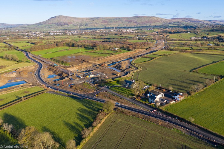
Pic 1: View north-east towards
Dungiven town on 15 Nov 2019, with Feeny Road in
the foreground. This will be the first
grade-separated junction on the scheme. The new
road, seen heading off to the top right here,
will be in a shallow cutting and Feeny Road will
remain on its original route, bridged over it.
However, it has been temporarily realigned to
the west to allow the bridge to be built. This
temporary road will eventually be removed. There
will be two pairs of sliproads - one to the top
left of the bridge as seen from this angle, and
one to the bottom right. There is some water
ponding evident here due to the heavy rain, and
the fact that the permanent drainage system has
not yet been completed. [Aerial Vision NI]
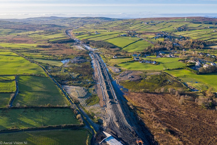
Pic 2: Stunning view looking west of the new
dual-carriageway taking shape near Foreglen on
15 Nov 2019. Foreglen village is off frame to
the right, and the box structure visible at the
very bottom is to carry Altagarran Road beneath
the new road. The new road is on an embankment
here, which is clearly taking shape, before
entering a shallow cutting in the distance. The
white lines on either side of the embankment
mark the location of the future drainage
channels. The existing A6 runs parallel to the
new road, but about 500 metres to the right
here. [Aerial Vision NI]
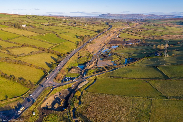
Pic 3: View east along the new dual-carriageway
from close to Ballyhanedin Road (visible in the
foreground) on 15 Nov 2019. This is between
Foreglen village and Claudy. At this point the
new road runs parallel to, but at a slightly
lower elevation than, the existing A6 which will
remain in use as a local road. Ballyhanedin Road
will be bridged over the new road. Look at
Ballyhanedin Road just as it approaches the
T-junction. Then if you look upwards from there
you can just see a rectangular water-filled
hole. This is the excavation for the future
overbridge. Ballyhanedin Road will be realigned
to cross over a new bridge at this spot. At the
bottom of the frame you can see workers
continuing to excavate the cutting, which is in
relatively soft ground here. [Aerial Vision NI]
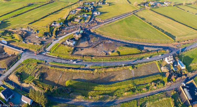
Pic 4: Fish-eye view looking north across the
site of the future Baranailt Road
grade-separated junction, near Claudy, on 15 Nov
2019. To make sense of this shot it may be
helpful to look at the map below, which shows
how it will look when finished. All A6 traffic
is now being diverted up the new link road
visible above and to the right of the centre of
the shot. This will become a permament road in
due course, as this is the point where the
existing A6 will become subsumed by the new road
(to the left) but, beyond which it will remain
as a local road (to the right). The closure of
the current A6 is needed because the existing
road is to be buried beneath an embankment which
will carry it up and over Baranailt Road, which
will be realigned and put into a slight cutting.
On the extreme left you can see a deep hole
which is being dug for the foundations of the
new bridge. The house visible at the extreme
right has been vested and will shortly be
demolished, as it lies in the centre of the new
road. [Aerial Vision NI] 
Pic 5: Map showing the final layout of the
Baranailt Road (Claudy) grade-separated
junction.
14 Oct 2019: As the nights start to draw
in, work on this scheme passed its first
anniversary at the end of September. A number of
road closures are underway - including Gulf
Road and part of Foreglen Road at Killaloo,
just west of Claudy. A new grade-separated
junction is being built here, and Gulf Road lies
beneath it, so it needs to be closed to allow
the construction of a new bridge to carry Gulf
Road over the new dual-carriageway. Meanwhile, a
few miles to the east, a temporary
new link road has
opened at Baranailt Road. Because this is
a relatively busy road (it is the main access
onto the A6 from Claudy) it needs to remain
open, despite a new junction being built on top
of it. So the temporary new
link road has been built to bypass the site in
the interim. It will presumably be
removed in due course. Meanwhile,
just west of Dungiven, Killunaght
Road and Derrychrier
Road have both now been closed and will
remain so until next summer. At this point the
new road runs parallel to, and at a lower
elevation than, the current road. Both local
roads will be bridged over the new road, but as
these bridge both lie on the route of the
current roads they have to be closed to allow
the bridges to be built. They will be reopened
once completed. Finally, between Burntollet and
Drumahoe Mavis
Road is about to be closed, and will
remain so for two years. Mavis Road is a very
minor road, and is largely unaffected by the new
road (it lies off to one side), but is of
interest because a new link road is to be built
at its south end to connect Ervey Road to the
new Tamnaherin Road grade-separated junction. So
the closure is presumably to allow work on the
new link road to progress. In summary, we're now
in the central phase of the project where many
of the earthworks have been completed or
advanced and work is increasingly focusing on
construction of bridges and associated link
roads. This is likely to remain the dominant
activity for the next year. The new road is due
to open fully by spring 2022, i.e. two and a
half years from now.
11 Sep 2019: The scheme is approaching
its first anniversary, with two-and-a-half years
to go and activity is now evident along much of
the length of the scheme. I am sharing four
photographs below, which were all taken within
the past week. But in addition, the contractor
has put up a 45 minute aerial
video of the entire scheme that was taken
on 28 August, i.e. two weeks ago. As I did for
the last video three months ago I have provided
a brief commentary on the video below,
for those who would find it useful. You may wish
to open the video in a separate window and keep
the commentary open beside it. Times refer to
the points in the video where various things can
be seen, in minutes and seconds. The first three
photos below are aerial done shots taken by AerialVisionNI
and put up here with their permission - thank
you. You can see the original (higher-res)
versions here.
The final one was provided with thanks from Dee
Logue. He shared other photos of the same
location here
and here.
The contractor also put up an update in August
on their site here,
which includes further information and an
interesting selection of photographs.
Commentary on this
aerial video, which starts at Dungiven
and ends at Drumahoe:
0:14 Starting at the eastern side of Dungiven,
this is the site of the future Magherabuoy
roundabout where the scheme will begin with a
bypass around the town. Although the land here
was cleared some months ago, earthworks have now
begun to construct the road bed.
0:53 Dungiven Priory visible on the left. Access
will be preserved by a new bridge to be built
over the new road here.
1:30 Site of future bridge over the River Roe.
The road seems very wide here because it has to
be built up on an embankment on either side of
the river, adding to the width needed.
2:00 Approaching Teeavan Road and Magheramore
Road. There will eventually be a cutting here,
and a bridge to carry Magheramore Road over it,
but excavation has not yet begun.
2:40 Temporary bailey bridge over river.
4:30 Site of future Feeny Road grade-separated
junction. The black, curvey lane on the left is
a future agricultural accommodation laneway.
6:00 Temporary Derrychrier bailey bridge.
7:30 New embankment for the future A6
approaching Derrychrier Road, which will
eventually go under the new road.
9:50 Cutting to carry future A6 beneath
Killunaugh Road under construction (and partly
flooded after rain).
11:30 Approaching Ovil Hill cutting, the largest
cutting on the entire scheme where excavation
has been underway for almost a year.
12:35 Passing Foreglen GAA ground.
13:20 Structure to carry Altagarran Road beneath
the new A6 now complete and being backfilled to
create the embankments on either side,
especially visible beyond.
14:45 Passing Crock-na-brock Road.
16:10 Passing along a long, shallow cutting with
a new accommodation laneway being built to the
left.
17:40 Land to the left is not part of the
scheme, so the contractor must have an
arrangement with a landowner to use this field
for storing spoil.
18:30 Road approaches existing A6 and runs
alongside it for the next few kilometres at a
lower elevation.
19:45 Approaching site of bridge that will carry
Ballyhanedin Road over the new A6. Beyond this
point the road will run to the left of the
existing road, but earthworks have not yet
begun.
21:00 Long stretch with earthworks yet to begin.
22:30 Works underway to construct the bridge
that will carry Gortilea Road over the new road.
The new road is still running parallel to the
existing road at this point.
23:30 Resumption of earthworks.
26:20 Point where the new road will joint he
existing A6. From here to near Drumahoe it will
be an online upgrade. New route for the existing
bit of the A6 that we've already passed is
visible curving to the right ahead.
27:00 Future site of Claudy grade-separated
junction. Traffic has been diverted to the right
to facilitate construction of a new bridge that
will carry the future dual-carriageway over the
local road network here.
29:00 Excavation of soft material.
29:50 Passing contractor's site HQ (hello!) with
road foundations well underway on the left.
30:50 Site of future Killaloo grade-separated
junction. Approach embankment to the flyover
over the new road is taking shape on the left.
33:50 Significant cutting will be made into the
hill to the right of the A6 here, to accommodate
the wider road. Site clearance already carried
out.
35:40 Site of the Burntollet bridges. The "old"
bridge, which probably dated to the 18th century
(but not listed), was demolished during August.
The "new" bridge, which dates to the 1950s, will
soon be demolished too to make way for a much
larger bridge. Environmental constraints
including rivers and protected woodland make
this the most confined part of the whole scheme.
36:20 Site of future cutting in hillside with
land already cleared.
37:00 New local road (extension of Ervey Road)
under construction on right to provide a link to
Tamnaherin Road (ahead) for local traffic.
39:00 Site of future Tamnaherin grade-separated
junction, with not much earthworks yet evident.
At this point the new road swings offline again
from the existing A6 (to the right) and is
offline until its terminus at Drumahoe.
41:10 Site of future bridge over Liberty Glen,
the longest bridge on the whole scheme.
42:05 Foundations in place for future
accommodation overbridge, crossing cutting.
43:00 Terminus of scheme at Tirbracken Road in
Drumahoe. The two carriageways diverge and will
join a new roundabout. Works beyond Tirbracken
Road ahead are for a new park-and-ride.
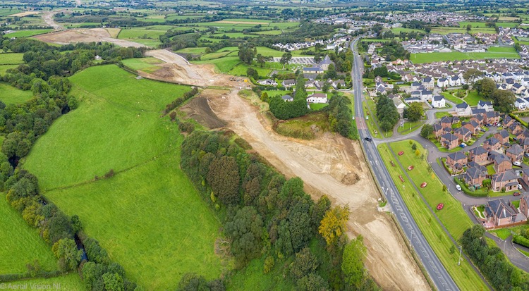
View west from the start of the scheme at
Magherabuoy, east Dungiven, on 8 September 2019,
showing the route of the future Dungiven Bypass
snaking away to the left. [AerialVisionNI]
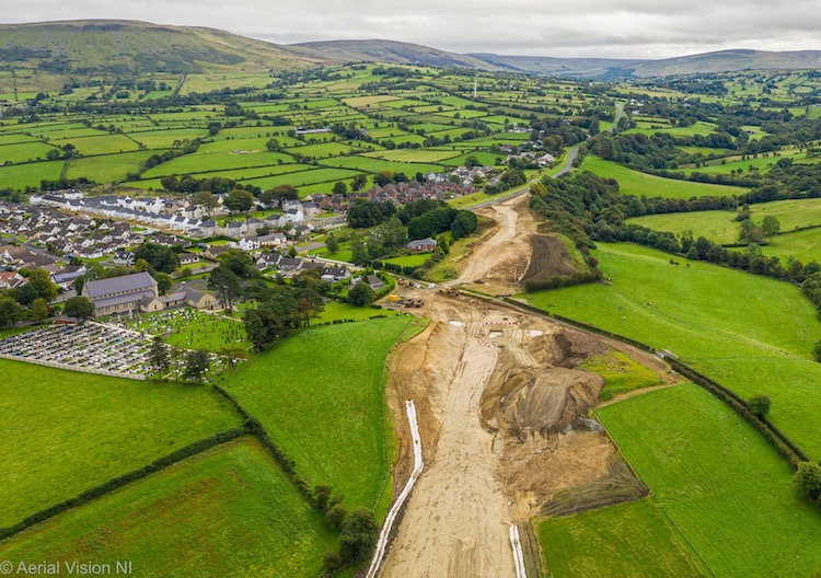
View east towards the start of the scheme in
Dungiven, looking over the access road to
Dungiven Priory (off frame to right). A cutting
has recently been excavated in the foreground.
The white lines are for drainage. 8 Sep 2019.
[AerialVisionNI]
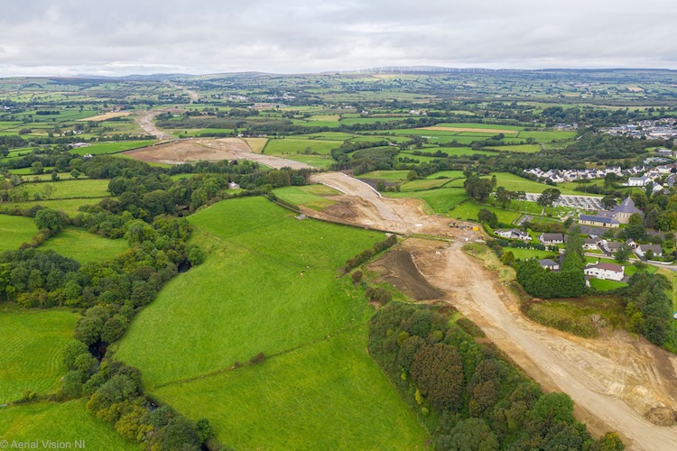
View of the A6 site heading west into the
distance from Dungiven on 8 Sep 2019.
[AerialVisionNI]
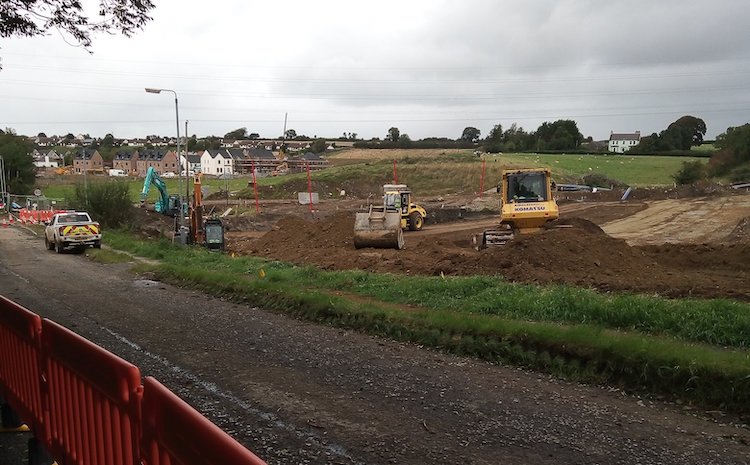
Work underway on the new park-and-ride at the
terminus of the scheme on Tirbracken Road,
Drumahoe (which is currently closed). [Dee
Logue]
26 Jul 2019: The contractor has been
enjoying some wonderful weather in recent weeks
and taking full advantage of it. This update is
to bring you some wonderful aerial done shots
taken by AerialVisionNI
and put up here with their permission. I've also
included a couple of extracts from the design
drawings to help you make sense of these views,
which were taken at three different locations.
You can find the original (higher-res) images here
and here,
including a couple I haven't put up here. Thank
you to AerialVisionNI!
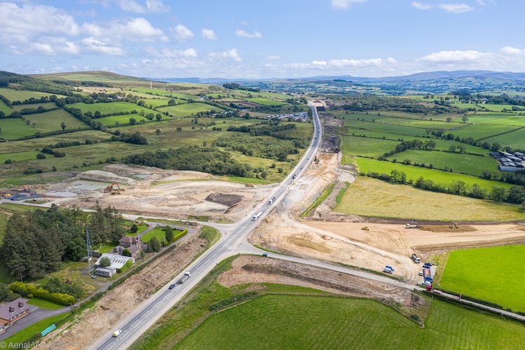
This is the view looking east across what will
be the Killaloo grade-separated junction,
serving the western end of Claudy village, on 23
July 2019. The image below shows the plan for
this junction. The shape of the NE sliproad loop
is clearly visible, as is the connection to the
B74 Glenshane Road on the right. There will
eventually be an bridge over the new
dual-carriageway, which is an online upgrade
here. [AerialVisionNI]
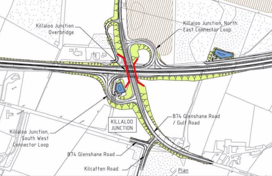
Plan of the completed Killaloo junction.
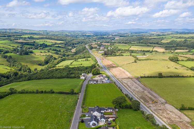
View west from the site of the Killaloo junction
on 23 July 2019. The new road is an online
upgrade along here. A bit of road history is
evident in this picture. The road to the left of
centre is the Glenshane Road, which was the main
road to Derry until 1969. It was replaced by the
Foreglen Road, the road to the right of centre,
in the major upgrade of the A6 that took place
between 1960 and 1975 that saw almost the entire
route from Derry to Castledawson upgraded to a
high quality single-carriageway standard.
[AerialVisionNI]
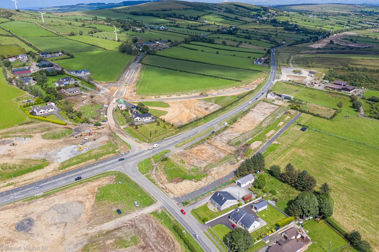
The view north-east across the site of the
Claudy junction of 23 July 2019. This is the
point where the online upgrade (to the left/west
of here) becomes an offline upgrade (to the
right/east of here). That means that the current
Foreglen Road east of here will remain in-situ
after the new road opens, so a new link is being
built here to connect it to the Baranailt Road,
visible at the top of this picture. The image
below shows the design for this junction, to
help you get your bearings. The dual-carriageway
will eventually pass over this junction on a
large flyover with embankments on either side.
[AerialVisionNI]
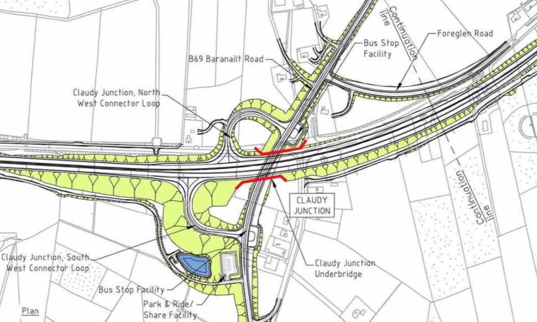
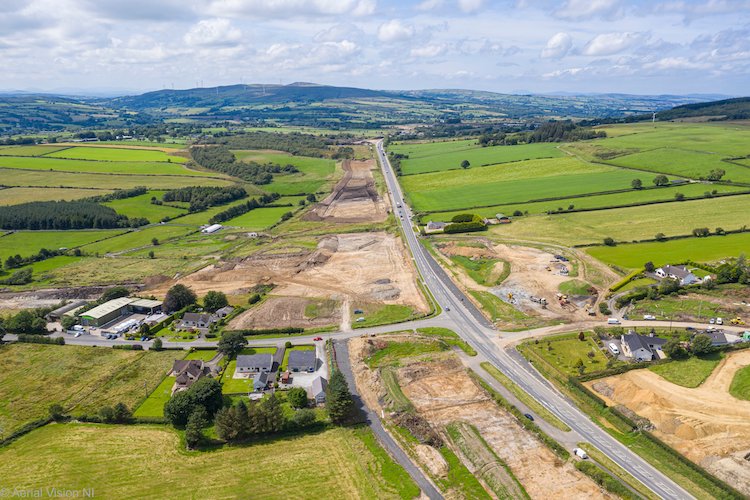
View west across the site of the Claudy junction
on 23 July 2019, with the route of the new road
clearly visible ahead. Although the new route
strays slightly from the existing route at this
point, the existing road will be removed,
eventually leaving just the new road.
[AerialVisionNI]
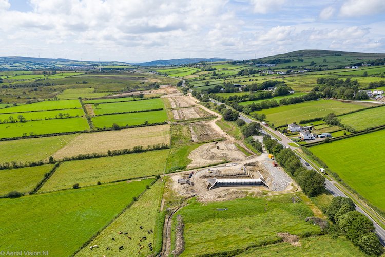
View west along the site of the future
dual-carriageway from near Gortilea Road, east
of Claudy, on 23 July 2019. The existing road
will remain in situ here for local access, with
the new road sitting at a lower elevation beside
it. The concrete structure in the foreground is
(I believe) a culvert to carry a stream under
the new road. In three years there will be an
eastbound layby just here, but a lot is to be
done before that! [AerialVisionNI]
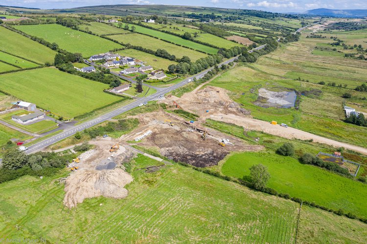
View east across Gortilea Road (the brown line
going to the right, as the road is currently
closed) on 23 July 2019. Again, the existing
road will remain in situ here for local access,
with the new road sitting at a lower elevation
beside it. This difference in elevation will
allow Gortilea Road to be comfortably carried
over the new road on a bridge. No earthworks
have yet taken place along the route just to the
east of Gortilea Road, on the right here.
[AerialVisionNI] 13 Jun 2019: The contractor has put up a
magnificent drone
video, over 40 minutes long, which takes
the viewer along the entire length of this 30 km
scheme. While the photos that I shared last
month (below) are interesting, there is nothing
that beats drone footage for getting an overview
of a project. Many thanks to the contractor for
putting up this video – I hope that they put up
similar videos at intervals in the next three
years as the project progresses. I have provided
a brief commentary on the video below,
for those who would find it useful. You may wish
to open the video in a separate window and keep
the commentary open beside it. Times refer to
the points in the video where various things can
be seen, in minutes and seconds.
0:00 The video begins at Dungiven and heads
west. This first view shows the existing A6
Glenshane Road to the east of the town, which is
the start of the scheme. A new roundabout, to be
called Magherabuoy Roundabout, will be sited close
to where the bare soil can be seen. The Dungiven
Bypass component of the scheme will then head off
cross-country to the left.
1:40 The new road passes Dungiven Priory.
3:00 The new road crosses Magheramore Road.
There will be a bridge here but no access to the
dual-carriageway.
5:00 Site of the future grade-separated
junction at Feeny Road. There will be two pairs of
looped sliproads, one to the lower left and one to
the upper right, which can be seen in the shape of
the fenced-off land. Travelling west this will be
the last junction until Claudy, a full 8 miles to
the west, making this the longest stretch of road
with no junctions in Northern Ireland (the 6.4
mile stretch of the M1 from j8 to j9 is the
current record holder). From here until Claudy the
road runs generally offline to the south of the
current road.
5:30 Passing Owenbeg GAA ground.
6:20 Temporary bailey bridge for
construction traffic. Foreglen village visible on
the right.
8:10 Road crosses Derrychrier Road, still
running offline. The existing A6 will remain in
use as a local road.
10:20 Road crosses Killunaght Road.
12:00 Ovil Hill cutting, the largest
earthwork on the entire scheme. To provide
stability, the banks will be formed into three
terraces. This cutting is providing a huge amount
of rock for the scheme, minimising the amount of
quarried rock that needs to be brought in from
elsewhere. This rock is being graded and sorted
here – you can see a long line of light grey rock
in the cutting. This is thousands of tonnes of
processed rock being stored here until it is
needed.
13:00 Passing Foreglen GAA ground.
13:40 New underpass that will carry
Altagarron Road beneath the new dual-carriageway.
You can also see a new concrete accommodation road
on the left (to provide agricultural access).
14:00 Area of peat that has to be dug out
and replaced with harder material to support the
new road.
17:00 Long offline section to the south of
the existing road. Topsoil removal and some
earthworks have been completed.
18:20 Nearby land being used by the
contractor for deposition and storage of material.
20:00 Approaching Ballyhanedin Road, which
will pass over the new road on a bridge, yet to be
built. The new road runs parallel and very close
to the existing A6 along here, but at a lower
elevation. The existing A6 will remain in situ
here for local access.
21:30 One of the stretches where no work
has yet taken place.
22:50 Approaching Gortilea Road, which will
be bridged over the new road. The new road is
still running parallel to the existing road here.
24:00 Future accommodation underpass being
built, for agricultural access. The new road will
eventually run over the top of it. The contractor
is building some structures, like this one, in
isolation as time permits in order to maximise the
efficient spread of resources across the four-year
duration of the project.
25:30 Another long stretch where work has
yet to begin.
26:30 Approaching the future Claudy
junction at Baranailt Road. From this point on the
new road subsumes the existing A6 which we refer
to as an “online” upgrade. The new road here will
be built up on an embankment and bridged over
Baranailt Road.
27:10 Site of the future bridge over
Baranailt Road. Work has yet to begin, but the
footprint of the sliproads is evident in the fence
lines.
30:40 Gulf Road, where there will be
another grade-separated junction to be known as
Killaloo junction. Gulf Road will be bridged over
the new road at this point, which is running
online.
32:30 The junction visible here, plus the
next one on the right, will both be stopped-up,
with no access to the upgraded A6.
33:20 Passing Cumber Presbyterian Church.
Due to the tight curve of the existing road, and
the steep Faughan river valley to the left, the
new road will require cutting into the hill on the
right-hand edge of the current road. The lay-by on
the left marks the route of the A6 prior to the
previous (1960s) upgrade. It will be removed.
35:30 Burntollet bridges (old and new), one
of the most constricted points in the whole
project. The limitations imposed by the protected
river and woodlands on either side mean that the
new road has to pass directly over (and replace)
both of the existing bridges.
36:10 Land clearance for a new cutting in
the side of the hill to accommodate the new, wider
road.
38:00 Land being cleared on the right is
for a new stretch of local road to connect Ervey
Road to Tamnaherin Road, parallel to the new road,
to preserve local access.
39:00 Future site of Tamnaherin Road
grade-separated junction. At this point the new
road diverges from the existing A6 to the right
and becomes an “offline” upgrade again. The new
dual-carriageway will be built up on an embankment
here and bridged over the junction. The steep
incline to the left, not that obvious in the
aerial view, makes the planning of the temporary
traffic management here a real headache. The loop
of road to the left up ahead will be removed, with
the new road taking a more gentle line to the
right.
41:10 Route of the new road heading away
from the current A6 close to the Belfray Inn. At
this point it has to cross Liberty Glen, a steep
stream-carved valley, which will require a
significant bridge almost 200 metres long, the
longest on the entire scheme.
43:00 The “temporary” terminus of the
scheme at Tirbracken Road in Drumahoe. The plan is
that the road will eventually be continued to the
A2 Maydown Road, but will stop here for now. The
two sliproads will be built, but not the bridge
over Tirbracken Road. This is likely to become a
traffic bottleneck once the road is finished –
though the time lost here is likely to be more
than offset by the time gained from the 30 km of
new dual-carriageway from Dungiven, not to mention
the significant safety improvements.
20 May 2019: Last week I was honoured
to be invited up to the site by the contractor
(Sacyr, Wills Bros and Somague consortium) and
was given a guided tour of the whole length of
the scheme, from Drumahoe to Dungiven. From the
point of view of the road user, there are long
stretches of the scheme where little seems to be
happening other than site clearance. However,
having seen the scheme up close it is clear that
a lot of heavy earthworks and engineering are
happening, but in many cases in places which are
not easily visible from the current road. A lot
of staff were evident all over the scheme, a
good proportion of whom seem to be from the
local area. The biggest single earthwork so far
is the huge cutting through Ovil Hill near
Foreglen. Work here has been progressing for
some months now. One reason it is happening now
is that the contractor is extracting a lot of
good stone from the cut which is being sorted
and sized and stored for use elsewhere on the
scheme. Re-using rock in this way means that
very little stone will have to be brought in
from quarries, thus reducing the overall
environmental impact of the scheme. Earthworks
are also underway at various points on the
scheme including at the Drumahoe end where the
embankments for the off- and on-slips to the
terminal Lismacarol Roundabout are now in place.
On the offline stretch from Claudy to Dungiven
earthworks are underway at various points,
including cut-and-fill operations (where soft or
low-quality material is dug out and replaced
with higher-quality material suitable for
building on), and further cuttings and
embankments. Some concrete structures are also
underway, including a box structure that will
take Altagarron Road beneath the new
dual-carriageway and a new agricultural
underpass near Claudy. Further site clearance
work has also been taking place on what will be
the Dungiven Bypass. We are still three years
away from anticipated completion, but so far a
lot of work has taken place on what is the
largest single road project ever undertaken in
Northern Ireland. Thank you to the contractor
for a most enjoyable visit. I include a number
of photographs below.
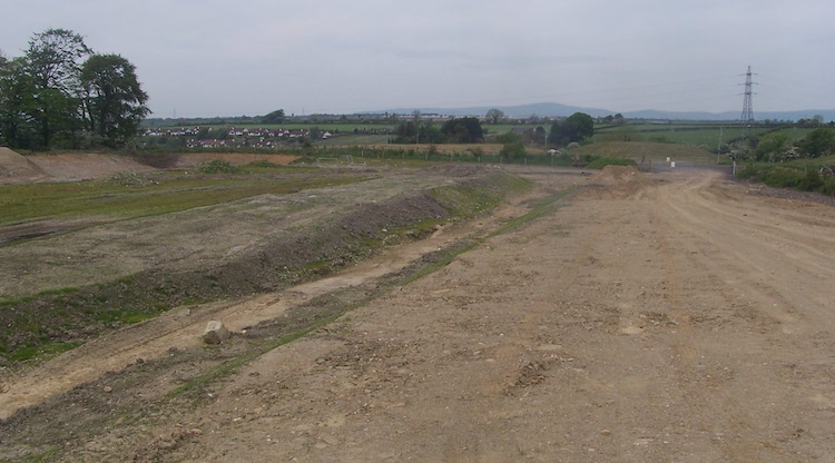 Pic 1: At the start of
the scheme at Drumahoe, the dual-carriageway
will commence at a Lismacarol Roundabout to be
located on Tirbracken Road. The future plan is
to extend the new road over the roundabout
towards Maydown, but for now the two
carriageways are going to terminate on the
future sliproads. This is the view towards the
site of the future roundabout on Tirbacken Road
from what will be the eastbound onslip. The
future westbound offslip will be located near
the bank visible on the extreme left. The flat
area in between will be left clear for the
future extension of the dual-carriageway. 15 May
2019 [Wesley Johnston]
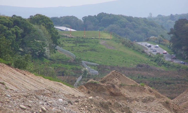
Pic 2: This is the view south east along
the route of the future road near The Cross
(Belfray Inn area) on 15 May 2019. The road runs
offline here, with the existing A6 on the right
to remain in-situ for local access. The large
depression ahead of the camera is Liberty Glen,
which will eventually be spanned by a large
(approx 200 metre long) bridge. [Wesley
Johnston]
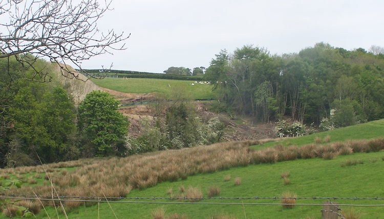
Pic 3: This is the view of Liberty Glen
looking north-east from the existing A6 on 15
May 2019. Pic 2 was taken from the large mound
visible on the extreme left. The new
dual-carriageway will cross the glen on a new
bridge across the centre of the shot here.
[Wesley Johnston]
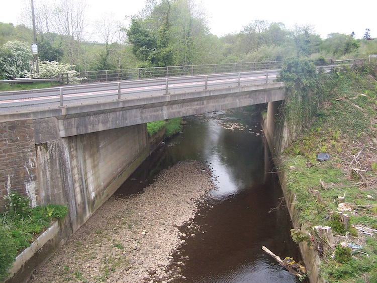
Pic 4: Moving to Burntollet, one of the
most constricted parts of the whole scheme, this
is the existing A6 bridge as seen on 15 May
2019. This bridge will be demolished, along with
the adjacent older bridge, and replaced with a
much wider structure which will also be about
three metres higher than the current bridge.
When this bridge was built in the mid 20th
century, the river beneath was straightened and
lined with concrete walls. This is no longer
regarded as environmentally good practice, so
the new bridge will also involve removing all
the concrete visible here and restoring a more
natural earth riverbank along with a new
pedestrian path. [Wesley Johnston]
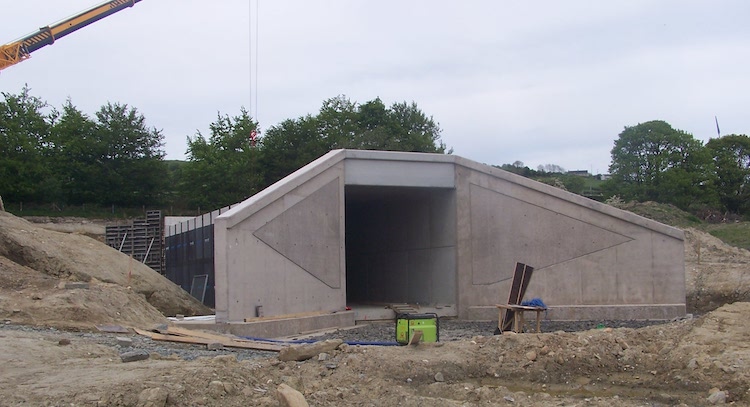
Pic 5: Moving much further east, to the
area just east of Claudy, this is a new
agricultural underpass being built to take a
farm lane beneath the new dual-carriageway. At
this point the new road will run adjacent to the
existing road (which in this shot runs
left-right beyond the trees), which will remain
in-situ. 15 May 2019 [Wesley Johnston]

Pic 6: Slightly further east than pic 5,
this is the view east along the route of the new
road as seen from Ballyhanedin Road on 15 May
2019. The topsoil has been cleared here and
earthworks are underway. The current A6, on the
left, will remain in place for local traffic
while the new road will run at a lower elevation
beside it. Ballyhanedin Road will eventually be
carried over the new road on a bridge to be
sited just ahead. [Wesley Johnston]
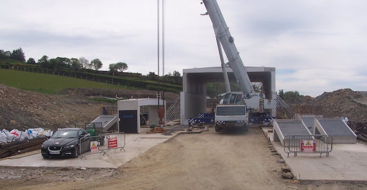
Pic 7: Near the village of Foreglen,
Altagarron Road is going to remain in place, but
is currently closed to allow the construction of
this new box structure, which is big enough to
carry two double-decker buses. The future
dual-carriageway will run over the top of this
structure at an oblique angle while Altagarron
Road will pass through it. This view is looking
south-west. 15 May 2019 [Wesley Johnston]
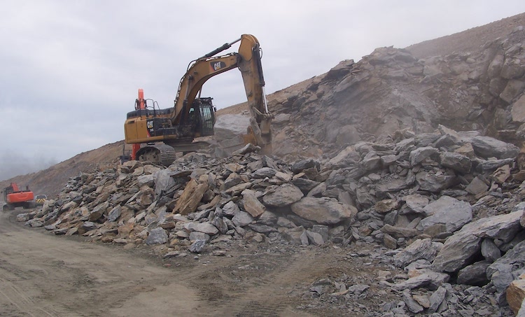
Pic 8: Just east of Foreglen the
dual-carriageway passes through Ovil Hill which
requires an enormous cutting, work on which is
now well underway. This view shows one of
several excavators busy removing rocks which
have been loosened by explosives. Although this
is a very large cutting, it is yielding an
enormous quantity of good quality rock which is
going to be sorted and used elsewhere on the
scheme. This means that very little rock needs
to be imported from quarries elsewhere, greatly
reducing the overall environmental impact of the
scheme. 15 May 2019 [Wesley Johnston]
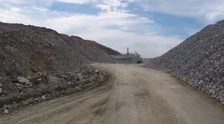
Pic 9: Another view of the Ovil Hill
cutting taking shape on 15 May 2019, looking
west. The material on the right is rock that has
been removed from the cutting and has been
sorted by size and is now being stored to await
use elsewhere on the project. If you drive
through here in three years time, reflect on the
effort that it has taken to create this cutting!
[Wesley Johnston]
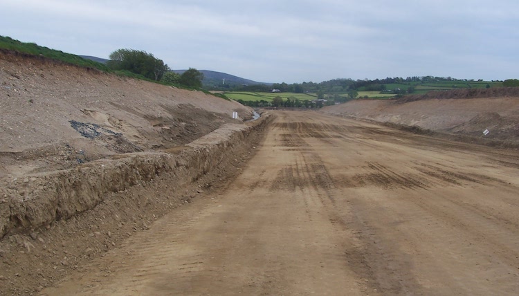
Pic 10: Moving now to the Dungiven Bypass
element of the scheme, this is the view east
from near Feeny Road on 15 May 2019. There will
be a grade-separated junction on Feeny Road
giving access to Dungiven from the west. The
road will travel in a shallow cutting here,
which has already been excavated. Note the
temporary drainage channel on the left. These
channels are equipped with structures designed
to filter out silt so that it doesn't make its
way into local watercourses during construction.
[Wesley Johnston]
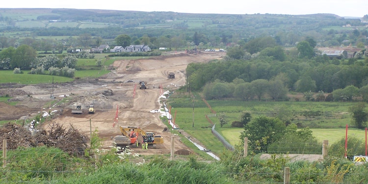
Pic 11: This final view shows the view
east from Teeavan Road, Dungiven, on 15 May
2019. The earthworks are well underway here. The
new road will be carried over the river in the
depression just ahead on a bridge, before
entering a cutting beyond which will carry the
road to its terminus at a new roundabout on the
current A6 just east of Dungiven (Magherabuoy
roundabout). [Wesley Johnston]
24 Mar 2019: In the last update I
commented on the difficulty of getting info on
this scheme, but since my previous update the
contractor has updated
their web site. The contractor confirms
that site clearance has now been completed on
the entire scheme except for an area in an area
in Brackfield and Burntollet. Fencing works have
also taken place in the past few weeks on
between Tamnaherin and Gortilea; between
Ballyhaedin and Munreery; from Feeny Road to
Dungiven and near Claudy towards Burntollet.
Utility diversions along the route are partially
completed with some still to be carried out.
Earthworks are underway at Drumahoe, Foreglen,
Munreery and Derrychrier and these are for three
public road bridges (Gortilea overbridge,
Ballyhanedin overbridge and Altagarron
underbridge) and one accommodation bridge
underbridge. By the end of March temporary
bridges over the Owenbeg and Owenrigh Rivers
will be completed, presumably to provide site
access for the contractor. Finally, access
tracks are being built between Killunaght and
Ovil Hill and Feeny towards Dungiven and
Munreery. Again these are probably for the
contractor to gain access to the site. The
update also contains a video – I can't get it to
play on my computer, but have a look as it might
work on yours!
6 Mar 2019: Work has been undereay on
this scheme now for six months, but it is
extremely difficult to get information on
progress. The contractor has a web site at https://a6d2d.com
but it is not being updated frequently or in any
useful detail, with the last construction update
being posted almost three months ago. This
requires us to instead depend on the
observations of local people on Twitter, which
are proving much more useful, especially Paul
McCloskey whose pictures I include below
with his permission. As far as I can ascertain,
work seems to be taking place at Drumahoe
park-and-ride site; on a major cutting south of
of Foreglen and on the Dungiven Bypass section,
shown in the photos below. Work also seems to be
taking place at various points along the online
stretch at the Derry end of the scheme, between
Claudy and Tamnaherin Road past Burntollet. The
whole scheme is due to be completed three years
from now, in spring 2022.
Pic 1 - View of the future A6 Dungiven Bypass
seen looking west from the junction of
Magheramore Road and Teeavan Road on 3 March
2019, showing both earthworks and what appears
to be watercourse diversions. [Paul McCloskey]
Pic 2 - Zoomed in version of the previous photo,
showing the future A6 Dungiven Bypass with
watercourse works underway and other earthworks
in the distance on 3 March 2019. [Paul
McCloskey]
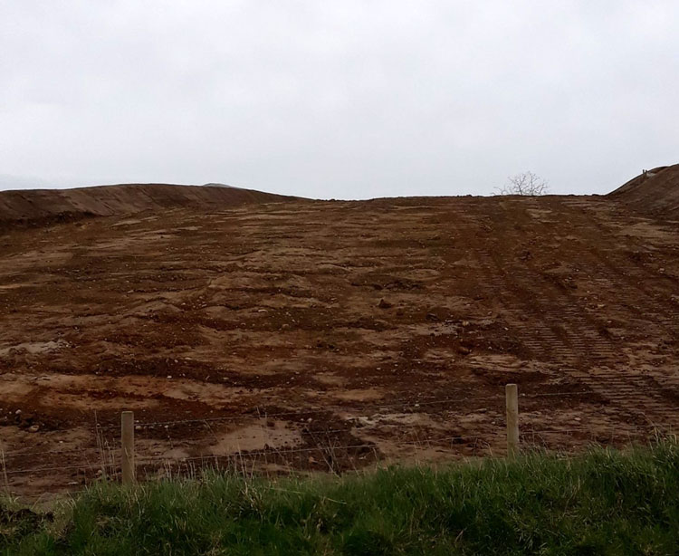
Pic 3 - View east along the route of the future
A6 Dungiven Bypass seen from the junction of
Magheramore Road and Teeavan Road (ie the same
location as above but turned 180° round) on 3
March 2019. A cutting will be excavated here.
[Paul McCloskey] 16 Jan 2019: Work is underway again
after the Christmas break. According to the contractor,
the work before Christmas focused on fencing
along the route of the road and on the necessary
environmental surveys along the route. This
means that site clearance works have not yet
commenced on much of the route. Works carried
out before Christmas also included culverts at
Foreglen and Drumahoe, and the installation of
temporary bailey bridges over the Owenbeg and
Owenrigh rivers to faciliate construction
traffic. More significant earthworks are
underway at Foreglen, and these can be seen in this YouTube video
posted by the contractor three weeks ago. It
shows works commencing on the route of the new
road above Foreglen GAA club (visible at 1:10).
The strip of gravel seen here is on the route of
the new dual-carriageway. However, its narrow
width suggests that at this stage this gravel is
intended to faciliate the movement of
construction traffic, rather than being the
foundation of the future road. At 1:30 the
camera swings round to show diggers working at
an excavation. This is the beginning of a much
larger cutting that needs to be made in the
hillside here. The contractor is starting
earthworks at this point and intends to work
westwards, ie towards Claudy. With work having
now been underway for about four months here's
hoping that we see further movement on the
ground before too long.
11 Nov 2018: Slowly but surely work
appears to be progressing on this scheme and
utility diversions (relocating pipes, cables
etc) and earthworks have now started. Earthworks
appear to be underway at both Foreglen, around
half way along the road, and at the western
terminus of the scheme at Tirbracken Road in
Drumahoe. The works at Foreglen have required
the closure of two local road (Crock na Brock
Road and Altagarron Road) because a bridge is
due to be constructed at that location. The
material at the location (peat) is too soft for
a bridge, so these initial works involve
removing the soft material and the two local
roads cross over the site and will be closed for
about six months. At the Dungiven end, the
contractor has constucted a temporary diversion
for the B74 Feeny Road in the locality of the
future Dungiven West grade-separated junction.
This is presumably to allow the junction to be
constructed on the site of the current road. According to
the contractor, the next two weeks will
see geotechnical works taking place at various
points along the western part of the scheme
which is to be an online upgrade of the current
road. Geotechnical works are essentially to
determine the exact nature of the material that
lies under the ground and informs detailed
design decisions. With thanks to Paul McCloskey
for information on the scheme.
6 Oct 2018: The official 'sod-cutting'
ceremony took
place on the scheme on 26 September (photo
1 below). There is still not much to see on the
scheme with the exception of an area around
Foreglen where substantial earthworks now appear
to be underway (photo 2 below). Motorists are
likely to see work progressively ramping up all
along the 25 km route over the autumn and winter
months, with the initial focus probably being on
earthworks (cuttings and embankments) and
construction of new culverts for watercourses.
Work on the Dungiven Bypass itself will
apparently be phased later in the schedule, so
may not begin straight away. Nevertheless, a
site yard also seems to have been established at
Magheramore Road just outside Dungiven. With
thanks to Paul McCloskey for information on
progress and photos.
 Photo 1: Causeway Coast and Glens Mayor
Brenda Chivers, Northern Divisional Roads
Manager David Porter and Derry City and Strabane
Deputy Mayor Derek Hussey cut the first sod on
construction of the A6 Dungiven to Drumahoe
[DFI]
Photo 2: Earthworks underway at
Foreglen on 28 Sep 2018. [Paul McCloskey]
18 Sep 2018: Earthworks didn't seem to
start in August as the grapevine had suggested,
but road users need not be concerned - I now
understand that there is to be a sod-cutting
ceremony within the next week or so (possibly
26th September). Since the contract was awarded
six months ago detailed design work has been
taking place. This is a substantial piece of
work, involving site surveys all along the
scheme to determine things like the exact depth
to bedrock, earth composition etc. In addition,
further environmental surveys have been taking
place. Fencing off the land that has been vested
for the scheme is a huge task - the scheme is 30
km long - and as a consequence the process of
fencing is going to take until April 2019 to
complete. A public consultation (by the
contractor, not DFI Roads) took place at the end
of June to inform landowners about things like
phasing. You can see
the panels here. While this also suggested
that work would begin in August, it states that
"sections" of the new road would be open by
Autumn 2021, with overall completion in Spring
2022. I'm told that advanced works have been
taking place near Foreglen and also near the
site of the future Magherabuoy roundabout in
Dungiven. These may be site yards in
development. With thanks to the ever-vigilant Paul
McCloskey for information on the works to
far.
21 Jul 2018: Still nothing much evident
on the ground, but things are moving fairly
quickly towards earthworks finally getting
underway on this scheme. Environmental walkover
work has been taking place since the contractor
was appointed in March, as well as detailed
ground investigation works that will facilitate
the detailed design (questions like "So, exactly
how far below the ground is the bedrock at the
eastern abutment of the bridge?"). The word on
the street is that construction work is going to
begin in mid August with the creation of a site
yard at Feeny Road near Dungiven with
construction due to begin there first. After
that work will take around three to four years
to complete. It's possible that sections of the
road, eg the Dungiven Bypass, may be opened
earlier than this. The contractor has also
followed recent good practice and set up a
dedicated web site for the scheme at http://a6d2d.com.
The contractor has also put up a video
on YouTube that consists of a joint
fly-through/drive-through of the whole road. If
the road seems a bit like a rollercoaster it's
because the virtual car is travelling at about
180mph in order to cover the length of the
scheme in the 6 minutes of the video!
24 Jun 2018: I spoke to an engineer
recently who is working on this scheme and he
confirmed that detailed design work is underway
as we thought. The word on the street is that
construction earthworks may begin during July,
though that has not been confirmed officially.
As I said in the previous update, the first
visible step will be for the contractor to
establish site yards at various points along the
site. Once that happens, the bulldozers will
follow fairly soon. Meanwhile, DFI are holding information
events this week as follows: Wednesday 27
June 12pm-8pm in Owenbeg GAA Club, 471 Foreglen
Road, Dungiven, BT47 7PW; and Thursday 28 June
12pm-8pm in The Belfray Country Inn, 171
Glenshane Road, Derry, BT47 3EN. The events are
mainly intended to allow affected landowners to
find out more about the timetable of works and
when their land, specifically, will be affected.
However, all members of the public are invited
to turn up to find out more about the scheme and
have their questions answered.
3 Apr 2018: The DFI awarded
the construction contract for phase 1 (25.5 km
from Dungiven to Drumahoe, ie the bulk of the
scheme) on 28 March 2018. The contractor is a
consortium of Sacyr, Wills Bros and Somague
(congratulations to them). These companies hail
from Spain, Rep of Ireland and Portugal
respectively and have not been much involved in
road building in Northern Ireland hitherto. The
total cost of phase 1 of the project is given as
£220m (a bit less than the last estimate), which
includes both the construction cost and the cost
of buying the necessary land. The cost may not
include the planning work that has taken place
over the past 13 years since the scheme was
first announced, so this may not represent the
overall cost of the scheme. The status of phase
2, essentially a bypass of the Waterside in
Derry, is less clear since the route is affected
by an illegal landfill whose status is still
unresolved. It would not entirely suprise me if
phase 2 never gets built as it will become much
less of a priority once phase 1 has opened and
may struggle to get to the head of the queue for
future funding. In any case, I've marked the
scheme as "underway" even though proper
construction has not yet begun (work visible to
date is part of a separate site clearance
contract). This is for two reasons. Firstly, it
will take a number of weeks for the contractor
to mobilise their resources and appoint
subcontractors for a scheme of this size, and
secondly the contract includes an element of
final design work which will need done first.
The first signs I would expect to see are the
provision of site yards at various points along
the route, followed by the arrival of heavy
plant equipment and then the commencement of
earthworks. Work is due to take approximately
four years, so we could expect to see completion
during 2022. To clarify - this scheme will see
25.5 km of dual-carriageway built east from
Derry, which compliments the separate stretch of
new dual-carriageway under construction on the
A6 west from Randalstown to Toome. A number of
people have asked what is happening to the gap
that will remain in the middle, ie the long
stretch of single-carriageway from Castledawson
to Dungiven via Glenshane Pass. The answer is
that DFI currently have no plans to dual this
stretch, which is currently the stretch with the
lowest traffic levels on the A6. However, there
is strong symbolism associated with having
continuous dual-carriageways between our two
largest cities, so the pressure to plan an
upgrade of this stretch will likely be
sustained.
13 Mar 2018: The design-and-build
construction tender has not yet been awarded,
although it is now over a year since it was
advertised. The word on the street is that the
contractor will be appointed within the next few
weeks which could see construction work commence
before the summer, depending on how much final
design work needs to be done (finalising the
design is part of the construction contract).
The Vesting order was "made" on 15 August last
year, and ownership of the land formally
transferred to DFI on 19 September. Meanwhile,
an advance siteworks contract has been underway
since late last year. This primarily involves
vegetation clearance, since trees must be felled
by 1 March, the start of the bird nesting
season. The photos below show examples of this
work. It is most noticeable on the western half
of the scheme, between Claudy and Drumahoe,
perhaps because this section is to be built as
an online upgrade of the existing road. The
eastern part, from Claudy to Dungiven, is
generally offline and hence not as immediately
obvious from the current A6. Archaeological
surveys are also underway and geotechnical and
ecological surveys have been completed. The
scheme will run from Dungiven (including a
bypass of the town) to Drumahoe, with the
"Waterside Bypass" stretch at the Derry end to
be built at an undefined point in the future.
The total cost of this phase will be £230-255m
and will take "up to four years" to complete, so
we could expect to see completion during 2022.
This will therefore be the most expensive single
road scheme ever undertaken in Northern Ireland
(not counting the A5 which has yet to commence),
the previous record holder being the 2010 A1
Newry Bypass at £165m. I am very grateful that
so many people have emailed and tweeted me with
updates on the works along this stretch. There
is a real sense of anticipation - it is clearly
an exciting time for the North West.
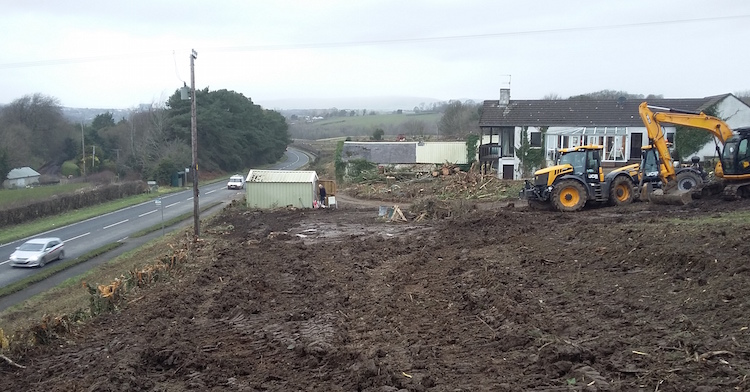
Vegetation clearance underway on the A6 at
Tamnaherin Road, about 2 miles outside Derry.
The house visible ahead will also be demolished
for the new road which will run roughly where
the photographer is standing. 19 Feb 2018.
[Anonymous contributor]
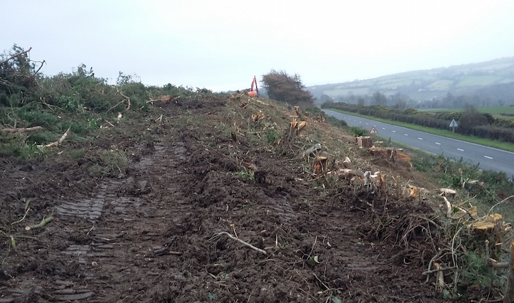
Same location as previously, but looking east
showing vegetation clearance well advanced at
Tamnaherin Road on 19 Feb 2018. At this point,
the current road (on the right) will be subsumed
by the new dual-carriageway. [Anonymous
contributor].
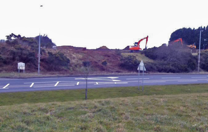
At the opposite end of the scheme this view
shows egetation clearance well advanced at
Magherabuoy, Dungiven, where the new
dual-carriageway will terminate at a roundabout.
12 Mar 2018. [Paul McCloskey]
5 Sep 2017: With all the publicity being
stolen by the other end of the A6 at Toome and
its legal difficulties, this scheme from Derry
to Dungiven has been quietly advancing to the
point of being not too far off commencement. The
tender has now been out for over 7 months, so I
would expect to see a contractor appointed
before the end of 2017. For clarity, the tender
is for the stretch of the A6 from Drumahoe to
Dungiven only, including the Dungiven
Bypass but NOT including the "Waterside Bypass"
stretch from Drumahoe to the A2 at Gransha. The
reason for this hasn't been widely discussed,
but is likely to be related to the unresolved
illegal dump at Mobuoy Road, which the route of
the new road traverses, and perhaps also the
potential for some money to be freed up in the
short term by the delayed stretch of the A6 west
of Toome. On 15 August 2017 DFI "made"
the Vesting Order for the scheme. The
Vesting Order is the legal document that
transfers ownership of the required land to DFI
(an independent body deciding the compensation
due to landowners). It exists in draft form
throughout the public inquiry stage so that all
those affected can see what is proposed, but the
act of "making" the Vesting Order is the moment
it is triggered and ownership actually changes
hands. Since doing this will immediately
generate a lot of large bills for DFI, they
would not do this until they were confident that
work was going to commence in the short term. So
this suggests that they are going to begin work
soon, perhaps earlier than my previously
predicted date of 2019. The scheme has already
got at least a partial funding allocation -
enough to begin, anyway - and hence commencement
does not depend on the existence of an
Executive. (Incidentally, it is surely not a
coincidence that the Vesting Order was made on
the same day as the A6 Toome legal hearing -
perhaps DFI trying to make sure that there was
at least some good news for the A6 on that
date.) Finally, DFI have released a new
document for the general public detailing
what is being proposed. This includes an image
showing how the "temporary" (!!!) terminus at
Drumahoe will look, and also revealing that it
is to be known as "Lismacarol Roundabout". Lismacarol
could well become the Broadway or Sandyknowes
of the North West, so expect to hear the name
mentioned a lot in traffic reports in the coming
years. At the other end, we now know that the
roundabout east of Dungiven is to be known as
"Magherabuoy Roundabout".
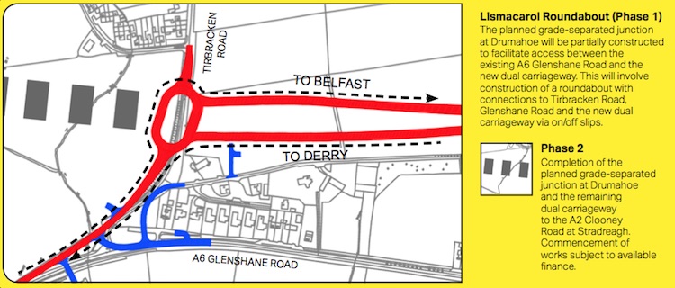
How the "temporary" terminus
of the A6 at Drumahoe will look. [DFI Roads]
26 Feb 2017: The tender for design and
construction of the bulk of this scheme was
advertised on Tuesday, 21 February. The
tender specifices the stretch from "Dungiven to
Drumahoe" including the Dungiven Bypass, so in
the strip map above that's everything from the
new "Dungiven East" roundabout up to the
"Drumahoe" grade-separated junction, ie only
omitting the bypass of the Waterside and
connection to the A2 at Gransha. The tender
specifices "four" grade-separated junctions
which implies that the Drumahoe junction will be
built as an at-grade roundabout without bridges
and sliproads. If so, that makes sense as in
Northern Ireland we already have far too many
untidy, unfinished junctions without adding yet
another one. The value given is £160m (which
doesn't include design work to date or purchase
of land). That still seems an optimistically low
figure to me, but given that the engineers in
DFI know what they are doing I am willing to
suspend disbelief on this for the time being!
Duration is given as 36 months which I would
consider normal for construction of a road of
this complexity in Northern Ireland. One cannot
ignore the timing of this tender release, which
has come just over a week before an Assembly
election, but it also has to be said that it is
entirely consistent with the recent history of
this scheme which has got a (partial)
budget allocation and has for some time looked
likely to commence on the ground by around
2019. The tender is probably a "design and
build" tender with a split between the two, so
even if a contractor is appointed they will
still have a lot of work to do to complete a
detailed design, and there is no guarantee from
a contractural standpoint that the road will be
built. But this is still probably the closest we
have come to getting a bypass of Dungiven for
several decades. Provided it doesn't get delayed
by a legal challenge from environmentalists, as
has happened on the A5 and the eastern poortion
of the A6, commencement around 2019 and
completion around 2022 seems quite plausible.
8 Feb 2017: In December 2015 the two A6
schemes (this one, plus the Randalstown-Castledawson
scheme) were given a total cash allocation
of £258m for the five years up to 2020/21. Since
we know that the Randalstown scheme is currently
estimated to cost £160m (in August 2016) that
leaves a surplus of £98m that could be used for
this scheme. The total cost of this scheme was
last stated to be £390-420m in 2014. So the
funding allocated up to 2020/21 is enough to
build about a quarter of the scheme. That could
still allow work to begin close to the end of
that time period, on the assumption that further
funds would be made available beyond 2020/21.
However, the Minister has consistently suggested
that the scheme is likely to be broken into
sections and built as money is available, and
that work would begin at the Dungiven end and
work towards Derry. For the past year the
question has been how much of the road could be
built in the first phase. Given that the road
has passed its public inquiry and is now simply
awaiting funding and a contractor, work on the
first phase could begin as soon as those two
items could be put in place. With that in mind,
this week a construciton tender appeared on the
DFI's "future tender" list for a scheme called "A6
Londonderry to Dungiven Dualling (Phase 1,
Drumahoe to Dungiven)" which is for
"25.5km" of dual-carriageway with a total cost
of £150-170m and a tender release date of
February 2017. This suggests that the plan is to
build everything except for the 5.3km "Waterside
bypass" stretch at the Derry end, which
coincidentally is home to the notorious Mobuoy
Road illegal dumping site that the route of the
road traverses. Three points need to be made
about this. Firstly, the timing of the
tender release in the final weeks of the current
Executive is surely not a coincidence. I get the
impression that the current Minister is very
keen to make sure this scheme is progressed as
far as possible before he loses his job prior to
the election. Secondly, the cost of the
scheme is greater than the amount of money
actually approved by the Executive for the A6 up
to 2020/21. When I asked one of the Minister's
advisors about this point (see this
Tweet and replies) he confirmed that
discussions had taken place behind the schenes
about getting further funding, but that nothing
had actually been approved by the Executive. So
I would say IF the election results in a new
Executive being successfully formed, and IF Sinn
Fein are as influential in that one as they are
in the current one, then such funding could well
be forthcoming. But that's something we can't
say until we see the election result and whether
the DUP and Sinn Fein can resolve what looks
like a significant rift. Thirdly, the
tender value of £150-170m seems low to me for
over 25 km of dual-carriageway. Even taking
account of the fact that this is the
construction cost, and does not include design
and land costs, it still seems quite optimistic
to me that that much road could be built for
£170m. The tender represents over 80% of a
scheme whose total cost (including design and
land) was estimated in December 2014 to be
£390-420m. But I imagine the folks at
TransportNI know what they are doing so we shall
have to wait and see. Barring a major change to
the functioning of Stormont, it is quite
plausible that work on this scheme will begin by
the 2019/20 financial year as I have said in
previous updates.
19 Oct 2016: It has been eight months
since I updated this page, mainly because very
little has publicly been said about it. We know
that the Minister has enough money over the next
four years to proceed with some, but not all, of
this scheme (about 30% of the required funds are
available up to 2020/21). He has already said
that he intends to go ahead with the Dungiven
Bypass, probably around 2019, and thereafter to
work west towards Derry as far as possible from
there, but that the extent of this will depend
on how much can be built with the money
available. There is due to be an autumn budget
statement within the next month or so that could
potentially make some more money available for
this scheme, but that is by no means certain. In
a Written
Answer in the Assembly in late September
(AQW 2761/16-21) the Minister said "Work is
underway to determine the extent of the A6
Derry to Dungiven Dualling scheme that can be
delivered within the 2015 Budget Statement
allocations, with priority being given to
commencing construction with a bypass of
Dungiven and progressing westwards towards
Drumahoe" which has been the official line
since Michelle McIlveen was Minister. However,
in a Written
Answer in July (AQW 1095/16-21) the
Minister did note that "in May of this year
[2016] my Department appointed consultants to
assist with the procurement and delivery of
this scheme" which was around the time he
became Minister and seems to represent some
concrete intention. Meanwhile, the Department
for Infrastructure's Business
Plan was published last week, and it gives
some further guidance on when we might know
more. It states a goal to "Develop and agree
the procurement strategy" for this scheme
and sets a target for March 2017. I would take
"procurement strategy" to be offical speak for
"figure out how much money we have, what we can
built with it and when". So on the basis of all
the above I think we might have some more
information at the time of the autumn statement,
and then further clarity by the Spring of next
year.
The only other outstanding issue is the Mobuoy
Road controversy, basically where a huge
amount of illegally dumped waste was found
buried along a short part the route of the road
at the Derry end. This will need dealt with
before work can begin, not least because it was
placed there illegally, but also for practical
reasons, in that the proposed road is in a
cutting at the point in question. Responsibility
ultimately lies with DAERA, not the DfI, but it
is still an issue for DfI as it directly affects
the A6 scheme. In a Written
Answer in July (AQW 394/16-21) the
Minister explained that "Discussions remain
ongoing with the DAERA which is currently
considering the management of the site and
long-term options for remedial measures. My
Department’s TransportNI will align any
proposed works with any potential remediation
solutions." He also noted that "I am
content that, should the contamination issue
remain unresolved when the A6 dualling is
being constructed, cost effective measures can
be deployed to remedy the undesirable effects
of the waste."
24 Feb 2016: The DRD has finally
published its Departmental
Statement into this project. After the
road has been planned and designed, it is
usually put to a public inquiry. For this scheme
that happened in September/October 2012. After
that, the Inspector writes a report with
recommendations in it and gives it to the DRD.
This happened around March 2013. The DRD then
study the recommendations and, when they are
happy that they have dealt with every issue,
publish their response - this is the
"Departmental Statement" which was issued today
along with the Inspector's
Report after almost three years. Why is
the Departmental Statement significant? Because,
while the road has been in planning for years,
this is the moment when the decision to proceed
is formally (legally) taken. All that needs to
happen now is that funding is allocated to the
road and a contractor has to be appointed
through a tendering process. This is the
complication - there is currently no formal
funding allocation, though the Executive did
allocate funding for the next five years to the
A6 generally in December. Rather than repeating
myself, I invite you to read the 20 December
update below for the implications of this.
Suffice to say that lack of funding for the
whole scheme means it will probably not happen
at once - the Dungiven Bypass will likely be
constructed first, along with a bit more - and
the wording of the Minister's
press release suggests that the most
likely stretch is a section immediately to the
west of Dungiven, perhaps as far as Claudy (her
wording was "It is envisaged that priority
will be given to construction from Dungiven
towards Londonderry"). But this has yet to
be confirmed. The Inspector's Report largely
accepts the DRD's proposals for the road,
including the route for the Dungiven Bypass
which caused so much controversy at the Inquiry.
This route was also backed up by the DRD's
subsequent research and that of an independent
consultant who then checked the DRD's work. So
the scheme will be going ahead largely as
planned.
29 Jan 2016: In the previous updted I
reiterated that there seems to be enough money
to build some, but not all, of this scheme over
the next five years. The assumption is that the
Dungiven Bypass will go ahead, but there seems
to be money to build a bit more than that. So
the question is, what will be built? In a Writtern
Answer in the Assembly this week (AQW
52772/11-16), the Minister said TransportNI "are
currently reviewing the extent of this scheme
which can be built with the funding
allocations in the December 2015 Budget
Statement.
Once I have received these reports and
considered them in full, I will make a
decision on how the scheme should proceed." So
basically the engineers are working to answer
this very question. There are various
possibilities (eg all of Dungiven-Claudy; or
perhaps Dungiven plus the Waterside "bypass" at
the Derry end) but with so many options I'm not
prepared to put my money on any particular
variation just now! But she finished with the
clearest indication yet that the Dungiven Bypass
will be going ahead after half a century
of waiting, saying "allocations for the
2017/18 – 2020/21 period will allow my
Department to construct elements of the A6
Londonderry to Dungiven dualling scheme, which
includes a bypass of Dungiven". Assuming
it does go ahead, I think we're still perhaps
three years away from construction starting on
the Dungiven Bypass which I estimate could start
in the 2019/20 financial year. Nothing is
certain until the bulldozers move in, but it's
looking promising.
11 Jan 2016: In my post a month ago (9
Dec, below) I expressed frustration with the
time it has taken for the DRD to publish its
response to the Public Inquiry, the report of
which they received almost three years ago. I
also gave some possible reasons. The DRD
Minister was explicitly asked this question in
the Assembly today, and she was adamant
that the delay is the first of the three reasons
I gave, namely ongoing work assessing
alternative routes around Dungiven. It is worth
quoting her at length. She said "One of the
inspector's recommendations was that an
alternative route for the Dungiven bypass be
considered in sufficient detail to allow an
informed comparison to be made between it and
my Department's published route. Transport
NI's project consultant subsequently reviewed
the alternative route, and its findings
endorsed my Department's published route.
However, there was a view that that was not
sufficiently independent and may not have
given the alternative route a fair
consideration, so an independent review of the
alternative route was commissioned by my
Department and has now been completed. Reports
have been prepared outlining the findings of
the review and addressing the other
recommendations arising from the public
inquiry. Once I have received those reports —
I have not as yet — and get the opportunity, I
will consider them in full and make a decision
on how the scheme should proceed after that."
There is no reason not to take this at face
value, though I still think that the other two
reasons I gave are probably also playing a role.
Meanwhile, in the previous update (20
Dec, below) I commented about the implications
of recent funding allocations for this scheme. I
noted that there seemed to be enough money to
build some, but not all, of this scheme over the
next five years and this assessment was
confirmed in the Assembly today when the
Minister said the DRD "are reviewing the
extent of the scheme which can be built with
the funding allocations in the December 2015
Budget statement". It could be that they
decide to progress the Dungiven Bypass alone, as
I suggested below, but it may be that they
decide to build a bit more, for example the
whole bit from the Dungiven Bypass to Claudy. It
sounds as if the Minister will be making an
announcement on this in due course, though
probably not in the immediate future.
20 Dec 2015: Three days ago the Finance
Minister delivered her budget
for the next financial year. This budget
included funding of £21m in the 2016/17
financial year (April to March) for the A6 and
also committed £57m, £60m, £60m and £60m for the
following four years. Now, let's clarify that
there are currently TWO A6 schemes - Derry to
Dungiven, and Randalstown to Castledawson. The
cash allocated is likely to mean the other
A6 scheme, the one to build a dual-carriageway
from Randalstown
to Castledawson, is likely to go ahead
around April 2016. That scheme is estimated to
cost £140m, so the first three years of the
aforementioned cash allocation should cover
this. That means that there is still £120m
allocated to the A6 for the final two years, and
that could only be spent on this A6
scheme. I have blogged
my thoughts on this in more detail here,
but the bottom line is that I think we could see
the A6 Dungiven Bypass detached from the main
scheme and work get underway during the
2019/20 financial year. I need to stress
that this is my own estimate - the DRD have not
said anything about timescales for any of these
schemes. The total estimated cost of the A6
Derry-Dungiven scheme is £420m, and the cash
allocation above is much too low to allow all
this to be built, but the cost of the Dungiven
Bypass portion alone is only £65m, which is LESS
than the £120m allocated for the last two of the
next five years. So it's possible that the
intention is to start the ENTIRE Derry-Dungiven
scheme in 2019, and carry on beyond the five
year period mentioned in the budget with further
funding allocations at that time, or possibly
before. But we shall see. For now, I think
there's a reasonable chance that we're within
three to four years of work beginning on the
Dungiven Bypass.
9 Dec 2015: This scheme is still
deafening in its silence. The Public Inquiry
happened in autumn 2012 and it is now almost three
years since the Inspector submitted his
report to the DRD, and almost two years since
the Minister said that he would be publishing
the DRD's response (the Departmental Statement)
shortly (see update 10 Feb 2014 below). It is
inconceivable that it has taken the DRD three
years to digest the report, so there must be
something else holding it up. Some possibilities
are (a) Consideration of the
"alternative route in the vicinity of Dungiven"
that the DRD keep alluding to when asked what is
happening. Although the Inspector's report has
not been published, it seems to have recommended
consideration of an alternative route. It's
possible, though I think unlikely, that
consideration of this alternative route is
taking this long. (b) That the scheme is
being held up by political and financial
considerations. The Executive has had
conflicting priorities on road building due to
insufficient cash to build everything desired,
and both the A5 and York Street Interchange have
seemed to be higher priorities in the Executive.
The Minister may have been working on the basis
that not publishing the Departmental Statement
effectively parks the project and avoids
questions about timescales getting more awkward.
(c) The Mobuoy Road controversy. In June
2013 a large illegal landfill site was
discovered at
Mobuoy Road, near Londonderry with about
1.5 million tonnes of illegal waste in it. The
site has still
not been dealt with. It impacts on this
scheme since part of the site is
to be purchased by the DRD to build the A6
dual-carriageway (which would be in a cutting
through much of the area in question), but also
for flood control measures and some local road
realignments. The scheme design was developed
prior to the discovery of the site and so it did
not take the illegal landfill into
consideration. Although the DRD are adamant that
the illegal landfill will not affect the
project, it inevitably will because the site
will have to be decontaminated in some shape or
form before the road can be built. It's possible
that delaying this project avoids this becoming
a more toxic (excuse the pun) issue. Finally,
while the DRD Minister did comment back in
September 2014 that he had decided that the
Dungiven Bypass "could" be decoupled from the
rest of the scheme and implemented at an earlier
date, nothing more has been said about this
possibility. As the only town on the entire
Belfast-Derry road that is not bypassed, and one
that is experiencing significant air pollution
and congestion, this really should be well up
the priority list within DRD.
6 Dec 2014: Speaking in the
Assembly three
weeks ago, the Minister was asked about
the scheme. He gave the current position as
follows: "the inspector [at the 2012 public
inquiry] has produced a report containing a
number of recommendations. Those include a
request to consider an alternative route
in the vicinity of Dungiven.That work is
continuing, and, when I am satisfied that all
issues have been appropriately reviewed, a
number of which are complex, I will issue a
departmental statement." In previous
updates I have expressed curiosity that it has
taken so long to respond to the report of the
public inquiry, since TransportNI have now had
it for nearly two years. The comment in the
Assembly implies that the main holdup is that an
alternative route is being considered at
Dungiven. Assessing an alternative route would
generate a lot of work, for example new surveys,
new cost estimation works and possibly new
traffic surveys and modelling. So this could
explain the delay. However, it has to be noted
that the minutes of a TransportNI board meeting
held on 1 October (but just
published) say that the "Departmental
Statement has been submitted to the Minister
for his consideration in advance of an
announcement on the way forward". The
"Departmental Statement" is the formal name
given to TransportNI's response to the report of
the public inquiry, and this suggests that the
statement was actually complete at the start of
October and therefore that the work at
Dungiven is already completed. This made
me suspect that the Minister was merely biding
his time for an appropriate moment to announce
the way forward. There was a debate
in the Northern Ireland Assembly last week
about the Dungiven Bypass, which is one
of the most anticipated components of this
larger scheme. I had therefore expected that the
Minister would use that debate to make some kind
of an announcement. However he did not, instead
stating that the work to assess the alternative
route at Dungiven was "ongoing" and that he
cannot give a timescale for these reasons: "I
cannot pre-empt due process and my decision on
the statutory orders [ie, whether and how he
presses ahead with the scheme]. If that
decision leads to the publication of the
direction order [ie, whether he gives it the
go-ahead], delivery of the scheme will be
subject to final approval of the business case
and be reliant on funding being made available
by the Executive". I still believe that it
is likely that the Dungiven Bypass component of
the scheme will proceed ahead of the remainder.
In his comments three weeks ago in the Assembly,
the Minister gave the costs of the scheme
as follows:
• Dungiven Bypass - £55m-£65m
• Dungiven to Maydown [Derry] - £290-£305m
• Maydown to Caw [upgrade of a short stretch of
the A2 in Derry] - £45-£50m
This gives a total scheme cost of £390-£420m
which is more than the figure of £350-£390m that
has been quoted since 2011. This is very
expensive, and it is unlikely in the current
climate that this kind of money will be
available in the near future.
14 Sep 2014: It has now been a
year-and-a-half since the DRD Minister was given
the inspector's report into the public inquiry
into this scheme which was held in September and
October 2012. In February 2014 he had indicated
that he would make a statement "later this
financial year", which presumably meant
April 2014, but this date also came and went
with no statement. So it has now been 18 months
since he received the report, so it's getting a
bit hard to explain the ongoing absence of any
statement. One possibility is that Northern
Ireland's financial situation is so uncertain,
and with the way forward for the A5 scheme still
not being clear, that the Minister does not want
to rashly commit to a particular course of
action that he may not be able to follow through
with. Another possibility is that the Inquiry
Inspector has identified an issue that is
proving particularly lengthy to resolve. The
Minister was asked about this very issue in
the Assembly on 8 September, when he said
"I am considering a response to [the
Inspector's] recommendations and will issue
the departmental statement in due course when
I am satisfied that all issues, a number of
which are complex, have been appropriately
reviewed." This is very vague. Although he
says some of the outstanding issues are
"complex" this doesn't necessarily imply that
this complexity is the root cause of the delay,
which I tend to suspect is more to do with
financial uncertainty. However, he did give
great hope to the people of Dungiven -
the only non-bypassed town on the whole Belfast
to Derry route - by basically saying that the
Dungiven Bypass will be built ahead of the whole
scheme. When asked if he would consider "decoupling
the bypass at Dungiven from the larger
project" his reply was "I am happy to
confirm that I have taken the decision that
the various components of the entire scheme
can be decoupled. Subject to the finance being
made available and the other issues being
resolved, we can proceed." That is as
close to a commitment as I have seen to date and
is a very positive sign that this is going to be
what happens. So I think we can expect that when
the Minister finally makes his statement, it
will be to say that the scheme is to be broken
into two parts - the Derry to Dungiven stretch,
and the Dungiven Bypass with the latter to
progress first.
10 Apr 2014: Based on the comment the
Minister made in February 2014 (see below) I had
expected us to have the Inspector's Report from
the Public Inquiry and the DRD's Departmental
Statement by now. This latter document is the
one outlining how the DRD will respond to any
recommendations the inspector made and setting
out what they plan to do next. However, in the Assembly
a few days ago the Minister was asked about the
scheme and explained that "we are still
considering the inspector's report arising out
of the public inquiry. The issues are
not yet concluded, and we hope to make
progress on outlining our thoughts on that in
the not-too-distant future". So it seems
we'll have to wait a bit longer. Certainly the
political pressure on the Minister to detach the
Dungiven Bypass element of the scheme and
progress it before the rest of the scheme is
great, and I would not be surprised if this is
what eventually happens in the face of tight
budgets.
19 Mar 2014: In the Assembly
yesterday, the Minister gave an update on
this scheme. This isn't the official statement
that we're still anticipating in the near future
(see previous update below), but is useful
nonetheless. We have known since June 2012 that
the DRD has prepared a plan to split the scheme
into two bits, which would allow the Dungiven
Bypass stretch to be built ahead of the rest of
the scheme in the evening of full funding being
an issue. In the Assembly today, he added that
it would be possible to split the project into three
by also separating off the upgrade of the short
stretch of the existing A2 at the Derry end of
the scheme (Maydown to Caw roundbout). In
reality, this is a relatively tiny component of
the whole scheme, so doesn't change that much.
The long (approx 25km) stretch from Dungiven to
Maydown roundabout constitutes the bulk of the
scheme. We are still waiting for a more formal
announcement within the next few weeks which
should set out more clearly what the Minister
intends to do next with this scheme.
10 Feb 2014: Ten days ago I commented
that it was now some time since the DRD Minister
had received the report from the Inspector of
the Public Inquiry that sat in September 2012,
and this week the Minister was asked about it
via a Question
for Written Answer. He said "I expect
to make a Departmental Statement on the way
forward later this financial year", which
presumably means by the end of March 2014. A
Departmental Statement is the document usually
released along with the Inspector's Report and
outlines how the DRD will respond to any
recommendations in the Inspector's Report and
sets out a decision on whether or not to
proceed. However, this does not mean
that the construction process would then begin,
as the scheme then has to wait for legal orders
to be made (eg, to buy the necessary land) and
most importantly for funding from the Executive,
which may not be forthcoming at this time since
the Minister has previously indicated that he's
unwilling to progress both the A5 and A6
schemes simultaneously.
31 Jan 2014: In my update on 15 April
2013 (below) I noted that the DRD Minister had
received the report from the Inspector of the
Public Inquiry that sat in September 2012.
Experience of recent years is such that I
anticipated that this would be published before
the end of 2013, but this has not happened.
They're not obliged to release it under any
particular timescale, but I'm just flagging up
the fact that they've now had it for almost ten
months, which is quite a long time. Perhaps
there is a reluctance to publish the report
ahead of a funding announcement as this would
simply draw attention to the fact that this is
yet another scheme serving Derry that hasn't
gone ahead! There is still nothing more on the
suggestion that the Dungiven Bypass scheme might
get split off and implemented at an earlier date
than the rest of the scheme, despite ongoing
local interest in the matter.
1 May 2013: In my previous update I
commented that with the 12-18 month delay to the
A5 project, the "Dungiven Bypass" element of
this scheme must surely be high up the list of
possible alternative schemes to be progressed in
the meantime. In the Assembly
yesterday the Minister seemed favourable
to the idea when that precise question was put
to him. He said "I am pleased to confirm that
the design of the scheme allows for the
Dungiven bypass to be taken forward and
completed as the first phase of the scheme. It
will provide 4·8 kilometres of dual
carriageway bypassing Dungiven to the south at
a total cost in the range of £60 million to
£80 million. The construction of this element
of the scheme would be dependent — and this is
the key thing — on the availability of finance
in subsequent periods." The last sentence
is something he 'has to say' since the Executive
has not yet agreed how the A5 money will be
reallocated, but the first two sentences show
that decoupling the Bypass section from the
larger scheme is a distinct possibility. The
main bit of work still to be done is the
analysis of the Inspector's Report from last
September's Public Inquiry which has been
received but not published.
15 Apr 2013: According to a Question
for Written Answer in the Assembly, the
DRD Minister has now received the report from
the Inspector at last September's Public
Inquiry. This is almost exactly to the timescale
predicted at the end of the Inquiry (see update
below for 4 Oct) which is nice. The report will
not be published just yet. Typically, the DRD
take a few months to examine it and respond to
any recommendations before publishing both the
inspector's report and their response (called a
"Departmental Statement") simultaneously. We
could expect to see this before the end of 2013.
Given the recent delays on the A5 project, the
"Dungiven Bypass" element of this scheme (a
small but critical part of the whole scheme) is
surely high up on the list of possible schemes
to be taken forward at an earlier date, so it is
very timely that the Public Inquiry report has
been received. Let us hope that there were not
too many issues with the plans.
24 Oct 2012: For those with a particular
interest in this scheme, Roads Service have just
published transcripts of the six day Public
Inquiry that took place a month ago. You can download
them here. This is only the third time
that I know of that Roads Service have published
such transcripts (the first two being for the
A55 at Knock and the A5 WTC) and is a very
welcome development for public transparency.
Happy reading!
4 Oct 2012: The Public Inquiry into this
scheme took place as planned from 24th September
to 2nd October, and finished on schedule having
heard over 125 objections. The Inspector, JA
Robb, will finish by conducting site visits on
9th and 10th October. The DRD say that they
expect the Inspector to submit his report
"before the end of March 2013", but it is
important to note that it will not be published
at that point. The DRD typically take a few
months more to consider the recommendations and
outline their response before publishing it. So
we might expect to see it around the summer time
next year. Detailed information about the
objections, along with transcripts of the Public
Inquiry are (or soon will be) available
here. With thanks to Paul McCloskey. Some
(including me!) are speculating that the
unexpected delays to the A5 scheme over the past
month might free up some money over the coming
months that could potentially be redirected to
the Dungiven Bypass element of this scheme. This
is quite possible, since the Minister has
already indicated
that he is sympathetic to the idea of proceeding
with the Dungiven Bypass ahead of the rest of
the scheme. Watch this space.
26 Jun 2012:
We now
know that the Public Inquiry into this
scheme will begin at 10am on 24 September 2012,
in the Roe Park Hotel, 40 Drumrane Road,
Limavady BT49 9LB. The Inspector will be JA
Robb, who was also the Inspector for the A8
Larne Public Inquiry and the A6
Castledawson-Randalstown dualling Public
Inquiry. Roads Service has also published their
pre-Inquiry Departmental
Statement, which sets out in considerable
detail their case for building the road as
proposed. This contains some interesting
historical information and is worth a read for
that reason alone. In another interesting
development, speaking
in the Assembly yesterday the DRD Minister
gave a strong hint that the Dungiven Bypass
section may be decoupled from the rest of the
scheme and built separately. They had previously
resisted this as it was anticipated that the
entire A6 scheme would proceed before too long,
and hence there was little to gain by dealing
with Dungiven separately. However, as it now
seems as if it could be some years before the
scheme is built, there would now be merit in
building the Dungiven Bypass scheme separately
(see update below for 14 Feb 2012). The Minister
said: "I can
confirm that it will be possible to bring
forward the draft statutory Orders for the
construction of the bypass at Dungiven ahead
of and without compromising the future
delivery of the remainder of that scheme.
However, this is, of course, all conditional
on available funding." This is
interesting news.
24 Jun 2012: The
DRD Minister has announced
that (not surprisingly) a Public Inquiry will be
held into this scheme, since it attracted 122
objections during the consultation period
between December 2011 and March 2012. The
Inquiry will probably be held in late September,
and further details are due to be released this
week. This is later than anticipated last
summer, but still welcome. There is currently no
financial commitment to actually build the
scheme, but it is important to keep progressing
the scheme so that it is 'good to go' if and
when money becomes available.
14 Feb 2012:
Today saw a major
announcement of how the money for roads
will be spent over the next four years. This
scheme was not among them. This was not
surprising, but until now we have had at least
hoped that it might begin around 2014/15 (see
update below for 11 May 2011). Today's
announcement means it won't commence until at
least 2015. However, it is disappointing that
the Minister has not at least chosen to press
ahead with the Dungiven Bypass element of the
scheme. Dungiven is the only town not bypassed
on the entire A6, and all the traffic pollutes
the village. However, it should be said in the
Minister's defense that the scheme has not yet
had its public inquiry, and this means even the
Dungiven Bypass could not commence for at least
a couple of years, even if it was decided to go
ahead with it separately. The money that is
available needs to be spent sooner than that
timescale would allow.
8 Jan 2012: Roads
Service will be holding the next round of public
exhibitions into this scheme this month. As
always, I would urge anyone with an interest in
the scheme to turn up as this is a vital part of
the process, and an opportunity to express your
views. According to this
press release, issued just before
Christmas, the exhibition dates are:
- 17 and 18 Jan 2012 - Dungiven Sports
Pavilion, Chapel Road - 10am to 9pm
- 24 and 25 Jan 2012 - YMCA, 51 Glenshane
Road, Drumahoe - 10am to 9pm
- 26 Jan 2012 - Strathfoyle Youth Centre, 13
Deramore Drive - 10am to 9pm
The deadline for comments and objections is 2
March 2012.
For those interested in history, this
scheme page now contains links to multiple
historical documents.
17 Dec 2011:
The draft legal orders for this scheme were
published on 14th December. These include the Environmental
Statement (sets out what impact the scheme
will have on society and the environment and is
required by law). It also includes the draft legal
order (required to build a new trunk road)
and the vesting orders, part
1 and part
2 (which define whose land they will be
buying to build the road) and some other
documents. The Environmental Statement includes
revised plans for the junction, which are
interesting in that two junctions have been dropped entirely
- which is excellent news as they merely
provided superfluous links across to the
existing A6 which will remain in place as a
perfectly adequate route (presumably with a
60mph speed limit) for accessing all the
properties along that stretch. The changes made
since we were last given junction designs in May
2009 are as follows:
- The layout of Killaloo junction west of
Claudy has been amended slightly - I have
altered the strip map above to reflect the new
design.
- Ballyhanedin Road junction east of Claudy
has been dropped - the road will be bridged
over the A6 but with no access to the A6.
- Killunaght Road junction near Foreglen has
been dropped - the road will be bridged over
the A6 but with no access to the A6.
4 Jul 2011: The Minister has confirmed
that the draft legal documents required to build
the road will be published "later this year",
and that the Public Inquiry will likely be held
in Spring 2012, slightly later than expected in
April. This does not imply that the road will go
ahead any earlier than previously stated, merely
that Roads Service want to press ahead with the
process so that, subject to the Inquiry,
construction of the road can go ahead once
finance is available.
14 May 2011: Speaking at the
Annual Dinner of the Chartered Institution of
Highway Enginners Northern Ireland, the
Permanent Secretary of the Department for
Regional Development Malcolm McKibbin said "development
work is proceeding on the A6 schemes and late
changes to the draft budget mean that we
should also be able to start construction in
the last year of the budget period"
(quoted in Plant & Civil Engineer, May
2011). There are two "A6 schemes" - this one,
and the scheme to dual the A6 from Randalstown
to Castledawson. The Minister's comments last
month about Dungiven (see previous update)
suggest that Mr McKibbin may be referring
specifically to this scheme when he says that
construction should be able to start, but it's
possible he means both. Previously both schemes
were delayed until at least 2015. The "last year
of the budget period" is the financial year
running from April 2014 to April 2015.
27 Apr 2011: The Minister has
confirmed in a Written
Answer that development work will proceed
on this scheme over the next few years, despite
there not being enough money to build it. In
particular, he suggests that the draft legal
documents required to build the road will be
released in late 2011, and that the Public
Inquiry is likely to take place in "late
2011/early 2012" - somewhat later than was
anticipated last Autumn. He also implies again
that the 2.5km Dungiven Bypass may be built
ahead of the main scheme. The cost is now
being given as "£350m-£390m", slightly
higher than the figure of "£320-£390m"
being quoted in late 2009.
7 Mar 2011: Roads Service have
come into some new money, to the tune of £107m,
and this
press release suggests that some of it may
be put towards the A6. The Minister does not say
which of the two A6 schemes it refers to
(Randalstown to Castledawson or Derry to
Dungiven), but his comment that "the Dungiven
Bypass will be the priority" suggests it is this
scheme. The money is nowhere near enough to
complete this entire scheme, so it is possible
that the 2.5km Dungiven Bypass section may
proceed before the rest of the scheme - but this
is not stated, so we don't know. Dungiven is
singled out because it is now the only town on
the entire Belfast to Derry route that is not
bypassed.
14 Jan 2011: Roads Service have
revealed their budget for 2011-2015 and,
due to lack of money, this scheme has now been
put on hold, seemingly until at least 2015. The
only note is that funding will be available to "continue
development" of the project, but not
actually build it. In the reduced funding
climate all available monies are being funnelled
into the A5 and A8 schemes.
19 Oct 2010: In a Written
Answer in the Assembly, the Minister has
said that the legal documents that are required
(see update below on 16 Feb) will be published
in early 2011, which represents a bit of
slippage on the dates given earlier this year.
The estimated date of the Public Inquiry is now
being given as "summer 2011". Assuming the
public inquiry passes the scheme, and subject to
the availability of finance, the Minister is
saying that work should begin in 2013. Due to
the inevitable budget cuts in the coming months,
the Minister for Finance has asked all other
Ministers to suggest how their budgets could be
cut. However the Minister for Regional
Development is currently reluctant to suggest
places were cuts could be made in his
department, which makes it impossible to assess
whether or not the 2013 date is realistic.
Hopefully the situation will become clearer in
the near future once firm decisions have been
made. A number of "Health Impact Assessment"
workshops were held in late September, and
details can be found on the Roads Service web
site. It's not immediately clear from the
material on the web site what material impact
this will have on the scheme.
18 Aug 2010: In a briefing
to Derry City Council in July, Roads Service
have said that work on this scheme is still
expected to begin in "early 2013". However, we
should not rely too much on this since the
important budget decisions due to be taken in
the coming months are likely to impact on roads.
16 Feb 2010: According to the
Minister in the Assembly
on 8 Feb 2010, design work is continuing and
Roads Service hope to publish the draft
Direction Order (basically the legal document
giving permission to build a new main road) and
the draft Vesting Order (the legal document
needed to buy the land to build the road)
"before the end of of 2010". The cost was
re-stated, and has not changed, at £320m-£390m.
18 Jan 2010: The terminus of
the new road at the Derry end will require
changes to the A2 Clooney Road, mainly involving
improving the alignment and standard, and
removing one roundabout. A public exhibition of
what is proposed will take place at The
North West Teachers Centre, 24 Temple
Road, Strathfoyle on Tuesday 19th January
5pm-9pm and Wednesday 20th January 1pm-9pm. I
would encourage all those with an interest in
the scheme to turn up as this is one of the main
ways that the public can engage with the
planners.
7 Jan 2010: According to a Written
Answer in the Assembly in late December
2009, the current estimate of the cost of this
scheme has risen to "£320m to £390m" which is a
further increase on the "£320m" estimated in
December 2008.
6 May 2009: The Minister
announced the
preferred route today. The new road will
be built to dual-two lane standard, with 1 metre
hard strips and no central reserve crossings.
Starting at a new roundabout east of Dungiven,
it will bypass Dungiven to the south before
following an offline route for the first 10km.
It will then join the existing A6 where it will
be an online upgrade past Claudy until close to
Drumahoe. It then heads cross country again to
the north to join the existing A2 road at a new
roundabout at Gransha. This is quite far north,
so we could expect a large percentage of
motorists will elect to leave the road at
Drumahoe and use the existing A6 past
Altnagelvin rather than go all the way up to
Gransha. All seven intermediate junctions will
be grade separated - six with a "compact" design
and one (Drumahoe) with a larger layout. There
may also be a westbound left-in/left-out
junction at Burntollet, but the Road Service map
is not clear enough to determine if this is
true. I have put an approximate
version of the route onto a Google Maps overlay,
seen by clicking
here. The press are reporting that
construction will start in 2012 and last until
2016, but this is not stated in the Roads
Service material. The official position late
last year was construction commencing in 2013
subject to the availability of funding.
27 April
2009: Roads Service have said that
the preferred route will be announced in early
May, and details will be on display to the
public at the following locations and dates:
- 6 & 7 May 2009:
Dungiven Community Hall, Chapel Road, Dungiven,
1pm to 9pm
- 12 & 13 May 2009: YMCA
Centre, 51 Glenshane Road, Drumahoe,
1pm to 9pm
All those with an
interest in the scheme should be urged to turn
up, as this is one of the key meetings to have
your questions answered and raise any concerns.
Representatives from Roads Service and the
design company will be there.
16 Dec 2008: According to a Stormont
Assembly written answer last week, the
estimated cost of the scheme has now risen to
£320m. It confirms that the preferred route is
due to be announced in the Spring of 2009 and
again tentatively suggests commencement may be
around 2012/13.
10 Dec 2008: Roads Service
published a
4-page leaflet on the scheme last month.
It does not contain any new information, but
confirms the timescale previously announced and
provides a useful summary of the scheme.
21 Oct 2008: According to an Assembly
written answer from 17 October, the scheme
is still on schedule for commencement "during
the 2012/13 financial year". The answer also
states that the Dungiven Bypass portion of the
scheme will take about 18 months to complete.
There have been hints that this part of the
scheme may progress early on in the scheme to
ensure that it is open as soon as possible.
15 Jun 2008: According to this
press release, the cost of the project has
risen to £300m (up from £250m estimated in
2005). It also revealed that the preferred route
is due to be announced in the summer of 2009 and
that "over 100 people" are involved in the route
development in one form or another. The press
release has also said that Roads Service are now
investigating how to provide a link from the A6
at Drumahoe to the A5 on the south side of the
city. Such a link would almost certainly follow
a new offline route. It is unclear if this link
would be part of this scheme, or be a separate
project.
24 May 2008: Roads Service are
holding a series of public exhibitions between
20 and 28 May. They are using these to reveal
the five chosen route corridors. Interestingly,
some of these stray OUTSIDE the route corridor
announced last year and thus there is now an
"expanded" route corridor. At the Derry end it
now looks almost certain that the road will tie
in to the existing A2 between Caw and Maydown
rather than the Crescent Link itself. At the
Dungiven end two new routes for the bypass of
the town are being considered, after complaints
about the current route that will sever a GAA
training ground. One of these passes further to
the south, beyond the river, while the other
passes to the north of the town. All the
documents made available on the days are also online
here, including more detailed versions of
the above maps.
28 Apr 2008: The publication
in April 2008 of the "Investment
Delivery Plan for Roads" document has
allayed fears that the scheme will be delayed,
since it includes this scheme in the
"Preparation pool" which contains schemes
anticipated to begin within 5 years, ie by 2013.
8 Mar 2008: According to
Roads Service, ground surveys on the chosen
route corridor are underway. This will inform
the decision on a preferred route within this
corridor. Roads Service still have the scheme in
their "preparation pool" (construction
anticipated within 5 years or so) but with the
recent announcements by Conor Murphy (see
previous updates) it's still unclear what the
timescale is.
5 Feb 2008: Conor Murphy has
again denied that there is any slippage in
the timetable for the project. He said that "it
is not correct to state that there has been
slippage on the A6 Derry to Dungiven project.
Indeed in July 2007 I announced the
appointment of consultants to examine options
to enable the selection of a preferred route
by spring 2009". There is no doubt that
this is true, but it only refers to the first
element of the project. The "slippage" being
noted is in the timescale for completion of the
project as a whole. When first announced,Roads
Service were saying that the scheme would be
delivered within the timetable of the Regional
Strategic Transport Plan which ran from
2005-2015. Now, they are saying that it's going
to be delivered within the timetable of the
Investment Strategy 2008-2018. While it's only a
time period, it still has the potential
to delay the project by up to three years.
30 Dec 2007: Conor Murphy responded
to the media reports last week by assuring
business leaders that the scheme has NOT been
cancelled and will proceed. However, while
reassuring, his statement does seem to be a
disguised attempt to sneak a revised timescale
through. When the scheme was first announced in
2005, it was stated that it would be built
within the timescale of the Regional Strategic
Transportation Network Transport Plan 2015, ie
by 2015. However in this week's statement, Conor
Murphy now says that it will be built within the
timescale of the draft Investment Strategy
2008-2018, ie by 2018. This subtle change means
that the project could potentially be delayed by
up to three years. This would seem inevitable
give the level of financial committment required
for the A5 dualling scheme.
24 Dec 2007: As has been noted
by the media, this scheme is mysteriously
missing from the Draft Investment Strategy
2008-2018 which was published in October. This
Strategy (admittedly a draft) outlines the
targets of spending of £3bn on roads over the
next ten years. Under its list of "key
milestones" it lists the A4 dualling scheme
(Dungannon to Ballygawley), completion of the A1
dualling, completion of the M1, M2 and Westlink
upgrades, the recently announced A5 dualling scheme
(Londonderry to Aughnacloy) and the A8 dualling
scheme (to Larne). However there is no
mention of the A6 dualling scheme. According to
Derry Chamber of Commerce, the DRD has said that
the A6 scheme may be put on hold or delayed.
This is speculation, but it is
worth noting that the shortfall required in
order to undertake the A5 dualling scheme is
£260m. This is almost the same amount as the
cost of this scheme. So it is possible that the
Regional Development Minister Conor Murphy has
decided to take the money from this scheme and
use it to fund the A5 scheme instead. If so, and
it is only guesswork, then it is likely to
prompt a lot of debate on the subject.
|


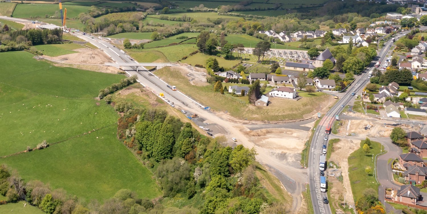
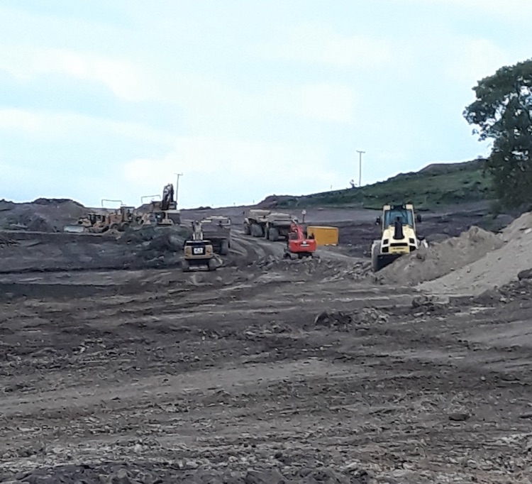