|
|
Status
|
Construction scheme
(completed)
Contractor: Lagan/Ferrovial/Costain
|
|
Where
|
To
complete the dualling of the Belfast to
Larne road by filling in the remaining
stretch from Coleman's Corner near
Ballyclare to the A36 Shane's Hill Road
/ B100 Ballyrickard Road at Ballyedward,
south of Larne. |
|
Total
Length
|
14.4km / 8.9 miles
|
|
Dates
|
Mar 2007 - Suggestions
that the Republic of Ireland may
partially fund the scheme.
17 Jul 2007 -
Northern Ireland Executive accepts offer
of money and agrees to proceed with the
scheme.
11 Nov 2008 -
Preliminary route options published
5 August 2009 -
Preferred route announced
26 Jan 2010 - Contractor appointed
Emerging design
published - Aug/Sep 2010
Environmental
Statement / draft orders - January 2011
Formal public
exhibition - 25-26 Jan 2011
Public inquiry held
15-23 June 2011
Work
was due to commence in June 2012 (as
of May 2012) (changed from "Apr/May
2012" as of Feb 2012, and "by 2013" as
of Apr 2008)
Work actually began
early August 2012, to last 34 months
"First Sod" ceremony
- 11 Oct 2012
Ballynure Bypass
stretch opened - 9 Feb 2015
All lanes opened - 29
May 2015 (changed from Jun 2015 at
project commencement)
Sep 2015 - 4 weeks of
lane closures to correct substandard
surfacing material
Completion of all landscaping works -
Dec 2015 (as of Jun 2015)
Official opening - 16 Dec 2015
|
|
Cost
|
£133m as of Dec 2015
(changed from £110m-£120m as of Feb
2012; itself changed from £113m
as of August 2009)
Of
which €18.372 funded by European
Commission TEN-T funding.
See important note on costs below.
|
|
Photos
|
See below |
|
See
Also
|
General
area map
Official
contractor's web site on scheme -
Lagan / Ferrovial / Costain
Official
DRD web site on scheme - Roads
Service
European
Commission page for this scheme -
part of Trans-European Transport Network
or TEN-T
A8 Corr's
Corner to Coleman's Corner on this
site
A8 Ballyedward to
Larne Harbour on this site
Ballynure
Southern Link road on this site
|
Click here to jump
straight down to updates for this scheme.
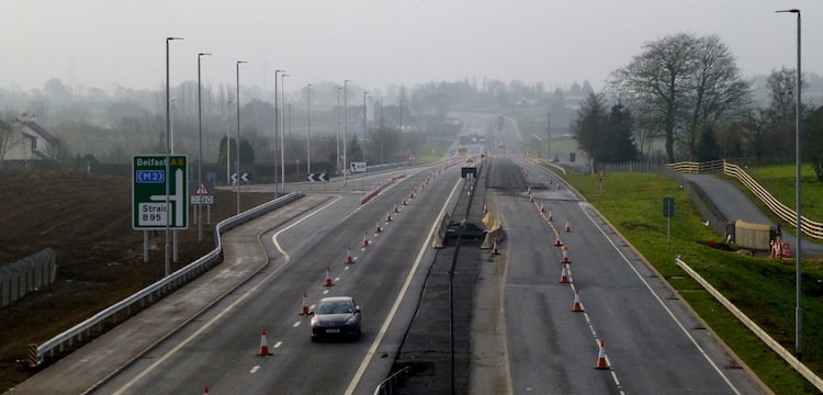
The A8 is the principal route from Belfast to
the major sea port of Larne, where a large
percentage of Northern Ireland's freight (and a
smaller percentage of Republic of Ireland
freight) enters arrives and departs. The A8 runs
from the M2 at Glengormley to Larne and also
forms part of European Route E01. Approximately
a third of the route is already dualled,
consisting of a stretch at the south end and a
stretch at the Larne end. Although the remaining
road is straight and well built, the presence of
large numbers of HGVs on the route means that
the average speed is lower than for other
similar roads. As of 2008 the average traffic
level was 18,000 vehicles per day, close to the
upper limit for a single-carriageway road. This
project, which is being supported by the Irish
Republic, will see the remainder of the road
dualled to a high standard. The map below shows
the approximate route proposed in red,
with new grade separated junctions marked by
blue dots and roundabouts by red dots. For a
more detailed map, see
here. Scroll on down for a strip map of
grade-separated junctions.
Route and Standard
The road will be built as a "Category 6"
dual-carriageway. This is the second highest
standard for an all purpose road. It means that
the road will have two lanes in each direction,
no breaks in the central reservation and all
junctions will be either grade separated,
limited to left-turns only or be in the form of
roundabouts. The road will have 1 metre hard
strips on each side.
For a detailed PDF
map of the route, as announced in August 2009, click
here. The route is essentially an online
upgrade of the existing road, with two
exceptions.
- Starting at the existing Coleman's Corner
roundabout (Hillhead Road turnoff) the new
road runs online as far as Ballynure, except
for a short detour round the east side of
Bruslee hamlet.
- On this stretch there are a pair of
Left-in/Left-out junctions at Lisglass Road; a
compact grade separated junction to serve
Calhame Road/Green Road/Legaloy Road.
- At Ballynure the road diverges offline to
the west before the current A57 roundabout. A
grade separated junction here serves the A57
and the south side of Ballynure.
- Continuing round the west of Ballynure, in
the Six Mile Water valley, the road rejoins
the line of the current A8 north of Ballynure
at Ballybracken Road where there is another
grade separated junction.
- The road then continues online all the way
to the A36 Shanes Hill Road junction (townland
of Ballyedward), where there will be a new
at-grade roundabout. Along this stretch there
will be compact grade separated junctions at
Moss Road and Deerpark Road/Park Road.
- There will be numerous left-in/left-out
T-junctions dotted along both sides of the
road.
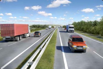
The picture below is
from the Roads Service web site (here)
and dates from August 2009. It shows how the new
road may look. The visual anticipates quite
heavy traffic.
Grade-Separated
Junction Strip Map
This strip map shows all
the grade-separated
junctions to be constructed as part of the new
dual-carriageway, along with the terminating
roundabouts. Note that the road will also have
multiple left-in/left-out T-junctions along its
length, between the principal junctions shown
below. These are not shown on the strip map.
|
NORTH
Begins
as existing A8 dual-carriageway at
Ballyrickard Road
.
|
|
BALLYRICKARD ROAD
/
SHANES HILL ROAD
(at-grade roundabout)
|
A36 Shanes Hill Road
(to Ballymena)
|
|
B100 Ballyrickard Road
|
|
2.4
km / 1.5 miles - 2+2 lanes
|
|
DEERPARK
ROAD
|
Deerpark
Road
Deerpark Road
|
|
FP
McCann Quarry
|
|
1.9
km / 1.2 miles - 2+2 lanes
|
|
MOSS ROAD
|
Moss Road
|
|
Moss
Road |
|
2.4
km / 1.5 miles - 2+2 lanes
|
BALLYBRACKEN ROAD,
BALLYNURE
(north-facing sliproads only)
|
|
|
Ballybracken Road
B?? (Existing A8)
into Ballynure
|
|
3.1
km / 1.9 miles - 2+2 lanes
|
|
TEMPLEPATRICK
ROAD, BALLYNURE
|
A57 Templepatrick
Road
(to Templepatrick)
|
|
B??
(Existing A8)
into Ballynure
B58 Carrickfergus Road
.
|
|
1.6
km / 1.0 miles - 2+2 lanes
|
GREEN ROAD / CALHAME
ROAD
|
Green Road
(to Ballyclare)
|
|
Legaloy Road
Calhame Road
(to Straid)
|
|
3.0
km / 1.9 miles - 2+2 lanes
|
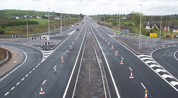
COLEMAN'S CORNER
(at-grade roundabout)
|
B94 Hillhead
Road
(to Ballyclare)
Old Belfast Road
(local access)
|
|
Carntall
Road
(to Mossley)
|
| |
Ends
as existing A8 dual-carriageway at
Coleman's Corner
SOUTH
|
Historical Background
Larne Council have been campaigning for the
route to be dualled but until 2006 Roads Service
had no plans to proceed in the following 10
years. However, during the optimistic political
developments of April 2007 the Irish government
offered a "peace dividend" to build
infrastructure in Northern Ireland. The two
schemes to benefit were the dualling of the A5
from Londonderry to the Irish border at
Aughnacloy, and this scheme to dual the A8.
Between 1999 and 2000 a detailed study was
carried out on the A8 with a view to improving
the route. This resulted in the construction of
a short stretch of dual-carriageway between
Houston's Corner and Coleman's Corner (at the
south end of this project), a roundabout with
climbing lanes at the south side of Ballynure,
the Ballynure Southern Link Road. Funding at the
time was limited, so a full dualling scheme did
not take place. Plans to widen the rest of the
A8 to dual-carriageway standard had however been
on the cards for some time and in fact a road
protection corridor exists for the entire route.
However, in the eight years since then the
funding level has increased dramatically. This
means that the current planners are no longer
limited by the route protection corridor. They
are now able to examine other options, including
partly or fully offline routes for a new road,
and more ambitious junction improvements,
including grade separation (ie flyovers). The
public consultation held in May 2008 informed
the public of this newfound freedom and prepared
landowners on the route for some of the options
that may be proposed as the scheme develops.
The Ballynure
Southern Link Road (a bit like the
south-eastern quarter of an imaginary ring round
Ballynure) opened in 2005, prior to the decision
to upgrade the whole A8. At the time there was a
suggestion that it could one day be upgraded to
dual-carriageway and form part of a new eastern
bypass around Ballynure. However this did not
happen as the alignment of that road was not
good enough for the proposed Category 6
dual-carriageway, so it will remain as a local
road.
Progress
20 Dec 2015: The A8 scheme
was "officially"
opened by the DRD Minister on 16 December
(ironically requiring part of the road to be
closed for the event!). I think it's likely that
the associated landscaping works that were due
to be completed in December are now done, so now
say that we can this scheme is completely
finished. The DRD Minister commented "Since
the scheme began in August 2012 over two
million cubic metres of earthworks material
was excavated, including over 500,000 cubic
metres of rock. Almost one third of a million
tonnes of bituminous material was used for the
road construction." Once again, well done
to the contractor, Lagan/Ferrovial/Costain and
their subcontractors for an excellent job
completed on time and on budget.
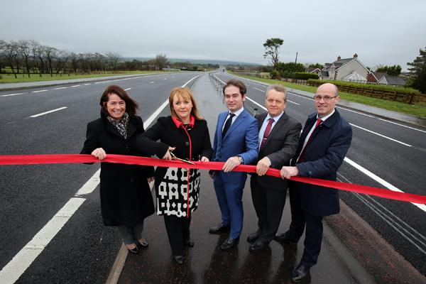
Pictured at the official opening
are (L-R) Deidre Mackle (Transport NI Divisional
Manager), DRD Minister Michelle McIlveen,
Enrique Nieto (Ferrovial), Adrian Bennett
(Costain), and John Cunningham (Lagan). [DRD
image]
11 Dec 2015: Although the
scheme has been "completed" from road users'
point of view since late May (apart from some
closures for resurfacing), work is still ongoing
on the final elements of the scheme. In a Question
in the Assembly about four weeks ago the
DRD Minister stated that "since [opening of
all 4 lanes in May 2015] as the Member will be
aware, localised traffic management along the
scheme has been required to facilitate
ancillary works on side roads, utility works
and the completion of the landscaping works
during the planting season. Construction of
this 8·7-mile-long dual carriageway scheme
commenced in August 2012 and is on target for
contract completion at the end of December
2015". She also noted that the current
estimated total project cost is £133m, around
what was expected. If any work is still ongoing
it will be landscape-related, so I think we can
expect all outstanding works to be completed
before the end of 2015. There is some talk
about a "court case" involving the A8, but I do
know what this refers to, who might be involved,
or how major or minor it might be so that is all
I can say! Anyhow, well done to the contractor,
Lagan/Ferrovial/Costain and their subcontractors
for an excellent job completed on time and on
budget.
9 Nov 2015: I have decided
to mark this scheme as "completed". When exactly
we date completion from is a slightly tricky
problem. From the point of view of motorists,
all four lanes opened to traffic on 29 May 2015.
However there were lengthy lane closures in June
and September to replace defective surfacing
material, meaning that a reasonable amount of
construction work was still going on until
September. And there are landscaping works that
will take place until the end of 2015. So I'm
going to instead list the scheme's "opening
date", 29 May 2015 and regard any works after
that as remedial in nature rather than proper
construction.
26 Sep 2015: As reported in
the previous update, the road was reduced back
down to one lane in a few locations in June to
re-lay some tarmac that was found to be
“substandard”. It has now emerged (via the Larne
Times) that the same problem has been
found on additional stretches, and so lane/speed
restrictions were re-imposed from 8 September
and are due to last for one month. So we could
expect the road to be back open again around the
first week of October. This work is being
carried out at the contractor’s own expense, so
there is no cost to the taxpayer.
5 Jul 2015: Regular users
of this road will have noticed that some
stretches have been reduced back to a single
lane over the past few weeks. According to a
report in the Larne Times three days ago (no
longer online), this was due to some of the
tarmac being found to be "defective". The term
"defective" makes the problem sound grander than
it really is. Probably what happened is that
routine checks at the end of the project
discovered that the precise makeup of the
material didn't meet the contracted
specification in these locations. There are
strict rules for these things so if it was not
right then replacing the material would have
been both necessary and appropriate, and it will
have been done at the contractor's expense. In
this case it looks as if the tarmac replacement
work is now completed so people can go back to
enjoying this lovely road - like the Freight
Transport Association who are very
impressed. Meanwhile, according to a Written
Answer in the Assembly in mid June, the
Minister said that the main outstanding works
are "to complete some works such as the tie
in to side roads and accommodation works along
the scheme". "Accommodation works" means
things designed to assist landowners affected by
the scheme, eg new driveways for houses or new
access arrangements for fields. The Minister
also noted that "Landscaping works will also be
taking place in the autumn planting season and,
with favourable weather conditions, should be
completed by December 2015". So we could expect
the project to be completely finished by
December, but with the actual engineering works
likely to be completed before then, perhaps by
the end of the summer.
1 Jun 2015: All four lanes
of the new dual-carriageway were opened to
traffic late on Friday evening, 29th May, with
the exception of a few hundred metres either
side of Shaneshill Road roundabout at the very
north end of the scheme. The temporary speed
limit was also removed, meaning that vehicles
can now travel at up to 70mph along almost all
of the road. From the point of view of the
traveling public, this marks the “completion” of
the scheme - however work will likely continue
for a few weeks yet as there is still a lot of
ancillary work to be carried out, such as
tidying up loose ends, vegetation works etc. A
marvelous achievement to the contractor who has
been working since August 2012. The DRD Minister
did issue a press release on 30 May 2015 which I
read, but for some reason it doesn’t appear on
the NI Executive Press Releases page so I can't
link to it. In that he thanks the traveling
public and the contractor and comments that “this
important scheme is expected due to be fully
completed in early July”. So I think we
are about a month or so away from actual
completion of the remaining works.
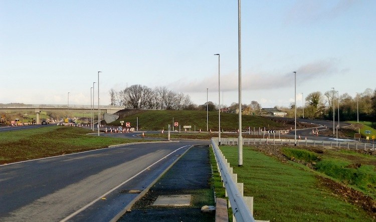
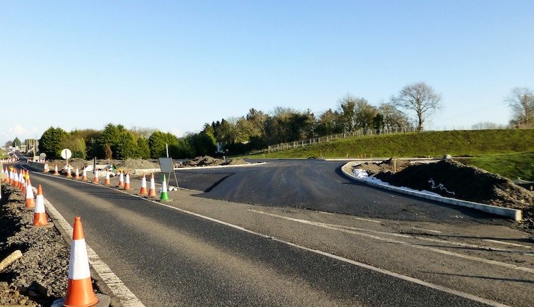
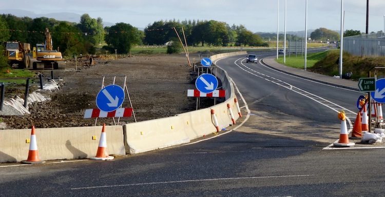
13 May 2015: I was honoured
to be given a guided tour of the scheme by Aidan
Kearney, the project's public liaison officer,
last week which was very informative - my
grateful thanks. The scheme is now very
advanced, as evidenced by the four photos I
include below. At the north end of the scheme
the A36 Shane's Hill Road, which was shut for a
while to be diverted, has now reopened again,
and now meets the new roundabout on the A8. The
work here appears to have been delayed by third
party service works that were beyond the control
of the contractor, but it seems sorted now. It
was obvious from everything I saw that the
scheme is in its final weeks now, with the
remaining areas of tarmac being laid, the
central crash barrier being installed and
tensioned, and thousands of trees being planted.
There is still some work needed in a few
isolated spots, such as on the local roads at
the A57/A8 junction, and at the very north end
of the scheme, and I suspect much of the work is
focused in these particular areas. At the A57
junction, the local service cables that were
left suspended above the new road when the A57
bridge was built, are still there. It was
explained that these are doing no harm where
they are and will be moved by their owner in due
course. The entire road is still coned down to
one lane with a 40mph speed limit, but the
contractor intends to open both lanes in each
direction in roughly two weeks' time, at the end
of May which is great news. An excellent job by
all involved.
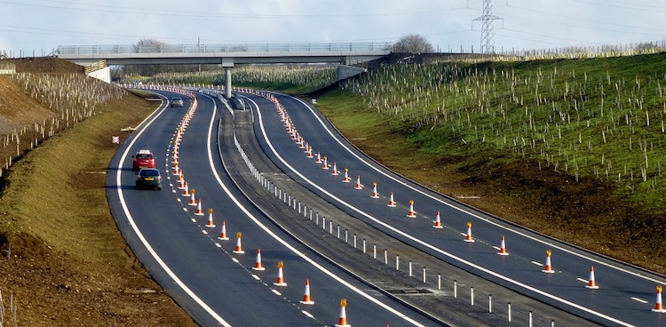
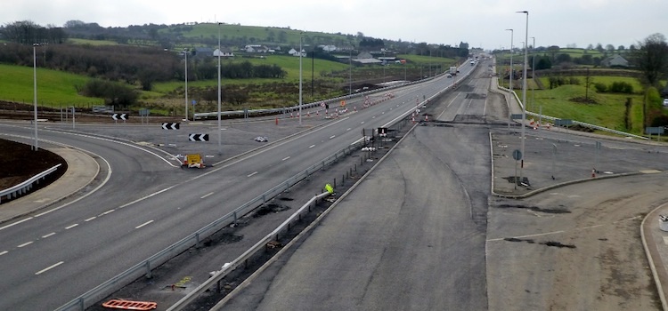
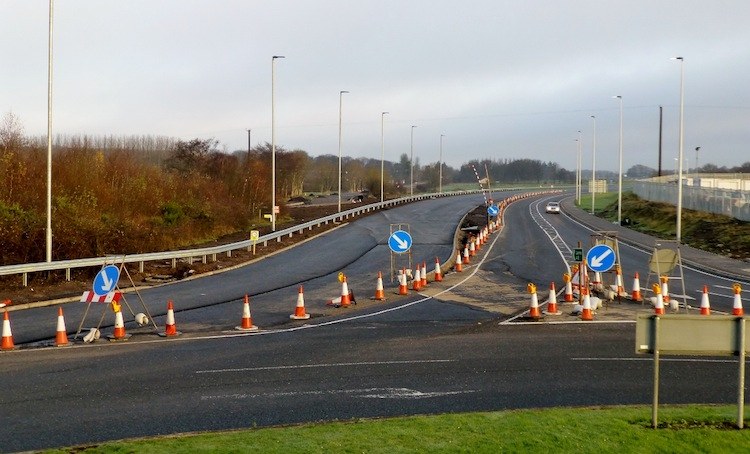
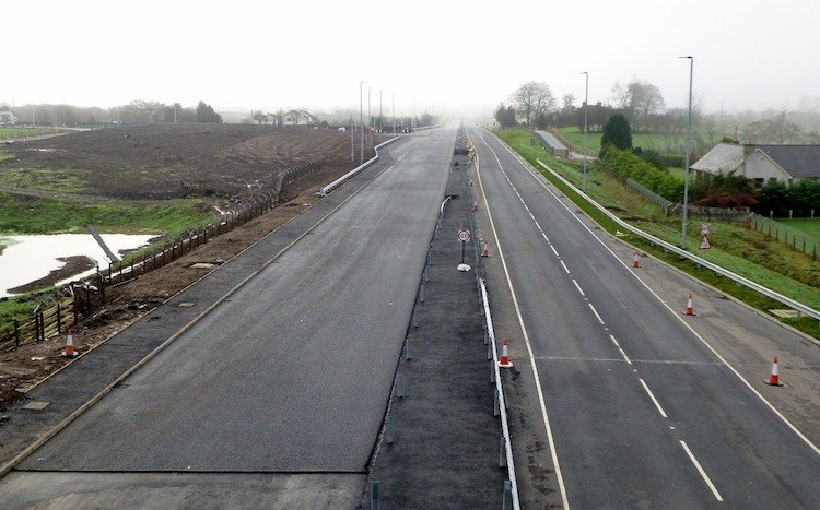
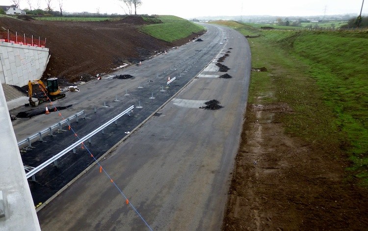
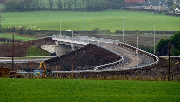
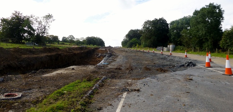
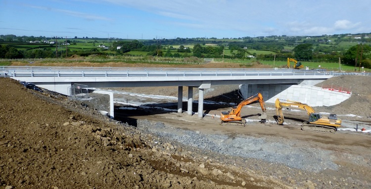
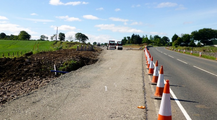
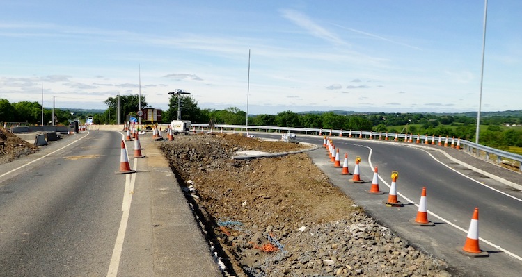
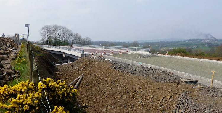
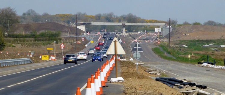
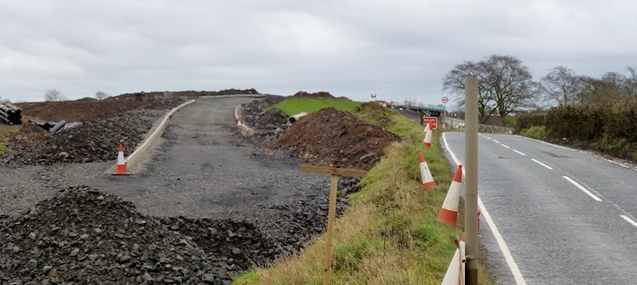
Pic 1: View south-west, towards Belfast, from
Green Road flyover on 8 May 2015 showing work
largely completed with some localised works
ongoing in the the central reservation. [Wesley
Johnston]
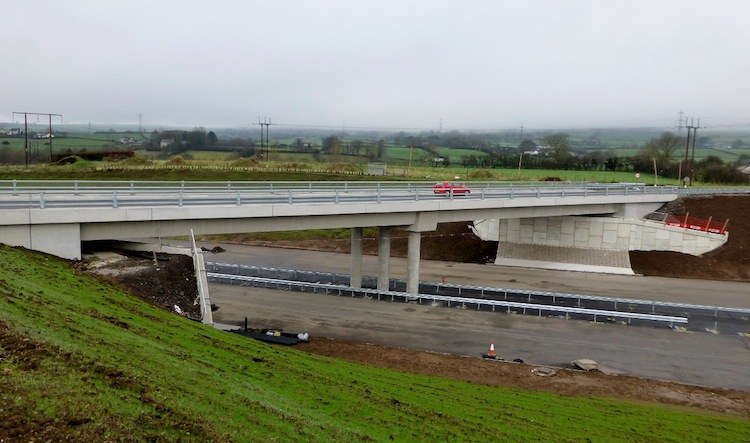
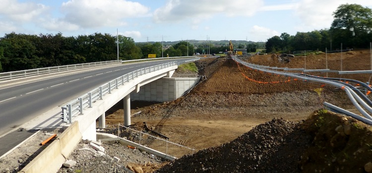
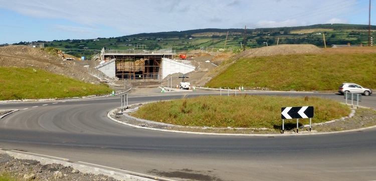
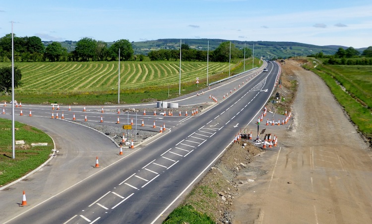
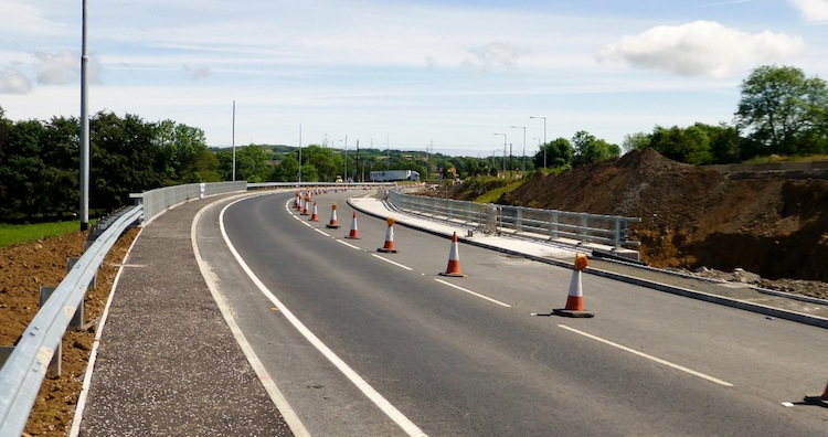
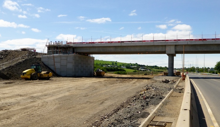
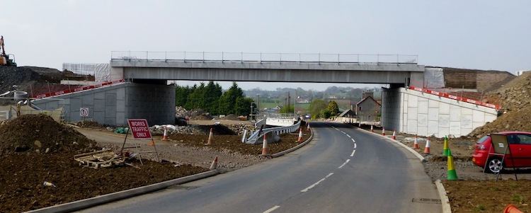
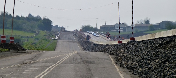
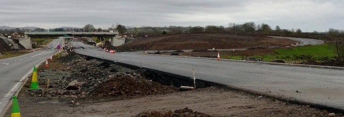
Pic 2: At Ballynure, this is the view north-west
on 8 May 2015 along Church Road where the new
Ballynure Bypass stretch crosses over both this
road and the Ballynure river on a flyover. This
part of the road seems completely finished. The
river is protected by some pretty robust looking
crash barriers. [Wesley Johnston]
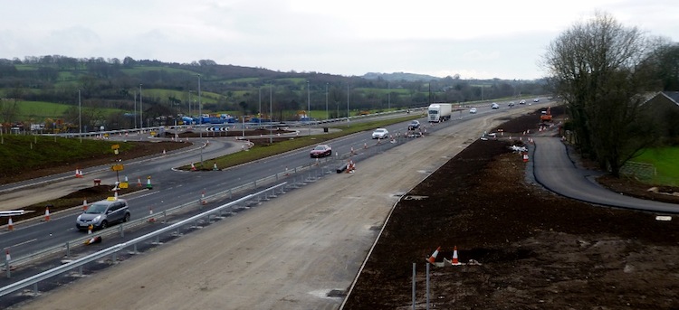
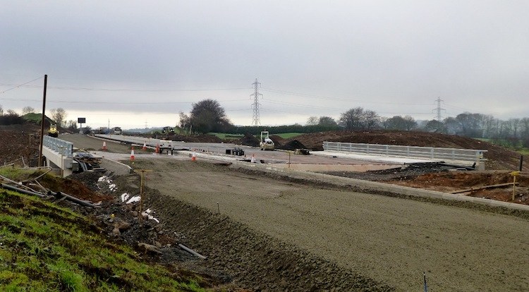
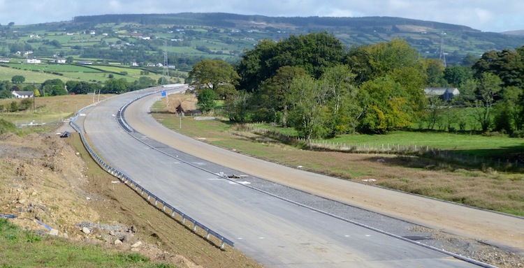
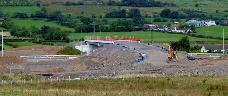
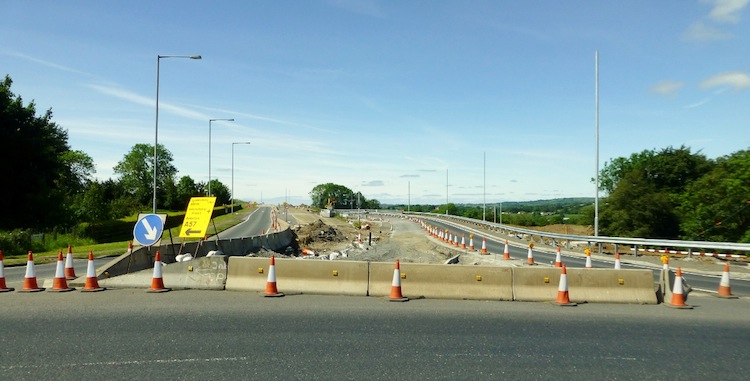
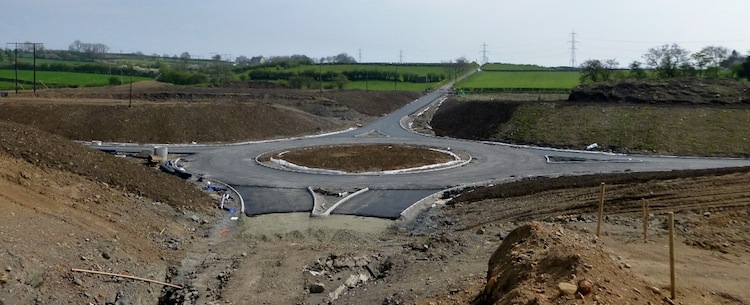
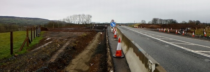
Pic 3: View south-west from Ballybracken Road
roundabout at the north end of Ballynure on 8
May 2015. The new A8 is carried on this bridge,
now completed, while the road beneath gives
access to some local properties and also the
northbound onslip onto the A8. Just a few local
works are evident in this shot, eg the mini
digger on the verge above. [Wesley Johnston]
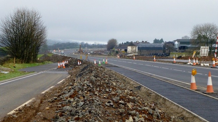
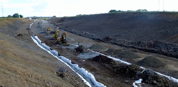
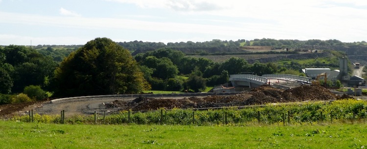
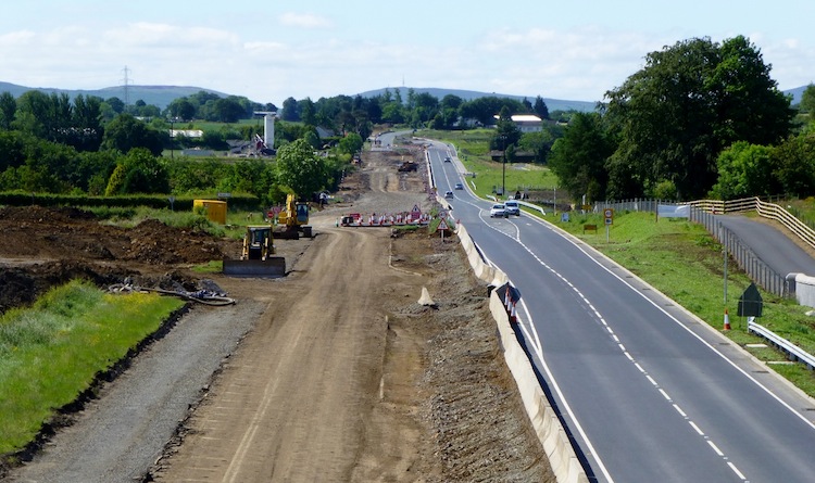
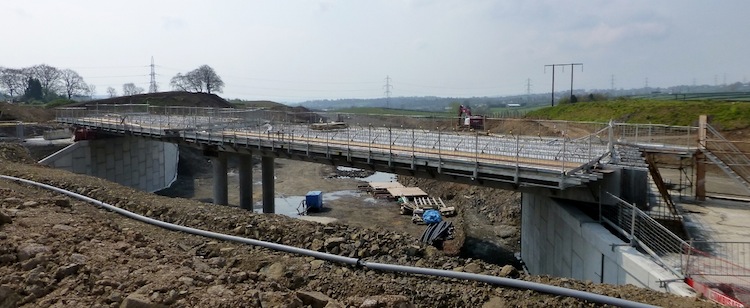
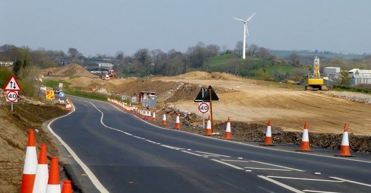
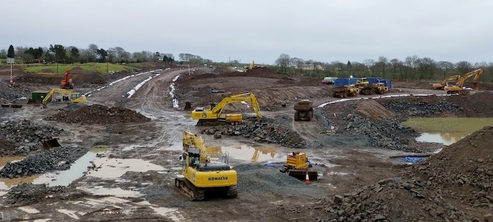
Pic 4: Finally, this is the view south (towards
Belfast) from Moss Road junction on 8 May 2015
showing how works here are largely completed as
well. A lot of white lining/hatching/chevron
work has gone in recent weeks. [Wesley Johnston]
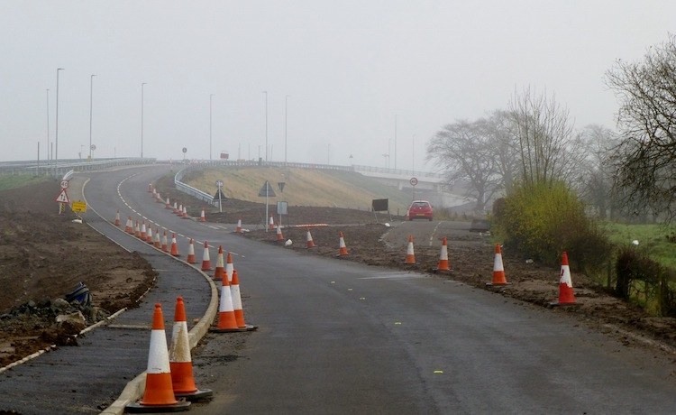
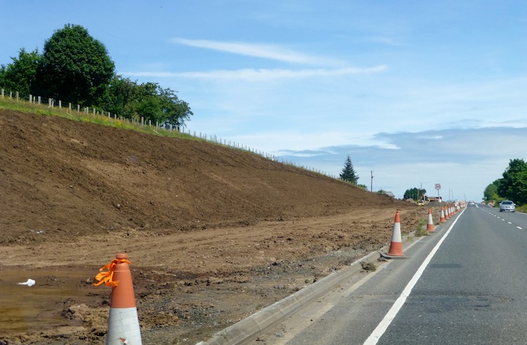
1 Mar 2015: We are
probably now less than three months off
completion of this project, and already we are
starting to see the "final" look of the road in
many places. The most notable change in the past
month was the opening
of the new Ballynure Bypass on Monday 9
February 2015, which is initially operating with
one lane only in each direction and with a
temporary speed limit. This also resulted in the
complete (but temporary) closure of access into
Ballynure from the north side of the town (ie
from the future Ballybracken Road junction),
meaning that the original A8 has been quieter
over the past few weeks than at any time for
several decades (see pic 12 below). The press
release linked above also says that the
estimated cost of the scheme is now £130m, which
is higher than the figure of £110-120m being
quoted shortly before the scheme began. The
photos below were taken two weeks ago by Noel
O'Rawe and illustrate the progress at various
points on the scheme starting at the south end
(Coleman's Corner) and ending at the north end
(the roundabout at Shane's Hill Road). As this
is likely to be Noel's last photoshoot of the
scheme before it is completed, can I say on
behalf of myself and all site visitors how much
we appreciate Noel for documenting this scheme
and for the many hours he spent on site that has
allowed the rest of us to watch progress over
the past two and a half years. It has been one
of the most well-documented schemes I have
followed on this site.
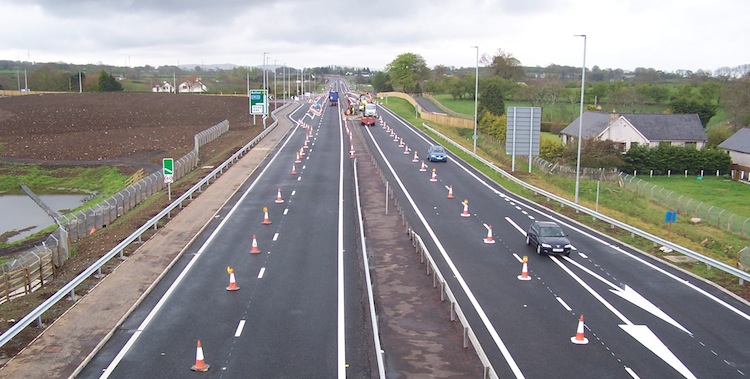
Pic 1: View north from Coleman's Corner
roundabout on 15 Feb 2015 showing traffic now
using both carriageways of the new road (one
lane on each) so that the "triangle" where it
meets the roundabout can be completed. The way a
road curves just before it reaches a roundabout
is known as the "deflection" as it orients
vehicles correctly for entering or exiting the
roundabout. The central crash barrier here also
does not yet seem to be in place. [Noel O'Rawe]
Pic 2: Work to divert the original A8 at Bruslee
(ahead, right) onto the existing Glen Road (to
right of camera) is now completed. The Bruslee
stretch of the A8 was bypassed by the new road
which is visible on the left. 15 Feb 2015. [Noel
O'Rawe]
Pic 3: View south-west (towards Belfast) from
the Green Road flyover on 15 Feb 2015 showing
the new road very close to completion with the
structure of the junction completed; barriers,
lights and signage in place; and works now
focusing on tidying up the road surface and
adding the final lane markings. [Noel O'Rawe]
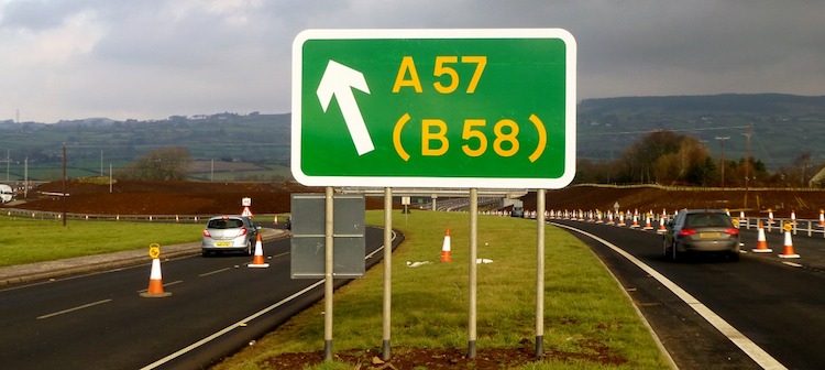
Pic 4: Sign at the start of the new Ballynure
Bypass (on the right) indicating the northbound
offslip to the A57 and Ballynure village (on the
left). I had asked the question as to whether it
was correct to show "B58" in yellow - with
thanks to Phil Brown who showed me the relevant
paragraph of the traffic signs manual which
demonstrated that this is permitted at this
location. [Noel O'Rawe]
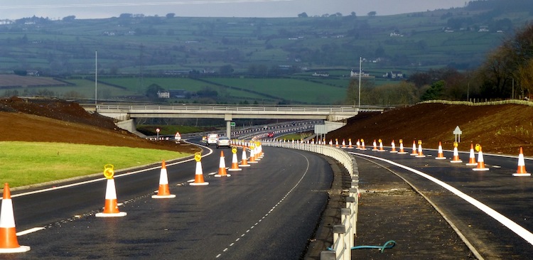
Pic 5: The view north along the new Ballynure
Bypass on 15 Feb 2015 with the bridge that
carries the A57 Templepatrick Road just ahead.
This stretch opened on 9 February 2015 and seems
to feature a tensioned-wire central barrier
rather than a traditional steel barrier. The
road here descends via an enormous cutting - the
ground above the camera was originally level
with the A57 road ahead. [Noel O'Rawe]
Pic 6: View south (towards Belfast) along the
line of the original A8 on 15 Feb 2015 at the
point where the new road diverges offline to
bypass Ballynure (on the right). Part of the
existing A8 is being retained on the left to
provide access to property. Click
here for the same view before work began.
[Noel O'Rawe]
Pic 7: Still looking south (towards Belfast)
along the line of the original A8 on 15 Feb
2015, but from slightly closer to Ballynure than
the previous image. At this point the existing
road has been reconstructed to form the
southbound onslip (left) and southbound offslip
(right). The new A8 is out of sight beyond the
brown bank on the right. Beyond the crash
barrier on the extreme left is a third, new,
road that provides access to properties. Click
here for the same view before work began.
[Noel O'Rawe]

Pic 8: The A57 bridge viewed from underneath, ie
from the new A8, on 15 Feb 2015. This view is
looking south west with Belfast to the left and
Larne to the right. Some utility cables that
were previously buried under the old A57 are
*still* suspended in mid air on the left! These
cables mark the line of the original A57,
showing just how much excavation has been done
here. [Noel O'Rawe]
Pic 9: The view north east (towards Larne) along
the recently opened Ballynure Bypass from
Lismenary Road bridge on 15 Feb 2015. The bridge
ahead is an "accommodation bridge", ie for use
only by local landowners to maintain access to
farmland and property. Note the huge number of
trees which have been planted on the verges. In
ten years this underpass is going to look as if
it goes through a forest. Note also how the
tensioned-wire central barrier stops just before
the bridge to be replaced by a pair of
conventional steel barriers to provide extra
protection. The road here lies in a long
cutting, which required a huge amount of
excavation - the land here was all previously at
the same level as the camera and the bridge
ahead. There is also a very happy traffic cone
salesperson somewhere! [Noel O'Rawe]
Pic 10: View east from the A8 towards the
roundabout that has been built at Ballybracken
Road north of Ballynure. When this picture was
taken on 15 Feb 2015 access to/from the A8 had
been temporarily closed here. The road visible
going to the left from this roundabout is the
future southbound offslip from the A8 and is
shown in the next image below. The road beneath
the camera will be the future northbound onslip
to the A8, although it is two-way here as it
also gives access to private property half way
along the sliproad. [Noel O'Rawe]
Pic 11: View from Ballybracken Road on 15 Feb
2015 showing the new bit of road that
temporarily carried all A8 traffic for most of
the winter. This has now been closed to be
rebuilt as the southbound offslip. In this shot
we see the tarmac on the left being removed -
this is likely to be to reduce the width of the
road now that it will only need to accommodate
one traffic lane rather than two. For reference,
the roundabout visible in the previous picture
is just off shot to the left in this image.
[Noel O'Rawe]
Pic 12: View south along the old A8 towards the
northern end of Ballynure from near the
Ballybracken Road junction on 15 Feb 2015. The
road was closed at the north end and accessible
only from Ballynure on the day this photo was
taken and was hence deserted. This stretch of
road has already been downgraded since the
project began, as you can see from this
view showing how it once had a northbound
overtaking lane here. It's still not clear what
number this bit of the old A8 will get when work
is complete, but B58 (the number of the existing
Ballynure southern link road) is a possibility.
[Noel O'Rawe]
Pic 13: View south west (towards Belfast) from
the Moss Road flyover on 15 Feb 2015. At this
location the southbound carriageway is completed
and in use, while work on the northbound
carriageway is very advanced with surfacing work
evident and the central crash barrier being
installed. [Noel O'Rawe]
Pic 14: The view south west (towards Belfast)
from the Deerpark Road flyover on 15 Feb 2015.
The roundabout to the east of the new road is
completed and in use (left of centre) while the
offslip is currently accessible from both
directions via a temporary T-junction (where the
yellow signs are on the left). The future
northbound carriageway is taking shape but the
central crash barrier has yet to be completed
and the final surfacing does not yet seem to
have been laid. The laneway on the right is
actually part of the original A8 that is being
retained to provide access to properties that
previously fronted directly onto the A8. [Noel
O'Rawe]
Pic 15: View north west along the future line of
the A36 Shane's Hill Road on 15 Feb 2015. The
road currently runs off frame to the right, but
is being curved round here to meet the new
roundabout that is being built on the A8 just
off to the left of shot. [Noel O'Rawe]
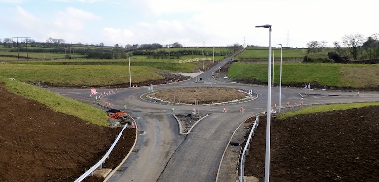
Pic 16: View of the terminal roundabout at the
north end of the scheme on 15 Feb 2015, seen
from the same vantage point as the previous
image but turning 90° to the left. The new
roundabout has now been laid out and traffic is
passing round either side of the central island.
However it is not yet operating as a roundabout.
The new line of the diverted A36 Shane's Hill
Road is visible on the right foreground, whilst
in the left distance is the diverted
Ballyrickard Road, which is also not yet open.
The linear pile of what looks like gravel in the
middle of the roundabout is probably the tarmac
of the old A8 (which passed straight through
here) and its foundations being removed. [Noel
O'Rawe]
7 Feb 2015: It seems that
the new Ballynure Bypass will be opened to
traffic early next week, either Monday (9th Feb)
or Tuesday (10th Feb) (see Translink
web site, for example). Initially it will
have just one lane open in each direction and be
subject to a temporary 40mph speed limit. The
existing A8 will be closed on the north side of
the village for a few weeks, presumably to
complete the Ballybracken Road junction. These
changes should result in the residents of
Ballynure seeing an immediate and sudden drop in
traffic levels through the village. I am told
that the rest of the road should be open by the
end of March, although there will continue to be
works around the site for some time after that.
But it does look as if we are now within 8 weeks
of the roads being fully opened, which is great
news. Presumably once the project is completed
the existing road through the village will lose
the number "A8", probably receiving a B-number
instead. There is also now an opportunity to
reintegrate the two severed halves of the
village with the road becoming much less busy.
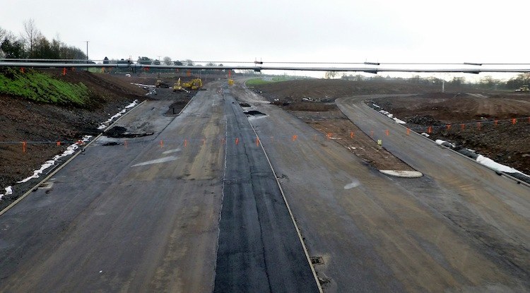
8 Dec 2014: We are now in
the final stretch of the project which, in time
terms, is about 80% completed. The 15 photos
below were all taken by Noel O'Rawe (thank you)
on 23rd November, although I've just had time to
put them up this evening. Overall the scheme is
very well advanced with at least some form of
surfacing now down on around 80% of the final
road. The pictures below are arranged in order
from south to north. But before we look at the
pictures, here (in bullet form) are some
specific notes informed by Noel's observations:
- The bit of the old A8 at Bruslee, now
bypassed, is in process of being connected to
the Hillhead Road at one end and Glen Road at
the other and this work looks close to being
completed (pics 1 and 2).
- Both carriageways between Coleman's Corner
(south end of the scheme) and Ballynure are
largely laid out and being tarmacked (pics 3
to 5).
- Rushvale Road has been reopened, and will
eventually be a left-in/left-out junction. In
the original plans this road was to have been
stopped up but this has now changed.
- New signs are appearing along the whole
road, including direction signs and the III,
II, I countdown markers for junctions.
- The old A8 just south of Ballynure is shut
while it is rebuilt to become the southbound
sliproads for Ballynure (pic 6).
- On the Ballynure Bypass stretch, Lismenary
Road Bridge opened on 29 August. The view from
here shows surfacing underway or completed
along much of this stretch (pics 7 to 10).
- The underpass under the future A8 at
Ballybracken Road, north of Ballynure, appears
to be complete, but not yet open to traffic
(pics 11 and 12). Traffic continues to use the
future southbound offslip to bypass this
section.
- Moss Road junction is very advanced,
although the bridge is not yet open to
traffic (pic 13).
- Deerpark Road junction is well advanced but
not yet fully open (pic 14). The A8 in this
locality is the last advanced with work to
build the second carriageway still underway.
- The terminating roundabout at Ballyrickard
Road is under construction, with all traffic
currently passing through its centre (pic 15).
The Ballyrickard Road is currently being
realigned to meet this new roundabout, as is
the A36 Shane's Hill Road.
Pic 1: View north along the new A8 from
Coleman's Corner roundabout on 23 Nov 2014. All
traffic is still using the future southbound
carriageway. Straight ahead beyond the barrier
is the original A8, now functioning as a local
road for property access. [Noel O'Rawe]
Pic 2: 23 Nov 2014. At the north end of the
"Bruslee Bypass" stretch this is the view along
the original A8, now being diverted to join the
existing Glen Road (the curve just ahead) in
order to provide continued access for residents.
You can see the new road sweeping in from the
right to rejoin the line of the existing road
ahead. [Noel O'Rawe]
Pic 3: View north from Drumadowney Road on 23
Nov 2014 showing the dual-carriageway almost
complete with wearing course down on the
southbound carriageway, and prepared for the
addition of white lines and cats' eyes. The
supports for the central crash barrier are in
place but the barriers themselves have not yet
been fitted. The striped poles ahead are to warn
workers about the cables overhead - as well as
causing disruption, striking electrical cables
with heavy machinery has been known to lead to
fatalities in the past. [Noel O'Rawe]
Pic 4: A foggy view east along Green Road on 23
Nov 2014, towards the bridge over the new A8.
Green Road has now been diverted and the new
Green Road/Calhame Road overbridge completed.
[Noel O'Rawe]
Pic 5: View south-west, towards Belfast, from
the Green Road/Calhame Road flyover on 23 Nov
2014. All traffic is on the future northbound
carriageway here, while the southbound
carriageway on the left seems to have just had
its wearing course of tarmac applied. [Noel
O'Rawe]
Pic 6: View south along the former A8 from the
A57/A8 roundabout in Ballynure on 23 Nov 2014 ( here).
It has been completely shut to allow it to be
rebuilt as the southbound on/offslip pair. This
requires a central kerb barrier to be installed.
A third carriageway is being added at the far
left to provide access to private property.
[Noel O'Rawe]
Pic 7: View north from the A57 at Ballynure on
23 Nov 2014 along the Ballynure Bypass stretch.
This part of the road appears to be finished and
is just awaiting completion of the sections at
either end to allow it to be opened. [Noel
O'Rawe]
Pic 8: Looking in the opposite direction (south)
as the previous photo from the A57 bridge at
Ballynure on 23 Nov 2014. This sea of tarmac
will include the southbound offslip (left) and
northbound onslip (right) for the main A57/A8
junction. It is hard to believe that two years
ago the ground level here was the height of the
camera - the utility pipes suspended in mid-air
showing the route of the original A57 which has
now been completely removed! [Noel O'Rawe]
Pic 9: The view south-west (towards Belfast)
along the Ballynure Bypass stretch from
Lismenary Road overbridge on 23 Nov 2014,
showing the first courses of tarmac laid and the
central crash barrier being installed. Nature is
already reclaiming the earth banks on the left
and right in this cutting. [Noel O'Rawe]
Pic 10: Another view of Lismenary Road bridge on
23 Nov 2014, with Belfast to the left and Larne
to the right. This bridge opened to traffic on
29 August and carries a local road over the new
dual-carriageway. [Noel O'Rawe]
Pic 11: View south-west (ie towards Belfast)
along the future A8 at Ballybracken Road, north
of Ballynure, on 23 Nov 2014. This bridge
crosses over the future northbound onslip at
this junction. The bridge appears to be complete
with the new road now being built over it. [Noel
O'Rawe]
Pic 12: View north-east along the line of the
original A8 (visible on the bottom left) from
near Ballybracken Road on 23 Nov 2014. You can
see how the new road takes a much gentler sweep
through the landscape here. [Noel O'Rawe]
Pic 13: View north-east towards the unopened
Moss Road flyover over the A8 on 23 Nov 2014,
taken from Ballygowan Road. The bridge appears
largely complete with tarmac now being laid.
[Noel O'Rawe]
Pic 14: View along the southbound onslip for the
A8 (which runs under the bridge on the left) at
Deerpark Road on 23 Nov 2014. Ahead is the
roundabout serving the east side of the future
Deerpark Road grade separated junction. The
flyover ahead is well advanced but doesn't yet
appear to be open to traffic. [Noel O'Rawe]
Pic 15: At the north end of the scheme, this is
the south-eastern side of the future terminating
roundabout as seen on 23 Nov 2014. Traffic is
still going through the centre of the site, ie
what will be the central circle of the
roundabout. On the right is the route of the
realigned Ballyrickard Road, which is not yet
open to traffic. [Noel O'Rawe]
8 Sep 2014: Below are 15
great photos taken by Noel O'Rawe on 31 August
(thank you, as always). They show that the
scheme is progressing very well indeed. Starting
at the south (Belfast) end, all traffic is now
using the "Bruslee Bypass" stretch, while the
old A8 is now lying almost devoid of traffic.
Work is underway to divert the south end of this
old road round a loop to meet the B84 Hillhead
Road at a new T-junction, since access is still
needed for local residents and landowners.
Approaching Ballynure, the cutting that allows
the new road to go under the new A57 bridge
appears to be either completely excavated, or
almost so, facilitated by the diversion of all
A57 traffic onto the new bridge back in June.
This change has opened up views through the
underpass for the first time, letting us see how
it will look when finished. It will be some time
yet, however, before the underpass - and the
"Ballynure Bypass" that this leads to - is
opened to traffic, since a lot of work has still
to take place on the north side of Ballynure to
tie it in to the existing road. Lismenary Road,
which crosses the new "Ballynure Bypass", is now
using the new bridge allowing the rest of the
cutting to be completed. If you appreciate civil
engineering, I have to say that this stretch
looks absolutely wonderful, curving gently into
the distance. North of Ballynure, work on the
Moss Road and Deerpark Road junctions is
progressing well, although neither bridge is
open. At the latter, the new roundabout serving
the FP McCann quarry is now open and in use.
Finally, at the very north end of the scheme,
work to realign the A36 Shane's Hill Road is
underway. It will be realigned slightly to the
south of the current junction so that it meets
the upgraded A8 at right-angles, via a new
roundabout. The pictures below tell far more
than a description can, so enjoy. I have
included 15 photos, which is quite a lot but I
could not bear to cut it down any further than
this! As always, they're ordered from south to
north. Work is scheduled to be completed around
May, so we're now only about 8 months away from
the end of the project.
Pic 1: View north-east along the future A8 from
Coleman's Corner roundabout on 31 August 2014.
All traffic is using the future southbound
carriageway on the right, while the road bed for
the future northbound carriageway takes shape
ahead. The old A8, which was in use until a few
weeks ago, goes off towards the left with the
diggers parked on it. [Noel O'Rawe]
Pic 2: View south west along the old A8 on 31
August 2014, towards Coleman's Corner
roundabout. This bit of road was in use until a
few weeks ago. Work has now begun to divert this
road to the right round a pair of loops to meet
the Hillhead Road at a new T-junction, in order
to give access to local residents who will still
use this old stretch of road. [Noel O'Rawe]
Pic 3: View north-east along the A8 on 31 August
2014, from near Glen Road (visible on the left).
This is taken from the old A8, which is now
inaccessible from this end due to the "Bruslee
Bypass" stretch being open (to the right of this
shot). The odd arrangement of kerbstones just
ahead is for a future northbound layby. [Noel
O'Rawe]
Pic 4: View along Green Road on 31 August 2014
towards the A8, which runs left-right in the
distance. You can see the new Green Road/Calhame
Road flyover in the distance. Work has begun to
divert Green Road up onto the new flyover,
instead of going straight ahead as it used to.
[Noel O'Rawe]
Pic 5: View north-east along the A8 from the new
flyover for the Green Road/Calhame Road grade
separated junction on 31 August 2014. All
traffic here is using the future northbound
carriageway, which has been kitted out with
right-turn pockets for the time being, while the
southbound carriageway on the right is very
advanced with surfacing now going down. Note the
difference in elevation between the two
carriageways. The expanse of tarmac to the left
of the cones is for the future northbound
onslip. [Noel O'Rawe]
Pic 6: View south along the old A8 from the
existing roundabout at Ballynure on 31 August
2014. This stretch has been closed to traffic
since the traffic was diverted onto the future
southbound offslip in mid July (see previous
update below for details). This bit is now being
rebuilt to become the access point for the
northbound sliproads, and it will also involve
adding an additional local access road to the
left to give access to landowners. [Noel O'Rawe]
Pic 7: At Ballynure, this is the new A57 bridge
with the earth that carried the old road now
completely removed on the right, except it seems
for the utilities which remained rather
hilariously suspended in mid air on 31 August
2014! [Noel O'Rawe]
Pic 8: View north-east along the Ballynure
Bypass on 31 August 2014, which is very well
advanced with surfacing down and safety fences
being fitted in both the central reservation and
on the left. I'm not sure what the "kink" in the
left-hand safety barrier is, but it is adjacent
to an attenuation pond, for collecting rainwater
that has run off the road, so it may be to allow
parking for maintenance vehicles. [Noel O'Rawe]
Pic 9: View north-east along the "Ballynure
Bypass" from Lismenary Road bridge on 31 August
2014. This is an absolutely spectacular view of
the road formation here, with a farm
accommodation overbridge visible in the
distance. The amount of material that has been
excavated here is incredible. The white sheets
and gravel form part of the road drainage
system. [Noel O'Rawe]
Pic 10: The completed Lismenary Road bridge in
use on 31 August 2014. The previous picture was
taken from this bridge. [Noel O'Rawe]
Pic 11: At Ballybracken Road, where the
"Ballynure Bypass" rejoins the line of the
existing A8, all traffic is being diverted down
the future sliproad onto this roundabout while
the A8 itself is closed behind to put in an
underpass to carry another sliproad. Seen here
on 31 August 2014, the new bridge seems to have
its beams in place. [Noel O'Rawe]
Pic 12: Moss Road flyover, over the A8, as seen
looking west from Ballygowan Road on 31 August
2014. Although well advanced, the road is not
completed over it and it is not yet open to
traffic. [Noel O'Rawe]
Pic 13: Deerpark Road flyover seen looking east
from Deerpark Road on 31 August 2014. The
C-shaped road (that runs from the right, to the
left, and back to the right again) is the future
northbound offslip from the A8. The commercial
buildings on the right are part of the FP McCann
quarry on the far side of the A8, which will
also be accessed via this junction. [Noel
O'Rawe]
Pic 14: View south west along the line of the
new A8 from near Deerpark Road flyover on 31
August 2014. At this point the new A8 swings
away from the line of the old road (seen on the
right) for a short distance to take the corner
more gently. This illustrates just how much
larger and higher-spec the new road is than the
old road. Note the angle of the carriageway on
the left (the "superelevation") which is
designed to allow vehicles to corner more
safely, and which also requires the drains to be
placed adjacent to the central reservation here.
[Noel O'Rawe]
Pic 15: Earthworks underway to clear the site of
the future roundabout for the A36 Shane's Hill
Road junction at the north end of the scheme on
31 August 2014. Both Shane's Hill Road and the
B100 Ballyrickard Road are currently being
realigned to meet this roundabout. [Noel O'Rawe]
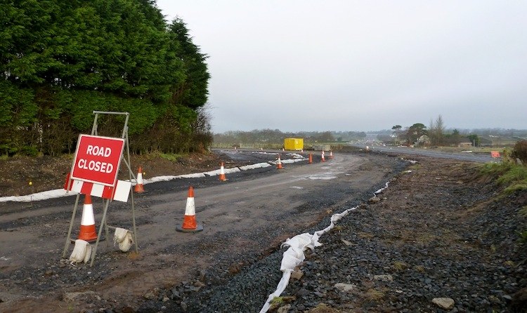
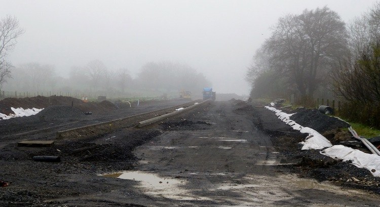
25 Jul 2014: This update is
to draw your attention to two bits of
information that have been released by the
contractor and Roads Service (or "TransportNI"
as it is now called). First of all, the
contractor Lagan Ferrovial Costain has published
the third of its newsletters on the scheme. You
can download
the newsletter directly, or see previous
editions on their web
site. It contains some very interesting
photographs, as well as giving the "insider
story" on progress to date. Secondly, an
incredible video
appeared on YouTube about a month ago. It
consists of a slow aerial movie of the entire A8
scheme, from south to north, taken by a drone.
It appears to have been posted up by the drone's
owners, Geospon,
but bears the Roads Service brand so is
presumably official. The whole video is about 50
minutes long, and you can see literally every
inch of the site. Well worth a watch.
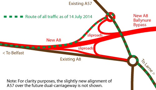
14 Jul 2014: Over the past
week some interesting changes have taken place
on the A8. Firstly, at Ballynure, all traffic on
the A8 is being diverted up what will be the
future northbound offslip, down a short length
of the A57 and back onto the A8. The map below
will hopefully make this clearer. The existing
road network is shown in Brown, with the future
dual-carriageway and associated sliproads in
red. There will eventually be a full-access
junction here, but for now all traffic is
following the route of the green dotted line,
presumably to allow work to take place on the
remaining junction and to tie the new A8 into
the existing A8.
Secondly, at Bruslee all
southbound (ie, Belfast-bound) traffic has
been diverted onto the new "Bruslee Bypass"
section at the south end of the scheme.
Northbound traffic is still on the old road,
but presumably it too will be diverted in due
course. So as of this moment, almost all of
the section between Ballynure and Coleman's
Corner (south end of the scheme) has traffic
running on "new" sections of road. Work has
now been underway for almost two years, and
completion is now less than a year away, so
it's great that we are seeing so much
progress. With thanks to Noel O'Rawe and Andy
Boal for the "from the scene" updates!
25 Jun 2014: Here are 11
more photos, taken about ten days ago by Noel
O'Rawe (thank you). At the south end of the
scheme (Coleman's Corner roundabout) the long
anticipated transfer of traffic onto the new
section of the A8 bypassing Bruslee can't be far
off as it's now been tied in to (ie, tarmacked
right up to ) the existing roundabout. North of
Bruslee all traffic is now using the completed
northbound carriageway while work is underway on
the southbound carriageway. the Green
Road/Calhame Road grade separated junction
appears to be largely completed, although the
bridge is not yet open to vehicles. At
Ballynure, northbound traffic on the A57 has
finally been switched onto the new bridge that
has been under construction here for some time.
Presumably southbound traffic will also move
over in due course. Construction of the
sliproads and associated second roundabout here
is also progressing well. On the Ballynure
Bypass stretch work continues, with the
Lismenary Road bridge still under construction.
Lismenary Road itself is currently closed to
traffic so it's not currently possible to get
right up to the site. At the north end of
Ballynure, where the Bypass stretch rejoins the
existing A8, all traffic is now being diverted
down what will be the sliproads to the
roundabout that has now been completed (in the
huge pit that was excavated last year). Part of
the existing A8 beside the roundabout has been
completely removed to allow construction of the
bridge that will carry it over the northbound
sliproad, with the columns already taking shape.
Large scale earthworks are underway along the
north end of the scheme, especially around Moss
Road where the work mostly involves new
embankments. Finally, at the north end of the
scheme near Ballyrickard Road, work is underway
on the future Larne bound carriageway and more
earthworks are underway at the site of the
future roundabout that will mark the northern
terminus of the scheme.
Pic 1: View towards Coleman's Corner rounddabout
on 15 June 2014 showing the existing A8 on the
right and the start of the "Bruslee Bypass"
stretch of the new A8 on the left, which is very
advanced but not yet open. [Noel O'Rawe]
Pic 2: Near Legaloy Road, looking south towards
where the "Bruslee Bypass" stretch of the new
road rejoins the line of the existing A8 on the
right 15 June 2014, which looks as if it will
shortly be tied in to the existing road and
perhaps opened. [Noel O'Rawe]
Pic 3: View north east from the (not yet opened)
flyover at the Green Road/Calhame Road grade
separated junction on 15 June 2014. The
northbound carriageway is completed and is being
used by all traffic, while work on the
southbound carriageway (on the right) is getting
underway. The road on the left is the future
northbound sliproad pair. Eventually this will
have a large triangular traffic island, but to
facilitate a temporary T-junction traffic
currently passes through the centre of the
island. [Noel O'Rawe]
Pic 4: View south west from Green Road/Calhame
Road flyover, ie towards Belfast on 15 June
2014. Again, the northbound carriageway is
completed and is being used by all traffic,
while work on the southbound carriageway (on the
left) is getting underway. [Noel O'Rawe]
Pic 5: View along the A57 from the existing A8
roundabout at Ballynure on 15 June 2014. The old
A57 is on the left, while the new bridge is on
the right, with northbound traffic only using
it. Presumably all traffic will soon switch to
the new bridge since the old road has to be
removed to make way for a cutting. [Noel O'Rawe]
Pic 6: Moving further along the A57 this is the
site of the new roundabout currently being built
to serve the northbound sliproads at the western
end of the new grade separated junction.
Ballynure and the new bridge are behind the
camera. 15 June 2014 [Noel O'Rawe]
Pic 7: Closeup of the new A57 bridge now
completed and in use by northbound traffic on 15
June 2014. This view is looking towards
Ballynure. The old road is on the bank on the
right, which will be completely removed to make
way for the A8 which will run left-right here in
a cutting. [Noel O'Rawe]
Pic 8: At Ballybracken Road, which marks the
north end of the Ballynure Bypass stretch, this
is the now-completed roundabout that has been
built after a huge amount of excavation, seen on
15 June 2014. The photographer is on what will
eventually be the main access road into
Ballynure (which is behind the camera) from the
north. The road straight ahead on the other side
of the roundabout is the future southbound
offslip from the A8, which will run to the left
of the shot here. The road signed "works traffic
only" (not visible) will be the future
northbound onslip, which will pass under the A8
via a bridge. [Noel O'Rawe]
Pic 9: Going ahead to the same roundabout
visible in Pic 8, but looking to the left, this
is the view along what will be the northbound
onslip. The existing A8 used to pass left-right
here but had been removed when this shot was
taken on 15 June 2014. Work is now underway on
the pillars for the bridge that will carry the
reconstructed A8 over the sliproad. [Noel
O'Rawe]
Pic 10: The Moss Road bridge, seen looking south
west on 15 June 2014. All traffic is on the
completed northbound carriageway (on the right),
while the southbound carriageway is constructed
on the left. [Noel O'Rawe]
Pic 11: Excavation work on the embankments near
Ballyrickard Road, as seen on 15 June 2014,
nicely finished. [Noel O'Rawe]
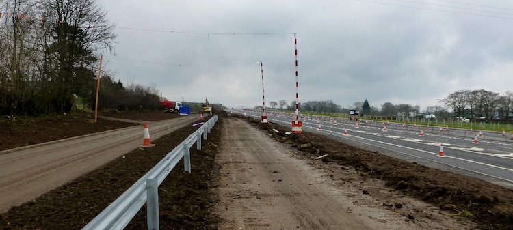
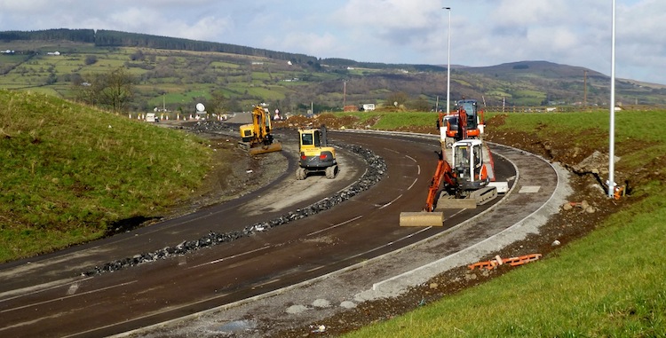
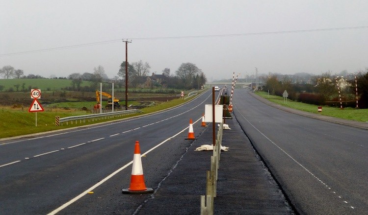
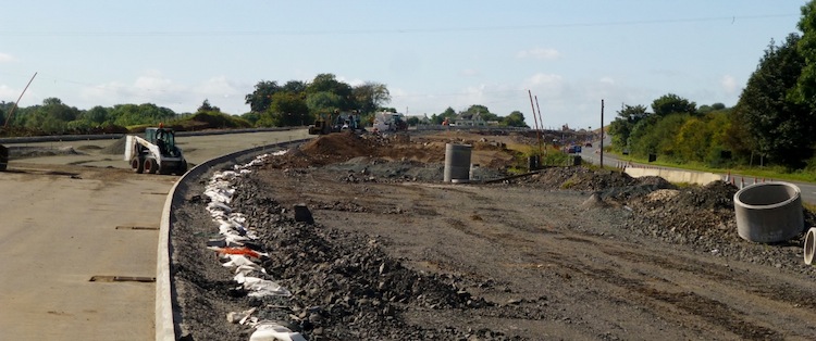
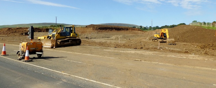
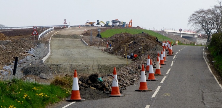
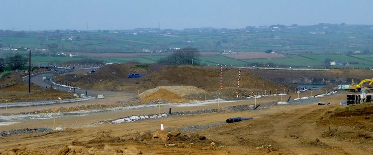
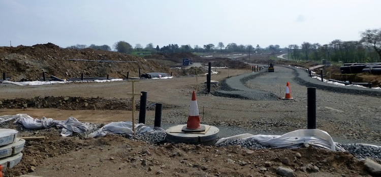
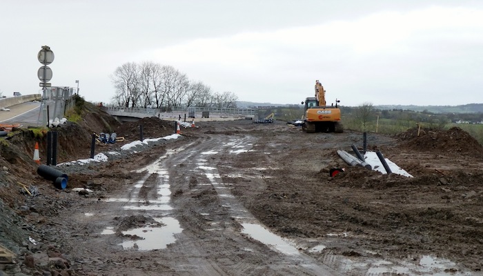
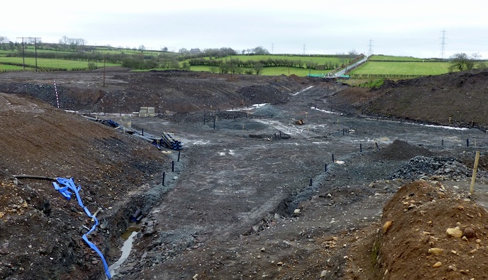
6 May 2014: The 13
pictures below were taken by Noel O'Rawe (thank
you) about two weeks ago. Work is coming along
at a great pace, with traffic now transferred
across to the new sections of road in more than
one place, most notably around the Moss Road
junction. The new bridge to carry the A57 over
the future road looked close to being ready to
carry traffic at the point Noel took these
pictures, and may even be doing so by now. The
pictures below are arranged in order starting at
the south (Belfast) end of the scheme.
Pic 1: Looking south west towards the existing
oleman's Corner roundabout from Lisglass Road on
20 Apr 2014. This stretch is near completion,
but has still not opened to traffic. I'd expect
southbound traffic to move onto it initially.
[Noel O'Rawe]
Pic 2: View north east towards Larne from Glen
Road on 20 Apr 2014, All traffic has now been
diverted onto the new northbound carriageway for
a short distance, with the old bit of A8 now
lying empty on the right. [Noel O'Rawe]
Pic 3: On Green Road, the diversion onto the new
flyover was getting close to the tarmacing stage
on 20 Apr 2014. The bit of Green Road on the
right will be retained for local access, but as
a cul-de-sac. [Noel O'Rawe]
Pic 4: View of the Green Road flyover as seen
from Calhame Road on 20 Apr 2014. The new link
road connecting Calhame Road to the new junction
is taking shape with signage in place, along
with an enormous quantity of safety barrier.
[Noel O'Rawe]
Pic 5: A new view of the offline section of the
A8 as it approaches the A57 Templepatrick Road
(running left-right across the screen in the
middle distance) on 20 Apr 2014. On the left is
the connecting road that will link to the
northbound sliproads. [Noel O'Rawe]
Pic 6: The same link road visible in pic 5, but
this time seen from the other end, on the A57
Templepatrick Road on 20 Apr 2014. The
photographer is standing in the middle of what
will be a new roundabout on the A57 (which runs
left-right beside the photographer). Larne-bound
traffic wishing to access the A8 will use the
sliproad ahead when the road is completed. [Noel
O'Rawe]
Pic 7: The new A57 bridge was not carrying
traffic on 20 Apr 2014, despite suggestions that
it would have come into use by then. I am not
sure if it is in use at the time of writing (6
May). Once opened, the existing road on the left
will be removed. [Noel O'Rawe]
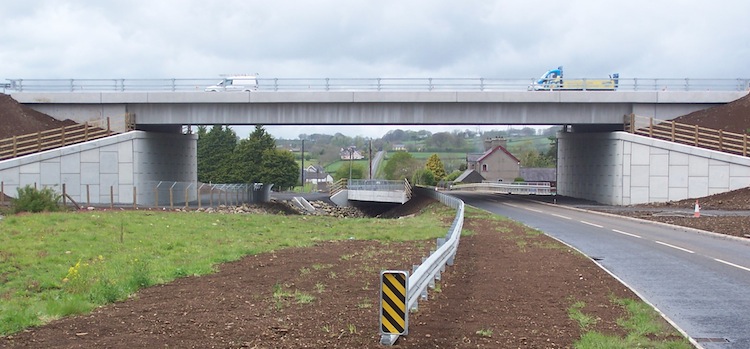
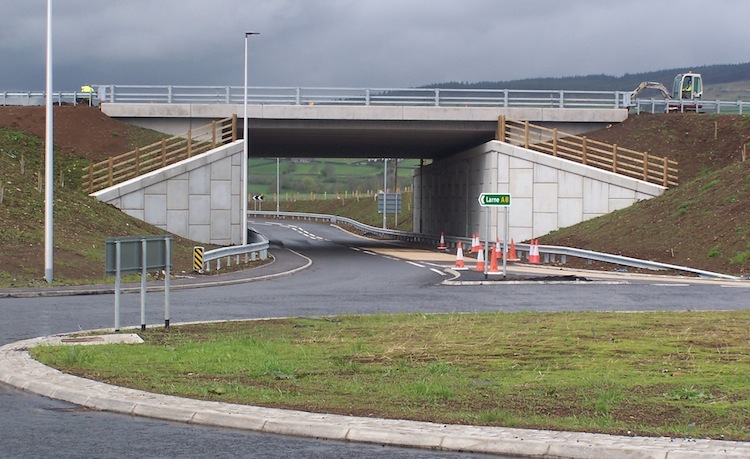
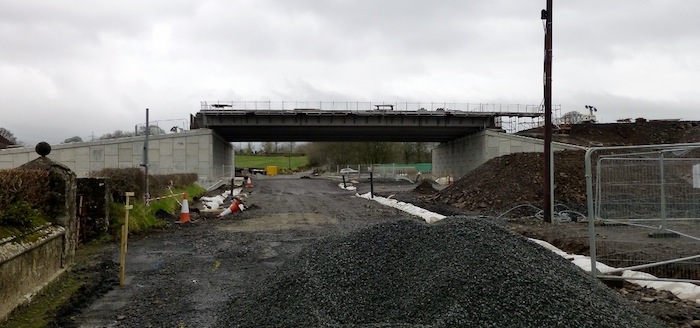
Pic 8: Church Road near Ballynure was finally
open to traffic when Noel visited on 20 Apr
2014, with the new bridge now in place above.
Church Road itself crosses over the Ballynure
Water just beyond the flyover - a kind of
'double bridge' effect. [Noel O'Rawe]
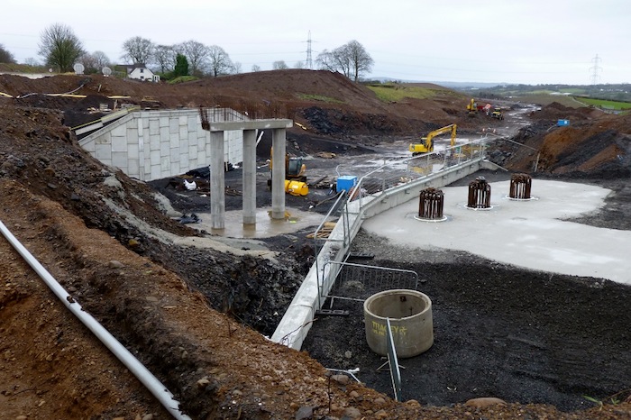
Pic 9: Looking east along Ballybracken Road from
the existing A8 on 20 Apr 2014. The local road
network seen here is being constructed below
ground level. This new roundabout will provide
access to north-facing sliproads from
the A8 (left) and to the A8 (under the
photographer). The road to the right will lead
into Ballynure on the route of the current A8,
which will become a local road. [Noel O'Rawe]
Pic 10: The bridge that will carry Lismenary
Road over the A8 on the Ballynure Bypass section
finally had its beams in place on 20 Apr 2014,
as seen from the existing Lismenary Road. The A8
is in a huge cutting here. [Noel O'Rawe]
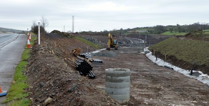
Pic 11: Looking north from Ballygowan Road
towards the Moss Road flyover on 20 Apr 2014.
All traffic is now using the future northbound
carriageway, and the old A8 now lies quietly on
the right, awaiting reconstruction as the
southbound carriageway. [Noel O'Rawe]
Pic 12: Looking at the same stretch of road as
pic 11, but from the opposite end at Moss Road
flyover on 20 Apr 2014. You can see how much
higher the new road is than the old road. This
is to smooth out the vertical undulations. [Noel
O'Rawe]
Pic 13: Finally, the A8 between Ballygowan Road
and Deerpark Road on 20 Apr 2014. The new road
swings offline to the right here in order to
take the left turn more gently than the current
road does. The bit of road in the foreground is
a temporary diversion though what was previously
a field. [Noel O'Rawe]
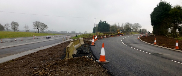
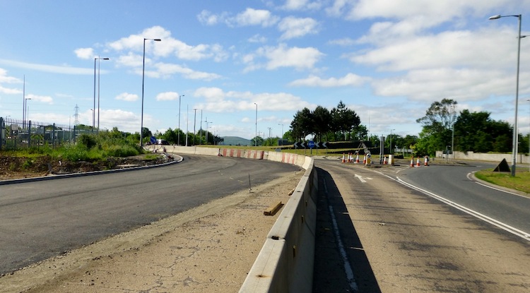
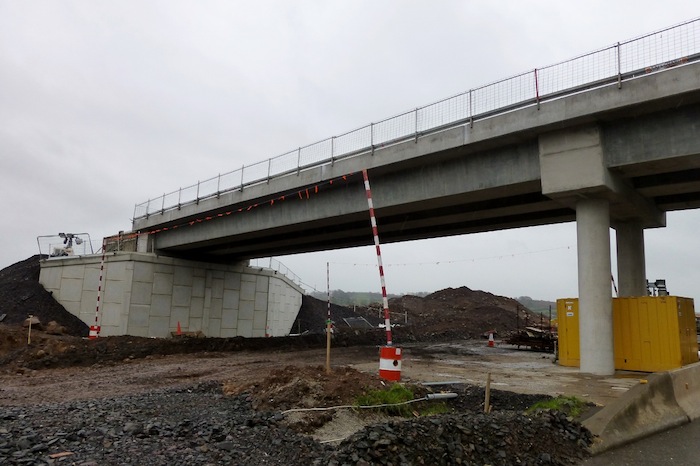
4 Apr 2014: The DRD
Minister visited the works site yesterday. The
most significant news is that the new bridge
that will carry the A57 Templepatrick Road over
the new A8 at Ballynure will open to one-way
traffic (presumably northbound) "within the next
few days" and then to all traffic following
further alterations to realign the A57. At this
point the old A57 will close and be removed to
make way for a cutting. This will complete the
cutting that already exists to the south of the
A57 and will really open up the view of how the
route of the A8 will eventually look. The bridge
itself cost £930,000 according to this
press release which also gives some
interesting facts about the amount of work done
to date, and details some awards that have been
won by the contractor Lagan Ferrovial Costain.
Congratulations to everyone working on the
scheme. Cesar Sierra, Project Manager for Lagan
Ferrovial Costain (LFC), said: “We are very
proud of these achievements, and believe that
it serves as recognition for the hard work and
determination that LFC have shown in trying to
improve the image of the construction
industry, and enhance its own standards”.
The minutes
of a meeting held on 26 Feb 2014 say that the
project is currently due to be completed by May
2015.
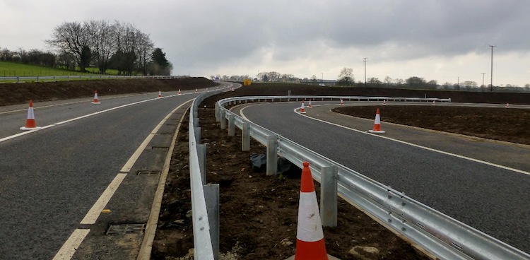
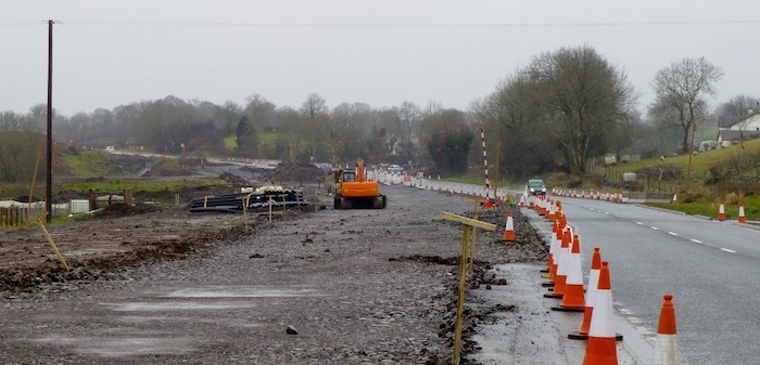
16 Mar 2014: The 13
pictures below were taken two weeks ago by Noel
O'Rawe (thank you) but due to illness I have
just been able to put them up tonight. Progress
is very impressive, and with the longer days and
better weather on the way, we can expect a very
productive summer ahead. Completion is now only
12 14 months away so the next
few months should start to see some sections of
the road starting to look almost complete. The
pictures below are arranged in order starting at
the south (Belfast) end of the scheme.
Pic 1: At Coleman's Corner, one lane of the
existing southbound A8 had been closed and its
tarmac ripped up on 2 Mar 2014, presumably to
facilitate the tying-in of the new
dual-carriageway (visible ahead) to the existing
roundabout. [Noel O'Rawe]
Pic 2: The view east along Green Road on 2 Mar
2014, towards the A8 - you can see the new
bridge ahead. Green Road is being diverted up
onto the new embankment on the left to climb up
and over the bridge. The existing road on the
right will be retained as a cul-de-sac to
maintain access to private properties. [Noel
O'Rawe]
Pic 3: The view south along the A8 towards the
Green Road/Calhame Road grade separated junction
on 2 Mar 2014. On the right is a 90° loop that
forms the future northbound offslip and onslip.
All traffic is on the original A8, which still
runs on the left. Presumably all traffic will
soon be transferred to the new northbound
carriageway on the right while the southbound
carriageway is rebuilt. [Noel O'Rawe]
Pic 4: Moving to Ballynure, this is the view
north-east along the A57 where work on a new
roundabout had begun on 2 Mar 2014. This new
roundabout will connect the northbound sliproads
from the A8 to the A57. [Noel O'Rawe]
Pic 5: This is the view south from the A57 where
the dual-carriageway from the Belfast direction
is taking shape. This is requiring the
excavation of a huge cutting, not only for the
road itself, but for the two pairs of sliproads,
one of which is visible on the right here. The
cuttings are much larger than may first appear
to be necessary due to the need to provide
adequate slightlines round the corners. 2 Mar
2014 [Noel O'Rawe]
Pic 6: This is the new bridge that will carry
the A57 over the new A8, which looked basically
finished on 2 Mar 2014. Work seems to be
underway on the approaches to the bridge, at
which point the road will be diverted onto it to
allow the existing A57 (on the left) to be
removed. [Noel O'Rawe]
Pic 7: At Church Road, here seen looking east on
2 Mar 2014, the beams have now been lifted into
place to carry the future A8. Hopefully Church
Road beneath it here will be reopened soon.
[Noel O'Rawe]
Pic 8: Work on the bridge that will carry
Lismenary Road over the A8 Ballynure Bypass
section of the new road progressing very well on
2 Mar 2014. It looks as if this bridge could
receive its beams in the not-too-distant future.
[Noel O'Rawe]
Pic 9: North of Ballynure work has resumed on
the Ballybracken Road grade separated junction
which is where the new Ballynure Bypass stretch
rejoins the line of the existing A8. This is the
future route of the current A8, which will be
retained as a local road into Ballynure but will
be diverted down and to the right as part of the
new junction design. Seen on 2 Mar 2014. [Noel
O'Rawe]
Pic 10: This huge cutting, which was made last
year but not progressed much over the winter,
carries local roads for the Ballybracken Road
grade separated junction, here seen on 2 Mar
2014. This appears to be a roundabout, which is
different from the design documents seen at the
public inquiry which envisaged a staggered
cross-roads here instead. [Noel O'Rawe]
Pic 11: Moss Road flyover, seen on 2 Mar 2014
looking south east from Moss Road itself. The
future line of Moss Road is very well advanced
to the left. The t-junction visible on the left
of the shot provides access to private property
which hitherto fronted onto the A8 itself. [Noel
O'Rawe]
Pic 12: Closeup of Deerpark Road flyover on 2
Mar 2014 which is looking very advanced. [Noel
O'Rawe]
Pic 13: At the northern end of the scheme, this
is the new road under construction not far from
Ballyrickard Road on 2 Mar 2014. As in most
locations, the existing A8 is being upgraded at
this point. [Noel O'Rawe]
|