|
|
Status
|
Construction scheme
(completed) |
|
Contractor
|
Sacyr, Wills Bros
and Somague consortium
|
|
Scheme
|
New
high-quality dual-carriageway to replace
the existing single-carriageway A6 from
Dungiven to Drumahoe, including
bypass around the south side of
Dungiven (Phase 1) and then
from Drumahoe to the A2 at Gransha, and
an upgrade of the existing A2
dual-carriageway from Caw to Maydown
(Phase 2).
|
|
Total
Length
|
30.0 km / 18.8
miles
|
|
Dates
|
Mar 2005 - Pilot study
to select route from Castledawson to
Derry announced.
Dec 2005 - Funding
announced to build section from Dungiven
to Derry.
Feb 2007 -
Preliminary route corridor selected.
May 2008 - Five route
options published.
6 May 2009 -
Preferred route announced.
14 Dec 2011 - Draft
legal documents published.
Jan 2012 - Public exhibitions.
24 Sep 2012 to 2 Oct
2012 - Public Inquiry held.
ca End Mar 2013 -
Inspector submitted Public Inquiry
report.
24 Feb 2016 -
Departmental Statement published.
21 Feb 2017 -
Construction tender released.
15 Aug 2017 - Vesting
Order "made".
28 Mar 2018 - Contract awarded for
Dungiven to Drumahoe section (phase 1).
(changed from
"after 2015" as of Jan 2011, and
"early 2013" as of Jul 2010).
26 Sep 2018 -
Sod-cutting ceremony.
9 Jul 2022 - Entire
road first opened to traffic (for a
period) with lane restrictions and 40mph
speed limit.
6 April 2023 - ca 9am
- Road fully opened to traffic
(was to have been late 2022/early
2023 as of Oct 2022; Autumn 2022 as of
Jun 2022; spring 2022 as of 2018)
|
|
Cost
|
£390-420m (as of Nov
2014) for whole scheme
(of which £250m for
phase 1, Dungiven to Drumahoe as of Feb
2022
(and £200m for phase 2, Drumahoe to
Gransha) as of Oct 2021
(changed from £220m for phase 1 as
of Mar 2018)
(Changed from £230-255m for phase 1 as
of Nov 2014; £350-390m as of Mar 2011;
£320-390m as of Dec 2009; £320m as of
Dec 2008 £300m as of Jun 2008 and £250
million as of 2005)
|
|
See
Also
|
General area map.
Contractor's
web site on scheme
DFI
web site on scheme - very detailed
information and reports.
|
Click here to jump
straight down to updates for this scheme.
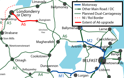
This major project
was first announced on 13 December 2005 by the
Northern Ireland Secretary of State Peter Hain
as part of a larger investment package for the
city of Derry, and work phase 1 was built from
2018-23. When completed it will see a non-stop
dual-carriageway starting with a bypass of
Dungiven town and dualling of the existing A6
from there to the A2 on the north-eastern
periphery of Derry city. The road will be build
to a high quality with two lanes each way, no
breaks in the central barrier and fully grade
separated junctions (ie flyovers). The map below
shows the section of the A6 affected by this
upgrade:
Route
The
chosen route closely follows the existing A6,
but generally off to one side apart from an
online section around Burntollet. At the Derry
end it heads inland and bypasses Drumahoe well
to the north, terminating on the A2 at Caw. At
the eastern end it bypasses Dungiven to the
south.
Strip Junction Map
This is a strip map of the design that was
published in May 2009, and is still correct as
of the updated design published in February
2016. Note that the design may change between
this map and construction due to the evolution
of the design, and the public inquiry.
|
WEST
Begins on
A2 dual-carriageway, Derry
2+2 lanes
|
|
STRADREAGH
or GRANSHA
|
A2 Clooney
Road
(into Derry)
|
|
Local
access
A2
Clooney
Road
(to Limavady)
|
|
5.3 km
/ 3.3 miles - 2+2 lanes
|
|
LISMACAROL
ROUNDABOUT
(DRUMAHOE)
|
A?
Glenshane
Road
(existing A6)
(into Derry).
|
|
Tirbracken
Road
|
| |
2.8 km / 1.7 miles - 2+2 lanes
|
|
TAMNAHERIN
ROAD
(THE CROSS)
|
Local
access
Local
access
|
|
Tamnaherin
Road
|
|
2.0 km
/ 1.2 miles - 2+2 lanes
|
|
ARDMORE
ROAD
(BURNTOLLET)
Westbound access
only.
|
Faughan
River
Ardmore Road
.
|
|
Burntollet
Bridge
.
|
| |
2.5 km / 1.6 miles -
2+2 lanes
|
|
KILLALOO
(GULF ROAD)
|
B74 Glenshane
Road
(Claudy west)
|
|
Gulf Road |
| |
2.5 km / 1.5 miles - 2+2 lanes
|
|
BARANAILT ROAD
(CLAUDY)
|
B69 Baranailt
Road (into
Claudy)
|
|
B69
Baranailt
Road (towards
Limavady)
|
| |
13.0 km / 8.1 miles - 2+2 lanes
|
|
FEENY
ROAD
(DUNGIVEN WEST)
|
|
|
B74 Feeny
Road (into
Dungiven)
|
|
2.5 km
/ 1.6 miles - 2+2 lanes
|
|
MAGHERABUOY
ROUNDABOUT
(DUNGIVEN EAST)
|
|
|
B64
Glenshane
Road
(former A6;
into
Dungiven)
Local
access
|
| |
EAST
Terminates
as single-carriageway
A6 towards Belfast
1 lane each way
|
Updates
6 Apr 2023: We are finally there!! The
A6 fully opened to traffic this morning, shortly
after 9am, and road users spent the day
travelling along the road and sharing their
views on social media. The response from the
travelling public has been overwhelmingly
positive today. I was even getting excited text
messages from people who wouldn't normally get
excited about roads. There is too much material
online to realistically share it all here, but
you can see videos by the BBC here,
by AerialVisionNI here,
by Paul McCloskey here,
the Belfast Telegraph here
and by Benbradagh here.
Thank you all! And a special thank you to all
those who have shared material and observations
with me over the past four and a half years. The
scheme is now open, but work will probably
continue for a number of weeks yet as there are
still lots of things to tidy up, especially on
the surrounding land, such as the new
agricultrual access laneways. But it is a good
moment to say a big "well done" to DFI Roads,
the contractors Sacyr, Wills Bros and Somague,
and the designers AECOM and all their staff for
bringing the scheme to this conclusion. Other
things that are happening are the opening of
Claudy park-and-ride tomorrow (7 April) as well
as the provision of a park-and-ride site at
Dungiven which is a separate project due to be
completed within a few years, plus an "official"
opening which will take place at some point in
the coming weeks. There is also the question of
"Phase 2" of this scheme (Drumahoe to the A2 at
Gransha) which is still unbuilt due to lack of
the £200m funds as well as the unresolved
illegal dump on the route at Mobuoy.
22 Mar 2023: With the road safety audit
close to completion the only significant issue I
know of that has come up is the location of the
parking area on the central island of
Magherabuoy Roundabout in Dungiven. This is
intended as a place for service vehicles to park
in order to give workers access to the centre of
the junction without having to walk across the
live roundabout. The issue seems to be that
motorists travelling east from Dungiven towards
Belfast are taking the "racing line" by cutting
across this parking area. This encourages higher
speeds on the roundabout and potentially
endangers users of the parking area and other
road users. So DFI appear to be planning to
relocate the parking area to another part of the
roundabout. We'll likely see that work take
place in the coming weeks. DFI continue to say
that the road will be open by the end of April,
but I increasingly suspect (and it's just a
suspicion) that it will take place sooner than
that, perhaps even 2 or 3 weeks sooner than
that. In this case, they will likely open it
with zero fanfare and we'll all just discover
that it has happened! Whenever it happens it
will be great news for both road users and
residents of places like Dungiven. Some people
have also pointed out on social medai that
completion may now coincide with the high
profile visit by the US President to Northern
Ireland around Easter time. I think opening a
road would be below President Biden's level of
dignity, but another member of the US delegation
might agree to do so. This would be a bonus if
it happened!
10 Mar 2023: In the past few weeks DFI
Roads seem to be getting increasingly confident
about the imminent opening of the A6
dual-carriageway from Derry to Dungiven. A month
ago they seemed fairly confident that it would
open by the end of April. At the end of February
this became stronger
when they said “barring any unforeseen
circumstances the road will open by end of
April”. As of today I get the sense that
it may be even sooner than that, perhaps the
third week of April. If so, we’re only about 4
to 5 weeks away from opening. Street lighting is
complete, the Road Safety audit continues, while
the final 20% of the signage continues to be
erected on the new road. The photos below give
some indication of the stage of the project.
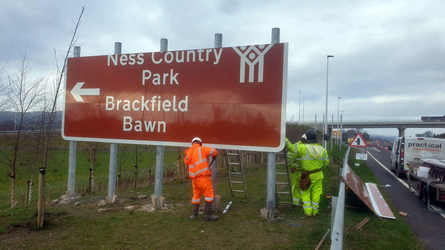
Pic 1: A new tourist sign being erected on the
A6 near Killaloo junction on 20 February 2023.
Due to the collision risk presented by the
five pillars for the sign, it is protected
behind a steel crash barrier. [DFI Roads].
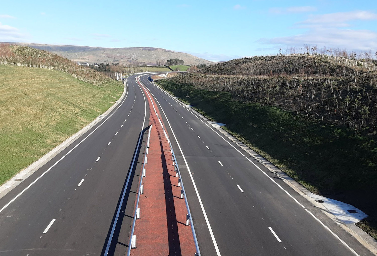
Pic 2: View of the completed but unopened A6
Dungiven Bypass on 2 March 2023, as seen from
Magheramore Road bridge and looking towards the
terminus of the scheme at Magherabuoy
roundabout. [Paul McCloskey]
Pic 3: New direction signage on the existing A6
approaching Dungiven westbound as seen on 7
March 2023. This sign directs people left onto
the new dual-carriageway, and confirms once
again that the existing A6 through the town will
become the B64. The sign also depicts the “jet
lane” that will allow traffic heading this way
to bypass the roundabout. [Paul McCloskey]
8 Feb 2023: Last week DFI Roads said
that the cost of the Drumahoe-Dungiven scheme
(the part of the A6 scheme that is currently
under construction) is likely to come in £30m
above its original estimate of £220m. This tells
us two things. Firstly, while all schemes have
come cost variation from the original estimate,
this is a good bit more than normal. It can be
explained by the huge rise in the cost of
building materials which has happened in the
past two years fuelled by the supply chain
crisis, high energy costs and the war in
Ukraine. Secondly, the fact that DFI are willing
to put even an approximate figure on it suggests
that negotiations between DFI and the contractor
over the final bill are bearing fruit. I believe
this has been the main source of the current
delay to opening the road, and given the huge
upheavals that have taken place since 2018,
there must be a lot to negotiate. A DFI
representatitve himself said in that article
that "there are a number of outstanding
disputes and unagreed items with the
contractor". DFI are now fairly confident
that the road will open by the end of April,
though we don't yet have a date. As I have said
before, the opening date is entirely down to the
contractor, but I am certain that DFI are
putting considerable pressure on the contractor
to get the road opened as soon as possible. A
risk for both parties would be a serious
collision occurring on part of the old road
before the new road is opened, which is
something they would be keen to avoid for many
reasons. We are now 4 years and 4 months into
this project, making it one of the
longest-running road schemes ever undertaken in
Northern Ireland. The only scheme I can recall
that took longer is the M2 foreshore in Belfast
which was built between 1966 and 1973. The
contractor recently posted an aerial
video of the entire road as it looks now.
I've included a brief commentary below. The
numbers are the times in the video in minutes
and seconds.
- 0:00 Start of scheme at Lismacarol
roundabout, Drumahoe.
- 0:45 Temporary terminus of the A6 – which I
strongly suspect will be permanent. Feel free
to remind me of this in ten years.
- 2:00 Liberty Glen bridge, with all local
laneways completed. Immediately followed by
two new laybys.
- 3:10 Empty posts for new direction signage
shows that some signs have still to be
supplied.
- 3:45 Tamnaherin Road junction.
- 4:00 The new Ervey Road link runs parallel
to the A6 on the left here. This is a brand
new local road which preserves local access
further along.
- 5:00 The Oaks accommodation bridge.
- 5:35 Fence line on left marks the site of
the temporary diversion of the A6 which
existed while The Oaks bridge was being built.
It has now been removed. Ervey Road link ends
on the left at, er, Ervey Road.
- 6:20 Burntollet Bridge with Ardmore Road
bridge on the right. This was a very intense
part of the site that bears no resemblance to
how it used to look five years ago. Works
still appear to be ongoing to tidy it up. Two
flood attenuation ponds can be seen, one on
each side, as well as a series of pipe
culverts under Ardmore Road to help flow when
the Faughan river is in flood.
- 7:30 The old A6 swung out further to the
right here. Old road has been removed and
replaced with an attenuation pond and an
access lane.
- 8:10 Passing Brackfield Bawn, which has seen
a lot of changes since it was built in the
early 1600s!
- 9:45 Killaloo (Gulf Road) junction west of
Claudy, looking essentially finished.
- 10:40 Old A6 on the left here has been
reduced in width and turned into an access
lane. These works appear to be ongoing.
- 11:45 Another set of empty signage posts.
Old A6 still visible on the left. It too will
be reduced in width before completion. This
work doesn’t appear to have started yet.
- 13:00 Baranailt Road junction, Claudy. Work
still seems to be underway on the
park-and-ride on the right. From here to
Dungiven the road is closed with all traffic
using the old A6 which begins on the left at
14:10.
- 16:15 Minor works on a local laneway evident
here. Mainline appears to be completely
finished with wire central barrier in place.
- 17:20 Gortilea Road bridge, where the
embankment had some issues a few weeks ago,
which have now been resolved.
- 20:30 Ballyhanedin Road bridge, again
looking completely finished.
- 25:30 Crock-na-brock Road, now permanently
severed by the new road.
- 27:30 Ovil Hill cutting, the largest cutting
on the scheme, with grass and bushes now
colonising the rocky banks. Local works here
and after appear finished.
- 30:10 Site of the contractor’s tarmac
batching plant, now gone.
- 31:00 Derrychrier Road underbridge.
- 33:10 Feeny Road junction, completed but not
yet open. This is the start of the Dungiven
Bypass section.
- 35:10 Owenrigh Road river bridge followed by
Magheramore Road overbridge, both completed.
- 36:20 River Roe bridge. Some landscaping
works still underway below the bridge.
- 37:05 Rumble strips to encourage drivers to
slow down as they approach the end of the
scheme at Magherabuoy Roundabout east of
Dungiven. Roundabout itself appears to be
completed, including the “jet lane” on the
right. It’s not clear from the markings
whether both lanes heading east along the
dual-carriageway will be able to take the
second exit to continue onto the A6. This is
something that’s highly likely to cause
confusion if it’s not made crystal clear, as I
suspect most drivers will assume that
continuing on the A6 towards Belfast is
“straight on”, and hence possible from the
left lane. The A6 exit does appear to assume
two lanes merging.
25 Jan 2023: There has been evidence
over the past few weeks of final work taking
place across the scheme, with signage appearing
in various locations and other loose ends. DFI
Roads issued a statement, reported
in Derry Now, that work on the mainline
would be finished "in the next few weeks". The
term "mainline" refers to the new
dual-carriageway itself, as opposed to changes
to the local road network and "accommodation
works" which refers to the additional local
laneways etc that are also being constructed to
maintain access for local landowners. While a
"few weeks" is quite vague, it does seem to
square with what we're seeing on the ground so I
do believe we're coming close to that milestone,
likely during February. In most road schemes,
the road is opened in phases as we approach the
end, with cones and speed restrictions remaining
in place for some time. During this time, a Road
Safety Audit is always carried out. This is
essentially to satisfy DFI that the road has
been constructed as designed, and is safe to
use. The road does not have to be
completely closed to allow this to happen.
However, the site remains under the control of
the contractor until the process has been
concluded, which means that it's the contractor,
not DFI, who decide whether to have traffic on
the new road at this point. In this case, the
contractor seems to have decided to keep the
road closed for the Road Safety Audit. While
extremely frustrating for drivers, they are not
going anything wrong in doing this, and their
motive may simply be that it is cheaper and
easier to carry out the audit on a closed road
than to have temporary traffic management in
operation. A period of three months has been
mooted (hence why I've kept saying April 2023
for opening) but DFI said that they were
"working hard to minimise this period", which I
read simply as "leaning on the contractor to be
as speedy as possible". The issue was once again
brought to the fore a few days ago when an
exceptional load travelling from Derry to Toome
had
to go down Dungiven's main street with
considerable disruption,
despite the completed bypass being just a few
hundred metres away. Anyway, I am convinced that
there is really nothing we as the public can do
about these delays and must instead console
ourselves that the road is going to be a
game-changer for Dungiven and the while North
West once it finally opens in the spring,
four-and-a-half years after work began.
4 Jan 2023: There is little more to
report since mid December, with final works on
the scheme continuing to progress at a very
sedate pace and no word on when the road might
open. Street lighting is in place in some
locations, and work recently got underway on
providing further electrical connections for
equipment along the site. Long stretches seem
completed, with the Dungiven Bypass even
sporting rumble strips approaching the
roundabout. I am now convinced that the primary
issue delaying the scheme is ongoing discussions
between the contractor and DFI related to
finance and the overall cost of the scheme, a
problem not assisted by the absence of an
Executive which makes it more difficult for DFI
to resolve. Despite the immense frustration and
negative publicity this is causing, I think we
have no choice but to wait this out. Staff on
the ground appear to be working towards an
assumed opening date of April 2023. Finally, we
now know that the old A6 between Dungiven and
Claudy will become the B64 upon completion of
the new road, while the short stretch of the old
A6 at the Derry end (Tamnaherin Road to
Drumahoe) will become the B118. Thanks for
Stephen Baxter for flagging that to me.
16 Dec 2022: Work on this scheme
continues, as the ongoing delay to opening
continues to attract negative
media attention and poor
publicity on social media, especially
around the nature of the temporary traffic
management which is viewed as unclear at night
and for those unfamiliar with the route. The
contractor posted an update
a couple of days ago which clarifies that the
bulk of the outstanding works relate to NIE
works (supplies to lighting and signage),
landscaping and completion of new local side
roads/access lanes along the scheme. Their
update comments that street lighting at three
junctions is installed but is awaiting power
supply. This tallies with what I have heard from
landowners along the route, who have noticed
that NIE only seems to be seeking permission to
install new power cables now. It's not clear why
these works are only happening now given that
the scheme having been underway now for over
four years, but installations of this type are
not easy and are quite time-consuming. The
update also comments that installation of road
signs on the main road will not be completed
until "early 2023" with signs on side roads to
follow after that. This tallies with what I've
heard from people familiar with the scheme that
sign acquisition has been problematic, for
whatever reason. While the main A6 itself looks
substantially complete, the local roads and
access lanes around it look less completed and
it seems there is still a good bit of work to be
done on those. Finally, the contractor's update
notes that the road safety audit (a normal step
which takes place after every major new road is
built) will not take place until all
construction works are completed, which is
rather open-ended. I can still see no good
reason why the new road could not be opened
tomorrow – with a speed limit and lane
restrictions as it was in the summer – except
that somebody is choosing not to open it.
Certainly there is no need for the road to be
closed to complete a road safety audit. In fact,
it can't be completed until the road is
fully open. Finally, here is a video
posted by Benbradagh (but not taken by him)
which shows a drive along the whole offline
stretch from Claudy east to Dungiven. This is
the stretch that is currently closed. The video
indicates that the central wire barrier is now
largely complete which is one positive thing in
what is otherwise a very frustrating situation.
25 Nov 2022: Having observed the scheme,
public frustration, and especially DFI's
comments on it, for another month this update is
to bring together my current thinking on what is
going on. Basically, the road was to have been
opened in the autumn of 2022 but it now looks
like it will be April 2023. DFI have been
tight-lipped about the reasons, referring to the
need for a road safety audit, supply chain
issues and Covid. In my view none of these is a
sufficient explanation for the road to still be
closed. Firstly, the road safety audit.
This is the final QA process that needs to be
done in order to ensure that the road has been
built exactly as it should have been and to a
sufficient quality. Essentially, this is to
ensure value for money for the taxpayer. The
road can't be fully handed over from the
contractor to DFI until this is done. However it
is NOT the case that it prevents the road
opening. Roads open all the time while work is
still taking place, as we saw at Dungiven in the
summer. In fact, the road HAS to be open for the
final stages of the audit to be carried out.
Secondly, the supply chain issues
definitely do seem to have happened. A recent aerial
movie released by the contractor shows a
surprising lack of road signage, with lots of
empty posts, at various places, as well as a
lack of central crash barrier. So it looks as if
there are issues acquiring the signs and
possibly the barrier steel. However, again, the
lack of final signage would not prevent the road
being opened as it is perfectly acceptable to
use temporary signage while works are ongoing.
Thirdly, Covid. This has definitely
impacted the scheme. However, as recently as the
spring of 2022 DFI were saying that it was
intended that the road would open in the autumn.
Covid was a major issue for around two years
from March 2020, but it can't account for a
delay of five months appearing since the
spring of this year. I think Covid is a
red herring. So where does this leave us? Having
eliminated these as possible causes of the delay
to opening, the only plausible reason that
remains is what I said in October - a
contractual dispute of some kind between DFI and
the contractor. Contractual disputes in major
infrastructure projects usually boil down to
disagreements over money. Now we have to be
quite clear here that there is no suggestion
that anybody has done anything wrong, simply
that there may be a difference of opinion about
who should pay for what and under what
circumstances, especially given recent steep
rises in costs. But it does seem to me that
there is no technical reason why this
road could not be open right now, perhaps with
cones and reduced speed limits. I don't know why
it is not.
27 Oct 2022: Having had another three
weeks to observe what's going on on this scheme
and observe increasing public disquiet
I am now of the view that the issue is mainly,
though not exclusively, of a contractual
nature. Members of the contractor's staff on the
ground have told some local people that they are
working towards a completion date of April 2023
which is so far beyond what we expected that it
suggests something beyond supply chain or
engineering problems is delaying it. We can tell
from drone photos that whatever the issue was at
Gortilea Road it was related to the approach
embankment, not the bridge itself, so is
unlikely to be a deal-breaking problem. We also
know that there have been some delays with
installing electrical supplies to new equipment
along the road, which is in turn delaying the
final Road Safety Audit. However a road does not
actually have to have passed its safety audit to
be opened - otherwise the temporary openings in
the summer could not have happened. The removal
of the tarmac batching plant at Ovil, which is
now more or less gone, suggests that there isn't
any perceived need of major resurfacing works.
So having eliminated serious engineering
problems, the only other plausible reason for
such a significant delay is some kind of
contractual dispute between DFI and the
contractor. if this is the case then, given the
disruption caused by the Covid pandemic combined
with recent soaring costs, it's quite likely
that it relates to money. It's not hard to
imagine a scenario where the scheme has cost
more than the contractor planned and where the
contractor feels that it would be reasonable for
some of this risk to fall on DFI. A contractual
dispute would also explain why DFI seem to be so
reluctant to talk publicly about what's going
on, instead repeating the same lines about the
outstanding work, despite it being obvious that
more is going on than this. If this is what is
going on, then the opening of the road is
probably one of several points of leverage that
exists in the discussions between DFI and the
contractor. It is infuriating for motorists
driving alongside a largely-completed road but,
if what I have speculated above turns out to be
the case, it does seem as if this is one that
the lawyers will have to solve while the rest of
us wait.
6 Oct 2022: Work continues on the
project, but I am adding this update to address
the speculation that has become more frequent in
the past couple of weeks about what is happening
on this project – not helped by the vacuum of
information coming from DFI on the subject,
which provides fertile ground for rumours to
breed! A couple of days ago DFI responded to a
question by a member of public by saying that,
while a lot had been achieved, "there remains
significant work that still need to be
completed before the road can be fully opened
safely. This includes the provision of vehicle
restraint systems, signage, street lighting
and completion of Road Safety Audit." The
first three of these have been self-apparent.
The fourth, the Road Safety Audit, is basically
the final quality assurance check that is done
on all road schemes. It is done to ensure that
what the contractor has built is exactly what
was commissioned and is of sufficient quality.
Such audits always bring up issues that need
addressed, this is normal. Less often, they
reveal larger problems. The rumours are that the
project may be experiencing something of this
nature. There are three things that back up this
theory. Firstly, the apparent lack of progress
over the past two months, especially on the
central crash barrier, which is still not
completed, and lack of a convincing explanation
for the delay and the refusal to commit to
anything more specific than "the coming
months". Secondly, the fact that one of
the new bridges over the A6 (Gortilea Road) has
been closed for a number of weeks now. Some
utility works were taking place here a few weeks
ago, but not enough to justify a closure of this
length. This raises the possibility that there
is some kind of issue with this bridge.
Generally you don't close a bridge unless work
is actively taking place or there is a concern
for the safety of road users. Finally, a DFI
employee wrote to a member of the public a few
days ago who was inquiring when the road would
open and said "we suspect it will be a number
of months". A delay of several months
could potentially bring us into the new year. If
this is the scenario that is developing then it
would be tricky for DFI to comment on as it will
involve the reputation of the contractor. We
must, of course, caveat all of this by saying
that this is all circumstantial and there is
nothing in the public domain to suggest that
there are any quality issues with the work. But
either way, my suspicion now is that the new
road may not even be open during 2022. Note
7 Oct: The original post referred to a
theory that there was an issue with the tarmac
on the road. I no longer think this is likely to
be the case, so to avoid confusion I deleted
those two sentences.
22 Sep 2022: The lack of information
from DFI and the contractor about when this road
will be completed is beginning to attract negative
press coverage. DFI have already explained
that a combination of Covid earlier in the
scheme, supply chain issues and market
volatility had delayed the project, and there is
no reason to doubt the truth of this. However,
the lack of even a vague timescale is
increasingly frustrating to motorists who don't
see much sign of work happening. In practice,
quite a bit of work is ongoing - especially in
relation to signage, vegetation, finishing
earthworks and safety barriers - but much of
this is very localised in nature meaning that
there are often long stretches with no visible
workers. I have previously said that my best
guess for completion is mid Autumn, and more
recently I have said late autumn. However in the
past couple of days DFI would only say that it
would be opened "in the coming months". Given
the length of time that motorists have endured
40mph speed limits and no overtaking
opportunities, I do think they deserve to given
a bit more information than this. While
appreciating that it is impossible to name a
date right now, at least admitting (let's say)
that opening would be unlikely to happen before
January would at least give people something to
go on. In other news, the works carried out
during the two weekend closures of Magherabuoy
roundabout in Dungiven were successful. The
roundabout now looks much more finalised with
the temporary bus stop removed and the brickwork
around the central island well advanced.
Benbradagh recently put up an aerial
movie of the roundabout as it was before
last weekend's closure.
24 Aug 2022: This month we can again
take advantage of a new
aerial video posted on YouTube by the
contractor. It shows the entire scheme from west
(Drumahoe) to east (Dungiven) as it was a week
ago, on 17 August. Currently the "offline"
section from Dungiven to Claudy is closed to
traffic again, and will likely remain so for
some weeks as a lot of work still needs to be
done. It does certainly feel as if the pace has
slowed in the past couple of months, but I am
not aware of the contractor's planned
timescales. In particular, work on the central
tensioned-wire barrier still has a long way to
go. As far as I can tell a short stretch from
the start of the scheme at Drumahoe to around
the Belfray Inn (2:52 in the video, about a mile
or so) has been fitted. After that the next
section begins half away along the scheme from
around Ballyhanedin Road (20:40 in the video) as
far as the Owenbeg River bridge near Feeny Road
(29:15 in the video) has had its wires put in
place, though as yet they don't seem to be fully
connected or tensioned. That leaves about half
the scheme still to get its barrier. There is
also a lot of red tarmac to be laid in the
central reservation - you can see this happening
at 14:28 in the video. The tarmac batching plant
near Foreglen seems to be ramping down now,
though it is still in place and seems to be
still in use. It had been due to be removed at
the end of July but the fact that it's still
there suggests delays. Other than the central
reservation, the road itself seems to be
completed along its entire length with works
focused more on ancillary works such as local
access lanes, signage and drainage. It is now
looking to me as if work on the scheme will need
go to go on until at least mid Autumn.
24 Jul 2022: Time
constraints prevent me from making a large
update this month. The scheme has made progress
over the past month, though the pace of works
seems to be slowing as the contractor focuses on
a couple of key locations, and is more involved
now with time-consuming but
visually-inconspicuous works such as signage,
planting and finishing works to local roads. On
9 July the entire length of the scheme from east
of Dungiven to Drumahoe opened to traffic with
one lane each way and a 40mph speed limit. It is
worth reminding road users that both the
Dungiven Bypass and the offline section from
Dungiven to Claudy will close again - hopefully
for the final time - in mid August to allow
final works to take place along this stretch.
The immensely frustrating 40mph speed limit is
needed to protect workers along what is still a
construction site, and is unlikely to be lifted
before the road closes again in mid August. The
contractor and DFI are both being
(understandably) tight-lipped about when the
scheme will be completed but my best information
is that September is too optimistic but December
would be pessimistic, so my best guesstimate is
mid to late Autumn. The contractor recently posted
a YouTube video flythrough of the entire
scheme (from East to West). Three points to note
in this video:
- At 21:16 – construction well underway on the
section of new road that will link the "old"
A6 to the local road network at Claudy. From
here to near Derry the new road subsumes the
old road.
- At 29:40 – Ardmore Road junction at
Burntollet was opened to traffic at last in
June – hurrah! Burntollet Bridge itself
appears to be completed and work has clearly
taken place to restore the landscape here
which was significantly affected by the works.
- At 32:00 – At Tamnaherin Road junction work
is underway to complete the Ervey Road link
(on the right) which will link Ervey Road,
near Burntollet, to the new road via this new
junction.
Benbradagh has also recently posted aerial
videos of the River Roe bridge at Dungiven
then-and-now style, and
also one of the new Magherabuoy Roundabout
in Dungiven where the scheme terminates.
29 Jun 2022: A very brief update to
comment that the contractor has just put their
monthly aerial movie of the scheme on YouTube.
You can find the East to West movie here,
and the West to East movie here.
Both were taken on 21 June. These are the first
movies taken since traffic was diverted onto the
Dungiven to Claudy stretch, and also since the
Killaloo junction west of Claudy was opened.
19 Jun 2022: A few milestones were
achieved over the past few weeks on a project
which is now entering its final few months.
Firstly, the Gulf Road junction (Killaloo)
opened to traffic on 9 June. It gives access to
Claudy to/from the Derry direction. At Drumahoe,
the adjustments to the local road network are
now complete, and access to Lismacarol Road has
now been restored (see pic 2 below). At
Burntollet, all traffic has been using the
future westbound bridge for some weeks, but the
rebuilt Ardmore Road is now finally looking well
advanced with earthworks essentially complete
and the westbound on/offslip taking shape (there
is no eastbound access here). A big change was
the temporary opening of the long
stretch of dual-carriageway between Dungiven and
Claudy which came into use on 12 June and will
remain in use for about two months. This
includes closing the Feeny Road junction
temporarily and is to facilitate works to the
existing A6. In mid August this stretch of road
will close again for final works. It is worth
noting that at 13.0 km the stretch from Feeny
Road to Claudy is now the longest stretch of
road with no intermediate access in
Northern Ireland, beating the current
record-holder, the M1 between Blaris and Moira
at 10.3 km. It is not yet clear clear when the
whole scheme will be open and cones/speed
restrictions removed, but my understanding is
that September would be a bit too optimistic. So
I'm going to say closer to late autumn. Before
we get into some more photos, here are links to
two aerial videos posted by the contractor, both
taken on 28 May 2022: East to
West and West to
East. They are about 40 minutes each, so
go and make a coffee, they should fill an
evening nicely! The bullet points below are a
brief list of points of interest on the East to
West video:
- Start – Magherabuoy roundabout Dungiven
- 2:25 Magheramore Road bridge
- 4:10 Feeny Road junction
- 8:35 Killunaught Road bridge
- 10:10 Ovil Hill Cutting
- 14:35 Munreary Road bridge
- 17:00 Ballyhanedin Road bridge
- 19:20 Gortilea Road bridge
- 22:30 Claudy junction (Baranailt Road)
- 26:20 Killaloo junction (Gulf Road)
- 31:00 Burntollet bridge
- 33:45 Tamnaherin Road junction
- 39:05 Liberty Glen bridge
- 40:50 Terminus of scheme at Lismacarol
roundabout
Anyway, here are 7 more photos, arranged as usual
from west (Derry end) to east (Dungiven end).
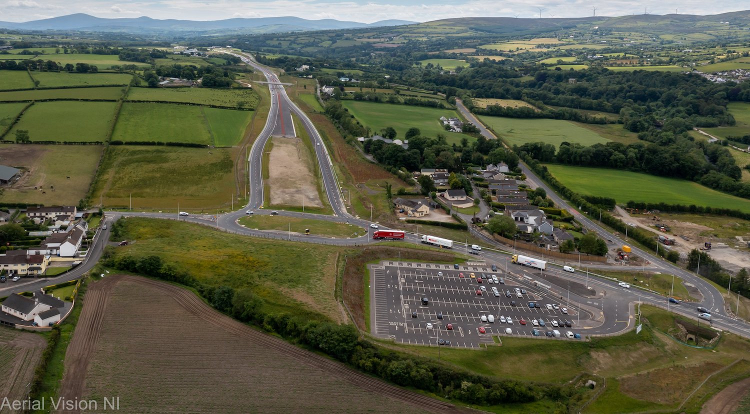
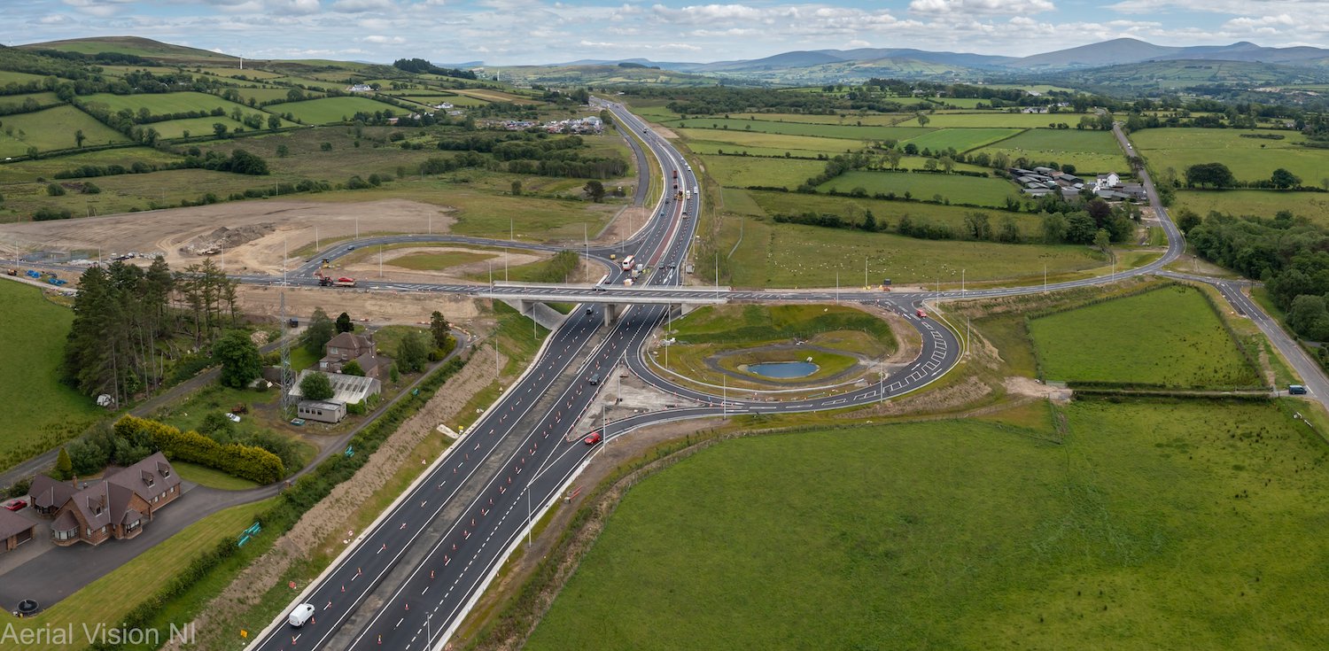
Pic 1: Terminus of the scheme at Lismacarol
roundabout, Derry showing the splayed
carriageways future-proofed for the planned
extension to Gransha, and the park-and-ride. My
gut feeling is that the future extension will
not happen, and this will become another
permanent-termporary terminus. 15 June 2022
[Aerial Vision NI]
Pic 2: Closeup of the junction between the
realigned Glenshane Road, Dumahoe (with
Lismacarol roundabout off to the bottom) on 28
May 2022. Showing the "original" A6 heading off
to the left past the yellow box, plus the new
link road connecting Lismacarol Road now
completed left of centre. [Contractor's pic]
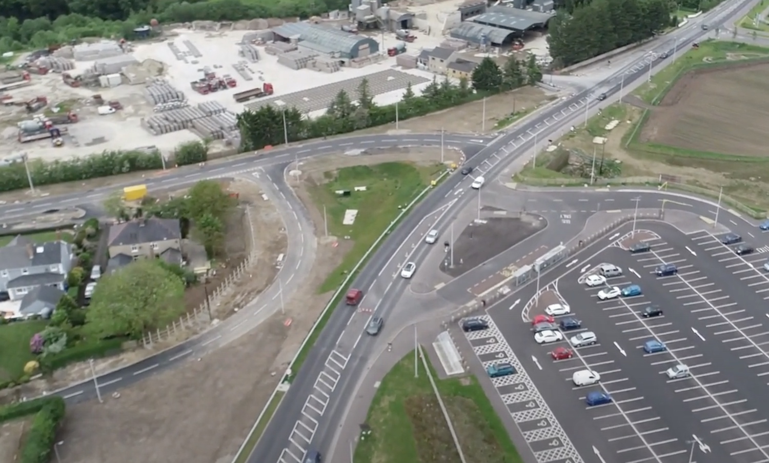
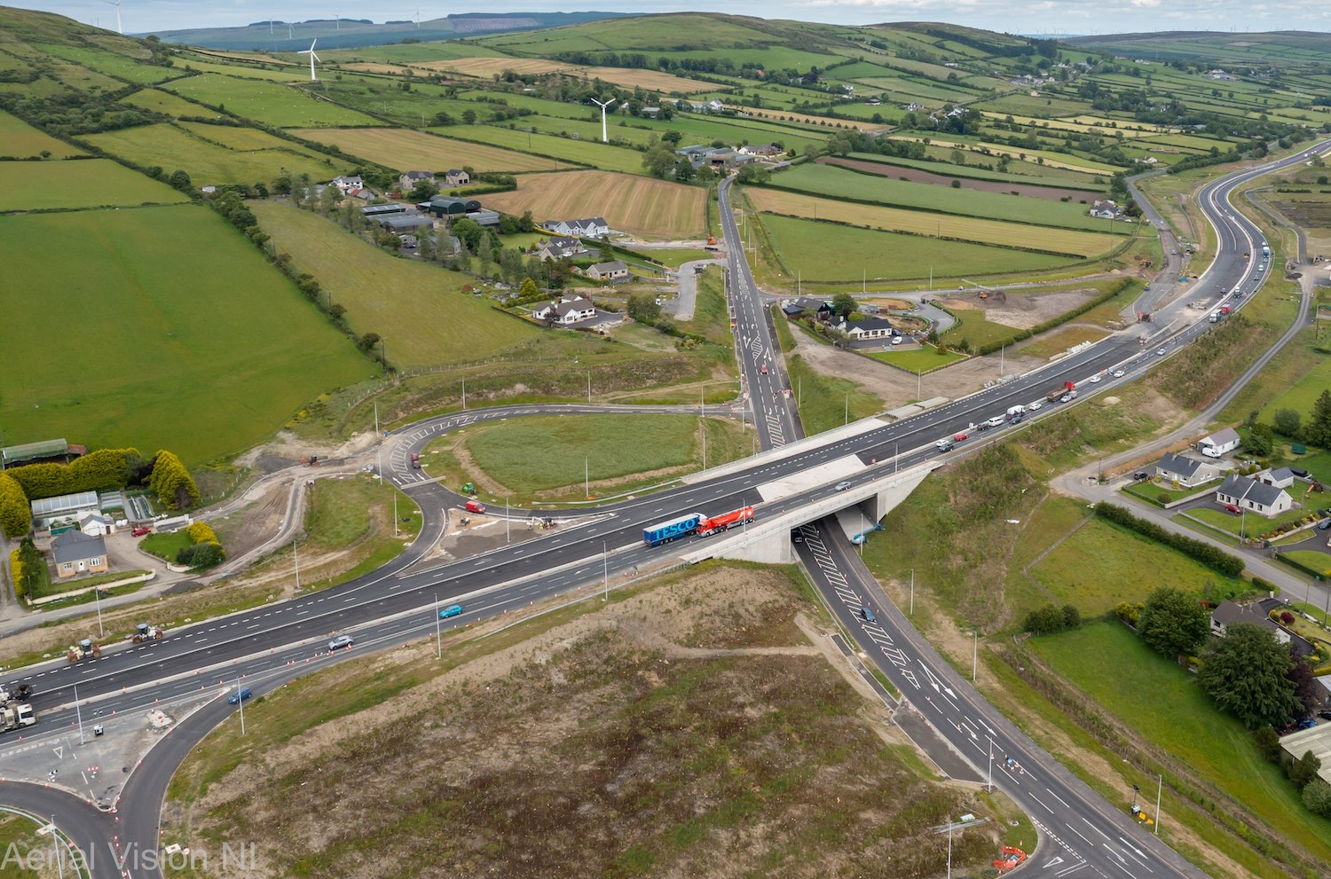
Pic 3: Tamnaherin Junction just east of Drumahoe
on 15 June 2022, which is not yet open to
traffic. The scale of the future
dual-carriageway is evident in the width of the
new road, compared to the two tiny lanes being
used by current traffic. The curved road to the
right here (which was used earlier in the
project as a temporary route for all traffic) is
now being reconstructed as a permanent
connection to the Ervey Road link, which will
preserve access to Ervey Road, near Burntollet.
[Aerial Vision NI]
Pic 4: View of Burntollet on 28 May 2022,
showing the very-advanced Ardmore Road which
took a tremendous amount of engineering. Note
also the left-in/left-out junction which is now
taking shape. The contractor appears to be
working to restore the landscape which was
significantly impacted by the works here.
[Contractor's image]
Pic 5: Gulf Road junction at Killaloo, west of
Claudy, seen here looking east on 15 June, a
week after opening. The local road on the right
has also been realigned to flow directly to the
junction from Claudy. [Aerial Vision NI]
Pic 6: Claudy junction, at Baranailt Road, seen
on 15 June 2022. The Baranailt Road link here is
due to the closed for two months from around now
until mid August for final works. [Aerial Vision
NI]
Pic 7: This ground-level view of the new road
was taken from Ballyhanedin Road bridge on 12
June, shortly before it was opened to traffic.
It shows that the tensioned-wire central barrier
has now been fitted here, though it has not in
many other locations. This is one of the big
bits of work still to be done. [Paul McCloskey]
25 May 2022: Another update, this time
mainly to share this
aerial video just put up by Benbradagh
(thank you!), which covers the long offline
section of the scheme from Barnailt Road
(Claudy) to Feeny Road (Dungiven). I have added
a short commentary below. Not shown in the video
is the start of the scheme at Drumahoe. Here the
tie-in works to connect the existing A6 and
Lismacarol Road into the new local road network
here are finally completed, and the local roads
reopened to traffic. DFI recently said that the
scheme would be completed in "the autumn", which
fits with the original completion date of spring
2022 but with six months added due to the Covid
pandemic during 2020, as was advised at the
time. I still think that the roads themselves
are likely to be opened earlier than this,
perhaps during the summer, with ancillary and
snagging works extending into the autumn.
Finally, the contractor has put a video
on YouTube here which covers the entire
scheme from Drumahoe to Dungiven, the only
down-side being that it is a month old (20
April).
Anyway, here is a commentary to go with
Benbradagh's aerial
video:
- 0:05 Having just passed over Baranailt Road
(Claudy junction) we are now travelling east.
Traffic comes off the future dual-carriageway
and rejoins the old A6. Traffic is not using
any of the new road from here to Feeny Road.
- 0:20 Drainage channels (white) in the
central reservation switch sides as the camber
of the road switches to transition into a
right-hand bend.
- 0:40 One of many attenuation bonds - they
collect water from the road during heavy rain
and hold it to stop it overwhelming local
watercourses, and also let particles like
rubber settle out.
- 1:00 New road here is finished, other than
the installation of the central crash barrier.
Long lengths of parallel access lanes for
landowners on the right.
- 1:45 Passing over Gortilea Road bridge.
- 2:55 Passing over Ballyhanedin Road bridge.
The old alignment of the road has been
retained as a local access laneway.
- 3:35 Pair of future lay-bys.
- 4:25 Munreery accommodation bridge (for
local access)
- 5:15 Where Crock-na-brock Road used to run
across the route. It has now been closed at
either side here.
- 5:50 Passing Foreglen village to the left.
Altagarron Road passes under the new road.
- 6:25 Ovil Hill cutting. A large amount of
peat material has been replaced at the top of
the hill on the right here, while there are
signs of vegetation reclaiming the bare rock
faces of cutting.
- 7:35 Passing over Killunaught Road bridge.
- 7:55 Another pair of laybys. Tarmac batching
plant still in place on the left, though the
majority of surfacing work is now complete.
- 8:25 Derrychrier Road passes under the new
road in a box tunnel.
- 9:15 Owenrigh River bridge
- 9:45 Feeny Road junction at the western side
of Dungiven. Traffic is using the new road
from here to the terminus of the scheme at
Magherabuoy roundabout (not in this video).
- 10:20 Video halts with Magheramore Road
bridge visible ahead.
15 May 2022: This is a brief update to
note that traffic was switched to the westbound
carriageway of the new A6 from Gulf Road
junction (Killaloo, west of Claudy) to
Tamnaherin Road junction (2 miles from Drumahoe)
yesterday (Saturday). This includes Burntollet
Bridge where traffic is now using the southern
half of the new bridge which was surfaced during
April. The northern half of Burntollet Bridge
has been closed again, presumably until the
dual-carriageway opens fully. This follows a
frustrating few days for motorists due to
temporary traffic signals at Tamnaherin Road
which led to tailbacks up to two miles long at
times. Hopefully those are now over. Major works
are talking place over the next two weeks at
Gulf Road (Killaloo) junction which is getting
tied in to the local road network and the new
junction between 13th May and 27th May. Once
completed, the new overbridge here will be
opened to traffic and the junction fully opened
(though probably with Give Ways at the onslips
until all four lanes of the dual-carriageway
open). On the rest of the scheme, there are
still long stretches that require a central
crash barrier, which is a substantial amount of
work that still needs done before opening in the
summer. And, no, neither the contractor nor DFI
has yet given us any indication of an opening
date! I would not expect a date to be publicised
until the opening is imminent as neither party
has any desire to create a rod for their own
back by naming a date well in advance.
22 Apr 2022: The biggest change to the
scheme over the past month was the opening of
the Dungiven Bypass, albeit with one lane each
way and a speed restriction, on 26 March 2022.
Given that all westbound traffic has to queue to
come off the Bypass at Feeny Road, double back
to Dungiven and then turn left towards Derry,
this has been a rather underwhelming experience
for drivers. However the opening is actually
intended to facilitate the closure of the
current A6 at the eastern end of the town for
final works at Magherabuoy roundabout. The
bypass will close again for a short period in
the early summer to facilitate further tying-in
works but after that will be open permanently.
The stretch of the road from Dungiven all the
way to Feeny is more or less completed, with the
exception of the central crash barrier. This
entire stretch could be opened to traffic at any
time – provided the contractor could find the 26
km of cones that would be needed to reduce it to
one lane in the absence of a crash barrier! Work
on bridge structures is now completed except for
five places (1) Tamnaherin Road bridge which
still needs some work on the verges (2) the
second half of Burntollet bridge which received
its tarmac during April and is now being
finished off (3) Ardmore Road bridge which has
yet to be surfaced and is due to be completed
around June (4) Killaloo Road [Claudy west]
which is expected to open to traffic in June and
(5) an accommodation underpass just west of
Gortilea Road which is to be completed by early
May. All bridges between Gortilea Road and the
terminus of the scheme at Dungiven are now
complete. When will it all open? The contractor
is remaining quiet on this point, but I think
it's likely that Claudy to Dungiven will open
next, with one lane each way, followed by the
final stretch around June or July. All speed and
lane restrictions – which are primarily there to
protect workers – would be needed until
substantial works are completed, again probably
early summer. Before we get into photos (all by
me on this occasion thanks to my first
post-Covid trip to the site!) here are some
links to interesting A6 movies posted by others:
- Aerial movie
of the A6 at Dungiven, taken by Benbradagh
just after opening on 28 March.
- Another aerial
movie of the A6 at Dungiven, also by
Benbradagh, two weeks later on 8 April.
- A drivers-eye
view of a drive along the A6 at
Dungiven, the day after opening, on 27 March.
Taken by Diarmaid Macfheargail
Diarmaid Macfheargail.
- Sub-contractor P.Keenan's footage
of asphalt being laid at Burntollet
Bridge around 6–8 April. Including some lovely
drone footage. Thanks to Paul McCloskey for
the link.
- Worth also checking out Benbradagh's
videos more generally as he has posted
some then-and-now footage of stretches of the
A6.
Pic 1: View taken at Drumahoe on 12 April 2022,
with the new Lismacarol roundabout directly
behind the camera. The road running left-right
in the distance is the former A6 Glenshane Road,
now a local road. In the foreground is a new
link being built to connect Lismacarol Road (to
the left) to the existing Glenshane Road. This
is a similar view before works began. [Wesley
Johnston]
Pic 2: View looking east towards the new
Lismacarol roundabout on 2 April 2022, with the
"temporary" terminus of the A6 on the right. In
theory the A6 will eventually be extended west
over this roundabout on a viaduct to the A2 at
Gransha. However I have doubts about whether
this will happen in the foreseeable future.
[Wesley Johnston]
Pic 3: View north from McKay's accommodation
bridge towards the "temporary" terminus of the
scheme at Lismacarol roundabout on 12 April
2022. In this view the final lane markings have
been added, and the posts for the central crash
barrier have been installed. It looks as if the
westbound carriageway will reduce to one lane
well ahead of the roundabout, leaving a
substantial amount of un-used tarmac here. It
may be painted with chevrons before opening to
reinforce the message that it is not a lane.
[Wesley Johnston]
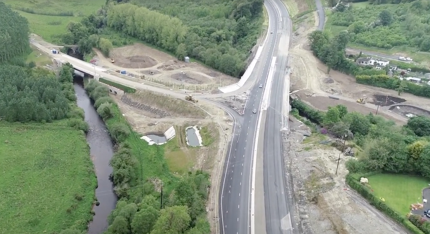
Pic 4: View west from Gortilea Road overbridge
(just east of Claudy) on 12 April 2022, showing
the road essentially completed save for the
central crash barrier. [Wesley Johnston]
Pic 5: View west along the Dungiven Bypass on 12
April 2022 from Magheramore Road overbridge with
the Owenrigh river bridge just ahead. The road
was open when this was taken, but without a
central crash barrier. Note the very lengthy
barrier in the foreground designed to prevent
vehicles entering the river. The barrier
terminus at the bottom right acts like a kind of
'carriage', which gets pushed along the barrier
in the event of a collision, reducing the
deceleration. [Wesley Johnston]
Pic 6: View east along the Dungiven Bypass from
Magheramore Road bridge on 12 April 2022. Again,
the road is open here. Note the thousands of
saplings on the right. In a few years this
cutting will look very different. [Wesley
Johnston]
Pic 7: View of Magherabuoy Roundabout at
Dungiven on 12 April 2022, with the town behind
and to the right of the camera, the new A6 to
the right distance and the current A6 towards
Glenshane on the top left. The roundabout is now
operating as a true roundabout with traffic
circulating right around it. [Wesley Johnston]
23 Mar 2022: The biggest change on the
scheme in the past month was the opening of the
Lismacarol roundabout in Drumahoe (the scheme's
western terminus) on 4 March, and the diversion
of traffic onto the new A6 from there towards
Dungiven. This means traffic is now using the
new road from Lismacarol roundabout, over
Liberty Glen Bridge and all the way to the end
of the "offline" stretch at Tamnaherin Road. If
you are not in the area, you can "drive" the
route from Drumahoe to Burntollet thanks to this
great dashcam footage shot by Diarmaid
Macfheargail. Currently the road is open with
one lane each way, switching carriageways
periodically as the works require it, and with a
40mph speed limit. FP McCann have written an
interesting blog
piece about the deck pour they did at
Liberty Glen bridge last month, highlighting the
logistical challenges of a pour that has to be
continuous yet needs 104 lorry loads of
concrete! Another big change seems to be coming
at some point this weekend with the rumoured
opening of the Dungiven Bypass (at least for
westbound traffic), presumably with the same
lane and speed restrictions. It's not certain
how much of the new road will open, or whether
eastbound traffic will also use the new road,
but based on the road markings we are seeing the
most likely section is the stretch from the
eastern terminus at Magherabuoy Roundabout as
far as Feeny Road junction where traffic would
then move back onto the existing A6 along Feeny
Road. This may explain the construction of a
mini roundabout on the existing A6 at the Feeny
Road T-junction this week. Then from mid-April
access into Dungiven from Magherabuoy Roundabout
will be closed off, presumably to allow the
completion of the roundabout. From this point,
and for a few weeks, A6 traffic will only be
able to access the town from the western side.
Progress is very advanced along all the scheme,
with the final course of blacktop in place along
the majority of the scheme, and lane markings in
place on long stretches. Much still needs to be
done on the central crash barrier, which is
mostly unbuilt. However, these works could take
place even with live traffic on the road,
provided there were lane and speed restricitons.
The whole road is still due to open sometime
during the spring (so I'm going to say, by the
end of May) with the completion of all works by
the summer. There is also a marvellous
aerial movie of the eastern stretch of the
route from Killunaught Road to Dungiven, by the
prolific Benbradagh. The photos below are, as
usual, arranged from west to east. Thanks again
to everyone who takes pictures and movies and
makes them freely available to the rest of us.
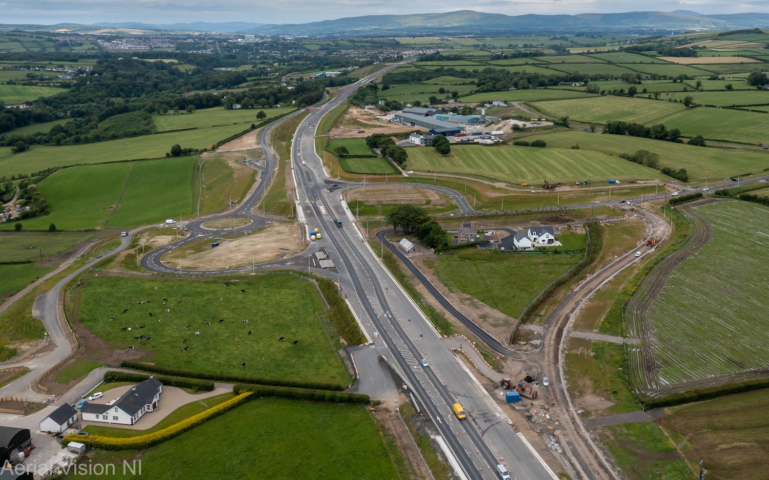
Pic 1: Work underway on the foundations of the
Ervey Road Link at Tamnaherin Road on 22 Mar
2022. The road on the right is Tamnaherin Road,
with the bridge carrying the new A6 in the
distance. The new A6 subsumes the existing road
from here east (to the left here), so the Ervey
Road Link is being built parallel to the new
road to retain local access. [Polyanne]
Pic 2: View looking west across Burntollet
Bridge on 22 Mar 2022. On the left the deck of
the southern half of the new bridge seems to be
complete and a layer of waterproofing is being
added. I would expect to see the road being
constructed over this half of the bridge within
the next few weeks. Up ahead you can see that
all traffic is now using the eastbound
carriageway, though the lane markings pointing
traffic to turn to the left at the switchover
point are still in place which is rather
confusing, especially in the dark. [Arthur Ming]
Pic 3: The DFI Minister Nichola Mallon has been
understandably keen to visit various sites prior
to the (presumed) end of her tenure after the
upcoming election. Here she is seen at
Ballyhanedin Road bridge east of Claudy with
Juan Rodriguez-Altonaga Martinez (Contracts
Manager) and Michael Troughton (Project
Director) representing the Contractor Joint
Venture of Sacyr, Wills Bros Ltd and Somague. 2
Mar 2022. This view shows the road surface
complete, lane markings in place with the
central crash barrier apparently all that is
needed. However this stretch is not yet open to
traffic, with all traffic currently using the
old road, visible on the right. [DFI]
Pic 4: View west from Munreery Road bridge on 20
Mar 2022, showing a stretch which is a little
less advanced with lane markings ending ahead.
Although the central crash barrier has yet to be
built, safety barriers on the left and right are
in place, as are a lot of new trees. [Paul
McCloskey]
Pic 5: View west from Killunaught Road bridge on
20 Mar 2022, with Ovil Hill cutting ahead. At
this location the westbound carriageway has been
completed. It is possible that this part of the
road will be opened to traffic in the next month
or so, with all traffic using one of the two
carriageways. However the contractor has not
said anything about this possibility or the
timing so this is my conjecture. [Paul
McCloskey]
Pic 6: Aerial view of the A6 west of Feeny Road
on 21 Mar 2022 showing what looks like three
brand-new distance signs erected in a field
beside the new road. Presumably they are being
stored here as they are not visible from the
road at this location. The new signage will
finally reveal the B-number that the old
downgraded A6 is going to get! [Benbradagh]
Pic 7: Aerial view of the new Feeny Road
junction on 21 Mar 2022, looking east. Work is
underway here in earnest, possibly in
preparation for the expected opening of the
Dungiven Bypass stretch as far as here this
coming weekend (by 27 March). If traffic ends up
leaving the new road here, some more work would
need done to the sliproads prior to the opening.
[Benbradagh]
Pic 8: The completed River Roe bridge near
Dungiven seen on 21 Mar 2022 with all but the
central barrier in place. Under the bridge you
can see two accommodation laneways under
construction, one on each bank. The bridge also
seems to be sporting some kind of brown fencing
on the south side which looks permanent. It's
not clear to me what this is – perhaps an
acoustic barrier or some kind of wind breaker?
[Benbradagh]
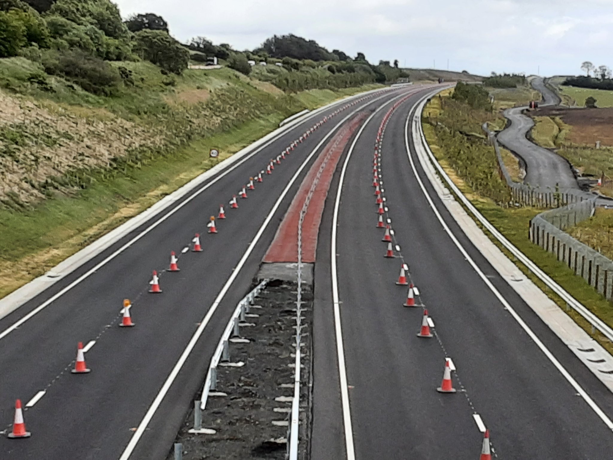
Pic 9: View west along the Dungiven Bypass on 17
Mar 2022 from Priory Lane overbridge, showing
the road completed other than the central crash
barrier. Traffic is likely to be on this road
within the next week. [Paul McCloskey]
Pic 10: Aerial view of the perpetual building
site which is Magherabuoy Roundabout, Dungiven
on 21 Mar 2022, with the new road heading off to
the upper left. A lot of work always seems to be
going on here, but not an awful lot seems to
change from week to week. This suggests that a
lot of relatively small-scale, but
time-consuming works are being required here. In
mid April the access into Dungiven (upper right)
will be temporarily closed to facilitate the
completion of the roundabout. [Benbradagh]
Older updates can be found in the archive.
Background to Scheme
The Regional Strategic Transport Plan,
published in 2004, explained why it was thought
that further dualling of the 40km of the A6
beyond Castledawson could not go ahead before
2015:
B3.3.41 When the funding envisaged by RTS
is extended to 2015, there would be £529.4m
available for Strategic Road Improvements in
the RSTN TP period. However, this is fully
taken up by the high priority SRIs proposed
across the RSTN, including the £171.9m
envisaged for SRI schemes on routes serving
the North-West. Therefore, within the
funding assumptions of this Plan, it would
not be realistic to expect that further
dualling of the A6 could be undertaken
within the Plan period (apart from the
Randalstown to Castledawson section already
proposed). B3.3.42 However, further dualling
of the A6 will be required outside the RSTN
Plan period, in order to develop and upgrade
the link between Northern Ireland’s two
largest cities by 2025. Therefore, during
the Plan period it will be necessary to plan
the route of a dual carriageway between
Castledawson and Derry, by undertaking a
route selection study. This will inform the
decision regarding the acquisition of land
and route protection lines, e.g. for the
Dungiven Bypass.
This lack of funding
was rectified suddenly and somewhat unexpectedly
in December 2005 by the announcement of
sufficient funding for the Dungiven to Derry
section. Prophetically, the RSTN did comment
that "It is... likely that future dualling
in the 2015 to 2025 period will commence at
the Londonderry end of the route." This
is because traffic levels are highest at the
Toome and Derry ends of the A6, and lowest at
the Glenshane Pass and because of the difficult
terrain crossing the Sperrins. Traffic figures
collected in 2004 showed the following daily
traffic at various points on the A6:
- Toome - 21160 vehicles
- Castledawson - 14880 vehicles
- Ranaghan (Glenshane Pass) - 10470 vehicles
- Western edge of Dungiven - 13820 vehicles
- Altnagelvin, Londonderry - 12930 vehicles
- Rossdowney, Londonderry - 26930 vehicles
Thanks to Diarmaid Elder for the traffic
information on this page
|


