|
The main road to Bangor is 4-lanes over its entire length, and much of this is dual-carriageway. At the Belfast end the A2 is dual-carriageway as far as Cultra. At this point it reverts to 4-lane single-carriageway as far as Ballyrobert, where it become dual once again.
This last section is high-quality with few junctions and accesses and one grade-separated junction where it meets the Bangor Ring Road. The section as far as Rathgael Road (now within Bangor town limits, then in the country) was definitely completed by 1968 as it is shown on a map of that date. However, the remaining section which bypasses what is now the Old Belfast Road was not built until sometime between 1968 and 1976. It was probably built as part of the Bangor Ring Road scheme, although I am too young to remember to know if this is true or not.
Photos
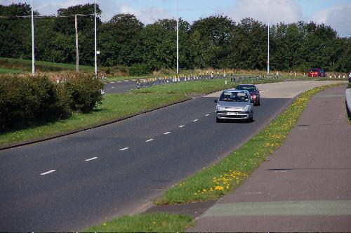
The view west along the A2 at Ballygilbert, between Bangor and Holywood, in August 2006. [Photo by Aubrey Dale]
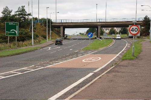
The dual-carriageway ends here, at the Bangor Ring Road. This view in August 2006 is looking from Bangor towards Belfast along the dual-carriageway. The ring road crosses on the bridge. This is the only grade-separated junction in Bangor or indeed on this part of the A2. [Photo by Aubrey Dale]
|
