Where |
The main road towards Bangor out of Belfast. |
Total Length |
9.0km / 5.6 miles |
Opened |
Sydenham Bypass - 23 Nov 1959.
Holywood Bypass - 1972. |
Cost |
? |
Photos |
See below. |
See Also |
Area map
A2 Sydenham Bypass widening scheme
|
The main road to Bangor is 4-lanes over its entire length, and much of this is dual-carriageway. At the Belfast end the A2 starts close to the city centre at the M3 motorway before heading north-east bypassing the Sydenham area of east Belfast. After meeting the A55 Outer Ring at Knocknagoney, the dual-carriageway continues past Holywood before reverting to single-carriageway at Cultra. There is a second length of dual-carriageway starting at Ballyrobert and going all the way to Bangor.
Although it is such an important route, the A2 has only one grade-separated junction (at Holywood Exchange), the rest being controlled by traffic lights. This causes delays at peak times, although not chronic problems. The Sydenham Bypass is Belfast's oldest dual-carriageway
having been begun in 1938 and opened in 1959. It is also very busy, carrying in excess of 50,000 vehicles per day. The Knocknagoney junction used to be a roundabout but was altered to improve flow in the early 1990s (?).
At Holywood, a bypass was constructed because the population of Bangor was exploding and Holywood could not cope with the traffic passing theough it. The road passes on the sea side of the town centre and the railway itself was shifted slightly sea-wards to make way for the bypass. Here the A2 squeezes through a very narrow gap between a graveyard and the railway line, and there are no less than 3 traffic light junctions with Holywood town centre, perhaps a concession to a town which faced much demolition to make way for the road.
With thanks to Patrick Shiels for helping date the Holywood Bypass.
Photos
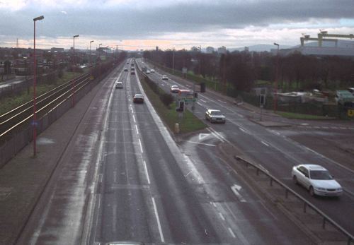
Looking south-west along the Sydenham Bypass part of the A2. The road becomes the M3 motorway beyond the next corner. The crash barrier in the centre and fence on the left have both been upgraded since this picture was taken in 2000. [Photo by Wesley Johnston]
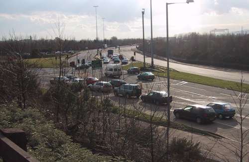
The A2 Sydenham Bypass (ahead) meets the A55 Outer Ring here (to the left) at Knocknagoney, sometimes called Tillysburn. The A2 continues to the right
as the Holywood Bypass. [Photo by Wesley Johnston]
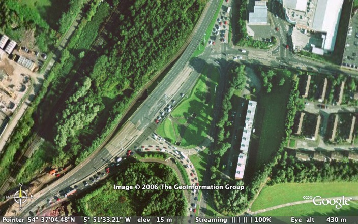
The Knocknagoney junction on the A2 from the air. The A2 Sydenham Bypass is to the bottom left with the A2 Holywood Bypass to the top. The fact that this junction was once a roundabout is very obvious from the central circular area. [Image from Google Earth]
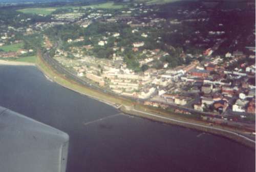
This 1993 aerial photo (!) shows Holywood and the A2 Holywood Bypass skirting close to the sea. [Photo by Wesley Johnston] |
