|
|
Status
|
Construction scheme
(current) |
|
Where
|
To
construct a link road connecting the
Movilla Road to Donaghadee Road, and on
to the A21 Bangor Road, round the
north-east of Newtownards |
|
Total
Length
|
1.7 km / 1.1 miles
for Movilla Road to Donaghadee Road
0.9 km / 0.6 miles for Donaghadee Road
to Bangor Road
|
|
Dates
|
2007 - Included in
Sub-Regional Transport Plan
March 2009 - Included in adopted Ards
and Down Area Plan
15 Feb 2016 - Planning granted for Phase
1 at the Movilla Road end
June/July 2016 - Work began on the
Movilla Road to Donaghadee Road section
Whole road could be completed within ten
years - as of May 2016
Oct 2022 - Work began on the Bangor Road
to Donaghadee Road section
Apr 2024 - About 850 metres now open at
north end
|
|
Cost
|
Unknown - to be
funded by private developers
|
|
See
Also
|
General
area map - Google Maps
|
The Ards and Down Area Plan 2015, which was
adopted in 2009, foresees significant growth in
housing in Newtownards. The land is divided into
two "Phases". Phase 1 lands must be fully
developed before Phase 2 lands are released. The
bulk of the proposed housing land lies to the
east of the town (Phase 1) and the north-east of
the town (Phase 2). The largest area of land in
Phase 2 has the designation NS 20 and NS21 and
these are shown on the map below. A condition of
planning is that a distributor road must be
built traversing the site, connecting Movilla
Road to Donaghadee Road, and then on towards the
Bangor Road. The route of this road will be up
to the developer of the lands in question,
but by way of illustration I have included below
an example of a route that such a road might
take. But bear in mind that this is pure
conjecture. The NS20 and NS21 housing lands are
shown in red, while a possible route of
the road is shown as a blue line where it
traverses the NS20 land. However, the route
through the NS21 lands is better known, and is
shown as a red line. It is known because this
red line is part of a plan for a
housing development by Dunlop
Developments, for which outline
planning permission was granted on 20
December 2012.
View Movilla
Road to Donaghadee Road Link, Newtownards
in a larger map
This scheme ties in to two other schemes that
will, ultimately, lead to the creation of a
partial "ring" road round the east of
Newtownards from the A20 Portaferry Road in the
south to the A21 Bangor Road dual-carriageway in
the north. The two further components that would
be needed to make this a reality are:
Updates
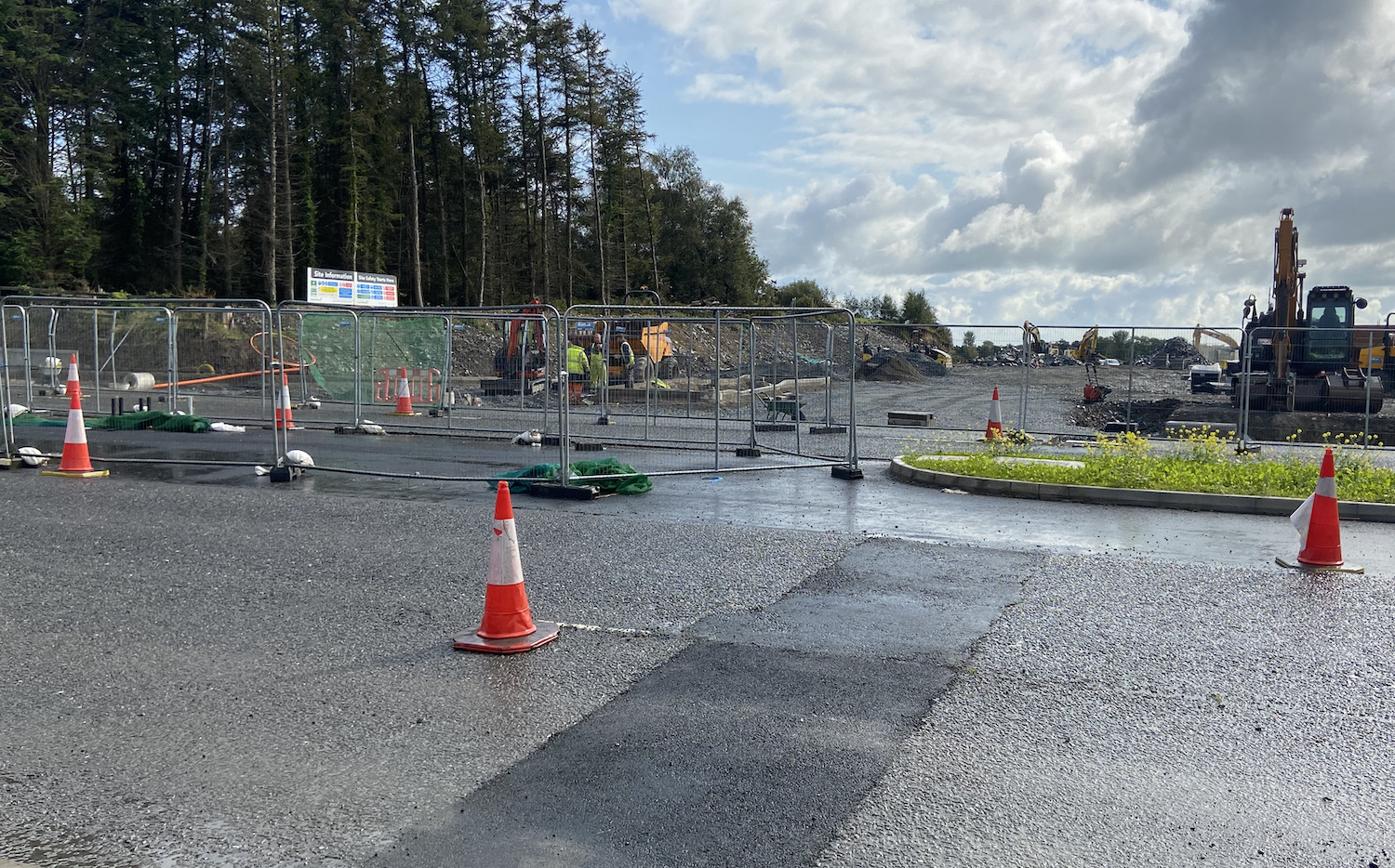
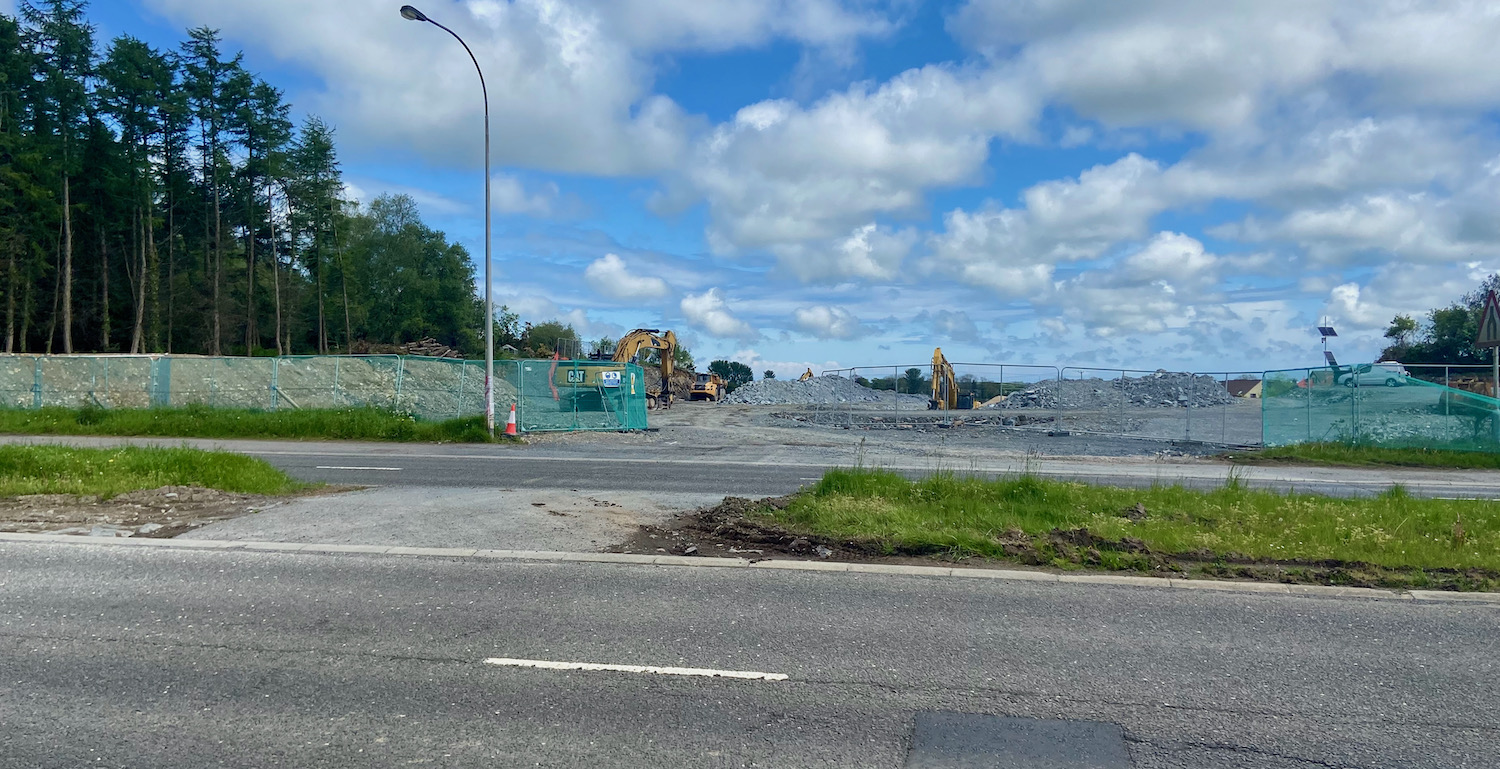
22 Oct 2025: I recently spotted a
planning application that has gone in to provide
the next part of this road on the south side of
Donaghadee Road (between the two sections of
road shown in the image in the previous update
below). The planning application, ref
LA06/2024/1095/F, was received in 2024 and
includes a roundabout on the Donaghadee Road, as
well as a few hundred metres of the link road
itself. The application can be seen here.
A map of what is proposed is here
(though this link might break).
30 Jun 2025: This developer-led scheme
has now been under construction for nine years.
I thought it was worth checking in with the
latest Google Earth imagery to see the progress.
The image below was taken on 23 April 2025, so
shows things as they pretty much are. North is
to the top-right. I have circled the two ends of
the scheme in red. At the left end is the A21
Bangor Road, while the right-hand side of the
road terminates on the Movilla Road. The
Donaghadee Road is just left of centre, with
neither road yet meeting it. Almost 50% of the
road is now in place. So, at this rate, we'll
see the whole road completed around 2034!
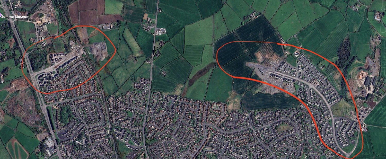
Progress on the Movilla Road to Donaghadee Road
to Bangor Road Link as of April 2025 (Google
Earth).
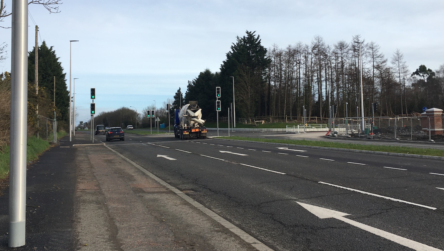
17 Apr 2024: The southern end of this
road (Rivenwood) continues to take shape, with
about 850 metres now built at that end, almost
exactly half its distance to Donaghadee Road.
The image below was taken in February 2024 and
shows the current terminus of the road. With
thanks to Keith Nash who monitors the area
nicely. A reminder that the road is being built
in separate sections, with the other one
advancing east from the Bangor Road at Beverly
Garden Village. We're still far from the whole
road being completed, but we're perhaps 40% of
the way there.
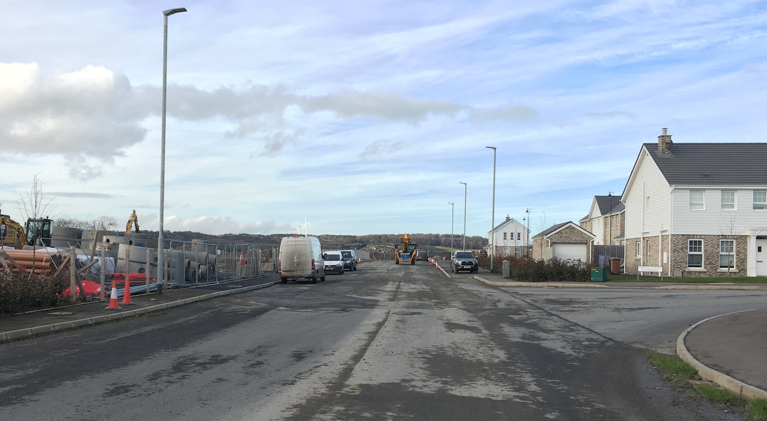
Current terminus of Rivenwood Boulevard as seen
on 21 February 2024 [Keith Nash]
9 Feb 2024: This update is to
share a few photos of the new junction on the
A21 Bangor Road at Beverley Garden Village, what
will eventually be the northern terminus of this
link road. The signalised junction opened about
six weeks ago and so it far seems to have gone
smoothly. With thanks to Keith Nash for sharing
these.
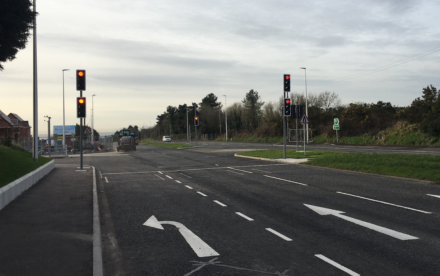
View south with Bangor behind the camera and
Newtownards ahead on 7 Feb 2024. The new link
road is on the left, with traffic signals in
place. A turn-left filter lane has been added.
[Keith Nash]
View north with Bangor ahead and Newtownards
behind the camera on 7 Feb 2024. The new
link road is on the right, with traffic signals
in place. A turn-right lane has been added in
the central reservation. Same view as the photo
on 30 Aug 2023 below. [Keith Nash]
View along the first section of the new road
from the A21 junction on 7 Feb 2024. No lanes
have been painted yet. 36 houses are being built
here in phase 1 with 12 on sale. [Keith Nash]
View west from the new road towards the new
junction with the A21 on 7 Feb 2024. The traffic
island ahead is the same one shown in the
previous image. [Keith Nash] 4 Jan 2024: A very brief update to say
that the traffic signals on the new junction on
the A21 Bangor Road came into operation on
Wednesday, 20 December 2023. This will allow
safe access to the new housing at that end of
the scheme, to be known as Beverly Garden
Village. I haven't got photos yet but will aim
to. With thanks to K Nash.
30 Aug 2023: Work on the new junction on
the A21 Bangor Road has progressed over the
summer, with traffic currently coned down to one
lane with a 40 speed limit. The photos below
were taken today and show what looks very much
like a signalised junction being built. Work on
the new road itself hasn't advanced much, but as
new houses are now going up close to the
junction, it's likely that the first short
section of the road will be needed soon.
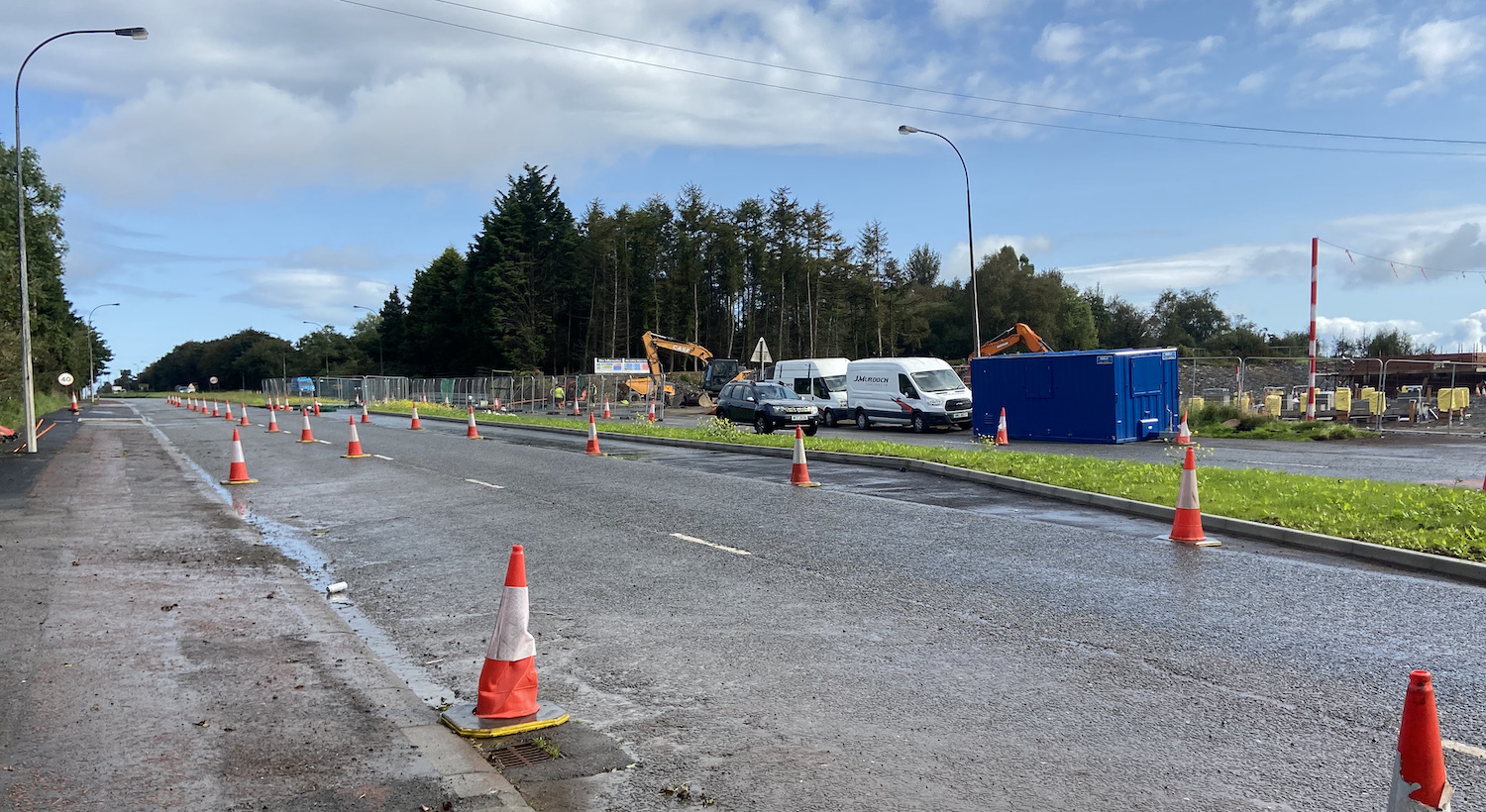
Pic 1: View north along the A21, with the future
road heading to the right where the diggers are.
Part of the central reservation has been
reconstructed to form a right-turn lane. Note on
the extreme left a new build-out of kerbs onto
the hard shoulder. This would be quite a
dangerous setup without traffic signals,
implying a traffic signal column will be placed
there. 30 Aug 2023. [Wesley Johnston]
Pic 2: View east across the A21 along the line
of the new road, 30 Aug 2023. The new right-turn
lane is visible in the foreground. On the new
road itself there is a new traffic island which
will likely separate the two directions of
traffic, or possibly separate a left-turn filter
lane for traffic heading south. The road base of
the new road is taking shape, but only for about
100 metres at this point in time. Some new
houses are being built off frame to the right of
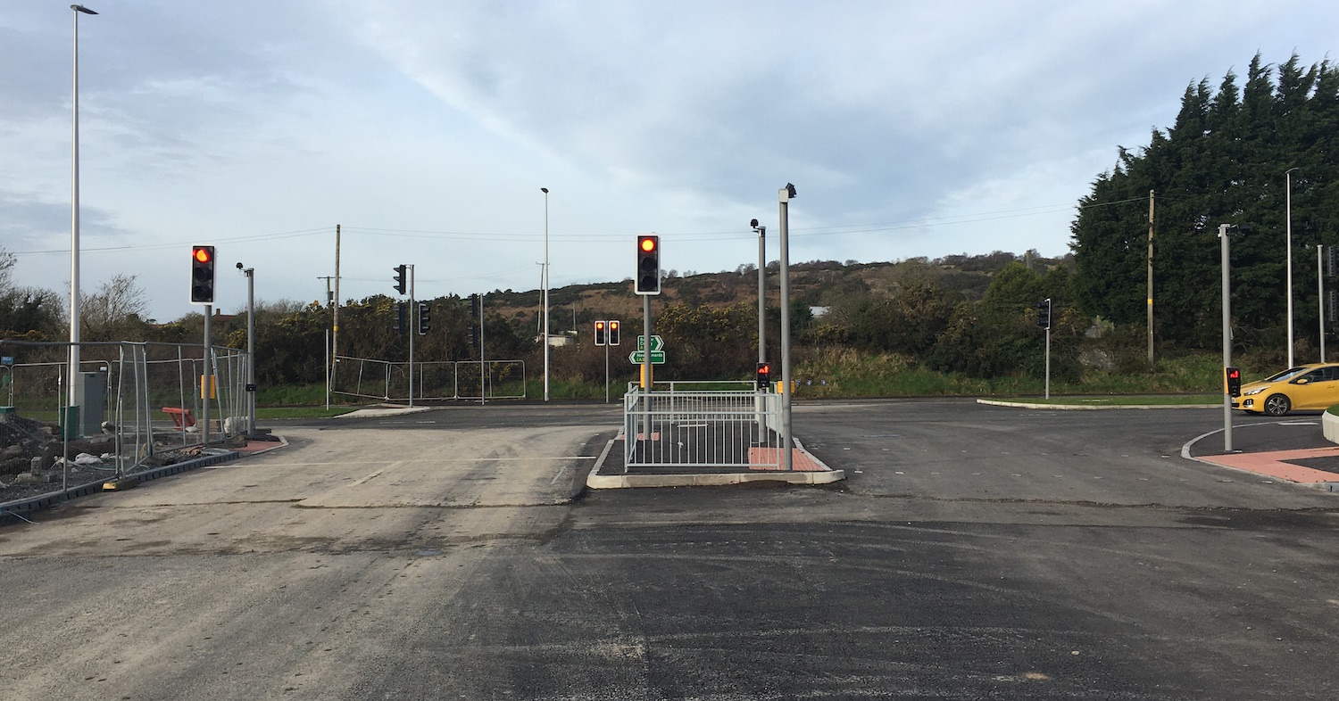
the shot. [Wesley Johnston] 17 May 2023: Work has been ongoing over
the past six months on the Donaghadee Road to
Bangor Road section of the new road, starting at
the Bangor Road end. After the site was cleared,
heaving excavation work got underway to lower
the height of the whole site to the level of
Bangor Road, as shown in the photograph below.
The excavation has been taken right down into
the underlying rock which is a major
undertaking. Works are due to get underway over
the summer on the new junction with the A21
Bangor Road, which I suspect is to be
signalised. The general area plan can be seen in
the previous update below.
View across the A21 Bangor Road on 11 May 2023,
showing clearance works for the western end of
the new road. The whole site has been lowered
down into the bed rock. The A21 here is a
dual-carriageway, and the new junction may
feature traffic signals. [Wesley Johnston]
14 Oct 2022: Six years after work began
on the southern part of this new road (Movilla
Road to Donaghadee Road) work finally seems to
be getting underway on the second section of
this road (Donaghadee Road to Bangor Road). As
this scheme is developer-led (i.e. developers
build and pay for it) this new phase is being
built by the developers of the Beverley Garden
Village site, a plan of which is included below.
So far the works have been site clearance on the
site generally, but as the new road is essential
to the plan it will need to be provided along
with the houses. With thanks to Darren Mackey
for letting me know about this.
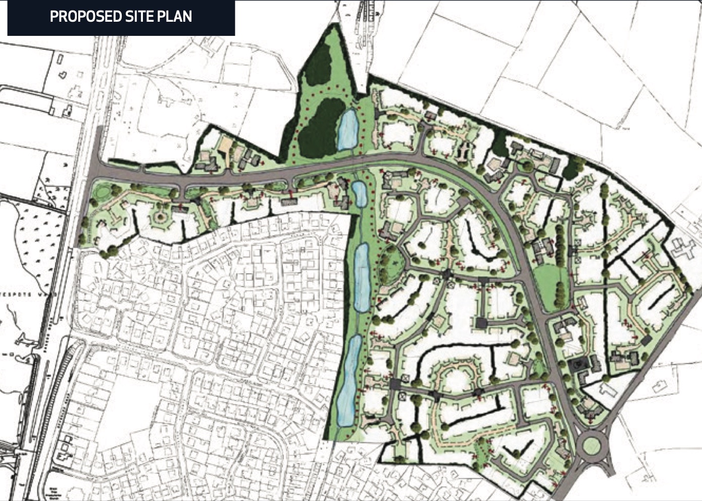
Proposed layout of Beverley Garden Village
showing the section of the new road from Bangor
Road to Doanghadee Road, where a roundabout
seems to be anticipated. It's not clear how the
new road will link to the Bangor
dual-carriageway but traffic signals are
plausible if the road generates a lot of
traffic. [From scheme developer]
2 Mar 2022: The new road continues its
slow advance as the developer adds more houses.
About 800 metres of the road between Movilla
Road and Donaghadee Road is now either completed
or underway, all at the Movilla Road end. The
road is appearing on Google Maps named Rivenwood
Boulevard/Rivenwood Road, but I am not sure if
this the "official" name which has to be agreed
by Ards & North Down Borough Council. Work
began 6 years ago, at which point it was
suggested that the whole road could be open
within 10 years. This seems very unlikely now,
unless the pace of development increases
rapidly. Certainly the Covid pandemic will have
delayed matters a bit. The developer is
currently working on Phase 2, and after this is
completed will extend the road further to the
north-west as part of phase 3. However phase 4
will be at the Donaghadee Road end, so that will
require part of the other end of the new road to
be built. Phase 5 will close the gap between
phases 3 and 4 and hence connect the two ends of
the new road together. If the current rate of
construction is maintained, then this wouuld be
sometime around 2028. The image below is the
most recent Google Earth image, showing the road
and associated (Phase 2) housing as it was in
spring 2021.
 Aerial shot of the new link road
taken on 24 April 2021 and showing progress at
that point. The yellow line at the bottom is
Movilla Road. Donaghadee is out of shot to the
upper left. [Google Earth]
30 Dec 2020: In the four years since the
last update the developer has worked away and a
number of houses in the Rivenwood development
are now occupied. The arterial route through the
site (Movilla Road to Donaghadee Road and Bangor
Road Link) is now partly build and has
apparently been named Rivenwood Boulevard - it's
not clear to me whether this is the name
approved by Ards and North Down Council, or just
a "working" name. In any case, 400 metres of the
road was open and in use by the time the image
below was taken (during lockdown in April 2020),
and an additional 300 metres was under
construction. This represents about 40% of the
stretch from Movilla Road to Donaghadee Road. At
this rate, I'd expect it to take another five
years or so to complete this stretch, which is
being built as needed as construction
progresses. No work has yet taken place on the
Donaghadee Road to Bangor Road section.
Aerial shot of the new link road taken on 25
April 2020 and showing progress at that point.
The yellow line at the bottom is Movilla Road.
Donaghadee is out of shot to the upper left.
[Google Earth]
19 Jan 2017: After my appeal for images
in the previous update on 1 January I am
grateful to two people for stepping up to the
mark! Firstly, a
short video by Carson Tse taken driving
east on Movilla Road past the start of the new
road on 9 January. This video shows us two
things, firstly that the roundabout shown in the
planning documents at the start of the new road
has NOT been built. Instead the junction has
been set up as a signalised junction. And
secondly, that it has involved widening a
lengthy stretch of Movilla Road (perhaps 100
metres) to provide a right-turn lane into the
new road. So thank you Carson. And secondly to
Paul McIlfatrick who explored the area on foot
on 9 January. I include four of his images
below. (There is a map at the bottom of this
page that may help you get your bearings.) Thank
you to Paul for taking and sharing these images.
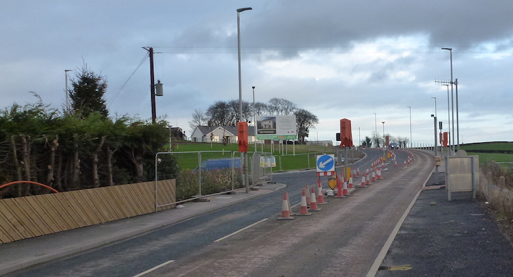
Pic 1: View east along Movilla Road on 9 January
2017, with the junction at the southern end of
the new road now completed but with the lights
currently deactivated. Original plans showed a
roundabout here. [Paul McIlfatrick]
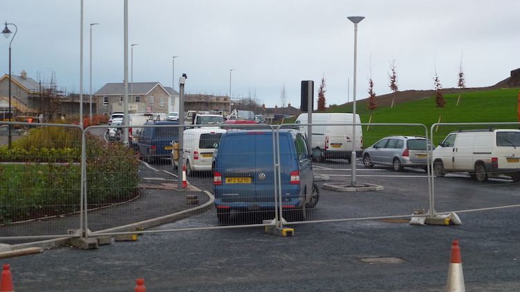
Pic 2: Looking north along the first section of
the new road on 9 January 2017. The developer is
calling the development "Rivenwood", but the
road hasn't been formally named yet. [Paul
McIlfatrick]
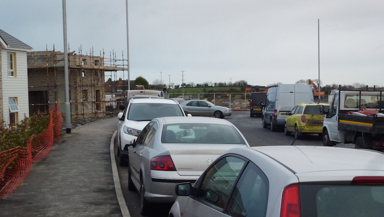
Pic 3: Moving a couple of hundred metres north
along the new road towards the point where
the completed stretch ends, on 9 January 2017.
[Paul McIlfatrick]
Pic 4: The final hundred metres or so of the
first phase of the new road under construction
on 9 January 2017. In total about 400 metres of
the 2.6km road is being built as part of this
phase of work. The rest will follow over a
period of years. [Paul McIlfatrick]
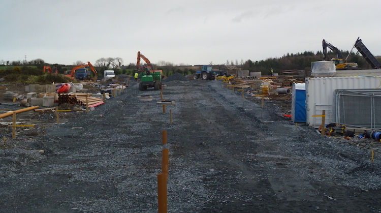
1 Jan 2017: I have not been in the area
of this road scheme since the last update in
May. At that point it was said that work would
begin on the southern stretch in "summer" 2016.
This seems to have happened, because Google have
now put up imagery that was taken in August 2016
and this clearly shows work underway. See
picture below. Given that this was taken five
months ago, work has surely progressed since
then. So if anyone is in the area and has
pictures of the scheme as it looks now please do
get in touch! If not, I will see if I can get a
trip out at some point in the coming weeks.
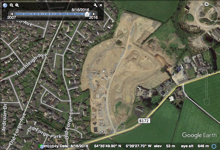
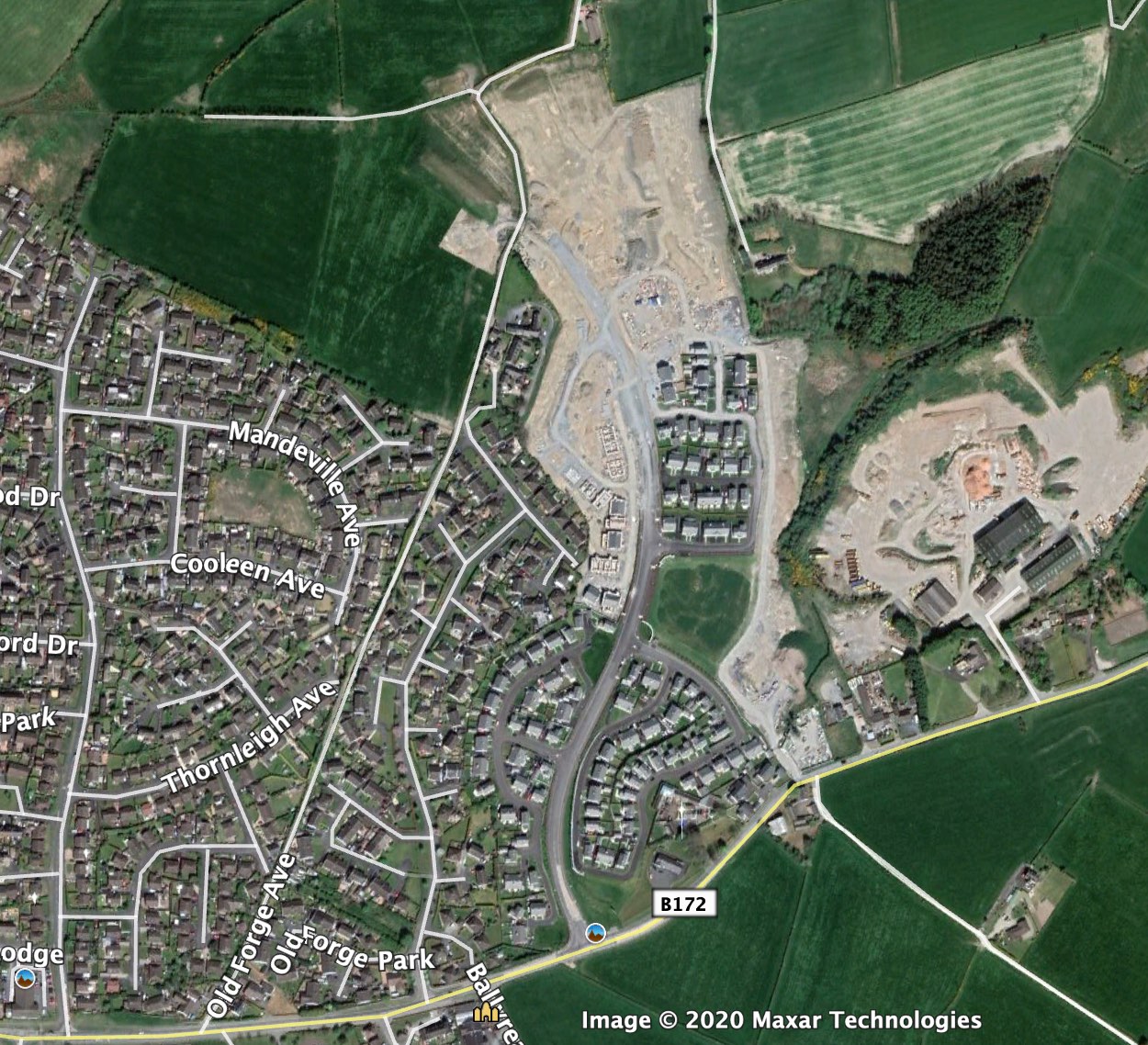
Imagery of work underway on the southern part of
the road on 16 August 2016. The road labelled
B172 is Movilla Road. Compare to the map in the
previous update below and you can clearly see
the line of the road. [Google Earth].
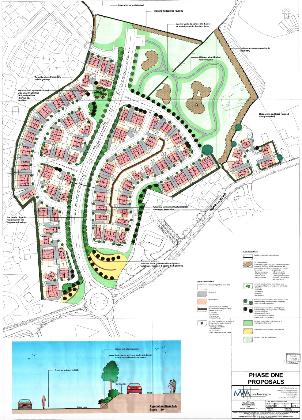
2 May 2016: According to a news
article on the BBC, Fraser Houses, who are
now developing these lands, has announced that
construction on new houses is to commence this
summer, with the first homes completed before
the end of 2016. The work is to take place at
the Movilla Road end of the N20 site (the bottom
right of the map above) in a development called
"Rivenwood". Fraser Houses estimate it will take
ten years to develop the site fully. This news
is relevant in that provision of the "Movilla
Road to Donaghadee Road" link is a condition of
planning for these homes. However, it is
important to stress that the road is not going
to be built in its entirety at this stage.
According to the most recent planning
permission (application X/2014/0370/F)
this is phase 1 and only the first part of the
distributor road will be provided at this stage.
Because the Planning Portal no longer (and very
unhelpfully) allows me to link directly to
documents relevant to the public, I have instead
had to reproduce the map below. This now
clarifies what the layout of the southern part
of the link road will be, which includes a new
roundabout on Movilla Road. Work commencing on
the site does raise the hope that this road will
be built sometime within the next ten years.
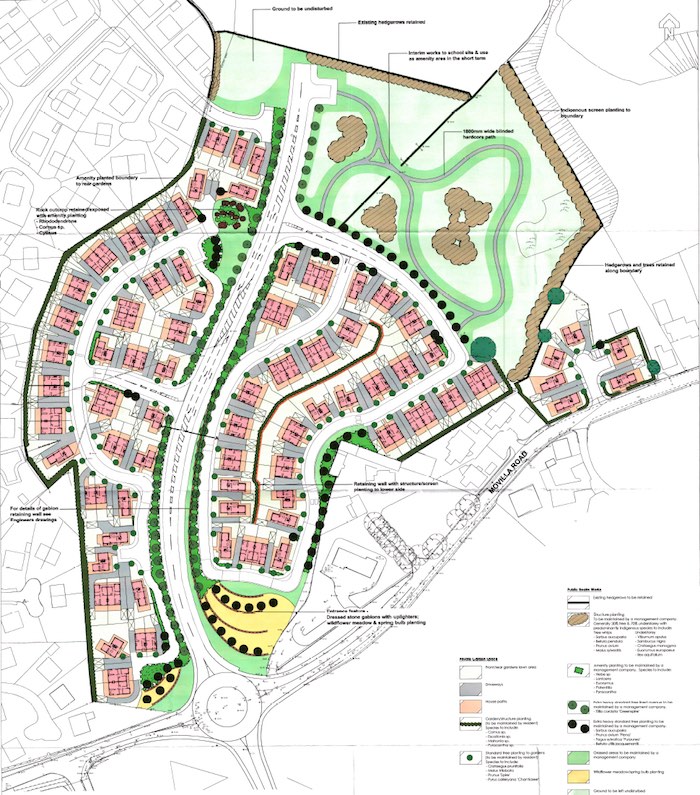
Map showing Phase 1 of the attractive Rivendale
development and the layout of the southern part
of the new link road. Movilla Road runs from
bottom left to centre right. Click image for a
larger version. [Map by the developer]
|