Where |
The main arterial route through Craigavon, between Portadown and Lurgan. |
Total Length |
3.7 km / 2.3 miles |
Opened |
c 1966 |
Cost |
? |
Photos |
See below. |
See Also |
General area map
M12 on this site.
|
Grand plans existed in the 1960s to build a new "city for the west" in Northern Ireland to try to halt the increasing polarity of development in Belfast. Work began in 1966 on a site between the neighbouring towns of Portadown and Lurgan in order to fill in the gap, and hence create a large urban area to be known as Craigavon. Due to optimistic population estimates, and a difficulty in attracting or keeping new residents, only 50% of the planned housing was built, and a large percentage of this was eventually demolished in the 1980s. Thankfully the towns of Portadown and Lurgan have retained their identity and are still attractive towns, and the Craigavon area has enjoyed something of a renaissance with several major private housing developments since 2000.
One stretch of the road system in Craigavon is dual-carriageway: the A3/A27 which runs through the heart of the new developments at Craigavon, and which is famous for having seven roundabouts on it as can be seen on the map link above. The road runs from "roundabout 1" at the Lurgan end, down to the large central "roundabout 4" near the Rushmere Shopping Centre. This stretch is called Lake Road. The rest of the dual-carriageway, from roundabout 4 to roundabout 7, is known as Mandeville Road. Roundabout 4 is so large that it seems clear that it was built with future grade separation in mind. This is now very unlikely to happen. Between roundabouts 1 and 2, the two carriageways diverge by over 100 metres. This is because the southbound carriageway re-uses a pre-existing road, whereas the northbound carriageway is a new-build on a more direct line.
Craigavon Urban Motorway
The new city plans also included an interesting "urban motorway" scheme, access to which would have been via the M12 motorway. Only part of the urban motorway was ever built, mostly as the A3 Northway with only 2 lanes and land set aside for later widening. Even today, this overgrown ghost carriageway can still be seen. The road system in this area seems awkward and half finished, mainly because it is. Click the map link above to see what I mean. Contrary to a popular misconception, this road through Craigavon is not part of the Northway.
Photograph
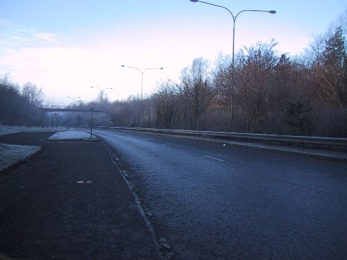
The A27 Lake Road seen here on a cold February day in 2006. This view is looking along the southbound carriageway between roundabouts 2 and 3 in the Legahory area of Craigavon. [Photo by Wesley Johnston]
|
