This is a sub-page of the main A26-M2 link Ballymena page containing archived progress updates. Please click to see that page for more recent updates.
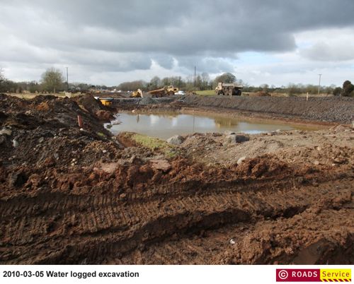
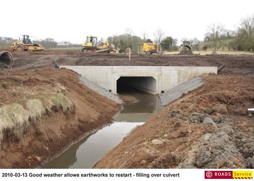
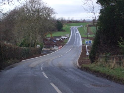
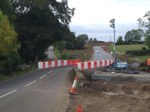
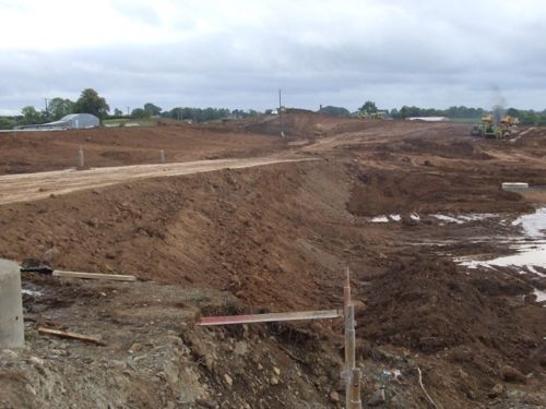
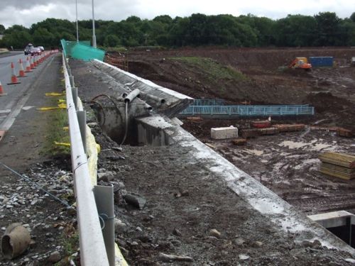
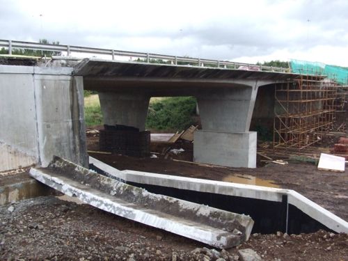
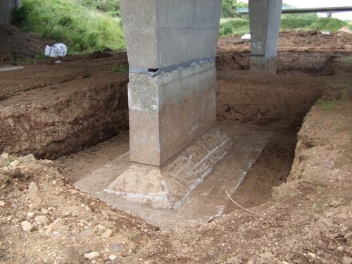
27 Mar 2010: As stated in the previous update, there have been delays to the project (pic 1). Roads Service say "Excavation and resolution of the rare Neolithic ring fort meant that excavation of the cutting and construction of embankments started later than anticipated. About 80% of the cutting was excavated before the weather deteriorated. Improving early spring 2010 weather has allowed excavation of the cutting and embankment construction to restart." Work has now begun on the future dual-carriageway (pics 2+3), with excavation resumed. There are now lane closures on the A26 Ballee Road East to allow it to be realigned onto its new route (pics 4+5). Pictures 1 and 2 are ©Roads Service and are taken from a much larger set which are available on their web site.
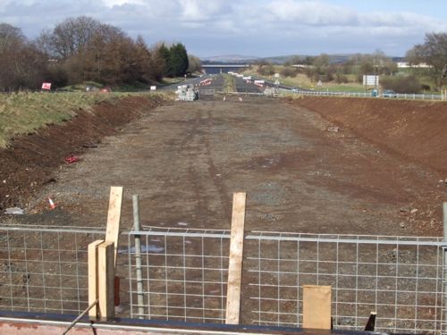
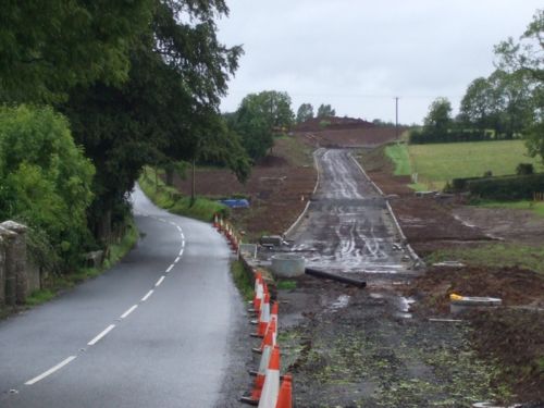
Pic 3: The foundation of the new dual-carriageway looking
towards the M2 on 27 March 2010. [Noel O'Rawe]
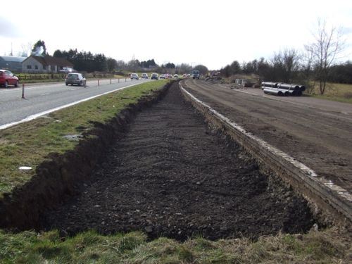
Pic 4: Ballee Road East now reduced to one lane wach way while the
road is realigned onto its new route. 27 March 2010. [Noel O'Rawe]
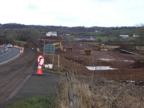
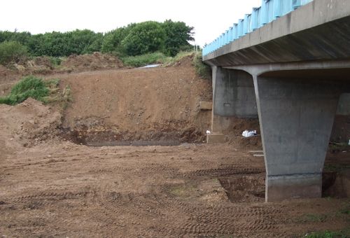
Pic 5: View east from Ballee Road East (left) with the future route
seen straight ahead (right). 27 March 2010. [Noel O'Rawe]
1 Mar 2010: In one of these Assembly Written Answers, the Minister has confirmed that a combination of archaeological discoveries and a particularly bad winter has set back the scheme by around two months. It is now due to open "in June 2010". The Minister said "Roads Service expects that once the weather improves, the contractor will be able to complete the earthworks and construction will continue", implying that some work had to actually stop.
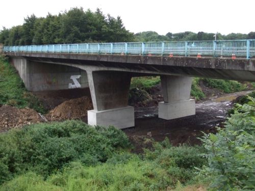
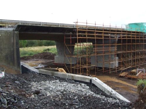
16 Feb 2010: Roads Service have put up some pictures taken in January on the photogallery of their web site. I reproduce two below. The first shows the view along the parapet of the south bridge, which is now completed. Similar works are underway, but at a less advanced stage, at the north bridge. The second shot shows that work is now underway north of the roundabout to clear the land that will allow the M2 Ballymena Bypass to flow directly underneath the two bridges. This area of road was actually built and surfaced in 1969 when the Bypass was built, but will have to be largely reconstructed due to the lack of any maintenance in the intervening four decades, and the large amount of debris that has been dumped there over the years. Visit the Roads Service web site for several more photos taken during January.
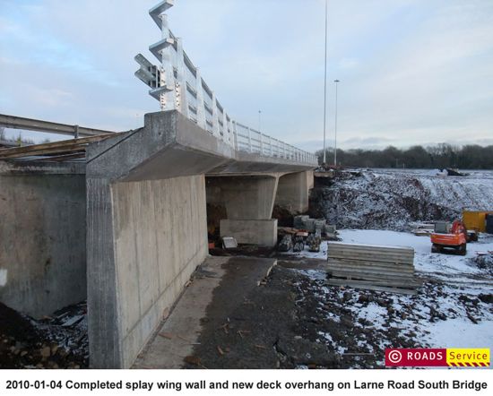
Photo 1: Completed parapet of the south bridge. [Roads Service]
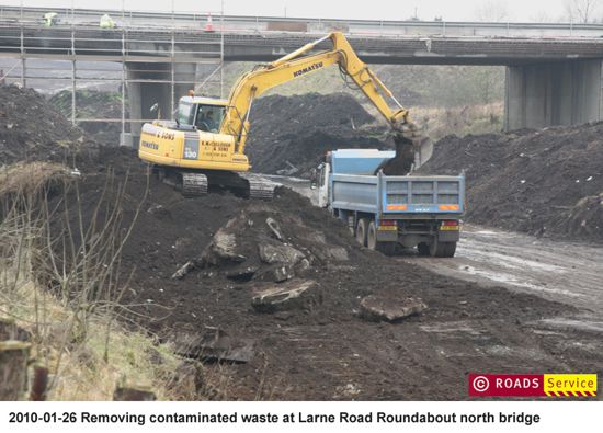
Photo 2: Clearing the land between the bridges and the M2. [Roads Service]
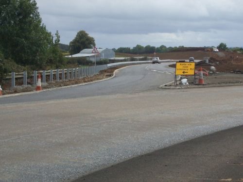
23 Jan 2010: Since Christmas, various works have been advancing. Earthmoving works (pic 1) and the construction of culverts are both in evidence south of the bridges, while the parapet on the south side of the South bridge is now complete. The works that were evident in December to complete the tie-in with the "new" Liminary Road are also finished (pic 2). With thanks to Noel O'Rawe for this information and photos.
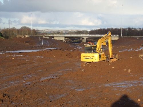
Pic 1: The site viewed from the south on 3rd January 2010. [Noel O'Rawe]
Pic 2: Completed Liminary Road, as seen on 12th Dec 2010. [Noel O'Rawe]
4 Dec 2009: Although work has progressed steadily over the past month, there has been little obvious change from the perspective of motorists. The work to finally align the "old" and "new" Liminary Road took place last week, as shown in photo 1 below. Roads Service have published some more construction pictures on their site, here. Picture 2 below is a copy of one of these images, and shows the work to replace and upgrade the parapets of the two bridges. In a press release last week, Roads Service said that the scheme has been held up a bit by the discovery of a late Neolithic ring fort, but that the scheme is due to be completed "in spring 2010". Finally, in their report to Ballymena District Council this week, Roads Service have announced plans to put spiral lane markings on the Ballee Roundabout (the "Seven Towers" rounabout) which will remove the ambiguity of whether it's permissible to turn right from the left lane when approaching from the south.
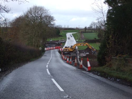
Photo 1: Work underway to realign the old Liminary Road (foreground) and
the new Liminary Road (background) on 21 Nov 2009. [Noel O'Rawe]
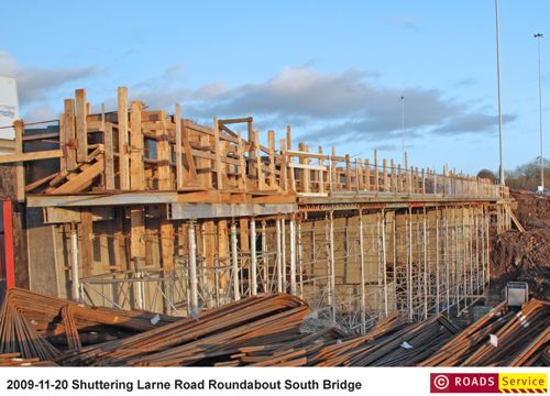
Photo 2: Work underway on the parapet of the south bridge. [Roads Service]
2 Nov 2009: Roads Service have posted up some fabulous aerial photos of the scheme, as well as quite a few ground level images, on their web site. For copyright reasons I can't reproduce the photos on this web site. However, if you click here and scroll down to "October 2009" you will see thumbnails that you can click on. Alternatively, you can click here, here, here and here to view them individually.
12 Oct 2009: This update is purely to bring more photos. The first two show the completed Liminary Road, while the second two show progress on the new road itself which has now got underway at full speed due to the closure of the "old" Liminary Road which crossed the site. Excavation is now well advanced on the south side of the roundabout and has now progressed into the central area. The slopes that will become the two south-facing sliproads are also visible. In addition, Roads Service have posted a number of photographs on their own web site in recent weeks showing further details and construction specifics.
Pic 1: The newly opened Liminary Road joining the Larne Road roundabout for the first time since it was originally planned to do so in 1969. Seen on 27 Sep 2009 [Noel O'Rawe]
Pic 2: The new Liminary Road (right) now open, with the old road (left)
now a dead end. Seen on 27 Sep 2009. [Noel O'Rawe]
Pic 3: The future southbound onslip taking shape, as seen from the south
bridge on Larne Road roundabout on 27 Sep 2009. [Noel O'Rawe]
Pic 4: The two bridges of Larne Road roundabout seen from a nearby hill on 8 Oct 2009, showing progress excavating the route for the new stretch of motorway beneath. [Wesley Johnston]
1 Oct 2009: Three different people wrote to me after the last update to report that the "new" Liminary Road opened to traffic on 26th September! This is quite an historic event, since it means that, after a delay of over 40 years, Liminary Road is now connected to the Ballee Road roundabout as was first intended when the Ballymena Bypass was opened in 1969. This change means that the old road no longer presents an obstacle to constructing the new dual-carriageway itself.
26 Sep 2009: The pictures here were all taken about three weeks ago, but due to time constraints I have only had time to upload them today. They show that the work to realign Liminary Road is progressing very well with the kerbing and formation in place along almost the entire length (pic 1). Works to strengthen the footings of the bridge colums are now complete at both the north (pic 2) and south bridges (pic 3). Work to replace the parapet and retaining walls is also continuing on the south bridge. Less work seems to have taken place on the new stretch of dual-carriageway itself which has yet to begin in most places. If work is on schedule, it should be complete within 7 months.
Pic 1: The realigned Liminary Road taking shape, looking north-west on 6 Sep 2009. [Noel O'Rawe]
Pic 2: Strengthing works to the north bridge footings completed, on 6 Sep 2009. [Noel O'Rawe]
Various works underway on the footings, parapet and embankments
of the south bridge as seen on 6 Sep 2009. [Noel O'Rawe]
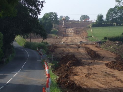
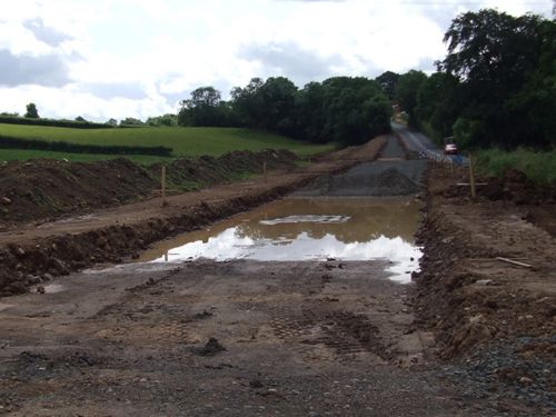
23 Aug 2009: Work has progressed steadily over the summer. The pictures below show progress in bringing the old 1960s bridges up to modern standards. This includes reconstructing the embankments and retaining walls, replacing the falsework on the bridge parapets and encasing the bases of the central support columns in concrete. The purpose of the last of these may be to do with strengthening the bridge, but could also be a mechanism for protecting the columns from damage caused by vehicle collisions. The new alignment of Liminary Road onto the east side of the existing Larne Road Roundabout is well underway, with the base formation and drainage now in place. Progress on the new dual-carriageway itself is harder to judge, due to the lack of a good vantage point, but still appears to consist of excavating the route through the undulating landscape.
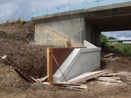
New retaining wall beside the south bridge at Larne Road
roundabout, seen here on 2 August. [Noel O'Rawe]
View west from the south bridge at Larne Road roundabout on 16 Aug 2009, sowing sections of the old 1969 parapet removed and lying on the ground below. [Noel O'Rawe]
Another view of the south bridge on 16 Aug 2009. Showing the huge blocks of concrete that have been cast around the bases of the 1969 bridge supports. [Noel O'Rawe]
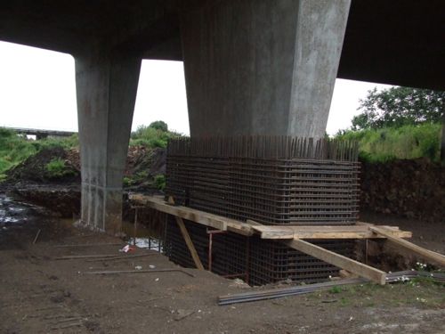
The bases of the north bridge on 16 Aug 2009 showing work underway (foreground) and not yet begun (background) in casting concrete around the 1969 supports. [Noel O'Rawe]
12 July 2009: Work has now been underway for about a month, but already there is substantial progress on the new alignment for Liminary Road (pics 1 and 2). Liminary Road is a rural road that runs east from the existing dual-carriageway. As it will be severed by the new road, it must be realigned to curve north and join the Larne Road roundabout. This work has to take place early on so that residents and farmers are not inconvenienced by a closure of Liminary Road. In addition, the ground beneath the existing bridges has been cleared, with the foundations exposed (pic 3; presumably for checking) and work has started on new retaining walls (pic 4). Meanwhile, engineers stripping the topsoil have uncovered the remains of a Neolithic causeway enclosure, which is apparently "quite rare" with only three others uncovered in Ireland. A team of 19 archaeologists will take the next month to record the site, but this is "unlikely to delay delivery of the 40 week contract". It is also worth noting that Roads Service are putting regular photos of the scheme on their site, which is good news. These include pictures of the archaeology.
Pic 1: The view north west along Liminary Road's existing alignment (left) and new alignment (right) as seen on 29 June 2009. The new dual-carriageway will run left-right beyond the JCBs in the distance. [Noel O'Rawe]
Pic 2: Not far from the same location as above, but
looking the other way, on 5 July 2009. [Noel O'Rawe]
Pic 3: The foundations of the southern bridge at Larne Road roundabout, now exposed for the first time in 40 years, and looking as crisp as the day they were poured. 5 July 2009. [Noel O'Rawe]
Pic 4: The southernmost bridge of Larne Road roundabout with vegetation cleared and the foundations of new retaining walls being installed. 5 July 2009. [Noel O'Rawe]
10 June 2009: Work on the ground began late last week with heavy plant arriving (see photo). The route of the new dual-carriageway has also been marked out on the ground (which was cleared of vegetation in a separate contract in the spring). The entrance to the future southbound onslip is being used as the site entrance. With thanks to Ian Hunter for this info. The commencement of work is a nice birthday present for the Ballymena Bypass which celebrated its 40th birthday six weeks ago - definitely not over the hill yet!
Route of the new dual-carriageway marked out with posts, as seen from the south side of the j10 roundabout on 9 June 2009. [Ian Hunter]
Plant machinery lined up ready for work on 9 June 2009. [Ian Hunter]
23 May 2009: The Minister of Regional Development has announced that work on the ground will finally get underway in June 2009, and will last about ten months. We can therefore expect completion in April 2010. The Minister also said that traffic disruption is unlikely until the later stages of the project as the early stages are being constructed entirely offline.
29 April 2009: The contract for this project was officially signed with the contractor (F P McCann) last Wednesday, 22 April. We can therefore expect work on the scheme to start imminently. Some site clearance work has already taken place, back in February.
9 March 2009: The last time a price was publicly quoted for this project was in 2006 and was £7m. Now the DRD Minister has said that the current estimated cost is £12m, quite a big rise. This is likely to be due to the extra costs anticipated as the design was developed. There is no reason to think that construction work will not begin next month as planned.
26 Feb 2009: According to site visitor Melvin Smyth, advanced site clearance works have now commenced, consisting of tree/hedge removal on the route of the new roads. Work proper is due to get underway in April.
2 Feb 2009: One of these Assembly written answers from 16 Jan 2009 confirms that the scheme is now due to get underway in "April 2009" and last approximately ten months. This is a shorter time than the figure given in July last year, when the scheme was estimated to last twelve months. If the scheme is on schedule, it should be completed by February next year.
24 Nov 2008: According to this press release, the commencement date of the project has been pushed back slightly further, this time to "Spring 2009". The project is nevertheless getting very close to commencement and work will be underway in just a few months.
9 July 2008: Roads Service are now saying on their web site that the procedure to appoint a contractor is now underway, with the commencement date now pushed back to February 2009 (from late 2008). The contract is due to last 12 months, which suggests completion by Spring 2010. There is no update on the price which was last stated to be "£7m" two years ago, but has likely risen since then.
4 May 2008: The DRD published its "intention to proceed" in March 2008. This basically means that the scheme has successfully passed the public inquiry stage and that the department will now carry out vesting of the necessary land and seek to begin work. The estimated date of commencement is still quite vague, but with completion due in "2009/2010" commencement must lie sometime between mid 2008 and mid 2009.
4 May 2007: According to this page, due to the number of objections received during the consultation, a public inquiry was convened on 23 March 2007. This will result in an inspectors report which will be submitted "later this year [2007]". Roads Service say that once they receive this they will announce the way ahead for the scheme. However, this process appears to have resulted in a delay of a year so the project is now expected to commence late in 2008, rather than late 2007 as previously stated.
|
