Status |
Construction scheme (completed) |
Where |
Construction of a new high-quality (ie motorway standard) dual-carriageway from the south end of the existing Newry Bypass to join the N1 Dundalk Bypass at the border and hence on to join the Irish M1. |
Total Length |
4.3km / 2.7 miles (+10km / 6 miles in Rep of Ireland) |
Dates |
Work began 28 Feb 2005
Most of Southern section partly or fully opened c15 Jun 2007
Whole of road officially opened 2 August 2007 (on schedule) |
Cost |
£34.5m (source) (plus £53m by Irish government)
|
Photos |
See below |
See Also |
General area map
Map of route - on Irish National Roads Authority site (PDF)
A1 Beech Hill to Cloghogue (new Newry Bypass) scheme on this site |
This project is the most southerly of three schemes that will see the completion of a dual-carriageway on the entire A1 Lisburn to Dublin route within Northern Ireland by 2010. It is currently (January 2007) dual-carriageway from Lisburn to just north of Newry but another projects (see link above) will see this extended to Cloghogue on the south side of Newry. This project will build the link from Cloghogue across the border to the Irish M1 motorway at Dundalk and is being part-funded by the UK and partly by the Irish government. This marks a major step forward in North-South relations as it is the first jointly-funded road project since Irish independence in 1921.
The road here carries around 20,000 vehicles per day of which 20% are HGVs. This section is one of the worst: a twisty accident-prone two-lane single-carriageway road running through a steep valley with dozens of private accesses onto it. The whole scheme will also see 5.7km of link roads and 11 bridges built.
According to the Roads Service, the scheme will be a "high quality dual-carriageway" meaning that it will be built to motorway standard with no central reservation crossing points, full hard shoulders and one fully grade-separated junction north of the border, with further grade-separated junctions on the Irish side. The terminus at Cloghogue will also be grade-separated once the ajoining scheme is completed. This marks a departure from normal NI policy which does permit central reservation crossings and is probably due to the quality of the road being proposed on the southern side of the border. The project has been quite controversial, principally because the new route is being constructed partly through Ravensdale Forest on the Irish side and because it will be highly visible where it runs along hillsides in this beautiful area.
The total of the Irish contribution is uncertain, with the Roads Service web site saying £37m, whereas the Dept of Regional Development says £53m. In addition, according to this Parliamentary Written Answer, the European Commission has contributed €5m to the cost of the scheme - about 4% of the total cost.
Although at its southern end the road will link directly to the Irish M1 motorway at Dundalk, the link road will not be a motorway. The Roads Service press release of 28 Feb 2005 explains it by saying "it is not designated as a motorway because at certain points it subsumes the existing road and there is no alternative route for the small volumes of non-motorway traffic."
Progress
5 July 2006: According to the May report by Roads Service to Newry & Mourne council "Earthworks are continuing, with rock excavation just south of Cloghogue well advanced. The rock produced in this cutting is being utilised on the remainder of the scheme. Bridge construction has also commenced."
15 Nov 2006: According to this Parliamentary written answer from 23 Oct, completion has been pushed back to "end 2007", compared to the date of August 2007 publicised when work began.
7 Jan 2007: The work on the Irish side seems to be progressing very well, with tarmac now laid on one carriageway and partly on the other. See photo below. Work on the Northern part is not so well advanced, perhaps due to the more difficult terrain here. About a year of work to go.
25 June 2007: The road is now only about 8 weeks from completion according to Roads Service. On 4 June, the Regional Development Minister told the NI Assembly that the design of the one mile section from Cloghogue, Newry, south to Ellisholding Road has been modified to 3+3 lanes with a lane gain/drop at the two junctions. This is to facilitate local traffic who cannot use the old A1 between these two points since it is being subsumed by the new road. Part of the Southern section of the road opened to traffic around June 15th, (2-3km fully, rest in contraflow) although as yet none of the Northern sections have opened.
2 August 2007: The whole road opened to traffic today, on schedule and within budget. A two-mile traffic jam quickly developed where the road reduces to one lane at the south end of the Newry bypass. However this will stop happening once the new Newry Bypass is completed (2009). BBC news report.
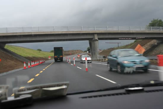
The new N1 link road, here on the Irish side, partially open. [Photo by Dermot McNally]
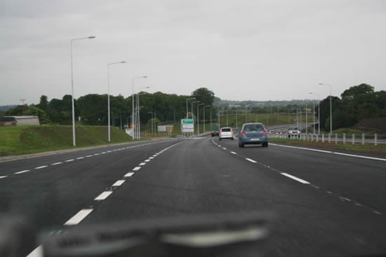
The new N1 link road, close to the Irish M1 at the south end is fully open. [Photo by Dermot McNally]
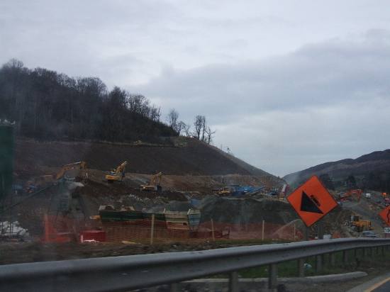
Work progressing on the road in the Republic of Ireland, a short distance from the border. Note the sheer amount of earth moving equipment! Late Feb 2007. [Photographer requested anonymity]
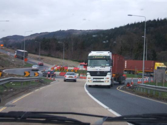
All vehicles currently using what will probably be the sliproads of a future grade-separated junction next to the future dual-carriageway, here in the Republic of Ireland. Late Feb 2007. [Photographer requested anonymity]
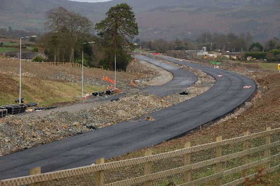
The southern section of the new road (here seen near Ballymascanlan in RoI close to where it will join the existing Irish M1 / Dundalk Bypass) is in an advanced stage with surfacing work well underway. Here seen looking north on 4 Jan 2007. [Photo by Aubrey Dale]
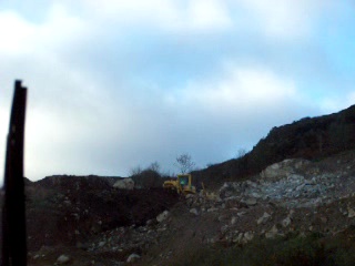
This still is from a movie taken on 18 Nov 2006, looking up from the existing A1 just south of Cloghogue. After almost 2 years, there is still a massive amount of work to be done as work is still at the stage of rock removal on this very challenging site. [Photo by Wesley Johnston]
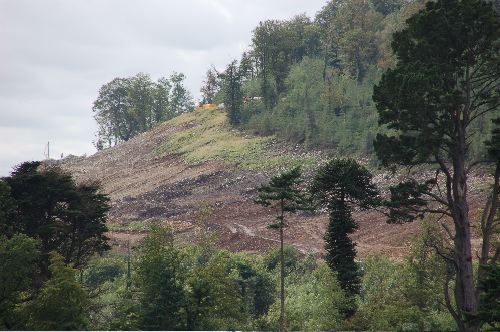
Clearance works underway at Drumad Wood just south of the border, seen from the opposite side of the valley on 6 Sep 2006. The existing N1 is in the valley below. The new road will run on this hillside (looking south west with Dundalk to the left). [Photo by Aubrey Dale]
|
