Status |
Construction scheme (proposed) |
Where |
To build a new bridge and associated link road over the River Foyle between the A5 and A40 south of Londonderry |
Total Length |
2.5 km / 1.6 miles |
Dates |
Has been suggested many times over the decades
Feasibility Study proposes this scheme - 7 June 2010 |
Cost |
? |
Photos |
See below |
See Also |
General area map - Google Maps
2010 Feasibility Study - Roads Service
A515 Foyle Bridge - on this site |
The need for a third bridge over the River Foyle in Derry has been suggested literally dozens of times over the years. Currently the two parts of this city of over 90,000 people is linked by just two bridges - the double-deck Craigavon Bridge in the city centre, opened in 1933 and the elegant Foyle Bridge to the north of the city, opened in 1984. A pedestrian and cycle bridge, known as the Peace Bridge and sited between these two, was under construction during 2010.
As part of a study into strategic roads in Derry which was published in June 2010 a proposal was made to construct a third road bridge between 3 and 5km south of the city, at the town of Newbuildings. The bridge would connect the main A5 road (towards Dublin) on the east bank of the Foyle to the A40 Letterkenny Road on the west bank. This would allow traffic arriving into the city on the A5 to transfer across the Foyle to the Cityside without having to all the way to the Craigavon Bridge at the city centre. Of the 6100 vehicles who arrive from the A5 each day, about 50% have a destination on the Cityside.
However, the Letterkenny Road itself is not of a high standard, and indeed also terminates near the city centre, so there would have to be further inprovements to the road network on the Cityside for this bridge to function to its full potential. The report recommends that "a more detailed investigation of traffic conditions on the A40 Letterkenny Road approach to the city up to the Craigavon Bridge should be undertaken to understand the potential impacts of increased traffic along this route".
Route
The 2010 report was merely a Feasibility Report, so did not go into a detailed investigation of the best location for the bridge. However, it did provide two indicative locations - the first, north of Newbuildings, would be about 900 metres long of which the bridge itself would be about 500 metres long. The second, south of Newbuildings, would be about 2.2 km long of which the bridge would be about 600 metres long. Both bridges would likely be "low level" (ie large boats could not pass beneath). The Foyle Bridge is an example of a "high level" bridge whereas the Craigavon Bridge is a "low level" bridge. The two routes are shown the map below - if you own any of the land shown here, please note that these plans are still VERY VAGUE and may not happen in either form.
Photos

The high level Foyle Bridge opened in 1984 to the north of the city.
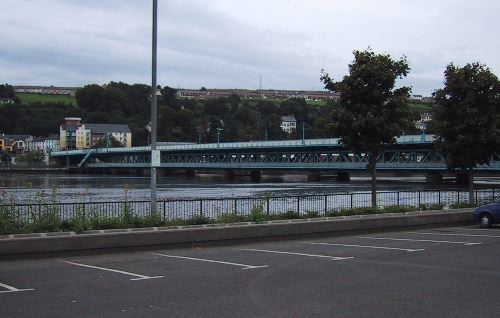
The Craigavon Bridge, built in 1933, is the closest bridge to the city centre. (Photo from ARUP http://www.arup.com/bridges/skill.cfm?pageid=2128)
The rest of these are links to Google Streetview
This is the route that the bridge could take if built at the site proposed north of Newbuildings.
This is the route that the bridge could take if built at the site proposed south of Newbuildings. |
