|
|
Status
|
Construction
scheme (completed)
Main contractor: Whitemountain/Coffey JV
|
|
Where
|
To
build a new single-carriageway link road
connecting Crevenagh Road to B158
Donaghanie Road to provide improved
access to the planned Omagh local
hospital. |
|
Total
Length
|
1.1 km / 0.7 miles
|
|
Dates
|
2004 - Work began to
identify site for new hospital
April 2008 - Landscape
and Visual Impact Assessment report for
new road published
December 2012 - Contract for road
awarded to Whitemountain/Coffey
Summer 2013 - Work began on the hospital
itself
January 2014 - Road
opens to traffic (?)
14 February 2014 - Road officially
opened and named Cranny Road.
|
|
Cost
|
£3.7m - funded by
Western Health Trust
|
|
Photos
/ Map
|
See below. |
|
See
Also
|
General
area map - Google Maps
|
As part of work to
build a new local hospital in Omagh, it was
deemed necessary to improve road access since
the entrance would be on the B158 Donaghanie
Road, which is not easily accessible from the
rest of the town. There was an existing link
road that went through the grounds of the former
Tyrone and Fermanagh Hospital, which connected
Donaghanie Road to Creveneagh Road, and hence to
the main A5. This road would have been very
appealing to users of the new hospital, but this road
was very narrow and sub-standard, in places not
wide enough for two vehicles to pass. The plan
was thus to provide a better road to replace it.
As the Western Trust said shortly before
opening: "The trust would then wish to
discourage the use of the internal trust roads
for public use for traffic transiting the
Donaghanie Road and Crevenagh Roads, as the
new road link will ensure less congestion on
the Tyrone and Fermanagh Hospital site and
therefore make it safer for hospital patients,
visitors and staff". The new road subsumes
the first few hundred metres of this older link
road, but thereafter follows a new route.
The map below shows
the route of the new road (the blue pin shows
the hospital site):
This image shows a
closeup of the proposed hospital site, with the
easten end of the link road at the bottom and
Donaghanie Road on the right.
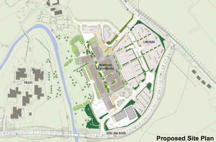
Image taken from "Omagh Enhanced Local Hospital,
Enviromental Statement" accessible here.
The road began at its
western end at a roundabout on Crevenagh Road
which was built circa 2008 as part of the
construction of Crevenagh Integrated College. It
terminates at its eastern end at a priority
T-junction on the B158 Donaghanie Road. The new
road required a significant bridge over
the Camowen river - it is 81 metres in length to
span not only the watercourse itself but the
floodplain on either side. The bridge is built
with three spans: two approach spans with beams
of 27.15 metres and one central span with beams
of 26.75 metres. You can see images
of the bridge under construction here and
further
details and images here (links live as of
Mar 2014).
There is an old,
disused stone
railway bridge adjacent to the new bridge.
This previously inaccessible structure can now
be seen very conveniently from the new bridge,
and it is well worth a visit for this reason
alone.
Photos
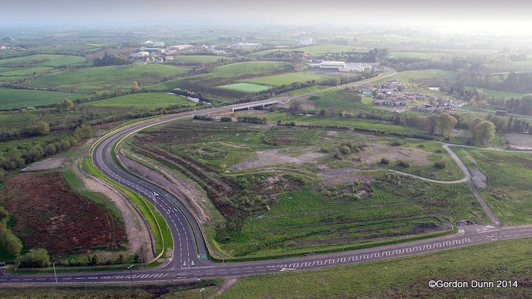
This picture of the completed road was taken by
Gordon Dunn 29 April 2014. It is part of a set
of pictures
visible here. The field straight ahead is
the site of the future hospital, while its
future entrance can be seen at the bottom right.
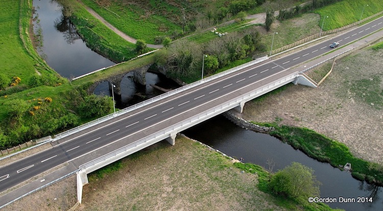
This picture of the completed bridge was taken
by Gordon Dunn 29 April 2014. It is part of a
set of pictures
visible here.
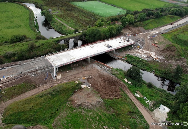
This picture of the bridge under construction
was taken by Gordon Dunn 22 Sep 2013. It is part
of a set of pictures
visible here.
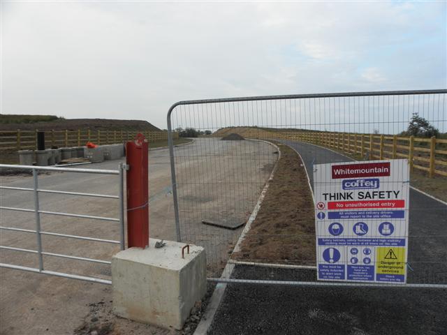
The view south west along the new Omagh Hospital
Link Road as seen from Donaghanie Road on 29
September 2013. At this stage the road was
around four months from completion, and not yet
opened.
© Copyright Kenneth
Allen and licensed for reuse
under this Creative
Commons Licence.
|
