|
|
Status
|
Construction scheme
(completed)
|
|
Where
|
To
connect the Antrim Road and Ballyclare
Road, Glengormley |
|
Total
Length
|
0.6 km / 0.4 miles |
|
Dates
|
Scheme proposed in
Belfast Transportation Study - 1969
Planning permission
granted - Oct 2002
Work began - circa start of 2003
Completed - August 2003
Road later named "Jubilee Way" by
Newtownabbey Borough Council
|
|
Cost
|
£1m* - funded
by private developers.
*according to an article in Belfast
Telegraph 12 Aug 2003
|
|
Photos
|
See below |
|
See
Also
|
General
area map of Glengormley
Blog
entry about the unbuilt roads of
Newtownabbey
|
This is one of the longest-running scheme
proposals in Northern Ireland. A road link
connecting the Antrim Road to the Ballyclare Road
and on to the Carnmoney Road was first proposed in
the Belfast Transportation Study of 1969, and land
reserved for it. This extract from the Belfast
Transportation Study shows the proposed road,
labelled here as "N19":
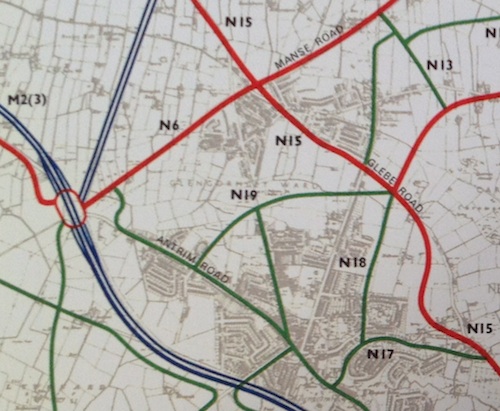
Extract from Belfast Transportation Study of 1966
showing proposed Northcott link road: the western
part of the green line labelled N19. However, despite bits of the road being built (in
the form of Burnthill Road) in the interim, the
link to Antrim Road remained absent. Northcott
Shopping Centre occupied the site for much of the
interim, and there was a small one-way exit road
beside the car park that was probably intended to
preserve the route of the proposed N19 link. The
picture below shows this road. You can also see it
in Google Earth by switching on "historical
imagery" and going back to 2001.
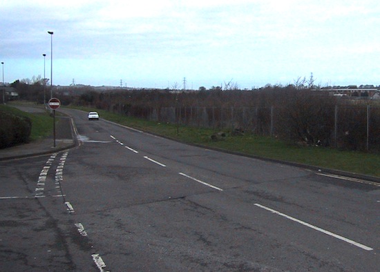
The pre-existing one-way road that occupied the
site of what is now the Northcott link road, here
seen on 7 March 2002. View west from entrance to
Northcott Shopping Centre. Click
here to see the same view today in Google
StreetView. [Wesley Johnston]
However, even this road was not completed as far as
Antrim Road. Part of the reason for this was that
there were three detached houses on the Antrim Road
blocking its path. These were slowly purchased and
cleared, presumably by the owners of the shopping
centre. Work finally got underway on the road in
late 2002/early 2003 and it was opened that August:
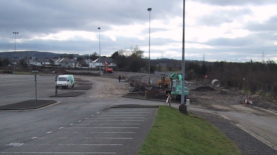
Construction work on the Northcott link road
underway on 3 April 2003. View west from just
after the entrance to Northcott Shopping
Centre. [Wesley Johnston]
|
