|
Please use the BACK button on your browser
to leave this page, or else click here to return
to the Northern Ireland Roads Site.
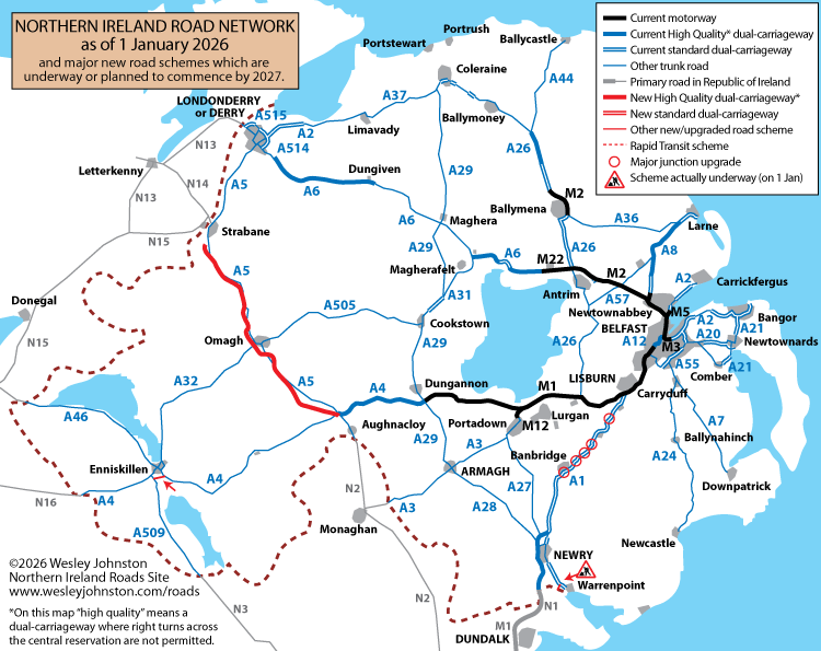
This map shows
Northern Ireland's trunk road network as it was
on 1 January 2026. It also indicates new road
schemes that are either underway, or are likely
to get underway by the early 2026. I normally
produce a map every January – see below for
older maps.
Old Maps
Click
here to open the network map of 1 January
2025 in a new window.
Click
here to open the network map of 1 January
2024 in a new window.
Click
here to open the network map of 1 January
2023 in a new window.
Click
here to open the network map of 1 January
2022 in a new window.
Click
here to open the network map of 1 January
2021 in a new window.
Click here to open the
network map of 1 January 2020 in a new window.
Click
here to open the network map of 1 January
2019 in a new window.
Click
here to open the network map of 1 January
2018 in a new window.
Click
here to open the network map of 1 January
2017*** in a new window.
Click
here to open the network map of 1 January
2016 in a new window.
Click
here to open the network map of 1 January
2015 in a new window.
Click
here to open the network map of 1 January
2014 in a new window.
Click
here to open the network map of 2 January
2013 in a new window.
Click
here to open the network map of 14
February 2012* in a new window.
Click
here to open the network map of 15 January
2011** in a new window.
Click here to open the
network map of 1 January 2010 in a new window.
Click here to open the
network map of 1 January 2009 in a new window.
Click here to open the
network map of 1 January 2008 in a new window.
*immediately after the funding
re-allocations announced
on 14 February 2012
**immediately after the spending cuts
announced on 13 January 2011
***the question marks on this map indicate my
own speculation, ie nothing was officially
stated
|
