|
|
Status
|
Construction scheme
(completed) |
|
Where
|
To
construct a road parallel to Lurgan's
main street to stimulate development of
the land to the south of the town centre
and act as a local bypass. |
|
Total
Length
|
0.8 km / 0.5 miles
|
|
Dates
|
Opened to traffic Dec
2002
|
|
Cost
|
? |
|
Photos
|
See below |
|
See
Also
|
General
area map - Google Maps
See also map below
|
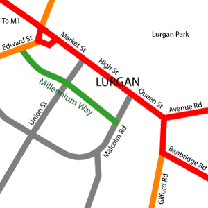
The name Lurgan comes
from the Irish for a "long, low ridge". Lurgan's
main street runs along this ridge with the land
sloping away to both the north east and the
south west. The north east is occupied by Lurgan
Park, while the area to the south west was until
recently a largely underdeveloped area of
derelict or poorly maintained industrial
building. The half-mile long Millennium Way was
built to traverse this area parallel to the main
street and stimulate its redevelopment.
Beginning at traffic lights on Edward Street it
runs south east, crossing Union Street, before
terminating at lights on Malcolm Road. The map
below (not to scale) shows the route:
The road has been a success, with many new
shops opening in the area, most notably a new
Tesco store. It also acts as a quick route for
traffic to bypass much of the congested town
centre. At the time of writing (Dec 2007) there
was a plan to extend the road to Gilford Road.
See Futures for
the latest information.
Photos
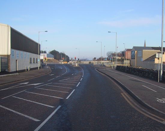
The
view north west along the A99 Millennium Way
early on a Sunday morning from half way between
Malcolm Road and Union Street in February 2006.
Note the new retail premises on the left.
[Wesley Johnston].
|
