Status |
Construction scheme (completed) |
Where |
To widen Dargan Road in the north Belfast harbour area from 2 lanes to 4 lanes from around Dargan Crescent to West Bank Road |
Total Length |
0.9 km / 0.5 miles |
Dates |
Work began November 2008
Work due to last 43 weeks according to site signage (as of Nov 2008)
Work substantially completed by early September 2009 (on schedule)
Scheme officially opened 16 Sep 2009
|
Cost |
£3.2m
Cost being met by Belfast Harbour Commissioners |
Photos |
See updates below for pictures of progress. |
See Also |
General area map - Google Maps
|
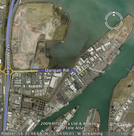
On 7 May 2008 Stena Line moved their ferry operations to the new VT4 terminal at the end of West Bank Road in the Harbour Estate. West Bank Road is accessed off Dargan Road which is itself connected to the M2 at Fortwilliam roundabout (see map below). The ferry terminal move resulted in the level of traffic on Dargan Road rising dramatically (much more than doubled), especially at ship arrival/departure times. Belfast Harbour Commissioners, who own all this land, have decided that the road needs to be upgraded to cope with this traffic.
Currently the first 500 metres of Dargan Road from the M2 motorway roundabout is dual-carriageway. This scheme will see the next 900 metres as far as West Bank Road upgraded from 2 lanes to 4 lanes. It will not all, apparently, be a dual-carriageway as there will be no central barrier on the eastern part. The map below shows the section of the upgrade highlighted in blue. The Stena terminal is at the top right, on the land shown in this (out of date) Google Earth image as undeveloped.
West Bank Road will receive "repair and resurfacing works" but no widening. The contractor is John McQuillan (Contracts). According to the map attached to the official press release, a part of the existing dual-carriageway between Duncrue Road and Dargan Crescent is also involved in the contract, although it's unclear what this aspect of the work entails.
Map
Progress
23 Sep 2009: The scheme was officially opened on 16 September by the Regional Development Minister. The press release implies that Westbank Road was either improved or widened to four lanes as part of the scheme. However, Westbank Road was already four lanes wide before the scheme began, so I am not sure what they mean by this. They also confirmed the cost for the first time as £3.2m. This is being met entirely by the Harbour Commissioners.
2 Sep 2009: Work is now substantially completed, with just one or two minor finishing works to be carried out. It is probably safe to regard the project as being completed in early Septemer, ie on schedule.
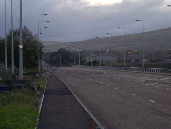
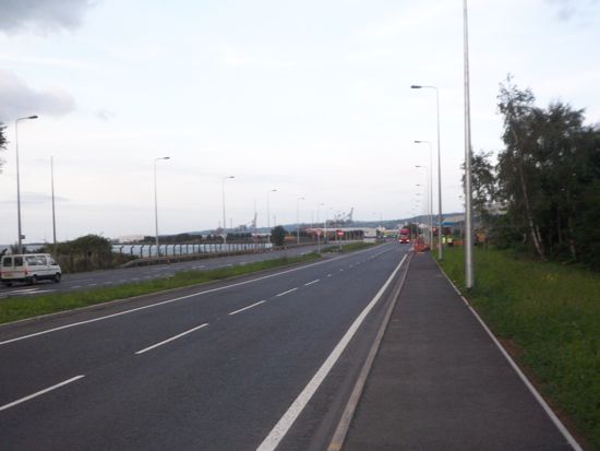
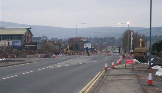
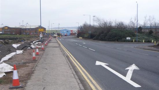
21 August 2009: Over the past six months, work has advanced almost to completion with just some finishing touches required to the footpaths. This update is with thanks to Owen Fulton, who notes that "The first junction before Westbank Road is now 3 lanes in each direction to allow for right turning lane and the westbank rd junction is also widened". The eastern part of the scheme is a single-carriageway with central hatching (picture 1 below) while the western part is a dual-carriageway (picture 2 below).
Pic 1: The view west along the eastern part of the scheme, showing the four lane arrangement with central hatching. Seen on 17 August 2009. [Owen Fulton]
Pic 2: Looking east along the western part of the scheme, now completed, on 17 Aug 2009. This is the short dual-carriageway stretch. Identical view to the photo below. [Owen Fulton]
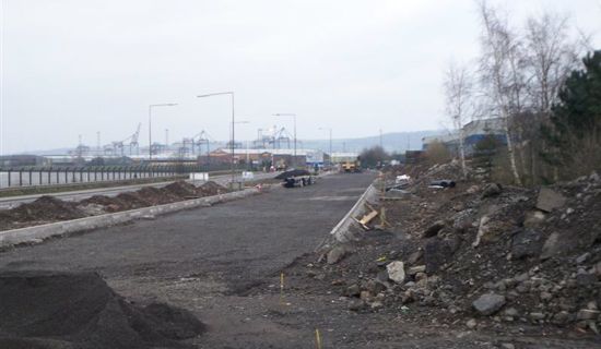
12 Feb 2009: Work is proceeding well with the widened carriageway taking shape already. The first part of the road is being upgraded to dual-carriageway and the second carriageway is being built offline (pic 1). East of here, the security post in the middle of the road, about half way along, has been demolished (pic 2). The eastern part of the road is being widened to four lanes, where the sea constricts the available land (pic 3).
Pic 1: Second carriageway taking shape on 1 Feb 2009, looking east. [Owen Fulton]
Pic 2: Site of the security hut, now demolished. Looking west on 1 Feb 2009. [Owen Fulton]
Pic 3: Eastern part being widened on the left. Looking east on 1 Feb 2009. [Owen Fulton]
|
