Status |
Construction scheme (completed)
Contractor: Amey Lagan Roads Limited |
Where |
Part online/part offline upgrade of existing A4 between the A4 Dungannon Bypass and Ballygawley roundabout to high quality dual-carriageway standard. |
Total Length |
20.5 km / 12.8 miles |
Dates |
Project announced Spring 2004.
Public inquiry Mar-Apr 2006.
Environmental impact statement due 2005-2006.
Preliminary work took place early 2007 / site clearance late 2007.
Contract signed mid December 2007.
Construction began 13 Feb 2008.
Killymoyle to Reaskmore offline section opened mid Sep 2010.
Cabragh to Killymoyle offline section opened mid Oct 2010.
Entire road fully opened 17 Nov 2010.
Road officially opened 1 Dec 2010 (about 2 months ahead of schedule).
(Duration was given as "3 years" at project commencement in Feb 2008.)
|
Cost |
c£116m - see important note on costs below.
About £30m of this was for land acquisition and compensation.
Funded through public/private partnership.
|
Photos |
See below for photos. |
See Also |
General area map.
Roads Service web site on scheme.
A4/A5 realignments Annaghilla and Tullyvar on this site |
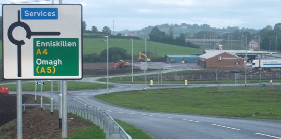
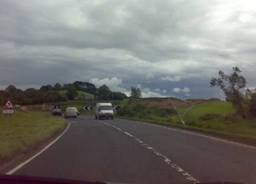
The A4 is a continuation westwards of the M1 motorway. The M1 first joins a 1km stretch of dual carriageway (the Dungannon Bypass) before becoming the single-carriageway A4. As the main east-west route between Fermanagh / Tyrone and Belfast the road has suffered from accidents and congestion due to right-turning and slow moving vehicles. The route is busy, and therefore has few opportunities for overtaking.
This ambitious scheme will see the entire road converted to high quality dual-carriageway standard, and all junctions either grade separated or limited to left turns only. Approximately 70% of the new road will be on a new offline route, with the rest (principally at the eastern end) formed by upgrading the current road. At its western end, the road will terminate at a new roundabout on the A5 a few hundred metres south of the existing Ballygawley roundabout, which will remain in situ. The two will be linked by a short section of dual-carriageway. The scheme will require 16 road bridges and 5 accommodation (ie private access) bridges. Only 3 houses will have to be demolished, although a further 13 will be within 50 metres of the new road, and 197 within 300 metres.
Construction will take place at the same time as the nearby Annaghilla and Tullyvar realignment schemes (see link above). A map published as part of a wider consultation in July 2006 contained a map showing the route of the proposed road (in green). As you can see, it shows around 70% of the dual-carriageway following a new route about 1km to the south of the existing route and approaching the Ballygawley roundabout from a different direction:
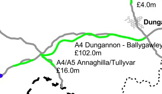
Map from "Expanding the Strategic Road Improvement
Programme 2015" consultation document, DRD, July 2006.
Note on Costs
In mid 2005 the combined cost for this scheme and the upgrades of A4 at Annaghilla and the A5 at Tullyvar was given as £117.7m (£102m for the A4, £15.7m for Annaghilla/Tullyvar). However by the time the scheme began in February 2008, the combined cost was given as £134. The cost of £116m stated above is an estimate which assumes that the proportions of the costs remain the same. This may not be accurate so this figure should be taken as approximate.
Junction Strip Map
The junctions on the new road will be at the following locations, according to the leaflet "A4 and A5 Corridor Improvements" released by the Roads Service in December 2005 [east to west]. Note that the westernmost section features the longest stretch without junctions. The names below are the names given by the Roads Service and are thus likely to become the 'official' names. Distances are between the approximate centre of each junction.
|
EAST
Begins as M1 motorway, Dungannon
.
|
M1 Junction 15:
Stangmore, Dungannon |
A29 Moy Road
(to Dungannon) |
|
A29 Moy Road
(to Moy) |
|
1.2 km / 0.8 miles |
MULLYBRANNON
No bridge over the A4 |
Mullybrannon Road (north)
(to Moygashel)
. |
|
.
Mullybrannon Road (south) |
| |
1.4 km / 0.9 miles |
| OLD EGLISH |
OId Eglish Road
Glengannon Hotel
|
|
Old Eglish Road
M1 Service Station |
| |
1.0 km / 0.6 miles |
| EGLISH |
|
|
.
B45 Eglish Road
(to Eglish) |
| |
0.7 km / 0.4 miles |
KILLYBRACKEN
(westbound access only) |
|
|
Killybracken Road |
| |
0.6 km / 0.4 miles |
| GRANVILLE |
A45 Granville Road
(to Granville)
|
|
B35 Granville Road
(to Aughnacloy) |
| |
1.0 km / 0.6 miles |
| KILLYLISS |
Eskragh Road
Killyliss Road
|
|
Killyliss Road |
| |
|
| REASKMORE |
B34 Wood Lough Road
(former A4)
|
|
.
Reaskmore Road |
| |
2.9 km / 1.8 miles |
KILLYMOYLE
(eastbound offslip only) |
B34 Ballygawley Road
(former A4)
|
|
B34 Ballygawley Road
(former A4) |
| |
1.5 km / 0.9 miles |
CABRAGH HILL
(two arms of the junction are 0.7km apart) |
.
B34 Ballygawley Road
(former A4)
|
|
B34 Ballygawley Road
(former A4)
. |
| |
9.5 km / 5.9 miles |
| BALLYGAWLEY |
A5 link to existing Ballygawley Roundabout and hence Omagh and L'Derry |
|
A5 Tullyvar Road
(to Aughnacloy and Dublin) |
| |
Terminates as A4 towards Enniskillen
WEST
|
Progress
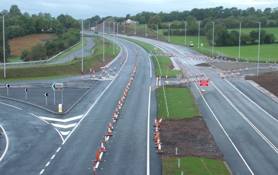
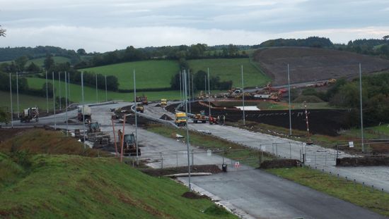
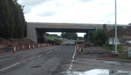
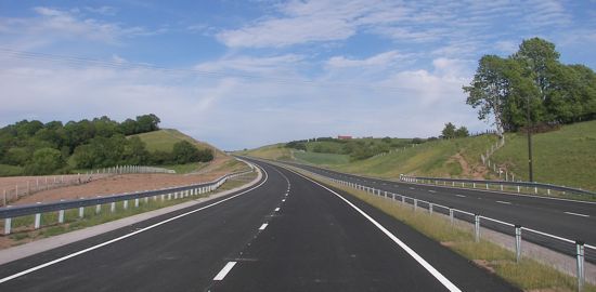
12 Dec 2010: The new road was officially opened 12 days ago on 1st December by the Minister for Regional Development, along with the First and Deputy First Ministers. At 20.5km this scheme is the single longest road scheme ever constructed in Northern Ireland to date - even including the major motorway schemes of the 1960s and early 70s. So far I have heard nothing but praise for what has been achieved here - congratulations to all involved. Despite the problems at the "bog" section near Cabragh, the scheme has still been completed about two months ahead of schedule.
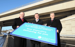
The three Ministers at the opening on 1 Dec 2010 [Roads Service]
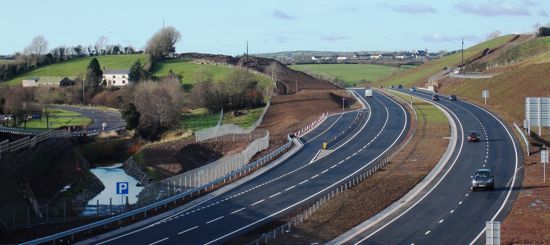
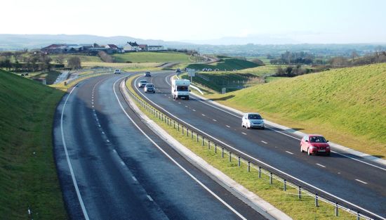
22 Nov 2010: The pictures below were taken yesterday by John Troy and show traffic on the new offline section of road. So far feedback on the new road has been 100% positive. Although it is fully open, ancillary works around the new road are continuing, but we are anticipating the "official opening" before Christmas.
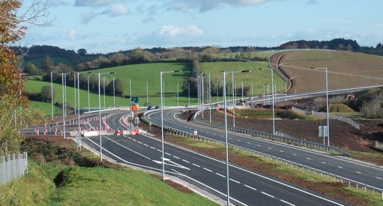
View west from Killymoyle overbridge with the former A4 at Killymaddy amenity area on the left on 21 Nov 2010. The contrast between the old and new roads is sharp here. [John Troy]
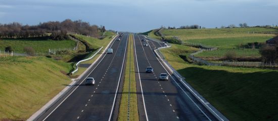
View east from Dergenagh Road bridge on 21 Nov 2010. Note the parking area on the right ahead, similar to several others on the new road. Similar view to that of 8 Feb below. [John Troy]
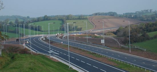
View west from Craveny Road bridge as the new A4 begins a long, slow descent to Ballygawley (2km distant) giving stunning views along the Clogher Valley. 21 Nov 2010. [John Troy]
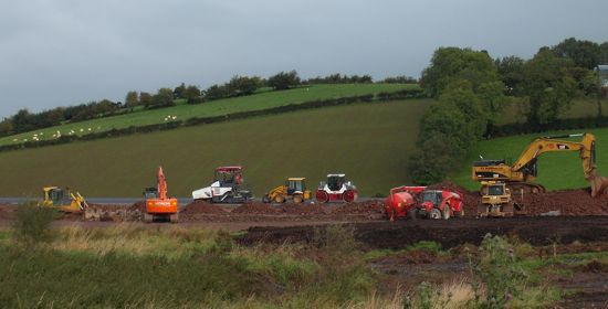
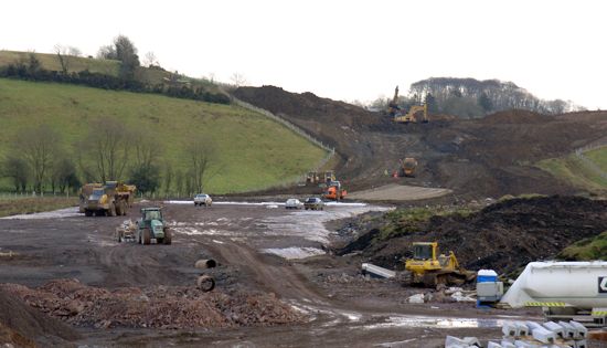
17 Nov 2010: The entire road was opened to traffic this morning - from Dungannon to Ballygawley. The first people to use the road reported that it flowed freely and that the whole route could be traversed in less than 15 minutes. The old A4 (now the B34) was eerily quiet by contrast. I don't have any pictures of traffic on the new road yet, but hopefully soon. This marks the culmination of almost three years' work, and indeed the project appears to have been completed around 3 months ahead of schedule. Well done to all those involved, especially the main contractor Amey Lagan Roads Limited. By way of tribute, the image below shows an impressive line-up of plant machinery (these ones owned by sub-contractor PT McWilliams) taken on the associated A5 Tullyvar scheme in the early stages of the project. In related news, the detailed plans for the A5 upgrade have just been published. They show that the plan is to extend the A4 dual-carriageway by a further kilometre to meet another proposed roundabout on the Annaghilla Road. The recently-opened "new" Ballygawley roundabout would be demolished as part of this proposal.
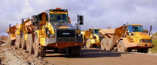
PT McWillians earthmoving equipment at Tullyvar in March 2009. [Mark Neeson]
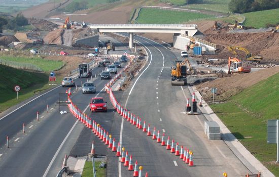
27 Oct 2010: The section of road between Killymoyle and Cabragh has now opened to traffic, with all vehicles on the future eastbound carriageway. This means that the entire eastern half of the scheme is now open with lane restrictions. However, Roads Service have announced that this stretch will open fully on a trial basis from 30th October to 5th November. The implication is that the cones may be put back after 5th November if circumstances require it. But it will allow people to get a feel for the final road. It's still not clear when the western stretch from Cabragh to Ballygawley will open, but this stretch is complete and ready to go as far as we are aware, so it may well open soon too. The pictures below were taken three days ago.
Looking east from Eglish Road bridge on 24 Oct 2010. The former Eglish roundabout was situated just ahead but all traces are now gone. [John Troy]
Looking west from Killymoyle on 24 Oct 2010. The new section of road ahead is now open to traffic, while the old, temporary, road on the left has now been removed. [John Troy]
Looking east from Cabragh on 24 Oct 2010 with the "Bog of Doom" section now open to traffic on the eastbound carriageway. The remainder of the road (behind the camera) is still closed. [John Troy]
19 Oct 2010: The contractors hope to be able to open a further 1.5km of the offline section of dual-carriageway between Killymoyle and Cabragh before the end of October. Pictures taken by John Troy nine days ago (see below) would seem to confirm this. The "Bog of Doom" section (pic 1), which is on this stretch, now appears complete with crash barriers and lines painted while at Killymoyle the road beyond the temporary terminus (pic 2) appears to be nearing completion. Given that the 9.5km section of road between Cabragh and Ballygawley has been complete for some months it seems plausible that the entire scheme will open in the near future, which would be well ahead of schedule. However, there would still be substantial works to be done, not least on the current A4 (future B34) once the dual-carriageway has opened which needs properly tied into all its new bridges and otherwise "tidied up" as it will remain in use as an important local road. The First and Deputy First Ministers paid the scheme a visit last Tuesday.
Pic 1: The completed "Bog of Doom", in the middle distance, at Cabragh on 10 October showing very substantial progress since 19 September (see pic below) [John Troy].
Pic 3: Looking west at Killymoyle on 10 October, the dual-carriageway beyond the temporary terminus appears well advanced. Even once the new road opens, the existing A4 will need to be reconstructed over the bridge shown here. [John Troy]
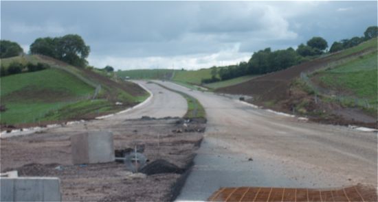
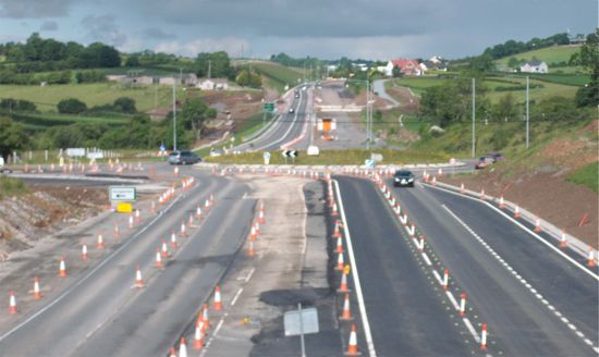
27 Sep 2010: This update brings several new photos. There are two bits of exciting news. Firstly, 3km of the new offline section of dual-carriageway opened to traffic around two weeks ago (albeit with all traffic using the future westbound carriageway). The section in question is the stretch between Reaskmore and Killymoyle (see strip map above). Traffic rejoins the existing A4 west of Killymoyle as shown in the photos below. Secondly, it looks as if the troubled Bog of Doom section near Cabragh has finally been resolved as the contractors now appear to be laying the final road surface here (again, see photos below). Although completion is still officially several months away, it looks possible that the rest of the offline section from Killymoyle to Ballygawley could well be in use within a month or so. The section west of Cabragh has been completed but mothballed for some months now. With thanks to John Troy for these photos and several site visitors for other updates.
View east from the new Eglish overbridge on 19 Sep 2010, showing the M1 service station which will shortly be accessible only from the link road visible on the far right. [John Troy]
The M1 service station seen looking east from the Old Eglish junction. The new link road visible in the previous photo is straight ahead here. 19 Sep 2010. [John Troy]
Killyliss junction complete and in use (with lane restrictions) on 19 Sep 2010. Note, however, the insanely short merge lane for traffic joining from the left which promises much fun and games for HGV drivers. [John Troy]
Part of the offline section of road that has only just opened, here seen looking east from the Killymoyle Road overbridge near Quinn's Corner on 19 Sep 2010. [John Troy]
Looking west from Killymoyle Road on 19 Sep 2010. The future A4 will continue straight on here, but for now this is where the opened stretch ends and traffic rejoins the old A4 (on the left). The bridge will eventually carry the old A4 once it's been downgraded to B34. [John Troy]
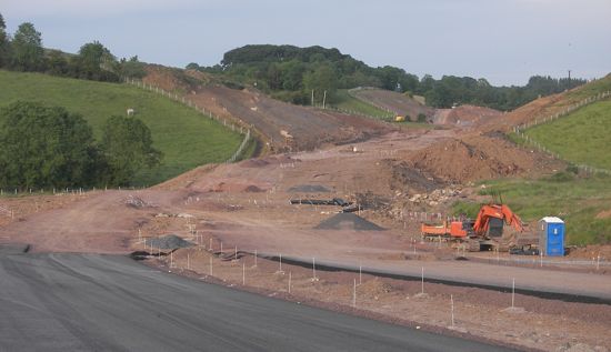
View east towards the Cabragh junction with the infamous "Bog of Doom" in the distance on 19 Sep 2010. The problems here seem finally to have been resolved. [John Troy]
Final road surface apparently being laid at the "Bog of Doom" near Cabragh on 19 Sep 2010, as seen looking north from the existing A4. [John Troy]
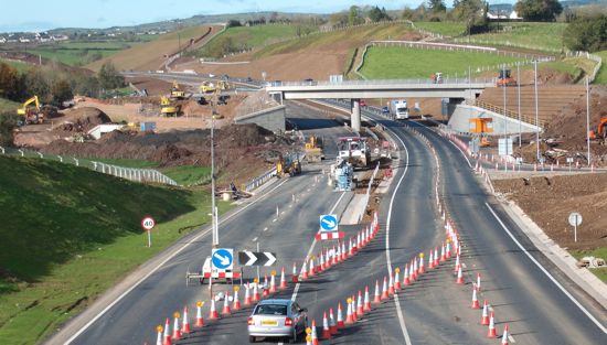
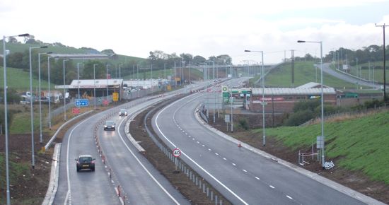
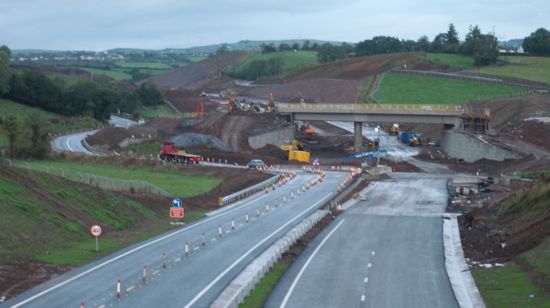
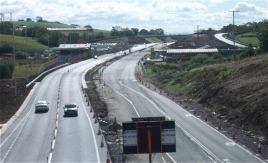
11 Sep 2010: This update is mostly thanks to Col2006. Work is progressing very well, with most of the junctions along the online stretch between Dungannon and Reaskmore nearing completion and in use to westbound traffic. All traffic on this stretch is using the completed westbound carriageway while the adjacent eastbound carriageway is constructed. The Eglish grade-separated junction is complete, and work began last week on removing the existing roundabout which straddles the A4. The "Bog of Doom" section near Cabragh is still a "hive of activity" with no evidence yet of a final road surface being put down. The short stretch of dual-carriageway that links the "new" Ballygawley roundabout to the "old" Ballygawley roundabout is also complete and in use. Work began over a year and a half ago, and completion is now less than six months away, so we are about 80% there. The current official estimated completion date is "early part of 2011", but barring the ongoing problems near Cabragh it may well be completed earlier than this.
24 Jul 2010: This update is purely to bring more photos - I have been bowled over by how many people are interested enough in the scheme to take photos and send them to me, so thank you. I am pleased to be able to share a selection below.
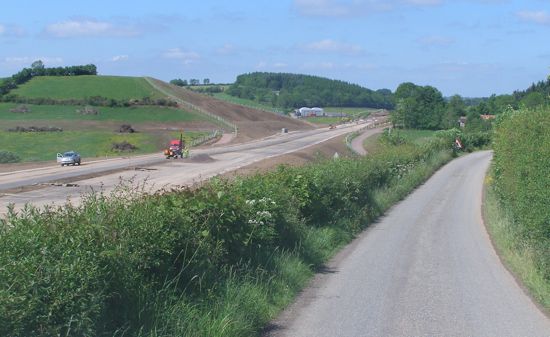
The view easbount at Reaskmore where the road is still under
construction, as seen on 11 July 2010. [John Troy]
Westbound at Killyliss where the existing T-junction (visible in the central reserve) is being replaced by two sets of sliproads (left, and right distance). 11 July 2010. [John Troy]
The existing bridge that carries the A4 over Granville Road is being widened to accommodate the dual-carriagway. 11 July 2010. [John Troy]
Eglish Road junction now sports this nice, shiny new roundabout. 11 July 2010. [John Troy]
View westbound from Eglish Road bridge showing the widened road taking shape with the existing roundabout, soon to be demolished, ahead. 11 July 2010. [John Troy]
View eastbound from Eglish Road bridge with the M1 service station on the right. In the distance is Old Eglish bridge, and the new access road to the service station. 11 July 2010. [John Troy]
A view of the new dual-carriageway we don't often see - this is the completed bridge over a local road, Mullaghbane Road, between Reaskmore and Killyliss. 10 July 2010. [Noel O'Rawe]
The bridge near Killymaddy taking shape in late June. [Nessan McGarvey]
Close-up of some of the contractor's plant at the bridge near Killymaddy. [Nessan McGarvey]
22 Jun 2010: In time terms the project is about 80% completed, and this is very evident on the western half of the scheme which is now essentially completed. It is the eastern section (the part the public sees as it lies adjacent to the current road) that is less advanced giving the impression that progress is not as good as is actually the case. I am fortunate enough to have had contributions from three different people who have taken fantastic shots of the works in recent weeks. I include these below, roughly arranged geographically from west to east. Two of the contributors wish to remain anonymous, but thank you regardless. The "Roads" Minister is now saying that the project will be completed "in the early part of 2011", which is slightly less definite than the date of "January 2011" being given earlier in the year. The driving public are getting more and more eager to use the road, and indeed some cyclists and pedestrians have been told off for using the completed sections at the Ballygawley end - naughty, naughty.
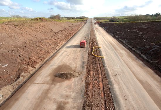
The completed, but unopened, A4 here seen looking east from close to the new Ballygawley roundabout on 20 June 2010. [Anonymous Contributor]
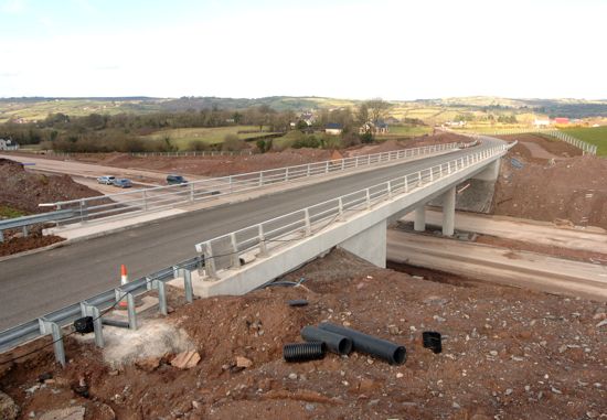
Completed overbridge which carries Craveny Road over the unopened A4 about 2km east of Ballygawley. Seen looking east on 20 June 2010. [Anonymous Contributor]
Completed, but unopened, A4, seen winding eastwards from near Farriter Road with the Killeeshil Road bridge in the distance. Seen on 20 June 2010. [Anonymous Contributor]
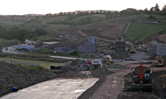
Looking along the completed, but unopened, A4 from beneath a bridge near Cabragh. Seen on 14 June 2010. [Steven Andrews]
The foundations of the future dual-carriageway in place at Cabragh. Seen looking east on 20 June 2010. [Anonymous Contributor]
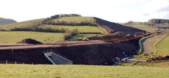
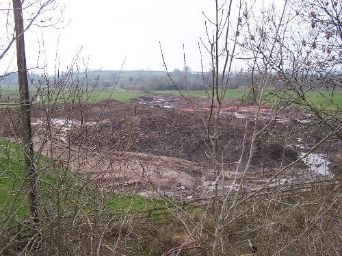
The infamous "Bog of Doom" east of Cabragh, where the road bed is continuing to sink into the ground despite huge amounts of work. Seen on 20 June 2010. [Anonymous Contributor]
The line of the future A4 near Quinn's Corner, here looking west with the current A4 crossing left-to-right. Work here is much less advanced. Seen on 20 June 2010. [Anonymous Contributor]
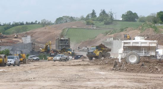
Similar view of the works at Quinn's Corner showing lots of heavy plant, along with a bridge that will carry the existing A4 over the new road. Seen on 10 June 2010. [Anonymous Contributor]
A less advanced section of the A4 seen from Drumnafern Road on 10 June 2010. [Anonymous Contributor]
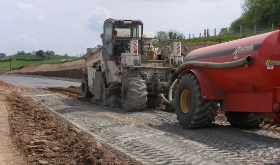
Contractor's machinery laying a concrete road base on the new A4.
Picture taken on 10 June 2010. [Anonymous Contributor]
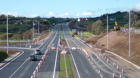
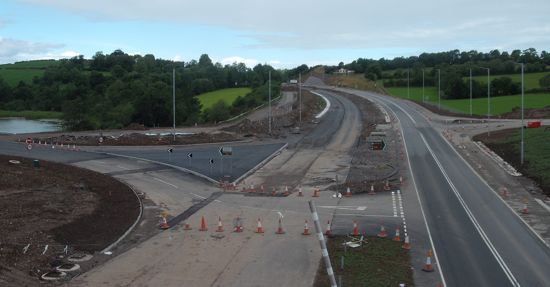
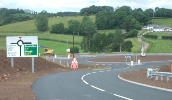
23 May 2010: The new roundabout at Ballygawley opened to traffic about a month ago. Currently traffic heading west on the A4 is diverted left onto the A5 for several hundred yards and then back again on the new road to the new roundabout. There has been a suggestion that the new roundabout has been accidentally sited about 10 metres from where it was supposed to have been built, but I can't confirm this. However, there do seem to be problems with construction of the new carriageway across a section of bog at Cabragh, near Quinn's Corner. According to the Irish News on 17th May (no free access to story online), both the road foundations and 160-foot piles that were inserted to stabilise the site have also disappeared. This is rather reminiscent of the problems currently facing the construction of the M7 in the Republic of Ireland, on a section known in the media as the 'bog of doom' which is facing similar problems on a larger scale.
3 May 2010: In a Written Answer in the Assembly last week, the Minister has confirmed that the existing sections of the A4 that will be bypassed by the new dual-carriageway are going to be re-numbered as the B34.
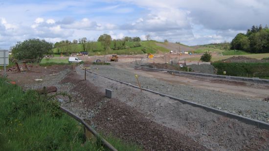
8 Apr 2010: About a month ago the Regional Development Minister visited the project and stated that "The A4 dual carriageway is scheduled for completion before March 2011 and to date works have been progressing in line with the scheduled programme." This is 2 or 3 months later than the completion date of "Dec 2010" which has been advertised on the site signage at project commencement two years ago. The project is now, therefore, about two-thirds complete. The pictures below were all taken by SABRE member loch_cuan73 in early March, although the exact locations are not identified.
The existing A4 with the new adjacent carriageway taking
shape on the left. Early March 2010. [loch_cuan73]
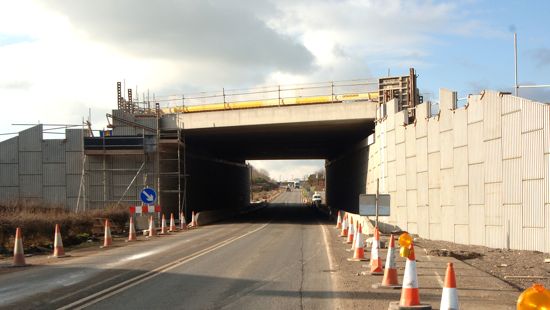
One of the new overbridges over the upgraded A4 with
beams in place in early March 2010. [loch_cuan73]
At this location the new road is being built offline, and will cross the existing A4 on this bridge. The existing road will remain for local access. Early March 2010. [loch_cuan73]
16 Feb 2010: After almost a year without any significant publicty, the News Letter featured a double page spread on the scheme last Saturday. It highlights that the scheme is progressing well, although the contractor says that "the scheme has suffered slightly following two bad summers." The scheme is now scheduled to be completed in January 2011, very slightly later than estimated at project commencement. The article also revealed some interesting facts about the scheme:
- The scheme includes 22 bridge structures.
- At its peak, 400 workers were on site at once.
- 3,000,000 cubic metres of material has been removed so far.
- 500,000 tonnes of bituminous surface materials (tarmac, to the layperson) have been laid.
Work at different parts of the scheme are at different stages, depending on the amount of earthworks (shifting of soil and rock), land stabilisation (eg to stop the road sinking into boggy ground) and structures (bridges, underpasses etc) that were required at each point. The News Letter has also given me permission to reproduce a number of photos here, for which I am grateful. These illustrate progress very well.
This section of boggy ground at Cabragh has required painstaking piling works to stabilise it before the road can be constructed. 8 Feb 2010. [Pat McSorley, courtesty the News Letter]
Beams in place on the bridge that will carry the new dual-carriageway over the existing A4. 8 Feb 2010. [Pat McSorley, courtesty the News Letter]
The new road taking shape, with the surface partly laid. Looking east from the new Dergenagh Road bridge. 8 Feb 2010. [Pat McSorley, courtesty the News Letter]
The new Dergenagh Road bridge that already carries this local road over the future dual-carriageway. 8 Feb 2010. [Pat McSorley, courtesty the News Letter]
Earthworks for the new road at an advanced stage at Drumnafern. Note the 'accommodation underpass' on the left which will allow a local farmer to access land on either side without using the dual-carriageway. 8 Feb 2010. [Pat McSorley, courtesty the News Letter]
7 Jan 2010: Web user Col2006 visited the site in December. He reports that the new carriageway on the section of online widening at the eastern end of the scheme is apparent from the Dungannon Bypass to Old Eglish Road, and from Eglish Road to Killyliss. The beams of the bridge that will carry Old Eglish Road over the A4 are also now im place. The abutments for the bridges at Killyliss and Cabragh are also in place, but no beams are in place. At Reaskmore, where the A4 goes offline, the new alignment of the A4 heading away is very apparent. For the remaining 60% of the road, which is entirely offline, it is difficult to view progress but it is likely that work is advancing well. Amey Lagan previously posted photos of the scheme on their web site, but unfortunately they have not done so since last June.
29 July 2009: The Minister commented last month that this scheme is "on schedule for completion towards the end of 2010" which is in line with the predicted completion date when work began back in February 2008.
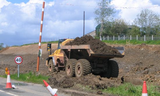
10 June 2009: The project is now almost at its half way point, and major changes are now noticeable at various places. In the words of site visitor Mark Wilson: "Killyliss Road and Mullaghbane Road are signed to be closed for 18 weeks from the middle of [May], serious earth moving is currently being done at Killyliss and the hard shoulder is coned off as far as Granville with diverted traffic being sent off towards Granville". The pictures below were all taken by Paul McIlfatrick on 26th May. Feverish work is underway constructing the new roundabout at Ballygawley (see pic 1). On the sections receiving an online upgrade, work is evident all along the side of the road (pic 2) while work on the offline sections is quite advanced, with some bridge structures apparently in place. It is great to see such good progress.
Pic 1: The "second" Ballygawley roundabout under construction, as seen from the A4 from the Enniskillen direction on 26 May 2009. [Paul McIlfatrick]
Pic 2: Work is underway on the online upgrade of the eastern
stretch as seen on 26 May 2009. [Paul McIlfatrick]
14 Sep 2008: Work has now been underway for about 7 months on this three year project. Currently the most visible progress consists of a series of advanced earthworks at various points along the A4, at locations where the A4 is to be widened, re-aligned or where there are to be new junctions. But there is no evidence so far of work beginning on creating the new road, unless work is underway on the entirely offline stretch to the west which can't easily be seen. This is not surprising, given the length of time the contract is to last and the large geographical area it covers. The pictures below were taken by site visitor Alan Mannis on 4th Sep 2008, heading eastbound. They show the general appearance of the earthworks as seen from the A4. In the last two, new fences that segregate the land vested for the scheme can be seen. Still over two years to go before the road opens.
13 Feb 2008: The first sod on the scheme was cut today by Regional Development Minister Conor Murphy. The cost of the scheme seems to have risen again - by about 14% to an estimated £116m. Although it is stated that the scheme will last 3 years, the contractor's signage on the road itself states the completion date as "December 2010". The press release also stated that "It is envisaged that disruption to traffic will be largely confined to the latter half of the three year construction period the scheme."
22 Dec 2007: According to this press release, the contract was finally signed in mid December, six months after the date reported by the Irish TImes in May. Since the contract also includes the A1 dual-carriageway around Newry, it's unclear what, if any, delay there will be to the commencement of the A4 project which is still officially to begin by the Spring. Also, advanced site and vegetation clearance work has now begun at Tullyallen Road, Aghintober Road, Cabragh, Reaskmore, Killybracken and Old Eglish.
23 May 2007: According to an article in the Irish Times yesterday, Roads Service is set to sign the contract with the builder in June 2007, with work starting "by" Spring 2008 and lasting three years.
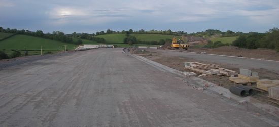
29 March 2007: Some preliminary site works have begun at Ballygawley, where the foundations for the new roundabout and link road are being prepared - see photo below. Fences have also appeared sporadically defining the land that has already been vested.
Problems
Given that the existing A4 will remain in-situ for about 70% of its current length, it seems odd and disappointing that there are going to be as many as 6 grade-separated junctions and 4 LILO junctions. The compact design of the junctions, their proximity in places and the sheer number of them will rule out any possiblity of upgrading the route to motorway standard - as part of the M1 - without rebuilding the junctions. Just three junctions, sited at Old Eglish Road, Killyliss and Cabragh would have offered a much better road, without offering much disadvantage to locals since the A4 remains in situ in many places. For the length from Killyliss to the M1, about 4000 metres of new single-carriageway link roads would have provided the same level of access as currently. In addition, the proposed sliproads seem very short for a 70mph road - just 80 metres in the case of Cabragh, for example. This will mean large vehicles, such as lorries, attempting to join the road at perhaps 20 to 30mph and in busy periods being forced to continue onto the hard shoulder to build up enough speed. The scheme as proposed will offer huge advantages but the design may still be seen as short sighted by generations to come.
Photos
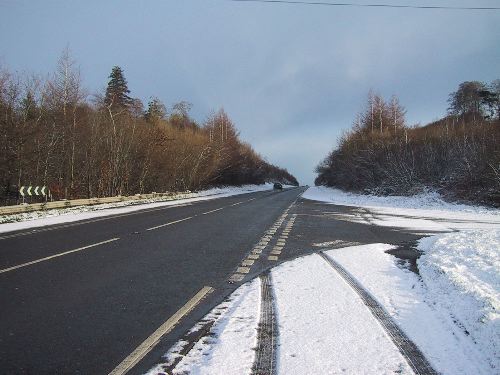
A snowy A4 in its current form, seen here near Castlecaulfield. [Photo by Wesley Johnston]
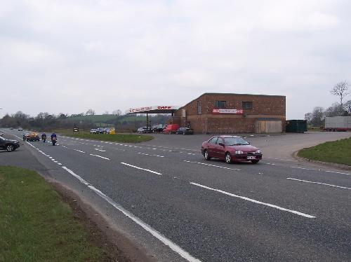
The M1 cafe and service station face each other across the A4 near Old Eglish Road. At this point, the new carriageway will mean widening on both sides, but the majority on the far side. Access will be via sliproads and a bridge only. [Photo by Wesley Johnston, Mar 2007]
The foundations of the new Ballygawley roundabout taking shape in March 2007. Taken from the A5 Tullyvar Road. [Photo by Wesley Johnston] |


