Where |
The principal route into Ballymena town centre from the M2 Ballymena Bypass to the south east. |
Total Length |
2.0km / 1.3 miles |
Opened |
Between 1968 and 1978 - possibly 1969 when the M2 opened here.. |
Cost |
? |
Photos |
See below |
See Also |
General area map
|
The Larne Road Link is an impressive dual-carriageway route that carries traffic from the M2 Ballymena Bypass practically to the town centre. It does so by bypassing the existing Larne Road to the north, and closer to the town it runs along the northern bank of the Braid River beneath the escarpment on which the town was first founded.
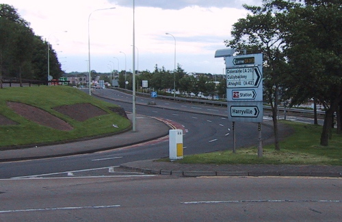
The road joins several other routes, three of them at roundabouts. Beginning at Bridge Street (see photo below) the A26 first meets the Braidwater roundabout giving access to the Seven Towers Leisure Centre and a large retail park. It then crosses the River Braid where it meets Ballykeel roundabout, which gives access to residential areas to the east. It then meets Pennybridge roundabout which accesses the old Larne Road and Pennybridge Industrial Estate, before terminating on the Larne Road roundabout of the M2 (junction 10). Which, incidentally, is said to have been the largest roundabout in the UK when it opened in 1969, with a circumference just shy of 900 metres!
This road was numbered A36 for most of its existence, only being re-numbered to A26 in 2010 when the Larne Road roundabout was grade-separated.
Photos
View west along Larne Road Link from Larne Road roundabout - Google Streetview.
Looking east along the Larne Road Link from its starting point at Bridge Street, close to Ballymena town centre, in 2003. [Photo by Wesley Johnston]
|
