|
Status
|
Construction scheme
(completed)
Contractor: Northstone
|
|
Where
|
Construction
of a northbound 2+1 overtaking lane on the
A26 (towards Ballymoney) plus an upgrade
of Dunloy crossroads featuring single-lane
dualling.
|
|
Total
Length
|
2.4 km (1.5 miles)
of which 1.2 km (0.7 miles) is the
overtaking lane
|
|
Dates
|
Work began - by May 2005
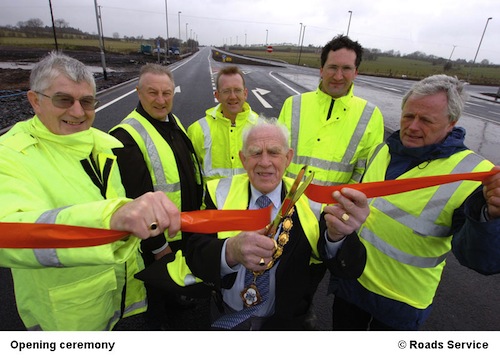
Official opening - 9 March 2006
|
|
Cost
|
£3.5m |
|
Photos
|
See below. |
|
See
Also
|
General
area map - Google Maps
Roads
Service web site on scheme
|
I don't normally list overtaking lane schemes on
this web site (due to there being so many) but I
have made an exception in this case due to its
unusually large scale. At £3.5m it is much
more expensive than other 2+1 overtaking lane
schemes, as should be clear from the description
below.
The purpose of the scheme was to provide a 1.2km
overtaking lane for traffic travelling north west.
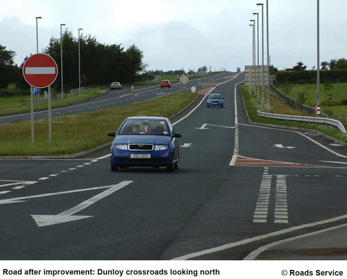
However the scheme also included a scheme to upgrade
Dunloy Crossroads, a pair of staggered T-junctions -
Station Road and Ballynaloob Road. A significant
number of vehicles wished to go from one to the
other, ie crossing over the A26. This was a
difficult manoeuvre on such a busy road, made worse
by the fact that a high proportion of them were
slow-moving agricultural vehicles.
The "traditional" solution would have been to
install a roundabout. However, this would have
forced all traffic to come to a near standstill,
which would have had an unacceptably negative impact
on the main A26. Instead, a rather clever
arrangement was devised whereby the two carriageways
were separated from each other, ie became a
dual-carriageway with one lane each way. This
allowed the provision of dedicated right-turn lanes
so that vehicles crossing over the A26 had a refuge
between the two flows of traffic. You can see the
arrangement in this map:
View
Larger Map
The carriageways are so far
apart that the road has a very expansive feel
about it. It is easily wide enough to
accommodate a future dual-carriageway upgrade of
the A26 (although this would require a
grade-separated junction at this location).
This is one of only a few places in Northern
Ireland where you will find a single-lane
dual-carriageway, but there are some others
about if you know
where to look.
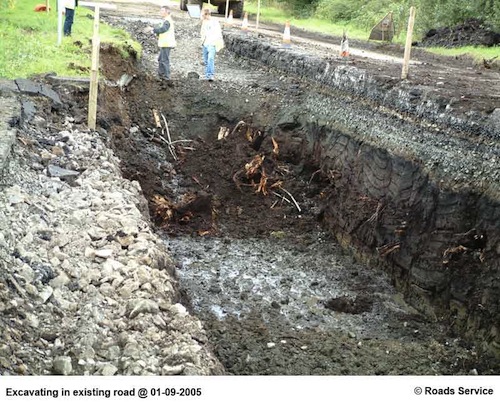
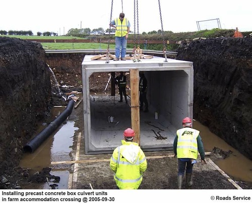
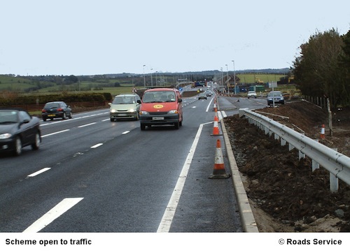
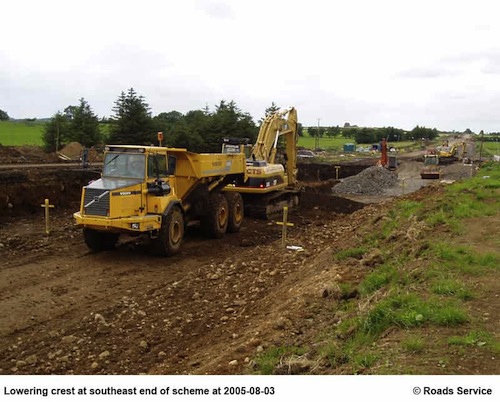
The work was substantial enough to require the
complete reconstruction of sections of the road,
including the lowering of two crests, and
required a two month closure of the road to
northbound traffic between May and July 2005.
Photos
The pictures below are all from
the Roads
Service web site used under the Open
Government License 1.0. I have not
re-captioned them, as the Roads Service captions
say it all. You can find additional pictures of
the scheme here.
It has to be said that Roads Service Northern
Division are far and away the best at putting
interesting photographs and resources about road
schemes on the web.
|