Where |
The main road connecting Newtownards and Comber. |
Total Length |
2.6 km / 1.6 miles |
Opened |
Sometime between 1976 and 1980
Extended by 500 metres at Comber end in 2003 |
Cost |
Unknown |
Photos |
See below. |
See Also |
General area map |
The town of Comber is situated about 3 miles south of Newtownards and, although it is quite small, is a commuter town and an important link on the route south from Bangor. Almost two miles of the link between the two towns has been upgraded to a dual-carriageway, but the final mile into Newtownards has not been completed. Why this last mile was not included in the dualling is a mystery to me, given the vast amount of open space to each side of the road.
The road passes across very flat land, much of which is former mud flats reclaimed in the 19th century from Strangford Lough by a system of levees. These levees still protect Newtownards from the sea, the southern part of which is below sea level at high tide. The A21 is thus a fast, flat road with lots of open space and some of the province's most fertile farmland on each side. The dual-carriageway was extended by 500 metres in 2003 to meet the new roundabout at the completed Comber Bypass.
With thanks to Andrew McCullough for providing the photos below.

The view north towards Newtownards at the Moat Road / Longlands Road junction [Photo by Andrew McCullough].
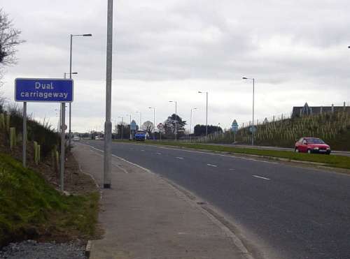
This new section of dual-carriageway opened in 2003 and extended the A21 to meet the completed Comber Bypass at a new roundabout. This view is looking towards Newtownards from that point. Note that hundreds of new trees and bushes have been planted - very common with recent road projects. This section of road will look stunning when they mature. [Photo by Andrew McCullough]
|
